
Thick fog or low clouds consisting of large droplets
Thick fog or low clouds consisting of large droplets usually appear pinkish grey at mid-latitudes in the VIIRS Night Microphysics RGB images.
In the images below, thick fog/low stratus clouds consisting mainly of large droplets are seen, over Greece and the Aegean Sea (left) and south of the Carpathian Mountains, over Romania, Serbia and Bulgaria (right). The cloud consists of small droplets in the green parts.
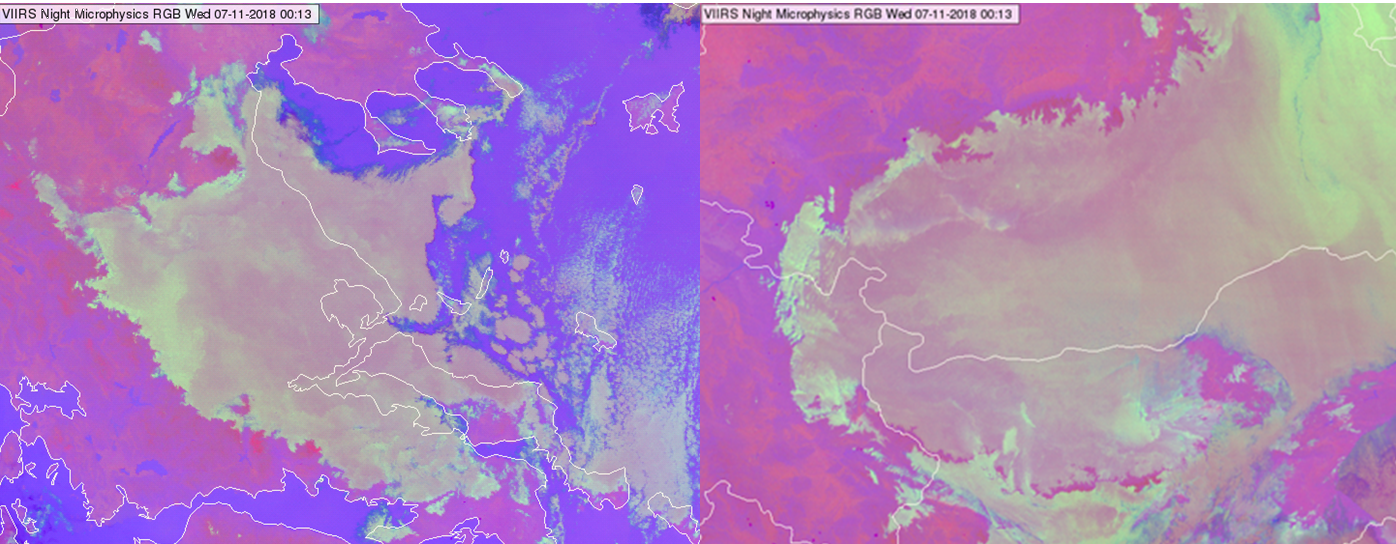
NPP, VIIRS Night Microphysics RGB images taken on 07 November 2018, at 00:13 UTC
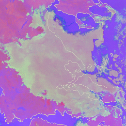
In the image below, thick fog/low stratus clouds consisting mainly of large droplets are seen, north-east of the Carpathian Mountains over Ukraine and Poland. The cloud consists of small droplets in the green parts.
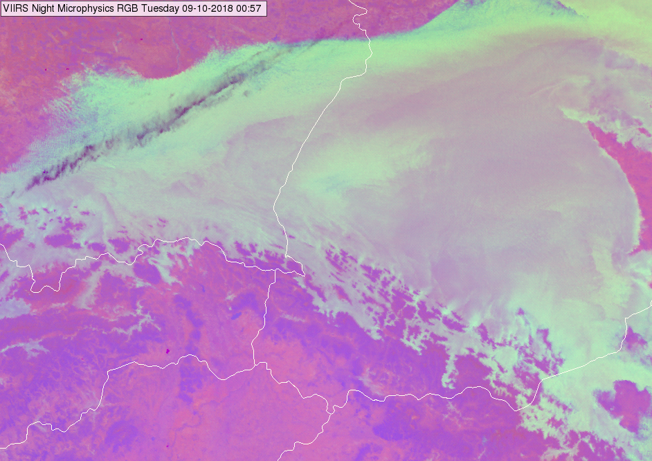
NPP, VIIRS Night Microphysics RGB image taken on 09 October 2018 at 00:57 UTC
In general, the colour shade depends on the temperature as well. Warmer cloud tops have more blue shades, while colder cloud tops have fewer blue shades. For example, at low-latitudes over ocean the water clouds are warm and consist typically of large particles. These clouds may appear even greyish purple/violet.
Note that pinkish colour does not always indicate thick fog/low water cloud consisting of large droplets.
• Thin fog/low clouds over land usually appear also pinkish grey.
• Cloud free area is usually pink
Explanation of the colour of thick fog/low water clouds consisting of large droplets at mid-latitudes in the Night Microphysics RGB (see the recipe):
• For thick clouds the (IR12.0 - IR10.8) brightness temperature difference is close to zero, so (taking account the range defined in the recipe) the red component will be between medium and maximum.
• For thick water clouds consisting of large droplets, the (IR10.8 - IR3.7) brightness temperature difference is not as high as in case of small droplets. (The emissivity difference between the IR10.8 and IR3.7 channels is lower). The green signal will be slightly weaker or about the same magnitude as the red component.
• The blue signal is most often between medium and maximum, for example in Central Europe in autumn nights, the top temperature of fog or low clouds are usually close to zero or low positive °C. In case warmer/colder cloud top temperature the cloud will have more/fewer blue shapes.
As a consequence, the thick fog/low water clouds consisting of large droplets usually appear pinkish grey in the VIIRS Night Microphysics RGB images at mid-latitudes.