
pinkish grey
Thick fog or low clouds consisting of large droplets usually appear pinkish grey at mid-latitudes in the VIIRS Night Microphysics RGB images.
In the images below, thick fog/low stratus clouds consisting mainly of large droplets are seen, over Greece and the Aegean Sea (left) and south of the Carpathian Mountains, over Romania, Serbia and Bulgaria (right). The cloud consists of small droplets in the green parts.
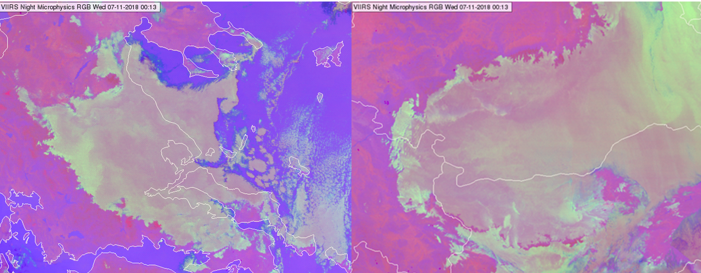
NPP, VIIRS Night Microphysics RGB images taken on 07 November 2018, at 00:13 UTC
In the image below, thick fog/low stratus clouds consisting mainly of large droplets are seen, north-east of the Carpathian Mountains over Ukraine and Poland. The cloud consists of small droplets in the green parts.
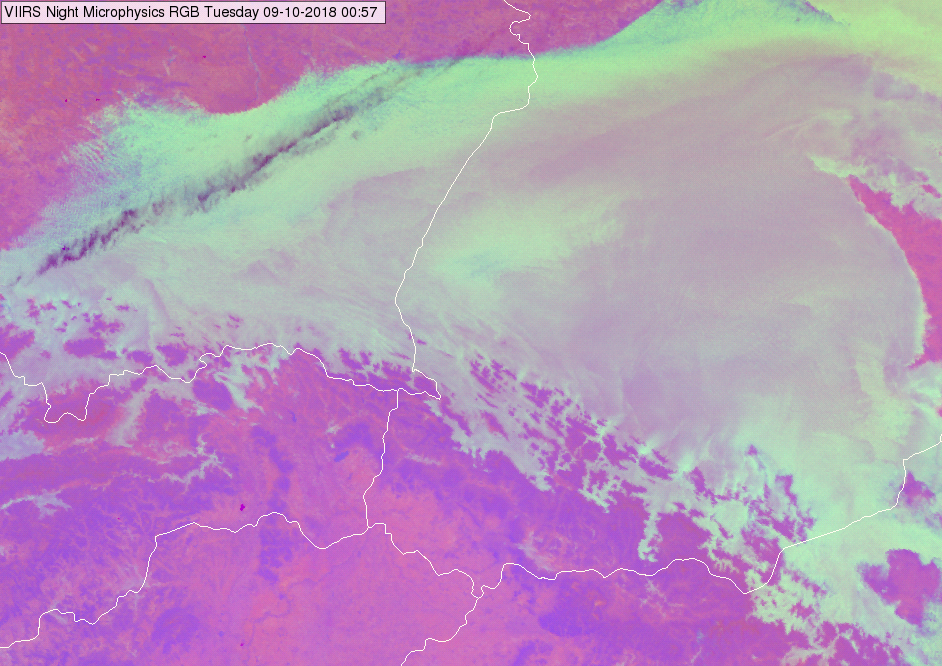
NPP, VIIRS Night Microphysics RGB image taken on 09 October 2018 at 00:57 UTC
In general, the colour shade depends on the temperature as well. Warmer cloud tops have more blue shades, while colder cloud tops have fewer blue shades. For example, at low-latitudes over ocean the water clouds are warm and consist typically of large particles. These clouds may appear even greyish purple/violet.
Note that pinkish colour does not always indicate thick fog/low water cloud consisting of large droplets.
• Thin fog/low clouds over land usually appear also pinkish grey.
• Cloud free area is usually pink
Explanation of the colour of thick fog/low water clouds consisting of large droplets at mid-latitudes in the Night Microphysics RGB (see the recipe):
• For thick clouds the (IR12.0 - IR10.8) brightness temperature difference is close to zero, so (taking account the range defined in the recipe) the red component will be between medium and maximum.
• For thick water clouds consisting of large droplets, the (IR10.8 - IR3.7) brightness temperature difference is not as high as in case of small droplets. (The emissivity difference between the IR10.8 and IR3.7 channels is lower). The green signal will be slightly weaker or about the same magnitude as the red component.
• The blue signal is most often between medium and maximum, for example in Central Europe in autumn nights, the top temperature of fog or low clouds are usually close to zero or low positive °C. In case warmer/colder cloud top temperature the cloud will have more/fewer blue shapes.
As a consequence, the thick fog/low water clouds consisting of large droplets usually appear pinkish grey in the VIIRS Night Microphysics RGB images at mid-latitudes.
Thin fog or low clouds over land appear usually pinkish grey at mid-latitudes in the VIIRS Night Microphysics RGB images.
Thin fog/low clouds over land may appear in many colour shades:
• The colour shade depends on the transparency of the thin fog/low cloud, and on its microphysical properties.
• Because of its transparency, the colour shade of the thin cloud depends on the colour of the underlaying surface:
---- Land surface at mid-latitudes appears usually pink. Above it the thin water cloud usually appear pinkish grey.
---- In some cases, (warmer surface temperature and/or more moisture above) the land may appear purple, even bluish. In these cases, the thin water clouds above contain more blue shades.
• The colour shade of thin fog/low cloud depends on the cloud top temperature as well. Warmer cloud tops have a stronger blue shade. Colder cloud tops have less blue shade.
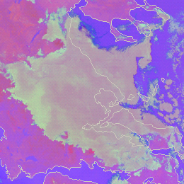
The images below show examples of thin fog/low clouds over the north-eastern part of Hungary and neighbouring counties.
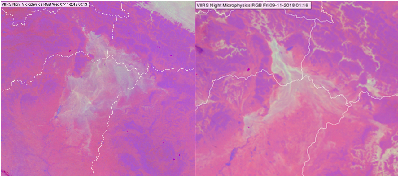
NPP, VIIRS Night Microphysics RGB images over the north-eastern part of Hungary and neighbouring counties taken on 07 November 2018 at 00:13 UTC (left) and 09 November 2018, 01:16 UTC (right)
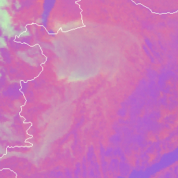
The central region of the image below shows thin fog over the south-eastern part of Poland.
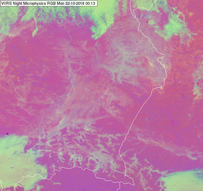
NPP, VIIRS Night Microphysics RGB image over southeast part of Poland taken on 22 October 2018 at 00:13 UTC
The image below shows thin fog/low clouds over the Po Valley. Some parts of the fog is evidently transparent. The thin fog here has more blue shades as it is relatively warm (~10°C). Note that in the lower part of the image thick clouds are also present.
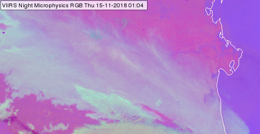
NPP, VIIRS Night Microphysics RGB image over the Po Valley taken on 15 November 2018 at 01:04 UTC
The image below shows thin and thick fog/low cloud at the coast of the Baltic countries, both over sea and land, see the encircled areas. The cloud top temperature was relatively warm (~10°C). The thin fog has slightly different colour shade over sea and land as the background has different colour.
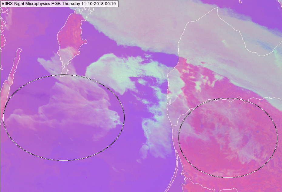
NPP, VIIRS Night Microphysics RGB image near the coast of the Baltic States taken on 11 October 2018 at 00:19 UTC
Note that if thin fog/low cloud are much colder than the warm land below then the thin clouds appear in a different shade (weaker red component). However, this happens rarely over land. This effect is discussed in the example of ‘thin fog/low cloud over sea’.
Note that thick fog or low water clouds consisting of large droplets usually appear also pinkish grey.
Explanation of the colour of thin fog/low water clouds over land at mid-latitudes in the Night Microphysics RGB (see the recipe):
In case of a thin cloud the measured radiance is a mixture of the radiance coming from below it and the radiance emitted by the cloud. Note that the IR channel differences depend on the difference between the surface and on the cloud top temperatures as well. However, in case of fog/low clouds over land this difference is usually low. So, the colour of the thin cloud usually will be a ‘simple weighed mixture’ of the colour of the underlaying surface and the colour of the (thick) cloud. (The weights depend on the transparency of the cloud)
• In case the land is pinkish (typical colour of cool land) thin fog/low cloud over land will be pinkish grey.
• In case bluish land surface, the thin fog/low cloud may appear bluish grey.