
High level, thick ice clouds with large particles on the cloud top
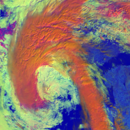
High-level, thick ice clouds with large particles on the cloud top appear red-orange in the MetOp AVHRR Day Microphysics RGB images.
The examples below show frontal cloudiness. Frontal clouds consist of many different cloud types, usually also high-level, tick ice clouds with large particles on the top.
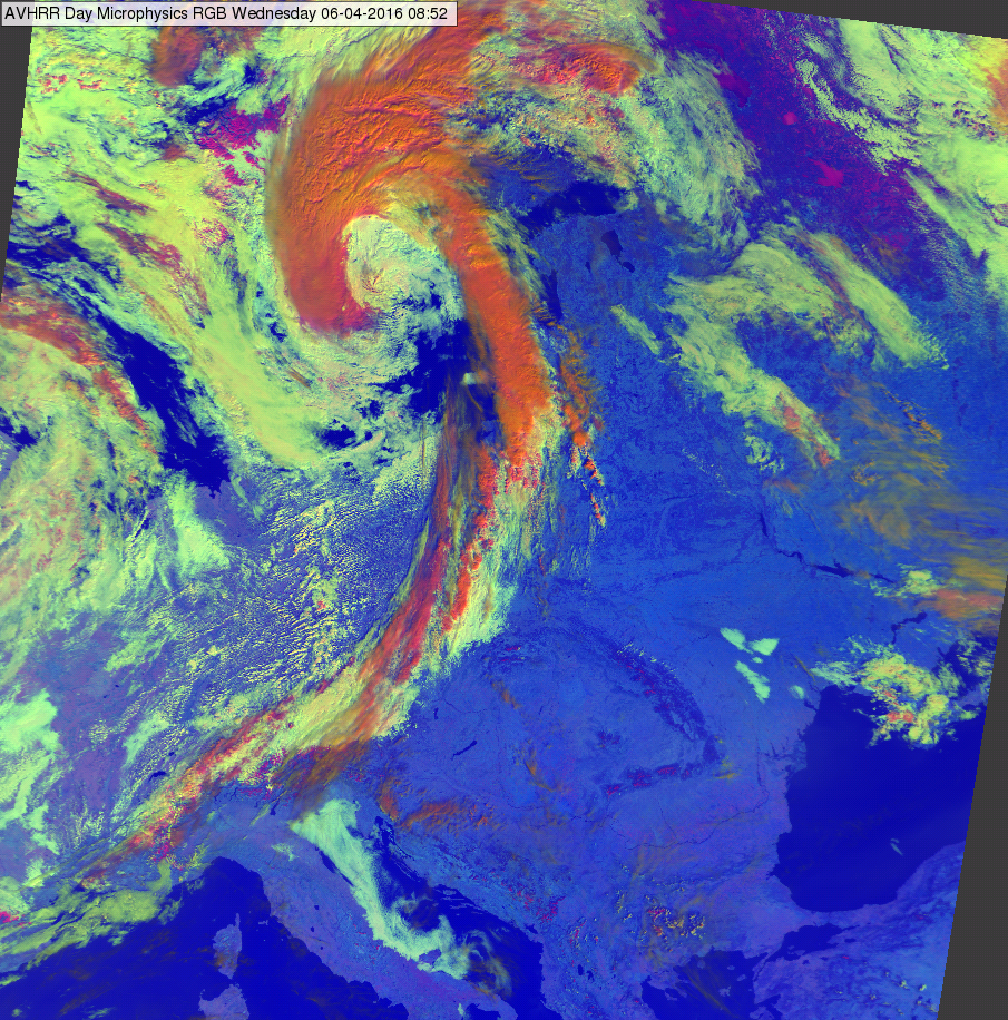
METOP AVHRR Day Microphysics RGB image for 06 April 2016 at 08:52 UTC
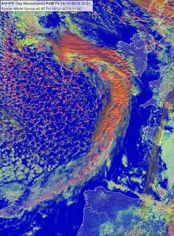
METOP AVHRR Day Microphysics RGB image for 14 October 2016 at 10:31 UTC
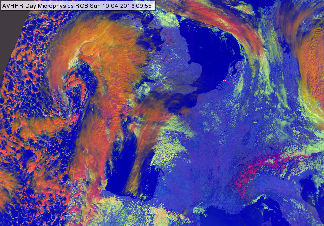
METOP-A AVHRR Day Microphysics RGB image at the coast of France and UK for 10 April 2016 at 09:55 UTC
Note that:
• In case the ice cloud top is warmer (mid-level ice-clouds) the blue component becomes stronger, while the colour turns into magenta.
• In case the cloud top particles are small the colour turns into orange (in extreme case greenish).
• Towards the edge of the swath the red-orange colour may turns to orange.
Explanation of the colours of high-level, thick ice clouds with large particles on the top (see the recipe):
• VIS0.63 reflectivity is high for thick ice clouds
• The large ice crystals absorb strongly the 1.6 radiation and so they do not reflect much. The NIR1.6 reflectivity values of these clouds are less than medium in the 0-70% range.
• The IR10.8 brightness temperature is low for high-level clouds.
As the red component is high, the green component is (slightly less than) medium and the blue component is low, so the high-level, thick ice clouds with large particles on the top appear red-orange.