
Cloud Streets
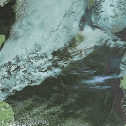
Small cloud cells arranged in parallel lines often found in cold air cloudiness.
Cold Air Cloudiness is the result of mesoscale shallow convection (1-2 km deep) and has distinctive appearances: Linear and Hexagonal. The former is called Cloud Streets, which will be discussed more deeply and can be roughly regarded as 2-dimensional convection. The latter, generally called in the literature Mesoscale Cellular Convection, is characterized by 3-dimensional convection which can be divided in two types: Open and Closed Cells. Cloud Streets occur over both water and land surfaces. The satellite image shows several parallel cloudbands with a length of 20-200 km and width of 2-10 km. Especially over the sea, the streets become wider with increasing distance from shore. The cloud bands consist of individual cumuli which are lined up like pearls on a string. The organisation of clouds into rows can be explained by the existence of horizontal roll vortices in the boundary layer. The clouds are formed in the upward parts of this roll system. The formation of Cloud Streets by this roll development are mainly caused by two types of instability: dynamic (inflection) and thermal instability.