Cloud Structure in Satellite and Radar Image of MCC merging
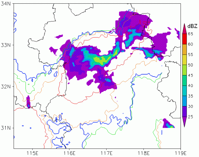
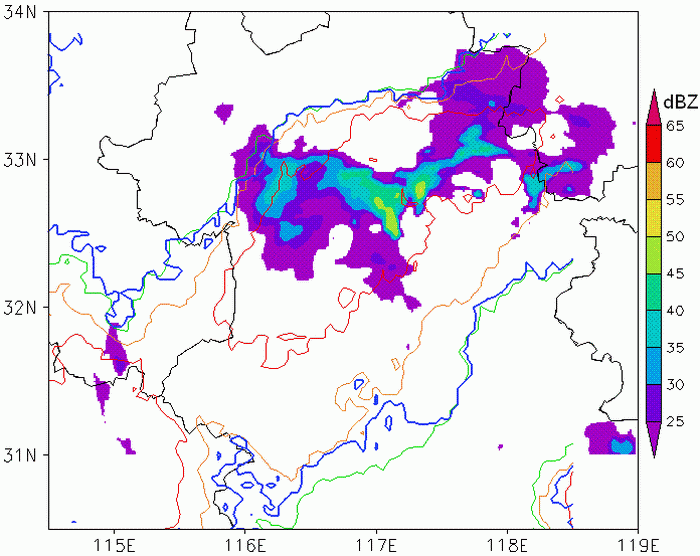
In the top two images of Figure 12, two MCCs can be recognized over the research region (Huaihe River) in isoline field at 07:15. The cold cloud top of two MCCs were connected 30 minutes later (07:45). But the bodies of MCCs were not merged, as in radar reflectivity field several cells under the connected cloudiness. On this stage, two MCCs were developed each and high level cloudiness merged only. A narrow cold cloudiness band existed between two MCCs with bright temperature below 210K, and named this band "bridge". Under the bridge, a weak radar reflectivity line lied on the north and parallel on it. As the bright temperature isoline near the reflectivity line were tighter than other part, it is assumed that the bridge cloud were developed form the reflectivity line. With the development of MCC merger, the radar reflectivity line disappeared, and bridge cloudiness been shorter at 08:15. Meanwhile, the east MCC was weakened, as decreasing of the cold cloud top area(red isoline region). At radar reflectivity field, the area of stronger than 45dBZ was also reduced. Because of the two factors, the east MCC was been in the dissipating stage. But at the west of the MCC, weak reflectivity feeler were emerged with trending to the west. The feeler were intensified and linked to the west MCC in radar reflectivity field with the increasing of strong echo field in the following 30 minutes. But as red isoline shown in imagery, the cold core of east MCC was separated into several small centers, and the biggest one was combined with the cold core of west MCC in bright temperature fields. As the merged of cold core and reflectivity echo, the dissipating MCC was merged completely with the west one at 08:45. Finally, the two MCCs were merged into a more larger MCC as Figure 12 shown.
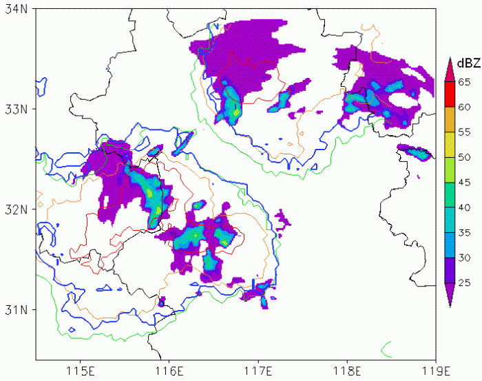
07:15
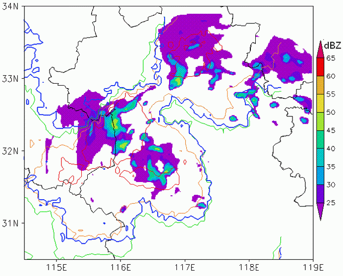
07:45
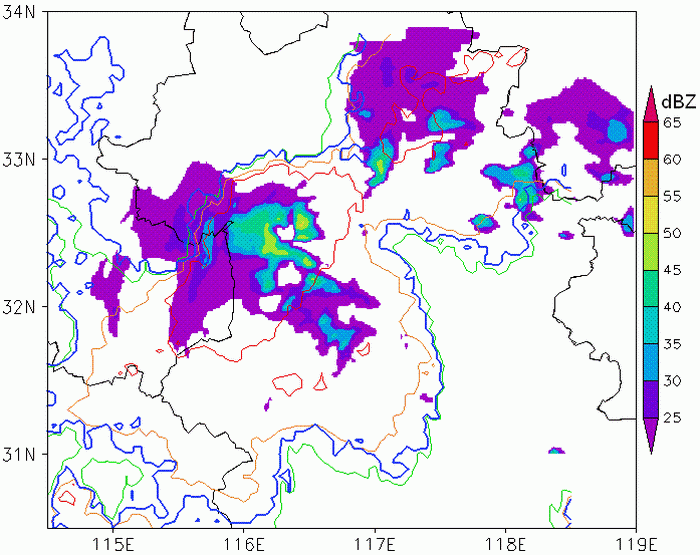
8:15
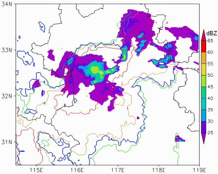
8:45
9:15
9:45
Figure 12: Radar Reflectivity image (Blue isoline: Tir10.7=Twv6.7; Green isoline: Tir10.7=221K; Orange isoline: Tir10.7=211K; Red isoline: Tir10.7=201K)
The evolvements of bridge between two MCCs were listed on Figure 13-16. At the first, several convective cells were emerged in the bridge region, and then these cells were connected each other and built a narrow bridge cloud band (Figure 13-14). But few minutes later, the bridge was broken with merger of the convective cells as Figure 15-16 shown. There were not any features of build-break of bridge evolution in satellite imagery. And only a cloud band could be found in this evolution. So radar reflectivity imagery were useful for analysis the detailed evolution of convective cloud system.
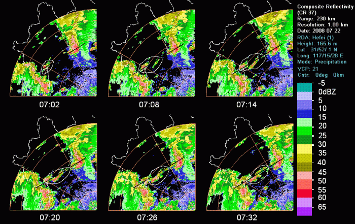
Figure 13: Composite Reflectivity of Hefei Radar From 07:02-07:32(black line: position of vertical cross section indeicated)
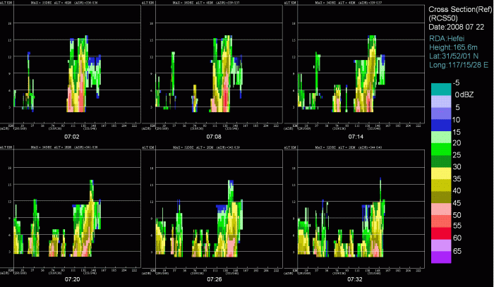
Figure 14: Vertical Cross Section of Reflectivity From 07:02-07:32
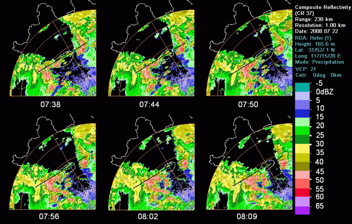
Figure 15: Composite Reflectivity of Hefei Radar From 07:38-08:09(black line: position of vertical cross section indeicated)
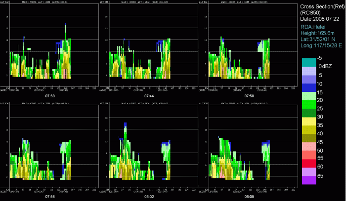
Figure 16: Vertical Cross Section of Reflectivity From 07:38-08:09