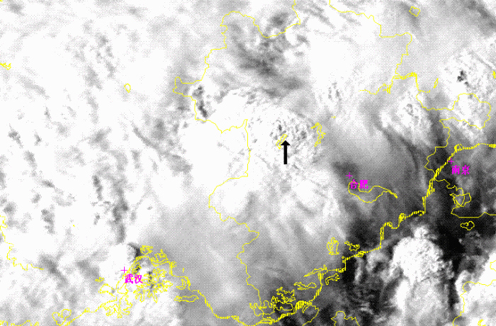
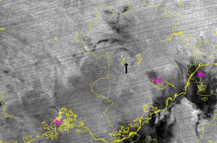
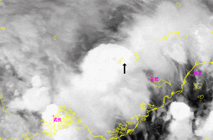
Characters in different NOAA/AVHRR channels of first cells merger
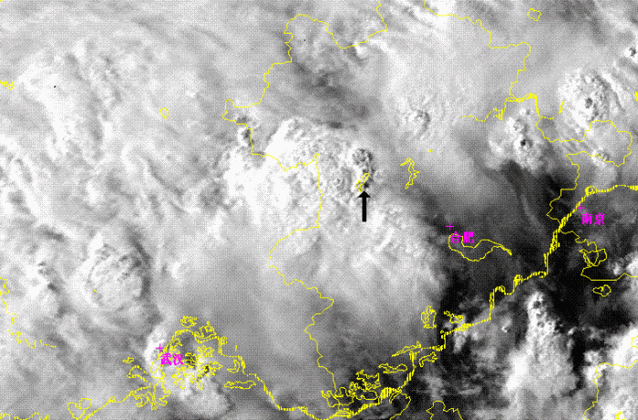
Channel 1 (0.67)
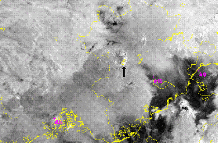
Channel 3 (3.9)
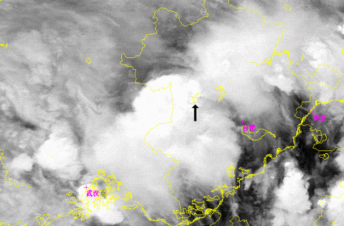
Channel 4 (10.7)
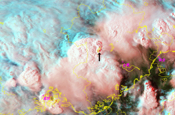
Figure 8: NOAA/AVHRR channel image and combination image at 08:17
As figure 8 shown, there was a comma shape cloudiness(as black arrow in picture) in a larger convective system at the west of Huaihe River. This comma shape cloudiness were consisted by three small convective cells and were clearly in the channel 1, 3 and Combination images. But the cloudiness were very cold cloud top as a one lager comma shape cloud system, and no any small cells were found in channel 4. In channel 1, several small dark or grey points appeared on the east of 3 convective cells. As it is already 16:00 on local time, so the dark or grey points is the shadows of cloud towns of 3 convective cells, and means the towns were high and steep. At the channel 3 image, ice cloud top as many very white points in image were shown at the center of 3 convective cells. So those 3 concoctive cells were in the developing stage.
There was a mesoscale convective cloudiness(MCC) with southern cirrus at the west of comma cloudiness as figure 7 shown. The texture of MCC were more rough than comma cloudiness in Visible channel. Because southern cirrus had been emerged and cloud top bright temperature density were became thinner as Figure 1 shown, this MCC was in mature stage.
Channel 1 (0.67)
Channel 3 (3.9)
Channel 4 (10.7)
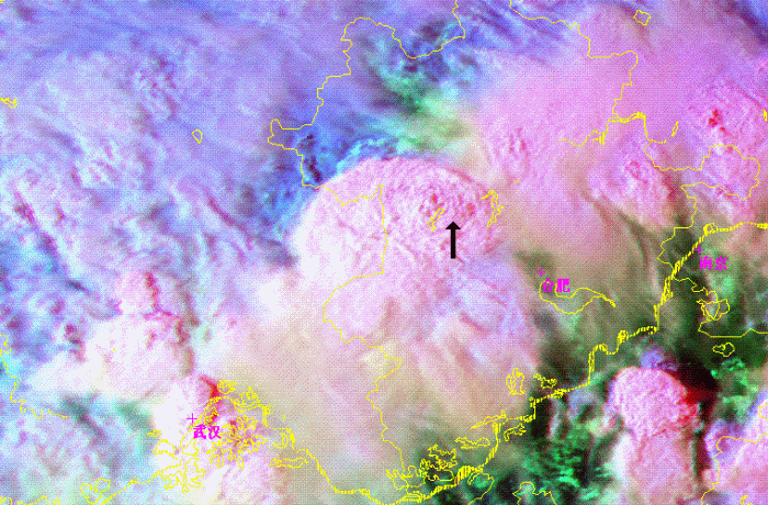
Figure 9: FY-1D/AVHRR channel image and combination image at 08:43
About 30 minutes later, the former comma shape cloudiness band were disappeared, and the MCC was bigger than before. In channel 1 image, the textures of MCC were more complex. And there were same white points among the MCC clouds in channel 3 image. That's means the comma shape cloudiness band were not disappeared really, and just been a part of MCC. So the MCC were merged with the comma shape cloudiness from 08:17 to 08:43 and became a more larger. And it is obviously that the MCC was developed again after merged 3 smaller convective cells.