Radar Image of First merger
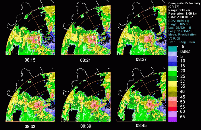
Figure 10: Composite Reflectivity of Hefei Radar From 08:15-09:45 (black line: position of vertical cross section indeicated)
At 08:15, the comma shape cloudiness of satellite image(Figure 8) were consisted by three or more high reflectivity echo center as figure shown. By the reflectivity cross section image, it is certainty that the comma shape cloudiness were consisted by 3 convective cells. The northern 2 cells of the cells had connected at 08:15, and the southern one was dissipated. Six minutes later, the cells were developed and moved east. In composite reflectivity image, there were still 3 strong echo centers. But in cross section image, the southern one had connected with the northern by a middle level(about 4-5Km) weak reflectivity band about 30dBZ. So the cells were merging at this moment. More 6 minutes later, the 2 cells were combined to a bigger one at 08:27. And in cross section image, there was a bigger convective cloud with more higher cloud top(about 18 Km). This merged bigger cloud was developed at the next 6 minutes. The cloud top were over 18Km at 08:33 as cross section image shown. In other words, the cells were developed after merged. Then the cloud top were decreased and about 16Km at 08:39. Compare to satellite image (figure 8 and figure 9), there were more detail information about merging at radar reflectivity field.
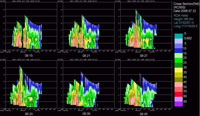
Figure 11: Vertical Cross Section of Reflectivity From 08:15-09:45