Introduction
The 22nd of July 2008 was marked by a motion of a vortex with several convective cells along a frontal cloud band. At the leading edge of a frontal cloud system, lots of thunderstorms reported on the ground stations, and heavy rain, strong wind and lighten were observed. All of this weather events with caused enormous agriculture damage and economical lost. As the movement of vortex, several convective cells emerged and became a larger MCC because of merging each other(as black arrow shown in figure 1), then the MCC was merged with a north MCC and brought severe weather in cloud area. So in this case, two different merging were analyzed in this case, first is the merger of cells and the second is a MCC merging with another one.
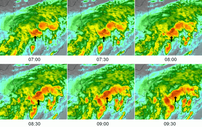
Figure 1: Enhanced IR(FY-2C) 07:00-09:30(UTC) Merging of Convective Cells
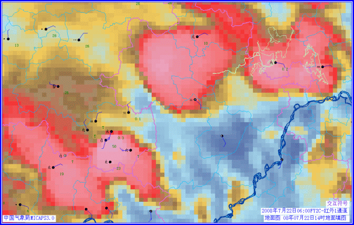
Figure 2: Surface observation Report and Enhanced IR(FY-2C) at 06:00
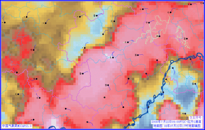
Figure 3: Surface observation Report and Enhanced IR(FY-2C) at 09:00
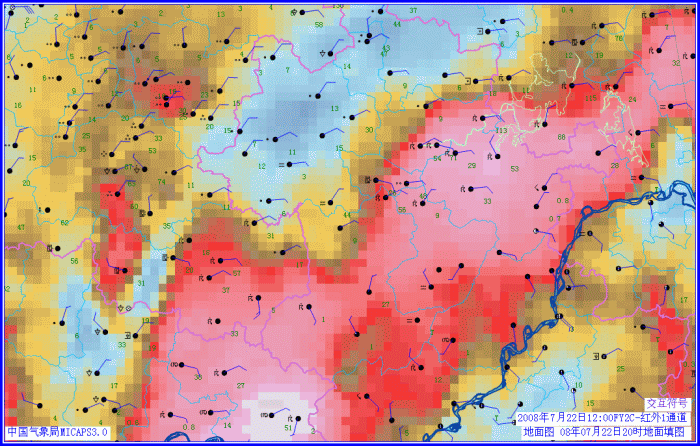
Figure 4: Surface observation Report and Enhanced IR(FY-2C) at 12:00
There were many thunderstorm observation reported from 06:00 to 12:00 in the cold cloud top area as figure shown. Especially after 09:00, when different convective cells had been merged, more and more thunderstorm were reported at weather stations.