Main ULL cut-off
A cut off process has already taken place during the last phases leading to an extended ULL with several sub-centres. One of these secondary lows lies over Austria and N. Italy and during the phase under discussion in this chapter, an intensive cut off process takes place there, leading to a large and pronounced cut-off low over Central Europe which remains for a long time.
The cut-off phase can be observed quite clearly in the satellite images.
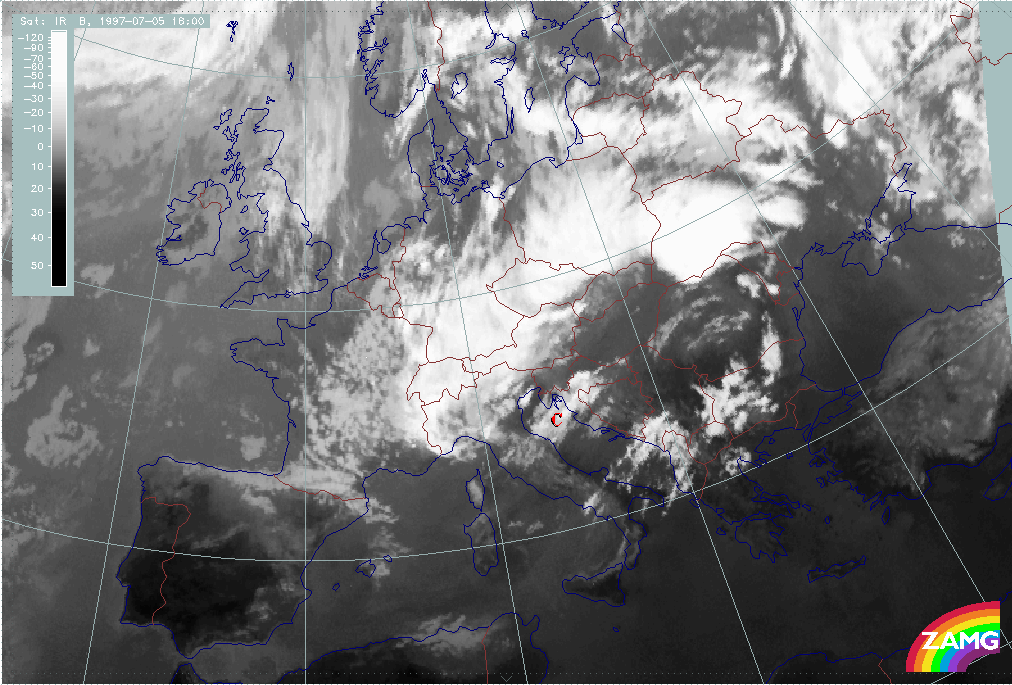
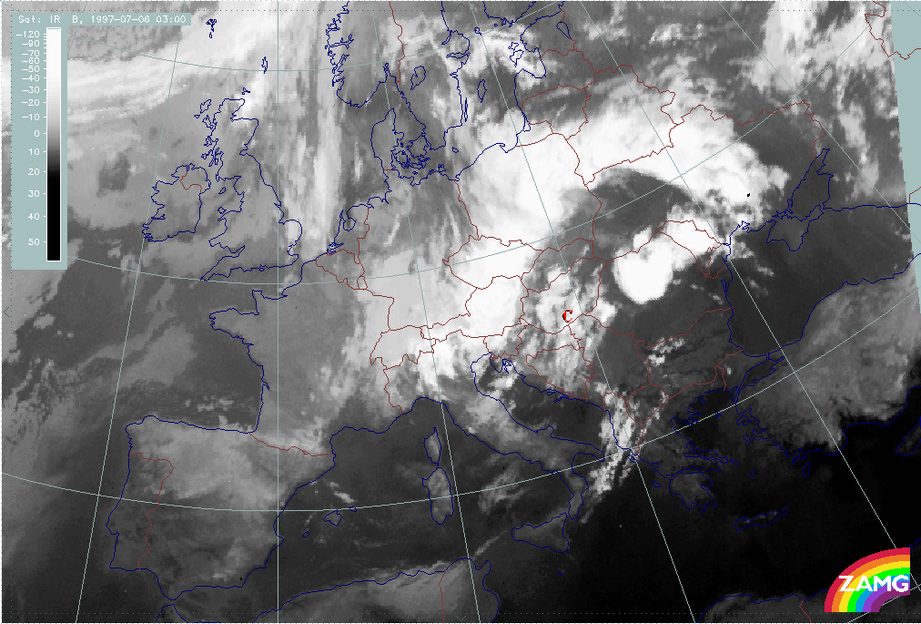
The 3 hourly sequence of images in the first phase between 05 July/18.00 UTC and 06 July/03.00 UTC shows the rapid development of a cloud area C over the Adriatic Sea propagating eastward to Croatia and Hungary. At the same time the western part of the Occlusion - like spiral moves eastward from Switzerland to E. Austria and W. Slovenia.
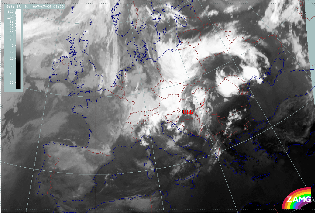
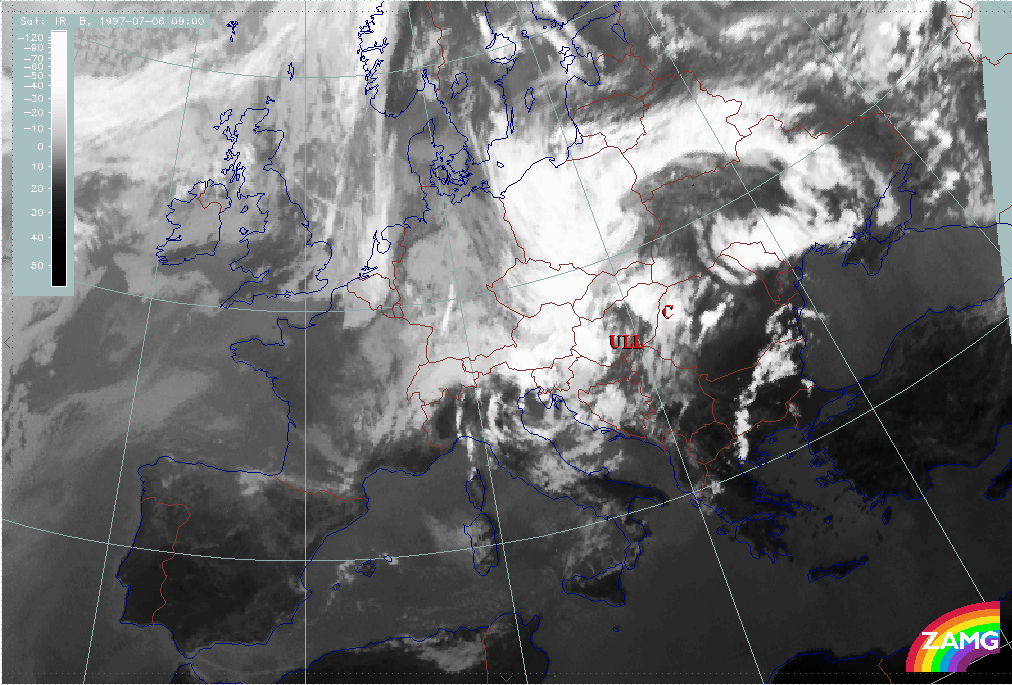
At 06 July/06.00 UTC, the cloud system C and the western Occlusion - like spiral form two cloud bands which are cyclonically curved against each other enclosing small cellular cloudiness over SW Hungary. This is very typical for an ULL in a cut-off stage. It becomes even more intensive at 06 July/09.00 UTC.
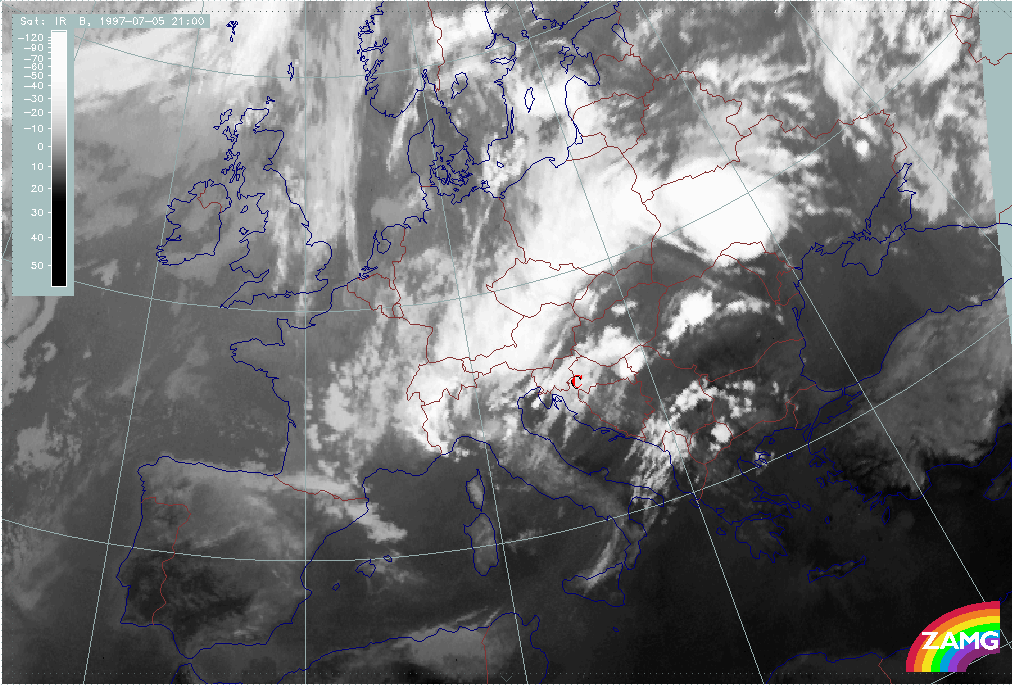
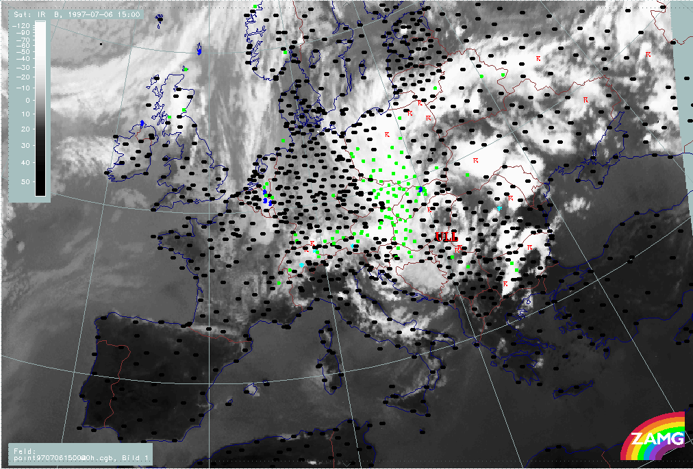
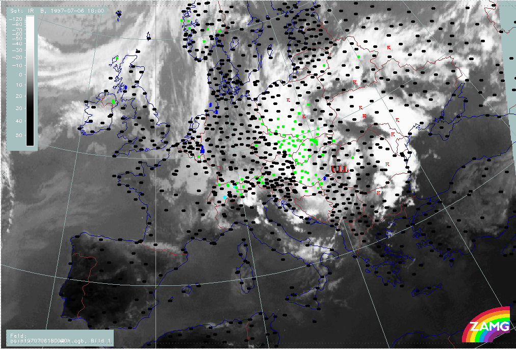
The next phase between 06 July/12.00 and 18.00 UTC shows an explosive development of the eastern boundary of the cut-off low into a huge convective line accompanied by many thunderstorms. The western boundary of the cut off low over Austria and Hungary is accompanied by wide spread rain events.
|
05 July 1997/18.00 UTC - Meteosat IR image; 05/18.00 - 06/09.00 UTC 3-hourly image loop
|
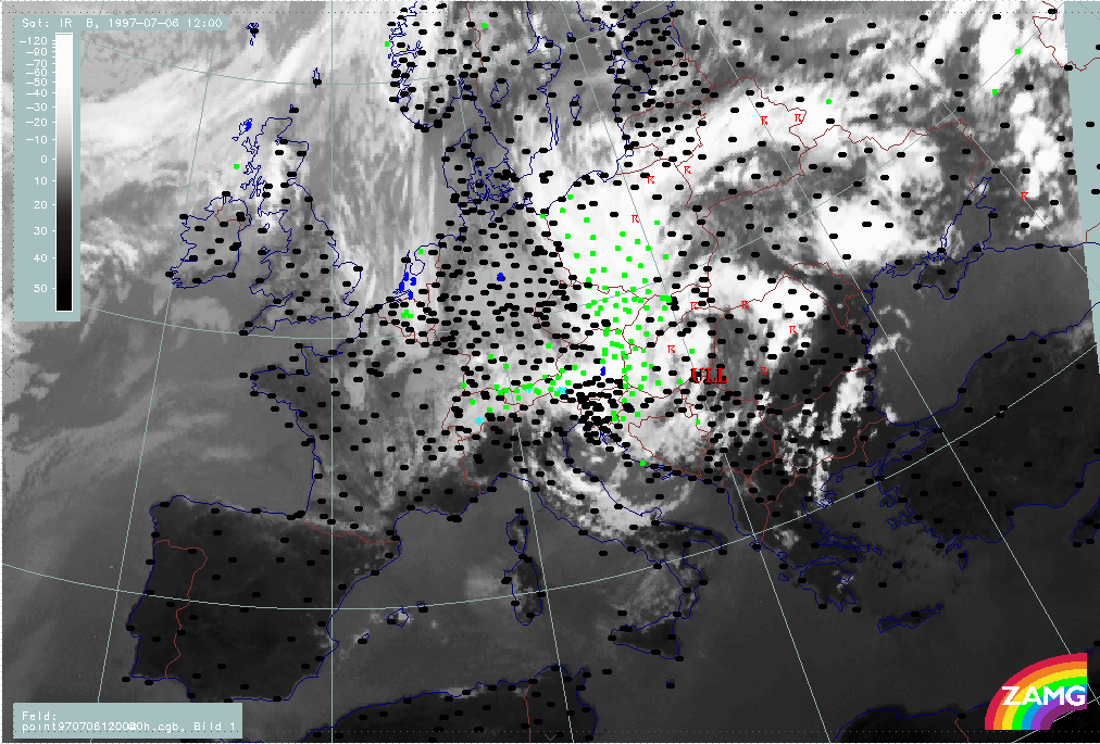
06 July 1997/12.00 UTC - Meteosat IR image; weather events (green: rain and showers, blue: drizzle, cyan: snow, red: thunderstorm with precipitation, purple: freezing rain, orange:
hail, black: no actual precipitation or thunderstorm with precipitation)
|
The first sign of cloud development over the Adriatic Sea appears at 05 July/16.00 UTC. Therefore, the time of 18.00 UTC is very close to this first cloud development event.
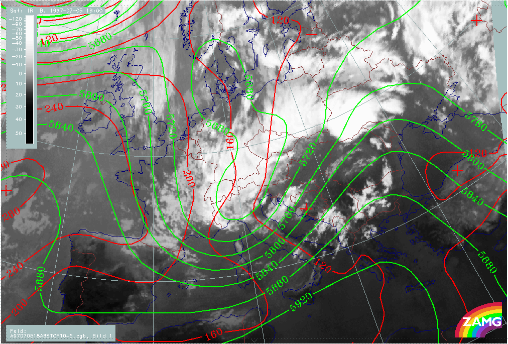
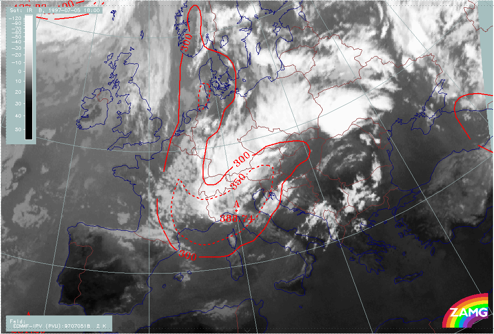
The cloudiness C over the Adriatic Sea and Croatia develops in the SW upper level stream in front of a secondary upper level low over W. Austria and N. Italy. There is no obvious low in the surface pressure field. The cyclonic curvature in the cloud field over N. Italy indicates the intensive trough there.
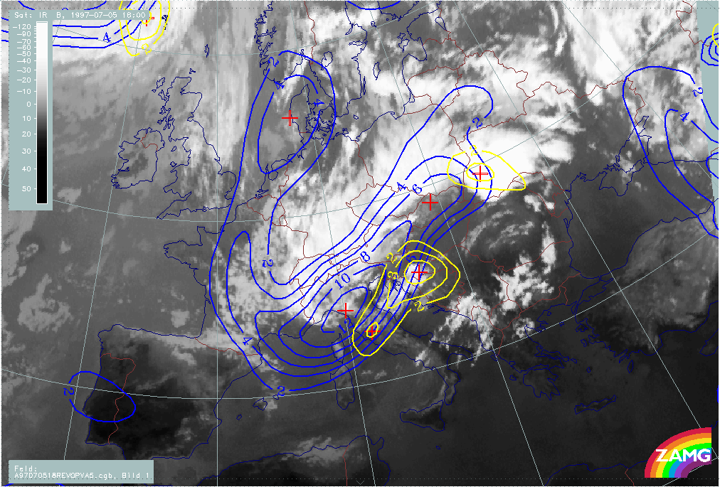
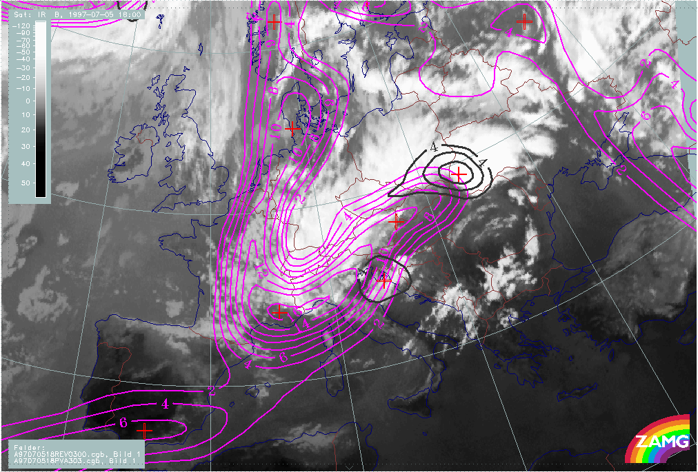
The effect of the upper levels becomes even clearer when looking at PVA at 500 hPa. There is an excellent correlation between PVA maxima and the new cloud field at both levels 500 and 300 hPa. The PVA maxima are immediately in front of vorticity maxima and represent the deepening as well as the propagation of the Upper Level Low to the rear.
The height of Potential Vorticity (PV) of 2 units shows a lowest values of 388 hPa in the area of the ULL over N. Italy.
|
05 July 1997/18.00 UTC - Meteosat IR image; red: height contours 1000 hPa, green: height contours 500 hPa
|
05 July 1997/18.00 UTC - Meteosat IR image; blue: vorticity 500 hPa, yellow: positive vorticity advection (PVA) 500 hPa
|
|
|
|
|
|
05 July 1997/18.00 UTC - Meteosat IR image; magenta: vorticity 300 hPa, black: positive vorticity advection (PVA) 300 hPa
|
05 July 1997/18.00 UTC - Meteosat IR image; red: height of PV=2 units
|
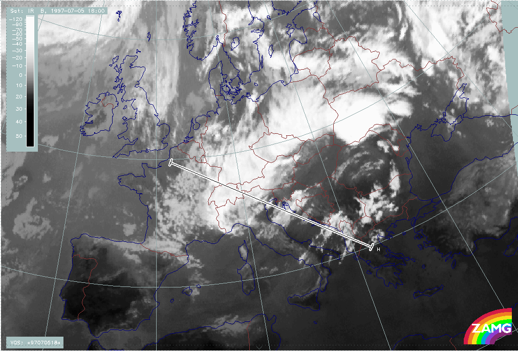
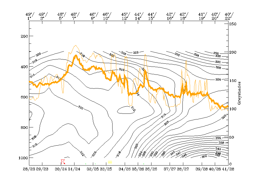
Vertical cross section line H is chosen from NW (France) across the ULL over N. Italy and the new cloud field C to the SW over Greece. Isentropes show several features:
The main IR and WV peak at about 48N/07E represents the western Occlusion - like cloud band and is (as discussed in the chapter before) connected to an unstable layer and an upper level cold
front zone. The area between about 46N/10E and 45N/12E consists of several peaks. The relative minimum of 312K at 45N/12E and 650 hPa indicates the ULL. The single peak at 44N/14E represents
the new cloud area C. It appears within an upper level Baroclinic Boundary with a high gradient of isentropes inclined downward from 400 hPa to 700 hPa.
The isentropic surface of 314K is representative for the zone of high gradient in connection with the ULL and is also the lowest surface of the Baroclinic Boundary in the area of C. Relative streams at this surface indicate the cyclonic curvature in the cut off area and some gentle ascent. The new cloud feature C appears in this ascending branch and is also generally parallel to the cloud fibres.
|
05 July 1997/18.00 UTC - Meteosat IR image; position of vertical cross section indicated
|
05 July 1997/18.00 UTC - Vertical cross section; black: isentropes (ThetaE), orange thin: IR pixel values, orange thick: WV pixel values
|
|
|
|
|
|
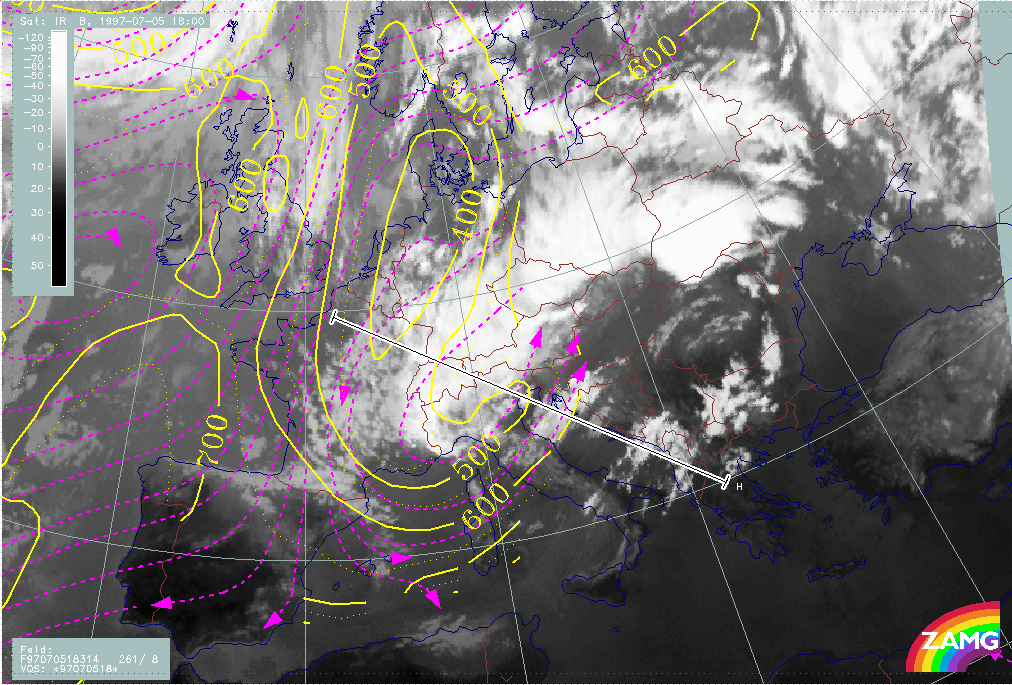
05 July 1997/18.00 UTC - Meteosat IR image; magenta: relative streams 314K - system velocity 261° 8 m/s, yellow: isobars
|
|
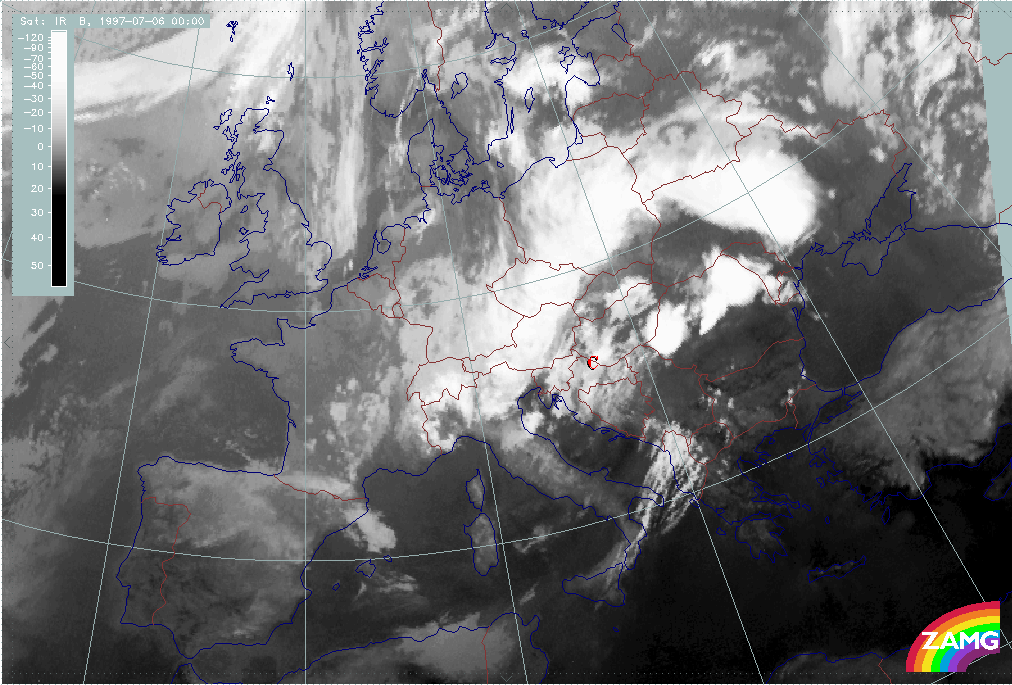
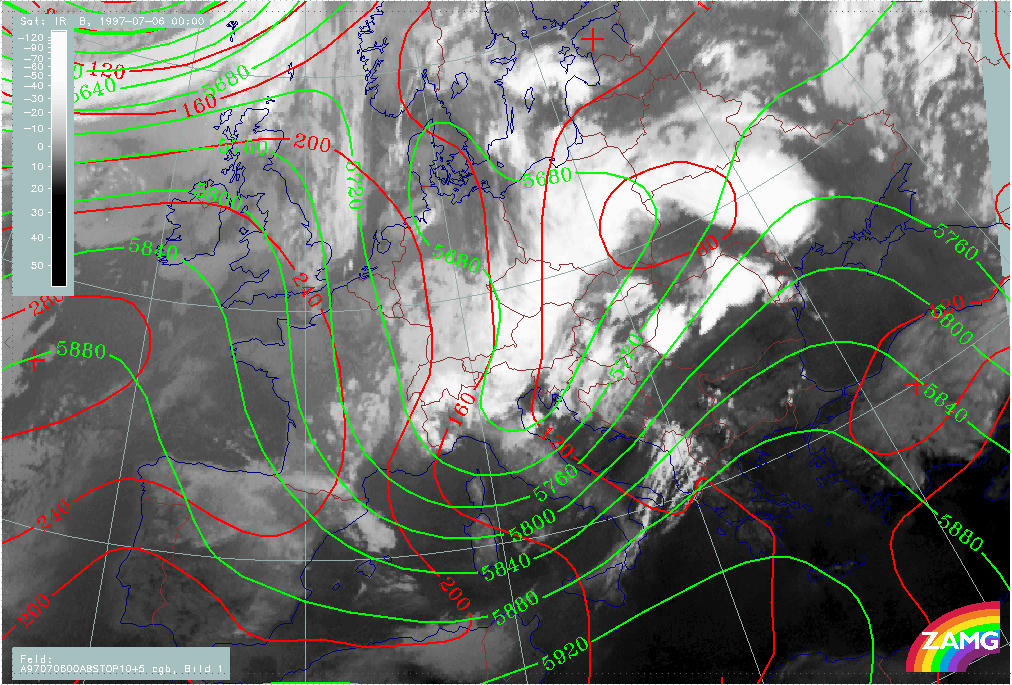
The development is rather quick; 6 hours later there is already a much larger area, marked C, which is fully developed. It mainly covers Slovenia - Croatia - Hungary. The western ULL boundary has moved from the W. Alps to E. Italy.
The height fields show an even more distinct secondary over N. Italy in excellent agreement with the cloud features there. There are no pronounced low pressure features in the surface field.
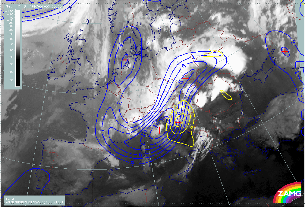
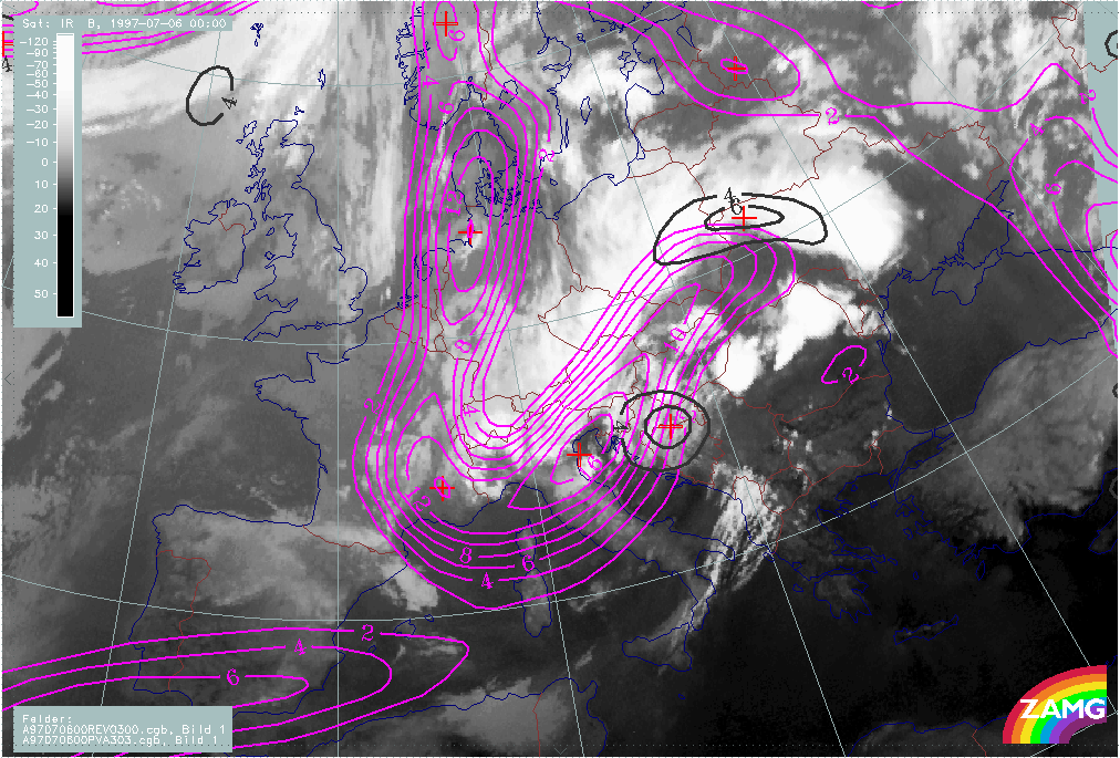
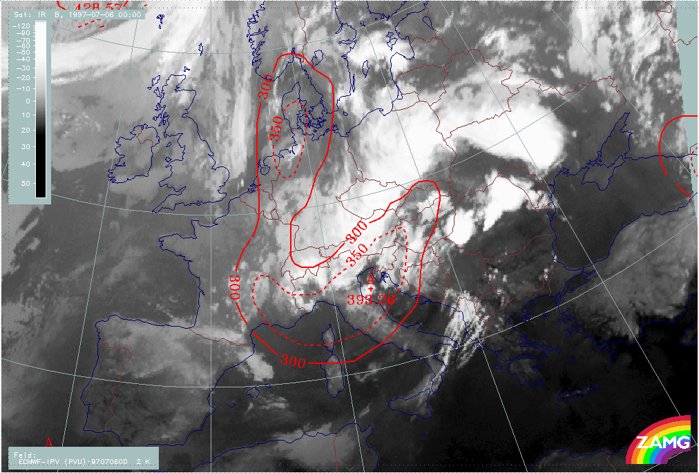
As before, the increased cloudiness is accompanied by PVA maxima in both the 500 and 300 hPa levels, indicating the further deepening and propagating ULL. In the centre of the cut-off low stratospheric air (PV=2 units) has reached about 400 hPa.
|
06 July 1997/00.00 UTC - Meteosat IR image; red: height contours 1000 hPa, green: height contours 500 hPa
|
06 July 1997/00.00 UTC - Meteosat IR image; blue: vorticity 500 hPa, yellow: positive vorticity advection (PVA) 500 hPa
|
|
|
|
|
|
06 July 1997/00.00 UTC - Meteosat IR image; magenta: vorticity 300 hPa, black: positive vorticity advection (PVA) 300 hPa
|
06 July 1997/00.00 UTC - Meteosat IR image; red: height of PV=2 units
|
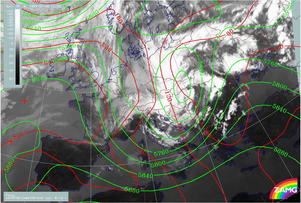
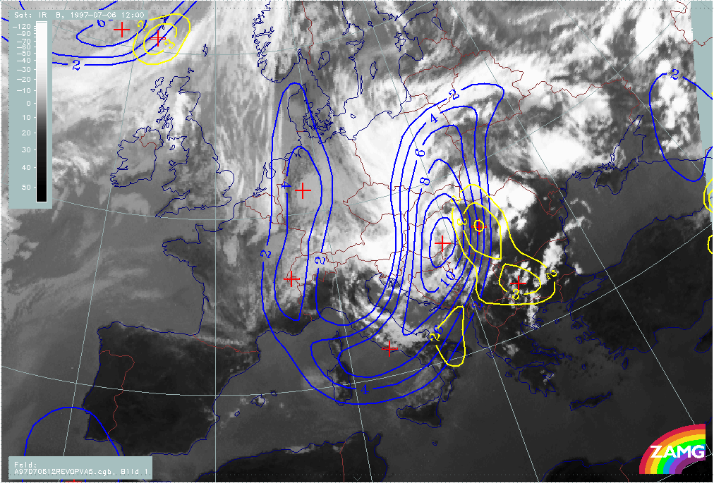
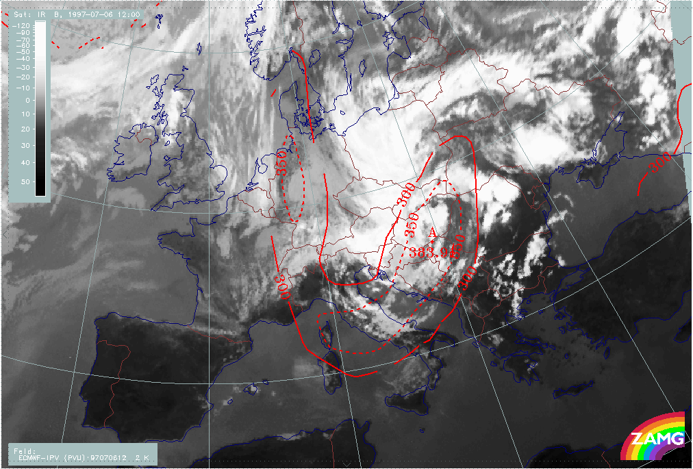
12 hours later at 06 July 12.00 UTC, a huge ULL has developed with its centre over Hungary and Slovakia. There are still two cloud bands cyclonically curved towards each other. The eastern one now consists of new developing convective cells.
The relationship between cloud configuration, vorticity and PVA maximum as well as lowest height of stratospheric air (PV=2 units) is (as before) very good and represents the cut off process in an ideal way.
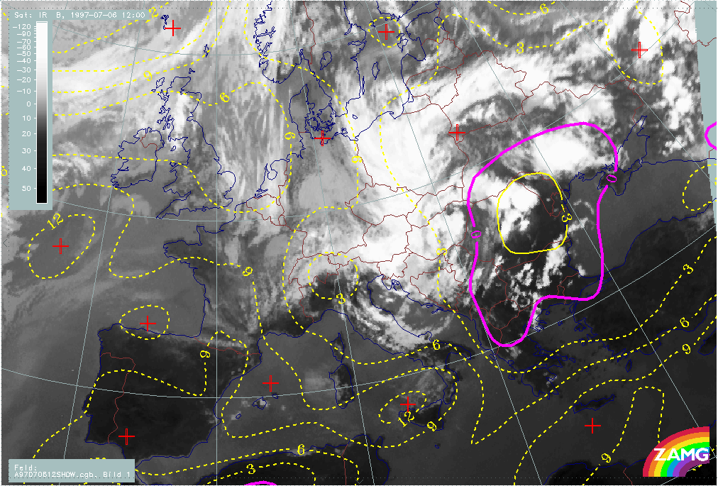
Convection is very intensive in the eastern boundary of the ULL. This is an area with very high instability. The Showalter Index has values below -3°C in this area, which indicate probabilities of very heavy thunderstorms.
|
06 July 1997/12.00 UTC - Meteosat IR image; red: height contours 1000 hPa, green: height contours 500 hPa
|
06 July 1997/12.00 UTC - Meteosat IR image; blue: vorticity 500 hPa, yellow: positive vorticity advection (PVA) 500 hPa
|
|
|
|
|
|
06 July 1997/12.00 UTC - Meteosat IR image; red: height of PV=2 units
|
06 July 1997/12.00 UTC - Meteosat IR image; yellow: Showalter index, magenta: Showalter index
|