Baroclinic ULL boundary and rotations of convective lines
The ULL which formed in the previous phase and was discussed in detail in the previous chapter is a very long lasting phenomenon. While the system as a whole is rather stationary, cloud lines of a predominantly convective nature develop at the eastern boundary and are incorporated into the cyclonic rotation. As such they feed the ULL with warm, humid air form the E - NE. This leads to a catastrophic situation concerning precipitation amounts. Almost the same countries which had already received much rainfall during the previous phases are now under the influence of a stationary Baroclinic Boundary fed by unstable humid air.
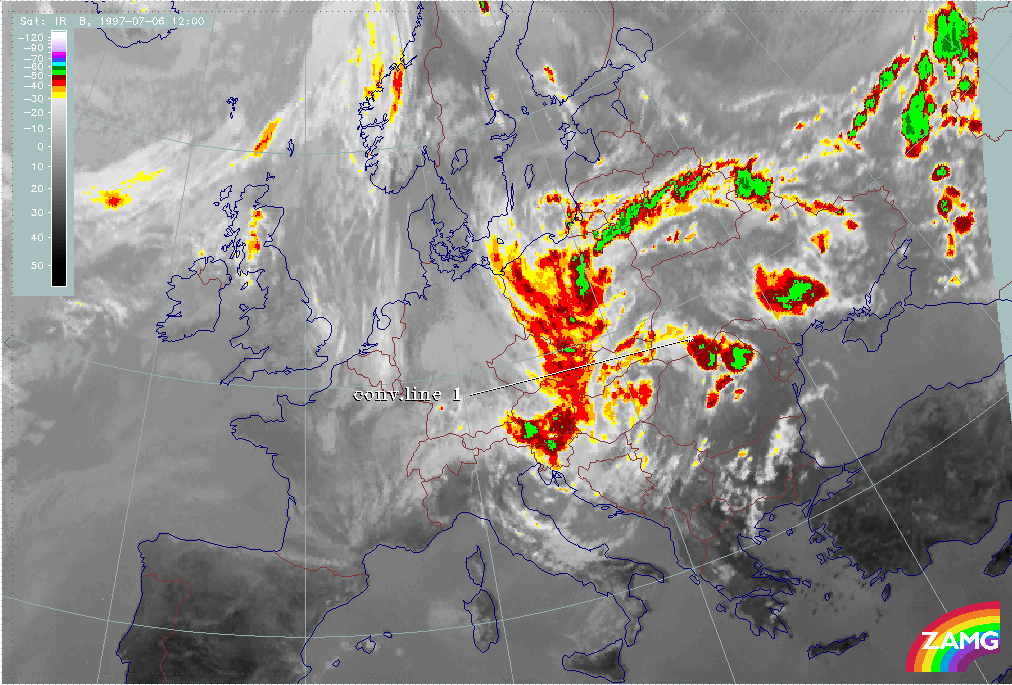
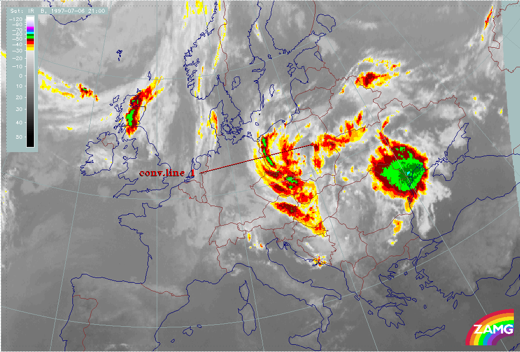
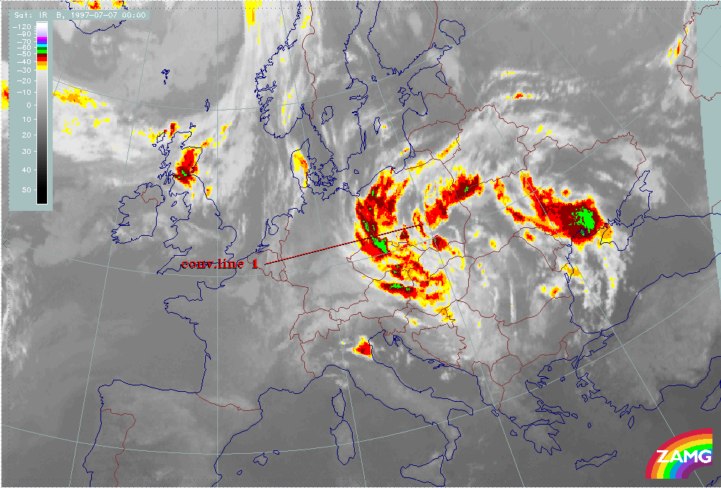
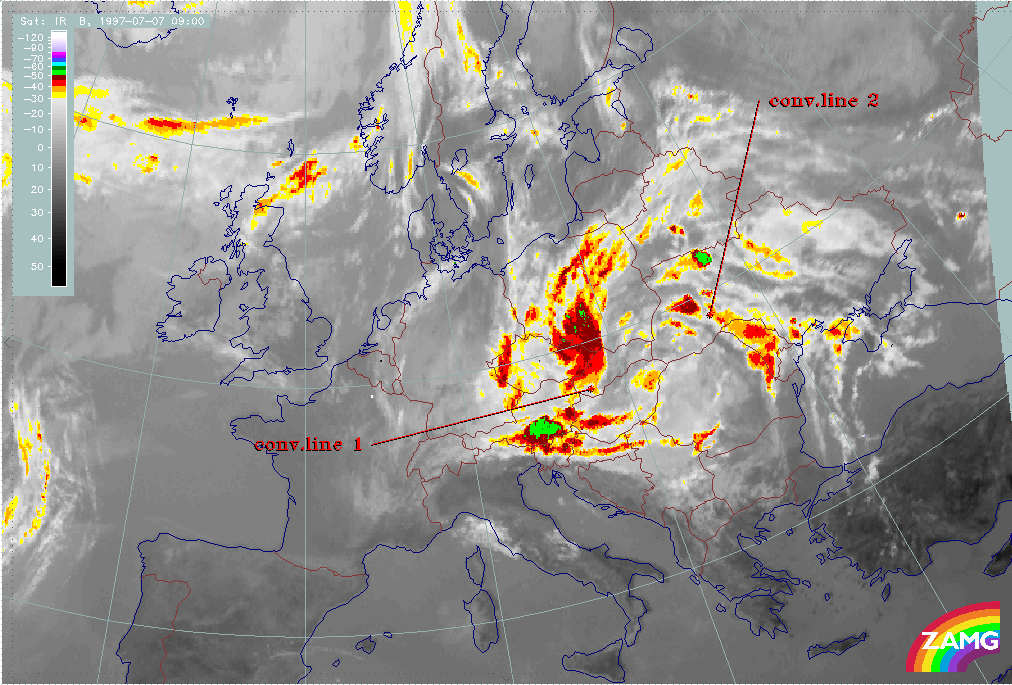
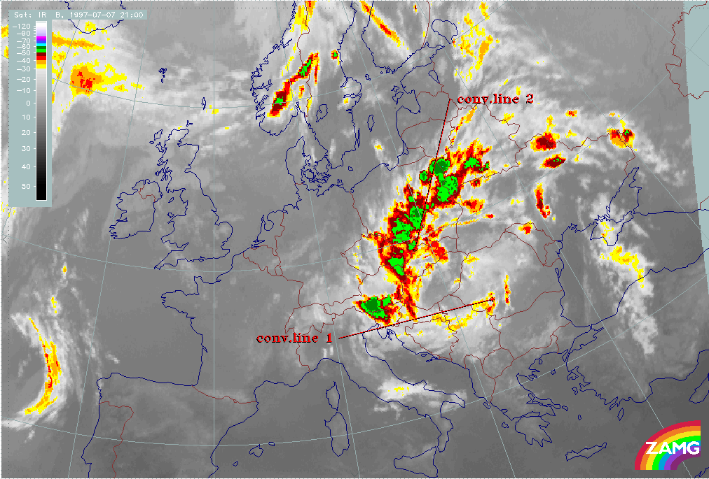
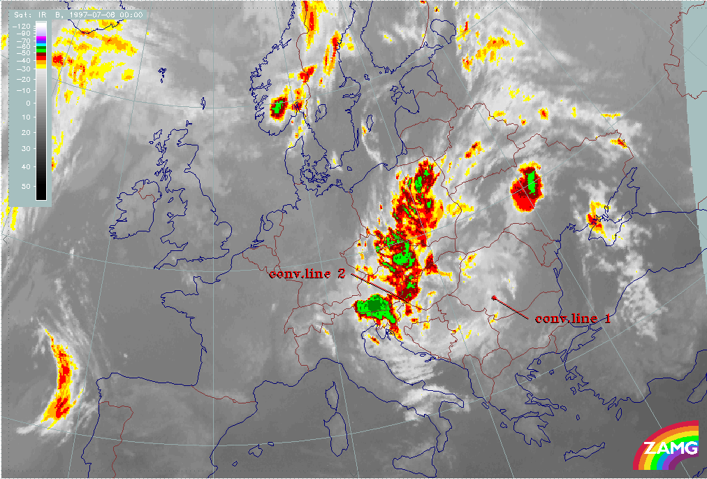
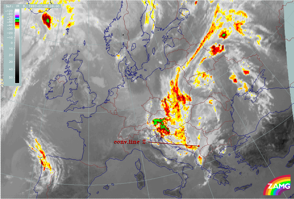
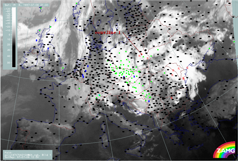
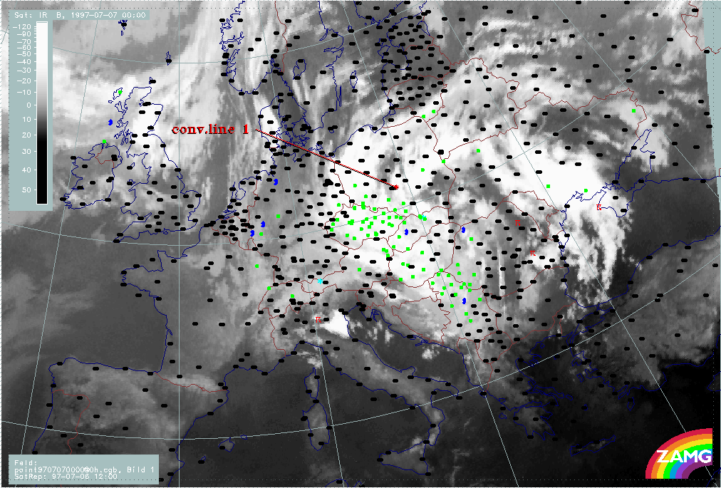
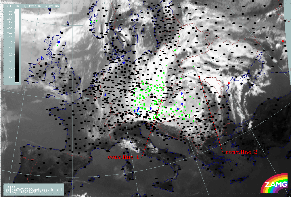
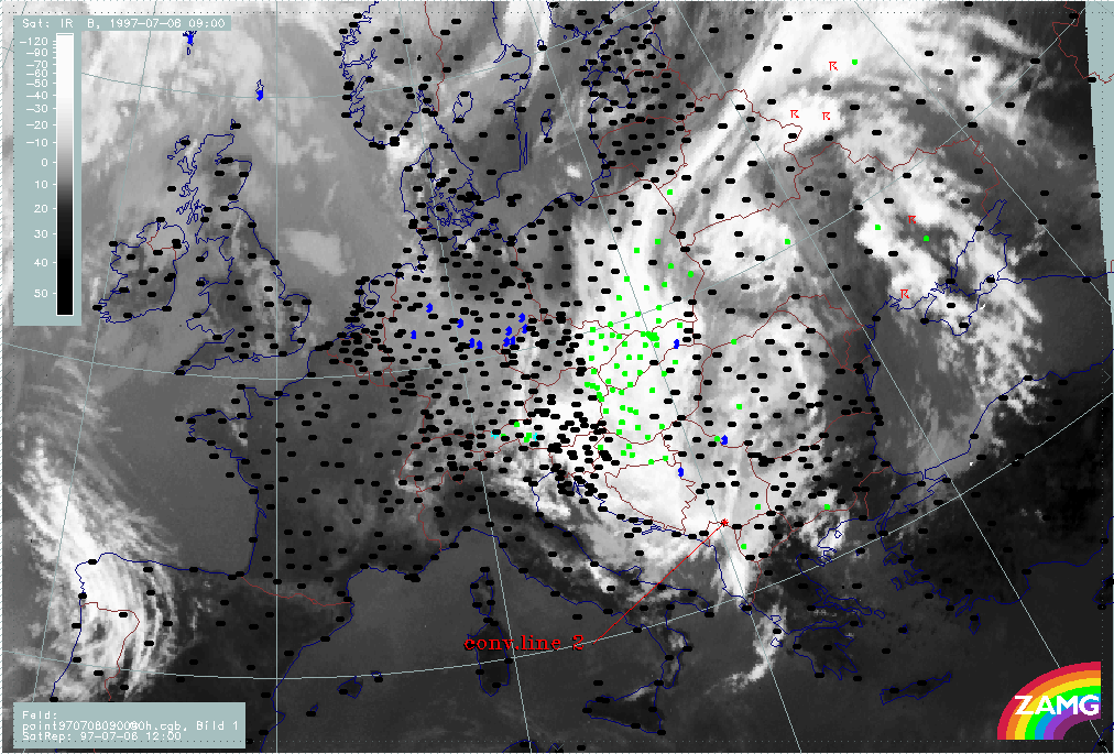
The 3-hourly image sequence starts with the last image of the previous period. In the sequence the leading edge of the convective line ("conv.line 1") is indicated.
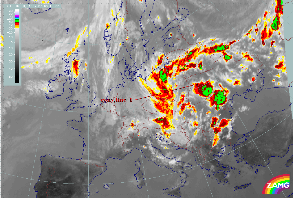
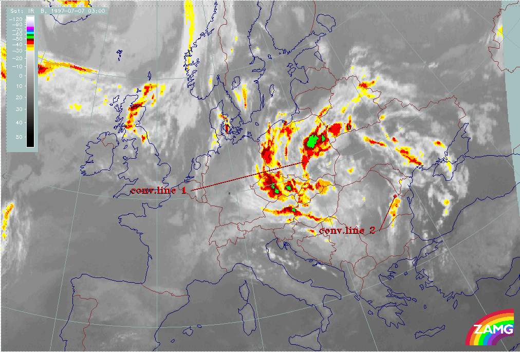
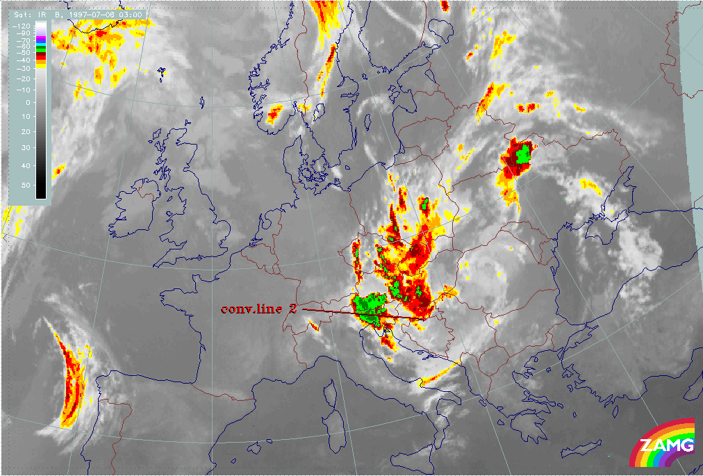
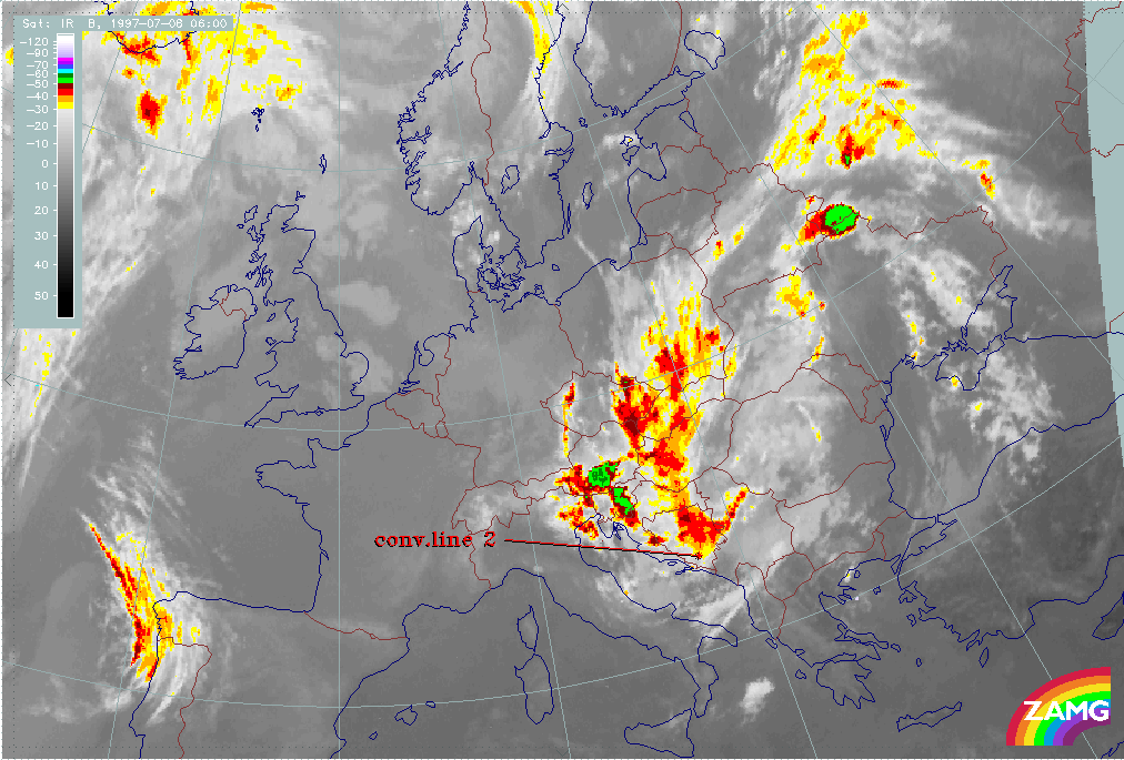
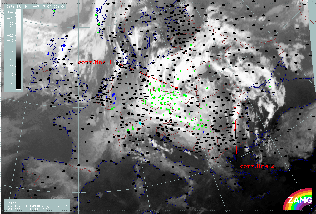
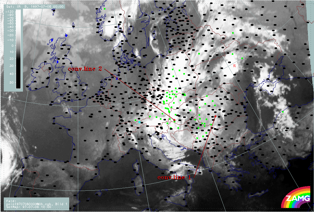
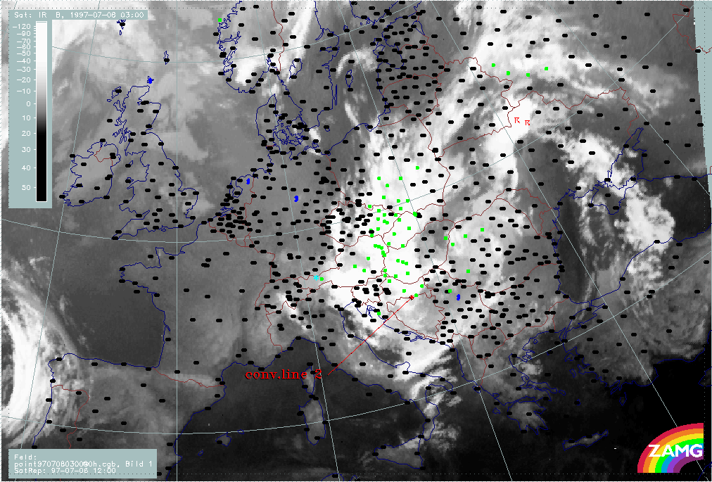
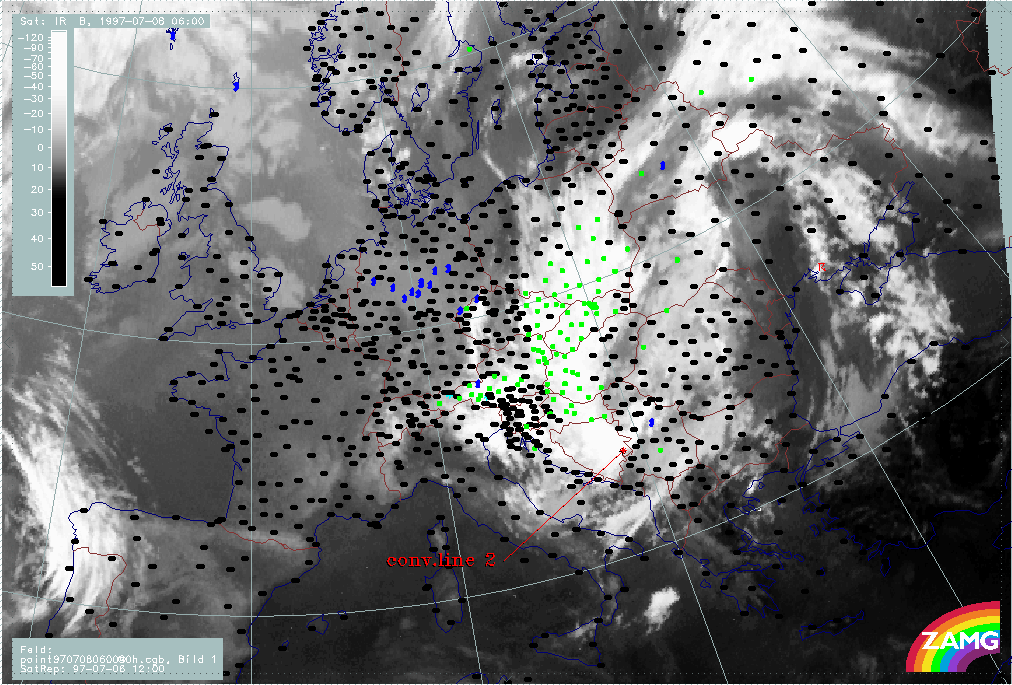
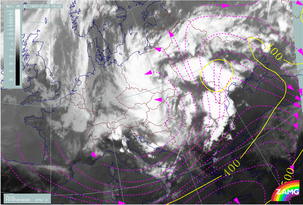
During the next 6 hours, till 06 July/18.00 UTC, the line increases and widens; it consists of heavily developing MCSs and its leading edge moves from the S. to the N. Ukraine. During the next period, till 07 July/03.00 UTC, convective line 1 splits into one huge convective part over the Black Sea and a smaller convective system which moves from the N. Ukraine into Poland, having been drawn into the cyclonic circulation and beginning to merge with the western ULL boundary.
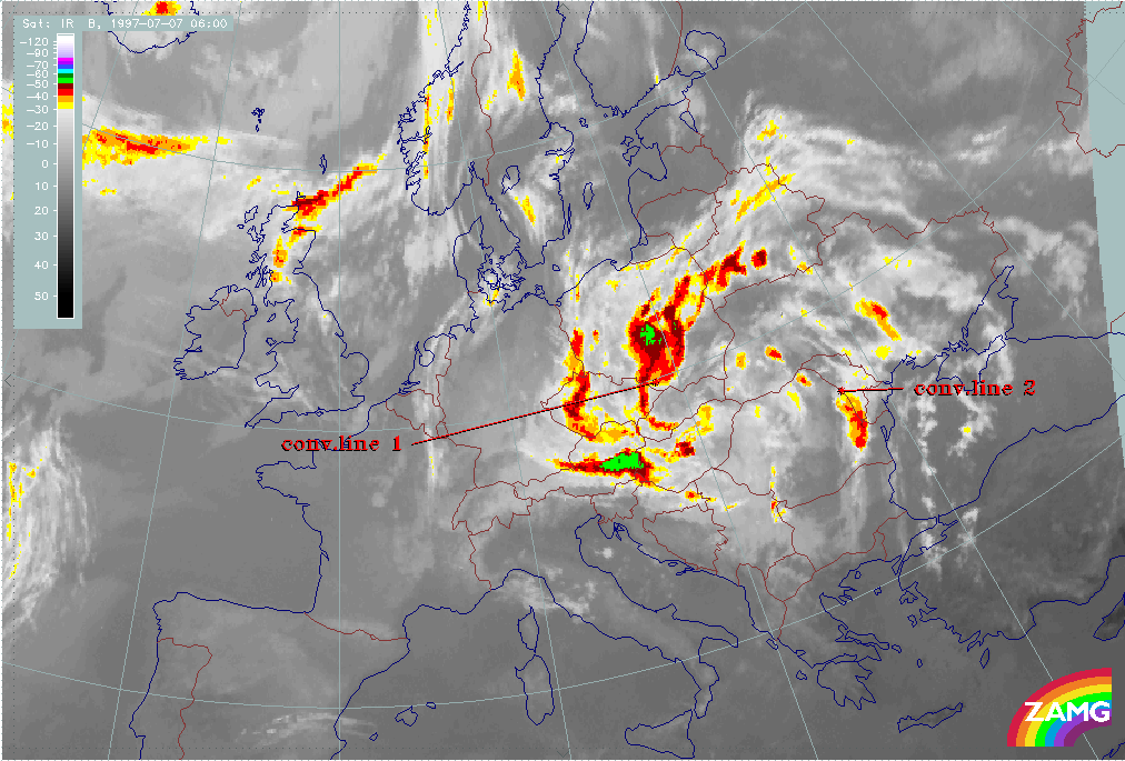
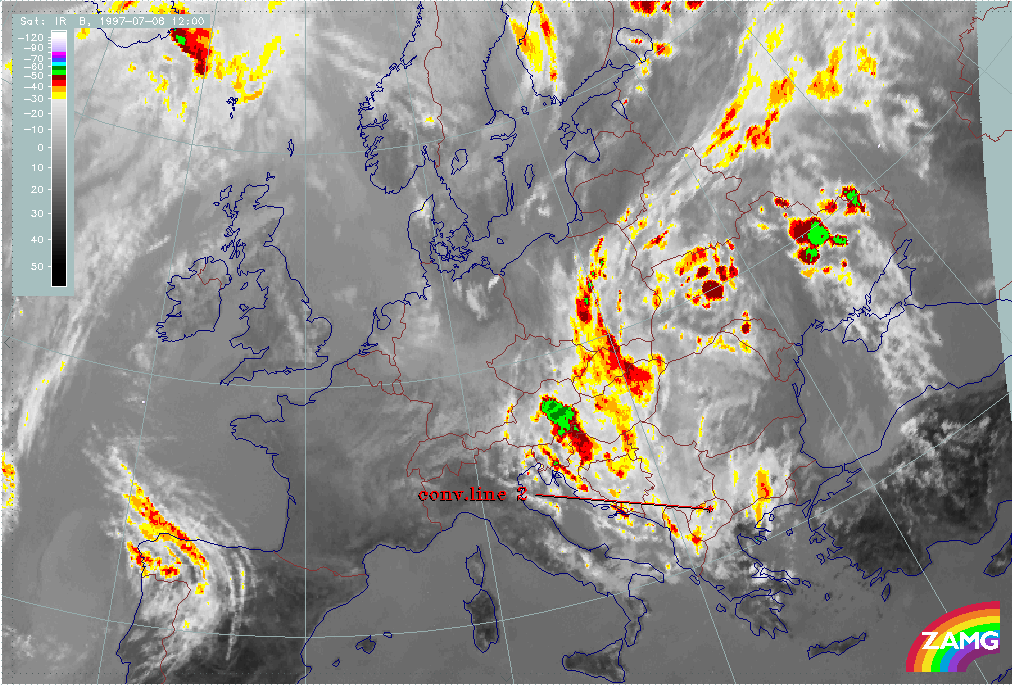
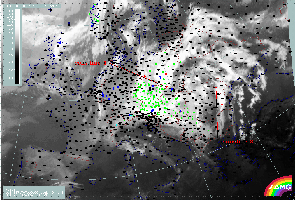
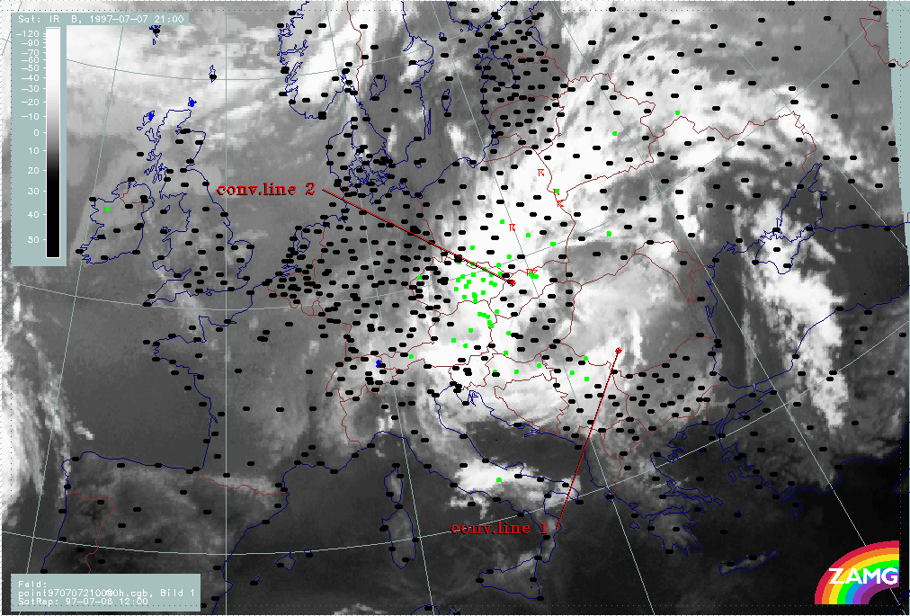
At 07 July/03.00 UTC, a new convective line is identified by its leading edge with "conv. line 2". During the next 6 hours till 07 July/09.00 UTC, "conv. line 1" moves across Poland into Slovakia. At the same time, the new "conv. line 2" has reached the Ukraine. Although this line contains the coldest cloud tops there is a wide area to the NE which is full of new convective cells and lines.
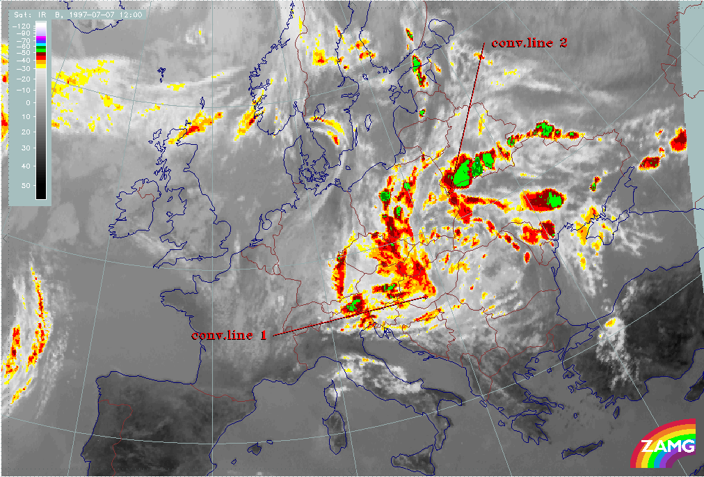
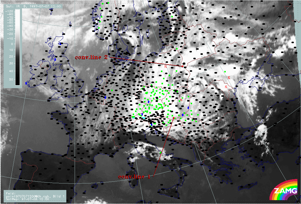
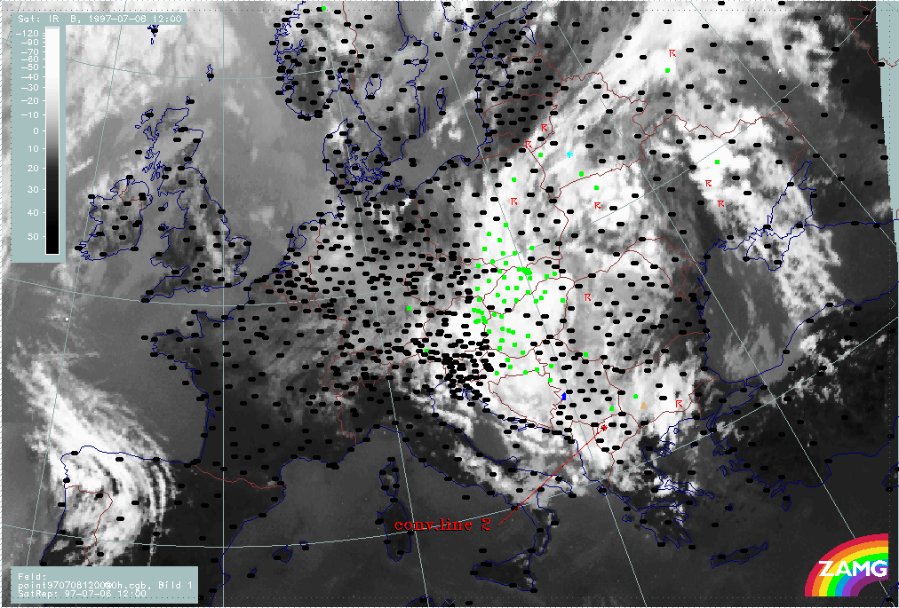
3 hours later at 07 July/12.00 UTC, the leading edge of "conv. line 1" has almost crossed Hungary and NE Austria. It is broad with cold tops and easy to follow. "Conv. line 2" has reached the E boundary of Poland, although it now merges with other cells. Especially a rapidly increasing cell over S. White Russia is involved into the process.
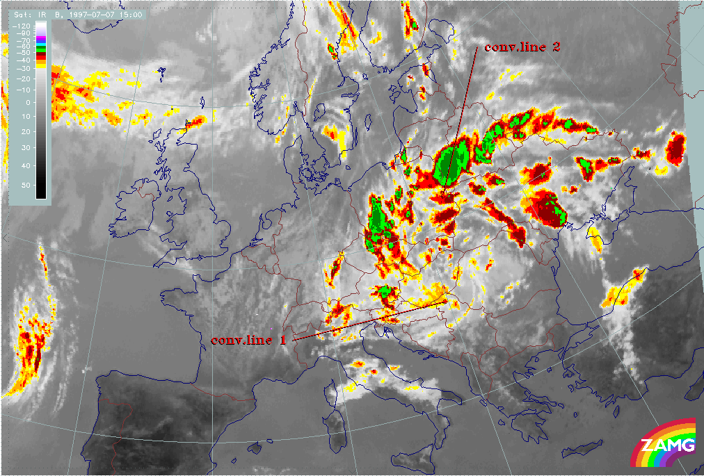
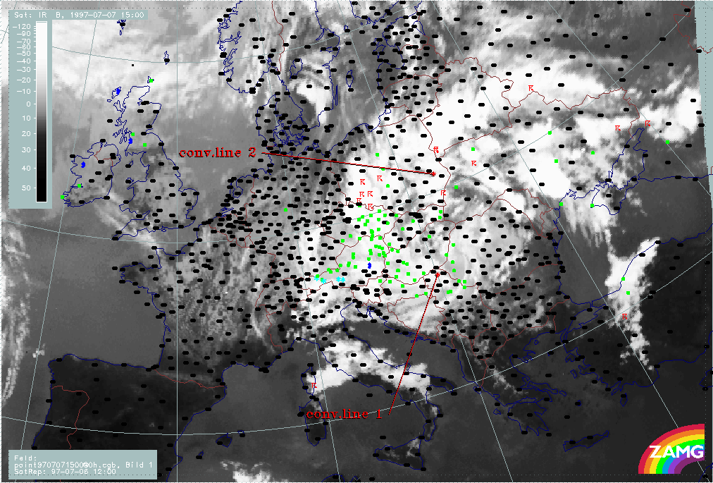
During the next 6 hours the height of "conv. line 1" decreases but its leading edge still can be followed from Hungary across N. Yugoslavia. The leading edge of "conv. line 2" is not so easy to identify as it merges with a very intensive line over White Russia. But even if this uncertainty is taken into account, its leading edge can still be identified over central Poland.
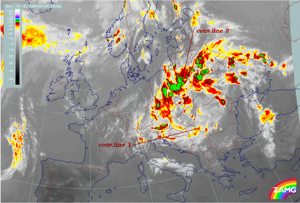
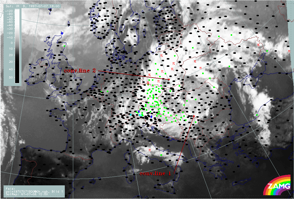
During the next phase, till 08 July/06.00 UTC, "conv. line 1" decreases in its cloud top height and finally is no longer labelled. "Conv. line 2" is very intensive and clearly discernible while it moves southward towards Bosnia.
Only during the next 6 hours, until 08 July/12.00 UTC, does "conv. line 2" decrease in height.
Both convective lines have rotated at least once around the ULL centre and have almost reached their original starting point.
|
06 July 1997/12.00 UTC - Meteosat IR enhanced image; 06/12.00 - 08/12.00 UTC 3-hourly image loop
|
|
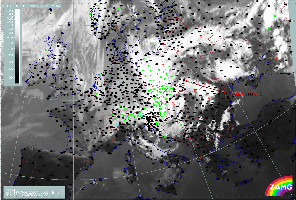
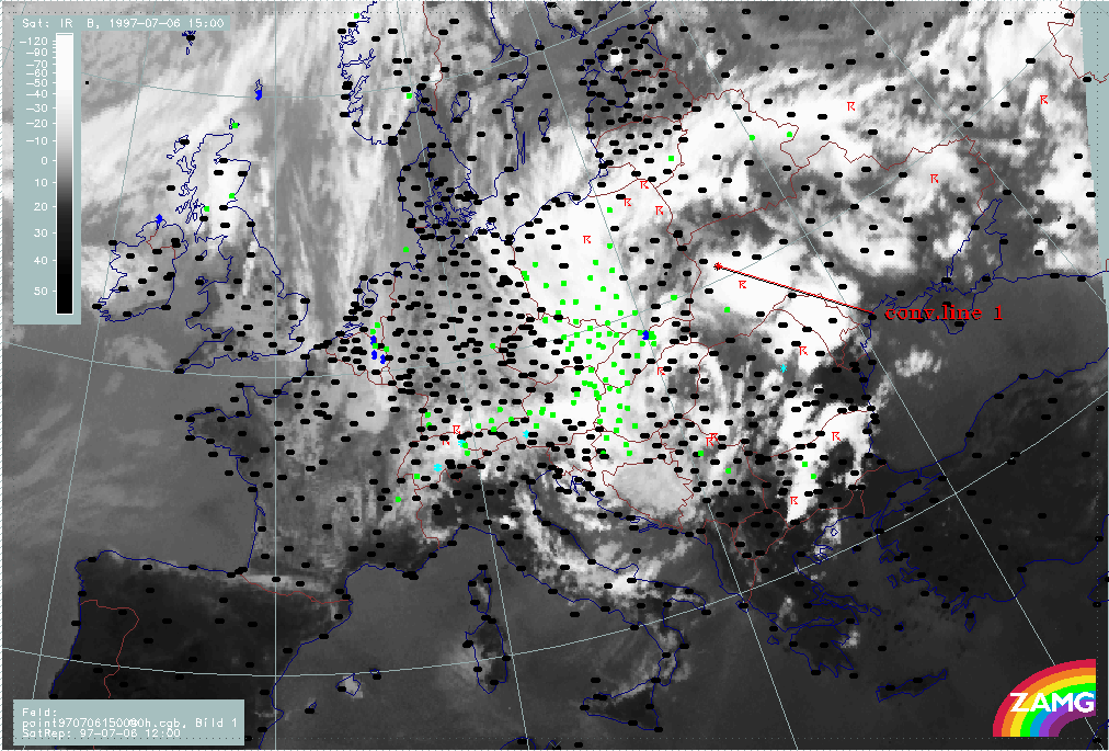
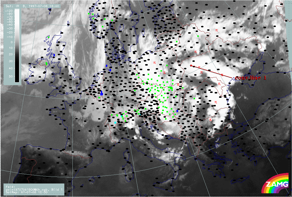
The next image sequence shows the precipitation and thunderstorm areas. The dramatic situation is clearly reflected in the images. The countries affected by rain throughout the whole period are: Poland (changing somewhat between S and E Poland), the Czech Republic, especially the eastern parts, Slovakia, especially the western parts, E. Austria, Hungary, especially the western parts, and NE Croatia for most of the time. N. Yugoslavia and W. Romania are also affected at times.
|
06 July 1997/12.00 UTC - Meteosat IR image; weather events (green: rain and showers, blue: drizzle, cyan: snow, red: thunderstorm with precipitation, purple: freezing rain, orange: hail, black: no actual precipitation or thunderstorm with precipitation); 06/12.00 - 08/12.00 UTC 3-hourly image loop
|
|
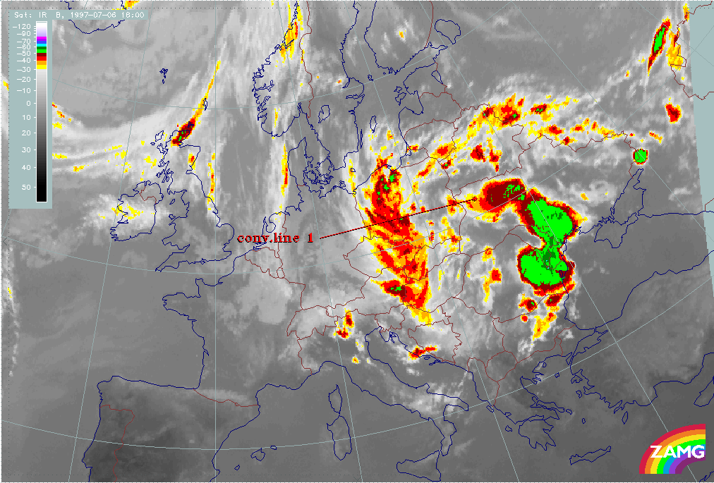
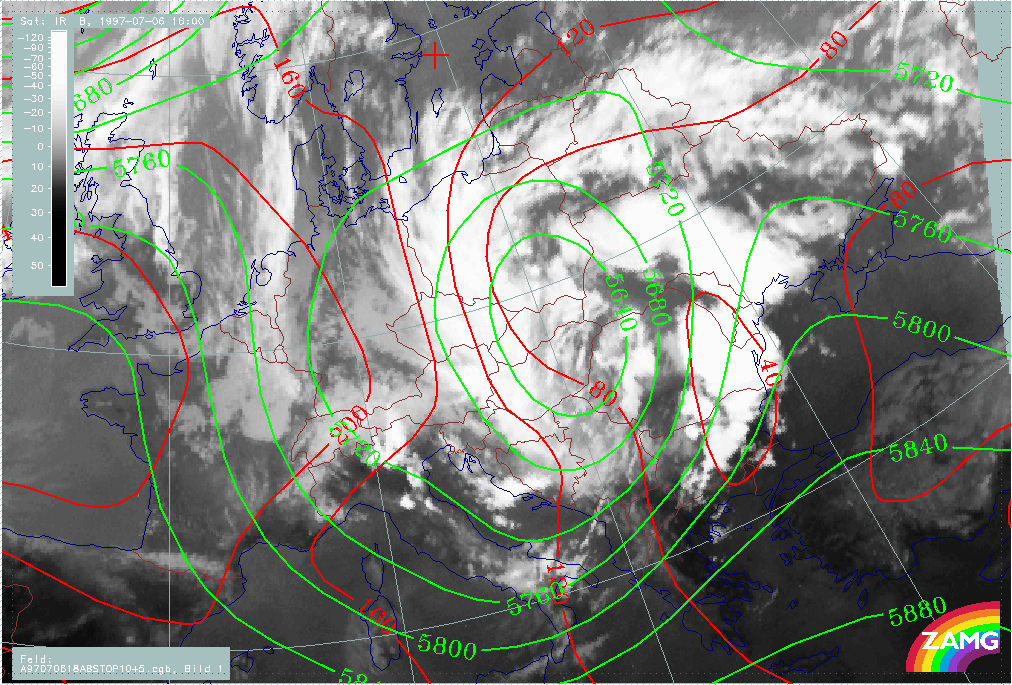
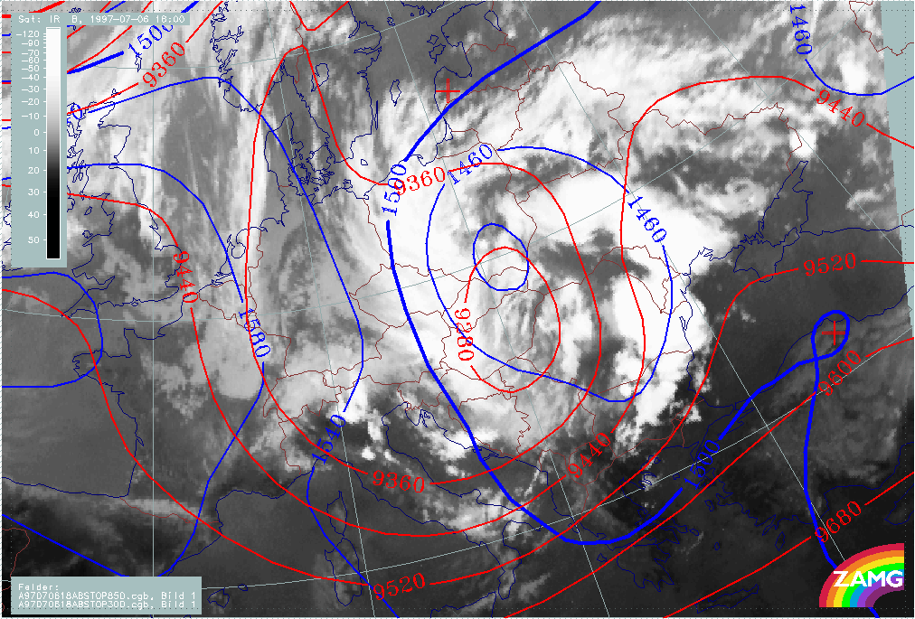
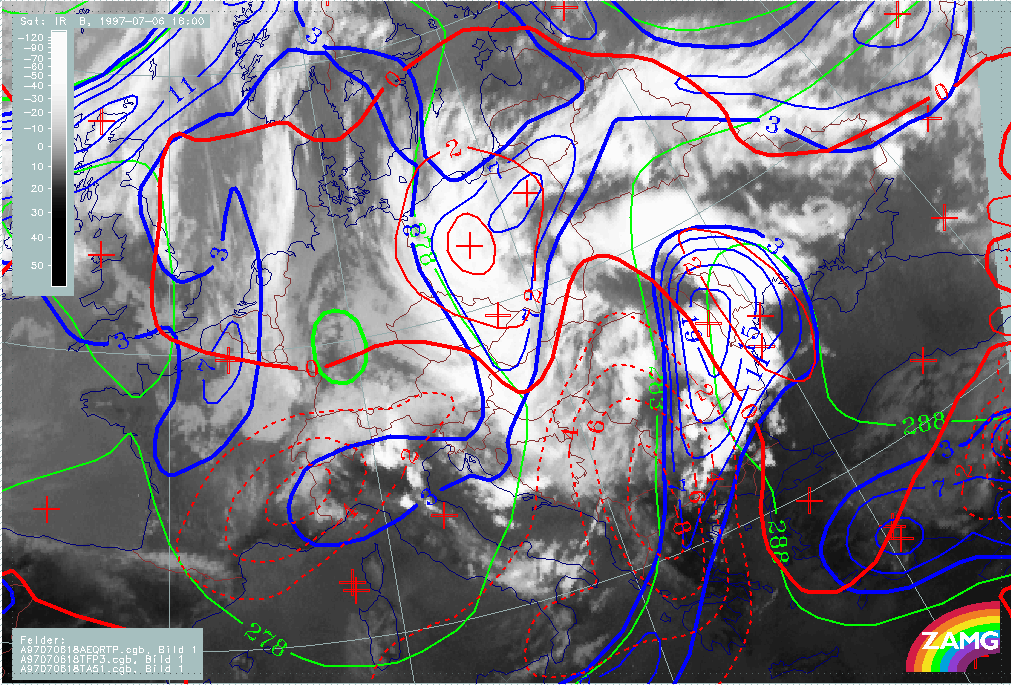
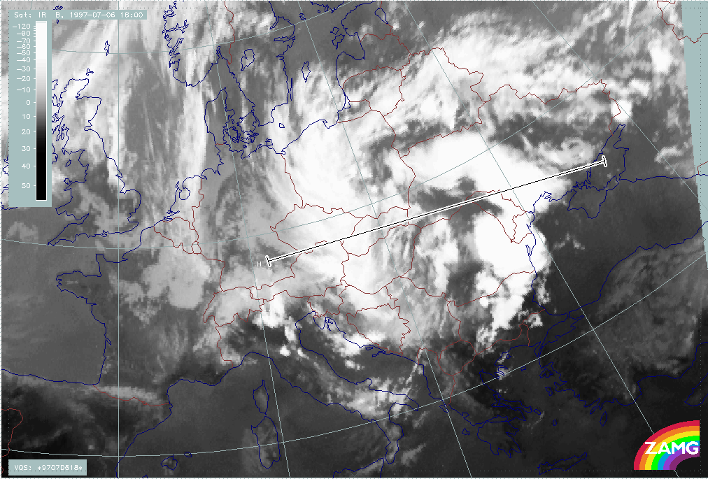
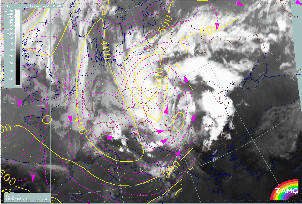
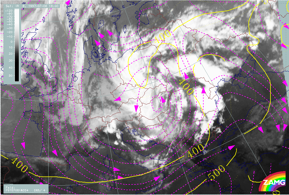
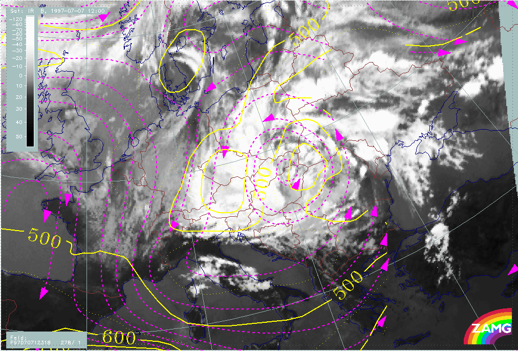
06 July/18.00 UTC is a point in time where convective line 1 (see chapter Main ULL cut-off) as well as the western Baroclinic Boundary which extends from Poland southward to Croatia are fully developed. Both cloud bands are cyclonically curved around the intensive ULL centre which can be found over E. Hungary and E. Slovakia at 500 and 300 hPa. There is no discernable surface low, but a closed isoline at 850 hPa over SE Poland.
Both cloud bands are accompanied by a TFP branch, but convective line 1 lies within a thickness ridge. Both cloud bands are under the influence of WA while the ULL centre is an area of rather strong CA.
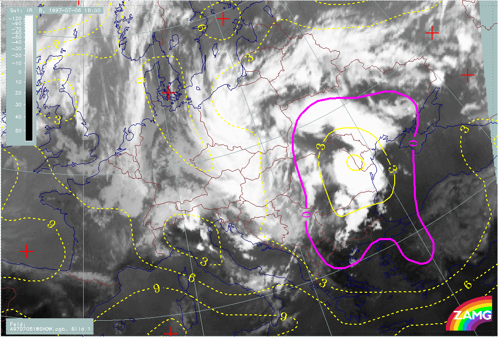
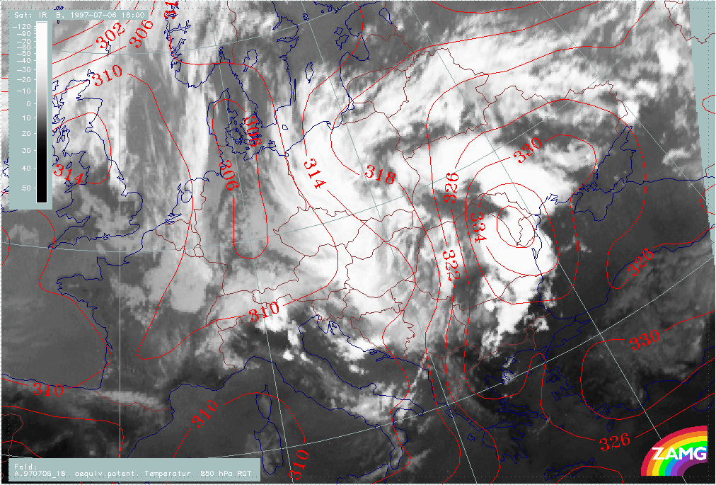
Instability is high in the whole area but extremely high in the eastern boundary at convective line 1, where the Showalter Index shows values of -6°C. This is also the area of a pronounced high in the equivalent potential temperature at 850 hPa, which is a typical location for convective developments.
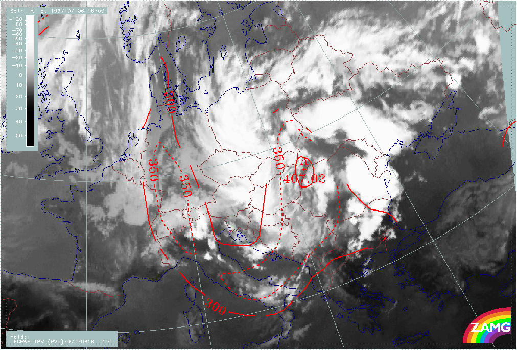
Stratospheric air (PV=2 units) has reached its lowest height of 407 hPa exactly in the centre of the ULL.
|
06 July 1997/18.00 UTC - Meteosat IR image; red: height contours 1000 hPa, green: height contours 500 hPa
|
06 July 1997/18.00 UTC - Meteosat IR image; blue: height contours 850 hPa, red: height contours 300 hPa
|
|
|
|
|
|
06 July 1997/18.00 UTC - Meteosat IR image; blue: Thermal Front Parameter (TFP) 500/850 hPa, green: equivalent thickness 500/1000 hPa, red solid: temperature advection - WA 1000 hPa,
red dashed: temperature advection - CA 1000 hPa
|
06 July 1997/18.00 UTC - Meteosat IR image; yellow: Showalter index, magenta: Showalter index
|
|
06 July 1997/18.00 UTC - Meteosat IR image; red: equivalent potential temperature 850 hPa
|
06 July 1997/18.00 UTC - Meteosat IR image; red: height of PV=2 units
|
|
|
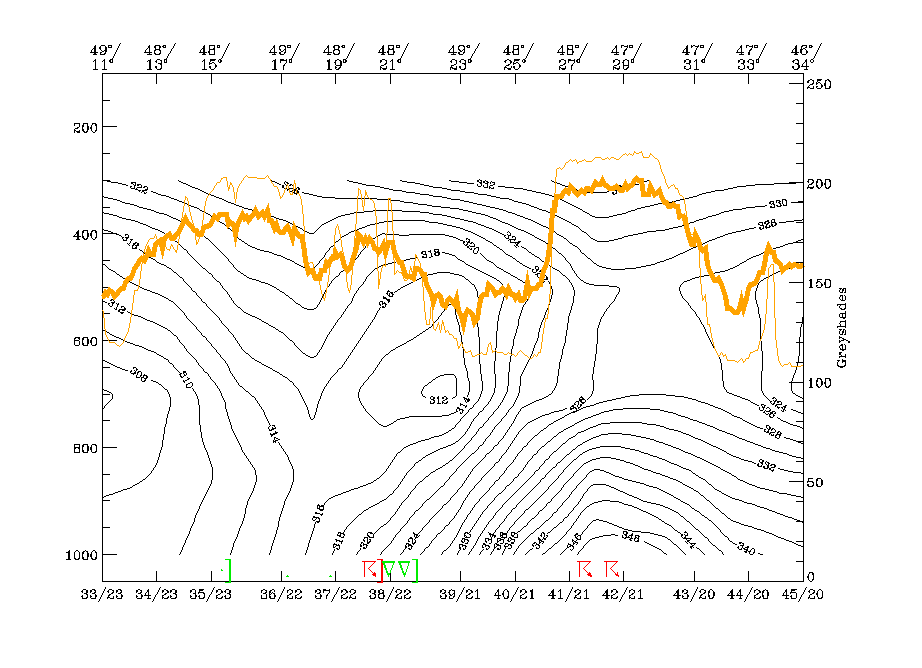
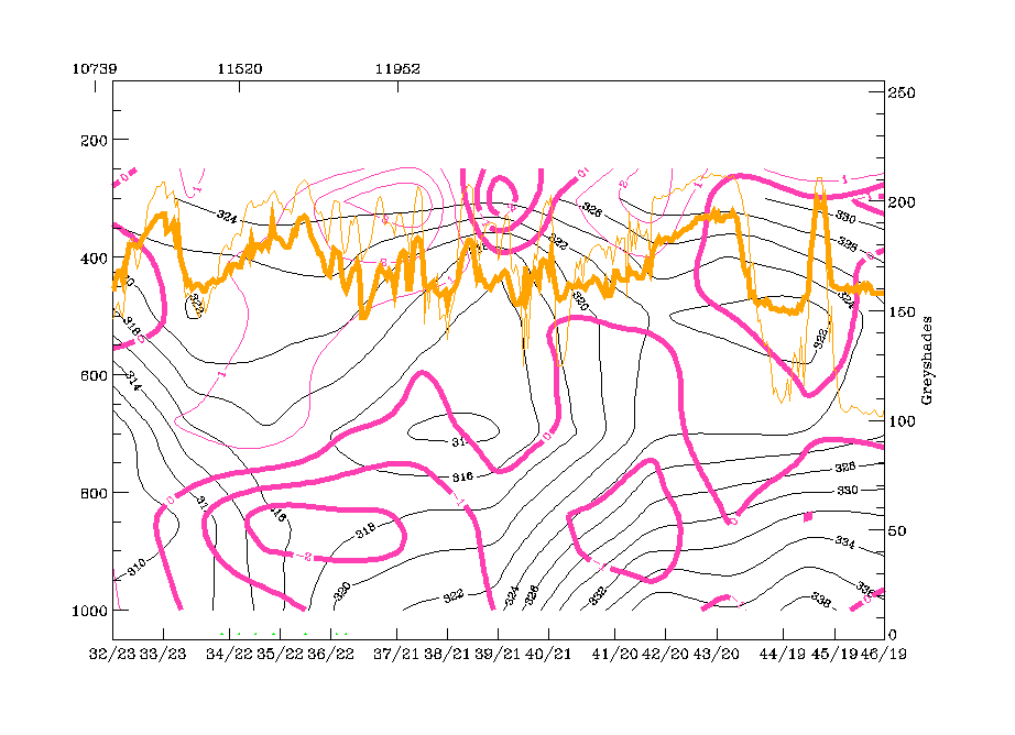
Vertical cross section line H crosses both ULL boundaries, the western Baroclinic Boundary and the eastern convective line. The cross section line is oriented from West to East.
The westernmost peak in the IR and WV pixel lines (48N/13E - 49N/17E) corresponds to the western ULL boundary. There is a downward inclined zone of high gradients in the isentropes typical for a cold front. The isentropic trough on top of this frontal zone, which can be seen above 700 hPa at 49N/17E, is typical for an Occlusion type, but (as already discussed in previous chapters) the genesis of a classical occlusion process has not taken place; it might indicate the advection of warm air in upper levels which leads to a stage somewhat similar to a mature Occlusion. The more ragged IR peaks between 48N/19E and 48N/21E represent the core of the ULL and there is a closed minimum in the isentropes (312K) between 700 and 400 hPa. The broad eastern peak in the satellite image pixel values between 48N/27E and 47N/31E corresponds to the convective line and there are reports of thunderstoms. The highly unstable character shown by the configuration of the isentropes is clear.
The vertical distribution of TA supports these ideas. There is remarkable WA associated with the Occlusion trough and partly within the Cold Front zone while below frontal zone and Occlusion trough CA prevails. Very typical is the vertical distribution of TA in the area of the convective line with WA up to 600 hPa and CA above; a situation which is indicative of instability.
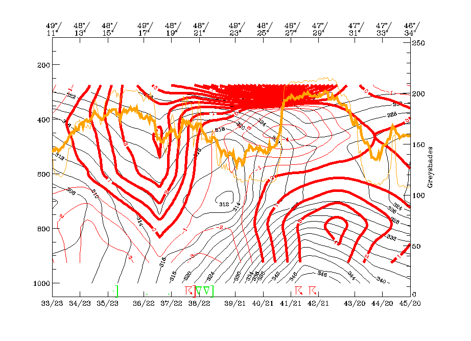
The most important features in the divergence field are:
- The backward inclined zone of convergence connected to the western frontal zone; since there is divergence below and above the zone of high gradients the typical frontal circulation cell is fulfilled.
- The intensive zone of convergence associated with the convective line which reaches from the surface up to 400 hPa.
This distribution of WA and convergence leads to a really dramatic appearance in the vertical motion field with 2 zones of very high values of upward motion accompanying the two boundaries of the ULL.
|
06 July 1997/18.00 UTC - Meteosat IR image; position of vertical cross section indicated
|
|
|
|
|
06 July 1997/18.00 UTC - Vertical cross section; black: isentropes (ThetaE), orange thin: IR pixel values, orange thick: WV pixel values
|
06 July 1997/18.00 UTC - Vertical cross section; black: isentropes (ThetaE), red thin: temperature advection - CA, red thick: temperature advection - WA, orange thin: IR pixel values,
orange thick: WV pixel values
|
|
|
|

|
|
06 July 1997/18.00 UTC - Vertical cross section; black: isentropes (ThetaE), magenta thin: divergence, magenta thick: convergence, orange thin: IR pixel values, orange thick: WV pixel
values
|
06 July 1997/18.00 UTC - Vertical cross section; black: isentropes (ThetaE), cyan thick: vertical motion (omega) - upward motion, cyan thin: vertical motion (omega) - downward motion,
orange thin: IR pixel values, orange thick: WV pixel values
|
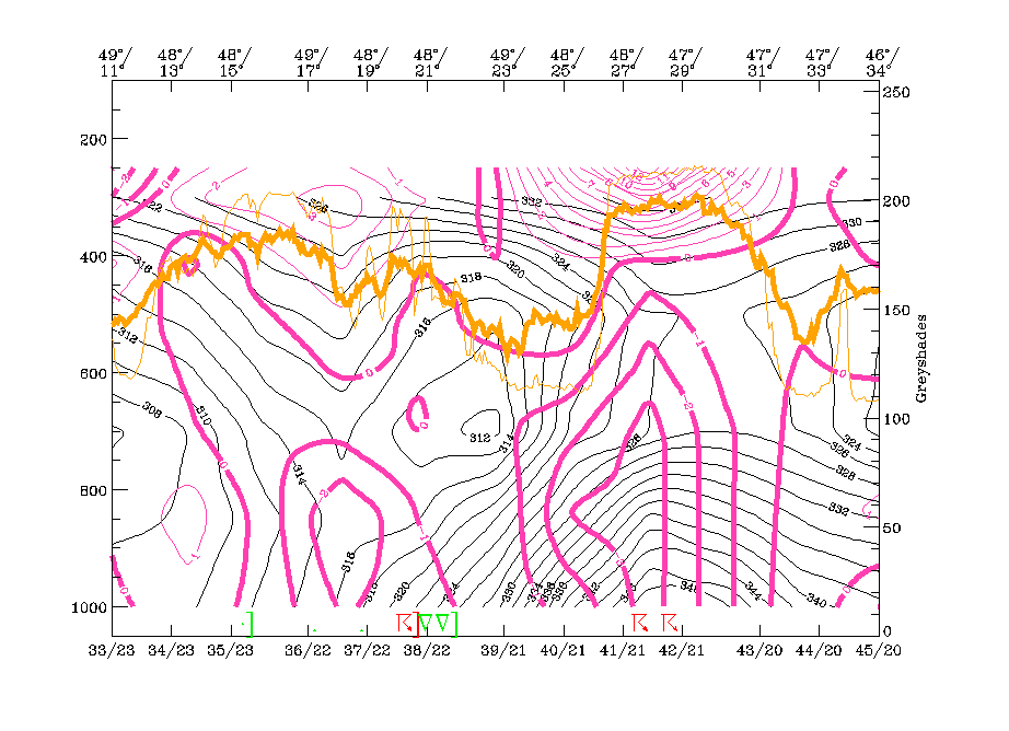
Three isentropic surfaces are chosen: the lowest is 318K, which is on top of the western Cold Front zone as well as on top of the ULL core. 324K is above the frontal zone and on top of the ULL core and 328K is an undisturbed surface which should represent for high levels within the convective line of the eastern ULL boundary.
The lowest surface clearly shows the cyclonic rotation within the ULL, but of special importance is the strongly rising branch in the area of the western cloud band; on this surface there is rising from about 650 hPa up to 400 hPa over Poland, the Czech Republic, Slovakia, Hungary and E. Austria.
The higher surface of 324K still shows rising in this area which, is above 400 hPa as well as the cyclonic rotation of the ULL centre. But another features might be of interest, namely the relative streams on top of the convective line which originate from the drier regions over W. Europe. A dry and relative stream lying on top of humid unstable air is indicative for development and strengthening of instability. This is even more distinct in the highest chosen surface of 328K with a branch of relative streams originating from E. Spain and S. Italy. The WV image shows a broad black area there, indicating dry air in the upper layer.
|
06 July 1997/18.00 UTC - Meteosat IR image; magenta: relative streams 318K - system velocity 275° 4 m/s, yellow: isobars
|
06 July 1997/18.00 UTC - Meteosat IR image; magenta: relative streams 324K - system velocity 265° 4 m/s, yellow: isobars
|
|
|
|
|
|
06 July 1997/18.00 UTC - Meteosat IR image; magenta: relative streams 328K - system velocity 275° 4 m/s, yellow: isobars
|
|
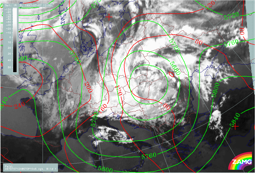
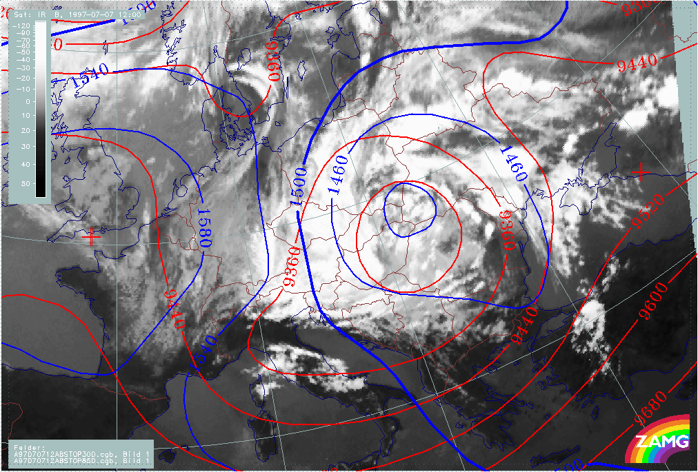
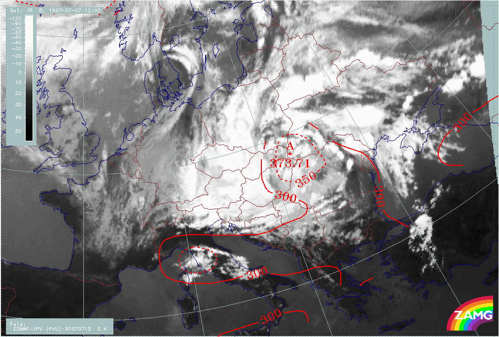
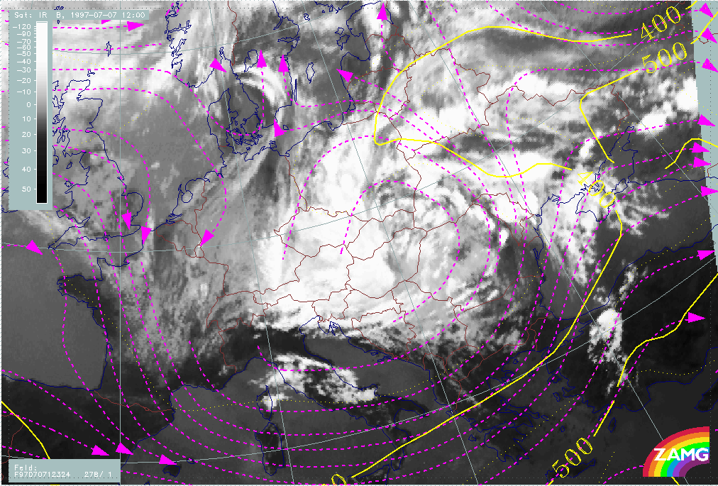
The second point in time which is discussed in detail is 07 July/12.00 UTC; it is characteristic of a further rotation stage where both convective lines 1 and 2 already exist. Convective line 1 has nearly made one complete rotation and its leading edge can be seen over S. Hungary. Convective line 2 lies over W. Ukraine and there are other new convective lines merging with line 2.
The height situation is largely unchanged from 18 hours earlier. There is still no marked surface low. The upper level low has a vertical axis from 850 to 300 hPa which is centred over E. Hungary and surrounding countries.
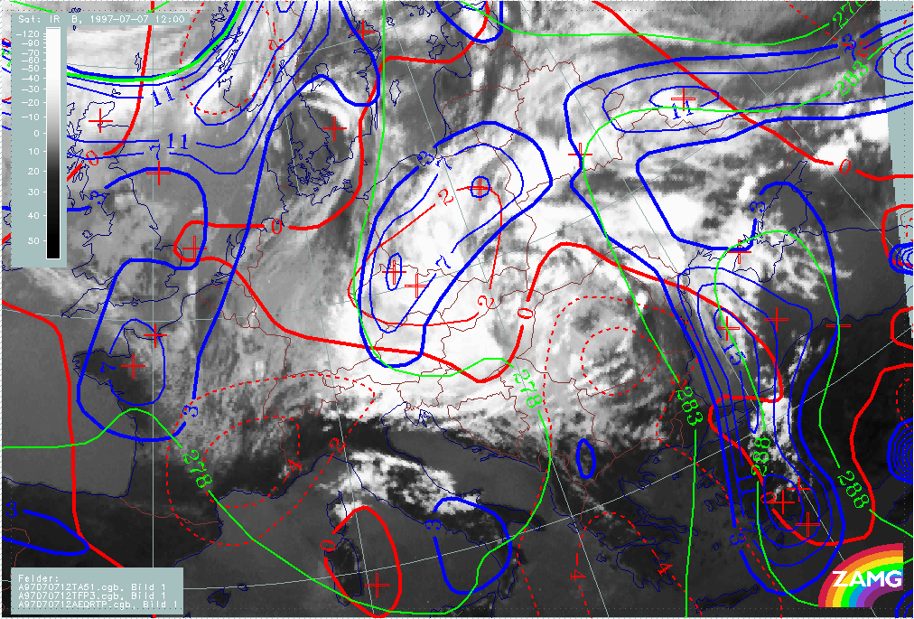
The frontal parameters are also unchanged. The two Baroclinic Boundaries in the E and W are accompanied by TFP branches and are under WA, with a maximum over the western branch. CA can be found within and to the S of the ULL core.
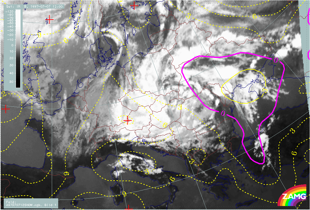
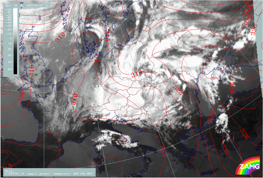
The eastern cloud boundary, which consists of convective line 2 as well as new convection over the Ukraine, appears in an area with Showalter values <-3 and within a very pronounced ridge in the equivalent potential temperature at 850 hPa. This is very typical of a strongly unstable area.
Lowest values of stratospheric air (374 hPa) can be found in the core of the ULL.
|
07 July 1997/12.00 UTC - Meteosat IR image; red: height contours 1000 hPa, green: height contours 500 hPa
|
07 July 1997/12.00 UTC - Meteosat IR image; blue: height contours 850 hPa, red: height contours 300 hPa
|
|
|
|
|
|
07 July 1997/12.00 UTC - Meteosat IR image; blue: Thermal Front Parameter (TFP) 500/850 hPa, green: equivalent thickness 500/1000 hPa, red solid: temperature advection - WA 1000 hPa,
red dashed: temperature advection - CA 1000 hPa
|
07 July 1997/12.00 UTC - Meteosat IR image; yellow: Showalter index, magenta: Showalter index
|
|
07 July 1997/12.00 UTC - Meteosat IR image; red: equivalent potential temperature 850 hPa
|
07 July 1997/12.00 UTC - Meteosat IR image; red: height of PV=2 units
|
|
|
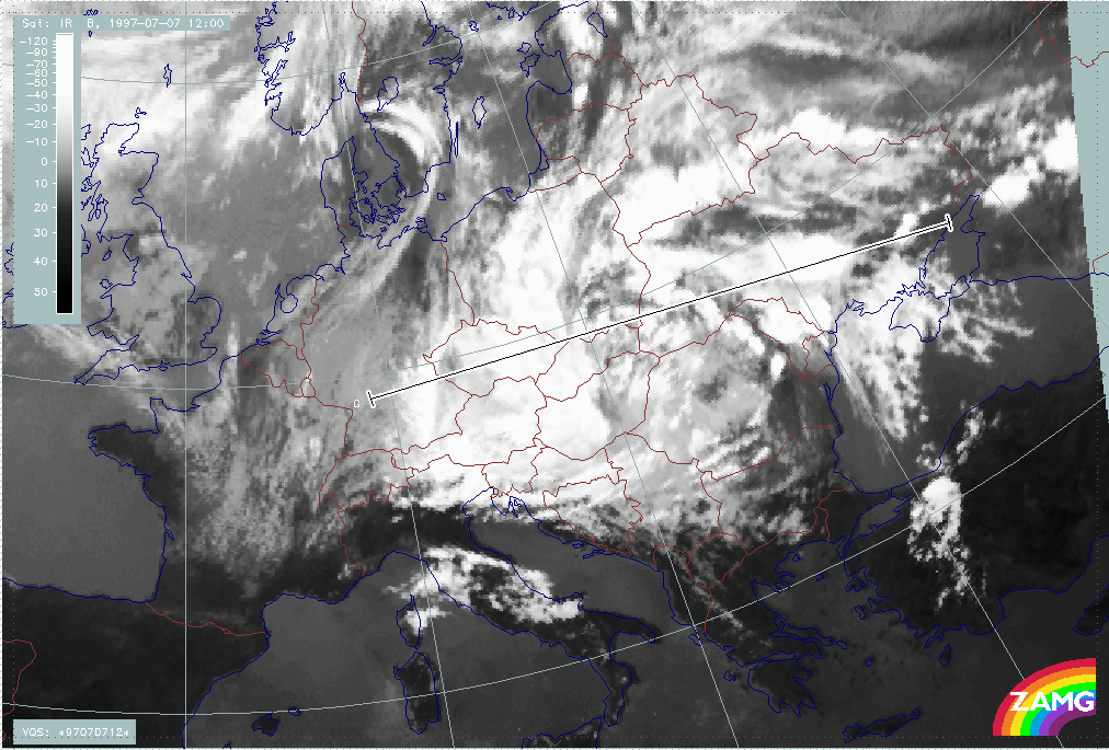
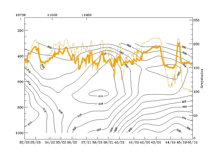
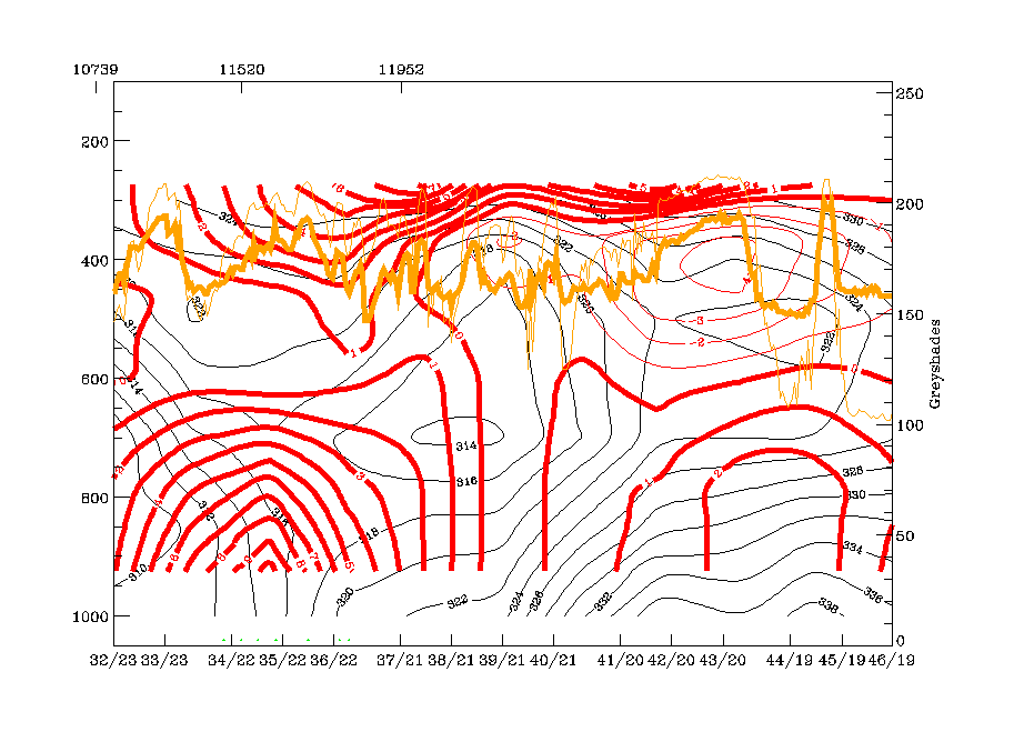
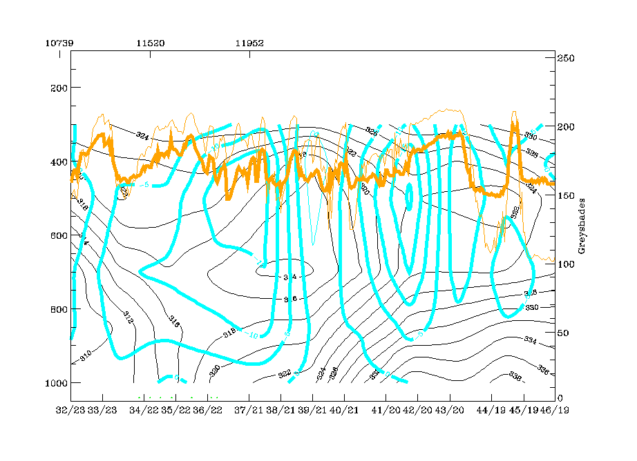
Vertical cross section line G crosses both baroclinic boundaries: the western one which is fed by convective line 1, and the eastern one, which comprises several convective lines or areas, one of them being convective line 2.
The configuration of the isentropes is the same as 18 hours earlier: a Cold Front - like downward inclined zone of high gradients at the western boundary of the vertical cross section with an occlusion like isentropic trough above this zone; this feature is accompanied by strong WA which is maximum in two layers:
- From the surface up to 600 hPa and
- Above 450 hPa.
The ULL core shows up very clearly in the isentropes; satellite pixel values have a ragged appearance there.
The area of "conv. line 2" and the cells east of it still show all the features of a highly unstable area in the configuration of isentropes as well as in the TA field, with WA up to 600 hPa and CA above The divergence field with a thick layer of convergence.
The whole area is characterized by strong upward motion with 3 maxima: in the unstable area of convective line 2, in the core of the ULL which is much more pronounced than 18 hours earlier and in the area of the western frontal cloud boundary where values are now less distinct.
|
07 July 1997/12.00 UTC - Meteosat IR image; position of vertical cross section indicated
|
|
|
|
|
07 July 1997/12.00 UTC - Vertical cross section; black: isentropes (ThetaE), orange thin: IR pixel values, orange thick: WV pixel values
|
07 July 1997/12.00 UTC - Vertical cross section; black: isentropes (ThetaE), red thin: temperature advection - CA, red thick: temperature advection - WA, orange thin: IR pixel values,
orange thick: WV pixel values
|
|
|
|
|
|
07 July 1997/12.00 UTC - Vertical cross section; black: isentropes (ThetaE), magenta thin: divergence, magenta thick: convergence, orange thin: IR pixel values, orange thick: WV pixel
values
|
07 July 1997/12.00 UTC - Vertical cross section; black: isentropes (ThetaE), cyan thick: vertical motion (omega) - upward motion, cyan thin: vertical motion (omega) - downward motion,
orange thin: IR pixel values, orange thick: WV pixel values
|
Isentropic surfaces similar to those used in the situation 18 hours earlier have been chosen: 318K which is above the western frontal zone and above the ULL core and 324K which is an undisturbed surface above the unstable layer of the eastern convective area.
The lower isentropic surface (318K) shows the strong cyclonic rotation within the ULL and - as 18 hours earlier - intensive ascent in the northern and western parts. It is of interest that over E. Austria relative streams change from ascent to descent, which affects the southernmost part of convective line 1 over W. Hungary. The image sequence shows that this is about the point in time where the tops of convective line 1 become much lower and which might be the effect of the sinking recognizable in this image.
At the higher isentropic level (324K), dry air from the eastern and southern Mediterranean is transported on top of the unstable area; this is clearly indicated in the WV image showing a broad black zone there.
|
07 July 1997/12.00 UTC - Meteosat IR image; magenta: relative streams 318K - system velocity 278° 1 m/s, yellow: isobars
|
07 July 1997/12.00 UTC - Meteosat IR image; magenta: relative streams 324K - system velocity 278° 1 m/s, yellow: isobars
|
|
|