Table of Contents
Overview
The flood catastrophe in Summer 1997 was the consequence of the development of a slow moving Upper Level Low (ULL) over Central Europe. The countries which were most effected are: Austria, Slovakia, the Czech Republic, eastern parts of Germany and Poland.
General remarks concerning the flood catastrophe
ZAMG thanks Mr. Struzik from the Institute of Meteorology and Water Management in Krakow for the following information as well as his fruitful participation in discussions.
Experience from Poland, one of the countries which was affected most, can be used to characterise the overall situation. The following topics can be summarised:
- The most critical area was the mountainous area in the south of Poland along the border to the Czech Republic as well as to Slovakia.
- As will be seen in the chapters below, the reason was a prolonged northerly flow; thus, orographic influence in form of Stau cloud and Stau precipitation was important.
- Precipitation amounts in Poland around 450 mm are typical in this situation but amounts of up to 600 mm were actually observed. In the Czech Republic, precipitation amounts reached 500 mm.
- Most of these values are close to the annual mean of precipitation.
- As it can be observed very often with catastrophic weather situations, the catastrophic situation was not the result of one extraordinary synoptic event, but the result of a typical
synoptic situation which was very long-lasting. Also in this case, the time factor was the main reason. For Poland the following periods of heavy rain can be summarised:
- 04 - 05 July: intensive convective situation
- 05 - 08 July: Upper Level Low; Baroclinic Boundary
- 09 July: New development of very intensive convective cells resulting in 200 mm additional precipitation
- 18 - 21 July: Upper Level Low; repetition of previous situation
- Consequently, and similar to other catastrophic situations, wrong forecasts or mis-interpretations of the synoptic situation are not the main problem; to overcome such situations is not so much a meteorological forecast problem but a technical and social organisational one.
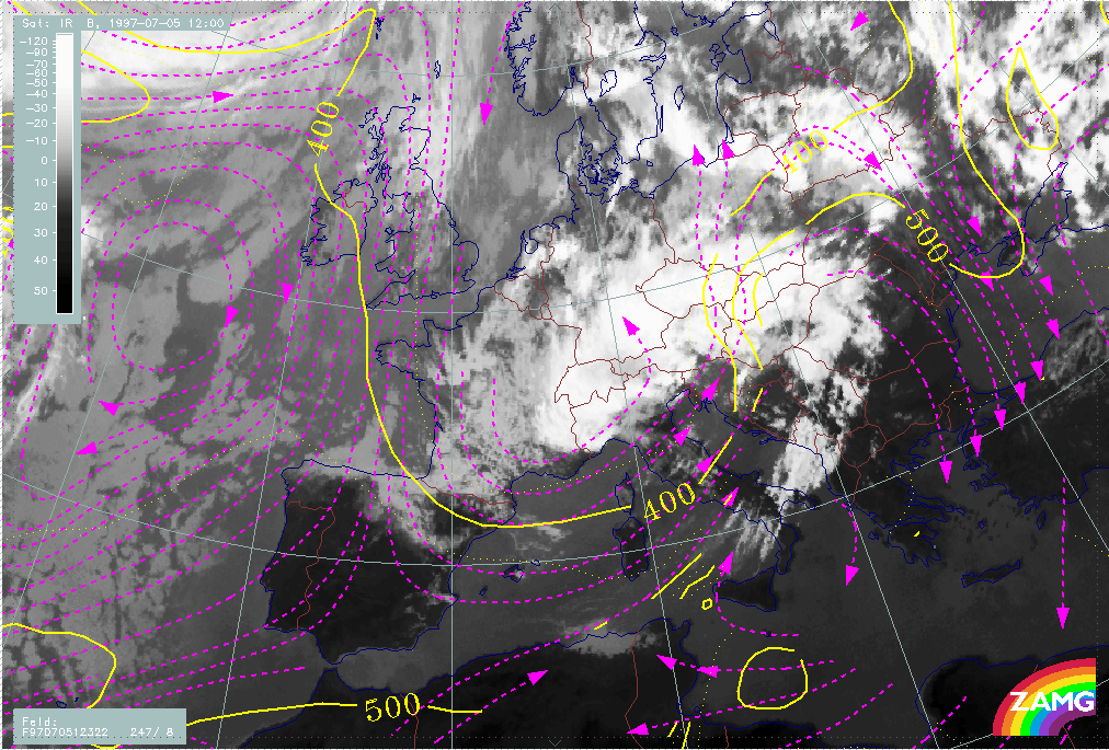
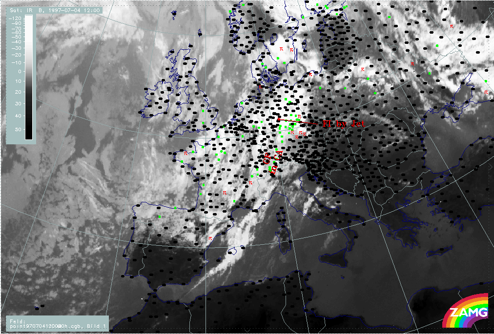
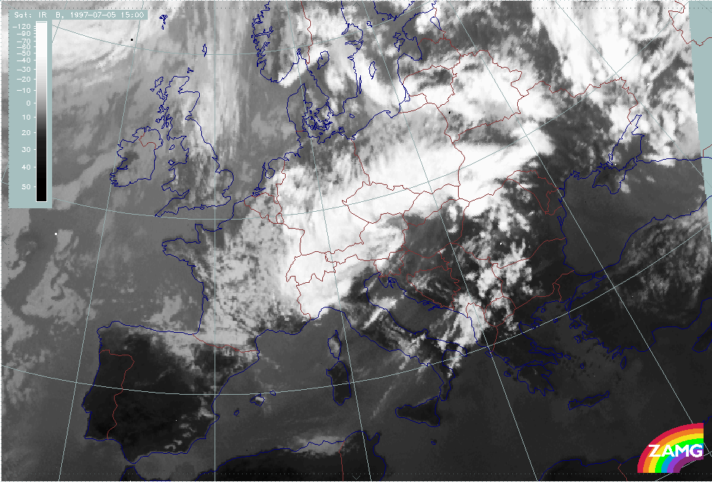
This case study concentrates on the situation between 04 and 08 July 1997.
In this chapter a very rough overview of the different stages of the synoptic situation is given.
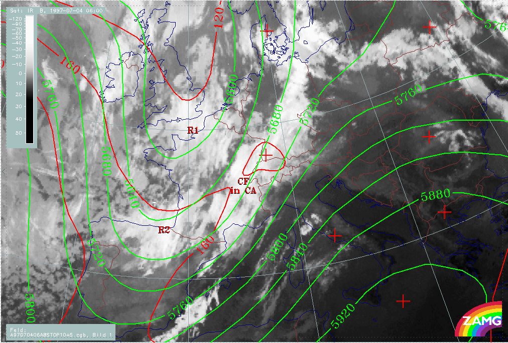
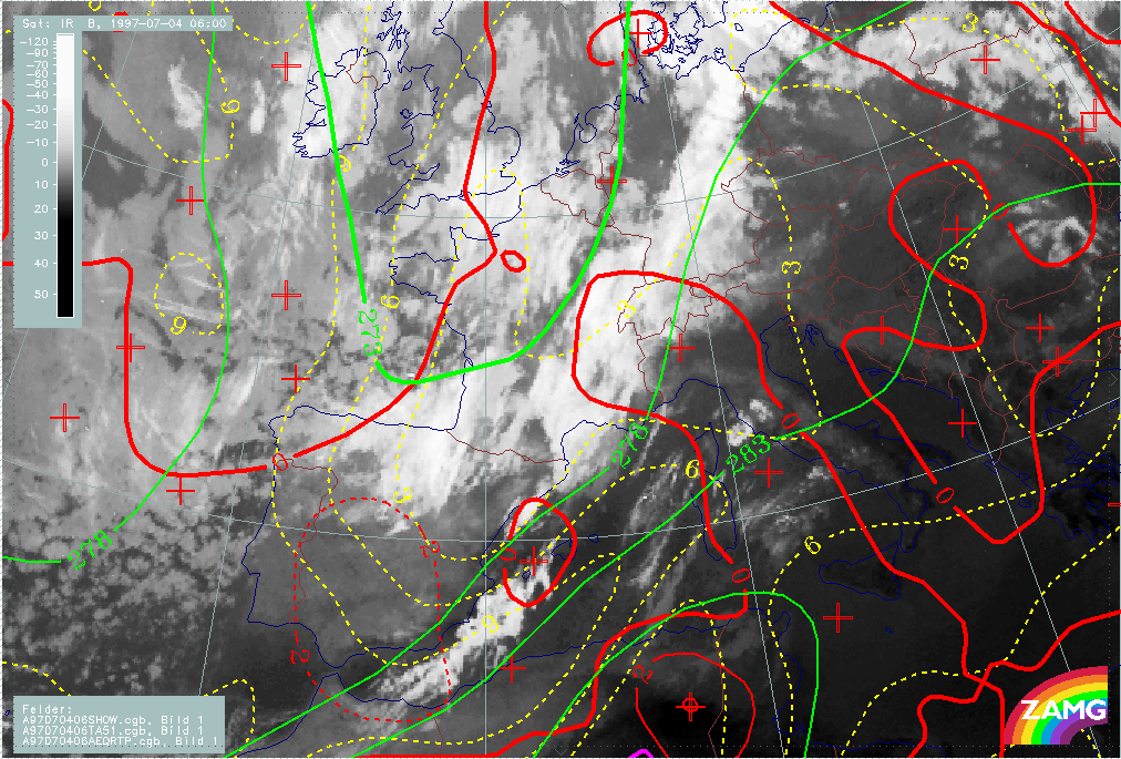
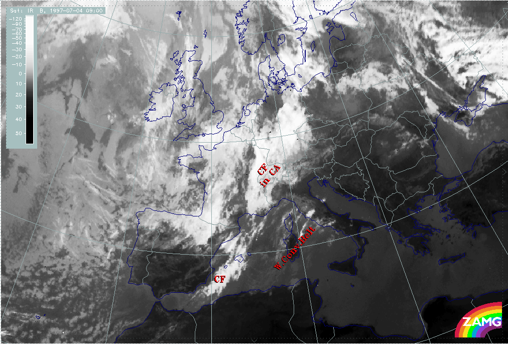
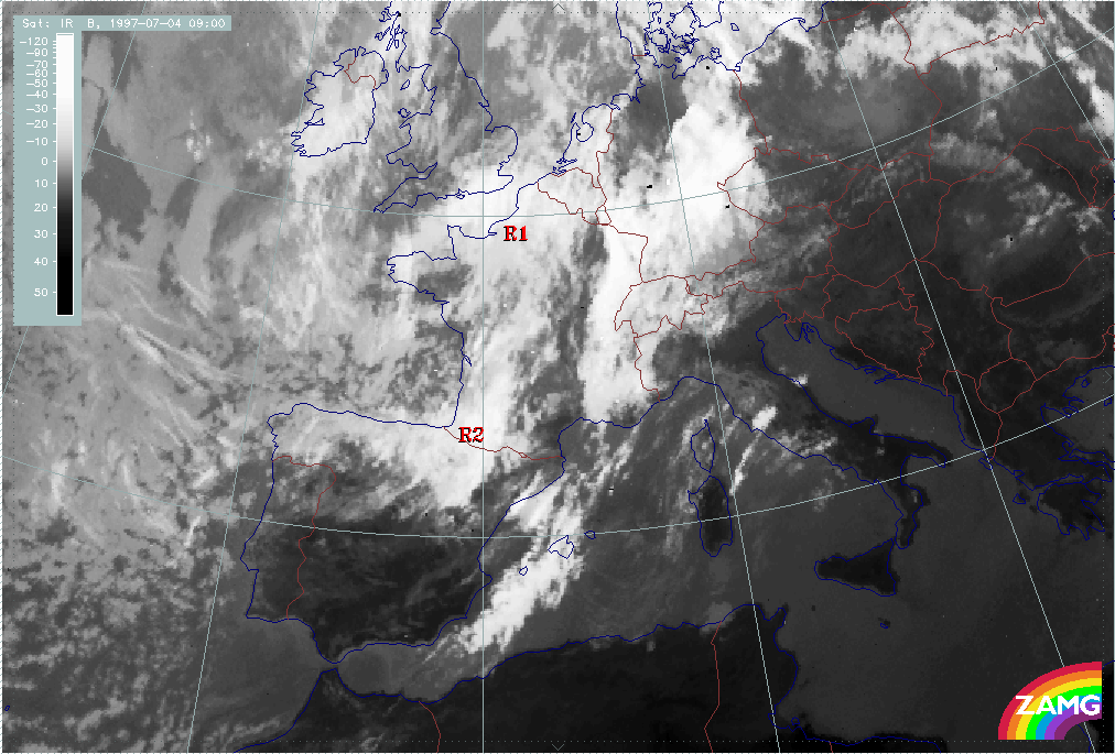
1. Trough Stage
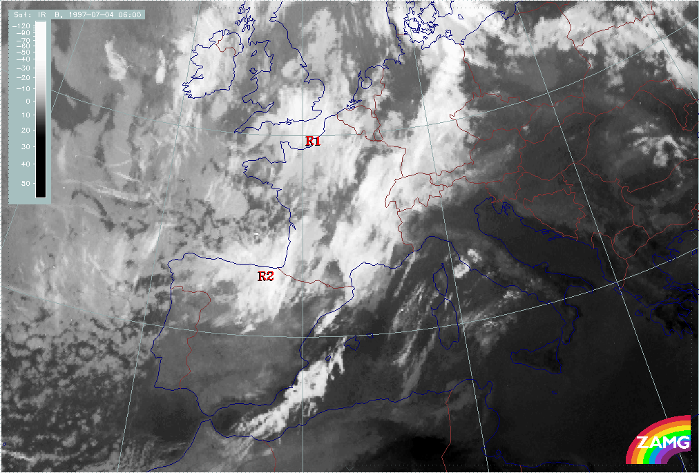
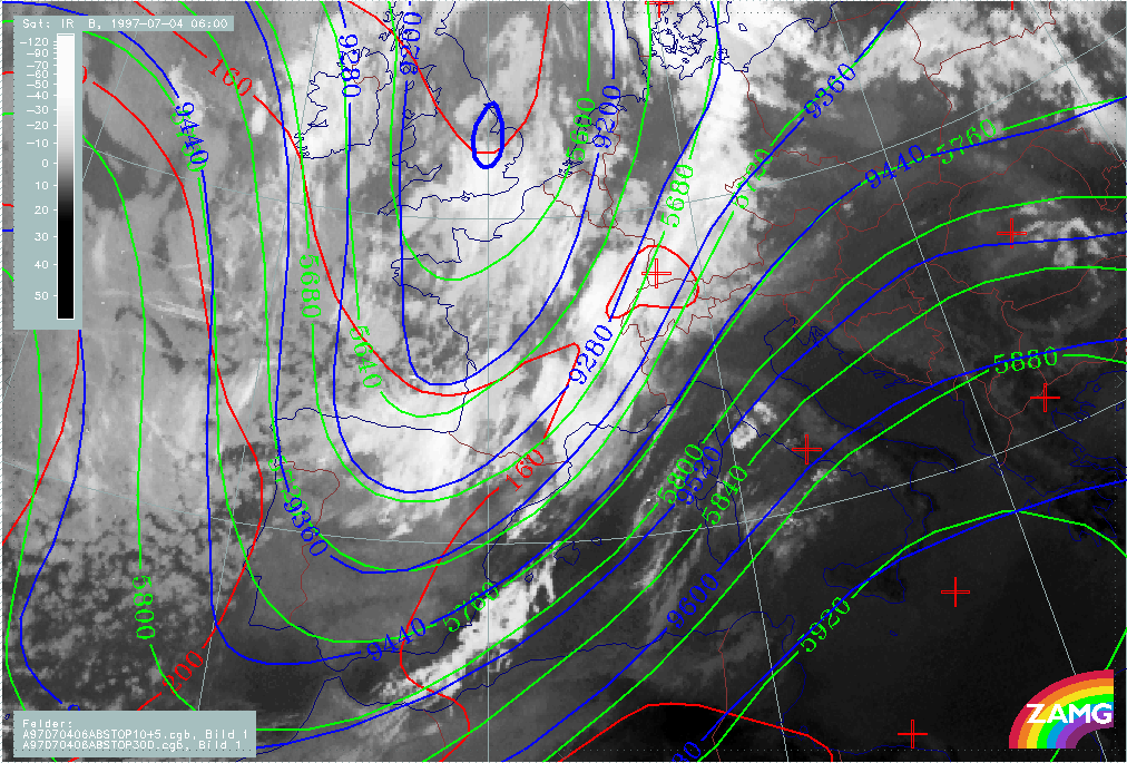
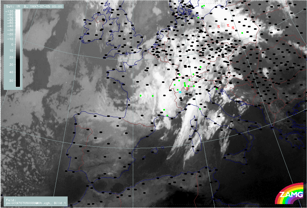
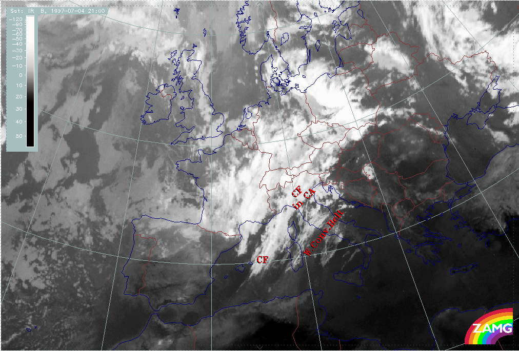
A frontal cloud band (Cold Front in Cold Advection) extends from the western Mediterranean across France and Switzerland to Germany. It is embedded in an upper level SW stream. To its rear, two rather extended cloud areas (R1 and R2) are situated in the upper level trough.
|
04 July 1997/06.00 UTC - Meteosat IR image; red: height contours 1000 hPa, green: height contours 500 hPa
|
|
|
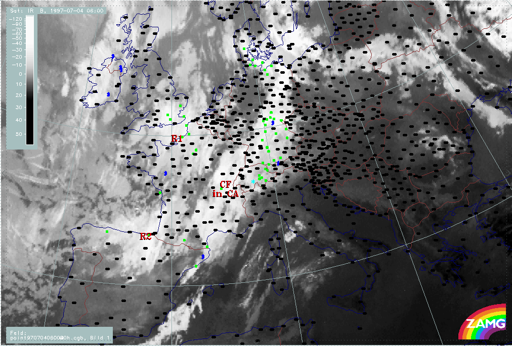
At this point of time precipitation is falling from the forward part of the frontal cloud band over Switzerland and Germany.
|
04 July 1997/06.00 UTC - Meteosat IR image; weather events (green: rain and showers, blue: drizzle, cyan: snow, red: thunderstorm with precipitation, purple: freezing rain, orange:
hail, black: no actual precipitation or thunderstorm with precipitation)
|
|
|
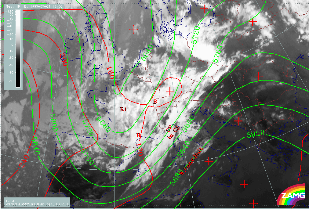
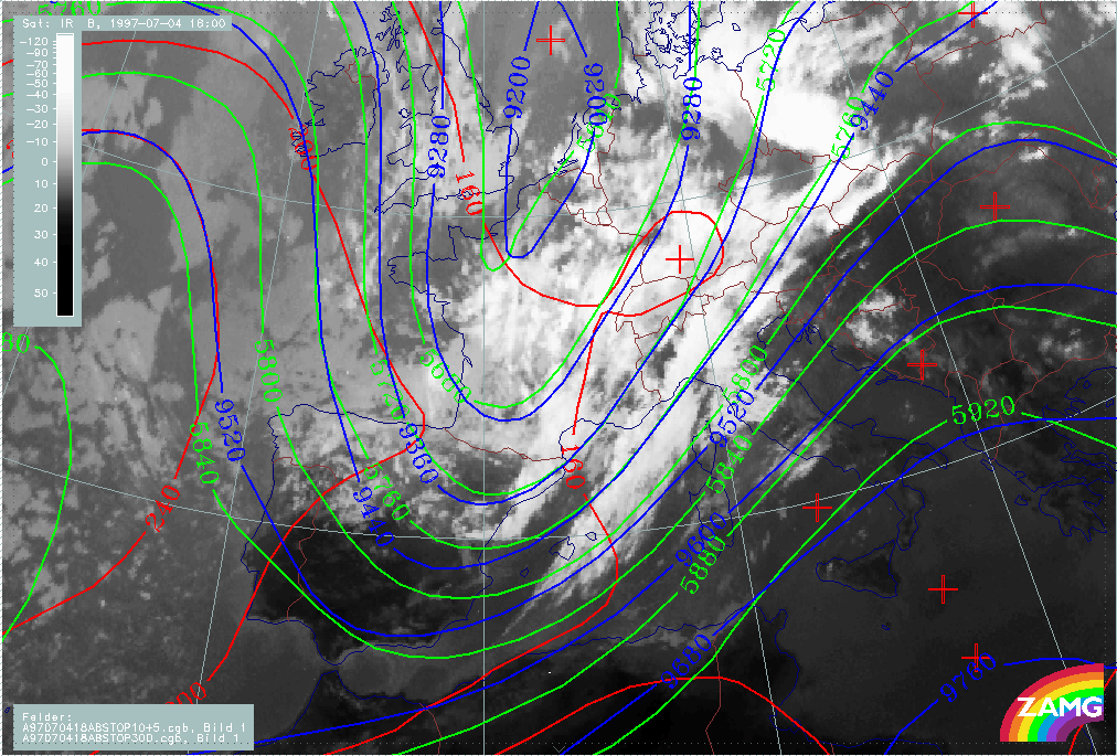
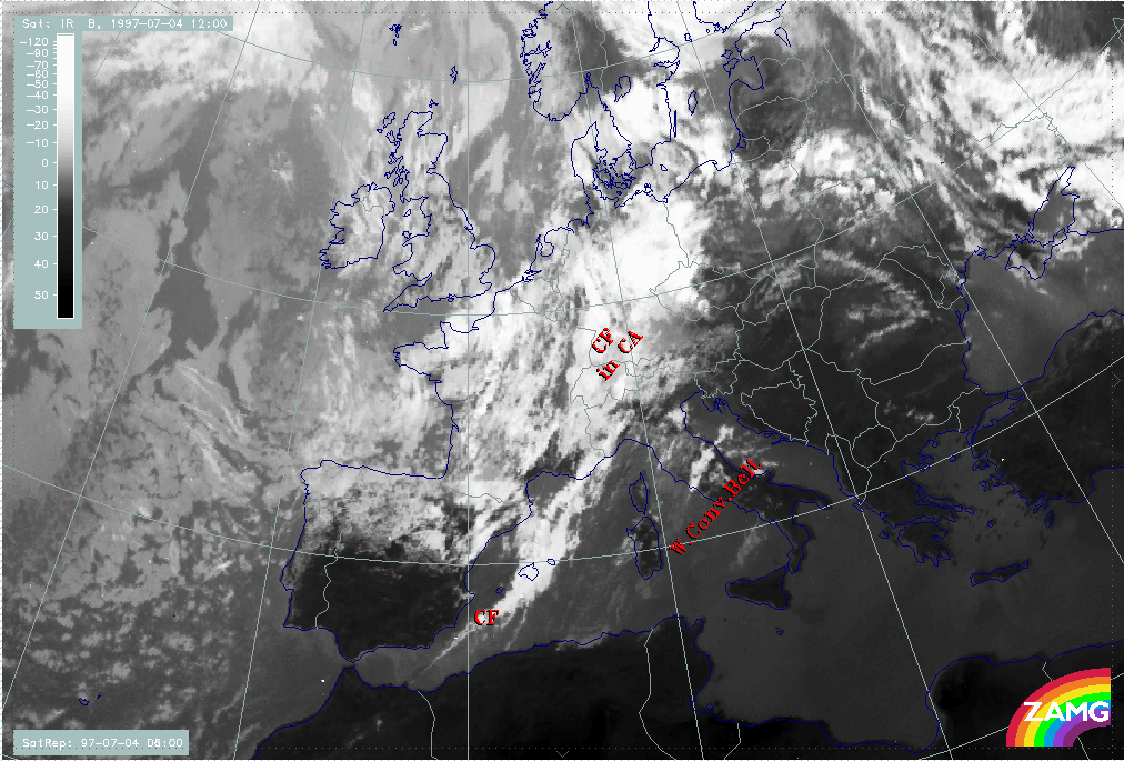
During the next 12 hours a second cloud band structure (B) develops behind the frontal cloud band. It is still at the stage of a very pronounced upper level trough.
|
04 July 1997/18.00 UTC - Meteosat IR image; red: height contours 1000 hPa, green: height contours 500 hPa
|
|
|
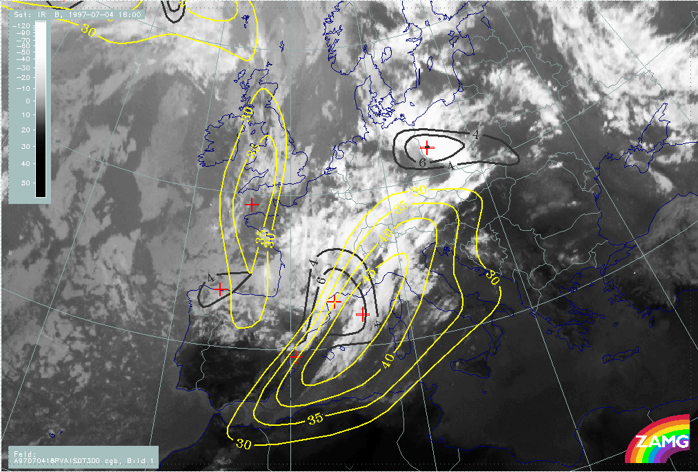
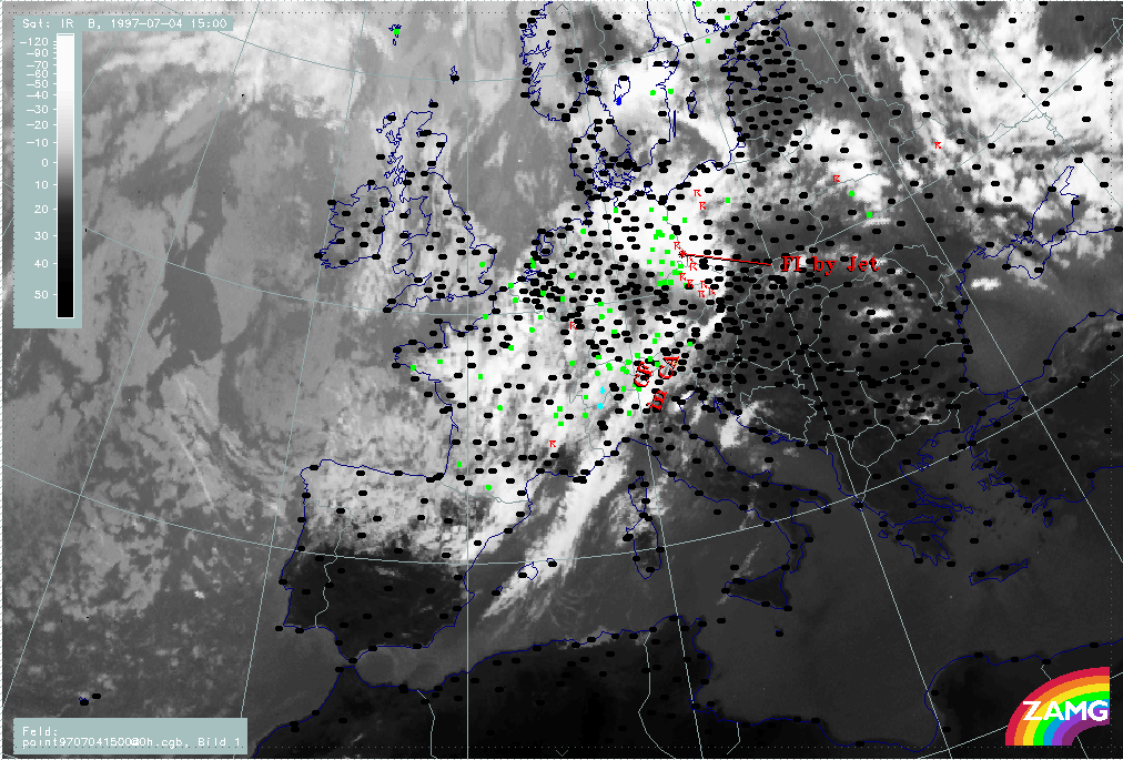
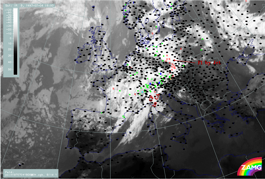
Precipitation propagates within the frontal cloud band eastward and can be found north of the Alps over Austria. An area of intensive thunderstorm activity can be found over the Czech Republic and Poland. It is associated with an intensification area within the frontal cloud band caused by the dynamic processes in the left exit region of a jet streak. This will be discussed in detail in a later chapter.
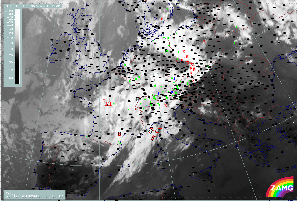
|
04 July 1997/18.00 UTC - Meteosat IR image; weather events (green: rain and showers, blue: drizzle, cyan: snow, red: thunderstorm with precipitation, purple: freezing rain, orange:
hail, black: no actual precipitation or thunderstorm with precipitation)
|
|
|
Within this period the following processes are described in detail in separate chapters:
- Frontal cloud band
- Front Intensification by Jet Crossing: FI by Jet
- Cold air features
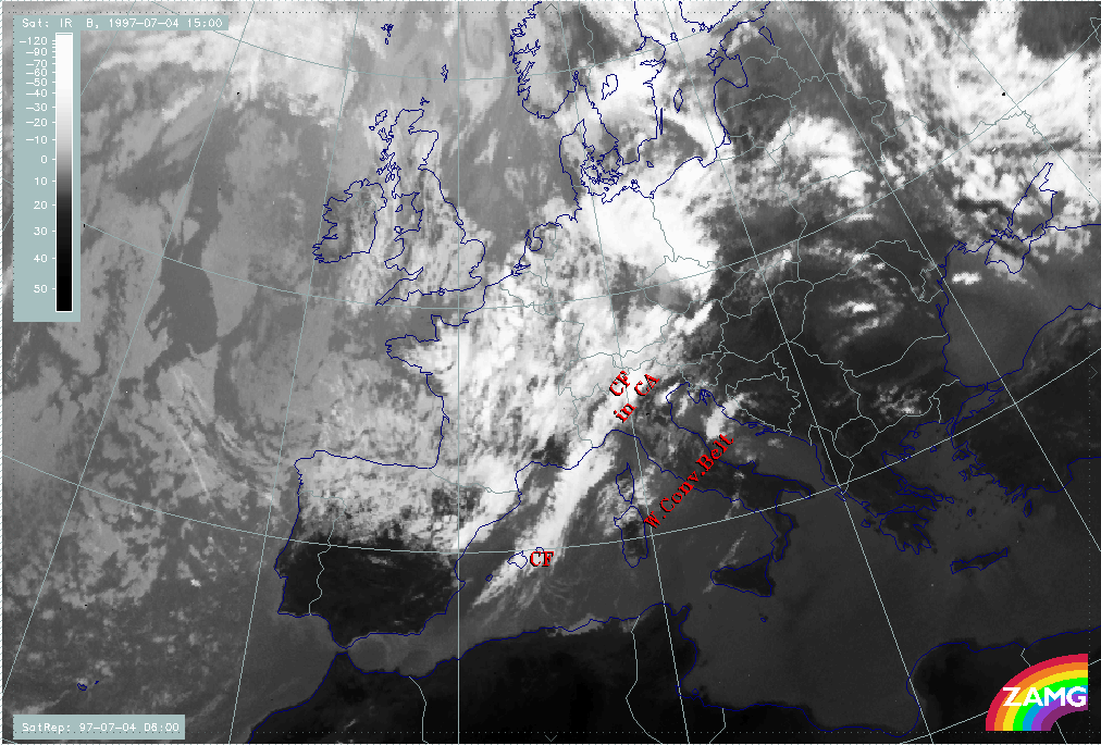
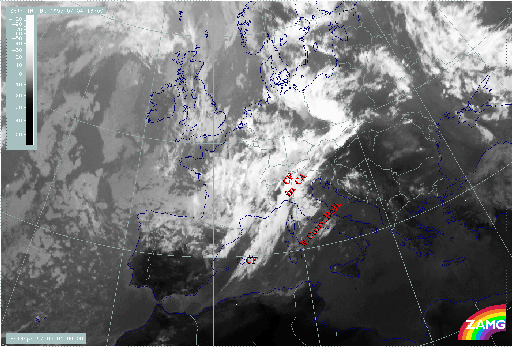
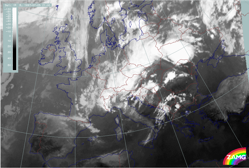
2. Tie-off Stage
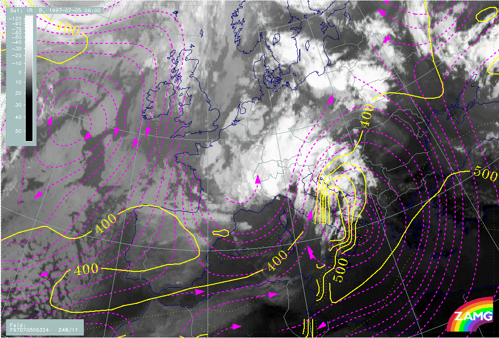
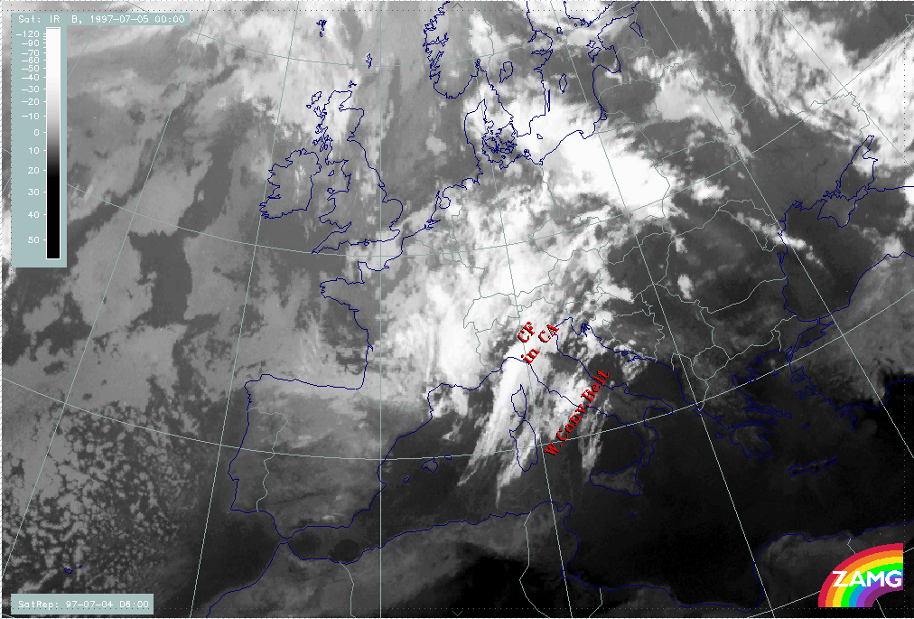
During the tie-off stage an Occlusion - like cloud configuration develops from the frontal cloud band and the cold air features. But although the appearance of an Occlusion cloud spiral develops, the genesis is completely different from a classical Occlusion process.
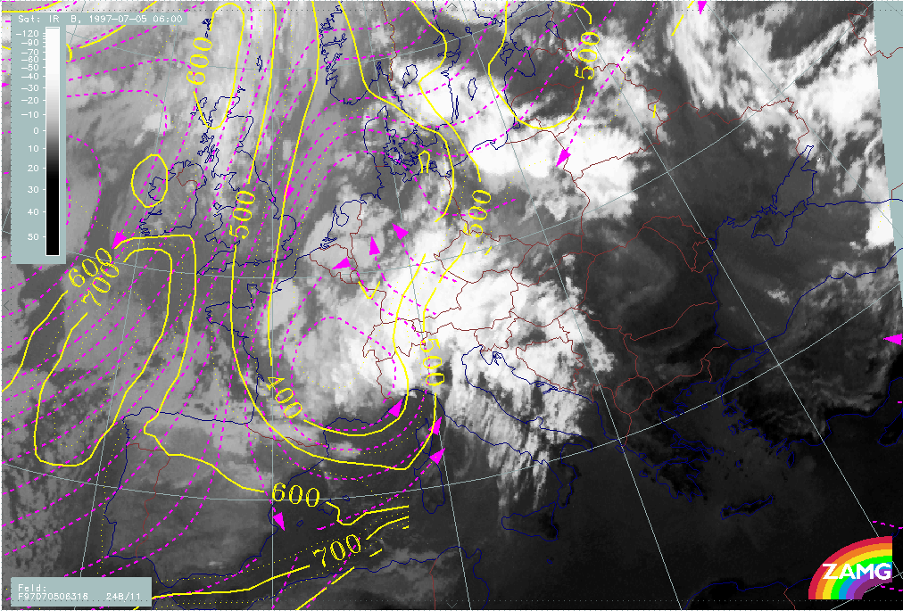
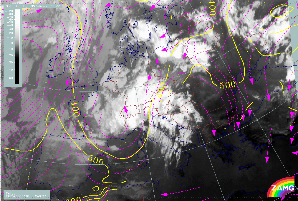
|
05 July 1997/06.00 UTC - Meteosat IR image; red: height contours 1000 hPa, green: height contours 500 hPa
|
|
|
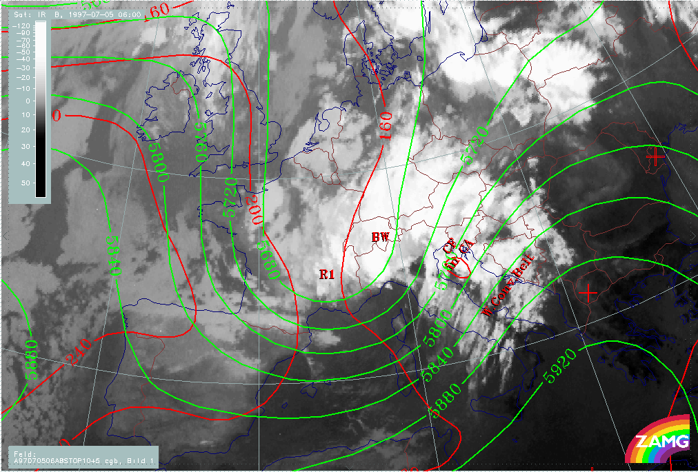
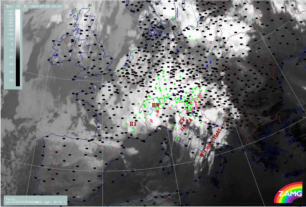
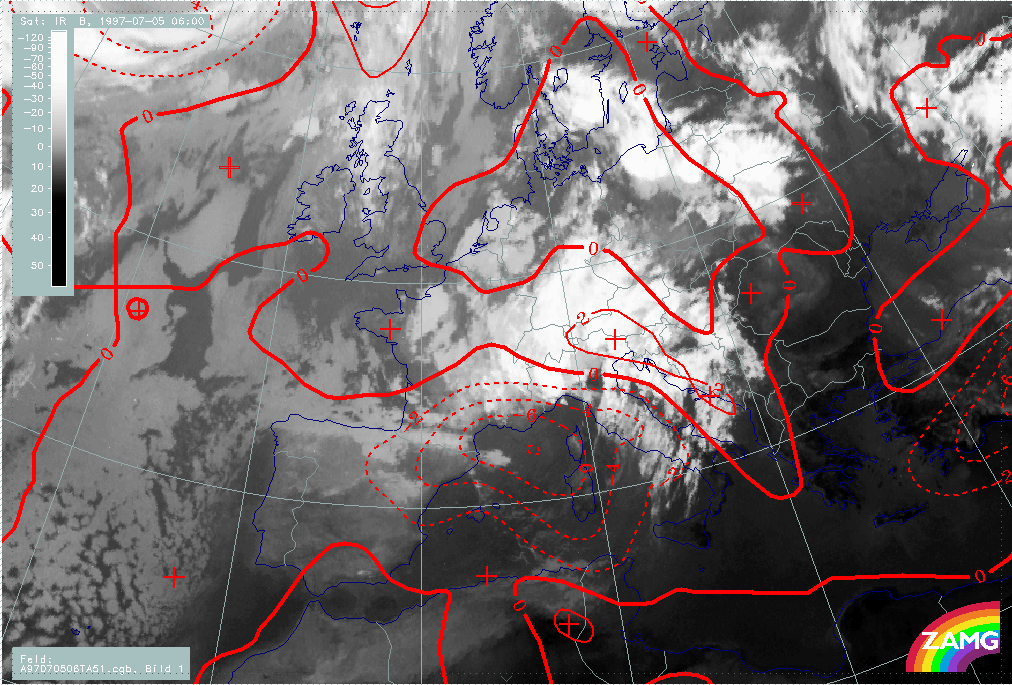
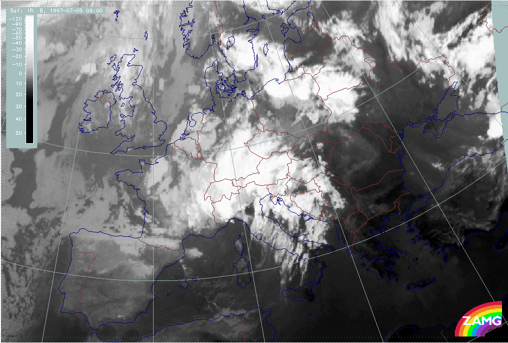
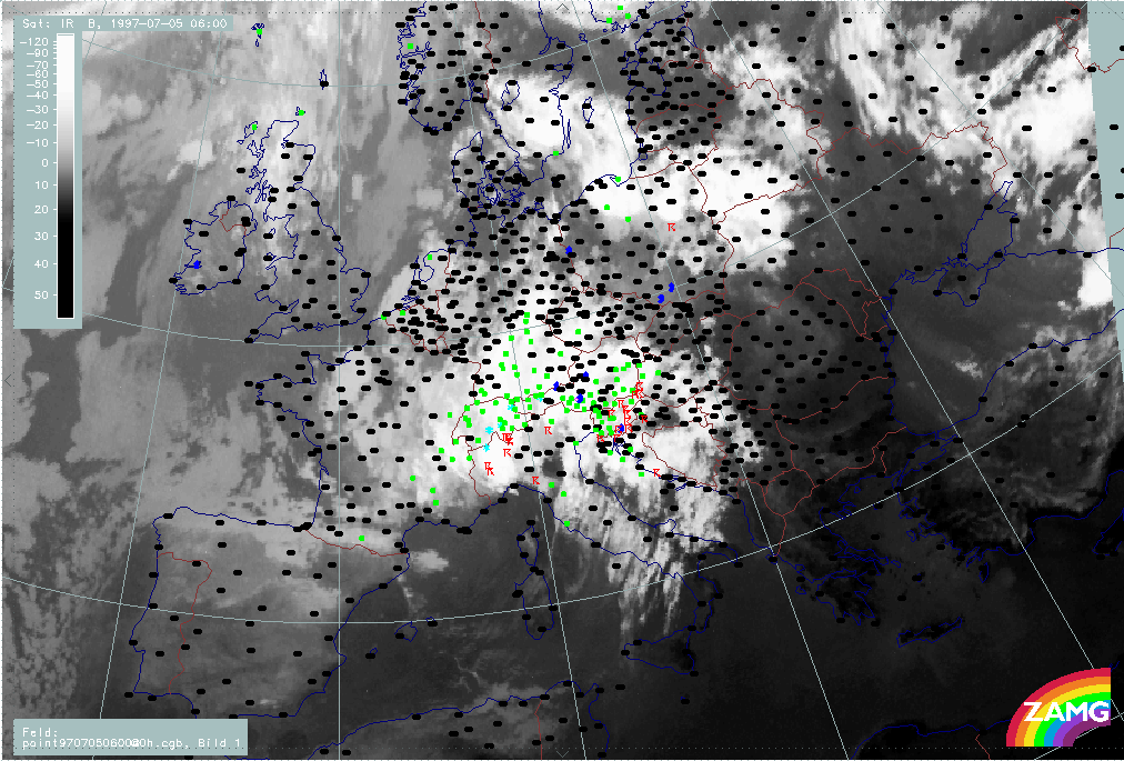
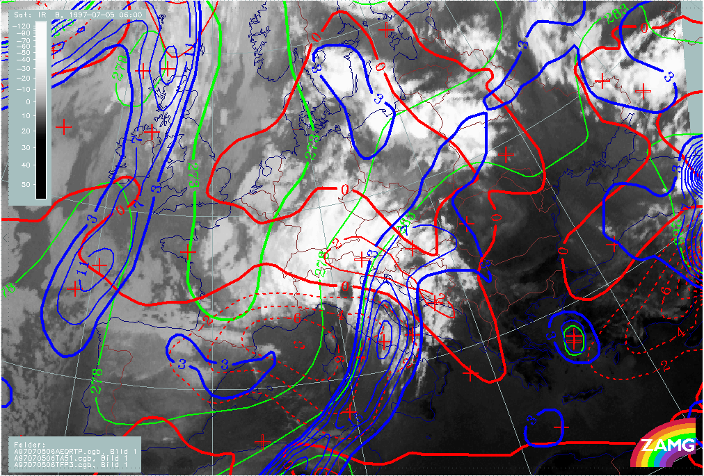
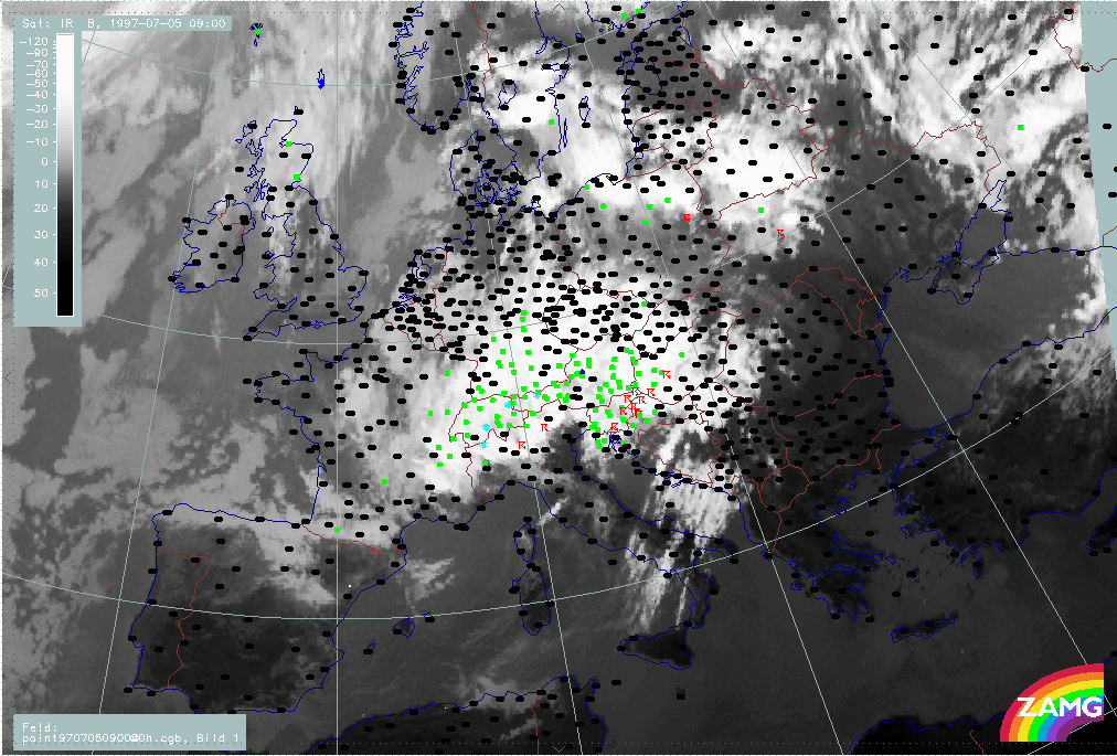
Precipitation is now already wide-spread. South of the Alps lots of thunderstorm are reported.
|
05 July 1997/06.00 UTC - Meteosat IR image; weather events (green: rain and showers, blue: drizzle, cyan: snow, red: thunderstorm with precipitation, purple: freezing rain, orange:
hail, black: no actual precipitation or thunderstorm with precipitation)
|
|
|
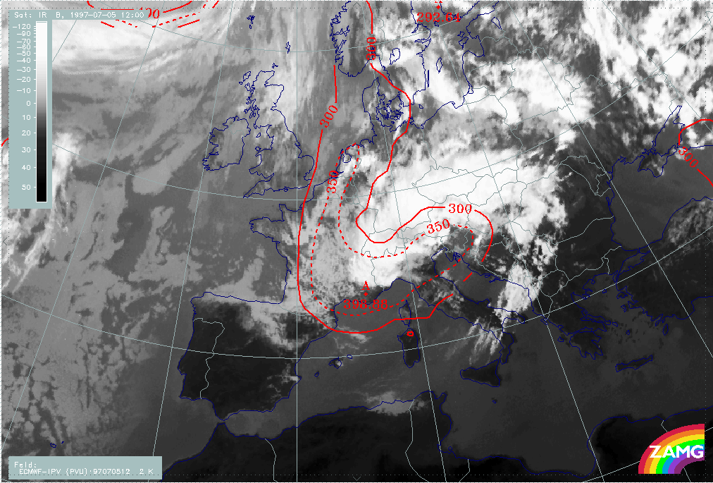
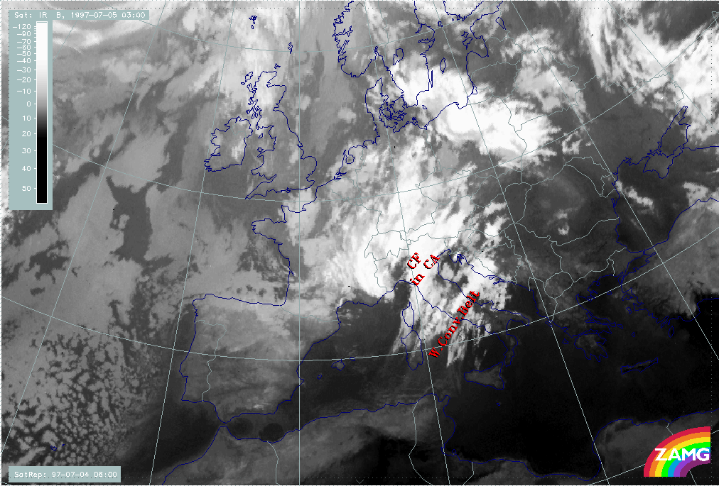
Six hours later, the character of the Occlusion spiral is even more developed. The upper level trough in the tie-off phase is located near the western part of the Occlusion spiral (OW). The main processes during these 6 hours took place in the Mediterranean, namely the dissolution of the frontal cloudiness by the overrunning of dry and cold air.
|
05 July 1997/12.00 UTC - Meteosat IR image; red: height contours 1000 hPa, green: height contours 500 hPa
|
|
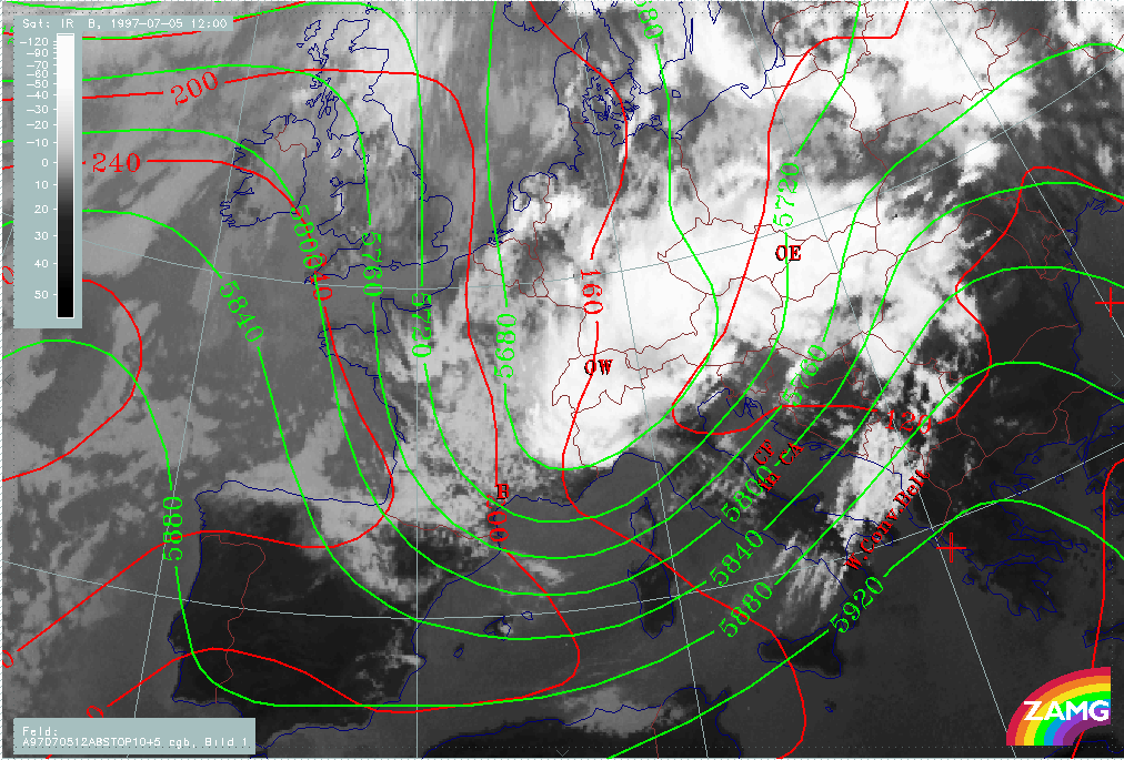
|
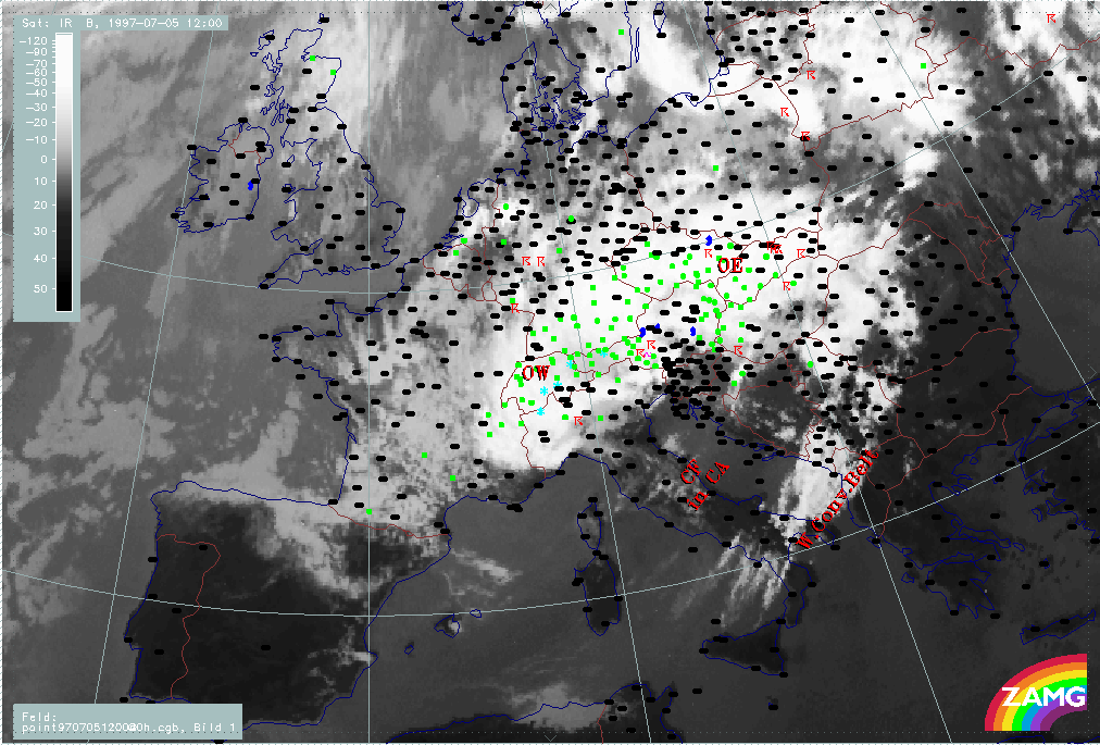
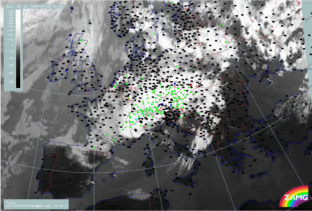
Precipitation is mostly in the area the Occlusion - like cloud band (OE - OW). Thunderstorms appear in the eastern and southern parts.
|
05 July 1997/12.00 UTC - Meteosat IR image; weather events (green: rain and showers, blue: drizzle, cyan: snow, red: thunderstorm with precipitation, purple: freezing rain, orange:
hail, black: no actual precipitation or thunderstorm with precipitation)
|
|
|
Within this period the following process is described in detail in separate chapters:
- Development of Occlusion - like cloud features
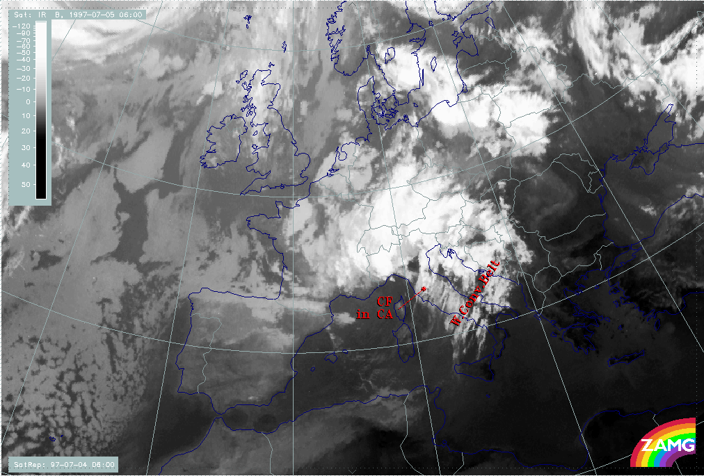
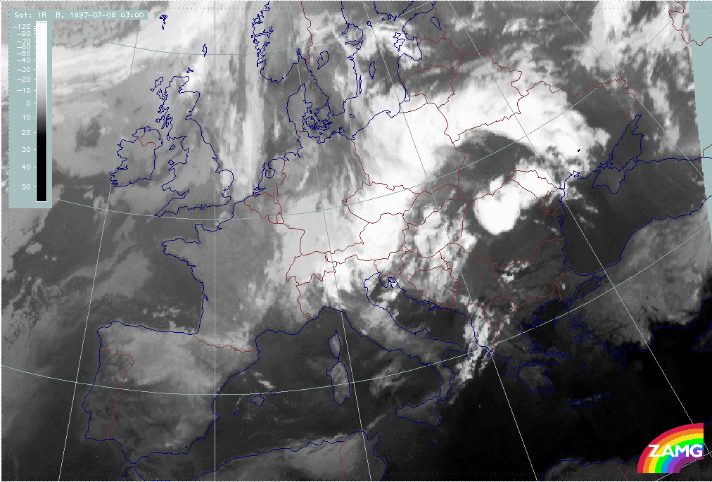
3. Cut-off Stage
1st cut-off phase: Extended low with several centres
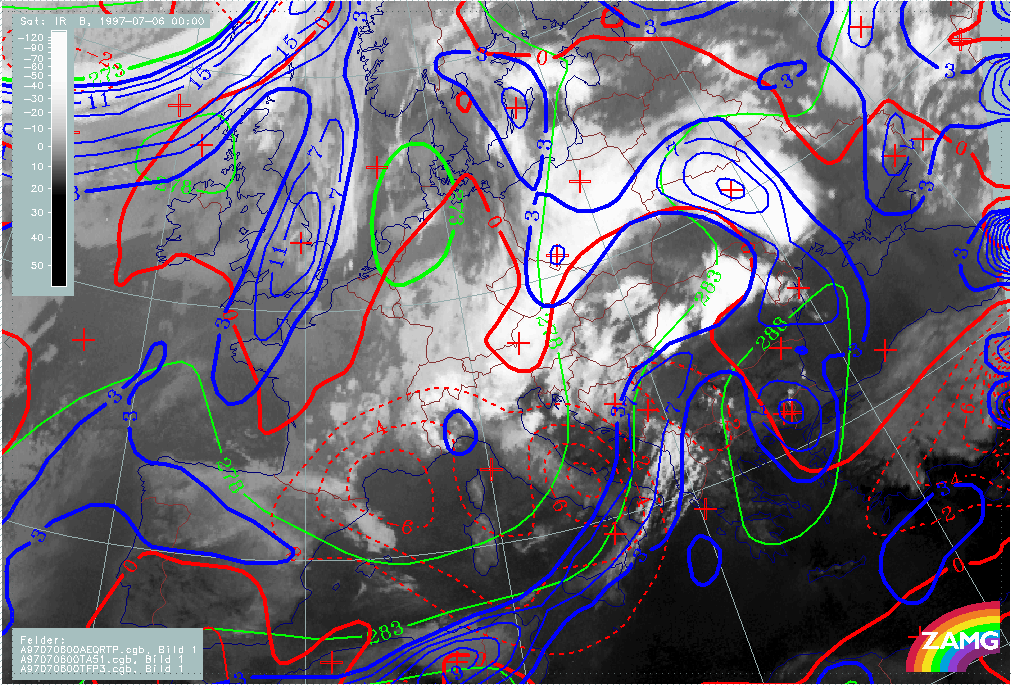
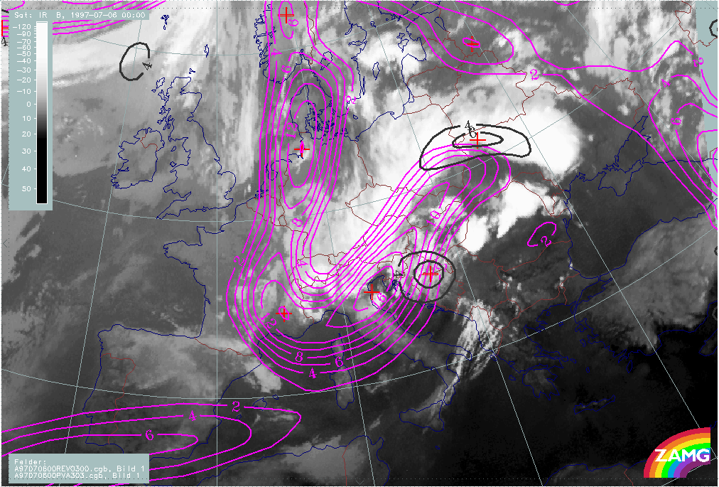
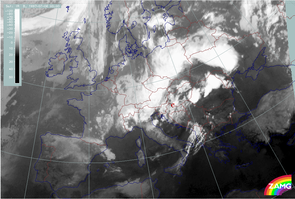
During this phase, an extended Upper Level Low with several centres has developed. An Occlusion - like cloud band (OE - OW) still exists. The most interesting developments occur over Austria - Hungary - Slovakia - Croatia where a new cut-off process seems to be under way (C). In the eastern parts over Romania and Ukraine intensive convective developments take place (MCSs).
|
06 July 1997/00.00 UTC - Meteosat IR image; red: height contours 1000 hPa, green: height contours 500 hPa
|
|
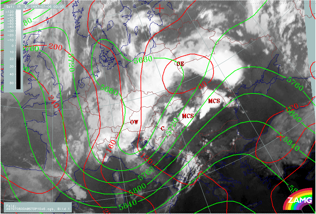
|
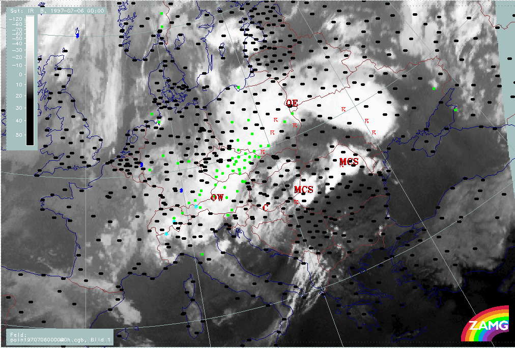
The main precipitation area extends from Poland across the Czech Republic to areas of Austria north of the Alps. Thunderstorms appear in the eastern and north-eastern parts where the MCSs (Mesoscale Convective Systems) are observed.
|
06 July 1997/00.00 UTC - Meteosat IR image; weather events (green: rain and showers, blue: drizzle, cyan: snow, red: thunderstorm with precipitation, purple: freezing rain, orange:
hail, black: no actual precipitation or thunderstorm with precipitation)
|
|
|
Within this period the following processes are described in detail in separate chapters:
- Development of Occlusion - like cloud features
- ULL cut-off
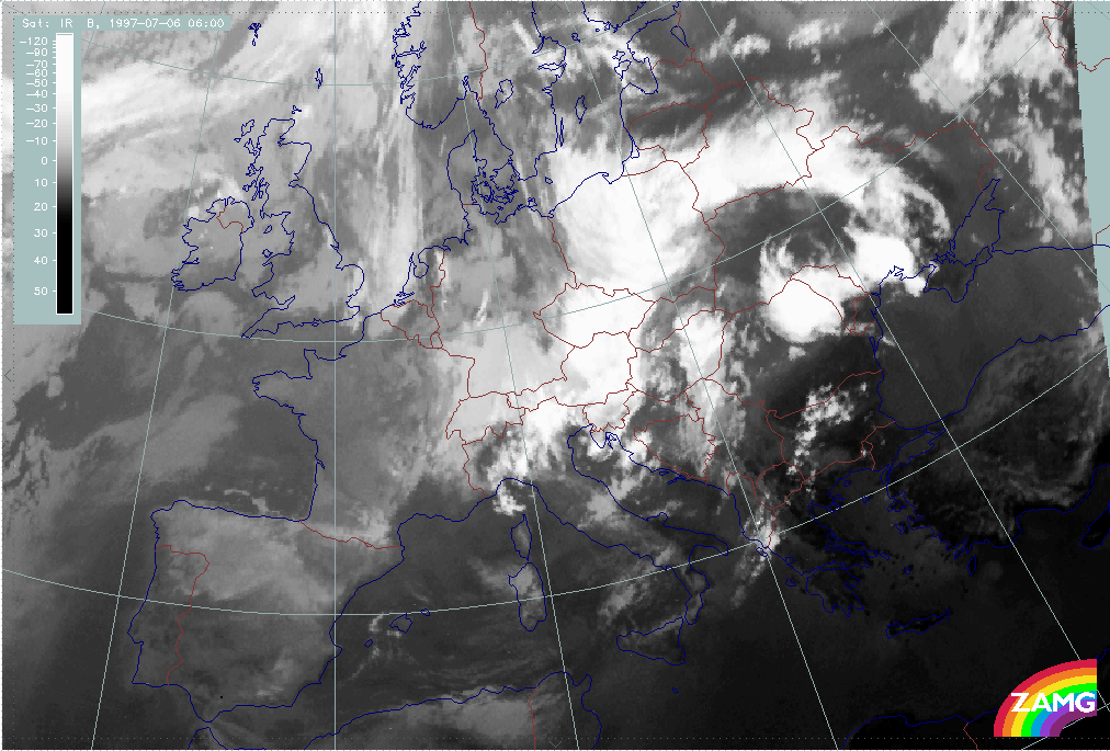
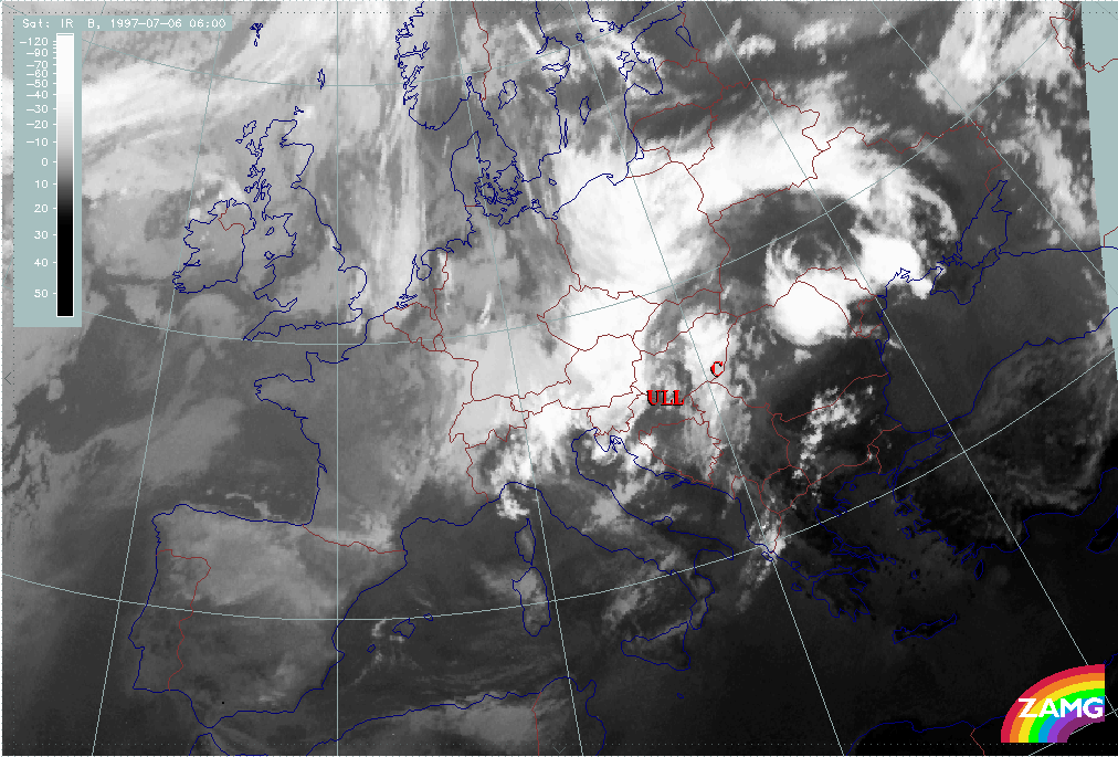
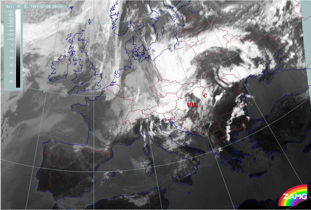
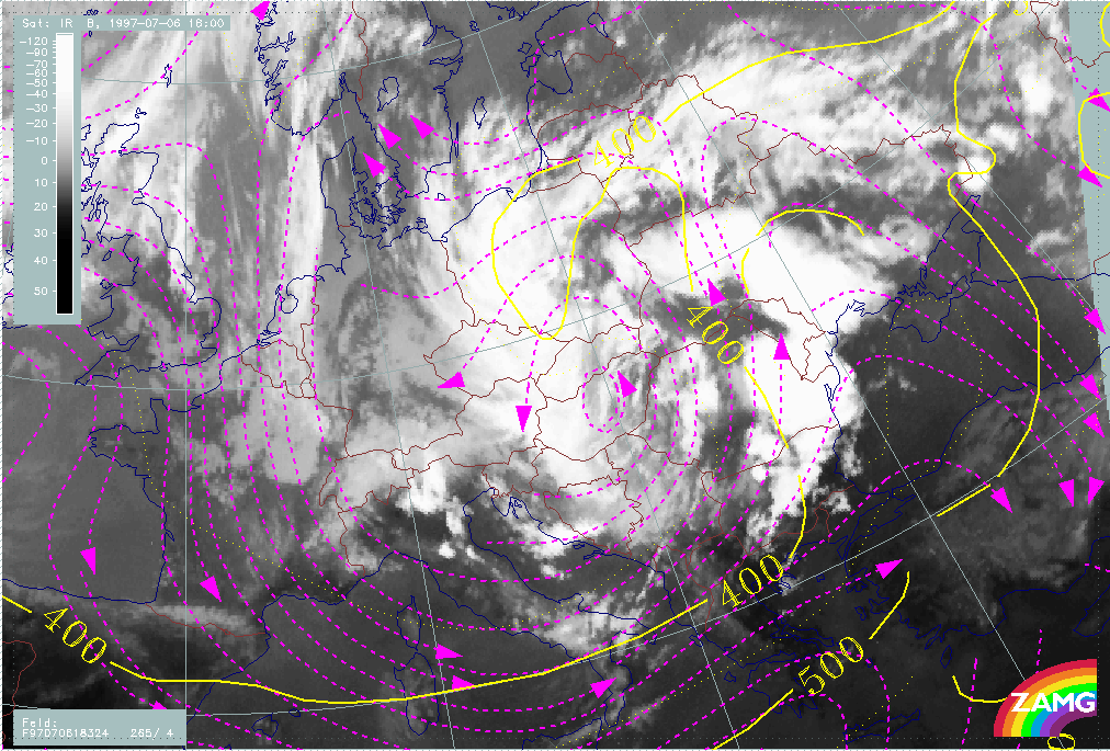
2nd cut-off phase: Separate main ULL centre
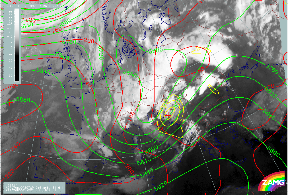
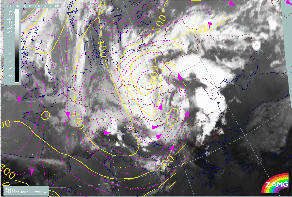
This phase is characterised by the cut-off stage of an intensive, huge ULL area over Central Europe (Austria - Hungary - Czech Republic - Slovakia - Slovenia - Croatia - Bosnia). It is a very stationary phenomenon. The first example (06/12.00 UTC) describes the beginning of a cut-off low, the second example (07/12.00 UTC) the fully developed stage.
At 06 July/12.00 UTC, two cloud bands, cyclonically curved towards each other, indicate the completion of the cut-off process. The convective developments along the eastern boundary are very intensive.
|
06 July 1997/12.00 UTC - Meteosat IR image; red: height contours 1000 hPa, green: height contours 500 hPa
|
|
|
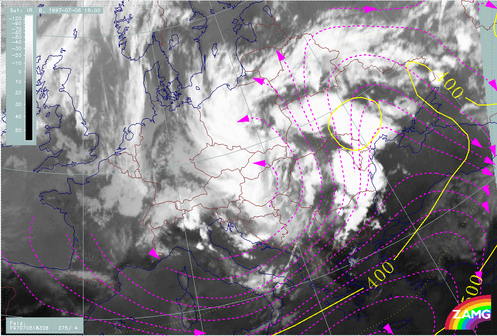
The main precipitation area still extends from Poland across the Czech Republic and Slovakia to E. Austria. Thunderstorms appear in the eastern and north-eastern parts.
|
06 July 1997/12.00 UTC - Meteosat IR image; weather events (green: rain and showers, blue: drizzle, cyan: snow, red: thunderstorm with precipitation, purple: freezing rain, orange:
hail, black: no actual precipitation or thunderstorm with precipitation)
|
|
|
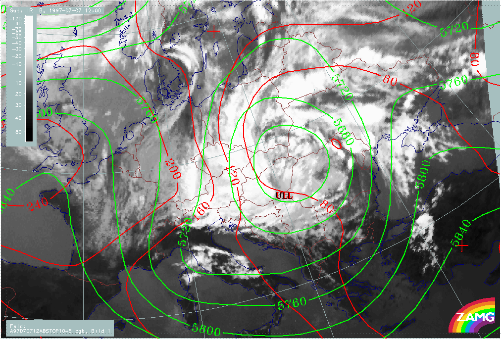
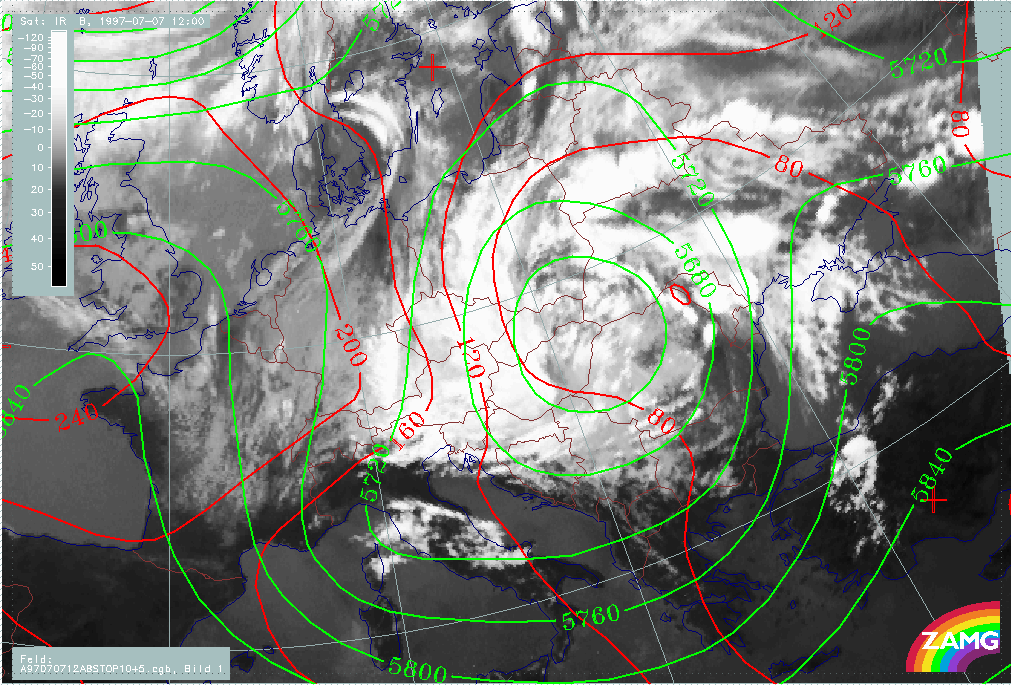
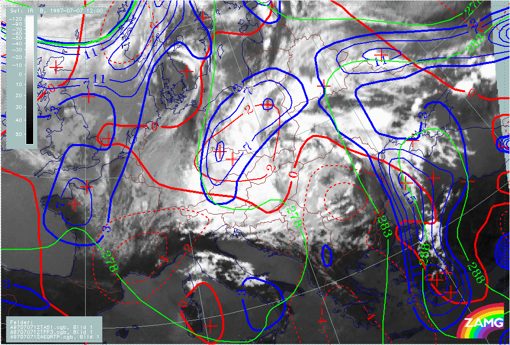
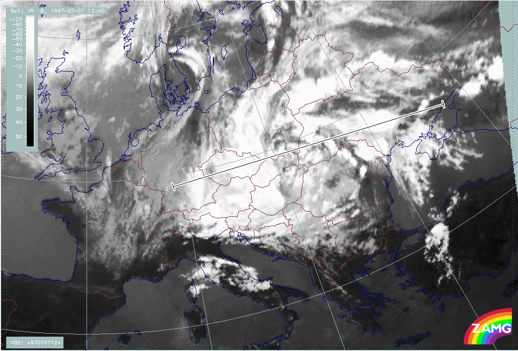
On 07 July/12.00 UTC, the overall configuration has hardly moved and, consequently, a rather continuous western cloud boundary can still be identified. More convective cellular cloudiness exists in the ULL centre as well as at the eastern boundaries.
|
07 July 1997/12.00 UTC - Meteosat IR image; red: height contours 1000 hPa, green: height contours 500 hPa
|
|
|
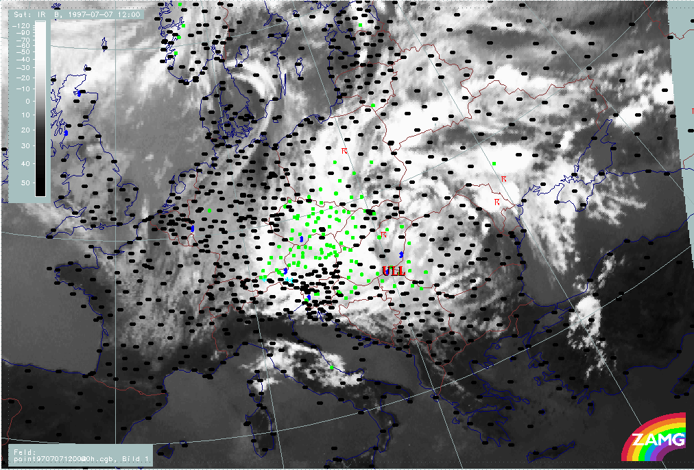
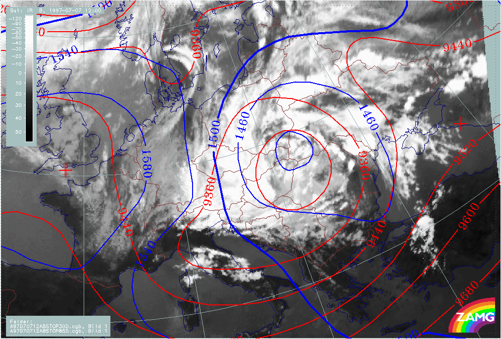
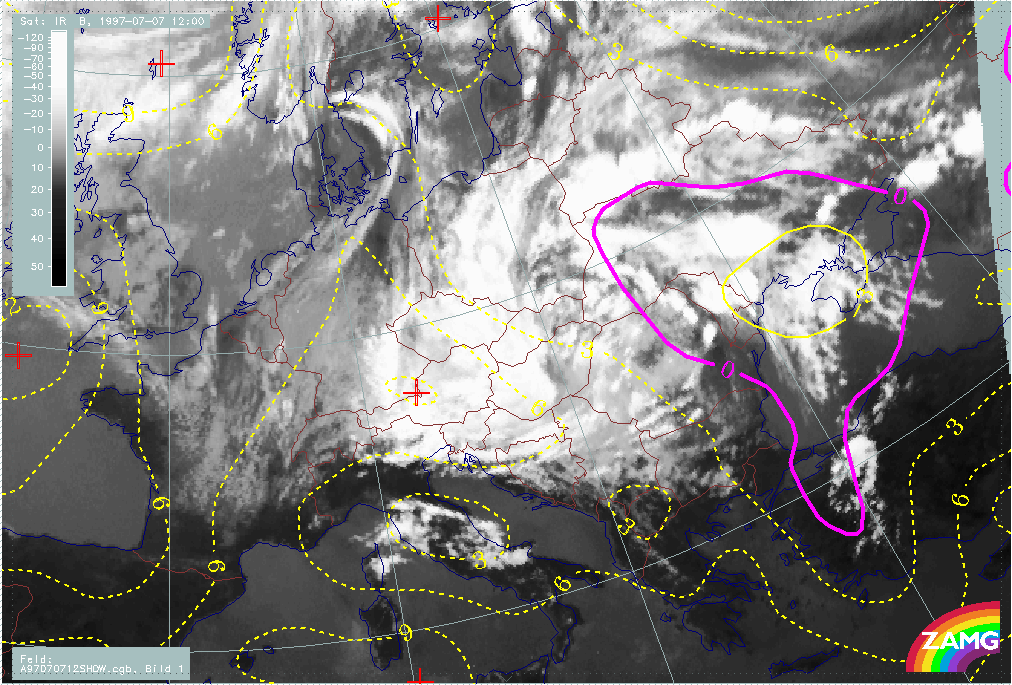
The system is fed from the east by cyclonically rotating convection lines, thus, during the whole period, the main precipitation area still extends from Poland across the Czech Republic and Slovakia to E. Austria and Hungary. Thunderstorms continue to appear in the eastern and north-eastern parts.
|
07 July 1997/12.00 UTC - Meteosat IR image; weather events (green: rain and showers, blue: drizzle, cyan: snow, red: thunderstorm with precipitation, purple: freezing rain, orange:
hail, black: no actual precipitation or thunderstorm with precipitation)
|
|
|
Within this period the following process is described in detail in separate chapters:
- Baroclinic boundary and rotation of convective lines
Contents of phases described in separate chapters
- Frontal cloud band
- Front intensification by Jet Crossing: FI by Jet
- Cold air features
- Development of Occlusion - like cloud features
- Main ULL cut-off
- Baroclinic Boundary and rotation of convective lines
Initial weather situation: 13 May 06.00 UTC
In the 3-hourly sequence of satellite images, the frontal cloud band can be followed as it moves from a position over the western Mediterranean to the Balkan Peninsula.
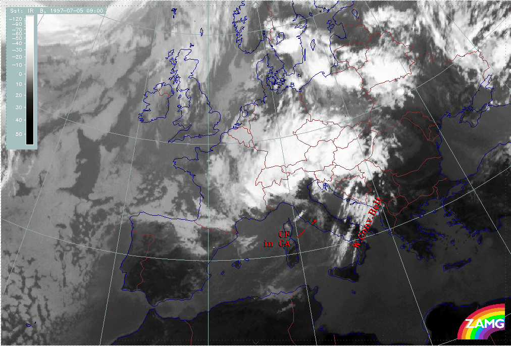
Initially the frontal cloud band extends from the western Mediterranean across Switzerland into Germany. There are some cloud fibres ahead of it over Sardinia which represent a rising warm conveyor belt. A Wave - like feature appears over the west Alps, but does not develop.
From 09.00 UTC, in addition to the Wave - like feature mentioned above, an intensification over Germany can be recognised which intensifies further and moves into Poland by 21.00 UTC. From then on it splits from the frontal cloud band and can be observed as a separate convective cloud system. This phenomenon is described in detail in the chapter Front intensification by jet crossing: FI by Jet.
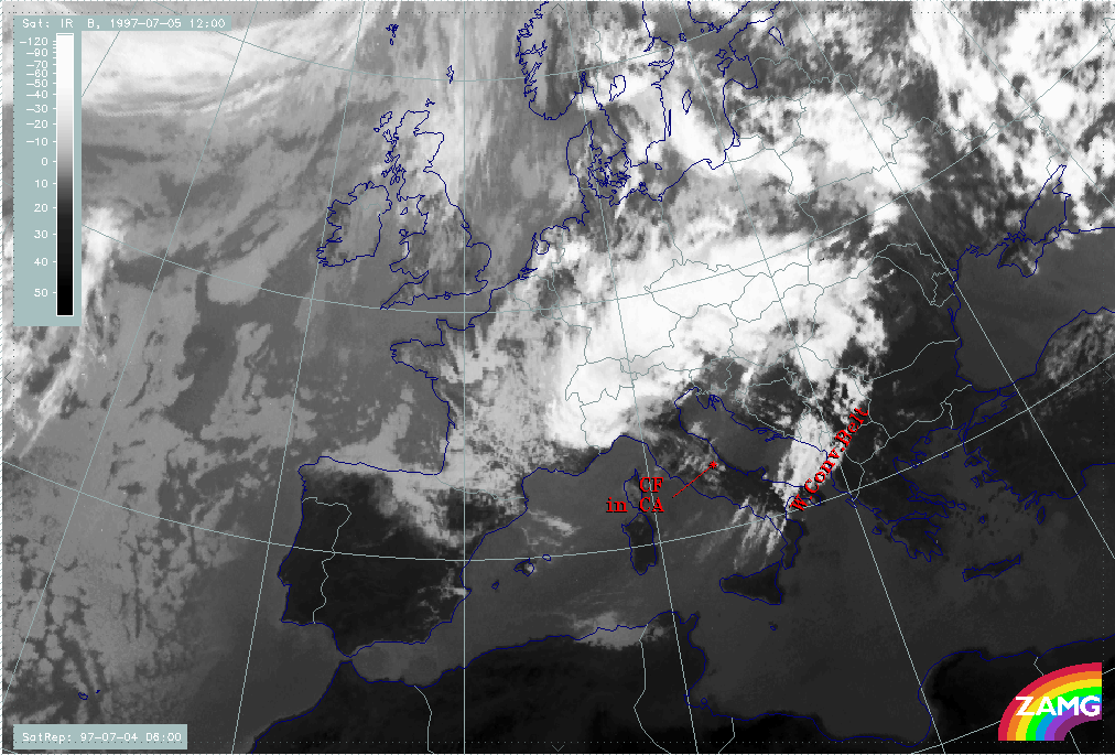
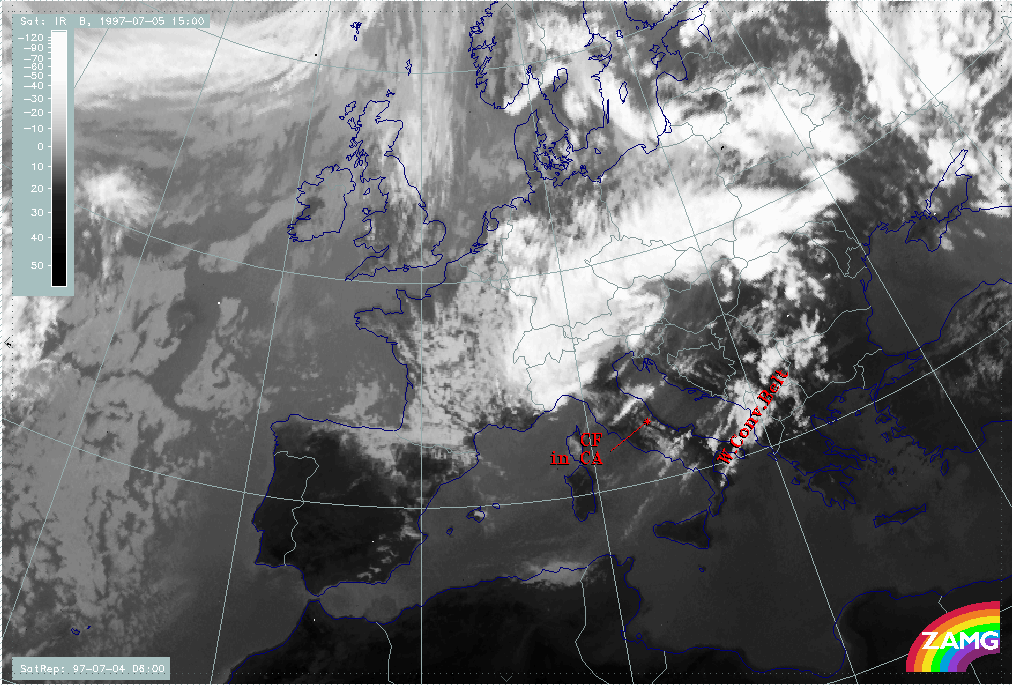
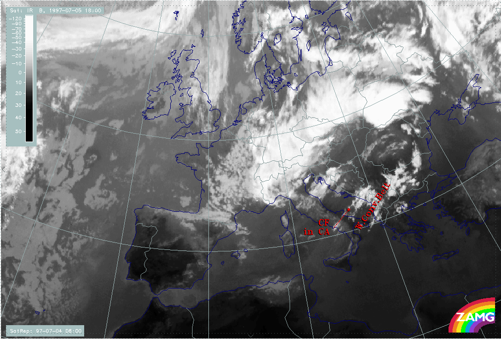
During the passage of the frontal band, the cloud fibres ahead of it indicating a Warm Conveyor Belt can be observed; but from about 21.00 UTC, a distinct intensification of this cloudiness takes place which suddenly leads to the appearance of a very broad frontal cloud band. Indeed, the frontal cloudiness is still at the western boundary. Between 06.00 and 12.00 UTC on 05 July, a dramatic dissolution of this frontal cloudiness takes place, while the cloud fibres belonging to the Warm Conveyor Belt can be observed till the end of this phase at 18.00 UTC.
|
04 July 1997/06.00 UTC - Meteosat IR image; 04/06.00 - 05/18.00 UTC 3-hourly image loop
|
|
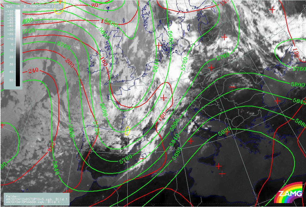
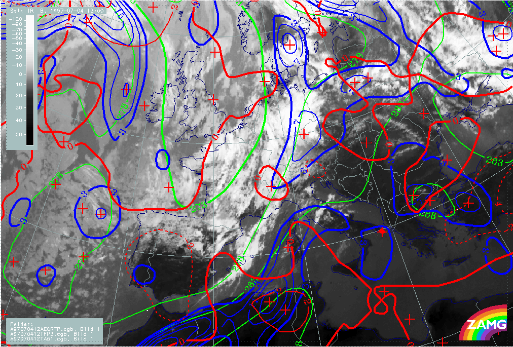
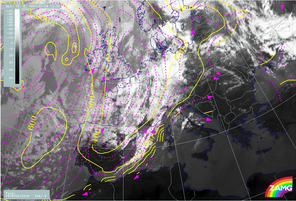
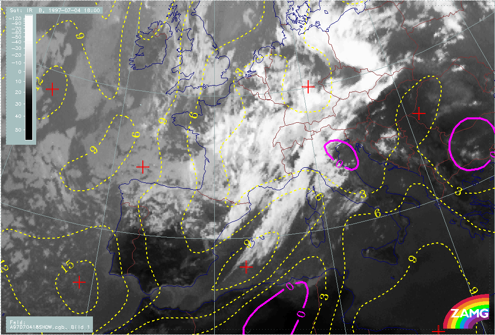
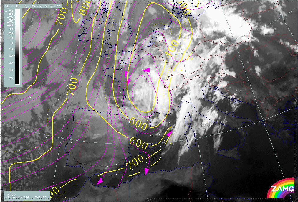
The frontal situation at the start of the event is shown on the image for 04 July/12.00 UTC. At this time, the frontal cloud band is situated within a distinct upper level SW stream and is not accompanied by any trough - like configuration in the surface pressure field. The typical frontal parameters show a rather broad zone with higher thickness gradients compared with the surrounding area which leads to a splitting of the TFP into two branches. The temperature advection (TA) field shows very low values, most of them representing cold advection (CA); this is in accordance with the diagnosis of the conceptual models "Cold Front in Cold Advection". There is a very pronounced jet streak at 300 hPa at the rear side of the frontal cloud band crossing it in the area of the west Alps. Two PVA maxima exceeding the threshold of 4 units exist on the cyclonic side of the jet streak: the northern one is associated with the cloud intensification area over Germany and shear vorticity and is described in detail in the chapter Front intensification by Jet Crossing: FI by Jet; the southern one is associated with the intensified cloudiness over NE Spain and curvature vorticity and is described in detail in the chapter Cold air features;.
|
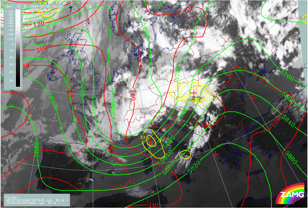
04 July 1997/12.00 UTC - Meteosat IR image; red: height contours 1000 hPa, green: height contours 500 hPa, yellow: positive vorticity advection (PVA) 500 hPa
|
04 July 1997/12.00 UTC - Meteosat IR image; blue: thermal front parameter (TFP) 500/850 hPa, green: equivalent thickness 500/850 hPa, red solid: temperature advection - WA 1000 hPa, red
solid: temperature advection - CA 1000 hPa, SatRep overlay: names of conceptual models
|
|
|
|
|
|
04 July 1997/12.00 UTC - Meteosat IR image; black: positive vorticity advection (PVA) 300 hPa, yellow: isotachs 300 hPa, red: shear vorticity 300 hPa
|
|
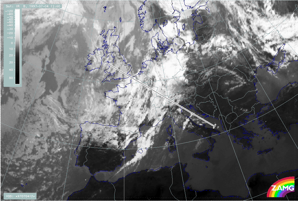
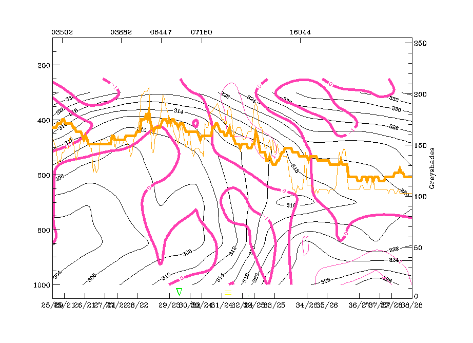
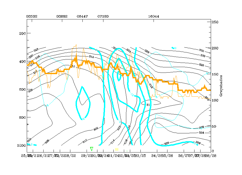
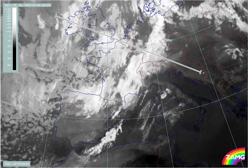
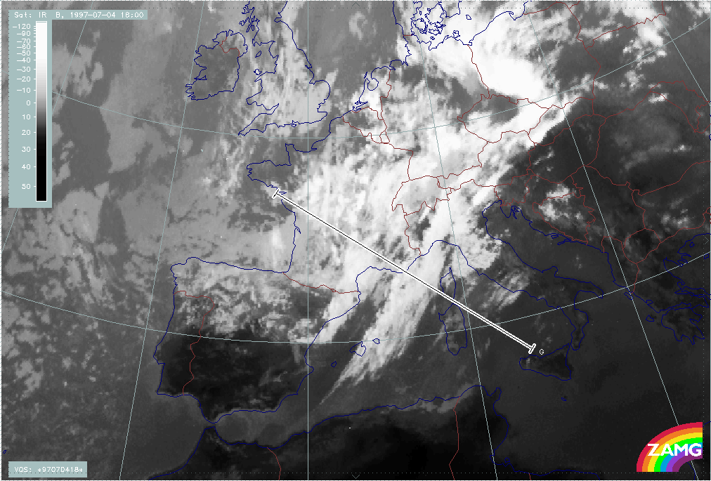
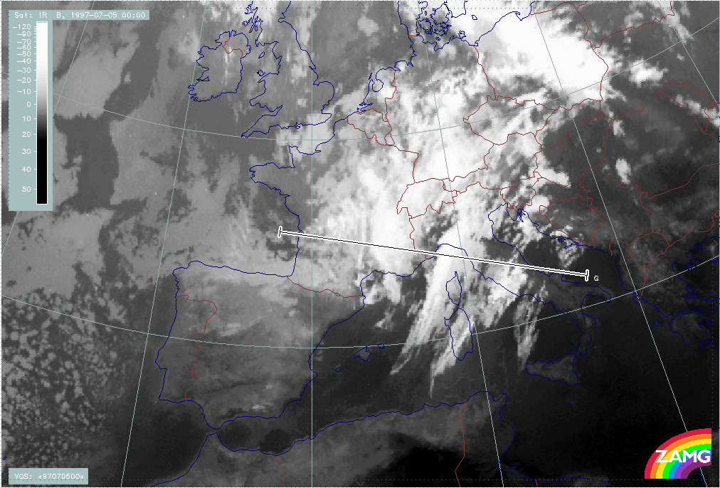
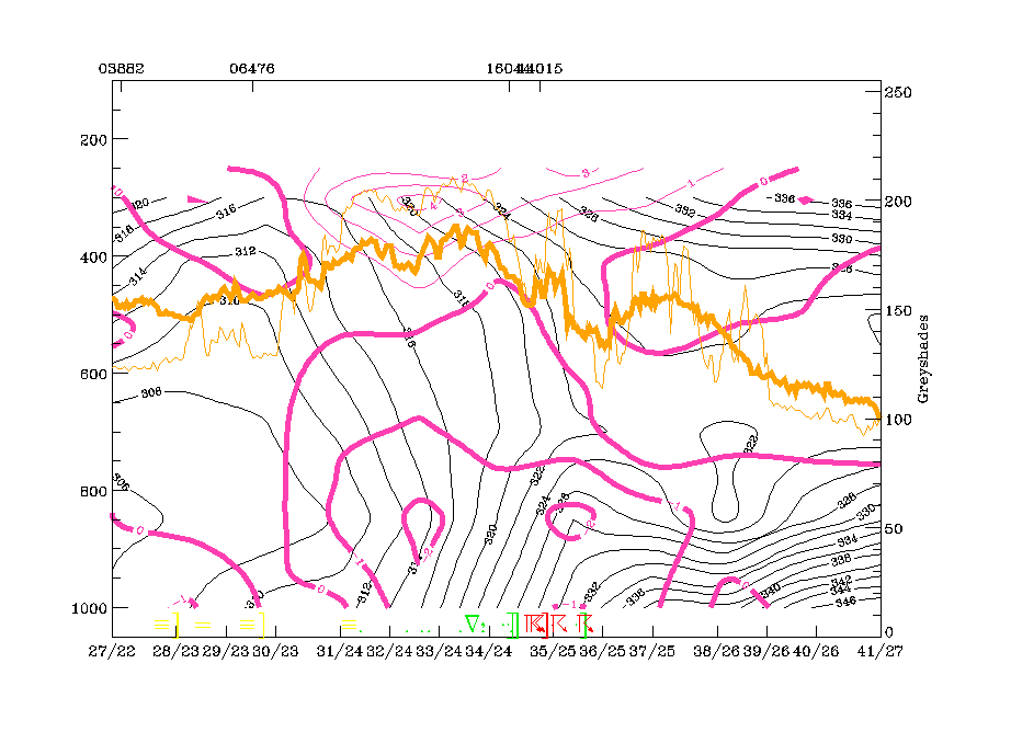
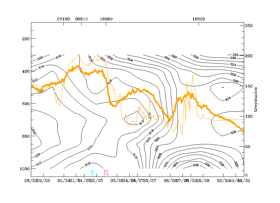
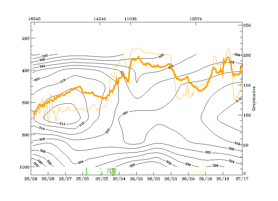
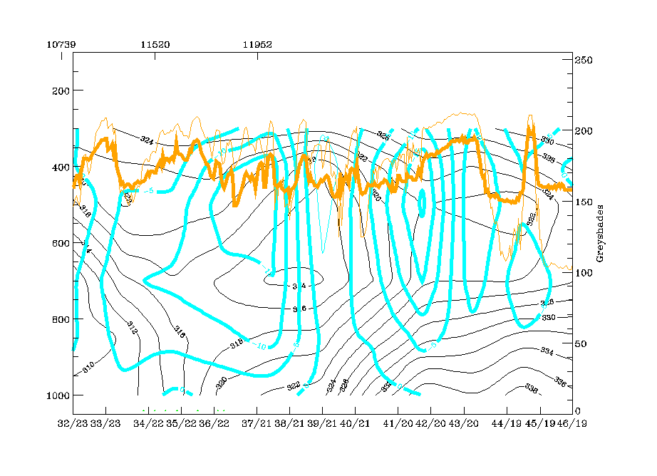
Additional information about the physical state of the frontal cloud band can be gained from the distribution of parameters in the vertical. The vertical cross section line F crosses the front from NW (Wales) to SE (Adriatic Sea).
|
04 July 1997/12.00 UTC - Meteosat IR image; position of vertical cross section indicated
|
|
|
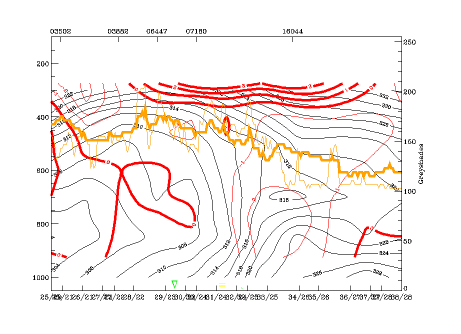
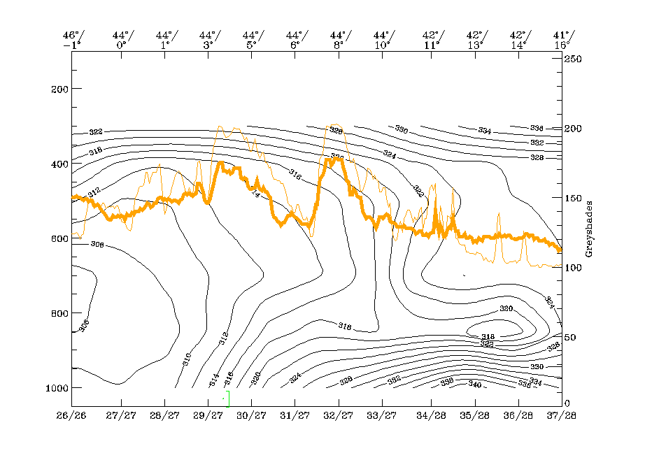
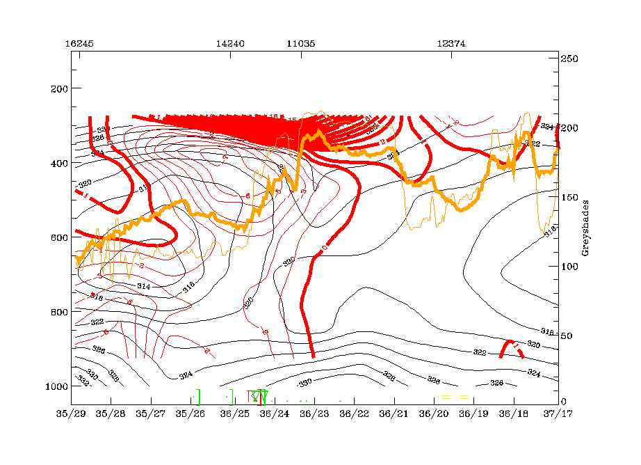
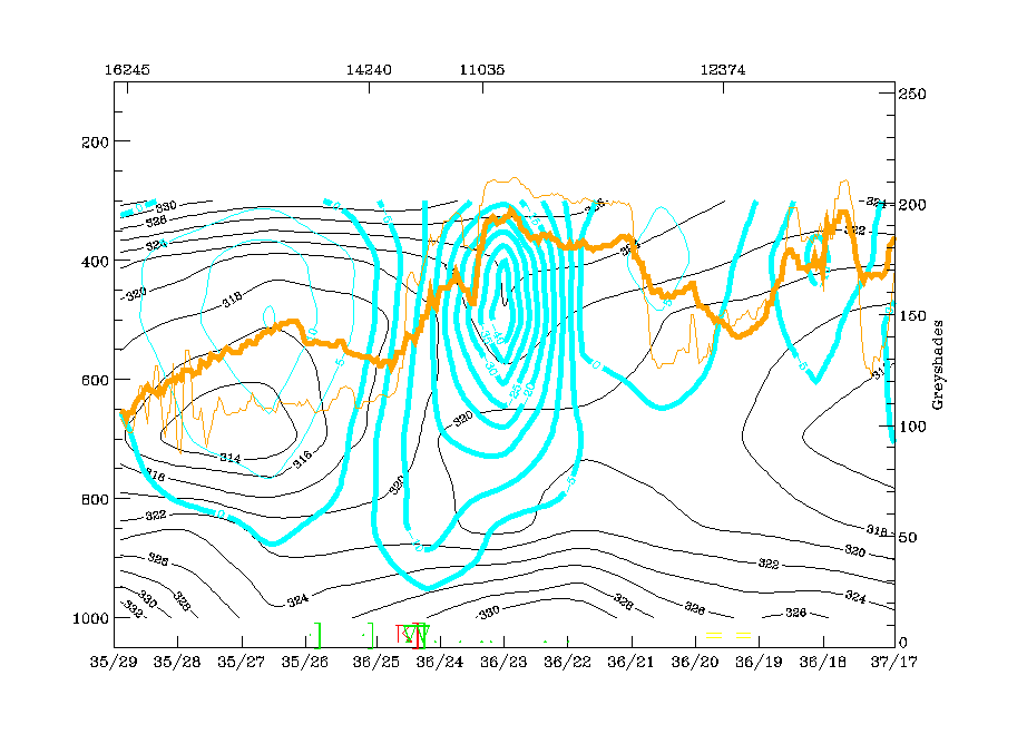
Isentropes, TA and satellite pixel values show different physical states along the cross section:
The main western IR and WV peak pixel values (around radiosonde station 06447, Brussels) indicate the convective cold air feature over NW France and is associated with an unstable area in the isentropes, but there are rather indistinct features in the TA.
The central peak pixel values SE of radiosonde station 07180 (Reims) represent the frontal cloudiness. There is a downward inclined zone of high gradients in isentropes from 400 hPa down to the surface with a superadiabatic behaviour below 800 hPa. The whole area is under CA, which supports the diagnosis of the cloud band as Cold Front in Cold Advection.
Immediately south-east of the frontal zone around the radiosonde station 16044 (Udine), again a very unstable layer from the surface up to about 600 hPa exists. On top of this layer an upper level frontal zone of high gradients can be observed which is also under CA, too. This is in coincidence with the area of the cloud fibres marking a Warm Conveyor Belt.
The vertical distribution of divergence and upward motion supports the idea of two frontal circulation zones:
- The main one, with convergence within, divergence above the frontal zone of high gradients leading to intensive upward motion there
and
- An upper level frontal zone which is accompanied by distinct convergence but with no significant upward motion.
|
04 July 1997/12.00 UTC - Vertical cross section; black: isentropes (ThetaE), red thin: temperature advection - CA, red thick: temperature advection - WA, orange thin: IR pixel values,
orange thick: WV pixel values
|
04 July 1997/12.00 UTC - Vertical cross section; black: isentropes (ThetaE), magenta thin: divergence, magenta thick: convergence, orange thin: IR pixel values, orange thick: WV pixel
values
|
|
|
|
|
|
04 July 1997/12.00 UTC - Vertical cross section; black: isentropes (ThetaE), cyan thick: vertical motion (omega) - upward motion, cyan thin: vertical motion (omega) - downward motion,
orange thin: IR pixel values, orange thick: WV pixel values
|
|
Relative streams on isentropic surfaces give some further insight into the distribution and approach of different air masses (e.g. conveyor belts). The 318K surface is very high above the Cold Front zone and immediately above the unstable zone to the south-east. In the development and maintenance of the Cold Front cloud band a rising Warm Conveyor Belt as well as an upper level stream and a dry intrusion are involved. They are rather classically distributed, and a large part of the frontal cloud band has developed within the Warm Conveyor Belt.
There is already some indication of cloud fibres and relative streams over Italy being parallel to each other. This is the area where cloudiness is going to develop which is discussed below.
|
04 July 1997/12.00 UTC - Meteosat IR image; magenta: relative streams 318K - system velocity 245° 9 m/s; yellow: isobars
|
|
|
A distinct intensification of the Warm Conveyor Belt over Italy as well as an increase in cloudiness in its rising branches is very well shown in the analysis of relative streams between 04 July/18.00 UTC and 05 July/06.00 UTC.
|
04 July 1997/18.00 UTC - Meteosat IR image; magenta: relative streams 322K - system velocity 238° 12 m/s; yellow: isobars
|
05 July 1997/00.00 UTC - Meteosat IR image; magenta: relative streams 324K - system velocity 241° 11 m/s; yellow: isobars
|
|

|
|
|
|
05 July 1997/06.00 UTC - Meteosat IR image; magenta: relative streams 322K - system velocity 248° 11 m/s; yellow: isobars
|
|
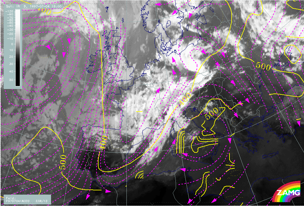
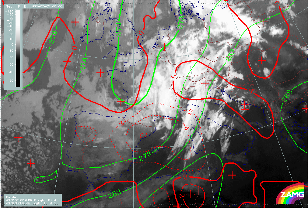
After the period of cloud intensification in the Warm Conveyor Belt, a very rapid dissolution of frontal cloudiness takes place in the short period between 05 July/06.00 and 05 July/12.00 UTC. This goes hand in hand with an intensification of CA starting at 05 July/00.00 in the western Mediterranean and approaching the Balkan Peninsula by 06 July/00.00 UTC. CA between 06.00 and 12.00 UTC as well as Potential Vorticity (in form of the height of the PV=2 units) show a fast eastward propagation of colder and dry air over the CF band.
|
05 July 1997/06.00 UTC - Meteosat IR image; red solid: temperauture advection - WA, red dashed: temperauture advection - CA
|
05 July 1997/06.00 UTC - Meteosat IR image; red: height of PV=2 units
|
|
|
|
|
|
05 July 1997/12.00 UTC - Meteosat IR image; red solid: temperauture advection - WA, red dashed: temperauture advection - CA
|
05 July 1997/12.00 UTC - Meteosat IR image; red: height of PV=2 units
|
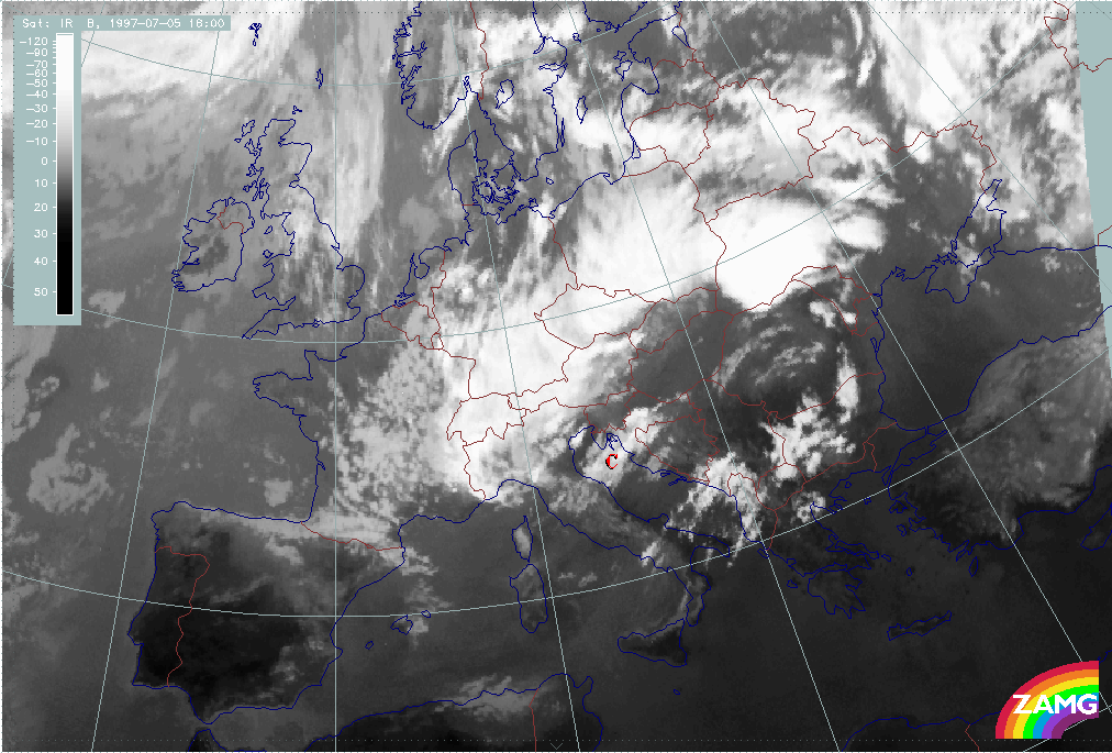
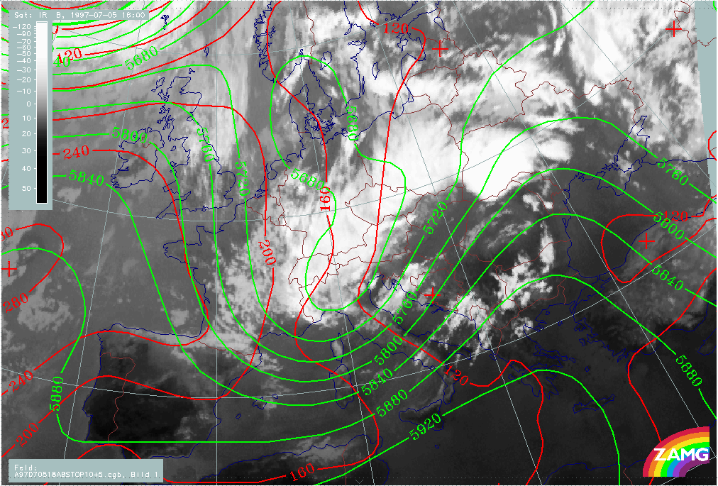
The situation of 05 July/12.00 UTC shows the end phase of the frontal cloud band, but with still some fibrous cloudiness in the Warm Conveyor Belt but only a few remnants of frontal cloudiness.
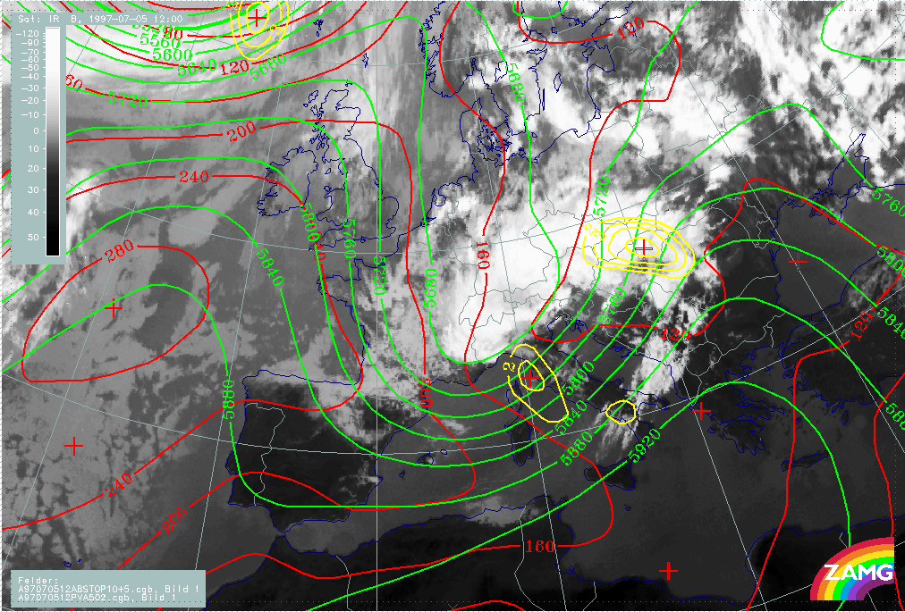
The overall pressure height field and its relation to cloudiness is very similar to 12 hours earlier: A broad SW stream in advance and no distinct trough or low in the surface (1000 hPa). In contrast to the initial stage, however, some distinct PVA maxima are now present.
The most dramatic change in the typical frontal parameters is the intensive increase of CA in the Mediterranean and, to some extend, over the Balkan Peninsula which is the area of largely dissolved Cold Front cloudiness. The jet streak at 300 hPa is still very dominant as well as the PVA maximum at 300 hPa in the left exit region.
|
05 July 1997/12.00 UTC - Meteosat IR image; red: height contours 1000 hPa, green: height contours 500 hPa, yellow: positive vorticity advection (PVA) 500 hPa
|
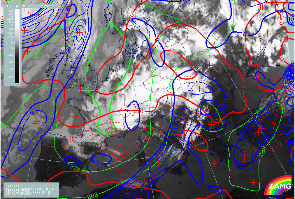
05 July 1997/12.00 UTC - Meteosat IR image; green: equivalent thickness 500/1000 hPa, red solid: temperature advection - WA 1000 hPa, red dashed: temperature advection - CA 1000 hPa,
blue: Thermal Front parameter (TFP) 500/850 hPa
|
|
|
|
|
|
05 July 1997/12.00 UTC - Meteosat IR image; yellow: isotachs 300 hPa, red: shear vorticity 300 hPa, black: positive vorticity advection (PVA) 300 hPa
|
|
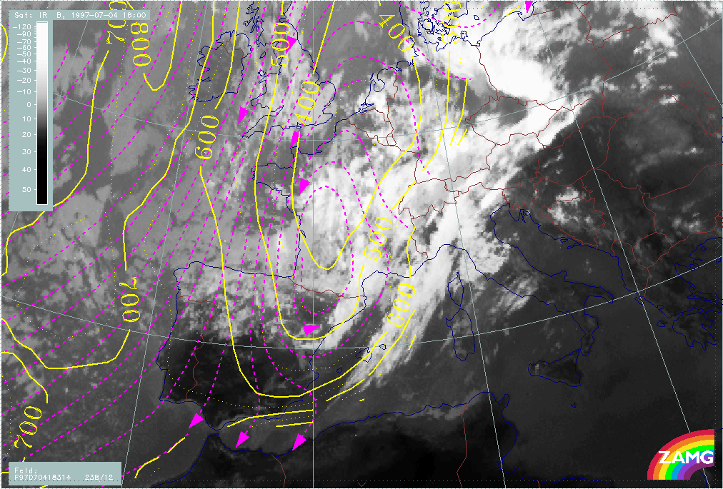
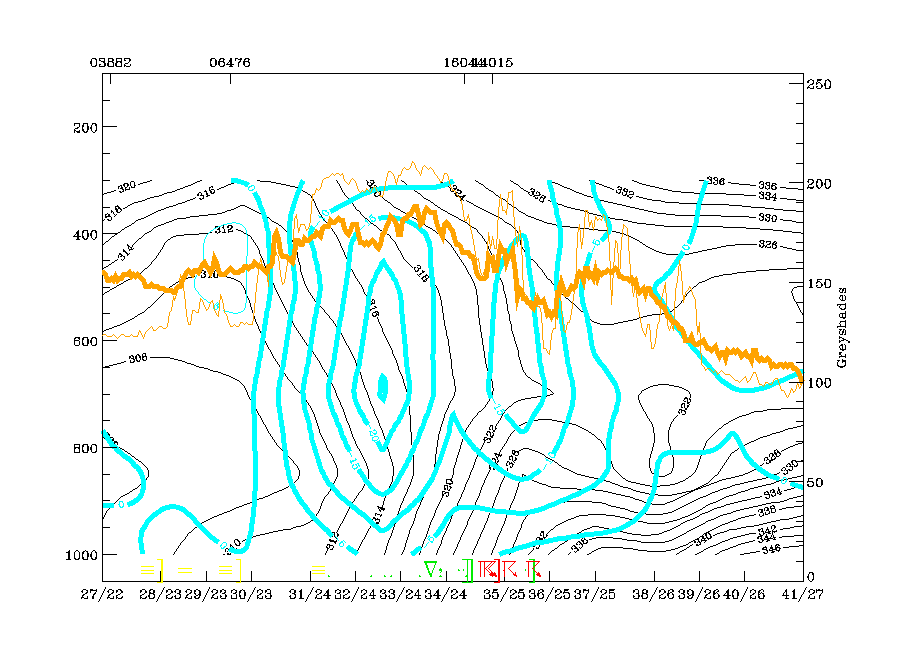
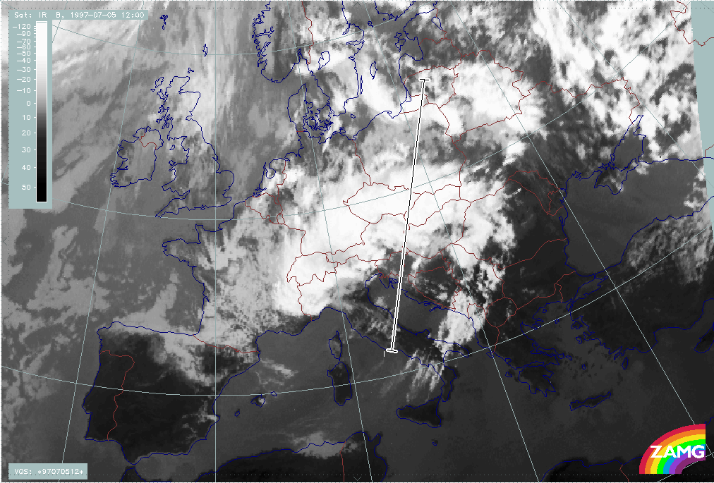
To add information in the vertical, a vertical cross section is computed from NW (France) to SW (Greece) across the Occlusion - like cloud band (see chapter Development of Occlusion - like cloud features), the nearly dissolved frontal cloudiness and the rest of the Warm Conveyor Belt cloudiness.
|
05 July 1997/12.00 UTC - Meteosat IR image; position of vertical cross section indicated
|
|
|
Isentropes, TA and satellite signals show different atmospheric systems along this cross section:
The main IR and WV peak pixel values between the radiosonde stations 07180 (Reims) and 16080 (Milan) indicate the Occlusion - like cloud band and appear in an area of high instability up to 600 hPa as well as an Occlusion - like isentropic trough above. Near the main front there is an almost vertically inclined zone of high gradients where there are rather low IR values; some single peaks represent the rest of the frontal cloudiness. The higher peaks close to the radiosonde station 16320 (Brindisi) belong to the warm conveyor belt; the upper level frontal zone detected 12 hours before has now merged with the main frontal zone. This is supported by the TA field showing intensive CA from the surface up to 600 - 500 hPa but WA above. The relative humidity field shows a very dry area between upper and middle levels exactly in the area of the rest of the frontal cloudiness.
Looking at the parameter divergence, there is a new upper level front with a backbent zone of convergence accompanying the frontal zone of high gradients from 600 hPa upwards.
The two most remarkable features in the omega field are the area of strong subsidence over the frontal zone and the area of strong upward motion in the Warm Conveyor Belt cloudiness. So a comparison with the same charts 12 hours earlier clearly shows transition from upward to downward motion in the region of the frontal cloudiness.
|
05 July 1997/12.00 UTC - Vertical cross section; black: isentropes (ThetaE), red thin: temperature advection - CA, red thick: temperature advection - WA, orange thin: IR pixel values,
orange thick: WV pixel values
|
05 July 1997/12.00 UTC - Vertical cross section; black: isentropes (ThetaE), orange thin: IR pixel values, orange thick: WV pixel values
|
|
|
|
|
|
05 July 1997/12.00 UTC - Vertical cross section; black: isentropes (ThetaE), magenta thin: divergence, magenta thick: convergence, orange thin: IR pixel values, orange thick: WV pixel
values
|
05 July 1997/12.00 UTC - Vertical cross section; black: isentropes (ThetaE), cyan thick: vertical motion (omega) - upward motion, cyan thin: vertical motion (omega) - downward motion,
orange thin: IR pixel values, orange thick: WV pixel values
|
At this point in time, relative streams on isentropic surfaces also give some more insight into the distribution and approach of different air masses (conveyor belts). The 322K surface is very high above the frontal zone dropping very steeply within the new upper level front (Warm Conveyor Belt). Compared to the relative streams 12 hours earlier, only the dry stream from behind the front can now be recognised which is overrunning the frontal cloud band, resulting in its gradual disappearance.
|
05 July 1997/12.00 UTC - Meteosat IR image; magenta: relative streams 322K - system velocity 247° 8 m/s; yellow: isobars
|
|
|
Front intensification by jet crossing: FI by Jet
There is a period within the life-time of the frontal cloud band where cloudiness is intensified in the left exit region of a crossing jet streak. This phase is not directly associated with the cut-off development and the flood event, but as it is accompanied by many thunderstorms over a rather long period of time it results in a heavy rainfall situation already prior to the main flood situation.
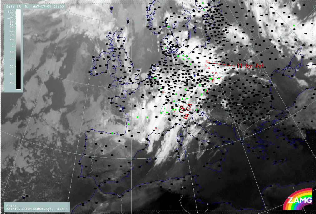
In the three-hourly sequence the first sign of a cloud intensification area is over Germany, where there are already many thunderstorms. By 18.00 UTC the intensification moves eastward and a distinct cyclonic curvature develops in the cloudiness. At the same time thunderstorm activity still increases, persisting until around 00.00 UTC but becoming less numerous.
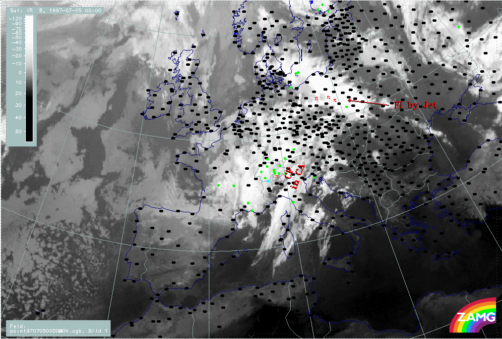
Another interesting phenomenon is the separation of the enhanced cloud part from the main frontal cloud band which can be seen best between 18.00 and 00.00 UTC. This separated part remains as a convective line and moves NE-ward to the Baltic States and White Russia, as shown on the 05/06.00 UTC image.
|
04 July 1997/12.00 UTC - Meteosat IR image; weather events (green: rain and showers, blue: drizzle, cyan: snow, red: thunderstorm with precipitation, purple: freezing rain, orange:
hail, black: no actual precipitation or thunderstorm with precipitation); 04/12.00 - 05/06.00 UTC 3-hourly image loop
|
|
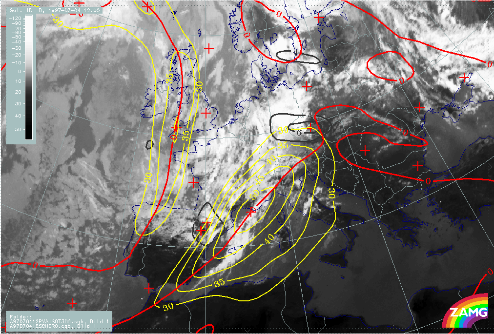
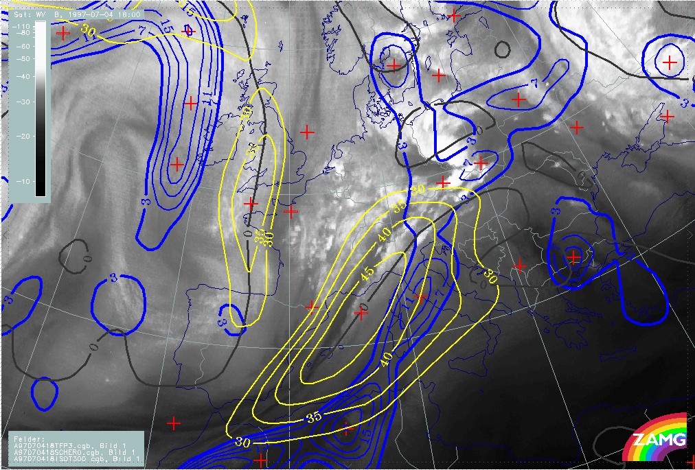
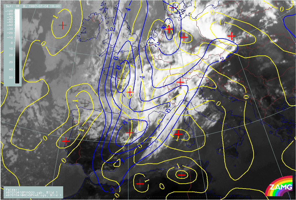
There is a pronounced jet streak parallel to the western edge of the frontal cloud band which crosses the front represented by the thermal front parameter TFP in the area of Austria - Slovakia. In the WV image some deviation between the Black Stripe and the model jet axis (zero line of shear vorticity at 300 hPa) can be observed over Italy and Austria.
There are two main PVA maxima accompanying the frontal cloud band and the jet streak area:
- One in the northern part which is the left exit region and is associated with the intensification area over E. Germany and Poland; this is typically a consequence of shear vorticity and
- One over France and NE Spain which is close to the centre of the jet streak and reaches and even overruns the jet axis, although the biggest part is on the cyclonic side; this PVA maximum is typically caused by curvature vorticity and is associated with the band feature which has developed in the cold air behind the frontal cloud band.
|
04 July 1997/18.00 UTC - Meteosat WV image; blue: thermal front parameter (TFP) 500/850 hPa, yellow: isotachs 300 hPa, black: shear vorticity 300 hPa
|
04 July 1997/18.00 UTC - Meteosat WV image; black: positive vorticity advection (PVA) 300 hPa, yellow: isotachs 300 hPa, black: shear vorticity 300 hPa
|
|
|
Cold air features
This chapter deals with the first development phase of the cloud features in the cold air and within the upper level trough. The 3-hourly image sequence shows developments taking place over W. France and moving from there eastward to E. France, Switzerland and Germany.
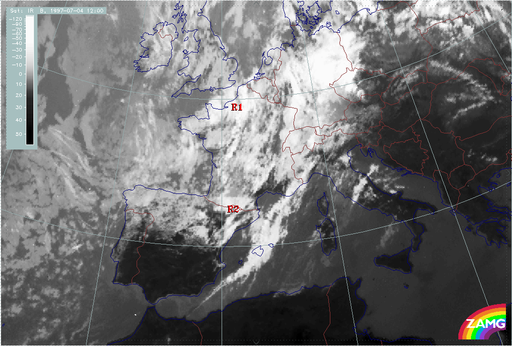
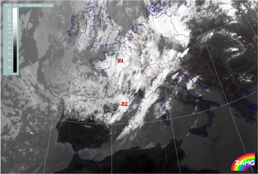
Initially, on 04 July/06.00 UTC, two intensified cloud areas R1 and R2 can be observed. They consist of multi-layered cloudiness with some convective elements embedded. Up to 04 July/12.00 UTC, both areas R1 and R2 can be followed easily; the convective character of the whole trough area behind the frontal cloud band increases as well as the convective character of both enhanced cloud areas R1 and R2. This convective character continues to strengthen during the next hours.
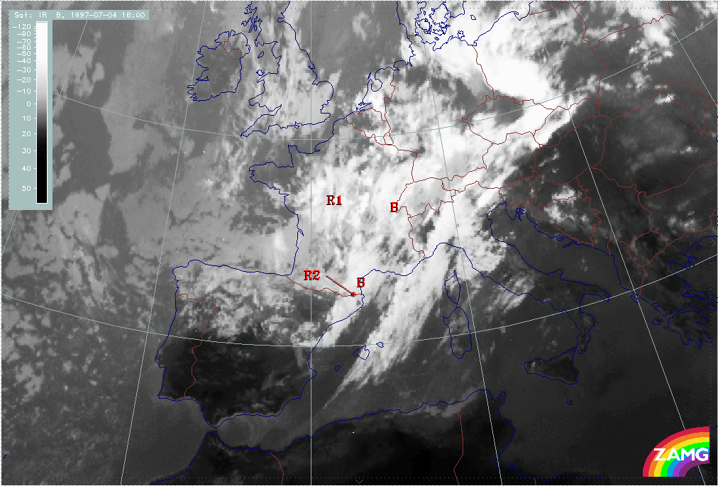
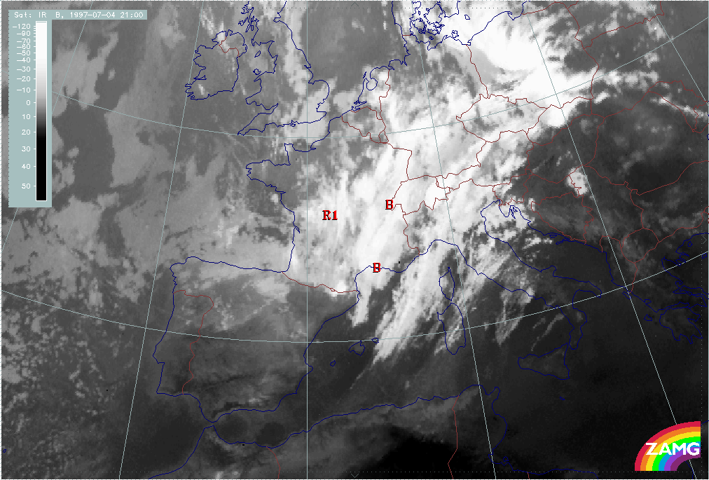
From 04 July/15.00 UTC till 04 July/21.00 UTC, a band-like feature (B) develops behind the frontal cloud band; it is built up from two main centres: the convective area R2 and a more northern new development over the W. Alps immediately behind the frontal cloud band. At 21.00 UTC the cloud band is continuous and extends from S. France across W. Switzerland into Germany. At the same time the enhanced cloud area R1 has moved southward into central France.
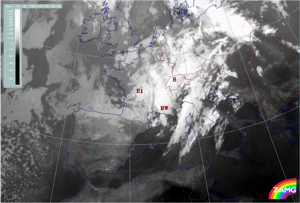
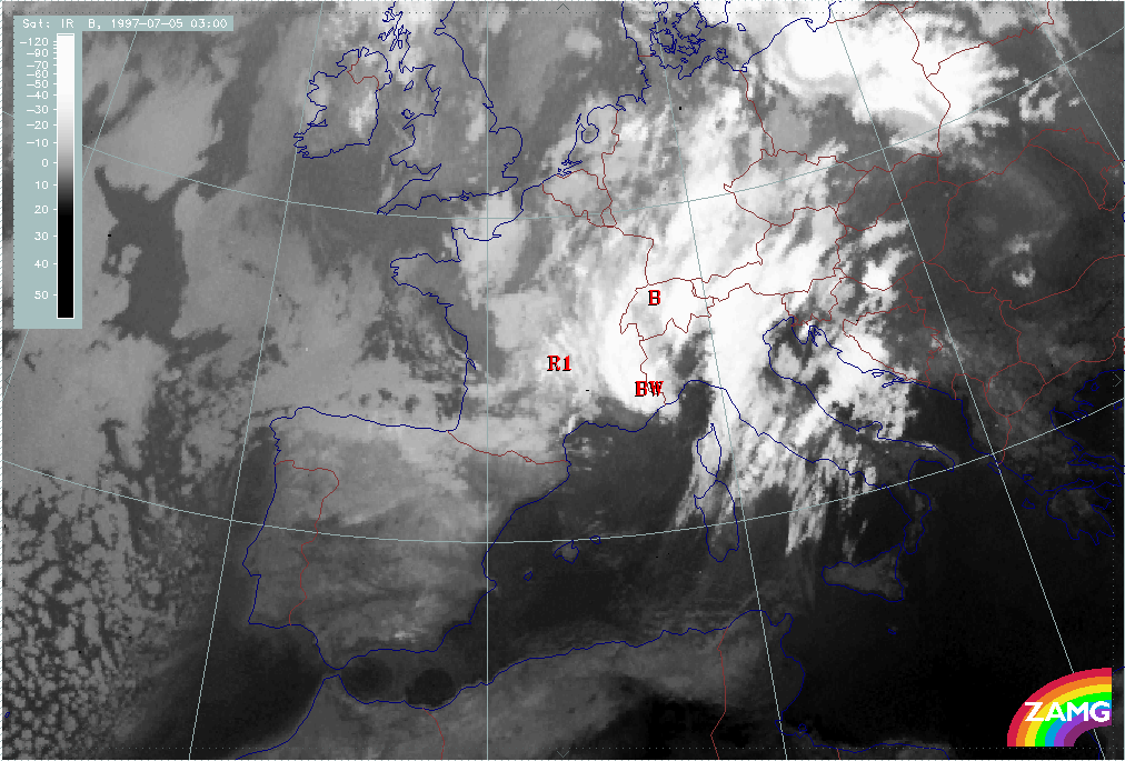
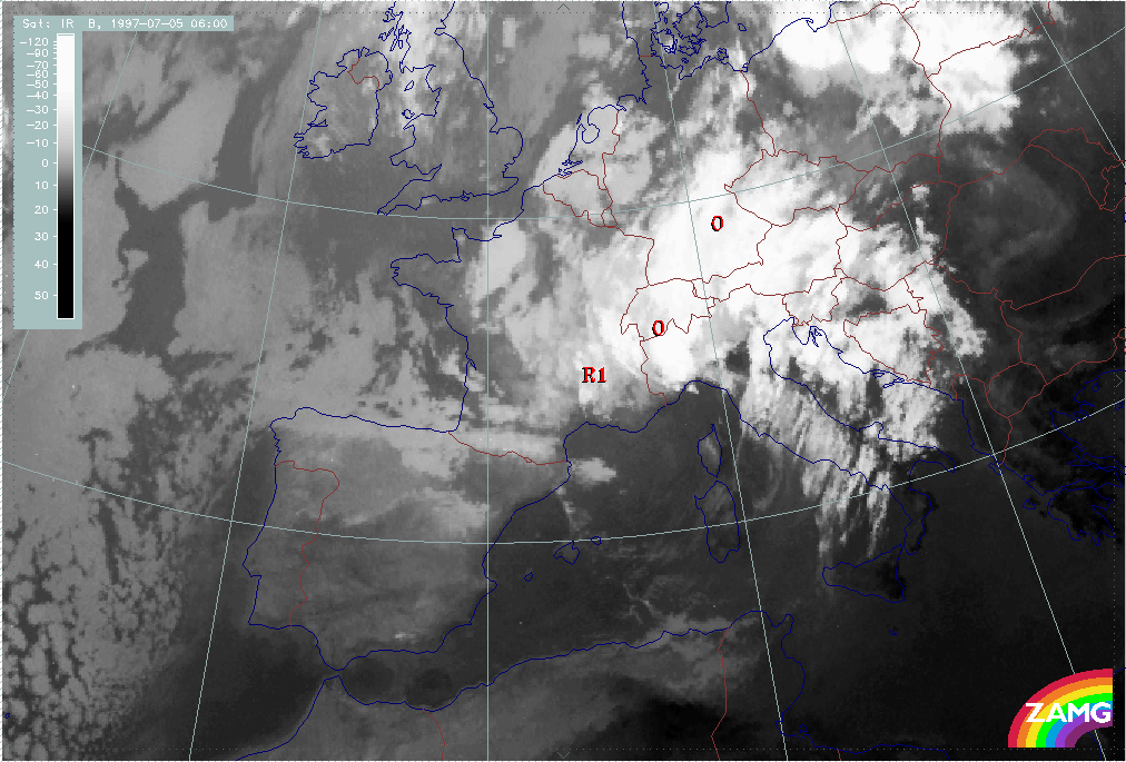
During the last time period from 04 July/21.00 UTC to 05 July/06.00 UTC, a cyclonic curvature within the band structure B develops, which at 05 July/00.00 UTC gives the impression of a Wave structure developing within B (BW); but the following images show the formation of a cyclonic cloud spiral from B, BW which in the last image of this sequence (05 July/06.00 UTC) gives an impression that an Occlusion process had taken place, indicated by (O) in the relevant image. But, bearing in mind that the cloud band B has developed behind and separate from the frontal cloud band, a classical Occlusion process (either from the Warm Conveyor Belt type or from the cold conveyor belt type) has to be excluded. In the image of 05 July/03.00 UTC, the development of cloudiness between the frontal cloud band and cloud band B can be observed over E. Switzerland.
During the whole period, the enhanced convective area R1 can be followed, although it is decaying.
|
04 July 1997/06.00 UTC - Meteosat IR image; 04/06.00 - 05/06.00 UTC 3-hourly image loop
|
|
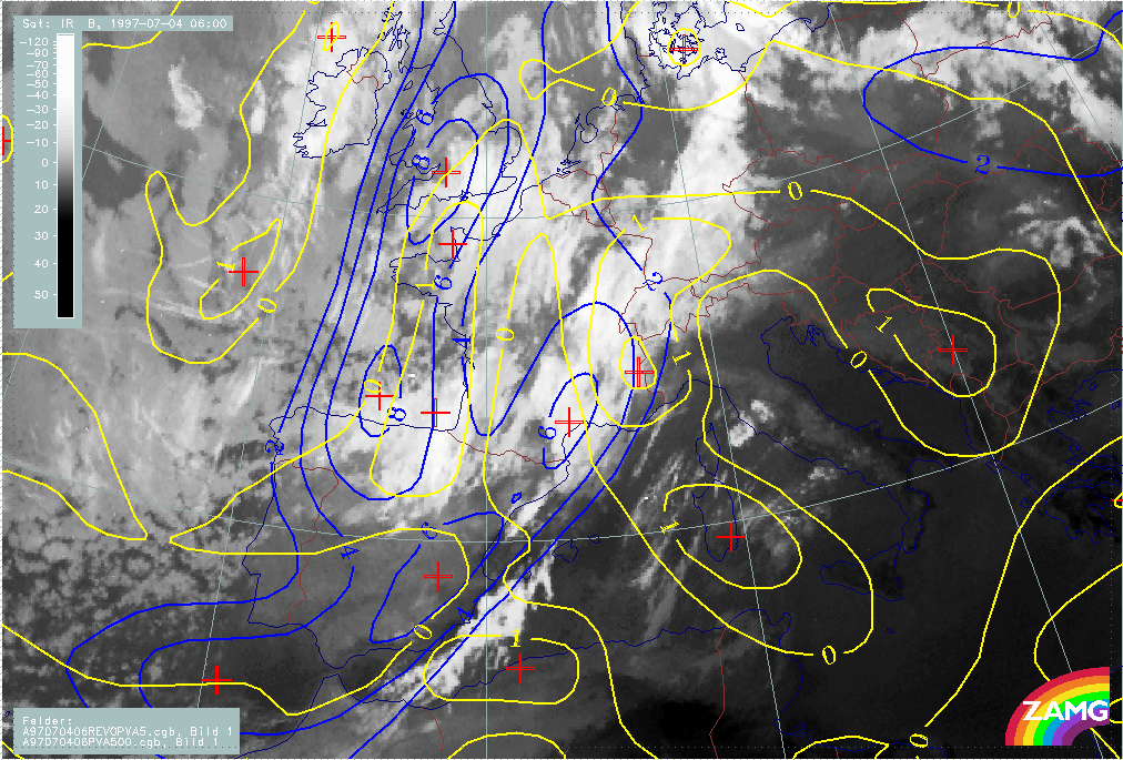
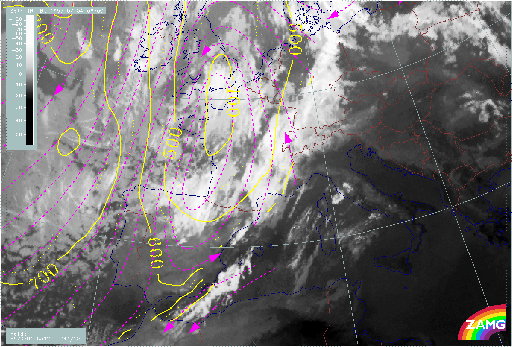
The situation of 04 July/06.00 UTC is characteristic of the initial phase of a distinct upper level trough. Both cloud areas R1 and R2 are situated in the axis of an intensive upper level trough between 500 and 300 hPa. The surface field (1000 hPa) does not contain any typical frontal trough or low pressure feature.
Enhanced cloud systems in cold air are usually driven by the upper level processes and consequently associated with PVA maxima; in this case there are two cyclonic vorticity maxima at 500 hPa exactly at the rear of R1 and R2, but PVA in advance of the vorticity maxima and superimposed on the cloud systems is (although existing) weak (1 unit). This leads to the conclusion that the upper level trough system is for the time being, rather stationary.
The stability situation in this area is typical: cloud systems R1 and R2 are within the thickness trough line under weak cold advection (CA) and the Showalter Index mostly shows values <3, indicating the existence and development of showers.
|
04 July 1997/06.00 UTC - Meteosat IR image; red: height contours 1000 hPa, green: height contours 500 hPa, blue: height contours 300 hPa
|
04 July 1997/06.00 UTC - Meteosat IR image; blue: vorticity 500 hPa, yellow: positive vorticity advection (PVA) 500 hPa
|
|
|
|
|
|
04 July 1997/06.00 UTC - Meteosat IR image; green: equivalent thickness 500/1000 hPa, red solid: temperature advection - WA 1000 hPa, red dashed: temperature advection - CA 1000 hPa,
yellow: Showalter index
|
|
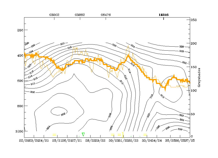
Vertical cross section and relative streams give additional insight into the ongoing processes. The vertical cross section F extends from the NW (Ireland) across the enhanced area R1 and the frontal cloud band to the SW (Balkan Peninsula). The western peak in the IR pixel values around radiosonde station 03882 indicates R1, the more south-western peak (SW of radiosonde station 06476) indicates the frontal cloud band. It is interesting that the CA features show up mainly in the IR signals, while the WV signals remain rather dry; in contrast, there is also a peak in the WV curve over the frontal cloud band. This is the consequence of the dry air within the upper level and thickness trough.
Isentropes show very typical configurations. An unstable area below R1 and a downward inclined frontal zone of high gradients at the south-western boundary. The isentropic surface of 312K is on top of the unstable area within R1 and within the frontal crowding zone. Relative streams at this surface show a cyclonic eddy in the cold air with rising branches in the area of the CA features R1 and R2.
|
04 July 1997/06.00 UTC - Meteosat IR image; position of vertical cross section indicated
|
04 July 1997/06.00 UTC - Vertical cross section; black: isentropes (ThetaE), blue: relative humidity, orange thin: IR pixel values, orange thick: WV pixel values
|
|
|
|
|
|
04 July 1997/06.00 UTC - Meteosat IR image; magenta: relative streams 312K - system velocity 244° 10 m/s, yellow: isobars
|
|
The situation at 04 July/18.00 UTC represents the near complete development of the cloud band B behind the frontal cloud band. At this point of time, it extends from NE Spain across France and W. Switzerland into S. Germany. This cloud band is situated within the extensive SW stream at the leading edge of the upper level trough (500 - 300 hPa) while R1 still can be found within the upper level trough itself. There is now an extended area of lower pressure in the surface fields (1000 hPa).
Compared to 12 hours before, the PVA maximum associated with R1 has now increased, indicating the propagation of the corresponding vorticity maximum over NW France. And indeed, the convective area R1 can be observed for a rather long time. The relation between the cloud band B and vorticity as well as PVA maxima at 500 hPa is not as clear. There is much better correspondence between B and the situation at 300 hPa. At least the southern part of B which has developed from the former CA feature R2 is under strong PVA at 300 hPa, which indicates a moving trough.
The cloud band B is clearly behind the high gradients in the thickness field and mostly under CA. As before, the biggest part of the cold air cloud band B is accompanied by Showalter Indices < 3 units which indicates shower activity.
|
04 July 1997/18.00 UTC - Meteosat IR image; red: height contours 1000 hPa, green: height contours 500 hPa, blue: height contours 300 hPa
|
04 July 1997/18.00 UTC - Meteosat IR image; blue: vorticity 500 hPa, yellow: positive vorticity advection (PVA) 500 hPa
|
|
|
|
|
|
04 July 1997/18.00 UTC - Meteosat IR image; magenta: vorticity 300 hPa, black: positive vorticity advection (PVA) 300 hPa
|
04 July 1997/18.00 UTC - Meteosat IR image; green: equivalent thickness 500/1000 hPa, red solid: temperature advection - WA 1000 hPa, red dashed: temperature advection - CA 1000 hPa
|
|
04 July 1997/18.00 UTC - Meteosat IR image; yellow: Showalter index, magenta: Showalter index
|
|
|
As before, additional information is gained by studying vertical cross sections and relative streams. The vertical cross section line is chosen from NW (Brittany) along the southern boundary of R1, across the cold air cloud band and the frontal cloud band to the SE (Sicily).
All three cloud systems can be identified in the IR pixel values peaks:
- The western one (47N/00 - 47N/01E) represents R1 and is connected to an unstable area in the isentropes.
- The peak around 44N/03E represents B. It is also associated with a very unstable layer from the surface up to about 650 hPa, but on top of this layer an upper level frontal zone can be analysed.
- This upper level frontal zone merges with the main frontal zone which is represented by the IR pixel value peak between 43N/05E and 41N/08E.
The isentropic surface at 314K is mainly representative for the upper level zone of high gradients accompanying the cloud band B, and is the lowest surface of the main frontal zone. Consequently the relative streams show a cyclonically curved conveyor belt within the cold air cloudiness, which is sinking to the rear of the cloudiness from SE England into the Bay of Biscay but sharply rising within the cloud areas of B and R1. The most spectacular rising area is in the area of cloud development within B over E. France and W. Switzerland.
|
04 July 1997/18.00 UTC - Meteosat IR image; position of vertical cross section indicated
|
04 July 1997/18.00 UTC - Vertical cross section; black: isentropes (ThetaE), blue: relative humidity, orange thin: IR pixel values, orange thick: WV pixel values
|
|

|
|
|
|
04 July 1997/18.00 UTC - Meteosat IR image; magenta: relative streams 314K - system velocity 238° 12 m/s, yellow: isobars
|
|
At 05 July/00.00 UTC, the cold air cloud band B takes on a distinct cyclonic curvature leading to the impression of an Occlusion process, although this is not at all supported by the genesis. The cloud band extends now from S. Germany across W. Switzerland to the W. Alps (France).
There is no change in the relation of the cloud systems to the pronounced upper level troughs nor the surface low pressure area. Although, as before, cloudiness area R1 is accompanied by a PVA maximum at 500 hPa, there is still no clear relation between the relevant fields at 500 hPa and the cloud band B. Only at 300 hPa a connection can be seen between the cloud band B and PVA. There is distinct correspondence between the intensified cloud area over the W. Alps and vorticity and PVA maxima caused mainly by curvature.
The relationship between the cold air cloud band B and thickness, TA and Showalter Index remains the same: The cloud band B is to the rear of the zone of high thickness gradient, but there is a new feature, namely a slight indication of a developing small scale thickness ridge, in the north-eastern parts of B. This is a configuration which supports an occlusion characteristic, although it has to be kept in mind that the genesis shows a completely different development.
As before, the whole cloud band B lies within an area of Showalter values <3 units; only south of the Alps do lower values appear, characteristic for thunderstorm development. At this point of time the main rain area covers the whole of Switzerland with some thunderstorms south of the Alps. There are reports of precipitation along the northern side of the Alps in Bavarian as well as over S. France.
|
05 July 1997/00.00 UTC - Meteosat IR image; red: height contours 1000 hPa, green: height contours 500 hPa, blue: height contours 300 hPa
|
05 July 1997/00.00 UTC - Meteosat IR image; blue: vorticity 500 hPa, yellow: positive vorticity advection (PVA) 500 hPa
|
|
|
|
|
|
05 July 1997/00.00 UTC - Meteosat IR image; magenta: vorticity 300 hPa, black: positive vorticity advection (PVA) 300 hPa
|
05 July 1997/00.00 UTC - Meteosat IR image; green: equivalent thickness 500/1000 hPa, red solid: temperature advection - WA 1000 hPa, red dashed: temperature advection - CA 1000 hPa
|
|
05 July 1997/00.00 UTC - Meteosat IR image; yellow: Showalter index, magenta: Showalter index
|
05 July 1997/00.00 UTC - Meteosat IR image; weather events (green: rain and showers, blue: drizzle, cyan: snow, red: thunderstorm with precipitation, purple: freezing rain, orange:
hail, black: no actual precipitation or thunderstorm with precipitation)
|
|
|
The relationship of cloudiness with the vertical cross section line is as before: from W to E crossing the southern parts of R1, the cyclonically curved part of B and the frontal cloud band. In addition to these areas, there is now increased cloudiness in the Warm Conveyor Belt area in front of the Cold Front.
All four peaks can be detected in the IR pixel values. The main features in the isentropes are the large unstable areas from the surface up to 700 hPa, and to even higher in the eastern parts and some indications of upper level fronts. The isentropic surface of 314K is especially representative of the cloud band B and can be detected down to 700 hPa.
On this surface the rising branch of a cyclonically curved conveyor belt in the cold air area is even more developed than before and is clearly associated with the intensification of cloudiness in B over E. France.
|
05 July 1997/00.00 UTC - Meteosat IR image; position of vertical cross section indicated
|
05 July 1997/00.00 UTC - Vertical cross section; black: isentropes (ThetaE), blue: relative humidity, orange thin: IR pixel values, orange thick: WV pixel values
|
|
|
|
|
|
05 July 1997/00.00 UTC - Meteosat IR image; magenta: relative streams 314K - system velocity 241° 11 m/s, yellow: isobars
|
|
Development of Oclusion - like cloud features
During the periods discussed so far, there was rather persistant upper level trough with cold air features developing. During the period discussed in this chapter there exists an occlusion-like cloud spiral in the area of the Alps widening to the NE to Romania and Poland. Although during this phase the upper level trough is cut-off, a rather extended low pressure centre with several sub centres develops over central Europe. This is a transition phase before an even deeper and much more compact cut-off low develops over central Europe which is discussed in the following two chapters.
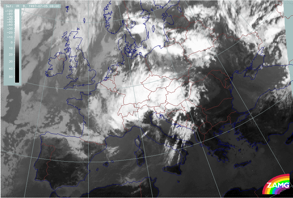
The 3-hourly sequence of IR images shows some separate phases. During the period 05 July/06.00 till 05 July/18.00 UTC an Occlusion - like spiral propagates more and more to the East (Romania) and from there to the North (White Russia and Poland). From the very beginning there is the impression of two circulation centres within this spiral, dividing the cloud band into an eastern part which is more connected to the former frontal cloud band and moves across Balkan Peninsula to Poland, and a western part, which has developed directly from the cold air features and moves from E. France and Switzerland across Austria.
From 05 July/18.00 UTC until the end of this period at 06 July/06.00 UTC, the Occlusion - like cloud band does not change dramatically but only widens and propagates. The most important changes and new developments take place to the south and east, namely intensive convective developments in the eastern part and the development of a cloudy area to the E of the western part of the Occlusion band, namely, over the northern Adriatic Sea moving from there on across the northern Balkan Peninsula. The latter development is very dramatic and represents a cut off process which is described in detail in the next chapter.
|
05 July 1997/06.00 UTC - Meteosat IR image; 05/06.00 - 06/06.00 UTC 3-hourly image loop
|
|
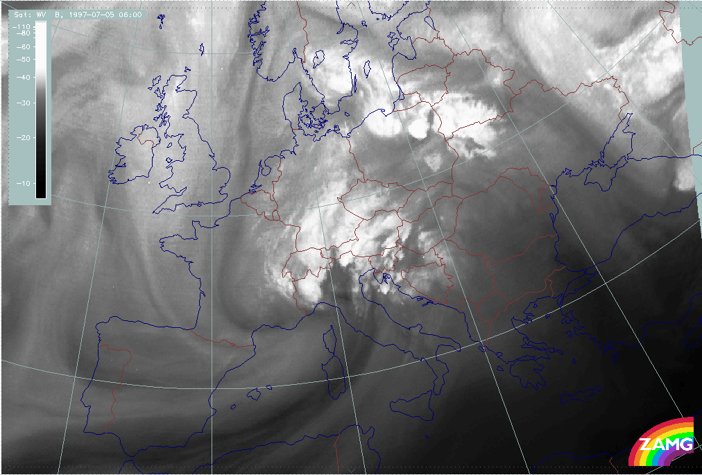
In this case a 3-hourly sequence of WV images gives some additional input as it shows the existence of two spiral centres much more clearly with the help of two Black Stripes indicating intruding dry air. There is, indeed, an eastern circulation centre which is associated with the frontal cloud band. From this point of view, the eastern cloud band might represent an occlusion development. But there is also a western circulation centre with dry air coming from the consecutive upper level trough. This can be seen very clearly till about 05 July/18.00 UTC. From then on, the features become more complicated in the area of the development of a cut off low.
During this phase an extended ULL with several sub-centres exists over middle Europe; furthermore, a very steady WV spiral is recognisable over N. Germany and Denmark.
|
05 July 1997/06.00 UTC - Meteosat WV image; 05/06.00 - 06/06.00 UTC 3-hourly image loop
|
|
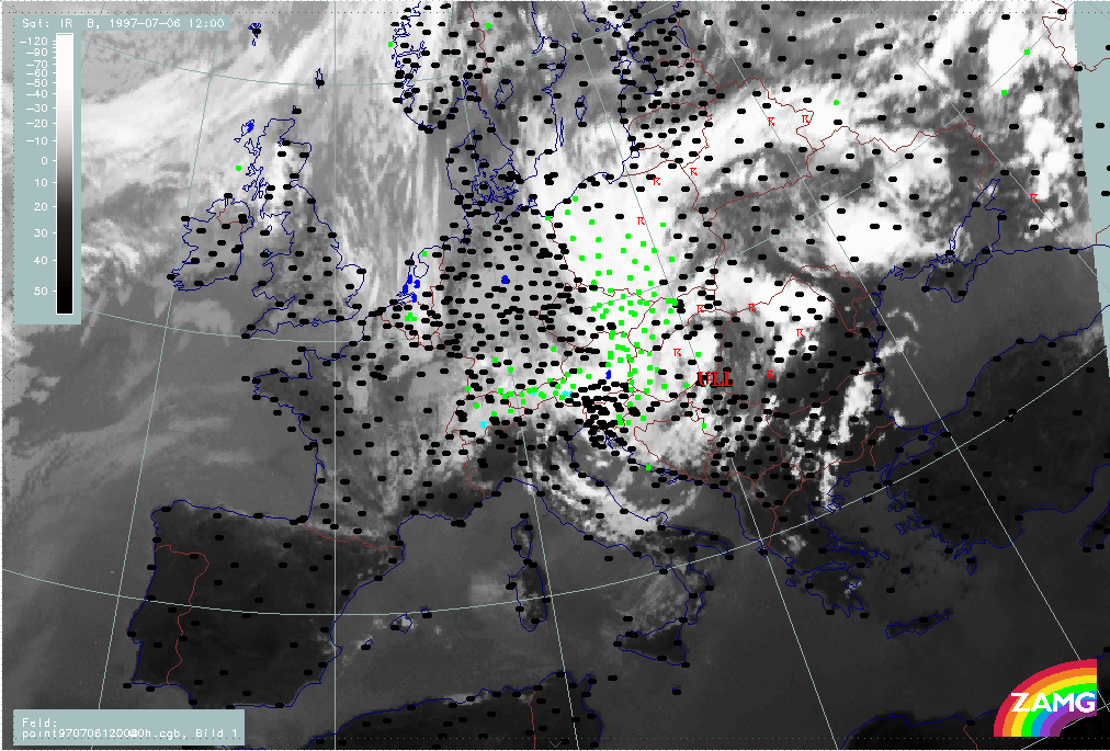
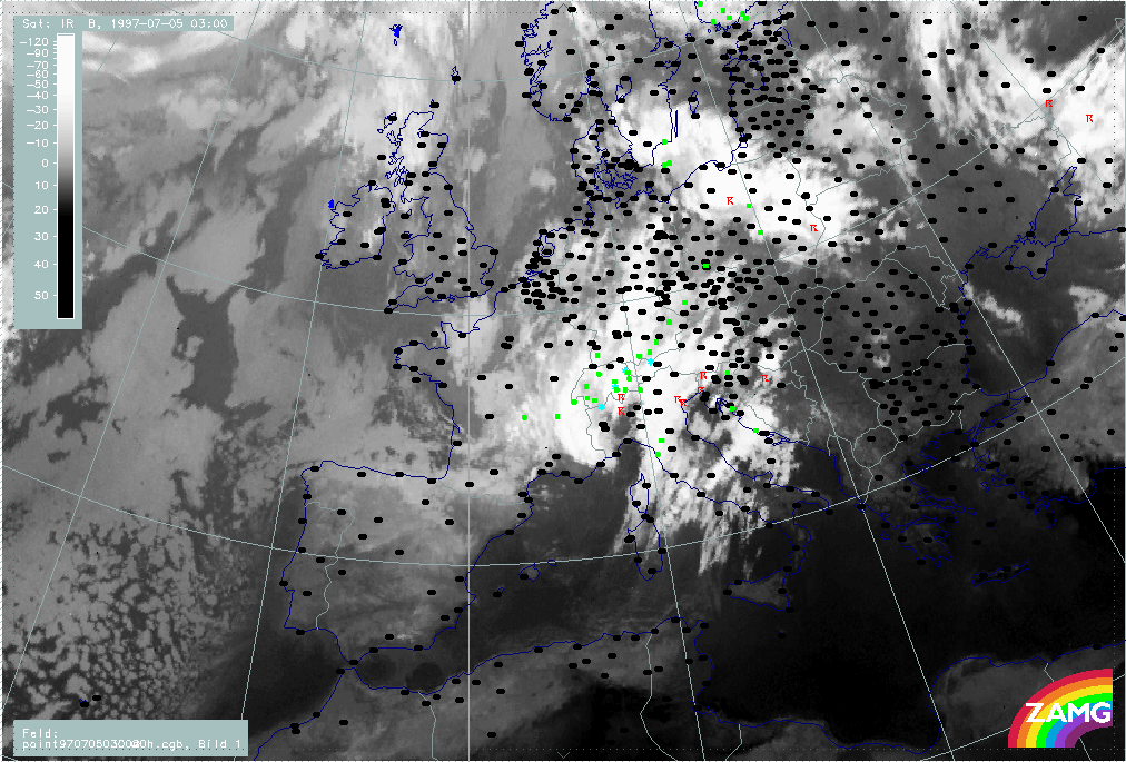
The third sequence shows the precipitation events superimposed on the IR images. There is a lot of precipitation associated with the occlusion (like) cloud band. The countries most influenced by rain are:
- Switzerland: during the whole period but with less extension from 06 July/00.00 UTC onwards
- Austria: during the whole period but with different regions involved
- Germany: on 05 July with the intensity maximum moving from north to the south
- Czech Republic: From 05 July/12.00 UTC to the end of the period
- Poland: from 05 July/12.00 UTC to the end of the period but moving from southern areas to the north
|
05 July 1997/06.00 UTC -Meteosat IR image; weather events (green: rain and showers, blue: drizzle, cyan: snow, red: thunderstorm with precipitation, purple: freezing rain, orange: hail,
black: no actual precipitation or thunderstorm with precipitation); 05/06.00 - 06/06.00 UTC 3-hourly image loop
|
|
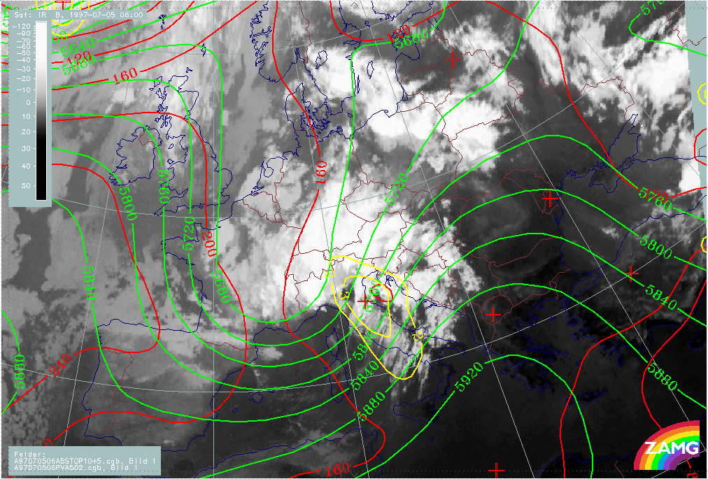
The example from 05 July/06.00 UTC represents the initial stage. The Occlusion - like spiral which extends from the W. Alps across Switzerland to Germany is within the upper level trough. However, the cloudiness over Austria, SSE Germany and the Czech Republic seems to be more closely associated with the frontal cloud band. This is supported by the WV images in the sequence. This eastern part of the Occlusion - like spiral can be found within the upper level SW stream.
A further distinction between the eastern and western part can be found in the thickness contours, which form a ridge area with remarkable WA in the eastern part.
|
05 July 1997/06.00 UTC - Meteosat IR image; red: height contours 1000 hPa, green: height contours 500 hPa; yellow: positive vorticity advection (PVA) 500 hPa
|
05 July 1997/06.00 UTC - Meteosat IR image; blue: Thermal Front Parameter (TFP) 500/850 hPa, green: equivalent thickness 500/1000 hPa, red solid: temperature advection - WA 1000 hPa,
red dashed: temperature advection - CA 1000 hPa
|
|
|
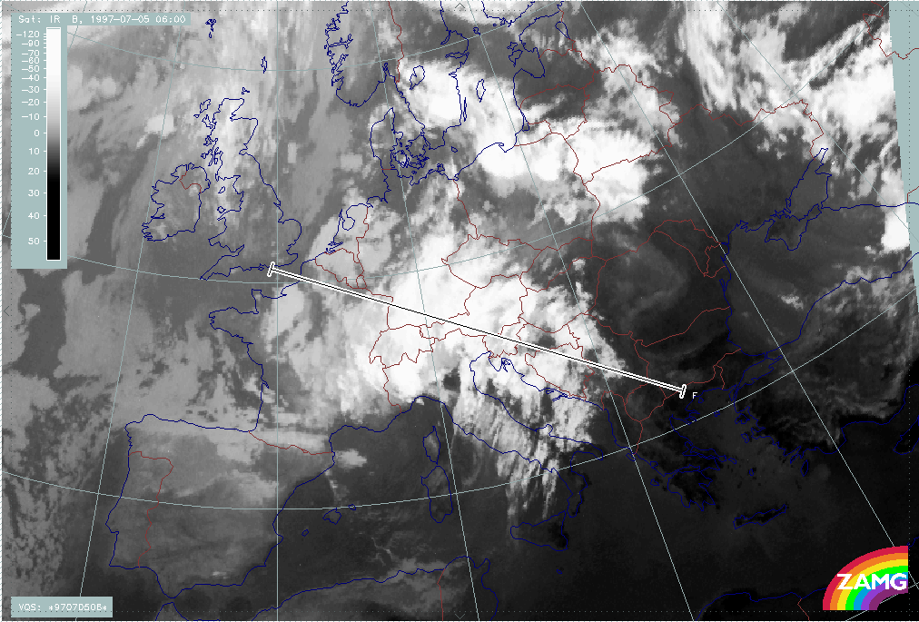
The diagnosis of the cloud band extending from the W. Alps to Germany and its relation with the frontal cloud band in the Mediterranean is not completely clear. It is called Occlusion - like because of the impression of a cyclonically curved cloud band, but the genesis within the cold air contradicts a classical Occlusion process. On the other hand the WV image reveals very clearly a double structure with some possible Occlusion development in the eastern part connected to the front. Vertical cross sections might give more insight into this problem. The vertical cross section line F extends from the NW (English Channel) across the Occlusion - like band and the frontal cloud band to the SE over N. Greece.
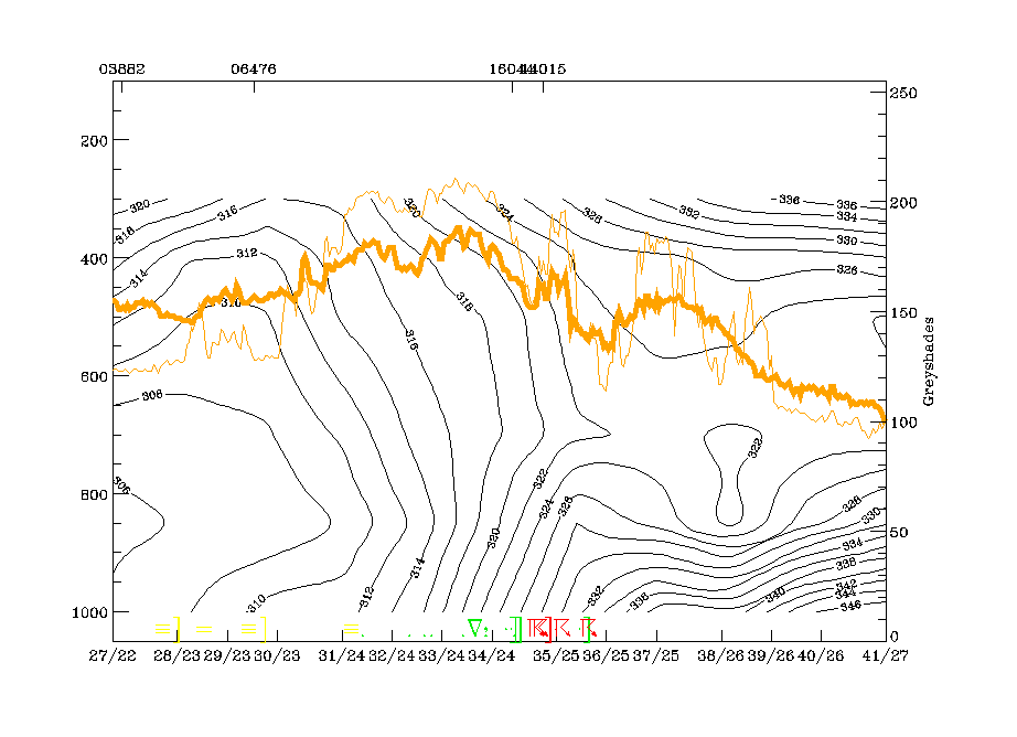
Indeed a double structure can be detected in the isentropes. There are two zones of high gradients in the isentropes: the western one is limited by the 310 and 316K isentropes and belongs to the Occlusion - like cold air band over Germany; it is accompanied by lots of rain. The more eastern one is limited by the 318 and 322K isentropes and belongs to the frontal cloudiness, especially to the area in the frontal cloudiness where an Occlusion process might start. It is accompanied by lots of thunderstorms. The unstable area in front of the frontal cloud band is very dramatic in this cross section. At this point of time no configuration typical for an Occlusion process can yet be detected in the isentropes. Both zones are much more characteristic of Cold Front zones.
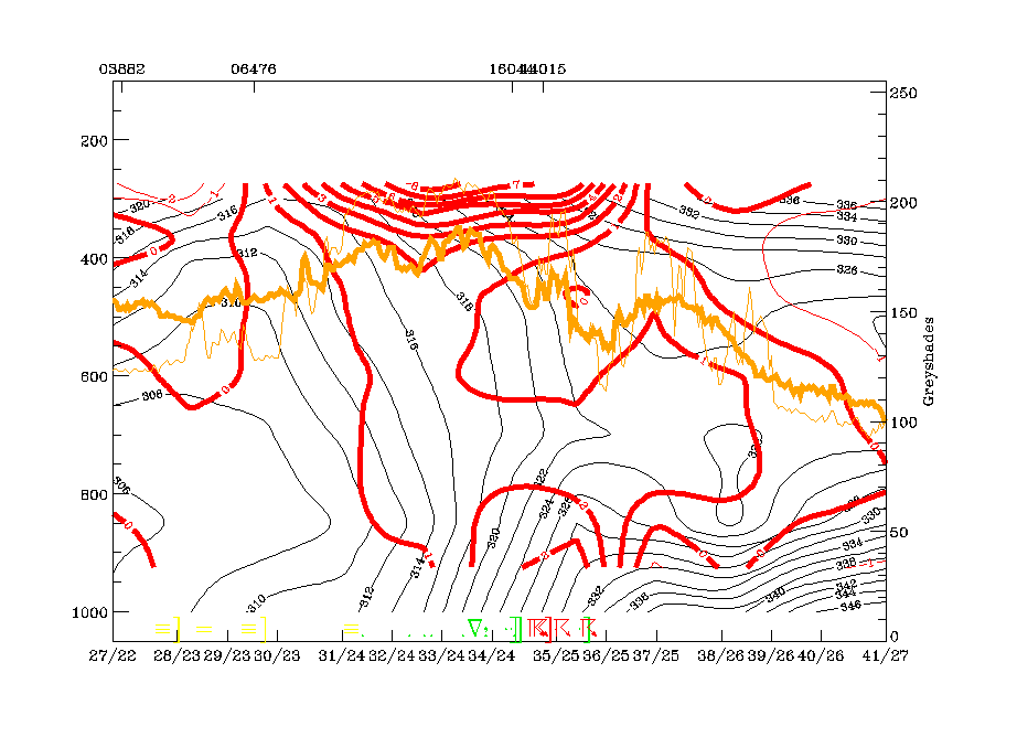
The TA distribution within this vertical cross section does not show very distinct features, but convergence strongly supports the double structure of the fronts: there are two zones of convergence maxima directly related to the two frontal zones. For the Cold Front zone, convergence reaches up to 450 hPa, for the cold air cloud band up to 500 hPa with maximum values around 850 hPa.
Another very distinct sign for the double structure can be found in the fields of vertical motion (omega) which show two separate and very strong maxima for the two frontal systems.
|
05 July 1997/06.00 UTC - Meteosat IR image; position of vertical cross section indicated
|
|
|
|
|
05 July 1997/06.00 UTC - Vertical cross section; black: isentropes (ThetaE), orange thin: IR pixel values, orange thick: WV pixel values
|
05 July 1997/06.00 UTC - Vertical cross section; black: isentropes (ThetaE), red thin: temperature advection - CA, red thick: temperature advection - WA, orange thin: IR pixel values,
orange thick: WV pixel values
|
|
|
|
|
|
05 July 1997/06.00 UTC - Vertical cross section; black: isentropes (ThetaE), magenta thin: divergence, magenta thick: convergence, orange thin: IR pixel values, orange thick: WV pixel
values
|
05 July 1997/06.00 UTC - Vertical cross section; black: isentropes (ThetaE), cyan thick: vertical motion (omega) - upward motion, cyan thin: vertical motion (omega) - downward motion,
orange thin: IR pixel values, orange thick: WV pixel values
|
Two isentropic surfaces are selected for investigating relative streams: 316K which is on top of the western frontal zone of high gradients (related to the Occlusion - like cold air cloud band) and 320K, which is within the frontal zone of high gradients typical for the frontal cloud band.
On the lower surface a strong rising conveyor belt accompanies the bright cloudiness of the newly developed cold air cloud band. This conveyor belt shows some explanation for the development of this band.
On the higher isentropic surface a relative stream from behind is superimposed on the frontal cloud band which shows only moderate ascent in the area of the frontal cloudiness.
|
05 July 1997/06.00 UTC - Meteosat IR image; magenta: relative streams 316K - system velocity 248° 11 m/s, yellow: isobars
|
05 July 1997/06.00 UTC - Meteosat IR image; magenta: relative streams 320K - system velocity 248° 11 m/s, yellow: isobars
|
|
|
Between 05 July/06.00 and 05 July/12.00 UTC, a dramatic change has taken place in the cloud features. The Occlusion - like cloud band is now fully developed and already shows the two spiral centres which divide the whole band into an eastern and a western part.
This separation, based on cloud structures, is also supported by numerical parameters: The eastern part (Romania - Hungary - Slovakia - Czech Republic - E. Austria) is within a small ridge in the upper level SW stream, while the western part (Germany - Switzerland - W. Alps) is in the centre of the upper level trough being at the tie-off stage. There is remarkable PVA at 500 hPa inthe eastern part.
Another set of parameters indicative of frontal conditions show a thickness ridge as well as a new branch in the TFP connected to the eastern part of the Occlusion - like spiral. The western part belongs to the thickness trough. WA is existing but is rather weak.
|
05 July 1997/12.00 UTC - Meteosat IR image; red: height contours 1000 hPa, green: height contours 500 hPa; yellow: positive vorticity advection (PVA) 500 hPa
|
05 July 1997/12.00 UTC - Meteosat IR image; blue: Thermal Front Parameter (TFP) 500/850 hPa, green: equivalent thickness 500/1000 hPa, red solid: temperature advection - WA 1000 hPa,
red dashed: temperature advection - CA 1000 hPa
|
|
|
There are two vertical cross sections representing the western and the eastern part of the Occlusion - like spiral.
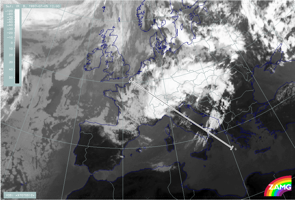
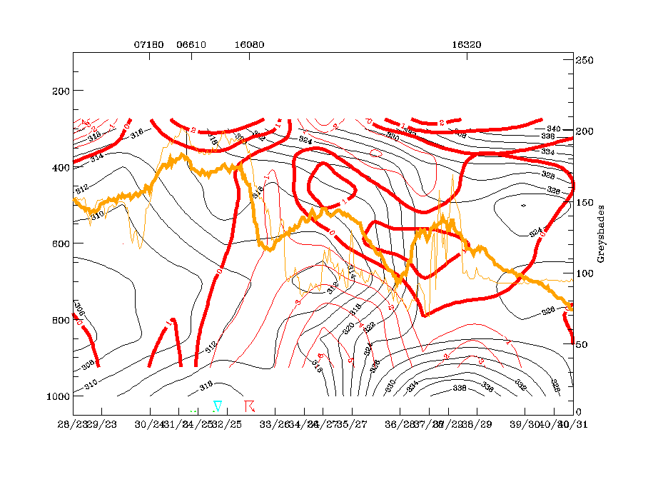
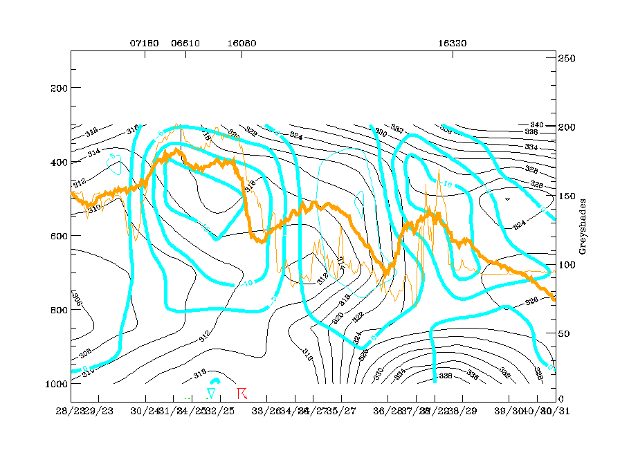
Vertical cross section line G is representative for the western cloud part. It crosses the cloudiness over Switzerland, and also crosses the southern parts of the rest of the Cold Front cloudiness and Warm Conveyor Belt cloudiness (see chapter Frontal cloud band). In this vertical cross section the westernmost broad peak of IR values (between radiosonde stations 07180 - 16080) represent the cloud band under consideration. The isentropes in this area differ from the situation 6 hours before, as there is no longer a frontal surface reaching the ground. There is an extremely unstable layer from the surface up to about 650 hPa. Above this, an upper level frontal zone can be detected but the isentropic trough configuration between 06610 and 16080 around 500 hPa might indicate the beginning of an Occlusion situation in this high levels: Consequently there are three different regimes on top of each other: a very unstable layer up to 700 hPa, an upper level Cold Front from 400 hPa down to about 700 hPa and an isentropic trough (pool of warm air) between 500 and 400 hPa above.
|
05 July 1997/12.00 UTC - Meteosat IR image; position of vertical cross section indicated
|
05 July 1997/12.00 UTC - Vertical cross section; black: isentropes (ThetaE), orange thin: IR pixel values, orange thick: WV pixel values
|

|
|
The eastern vertical cross section is oriented from S to N and crosses the eastern part of the Occlusion - like cloud spiral.
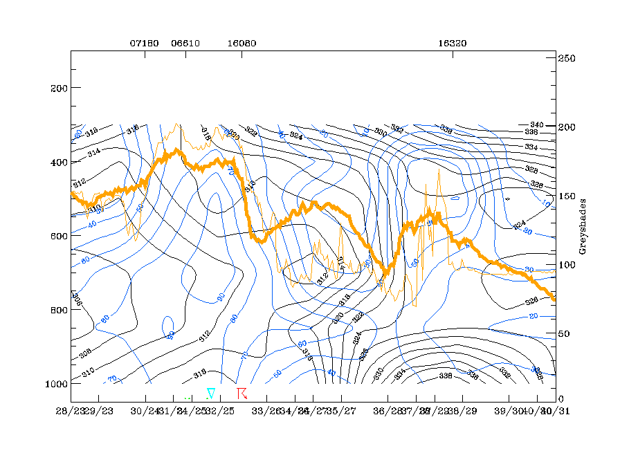
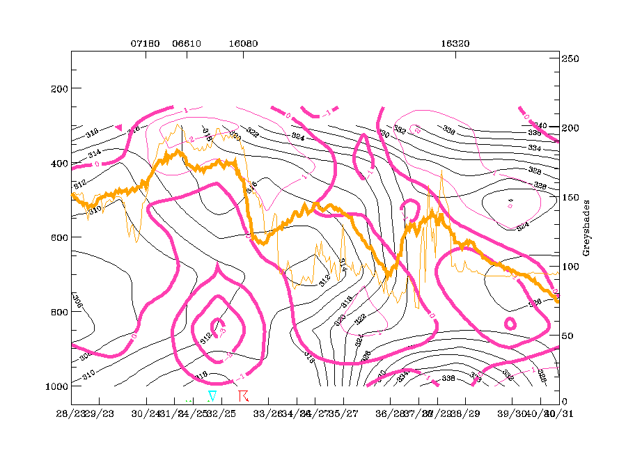
The isentropes reveal very unstable layers up to about 600 hPa and a trough feature typical for an Occlusion higher than 600 hPa and centred around the radiosonde station 11035 (Vienna). This matches exactly with the intensive cloud peak there. The zero line of TA is very close to the axis of this Occlusion trough, with WA to the north within the cloud band as well as very strong upward motion.
So the main difference to the western vertical cross section is the lack of a Cold Front surface. For the eastern part, conditions of an Occlusion cloud band are fulfilled much better.
|
05 July 1997/12.00 UTC - Meteosat IR image; position of vertical cross section indicated
|
05 July 1997/12.00 UTC - Vertical cross section; black: isentropes (ThetaE), orange thin: IR pixel values, orange thick: WV pixel values
|
|
|
|
|
|
05 July 1997/12.00 UTC - Vertical cross section; black: isentropes (ThetaE), red thin: temperature advection - CA, red thick: temperature advection - WA, orange thin: IR pixel values,
orange thick: WV pixel values
|
05 July 1997/12.00 UTC - Vertical cross section; black: isentropes (ThetaE), cyan thick: vertical motion (omega) - upward motion, cyan thin: vertical motion (omega) - downward motion,
orange thin: IR pixel values, orange thick: WV pixel values
|
06 July 00.00 UTC is a point of time representating the end phase of this Occlusion - like spiral immediately before the cut off of the main ULL, which is discussed in detail in the next chapter (Main ULL cut-off).
At this point of time an extended ULL is already existing with three sub-centres:
- Over Denmark where there is no remarkable cloudiness but a distinct spiral structure in the WV imagery (compare WV sequence)
- Over Poland which is associated with the surface minimum and the eastern part of the Occlusion cloud spiral
- Over N. Italy where an extensive cut off process is under way.
The frontal parameters thickness, TA and TFP do not show remarkable changes up to this time and still show different physical states for the eastern and the western part of the Occlusion spiral.
|
05 July 1997/12.00 UTC - Meteosat IR image; red: height contours 1000 hPa, green: height contours 500 hPa; yellow: positive vorticity advection (PVA) 500 hPa
|
05 July 1997/12.00 UTC - Meteosat IR image; blue: Thermal Front Parameter (TFP) 500/850 hPa, green: equivalent thickness 500/1000 hPa, red solid: temperature advection - WA 1000 hPa,
red dashed: temperature advection - CA 1000 hPa
|
|
|
Concluding the discussion about the occlusion character of the cloud spiral, the following points can be summarised:
- Although there is one main continuous cloud band, a double sub-structure can be observed in the cloudiness as well as numerical parameters
- The western part does not at all show an Occlusion process but develops from a cold air feature
- Later on, a rather well developed Cold Front character is revealed in this area; but still later advection of warm air from NE gives again some slight impression of an Occlusion at the mature stage
- The eastern part develops from the frontal cloud band and, as such, fulfils the conditions of an Occlusion process
- This is supported by numerical parameters such as thickness
- In the vertical cross section the typical parameter configurations for an Occlusion do exist
- For both systems a thick, very unstable layer can be observed.
Main ULL cut-off
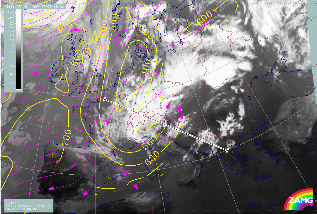
A cut off process has already taken place during the last phases leading to an extended ULL with several sub-centres. One of these secondary lows lies over Austria and N. Italy and during the phase under discussion in this chapter, an intensive cut off process takes place there, leading to a large and pronounced cut-off low over Central Europe which remains for a long time.
The cut-off phase can be observed quite clearly in the satellite images.
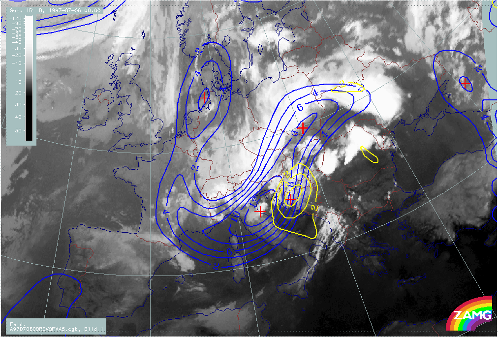
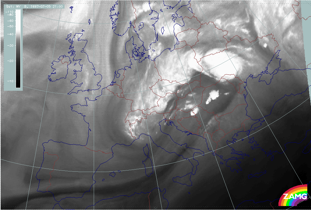
The 3 hourly sequence of images in the first phase between 05 July/18.00 UTC and 06 July/03.00 UTC shows the rapid development of a cloud area C over the Adriatic Sea propagating eastward to Croatia and Hungary. At the same time the western part of the Occlusion - like spiral moves eastward from Switzerland to E. Austria and W. Slovenia.
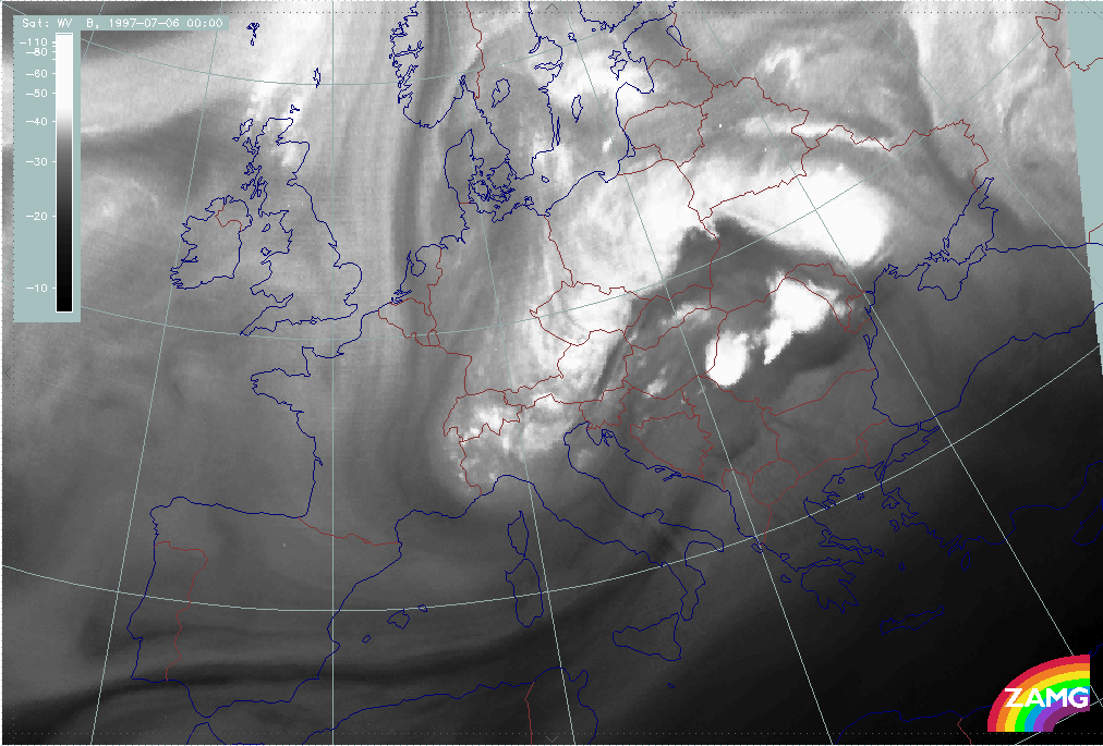
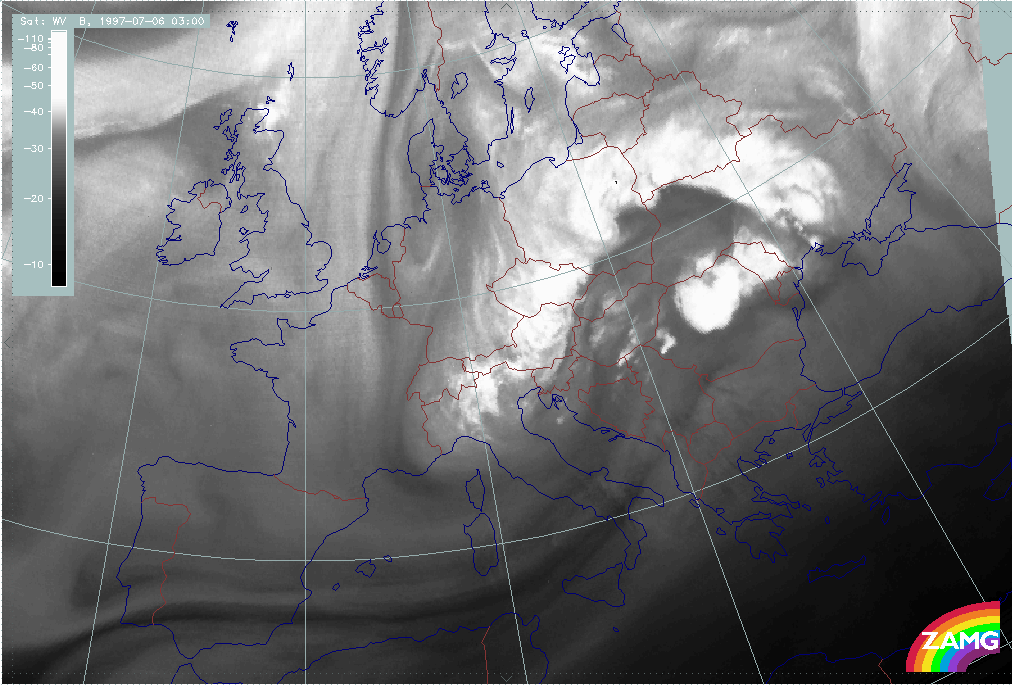
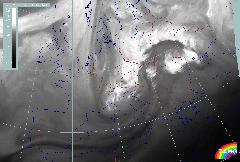
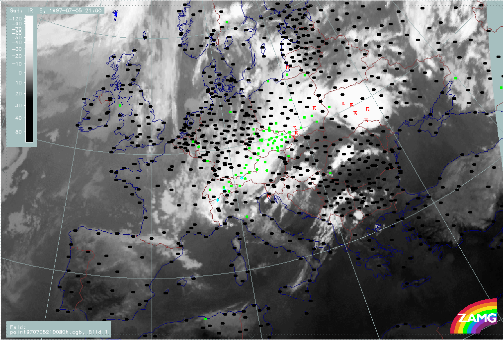
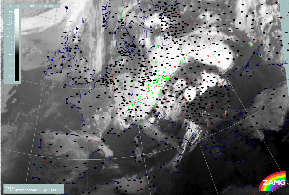
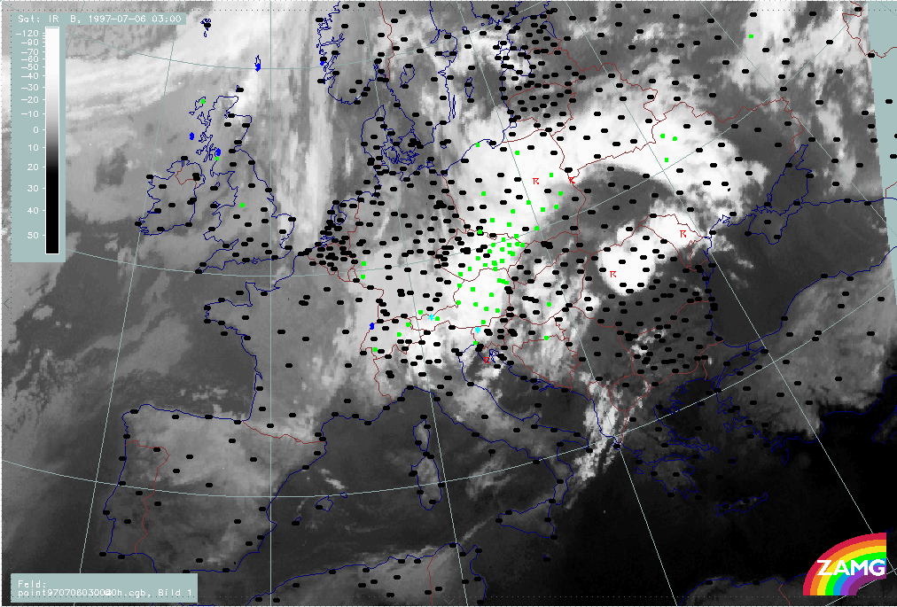
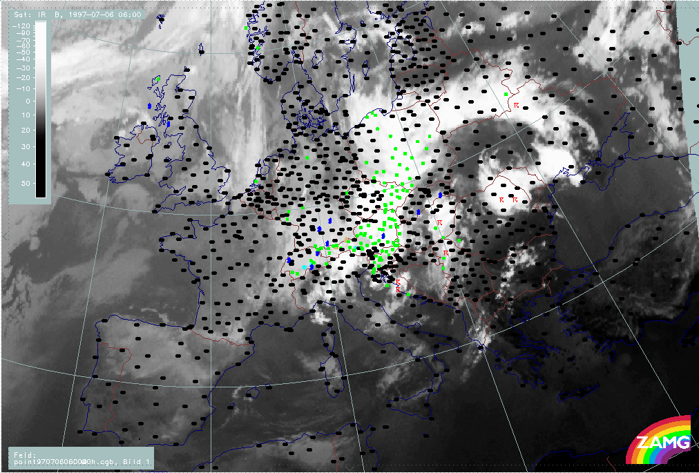
At 06 July/06.00 UTC, the cloud system C and the western Occlusion - like spiral form two cloud bands which are cyclonically curved against each other enclosing small cellular cloudiness over SW Hungary. This is very typical for an ULL in a cut-off stage. It becomes even more intensive at 06 July/09.00 UTC.
The next phase between 06 July/12.00 and 18.00 UTC shows an explosive development of the eastern boundary of the cut-off low into a huge convective line accompanied by many thunderstorms. The western boundary of the cut off low over Austria and Hungary is accompanied by wide spread rain events.
|
05 July 1997/18.00 UTC - Meteosat IR image; 05/18.00 - 06/09.00 UTC 3-hourly image loop
|
06 July 1997/12.00 UTC - Meteosat IR image; weather events (green: rain and showers, blue: drizzle, cyan: snow, red: thunderstorm with precipitation, purple: freezing rain, orange:
hail, black: no actual precipitation or thunderstorm with precipitation)
|
The first sign of cloud development over the Adriatic Sea appears at 05 July/16.00 UTC. Therefore, the time of 18.00 UTC is very close to this first cloud development event.
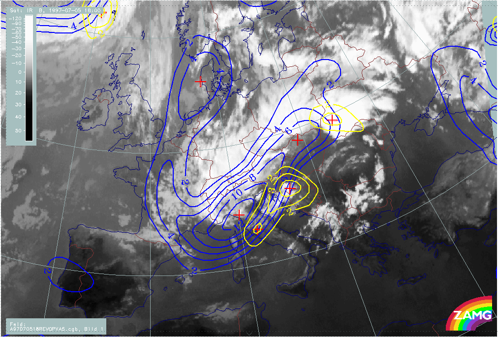
The cloudiness C over the Adriatic Sea and Croatia develops in the SW upper level stream in front of a secondary upper level low over W. Austria and N. Italy. There is no obvious low in the surface pressure field. The cyclonic curvature in the cloud field over N. Italy indicates the intensive trough there.
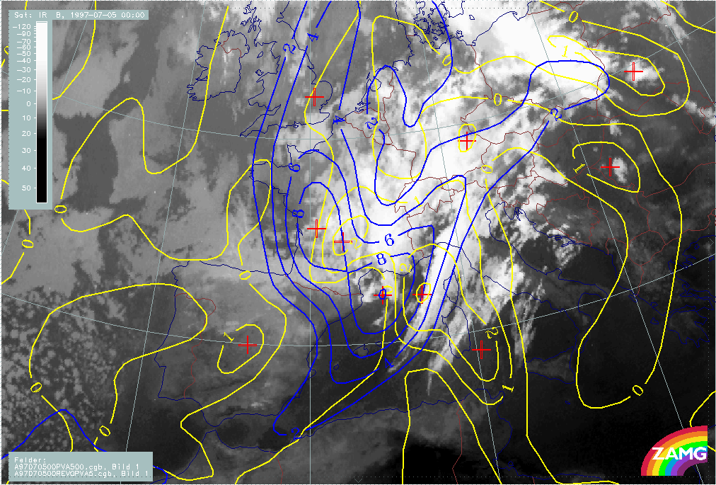
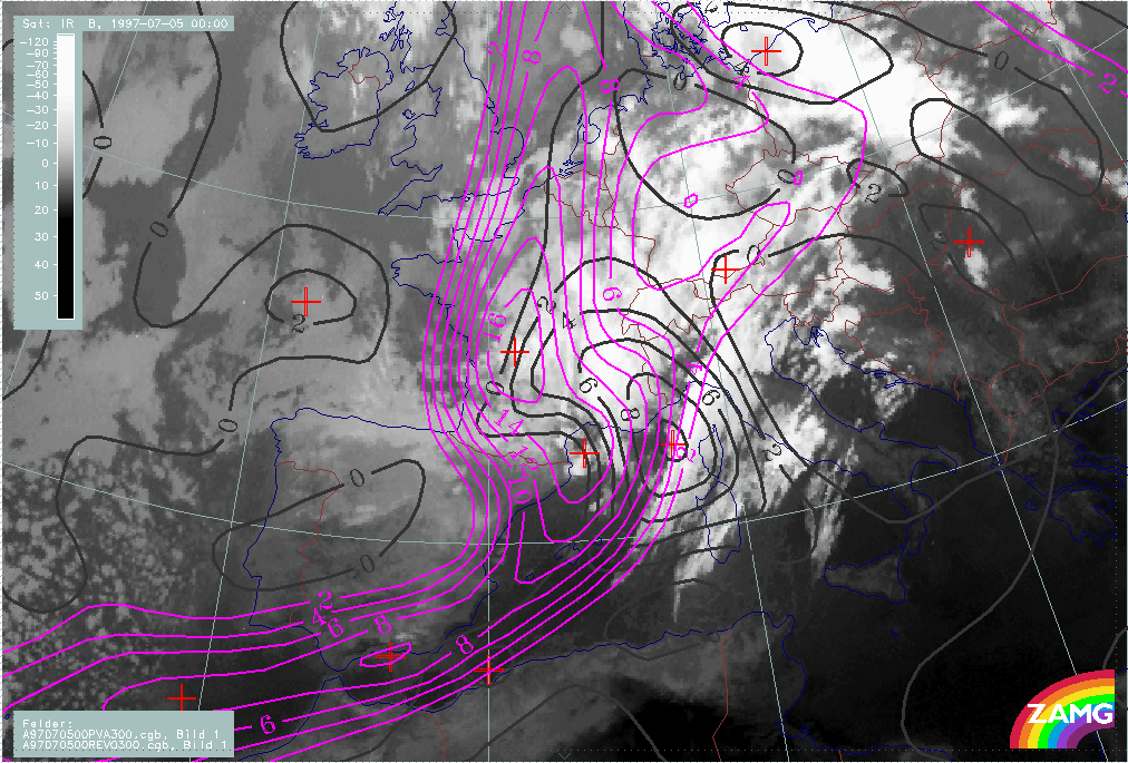
The effect of the upper levels becomes even clearer when looking at PVA at 500 hPa. There is an excellent correlation between PVA maxima and the new cloud field at both levels 500 and 300 hPa. The PVA maxima are immediately in front of vorticity maxima and represent the deepening as well as the propagation of the Upper Level Low to the rear.
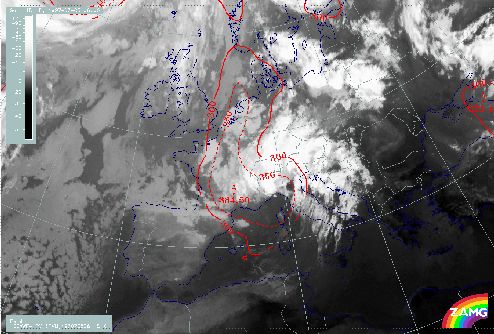
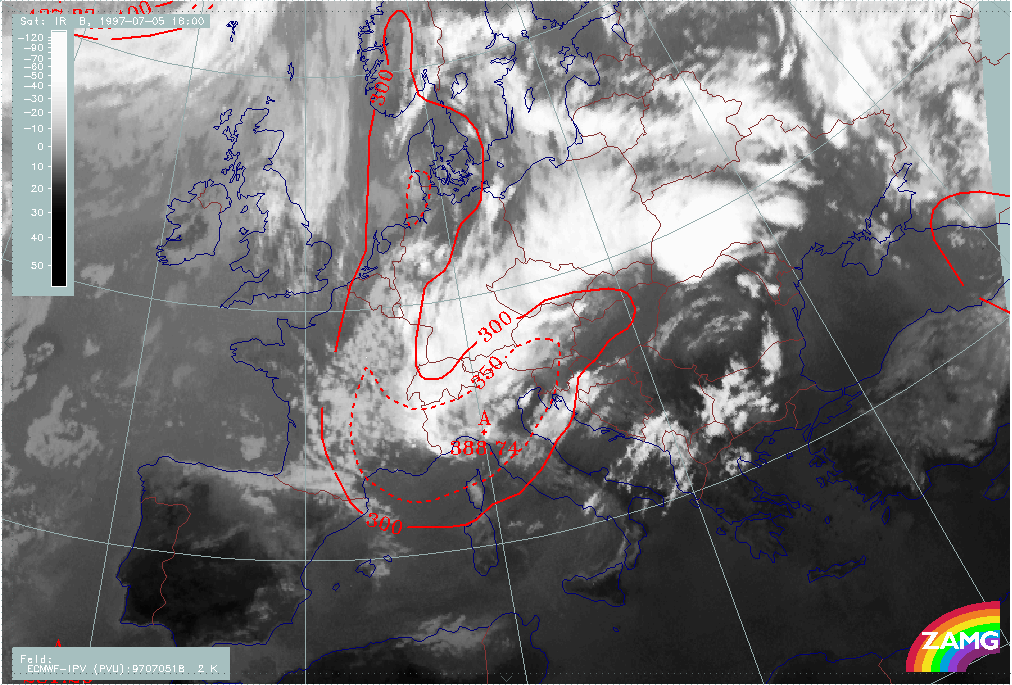
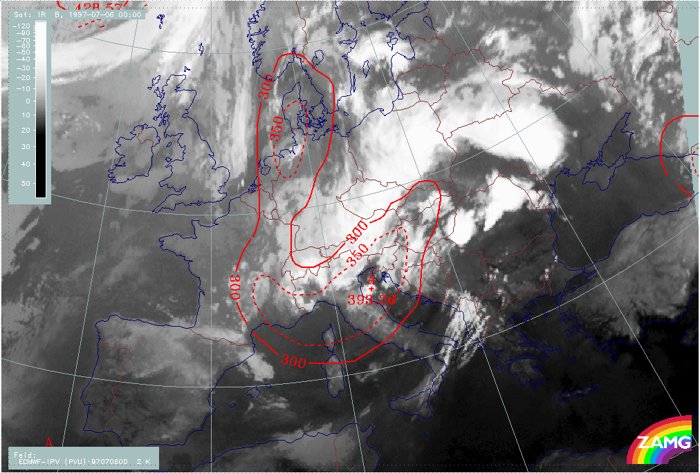
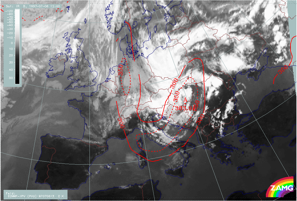
The height of Potential Vorticity (PV) of 2 units shows a lowest values of 388 hPa in the area of the ULL over N. Italy.
|
05 July 1997/18.00 UTC - Meteosat IR image; red: height contours 1000 hPa, green: height contours 500 hPa
|
05 July 1997/18.00 UTC - Meteosat IR image; blue: vorticity 500 hPa, yellow: positive vorticity advection (PVA) 500 hPa
|
|
|
|
|
|
05 July 1997/18.00 UTC - Meteosat IR image; magenta: vorticity 300 hPa, black: positive vorticity advection (PVA) 300 hPa
|
05 July 1997/18.00 UTC - Meteosat IR image; red: height of PV=2 units
|
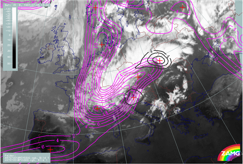
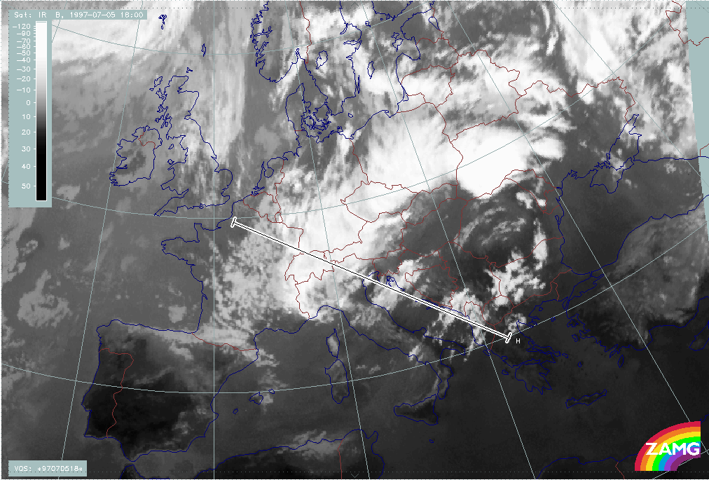
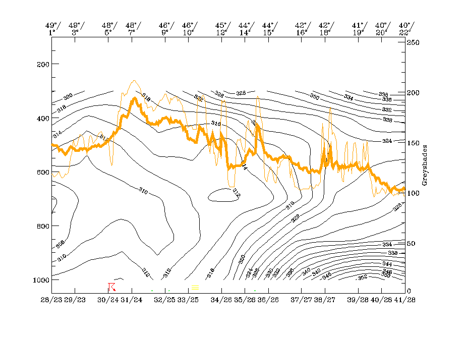
Vertical cross section line H is chosen from NW (France) across the ULL over N. Italy and the new cloud field C to the SW over Greece. Isentropes show several features:
The main IR and WV peak at about 48N/07E represents the western Occlusion - like cloud band and is (as discussed in the chapter before) connected to an unstable layer and an upper level cold
front zone. The area between about 46N/10E and 45N/12E consists of several peaks. The relative minimum of 312K at 45N/12E and 650 hPa indicates the ULL. The single peak at 44N/14E represents
the new cloud area C. It appears within an upper level Baroclinic Boundary with a high gradient of isentropes inclined downward from 400 hPa to 700 hPa.
The isentropic surface of 314K is representative for the zone of high gradient in connection with the ULL and is also the lowest surface of the Baroclinic Boundary in the area of C. Relative streams at this surface indicate the cyclonic curvature in the cut off area and some gentle ascent. The new cloud feature C appears in this ascending branch and is also generally parallel to the cloud fibres.
|
05 July 1997/18.00 UTC - Meteosat IR image; position of vertical cross section indicated
|
05 July 1997/18.00 UTC - Vertical cross section; black: isentropes (ThetaE), orange thin: IR pixel values, orange thick: WV pixel values
|
|
|
|
|
|
05 July 1997/18.00 UTC - Meteosat IR image; magenta: relative streams 314K - system velocity 261° 8 m/s, yellow: isobars
|
|
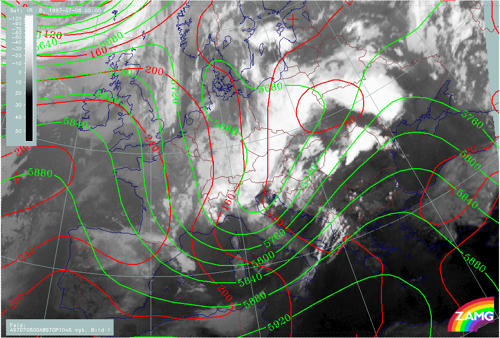
The development is rather quick; 6 hours later there is already a much larger area, marked C, which is fully developed. It mainly covers Slovenia - Croatia - Hungary. The western ULL boundary has moved from the W. Alps to E. Italy.
The height fields show an even more distinct secondary over N. Italy in excellent agreement with the cloud features there. There are no pronounced low pressure features in the surface field.
As before, the increased cloudiness is accompanied by PVA maxima in both the 500 and 300 hPa levels, indicating the further deepening and propagating ULL. In the centre of the cut-off low stratospheric air (PV=2 units) has reached about 400 hPa.
|
06 July 1997/00.00 UTC - Meteosat IR image; red: height contours 1000 hPa, green: height contours 500 hPa
|
06 July 1997/00.00 UTC - Meteosat IR image; blue: vorticity 500 hPa, yellow: positive vorticity advection (PVA) 500 hPa
|
|
|
|
|
|
06 July 1997/00.00 UTC - Meteosat IR image; magenta: vorticity 300 hPa, black: positive vorticity advection (PVA) 300 hPa
|
06 July 1997/00.00 UTC - Meteosat IR image; red: height of PV=2 units
|
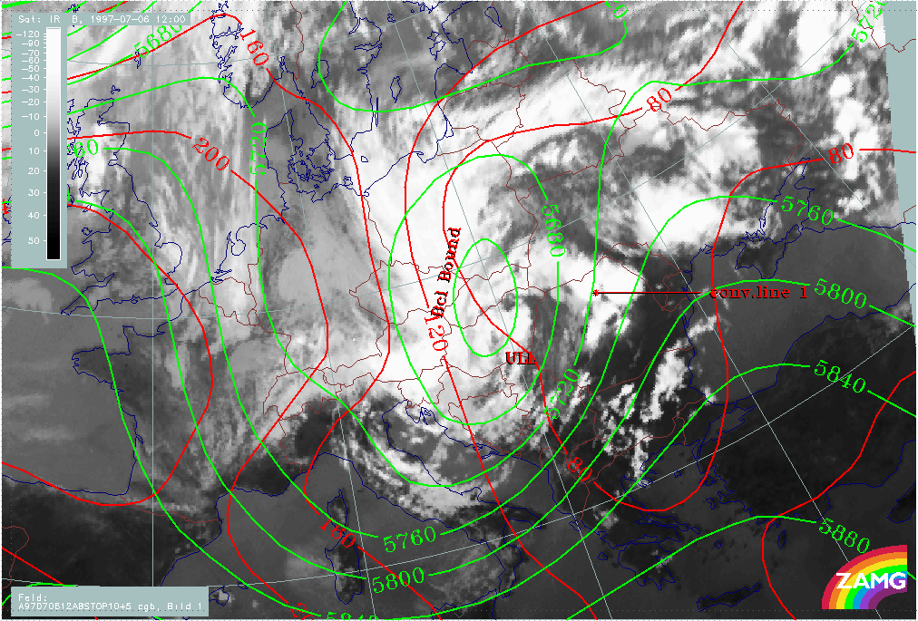
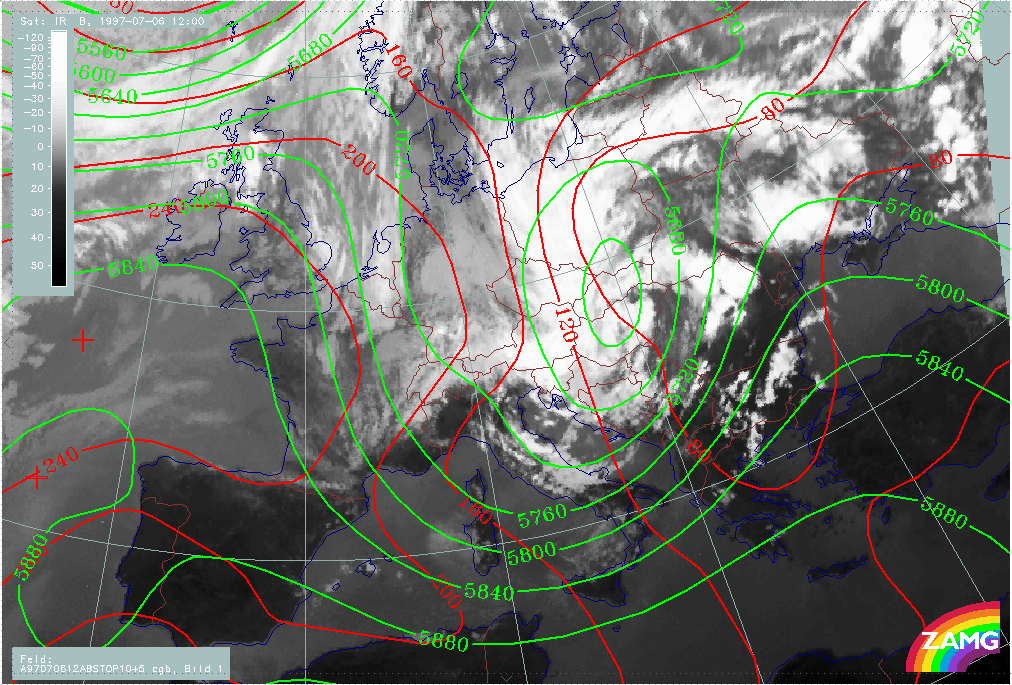
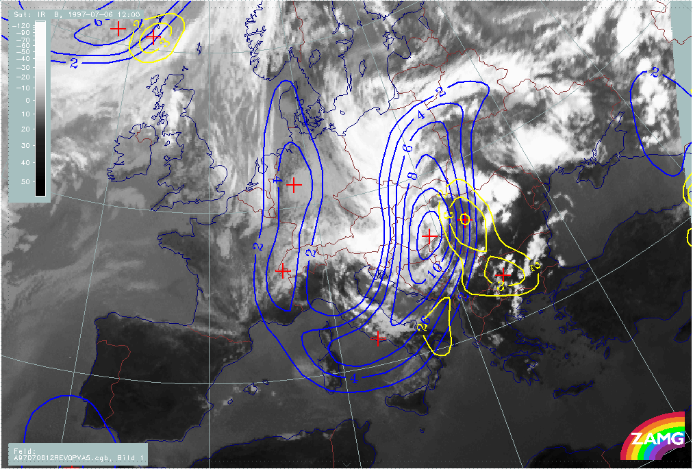
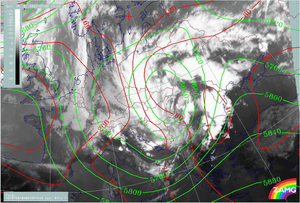
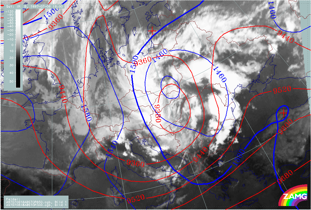
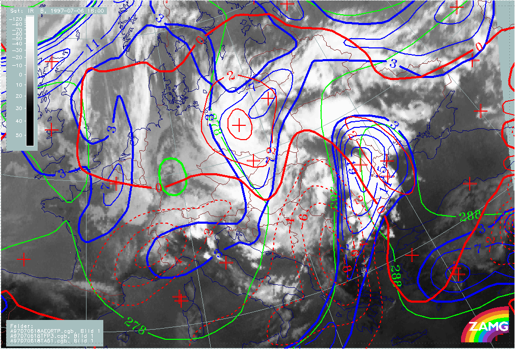
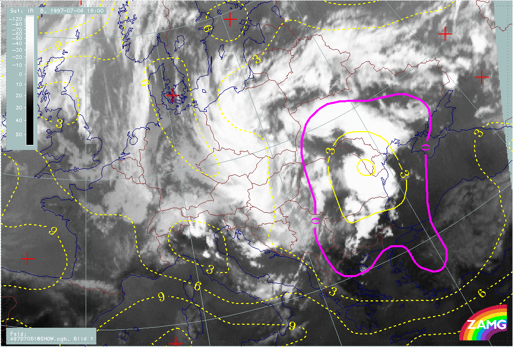
12 hours later at 06 July 12.00 UTC, a huge ULL has developed with its centre over Hungary and Slovakia. There are still two cloud bands cyclonically curved towards each other. The eastern one now consists of new developing convective cells.
The relationship between cloud configuration, vorticity and PVA maximum as well as lowest height of stratospheric air (PV=2 units) is (as before) very good and represents the cut off process in an ideal way.
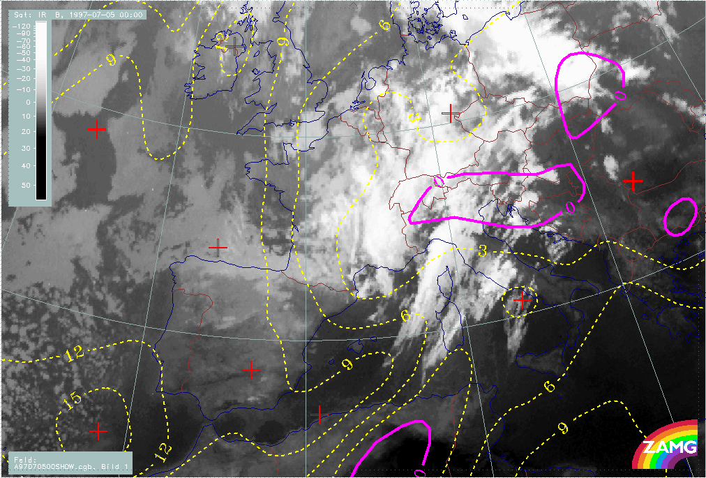
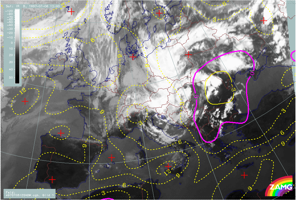
Convection is very intensive in the eastern boundary of the ULL. This is an area with very high instability. The Showalter Index has values below -3°C in this area, which indicate probabilities of very heavy thunderstorms.
|
06 July 1997/12.00 UTC - Meteosat IR image; red: height contours 1000 hPa, green: height contours 500 hPa
|
06 July 1997/12.00 UTC - Meteosat IR image; blue: vorticity 500 hPa, yellow: positive vorticity advection (PVA) 500 hPa
|
|
|
|
|
|
06 July 1997/12.00 UTC - Meteosat IR image; red: height of PV=2 units
|
06 July 1997/12.00 UTC - Meteosat IR image; yellow: Showalter index, magenta: Showalter index
|
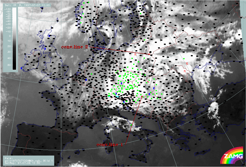
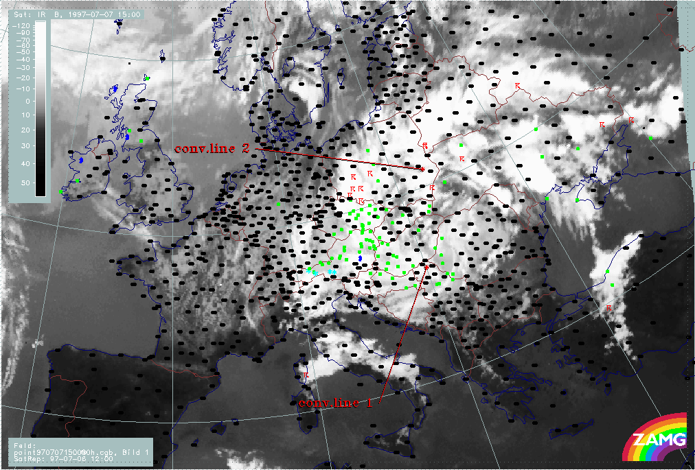
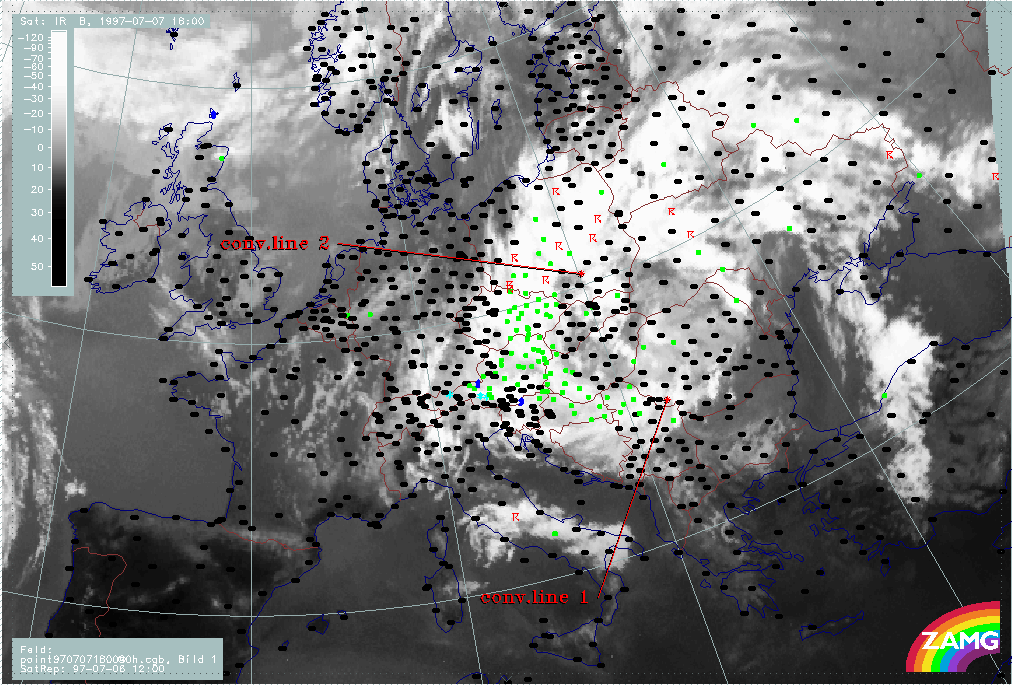
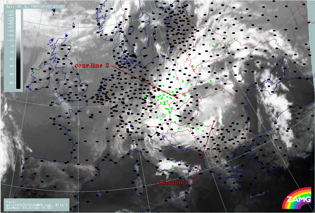
Baroclinic ULL boundary and rotations of convective lines
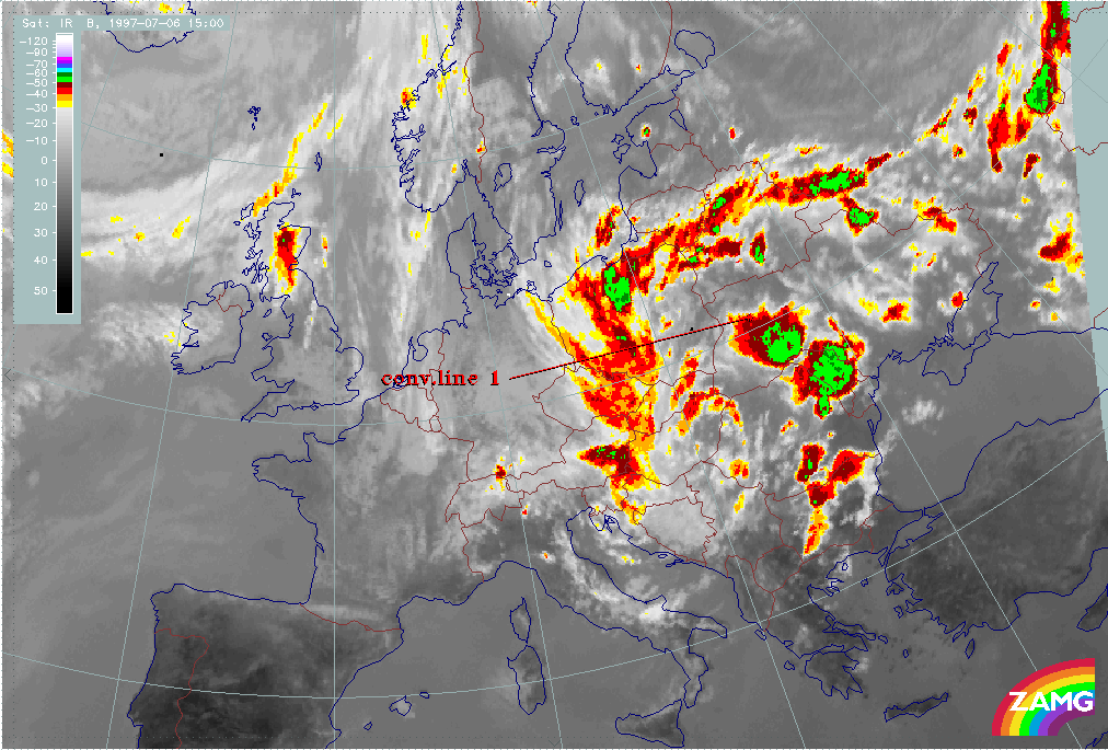
The ULL which formed in the previous phase and was discussed in detail in the previous chapter is a very long lasting phenomenon. While the system as a whole is rather stationary, cloud lines of a predominantly convective nature develop at the eastern boundary and are incorporated into the cyclonic rotation. As such they feed the ULL with warm, humid air form the E - NE. This leads to a catastrophic situation concerning precipitation amounts. Almost the same countries which had already received much rainfall during the previous phases are now under the influence of a stationary Baroclinic Boundary fed by unstable humid air.
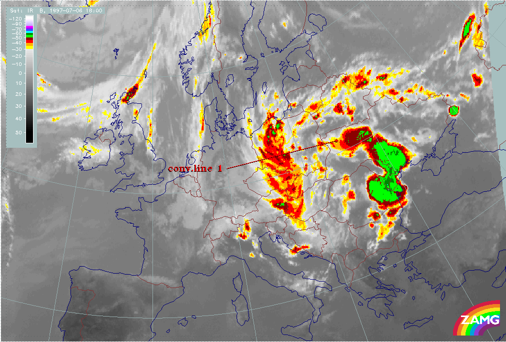
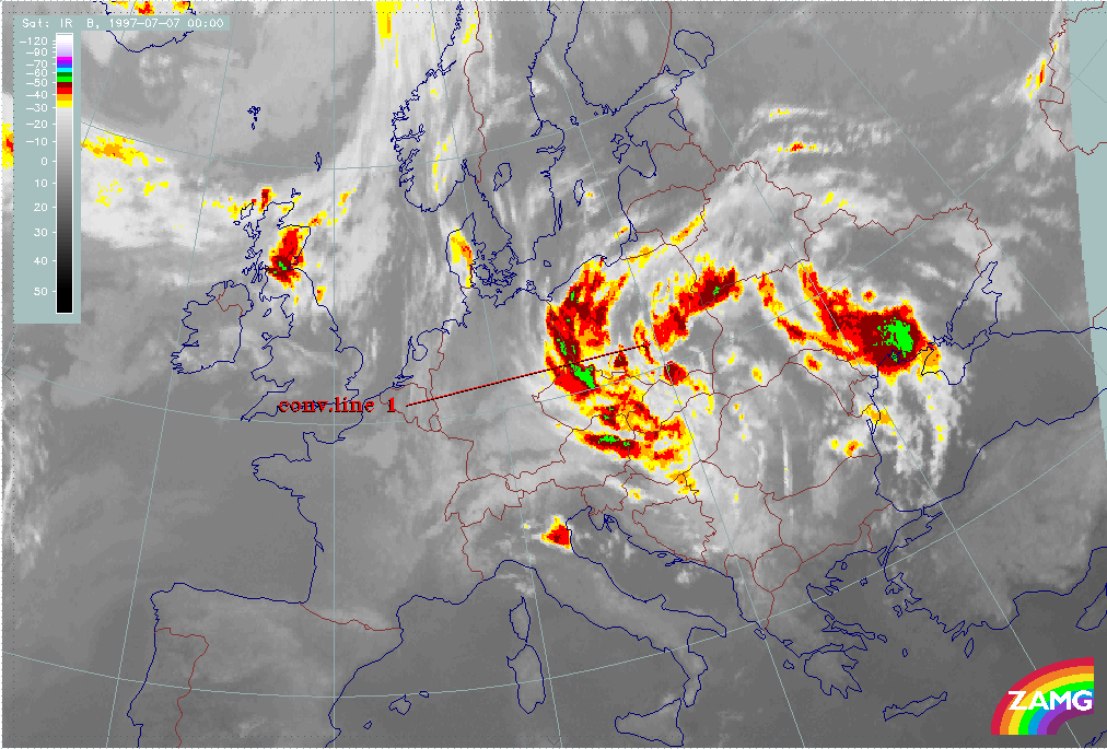
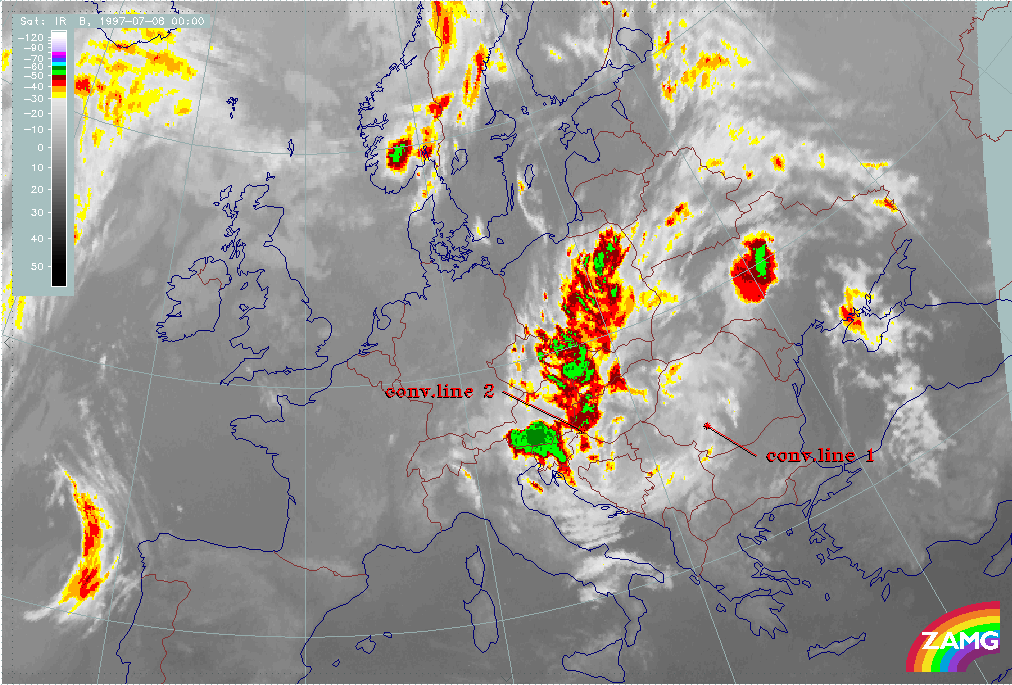
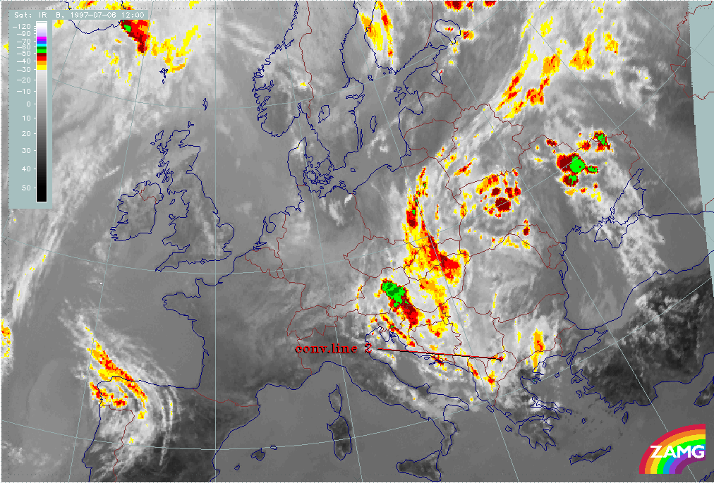
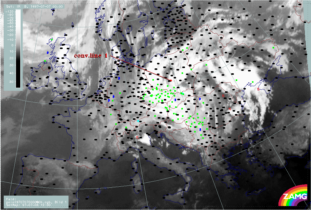
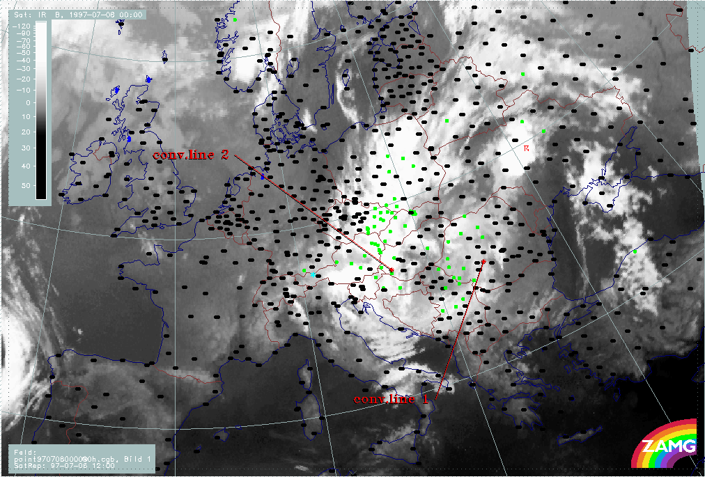
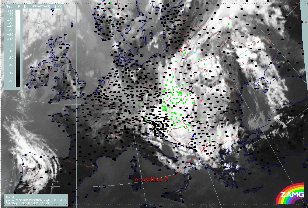
The 3-hourly image sequence starts with the last image of the previous period. In the sequence the leading edge of the convective line ("conv.line 1") is indicated.
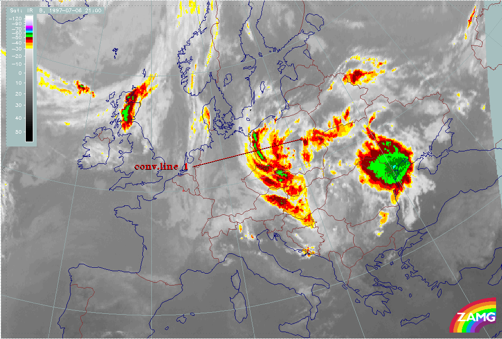
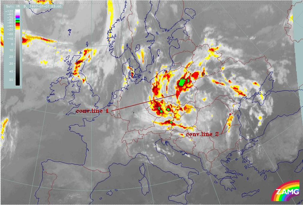
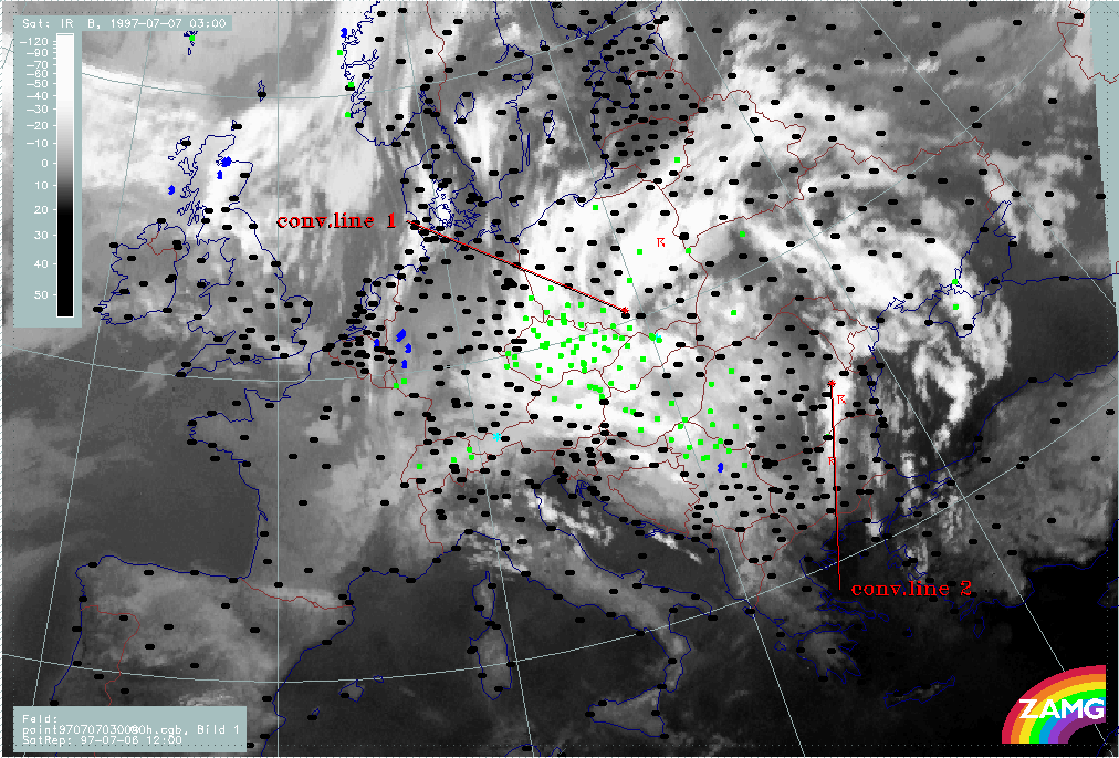
During the next 6 hours, till 06 July/18.00 UTC, the line increases and widens; it consists of heavily developing MCSs and its leading edge moves from the S. to the N. Ukraine. During the next period, till 07 July/03.00 UTC, convective line 1 splits into one huge convective part over the Black Sea and a smaller convective system which moves from the N. Ukraine into Poland, having been drawn into the cyclonic circulation and beginning to merge with the western ULL boundary.
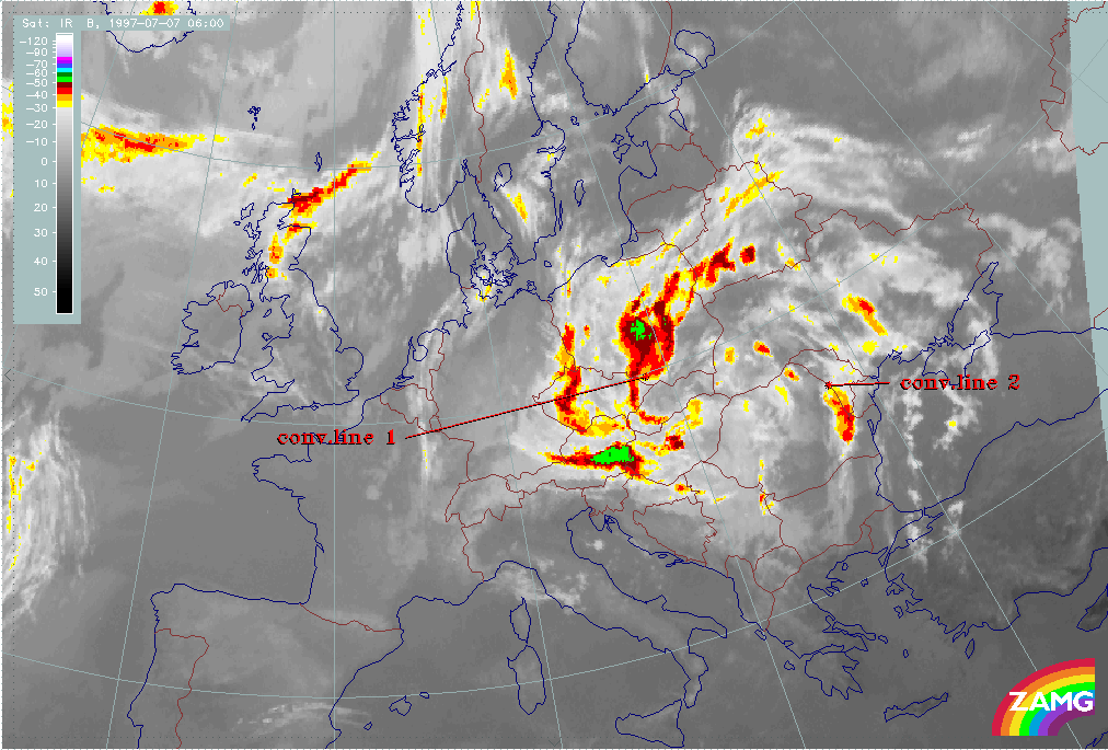
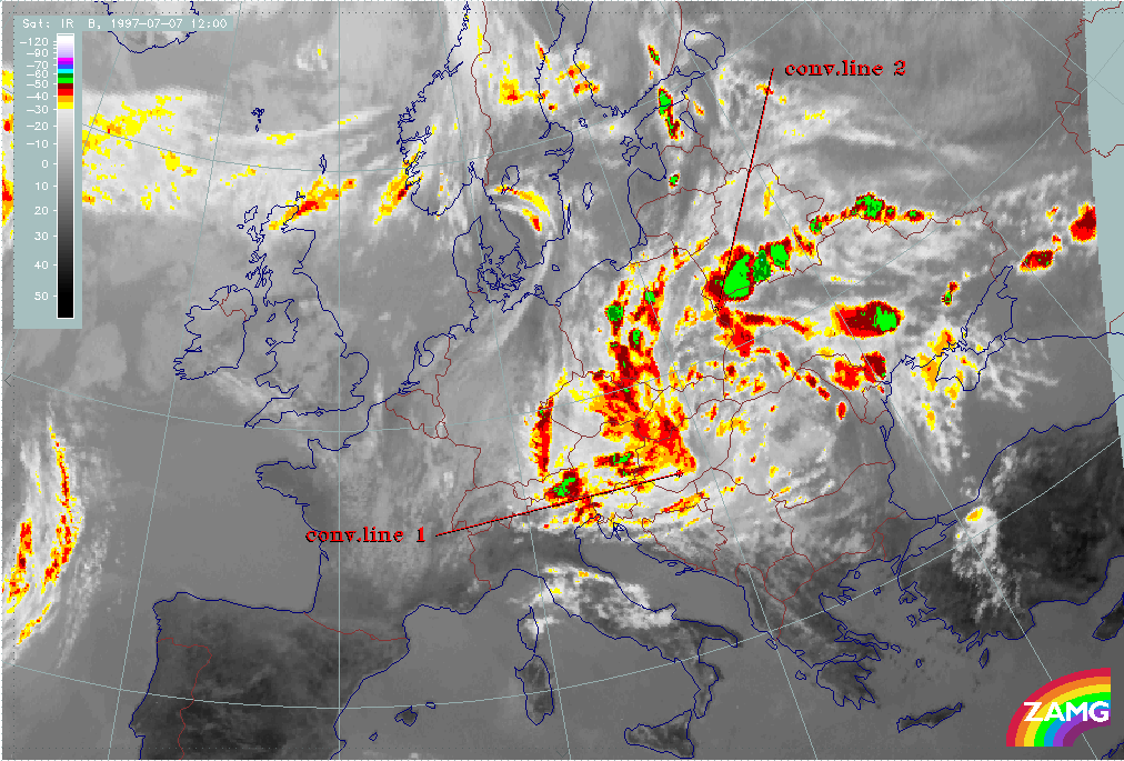
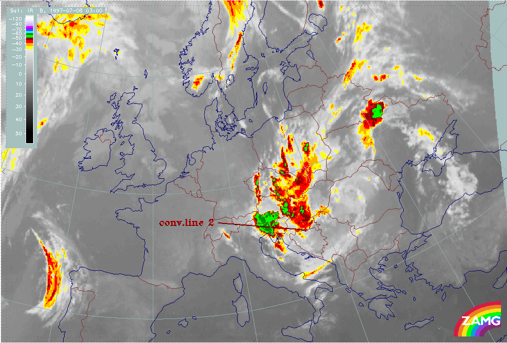
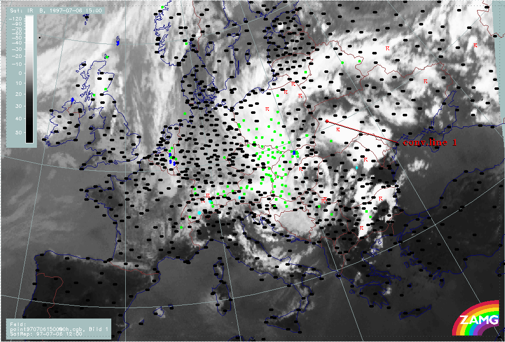
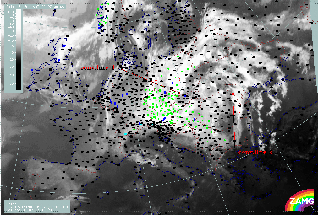
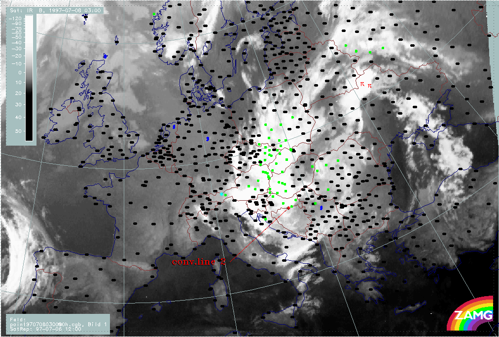
At 07 July/03.00 UTC, a new convective line is identified by its leading edge with "conv. line 2". During the next 6 hours till 07 July/09.00 UTC, "conv. line 1" moves across Poland into Slovakia. At the same time, the new "conv. line 2" has reached the Ukraine. Although this line contains the coldest cloud tops there is a wide area to the NE which is full of new convective cells and lines.
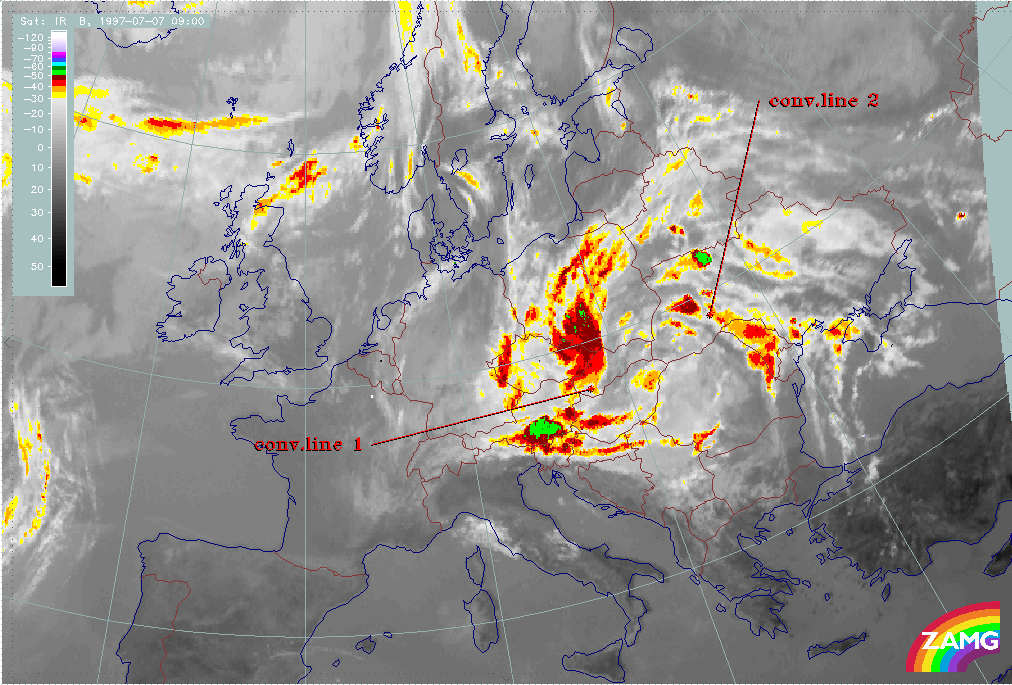
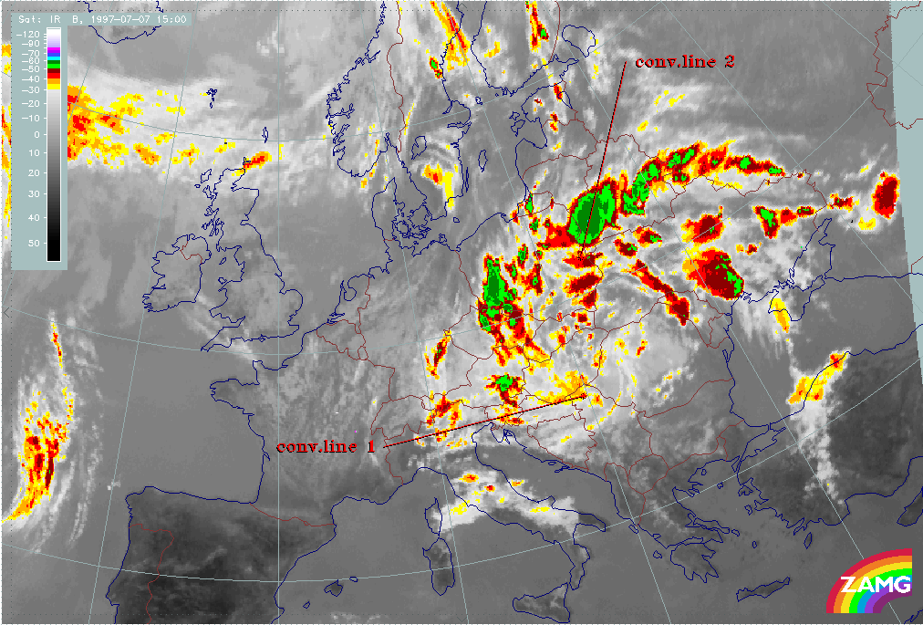
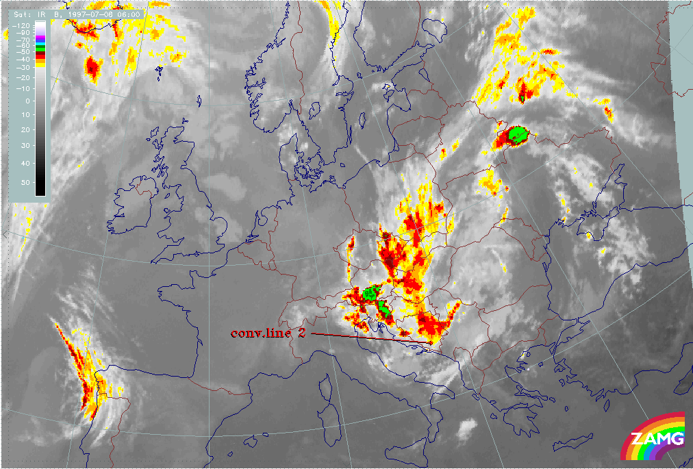
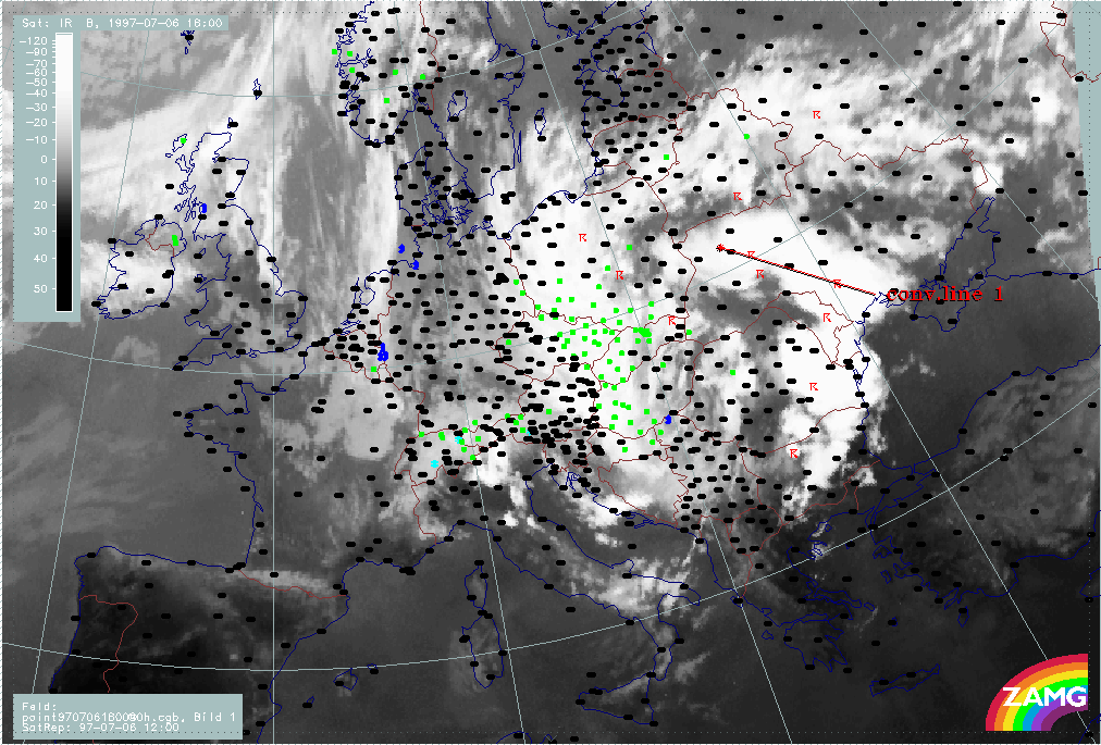
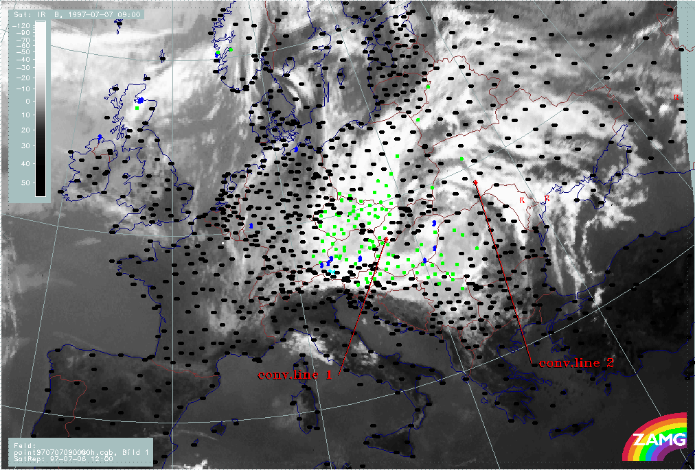
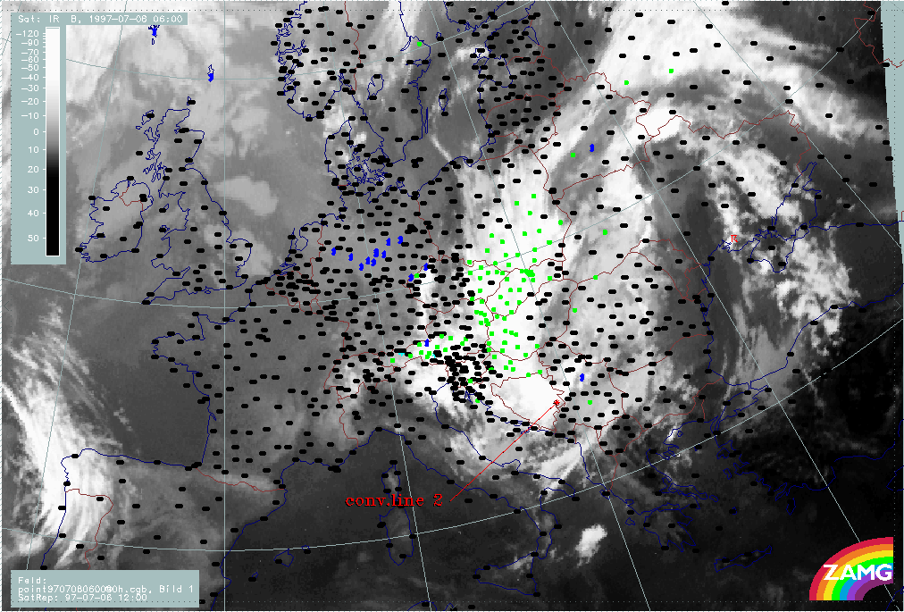
3 hours later at 07 July/12.00 UTC, the leading edge of "conv. line 1" has almost crossed Hungary and NE Austria. It is broad with cold tops and easy to follow. "Conv. line 2" has reached the E boundary of Poland, although it now merges with other cells. Especially a rapidly increasing cell over S. White Russia is involved into the process.
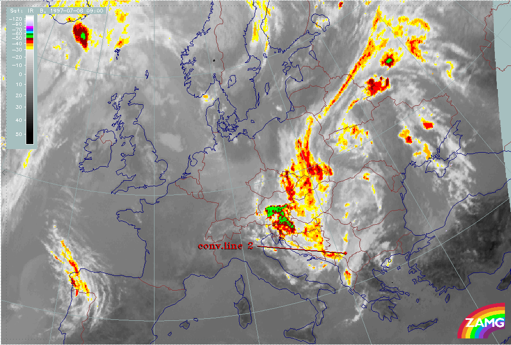
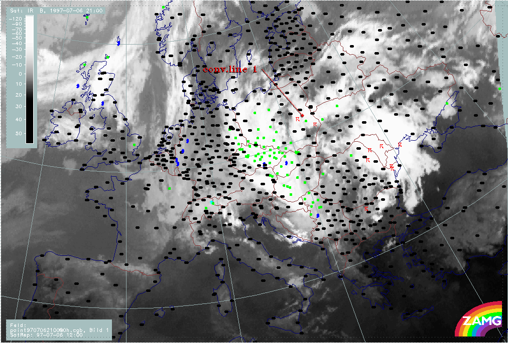
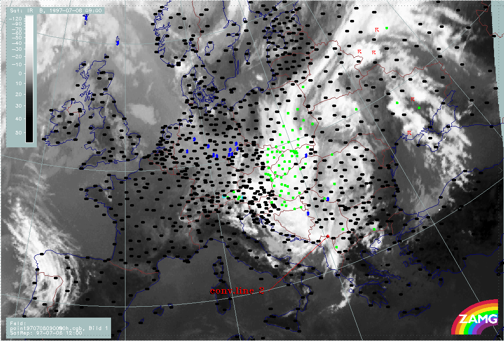
During the next 6 hours the height of "conv. line 1" decreases but its leading edge still can be followed from Hungary across N. Yugoslavia. The leading edge of "conv. line 2" is not so easy to identify as it merges with a very intensive line over White Russia. But even if this uncertainty is taken into account, its leading edge can still be identified over central Poland.
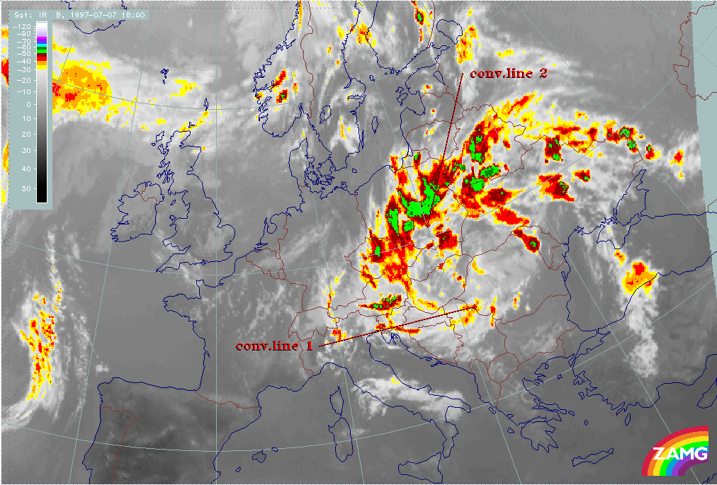
During the next phase, till 08 July/06.00 UTC, "conv. line 1" decreases in its cloud top height and finally is no longer labelled. "Conv. line 2" is very intensive and clearly discernible while it moves southward towards Bosnia.
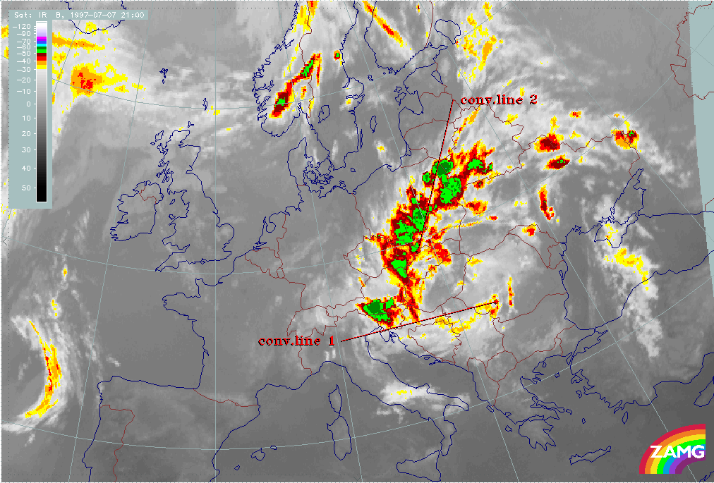
Only during the next 6 hours, until 08 July/12.00 UTC, does "conv. line 2" decrease in height.
Both convective lines have rotated at least once around the ULL centre and have almost reached their original starting point.
|
06 July 1997/12.00 UTC - Meteosat IR enhanced image; 06/12.00 - 08/12.00 UTC 3-hourly image loop
|
|
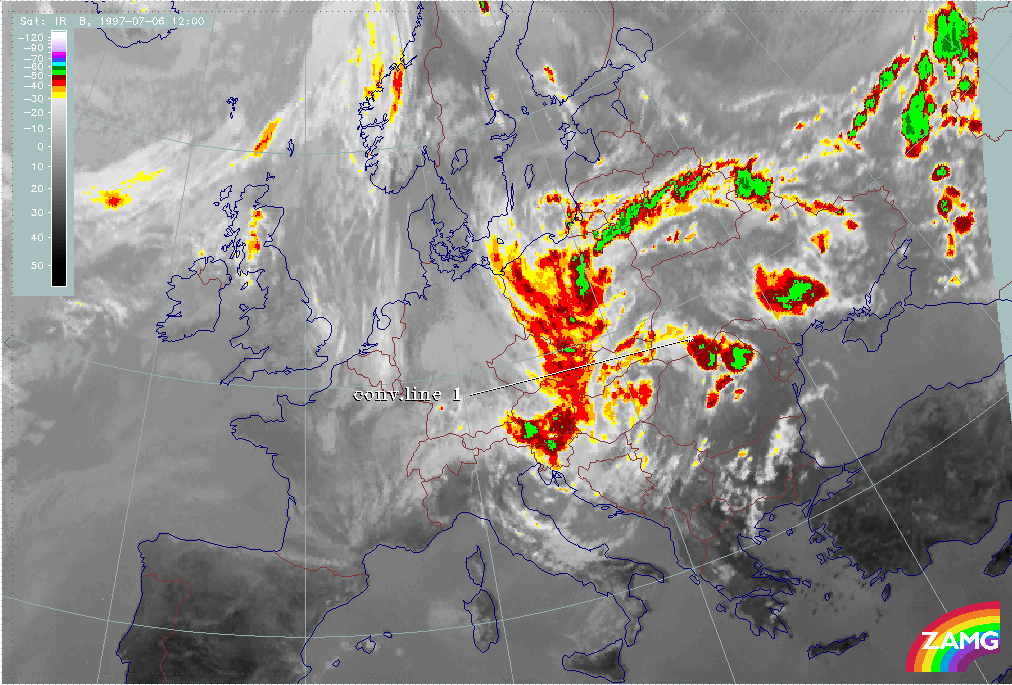
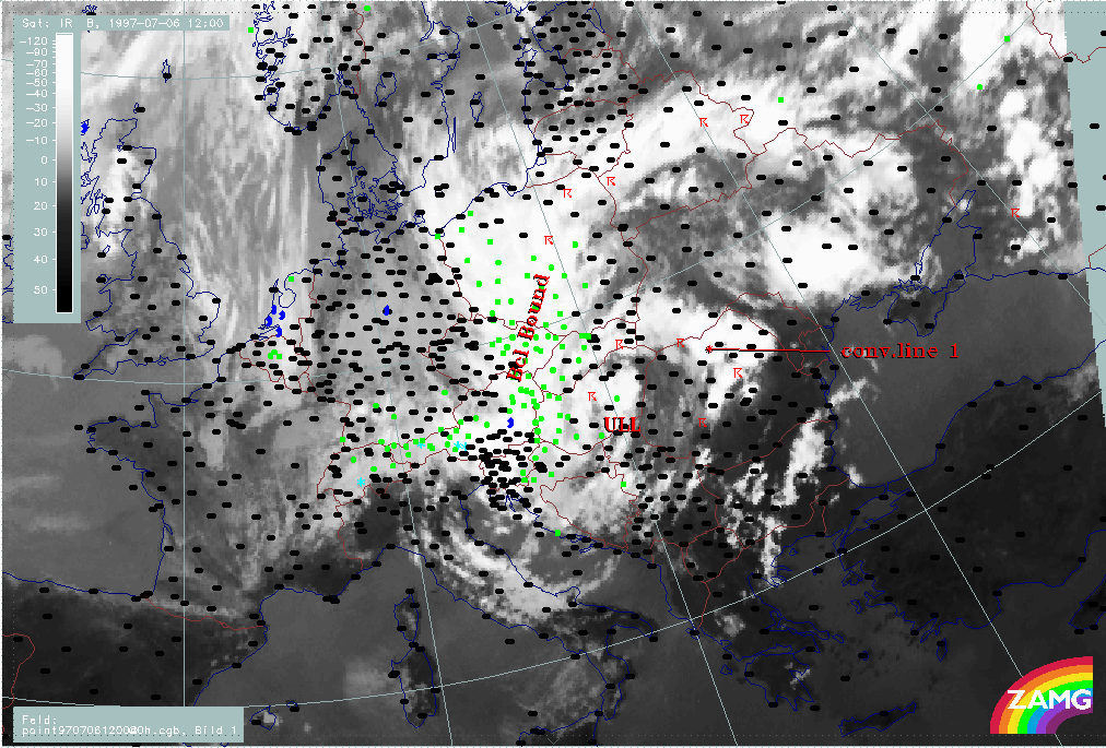
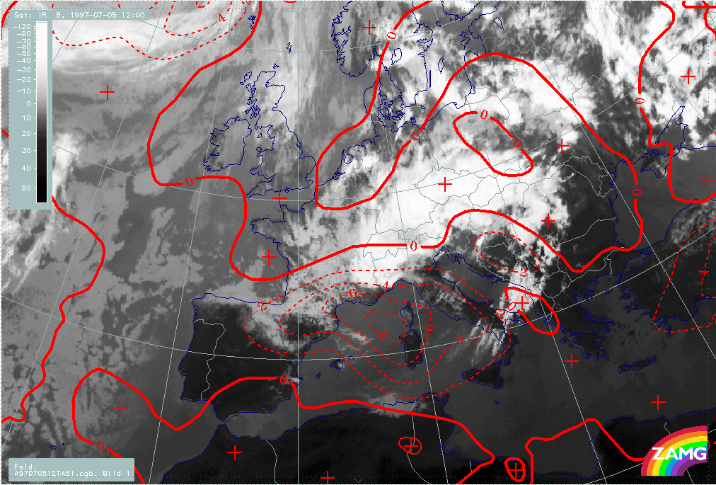
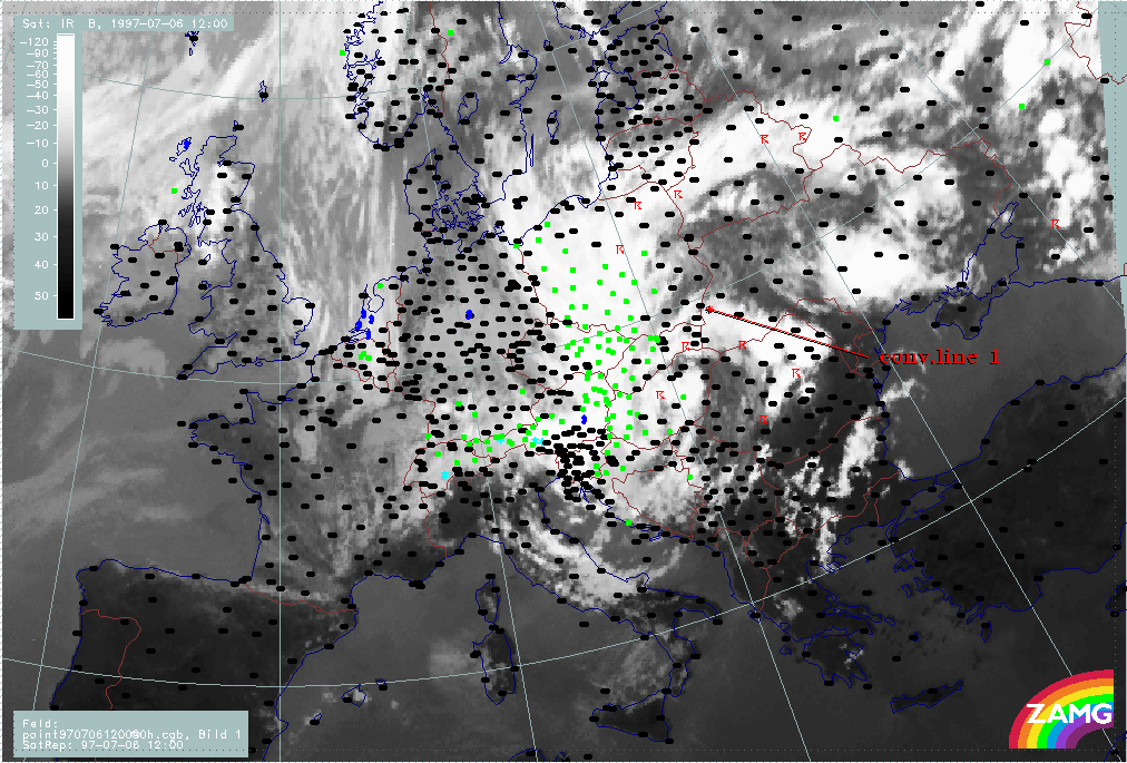
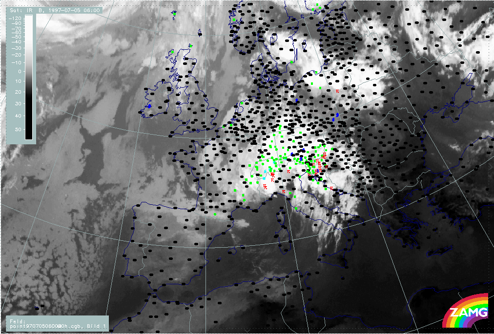
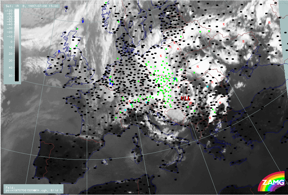
The next image sequence shows the precipitation and thunderstorm areas. The dramatic situation is clearly reflected in the images. The countries affected by rain throughout the whole period are: Poland (changing somewhat between S and E Poland), the Czech Republic, especially the eastern parts, Slovakia, especially the western parts, E. Austria, Hungary, especially the western parts, and NE Croatia for most of the time. N. Yugoslavia and W. Romania are also affected at times.
|
06 July 1997/12.00 UTC - Meteosat IR image; weather events (green: rain and showers, blue: drizzle, cyan: snow, red: thunderstorm with precipitation, purple: freezing rain, orange: hail, black: no actual precipitation or thunderstorm with precipitation); 06/12.00 - 08/12.00 UTC 3-hourly image loop
|
|
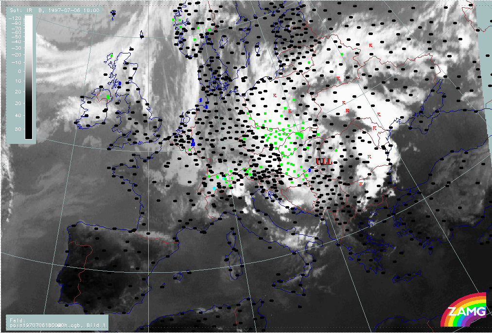
06 July/18.00 UTC is a point in time where convective line 1 (see chapter Main ULL cut-off) as well as the western Baroclinic Boundary which extends from Poland southward to Croatia are fully developed. Both cloud bands are cyclonically curved around the intensive ULL centre which can be found over E. Hungary and E. Slovakia at 500 and 300 hPa. There is no discernable surface low, but a closed isoline at 850 hPa over SE Poland.
Both cloud bands are accompanied by a TFP branch, but convective line 1 lies within a thickness ridge. Both cloud bands are under the influence of WA while the ULL centre is an area of rather strong CA.
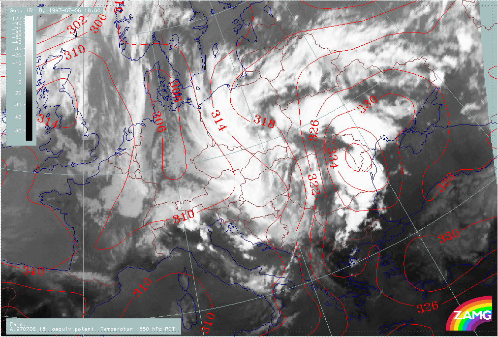
Instability is high in the whole area but extremely high in the eastern boundary at convective line 1, where the Showalter Index shows values of -6°C. This is also the area of a pronounced high in the equivalent potential temperature at 850 hPa, which is a typical location for convective developments.
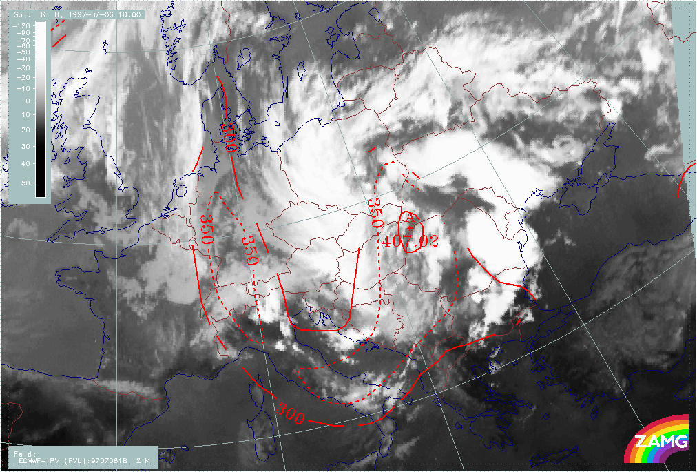
Stratospheric air (PV=2 units) has reached its lowest height of 407 hPa exactly in the centre of the ULL.
|
06 July 1997/18.00 UTC - Meteosat IR image; red: height contours 1000 hPa, green: height contours 500 hPa
|
06 July 1997/18.00 UTC - Meteosat IR image; blue: height contours 850 hPa, red: height contours 300 hPa
|
|
|
|
|
|
06 July 1997/18.00 UTC - Meteosat IR image; blue: Thermal Front Parameter (TFP) 500/850 hPa, green: equivalent thickness 500/1000 hPa, red solid: temperature advection - WA 1000 hPa,
red dashed: temperature advection - CA 1000 hPa
|
06 July 1997/18.00 UTC - Meteosat IR image; yellow: Showalter index, magenta: Showalter index
|
|
06 July 1997/18.00 UTC - Meteosat IR image; red: equivalent potential temperature 850 hPa
|
06 July 1997/18.00 UTC - Meteosat IR image; red: height of PV=2 units
|
|
|
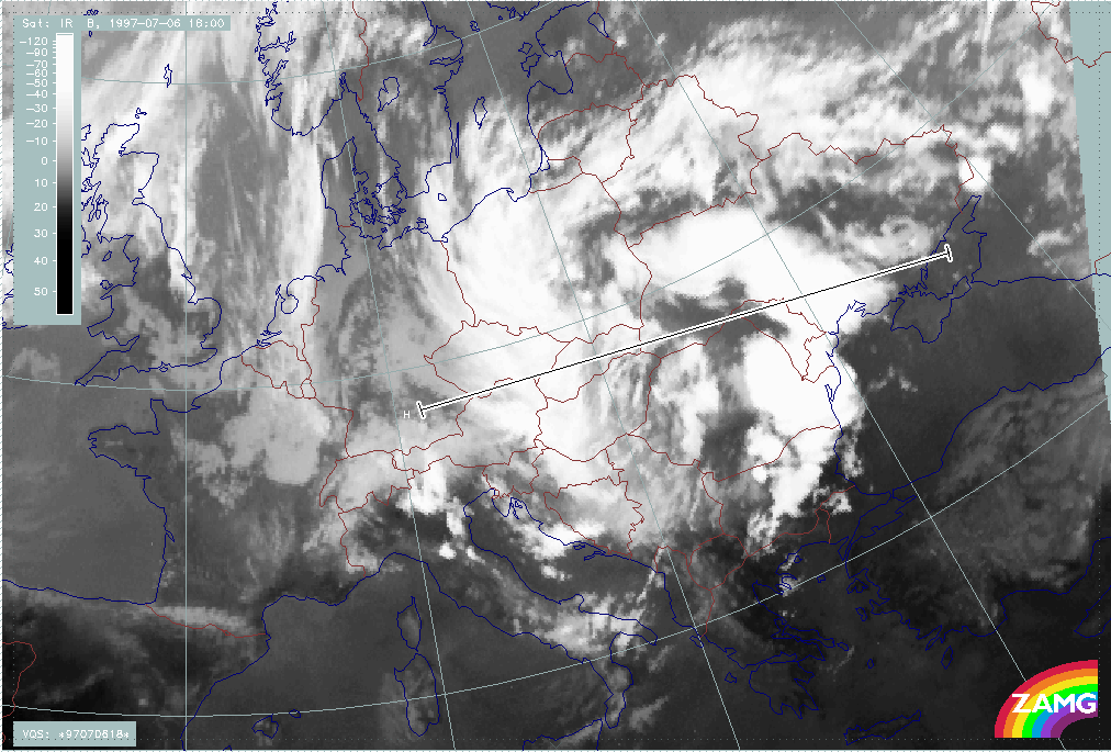
Vertical cross section line H crosses both ULL boundaries, the western Baroclinic Boundary and the eastern convective line. The cross section line is oriented from West to East.
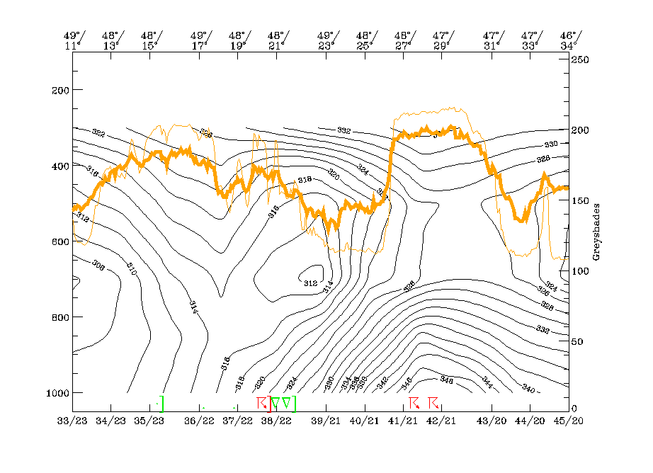
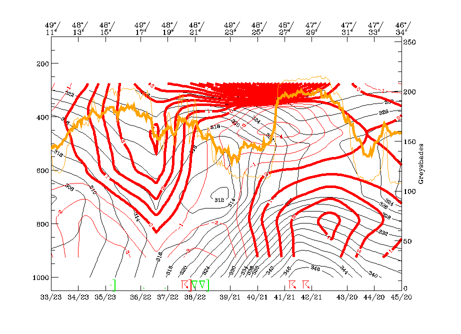
The westernmost peak in the IR and WV pixel lines (48N/13E - 49N/17E) corresponds to the western ULL boundary. There is a downward inclined zone of high gradients in the isentropes typical for a cold front. The isentropic trough on top of this frontal zone, which can be seen above 700 hPa at 49N/17E, is typical for an Occlusion type, but (as already discussed in previous chapters) the genesis of a classical occlusion process has not taken place; it might indicate the advection of warm air in upper levels which leads to a stage somewhat similar to a mature Occlusion. The more ragged IR peaks between 48N/19E and 48N/21E represent the core of the ULL and there is a closed minimum in the isentropes (312K) between 700 and 400 hPa. The broad eastern peak in the satellite image pixel values between 48N/27E and 47N/31E corresponds to the convective line and there are reports of thunderstoms. The highly unstable character shown by the configuration of the isentropes is clear.
The vertical distribution of TA supports these ideas. There is remarkable WA associated with the Occlusion trough and partly within the Cold Front zone while below frontal zone and Occlusion trough CA prevails. Very typical is the vertical distribution of TA in the area of the convective line with WA up to 600 hPa and CA above; a situation which is indicative of instability.
The most important features in the divergence field are:
- The backward inclined zone of convergence connected to the western frontal zone; since there is divergence below and above the zone of high gradients the typical frontal circulation cell is fulfilled.
- The intensive zone of convergence associated with the convective line which reaches from the surface up to 400 hPa.
This distribution of WA and convergence leads to a really dramatic appearance in the vertical motion field with 2 zones of very high values of upward motion accompanying the two boundaries of the ULL.
|
06 July 1997/18.00 UTC - Meteosat IR image; position of vertical cross section indicated
|
|
|
|
|
06 July 1997/18.00 UTC - Vertical cross section; black: isentropes (ThetaE), orange thin: IR pixel values, orange thick: WV pixel values
|
06 July 1997/18.00 UTC - Vertical cross section; black: isentropes (ThetaE), red thin: temperature advection - CA, red thick: temperature advection - WA, orange thin: IR pixel values,
orange thick: WV pixel values
|
|
|
|

|
|
06 July 1997/18.00 UTC - Vertical cross section; black: isentropes (ThetaE), magenta thin: divergence, magenta thick: convergence, orange thin: IR pixel values, orange thick: WV pixel
values
|
06 July 1997/18.00 UTC - Vertical cross section; black: isentropes (ThetaE), cyan thick: vertical motion (omega) - upward motion, cyan thin: vertical motion (omega) - downward motion,
orange thin: IR pixel values, orange thick: WV pixel values
|
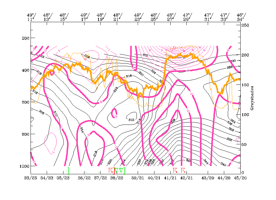
Three isentropic surfaces are chosen: the lowest is 318K, which is on top of the western Cold Front zone as well as on top of the ULL core. 324K is above the frontal zone and on top of the ULL core and 328K is an undisturbed surface which should represent for high levels within the convective line of the eastern ULL boundary.
The lowest surface clearly shows the cyclonic rotation within the ULL, but of special importance is the strongly rising branch in the area of the western cloud band; on this surface there is rising from about 650 hPa up to 400 hPa over Poland, the Czech Republic, Slovakia, Hungary and E. Austria.
The higher surface of 324K still shows rising in this area which, is above 400 hPa as well as the cyclonic rotation of the ULL centre. But another features might be of interest, namely the relative streams on top of the convective line which originate from the drier regions over W. Europe. A dry and relative stream lying on top of humid unstable air is indicative for development and strengthening of instability. This is even more distinct in the highest chosen surface of 328K with a branch of relative streams originating from E. Spain and S. Italy. The WV image shows a broad black area there, indicating dry air in the upper layer.
|
06 July 1997/18.00 UTC - Meteosat IR image; magenta: relative streams 318K - system velocity 275° 4 m/s, yellow: isobars
|
06 July 1997/18.00 UTC - Meteosat IR image; magenta: relative streams 324K - system velocity 265° 4 m/s, yellow: isobars
|
|
|
|
|
|
06 July 1997/18.00 UTC - Meteosat IR image; magenta: relative streams 328K - system velocity 275° 4 m/s, yellow: isobars
|
|
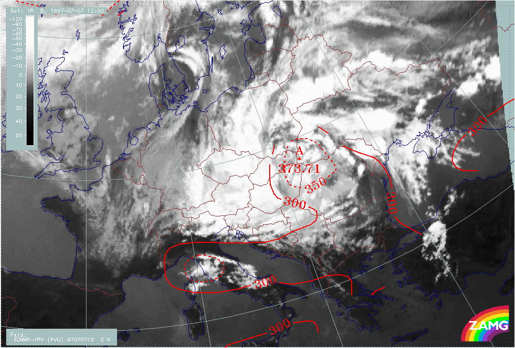
The second point in time which is discussed in detail is 07 July/12.00 UTC; it is characteristic of a further rotation stage where both convective lines 1 and 2 already exist. Convective line 1 has nearly made one complete rotation and its leading edge can be seen over S. Hungary. Convective line 2 lies over W. Ukraine and there are other new convective lines merging with line 2.
The height situation is largely unchanged from 18 hours earlier. There is still no marked surface low. The upper level low has a vertical axis from 850 to 300 hPa which is centred over E. Hungary and surrounding countries.
The frontal parameters are also unchanged. The two Baroclinic Boundaries in the E and W are accompanied by TFP branches and are under WA, with a maximum over the western branch. CA can be found within and to the S of the ULL core.
The eastern cloud boundary, which consists of convective line 2 as well as new convection over the Ukraine, appears in an area with Showalter values <-3 and within a very pronounced ridge in the equivalent potential temperature at 850 hPa. This is very typical of a strongly unstable area.
Lowest values of stratospheric air (374 hPa) can be found in the core of the ULL.
|
07 July 1997/12.00 UTC - Meteosat IR image; red: height contours 1000 hPa, green: height contours 500 hPa
|
07 July 1997/12.00 UTC - Meteosat IR image; blue: height contours 850 hPa, red: height contours 300 hPa
|
|
|
|
|
|
07 July 1997/12.00 UTC - Meteosat IR image; blue: Thermal Front Parameter (TFP) 500/850 hPa, green: equivalent thickness 500/1000 hPa, red solid: temperature advection - WA 1000 hPa,
red dashed: temperature advection - CA 1000 hPa
|
07 July 1997/12.00 UTC - Meteosat IR image; yellow: Showalter index, magenta: Showalter index
|
|
07 July 1997/12.00 UTC - Meteosat IR image; red: equivalent potential temperature 850 hPa
|
07 July 1997/12.00 UTC - Meteosat IR image; red: height of PV=2 units
|
|
|
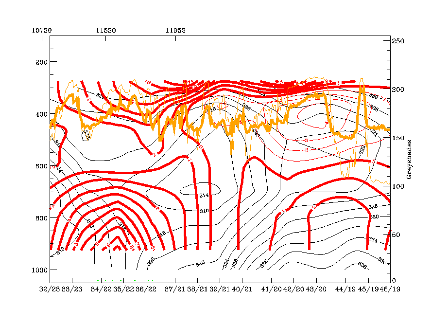
Vertical cross section line G crosses both baroclinic boundaries: the western one which is fed by convective line 1, and the eastern one, which comprises several convective lines or areas, one of them being convective line 2.
The configuration of the isentropes is the same as 18 hours earlier: a Cold Front - like downward inclined zone of high gradients at the western boundary of the vertical cross section with an occlusion like isentropic trough above this zone; this feature is accompanied by strong WA which is maximum in two layers:
- From the surface up to 600 hPa and
- Above 450 hPa.
The ULL core shows up very clearly in the isentropes; satellite pixel values have a ragged appearance there.
The area of "conv. line 2" and the cells east of it still show all the features of a highly unstable area in the configuration of isentropes as well as in the TA field, with WA up to 600 hPa and CA above The divergence field with a thick layer of convergence.
The whole area is characterized by strong upward motion with 3 maxima: in the unstable area of convective line 2, in the core of the ULL which is much more pronounced than 18 hours earlier and in the area of the western frontal cloud boundary where values are now less distinct.
|
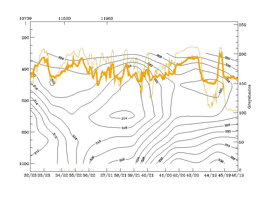
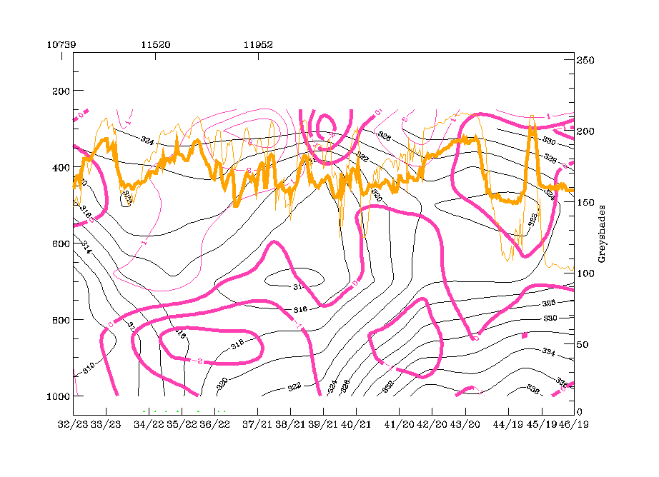
07 July 1997/12.00 UTC - Meteosat IR image; position of vertical cross section indicated
|
|
|
|
|
07 July 1997/12.00 UTC - Vertical cross section; black: isentropes (ThetaE), orange thin: IR pixel values, orange thick: WV pixel values
|
07 July 1997/12.00 UTC - Vertical cross section; black: isentropes (ThetaE), red thin: temperature advection - CA, red thick: temperature advection - WA, orange thin: IR pixel values,
orange thick: WV pixel values
|
|
|
|
|
|
07 July 1997/12.00 UTC - Vertical cross section; black: isentropes (ThetaE), magenta thin: divergence, magenta thick: convergence, orange thin: IR pixel values, orange thick: WV pixel
values
|
07 July 1997/12.00 UTC - Vertical cross section; black: isentropes (ThetaE), cyan thick: vertical motion (omega) - upward motion, cyan thin: vertical motion (omega) - downward motion,
orange thin: IR pixel values, orange thick: WV pixel values
|
Isentropic surfaces similar to those used in the situation 18 hours earlier have been chosen: 318K which is above the western frontal zone and above the ULL core and 324K which is an undisturbed surface above the unstable layer of the eastern convective area.
The lower isentropic surface (318K) shows the strong cyclonic rotation within the ULL and - as 18 hours earlier - intensive ascent in the northern and western parts. It is of interest that over E. Austria relative streams change from ascent to descent, which affects the southernmost part of convective line 1 over W. Hungary. The image sequence shows that this is about the point in time where the tops of convective line 1 become much lower and which might be the effect of the sinking recognizable in this image.
At the higher isentropic level (324K), dry air from the eastern and southern Mediterranean is transported on top of the unstable area; this is clearly indicated in the WV image showing a broad black zone there.
|
07 July 1997/12.00 UTC - Meteosat IR image; magenta: relative streams 318K - system velocity 278° 1 m/s, yellow: isobars
|
07 July 1997/12.00 UTC - Meteosat IR image; magenta: relative streams 324K - system velocity 278° 1 m/s, yellow: isobars
|
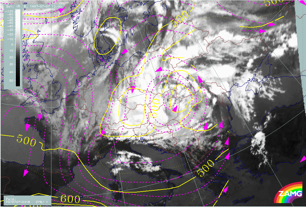
|
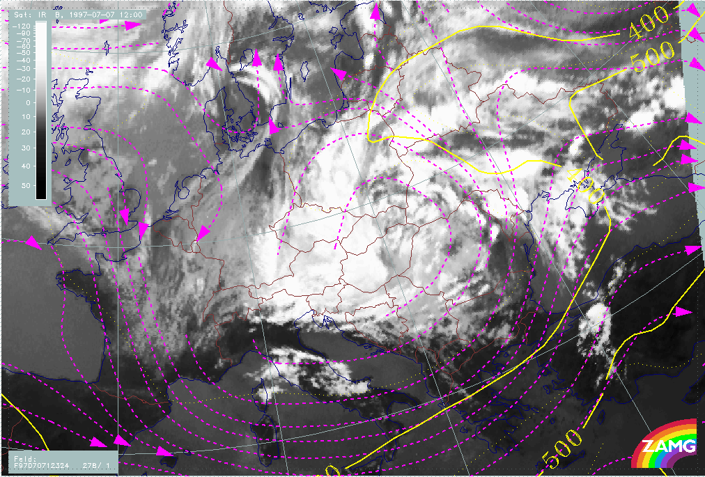
|