29 July 1997 - Diagnosis Of The Eastern Cloud Feature - Conceptual Models "Convergence Cloudiness" And "Cumulonimbus (Cb) And Mesoscale Convective System (MCS)"
|
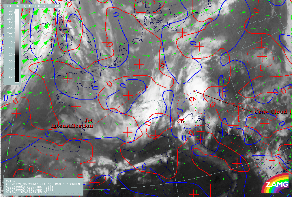
29 July 1997/06.00 UTC - Meteosat WV image; red: divergence 850 hPa, blue: divergence 700 hPa; green: wind vectors 850 hPa; SatRep
overlay: names of conceptual models
|
|
|
In the image above, divergence fields at 850 hPa (red) and 700 hPa (blue) as well as wind vectors at 850 hPa (cyan) are superimposed. The dashed lines indicate convergence in both levels, which means that the biggest part of the cloud band exists in an area where there is a rather thick layer of convergence leading to upward motion. It has to be remembered that this convergence area is not connected with frontal characteristics there. The wind vectors showing a pronounced confluent stream hint at the reasons for convergence in this area.
A much more convenient tool for the detection of non-frontal Convergence Cloudiness are vertical cross sections which are described in the next chapter (compare Diagnosis for 06.00 UTC with help of vertical cross sections ).
|
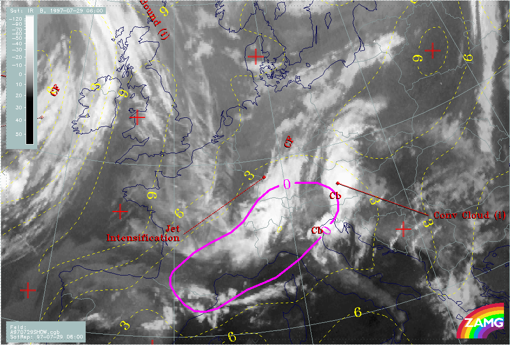
29 July 1997/06.00 UTC - Meteosat WV image; yellow: Showalter index 500/850 hPa, magenta: zero line of Showalter index 500/850 hPa;
SatRep overlay: names of conceptual models
|
|
|
Additional information about the embedded convective cloud cells (Cb) with the help of a stability parameter, the Showalter index, can be found in the image above. Showalter indices below 3 units represent areas with high probability of thunderstorm development; below 0 severe thunderstorms are very likely. There is a big area where these conditions are fulfilled extending from north Spain to east Austria, Slovenia and Croatia. It is a typical situation that the Showalter index describes areas of high thunderstorm probability very well but only on a larger rather than a local scale. Where the thunderstorm complexes actually develop within these large scale areas is dependent on additional local scale conditions.