Very Short Range Forecast 06.00 - 18.00 UTC
|
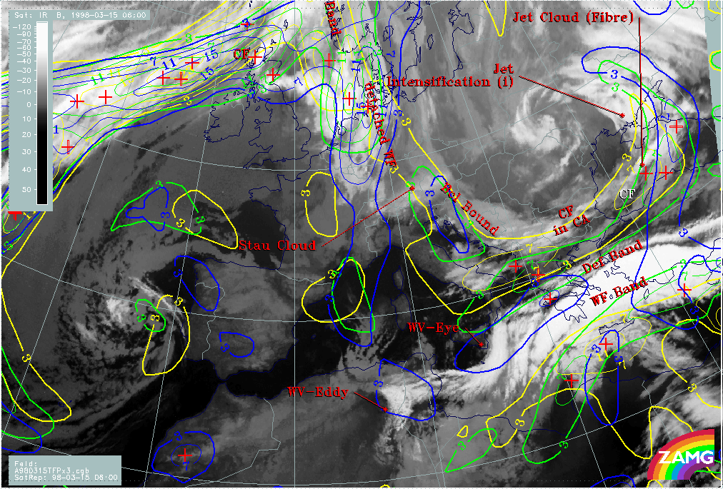
15 March 1998/06.00 UTC - Meteosat IR image; yellow: thermal front parameter 500/850 hPa 06.00 UTC, green: thermal front parameter
500/850 hPa 12.00 UTC, blue: thermal front parameter 500/850 hPa 18.00 UTC, SatRep overlay: names of conceptual models
|
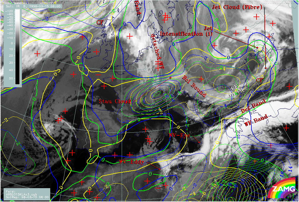
15 March 1998/06.00 UTC - Meteosat IR image; yellow: temperature advection - CA 06.00 UTC, green: temperature advection - CA 12.00 UTC,
blue: temperature advection - CA 18.00 UTC, SatRep overlay: names of conceptual models
|
|
|
|
|
|
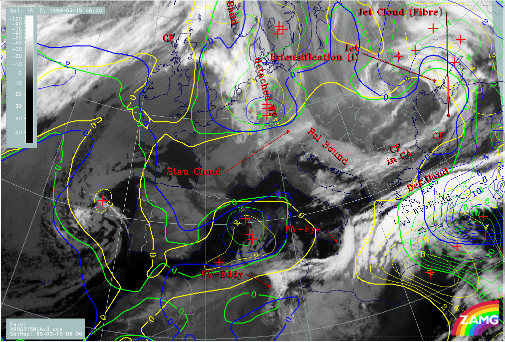
15 March 1998/06.00 UTC - Meteosat IR image; yellow: temperature advection - WA 06.00 UTC, green: temperature advection - WA 12.00 UTC,
blue: temperature advection - WA 18.00 UTC, SatRep overlay: names of conceptual models
|
|
The most important parameters for a VSRF in this case are the TFP (left image top), cold advection (right image top) and warm advection (left image bottom). The TFP shows a southward propagation of the westward part of the Cold Front in Cold Advection from Bulgaria to the north Peloponnesus as well as a north-north-eastward propagation of the southern TFP branch. There is a mergence of both systems over the Aegean Sea and Turkey.
Two CA maxima are influencing Greece and the eastern Mediterranean Sea: one is approaching from the north on the rear side of the Cold Front in Cold Advection and propagating southward, and another one is approaching from the south on the rear side of the surface low propagating north-eastward (right image top). Till 18.00 UTC the zeroline of TA has moved eastward into the Aegean Sea and crosses Crete just in the middle. Thus, at 18.00 UTC VSRF says that colder air has overflown Greece and part of the Island while much warmer air is just overflowing Turkey.