03.00 - 06.00 UTC - Overview of satellite imagery
|
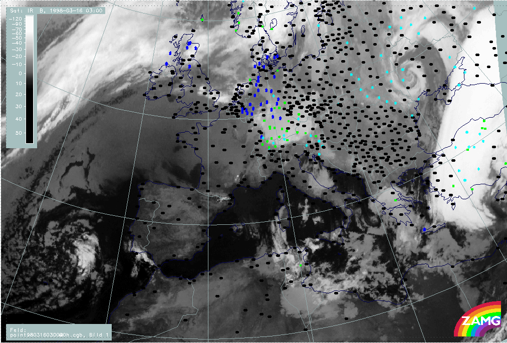
16 March 1998/03.00 UTC - Meteosat IR image; weather events (green: rain and showers, blue: drizzle, cyan: snow, red: thunderstorm with
precipitation, purple: freezing rain, orange: hail, black: no actual precipitation or thunderstorm with precipitation)
|
16 March 1998/03.00 UTC - Meteosat IR image; SatRep overlay: names of conceptual models
|
|
|
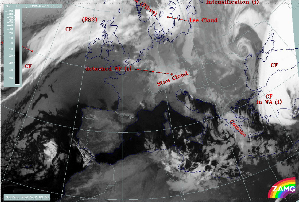
As can be seen in the IR images above, the white cloud band of the front and the low cloud features over and south of Greece are completely uncoupled now. Some precipitation has developed within this low top cloudiness over Greece; the frontal cloud band is still connected with extended precipitation over Turkey.
|
16 March 1998/06.00 UTC - Meteosat IR image; SatRep overlay: names of conceptual models
|
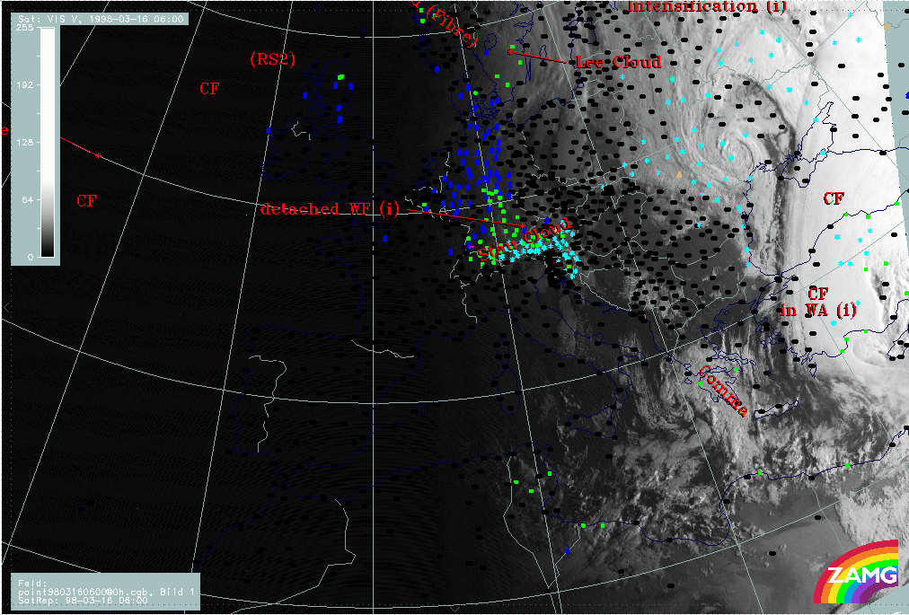
16 March 1998/06.00 UTC - Meteosat VIS image; weather events (green: rain and showers, blue: drizzle, cyan: snow, red: thunderstorm
with precipitation, purple: freezing rain, orange: hail, black: no actual precipitation or thunderstorm with precipitation), SatRep
overlay: names of conceptual models
|
|
|
|
|
|
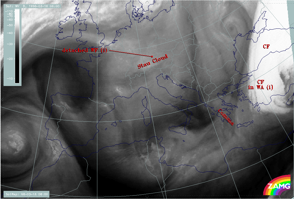
16 March 1998/06.00 UTC - Meteosat WV image
|
|
The most interesting cloud feature at 06.00 UTC is the low cloud feature which has been diagnosed in the actual SatRep as a Comma (compare Conceptual Models: Comma ). There is some discrepancy with the ideal description of this conceptual model since a Comma should usually consist of thick cellular cloudiness and not, as in this case, of rather warm and smooth cloud tops; however in the VIS image (right image top) the cyclonic curvature of the Comma system can be detected more easily and the texture shows some cellular features. Besides this there is rain and snow in the Comma area over the Peloponnesus. It is laready known from before that a sinking dry relative stream in upper and middle heights might be a reason for a restriction of cloud growth. A further confirmation of a Comma structure can be found in the WV image (left image bottom) which reveals the Comma structure quite well.
There seems to be (and was already before) some discrepancy in the interpretation of the WV features made so far. On the one hand the grey wet zones accompanying the Cold Front band and its remnants are mentioned and interpreted as a humidity supply from above, on the other hand a lack of vertical growth of cloud tops is explained by sinking dry air. The solution of this contradiction seems to lie in the word sinking. Although the grey WV features reflect the configuration of the frontal band and the Comma, the existing sinking motion in these layers leads to a drying of the troposphere; this additional information is gained from an application of the conveyor belt concept. Another source dealing with this matter is the vertical cross sections which reveal for six hours before, as well as at this time, (compare 03.00 - 06.00 UTC - Comma Diagnosis - Key parameters on isobaric surfaces) that the WV signal is rather low compared to the IR signal and to other synoptic systems.