06.00 UTC - Overview of satellite imagery
|
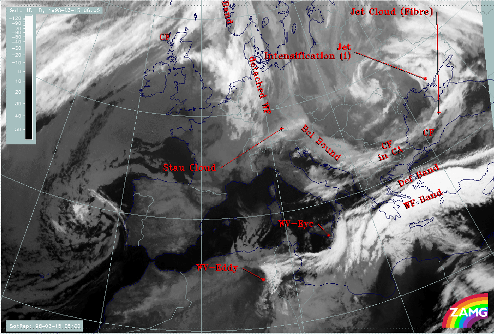
15 March 1998/06.00 UTC - Meteosat IR image; SatRep overlay: names of conceptual models
|
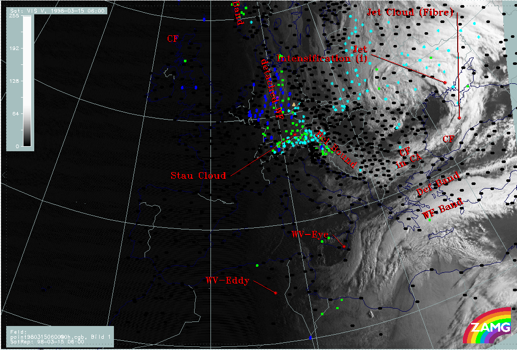
15 March 1998/06.00 UTC - Meteosat VIS image; weather events (green: rain and showers, blue: drizzle, cyan: snow, red: thunderstorm
with precipitation, purple: freezing rain, orange: hail, black: no actual precipitation or thunderstorm with precipitation), SatRep
overlay: names of conceptual models
|
|
|
|
|
|
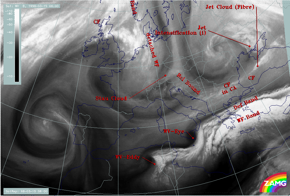
15 March 1998/06.00 UTC - Meteosat WV image; SatRep overlay: names of conceptual models
|
|
The names of conceptual models superimposed on the cloud systems in the satellite images in all three channels demonstrate the synoptic situation. According to the topic of this case study the main area of interest is the Balkan Peninsula and the eastern Mediterranean with special respect to Greece, the Aegean Sea and Turkey. The most important conceptual models involved are:
- A cloud band extending from Bulgaria across the Black Sea to the Ukraine; it accompanies a Cold Front (CF) which is to a big extent under the influence of cold advection (CA) (compare Conceptual Models: Cold Front );
- There is an area where the frontal cloudiness is intensified (Jet Intensification) by the crossing of a jet streak; this intensification happens in the left exit region of the jet streak (compare Conceptual Models: Front Intensification by Jet Crossing );
- A bright cloud band in the Mediterranean accompanying a Warm Front Band (WF band); there is some precipitation connected with the Warm Front Band in the Aegean Sea; no distinct cloud features of a Cold Front related to the Warm Front can be extracted (compare Conceptual Models: Warm Front Band );
- A narrow fibrous band named Deformation Band (DEF Band); extends parallel to the northern boundary of the Warm Front (compare Conceptual Models: Deformation Band );
- Two structures best seen in the WV image are named Water Vapour Eye (WV - Eye) and Water Vapour Eddy (WV - Eddy); they are represented by black, very dry circular features (compare Conceptual Models: Water Vapour Vortices ).