
High opaque clouds
High reaching opaque clouds appear blue in the HRV Cloud RGB images.
For frontal cloudiness and other types of high reaching clouds (e.g. convective cells), the blue colour prevails. The blue is somewhat lighter than for Cirrus clouds due to the stronger reflectivity of opaque clouds for short wave radiation. Moreover, fronts are often superimposed by a Cirrus layer which makes the cloud top appear very cold.
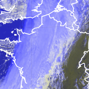
On the image below, pre-fontal Cirrus cloudiness (France and Gulf of Biscay) can be discriminated from the frontal cloud band by its darker blue in contrast to the lighter blue for the clouds within the front (England and Atlantic).
Shadows on the cloud top produced by different heights of the frontal cloudiness can result in dark blue stripes, as can be seen on the rear side of the cold front.
Depending on the thickness of the Cirrus veil above a high reaching opaque cloud, the blue colour can turn into a whitish blue when this veil is thin, and vice-versa into a darker blue when the Cirrus layer is thicker.
HRV Cloud RGB from 26 January 2016, 12:00 UTC
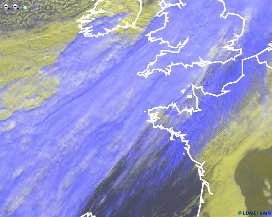
As can be seen in the image below, towering CBs show a lighter blue at the center and a darker blue around the cell. While the latter stems from the cirrus anvil, the former is the multi-layered cloud.
HRV Cloud RGB from 9 May 2015, 12:00 UTC
Explanation of the blue colour of high opaque clouds in the HRV Cloud RGB (see the recipe):
• Due to very cold temperatures, the blue contribution from channel IR10.8 dominates over the HRV channel contribution.
• Depending on how much Cirrus is atop of the high opaque cloud, the blue colour can vary from light blue (no Cirrus present) to darker blue (thick Cirrus layer).