Dust
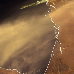
Dust clouds usually appear tan in VIIRS Cloud Phase RGB. Dust clouds are usually semi-transparent. Their actual colour shade depend both on the dust cloud properties and the characteristics of the background.
Dust detection is not the primary goal of Cloud Phase RGB, but the not too thin dust clouds are recognizable, especially over water. Dust clouds have different structure than ice and water clouds. They are smooth, blurred and have washed out colours.
In the following figures Cloud Phase RGB images are shown together with Dust and True Colour RGBs. This triple visualisation helps to confirm whether the blurred feature seen in Cloud Phase RGB is really dust cloud. Dust RGB was tuned especially for dust detection (based on IR channels), while True Colour RGB for aerosol detection (based on visible channels). Dust cloud appear pink in Dust RGB and grey (sometime with brownish shades) in True Colour RGB.
Figure 1 shows a dense dust cloud over Portugal, Spain, France and the ocean along their coast. Celia cyclone uplifted and transported Sahara dust over this area. The dust cloud is seen both over sea and land. It is better seen over water than over land or clouds.
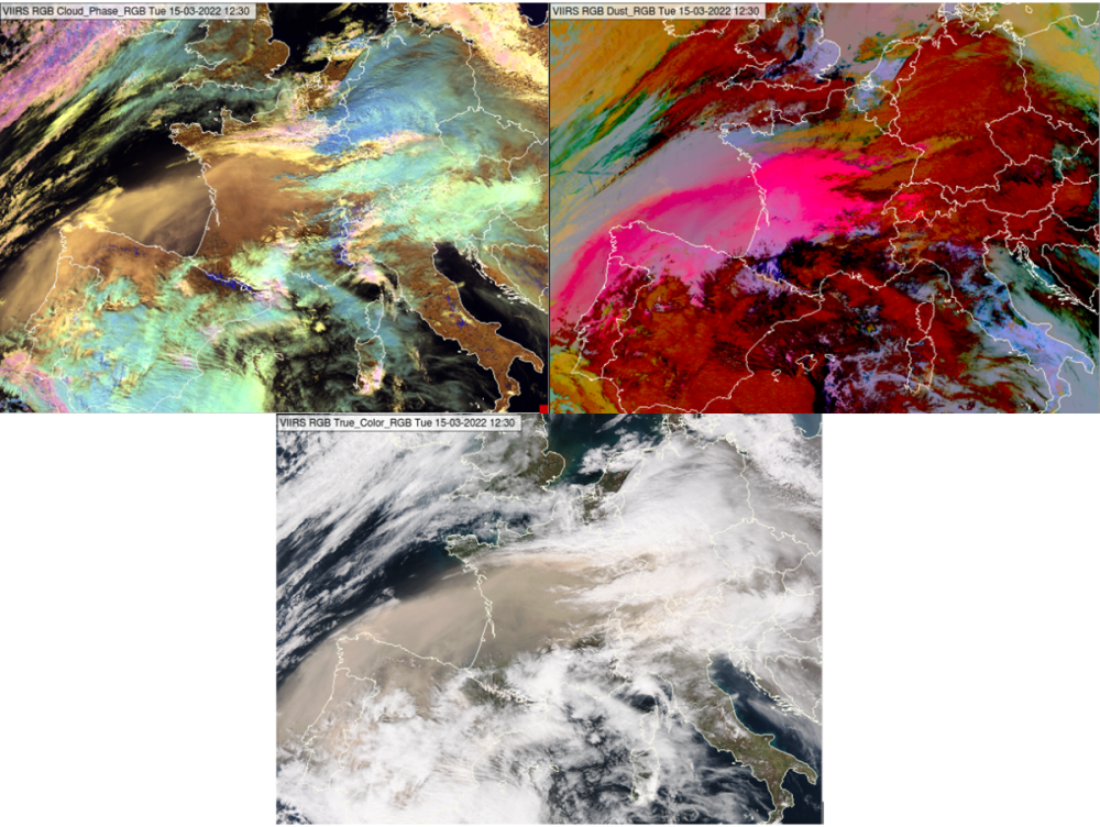
Fig. 1: VIIRS Cloud Phase, Dust and True Colour RGB images for 15 March 2022 12:30 UTC.
Figure 2 shows a thinner dust cloud over the Mediterranean Sea, around Corsica and Sardinia islands. It appears darker in the Cloud Phase RGB than in the previous case. Dust and True Colour RGBs confirm the presence of dust cloud.
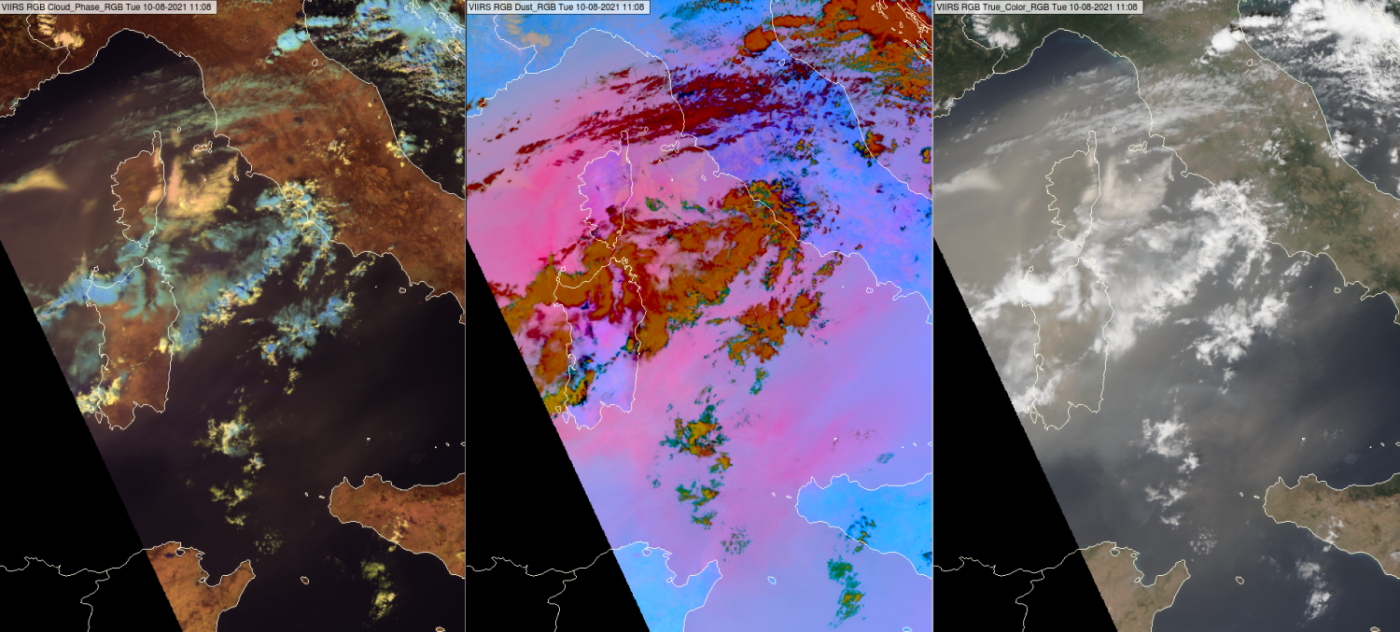
Fig. 2: VIIRS Cloud Phase, Dust and True Colour RGB images for 10 August 2021, 11:08 UTC.
Figure 3 shows a dust cloud over the Ionian Sea. Dust cloud is seen along the frontal cloudiness and also between the clouds, see the arrows.
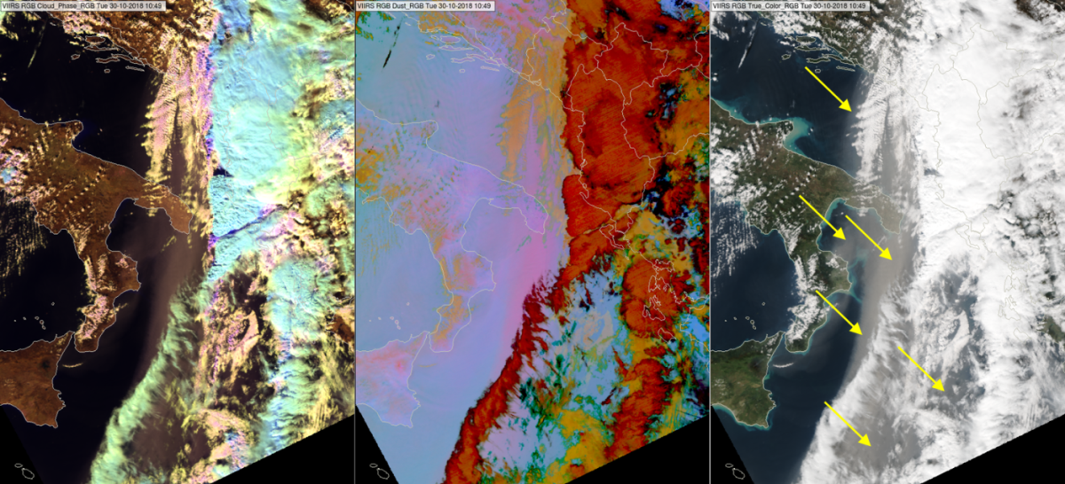
Figure 4 shows the Black Sea region. In the Dust RGB one can see a dust cloud in pink colour south of the Black Sea indicated by black arrows. In the True Colour RGB high aerosol content is seen over the southern regions of the sea. One can suspect the dust cloud over land in Turkey and maybe in Romania, see the yellow arrows. In the Cloud Phase RGB the dust cloud is not really recognizable. One might recognize it over the water in case you know already (based on the other two RGBs) that it is present.
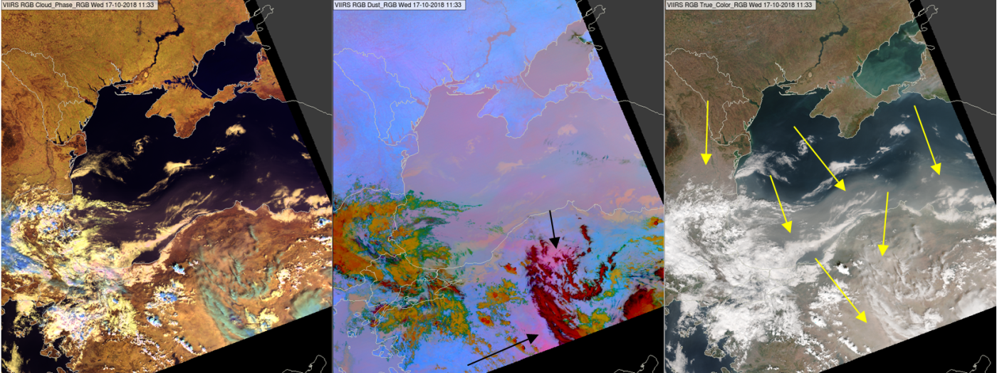
Fig. 4: VIIRS Cloud Phase, Dust and True Colour RGB images for 17 October 2018, 11:33 UTC.
Note that the actual colour shades depend on the sun-viewing geometry as well (solar and satellite directions). The reason is twofold:
• The scattering properties depends on the directions.
• Any semi-transparent cloud (ice cloud, dust cloud, aerosol plume) is thicker for a slant view.
Explanation of the colours of dust clouds in the Cloud Phase RGB (see the recipe):
For the semi-transparent dust cloud the colour shade depends not only on the dust cloud properties but also on the characteristics (colour) of the underlying surface.
Over sea the intensity of the signals depend on the transparency of the dust cloud. Usually the red signal is the strongest, while the blue signal is the weakest. For a very thin dust cloud it can happen that the green signal is the weakest.

