Thick fog or low clouds consisting of small droplets
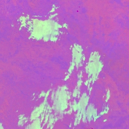
Thick fog or low clouds consisting of small droplets usually appear light green at mid-latitudes in the VIIRS Night Microphysics RGB images. In case of warm cloud tops, the colour turns into light blue; while in case of cold cloud tops, it turns into bright green.
In the image below, thick fog/low clouds with small droplets are seen over Czech Republic in light green colour. Cloud top brightness temperature (BT) is around 5°C.
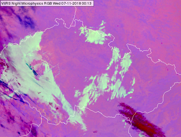
NPP, VIIRS Night Microphysics RGB image for 07 November 2018, 00:13 UTC
The colour shade depends on the temperature as well. Warmer cloud tops have more blue shades, while colder cloud tops have fewer blue shades, see the example below. On the left panel fog is seen at the coast of Portugal; its top brightness temperature is ~ 14°C. On the middle panel fog/low cloud is seen west of the Black Sea, over Moldavia, Romania and Ukraine; here cloud top brightness temperature is ~ 0°C. On the right panel fog/low cloud is seen in Russia, at the border of Ukraine; its cloud top brightness temperature is ~ -12°C.
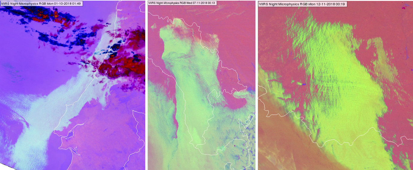
NPP, VIIRS Night Microphysics RGB images taken on 01 October 2018 at 01:49 UTC at coast of Portugal (left), 07 November 2018 at 00:13 UTC east of the Black Sea, over Romania Moldova and Ukraine (middle panel) and 12 November 2018 at 00:19 UTC over Russia and Ukraine (right)
Note that thick fog/low clouds at mid-latitudes can appear also in pinkish grey in case they consist of large droplets.
In the image below, mainly thick fog/low clouds are seen over Hungary and Slovakia. In some area the cloud is covered by small droplets (appearing light green), while in other areas the cloud is covered by large droplets (appearing pinkish grey). Note that valley fogs are seen in the Carpathian Mountains, left side of the image.
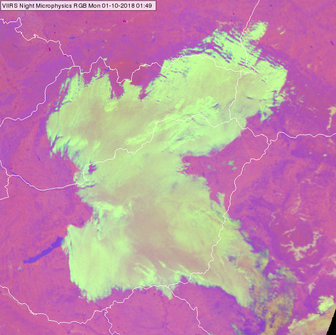
NPP, VIIRS Night Microphysics RGB image for 1 October 2018, 01:49 UTC
The image below shows low clouds consisting of mainly large droplets over east-northern Belarus (appearing in pinkish grey colours). Within this region several greenish plumes are seen indicating low clouds with small droplets. The reason of the strongest plume (indicated by the arrow) is the factories of Novopolotsk city emitting large amount of condensation nuclei.
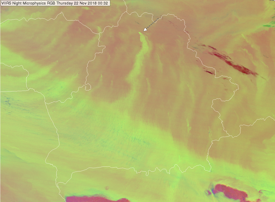
NPP, VIIRS Night Microphysics RGB image of Belarus taken on 22 November 2018, 00:32 UTC
Explanation of the colour of thick fog/low water clouds consisting of small droplets at mid-latitudes in the Night Microphysics RGB (see the recipe):
• For thick clouds the (IR12.0 - IR10.8) brightness temperature difference is close to zero, so the red component will be between medium and maximum.
• For thick fog/low clouds consisting of small droplets, the (IR10.8 - IR3.7) brightness temperature difference is very high (due to different emissivity values), so the green signal will be strong, stronger than the red component.
• The blue signal depends on the cloud top temperature. In case of warmer/colder cloud top temperature, the cloud will have more/fewer blue shapes.
As a consequence, thick fog/low clouds consisting of small droplets appear light green in case of cool cloud top, or light blue in case of warm cloud top, or bright green in case of supercooled water clouds.
