Pilar Rípodas talks about the improvements that the MTG will bring in regards to NWC SAF products.
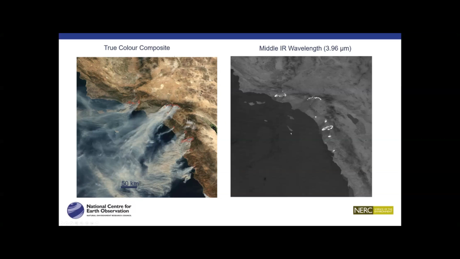
Martin Wooster talks about fire detection and FRP (Fire Radiative Power) product.
Ivan Smiljanic shows how to detect low level moisture with the FCI.
Mária Putsay talks about the new Cloud Phase RGB.
Carl Jones talks about his experience with the Cloud Type RGB, that will be the RGB using the new 1.38 μm channel on the FCI.
Andrea Meraner talks about wildfire detection and vizualisation by using FCI data.
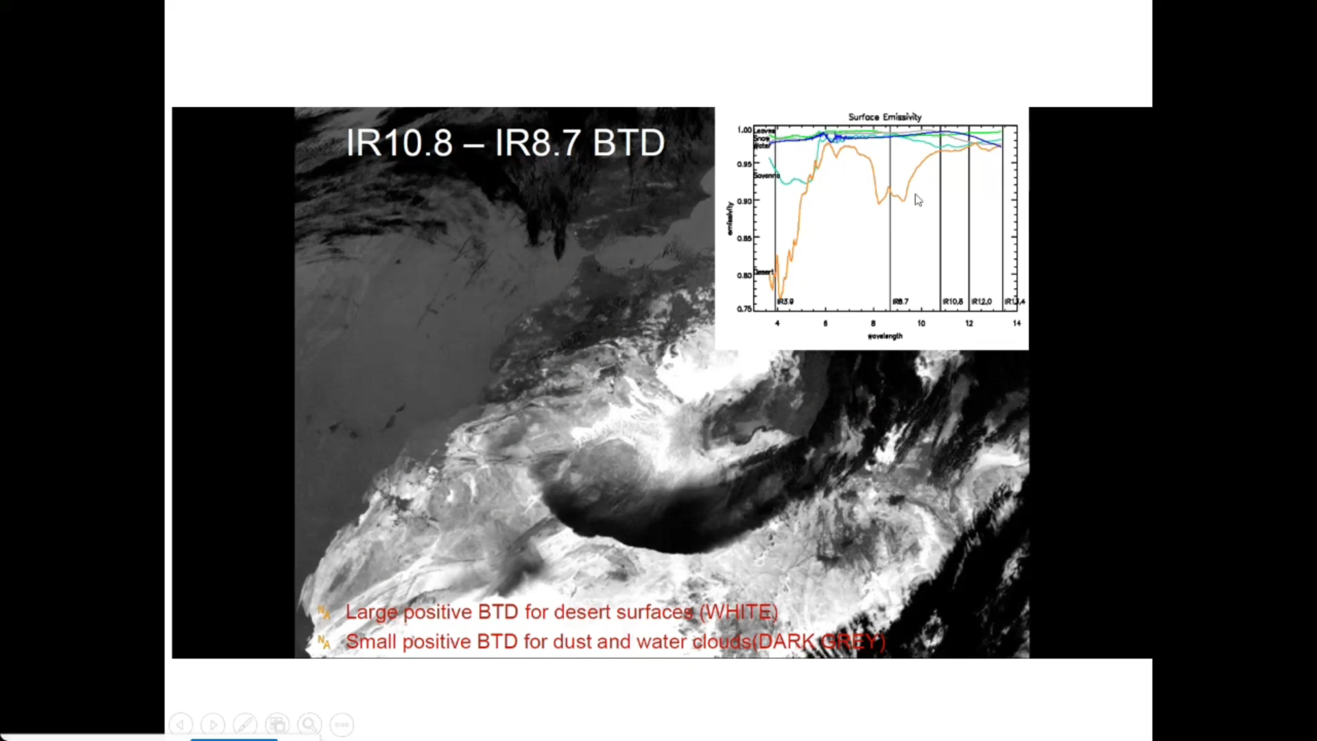
Federico Fierli shows how to use satellite imagery for observing aerosol.
Johan Strandgren talks about the FCI True Colour Imagery.