Djorjde Gencic shows the most useful RGBs for fog and low cloud detection, and mentions some "under development" products as well.
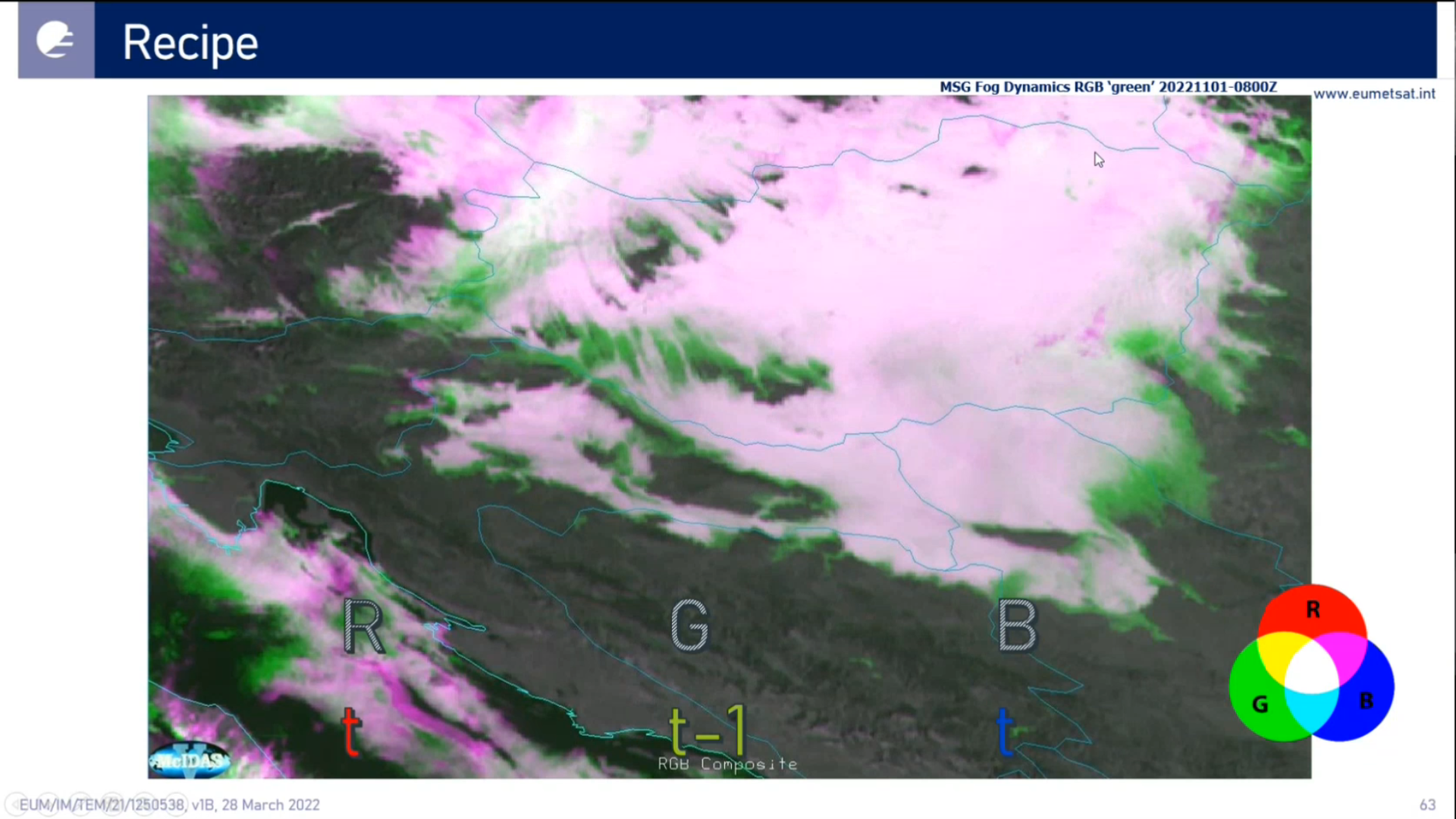
Zsofia Kocsis shows a wide range of possible visualizations using IRS Level-2 (L2) test data.
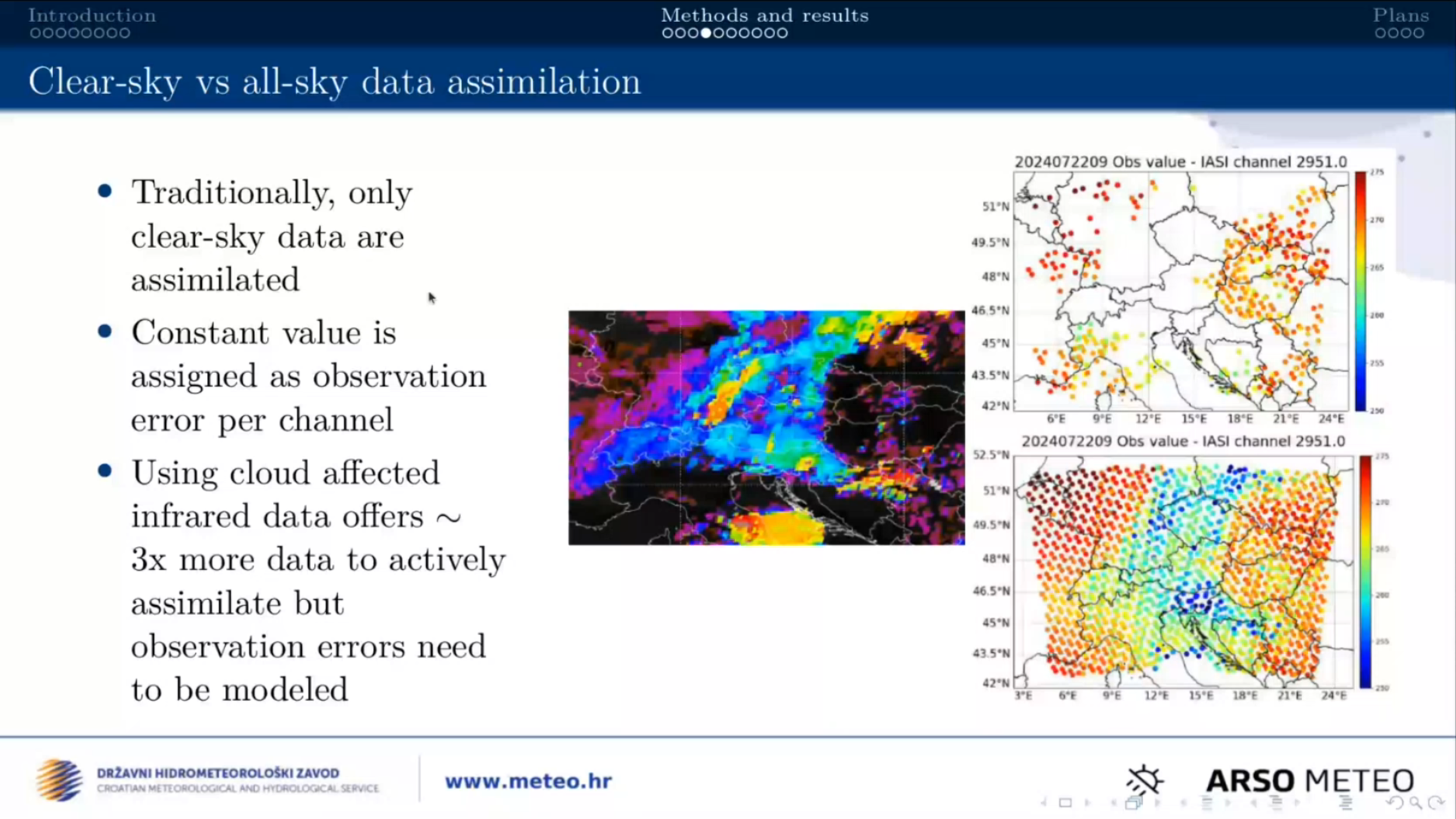
Suzana Panezic talks about using the Okamoto all-sky method in the regional numerical weather prediction model AROME using IASI radiances as proxy.
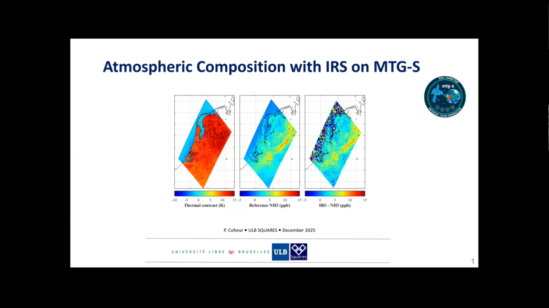
Pierre Coheur talks about the uses of IRS instrument for atmospheric composition.
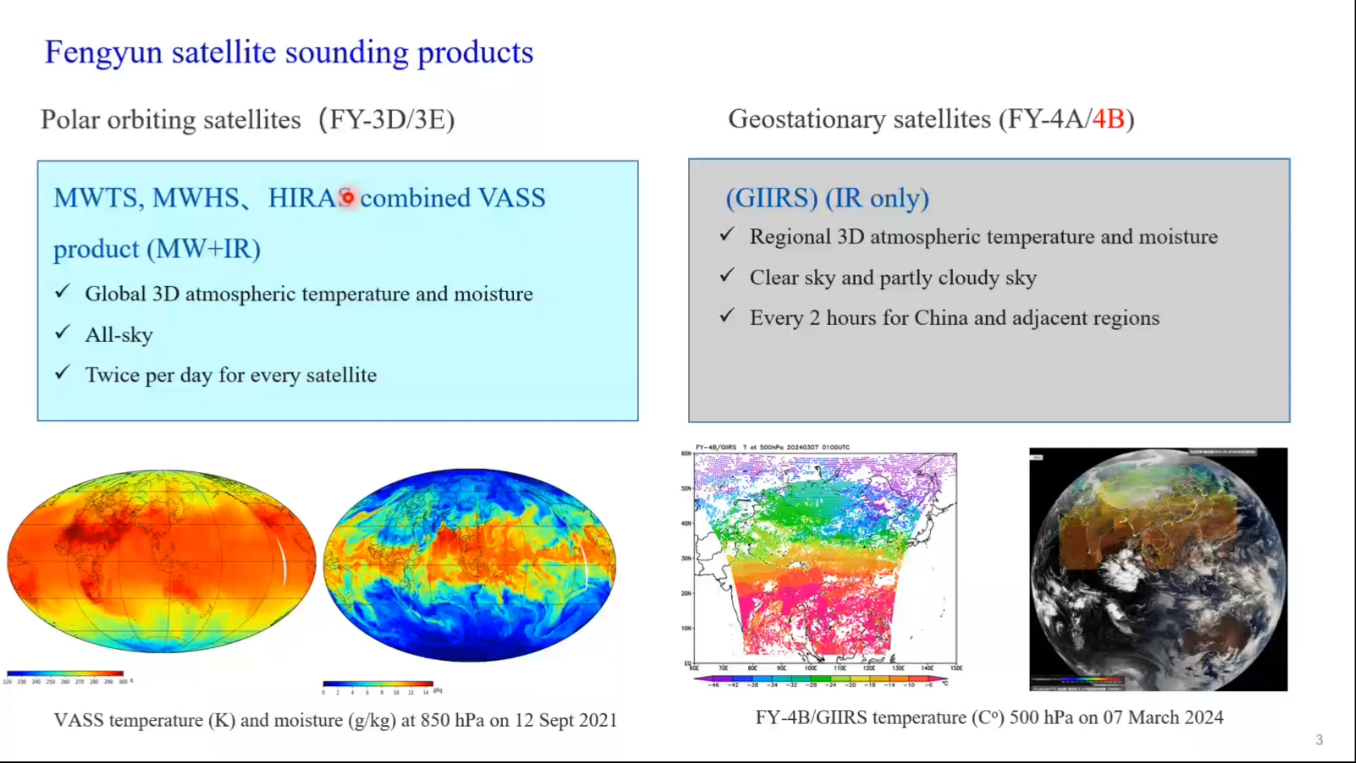
Jun Li shows applications of GIIRS onboard the Fengyun satellite in National Satellite Meteorological Center.
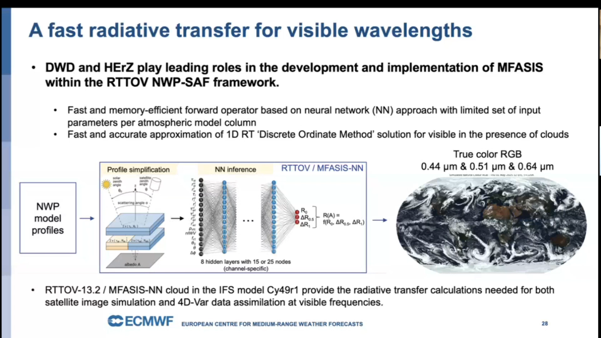
Chris Burrows talks about assimilation of different types of MTG data that is done by ECMWF.
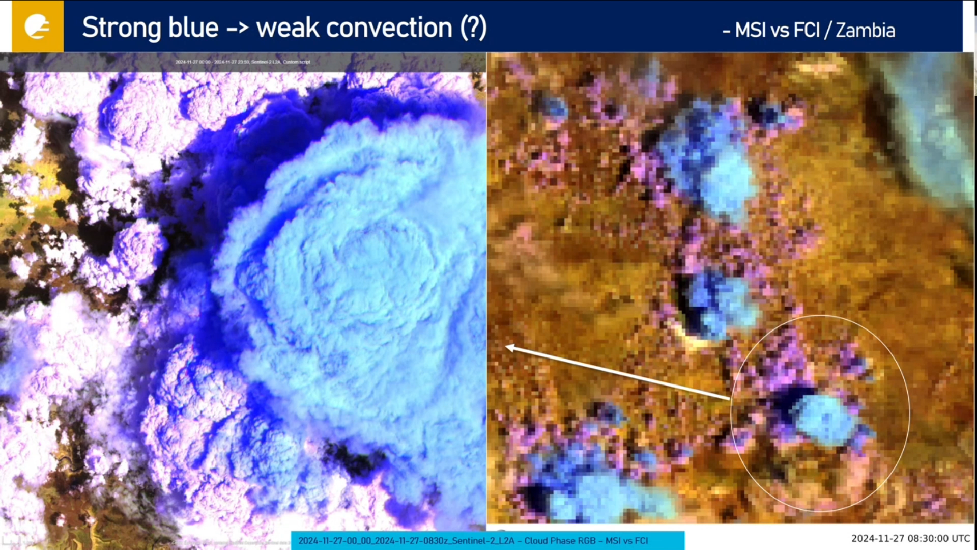
Ivan Smiljanic talks about shadows in FCI imagery, that are now better observed than ever due to high spatial resolution.
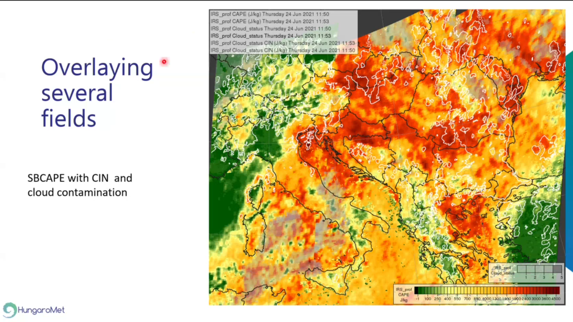
Xavier Calbet talks about IRS and it's uses, specifically from NWC SAF side.