- Event Weeks
- Event Week on IASI L2 Product 2020
Event Week on IASI L2 Product 2020

From 14 to 17 September 2020, EUMeTrain held a mini event week on IASI L2 profiles. IASI L2 product contains temperature and humidity profiles, which are available 30 minutes after sensing trough the IASI EARS Services from EUMETSAT. The event week aimed to raise awareness to EARS IASI L2 product with the understanding that the product usage is still in the early stages. During the event week it was shown how these profiles are made along with some possible applications.
Session 1 - 14 September 2020
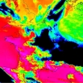
Assessing and monitoring atmospheric thermodynamic parameters is key for weather forecasting. Space-borne hyperspectral sounders provide vertically resolved information of atmospheric temperature and humidity, and of surface and cloud properties. The future geostationary infrared sounder IRS on board Meteosat Third Generation (MTG) will deliver operational atmospheric sounding at unprecedented temporal and spatial sampling, with 4-km pixels at Nadir and covering Europe every 30 minutes. It will hence be an important complement to satellite imagery (e.g. operational MSG/SEVIRI or the future MTG/FCI instruments), where long experience exist in support to nowcasting, by allowing the detection and monitoring of atmospheric instabilities before convective clouds develop.
In this presentation, we give an introduction to EUMETSAT current (IASI) and future (IASI-NG and MTG-IRS) hyperspectral sounders, the remote-sensing principles and geophysical information contained in the so-called Level 2 (L2) products. This includes temperature and humidity profiles, cloud and surface properties and indirect parameters relating to the atmospheric stability. We give an overview of recent application studies and experiments using IASI L2 products in support to weather forecasting.
Session 2 - 15 September 2020
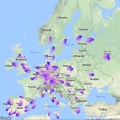
The knowledge of the vertical structure of the atmosphere is extremely important for a reliable weather forecast, especially in the case of severe convection. The arrival of the new infrared sounder with the MTG will open many new possibilities in assessing the atmospheric instability. However, satellite retrievals lack accuracy towards the lower levels, which are crucial fort the calculation of several stability indices.
In the first part of the talk, a comparison of stability indices calculated from IASI L2 and AMDAR aircraft profiles will be presented. The probability of detection can be relatively high with adapted thresholds, but unfortunately also false alarm ratios are relatively high. In the second part, the uncertainty of CAPE resulting from errors in the retrieved profiles will be estimated.
In this presentation, we provide an overview of the performances of the operational hyperspectral sounding products. They have been evaluated against independent reference measurements in dedicated validation studies and are continuously assessed in the routine monitoring. We introduce also the quality indicators (uncertainty estimates) provided along with the atmospheric profiles to support quality control and data acceptance on user side, accordingly to their applications.
Session 3 - 15 September 2020
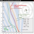
ESSL studied the use of retrieved temperature and humidity profiles available from the Infrared Atmospheric Sounding Interferometer (IASI) instrument on the polar-orbiting Metop satellites for storm forecasting during the 2019 Testbed and for a number of cases. Parameters relevant to convective storm prediction such as CAPE, CIN and humidity at various levels were computed and a direct visual comparison between the satellite-derived and NWP-modelled profiles was made possible. We present the main conclusions of this study, addressing the usability of the products, preferred derived parameters and observed limitations.
Session 4 - 16 September 2020
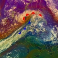
Strong winds southwest of the centre of a Shapiro-Keyser-Cyclone are often associated with a cold conveyor jet or a sting jet. The sting jet is a strong mesoscale flow with a very high damage potential. It is a huge challenge for NWP and forecasters to predict correctly a sting jet. The question is: Can IASI profiles help us for a better prediction of such mesoscale severe wind events connected with sting jets? Therefore, some case studies will be presented.
Session 5 - 16 September 2020
Using IASI L2 profiles, different instability indices (e.g. Lifted Index, CAPE) and water vapour content in different layers can be determined, which provides information on the convective environment. These indices were studied in several convective cases which led us to try to merge the IASI profiles and Synop measurements. In this presentation we present the reasons why we choose to combine these different measurements and we also present some of our experiences with the blended IASI product.
Session 6 - 17 September 2020
ECMWF develops and operates a global numerical weather prediction system. Currently ca. 400 million observations are present in a 12-hour assimilation window; the vast majority of these are satellite measurements. The main approach to assimilate satellite measurements is radiance assimilation, and together with the conventional observations, they are the main drivers for the headline scores. Assimilation of satellite retrievals, such as IASI temperature and humidity retrievals, is an alternative approach for the radiance assimilation. During the lecture the main findings from a recent assimilation study with IASI L2 retrievals will be discussed. Assimilation experiments indicate that in clear sky conditions the humidity retrievals have a positive impact on analyses and forecast quality, comparable in magnitude to that obtained when IASI radiances are assimilated. However, the results are very sensitive to the diagnosed observation error correlation that is used. Assimilation of cloud affected humidity retrievals brings further improvements to model analyses and forecasts. Impact can be enhanced by using scene dependent observation errors and error correlations. Assimilation of temperature retrievals currently degrades analyses and forecasts, most likely due to smoothing of inversions and tropopause structures while the vertical sensitivity and resolution of the products are not yet taken into account in the observation operator.
