Chapter V: Satellite data
Table of Contents
Introduction
In this chapter you can choose different satellite image loops from 31 May 2013 to compare their advantages and disadvantages (hit left or right arrows).
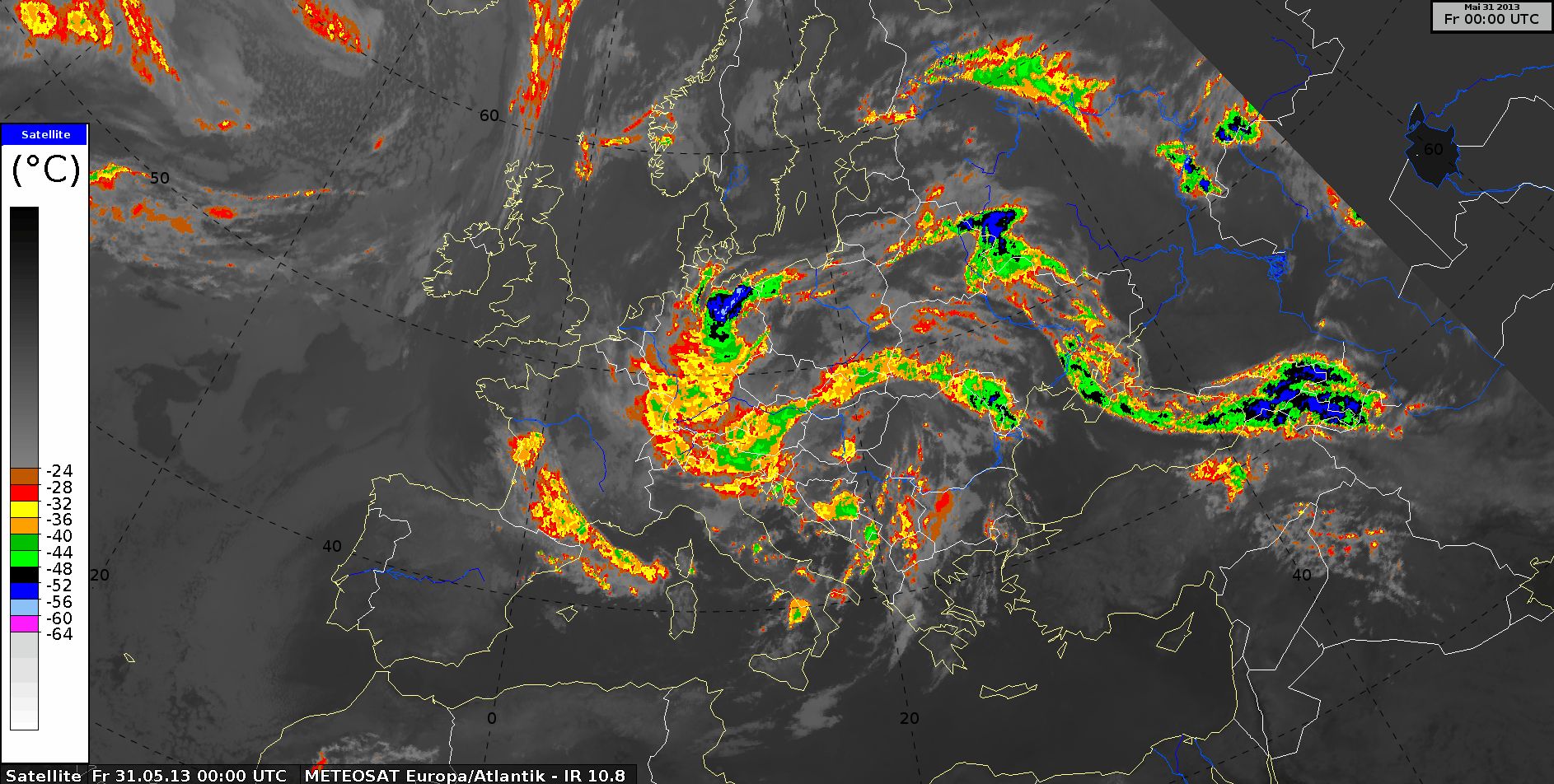
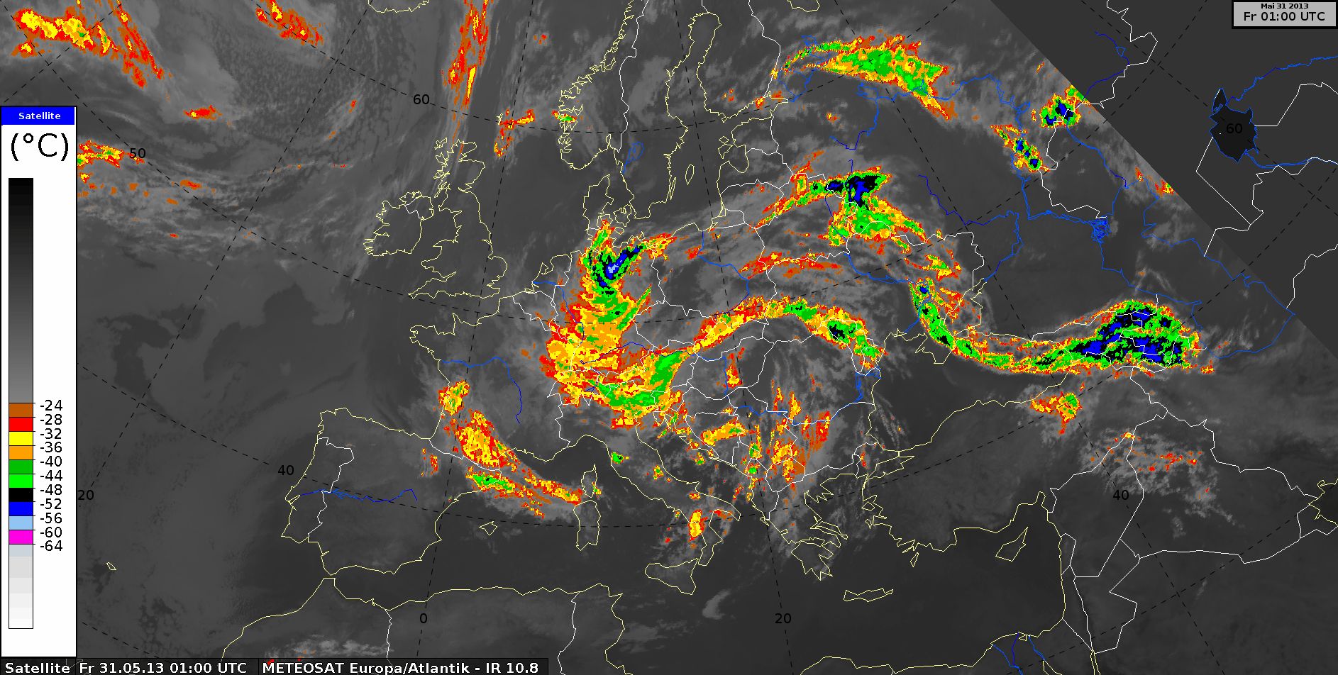
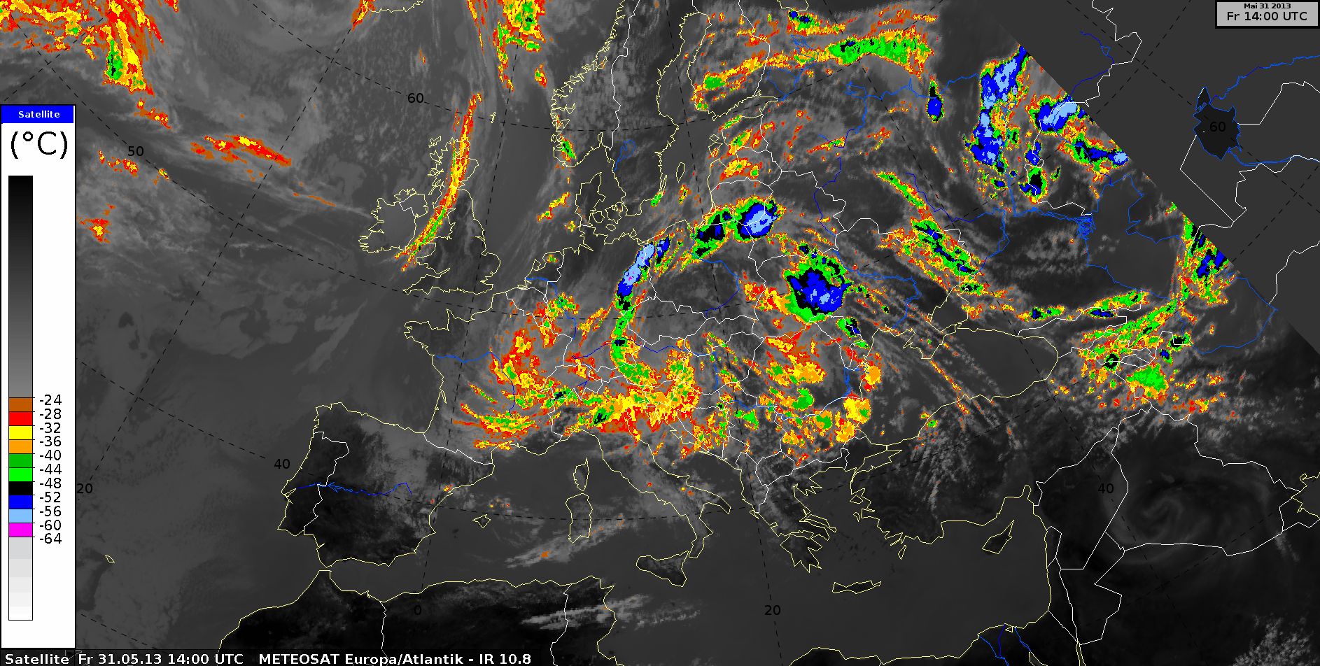
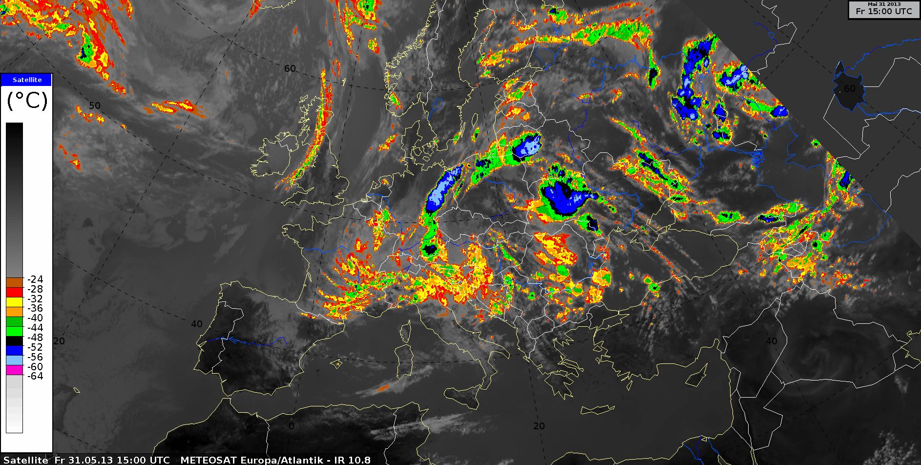
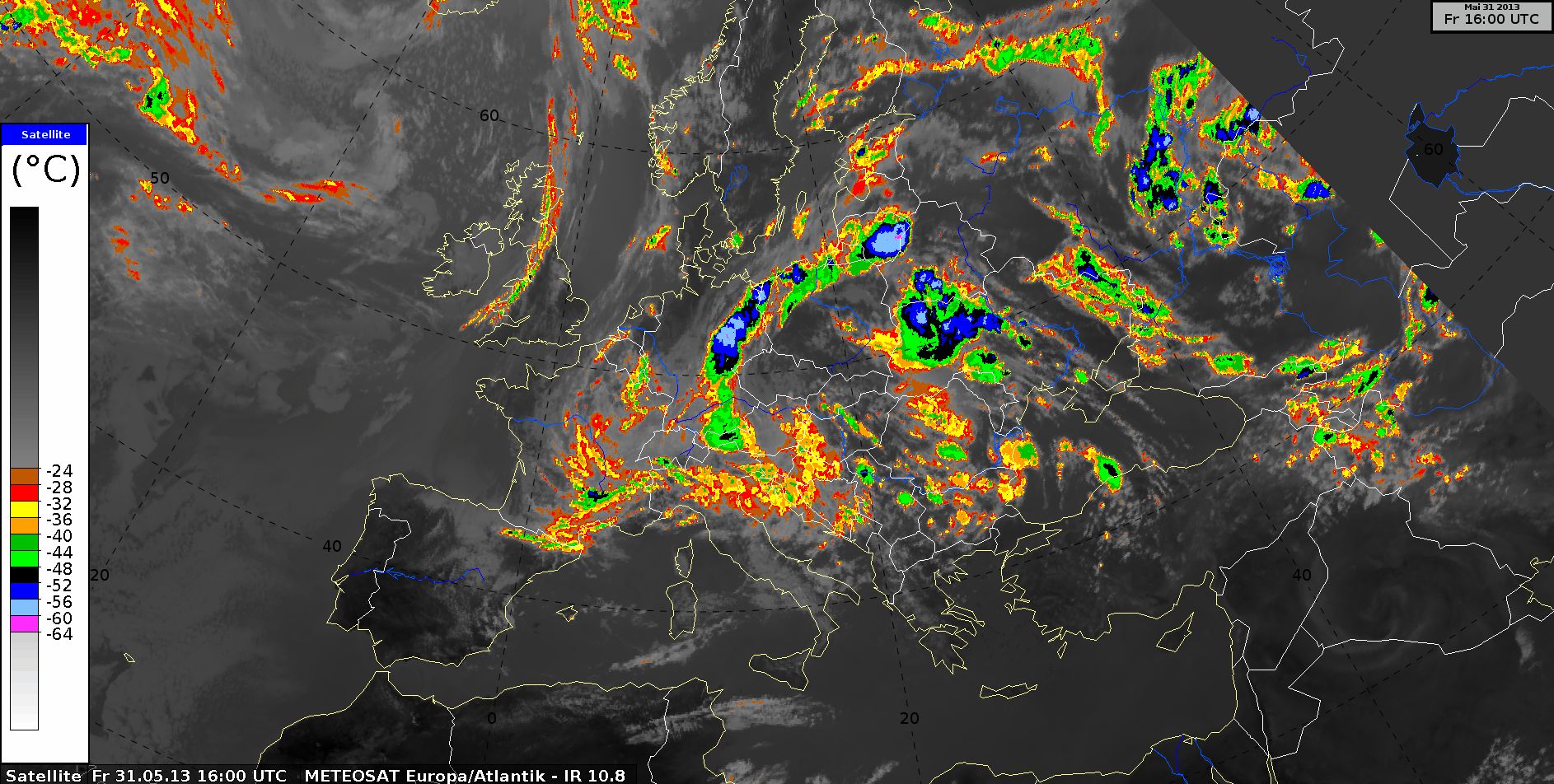
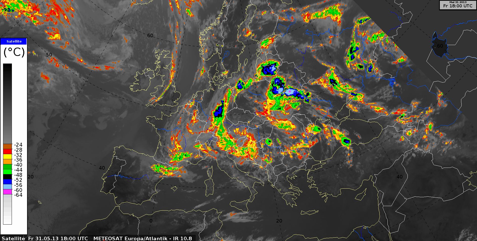
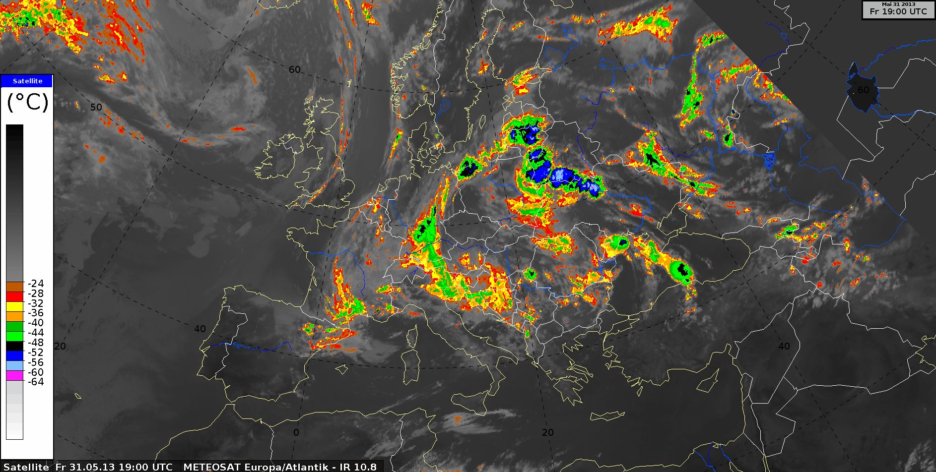
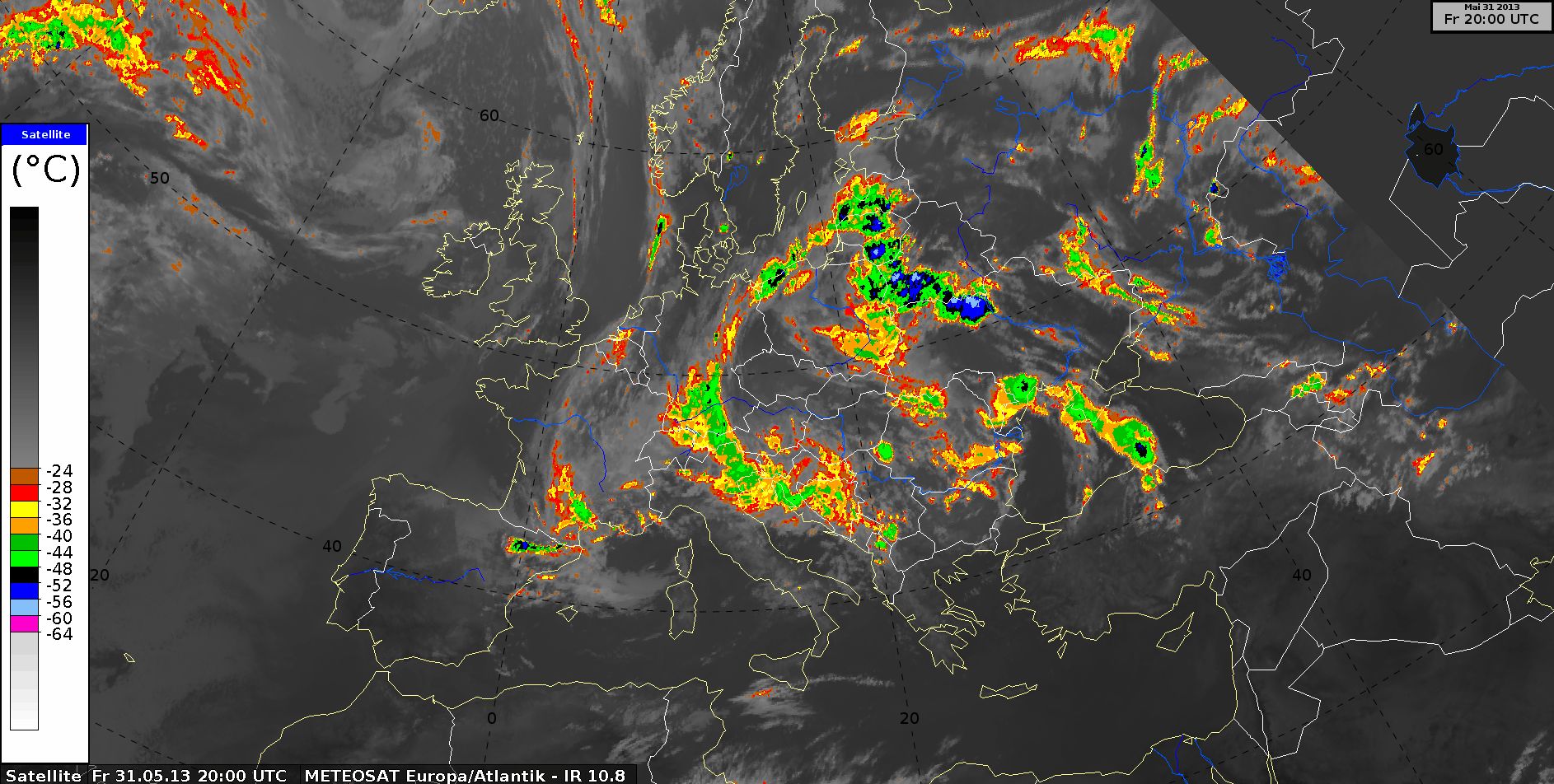
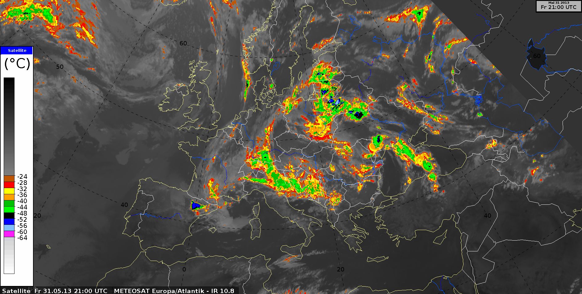
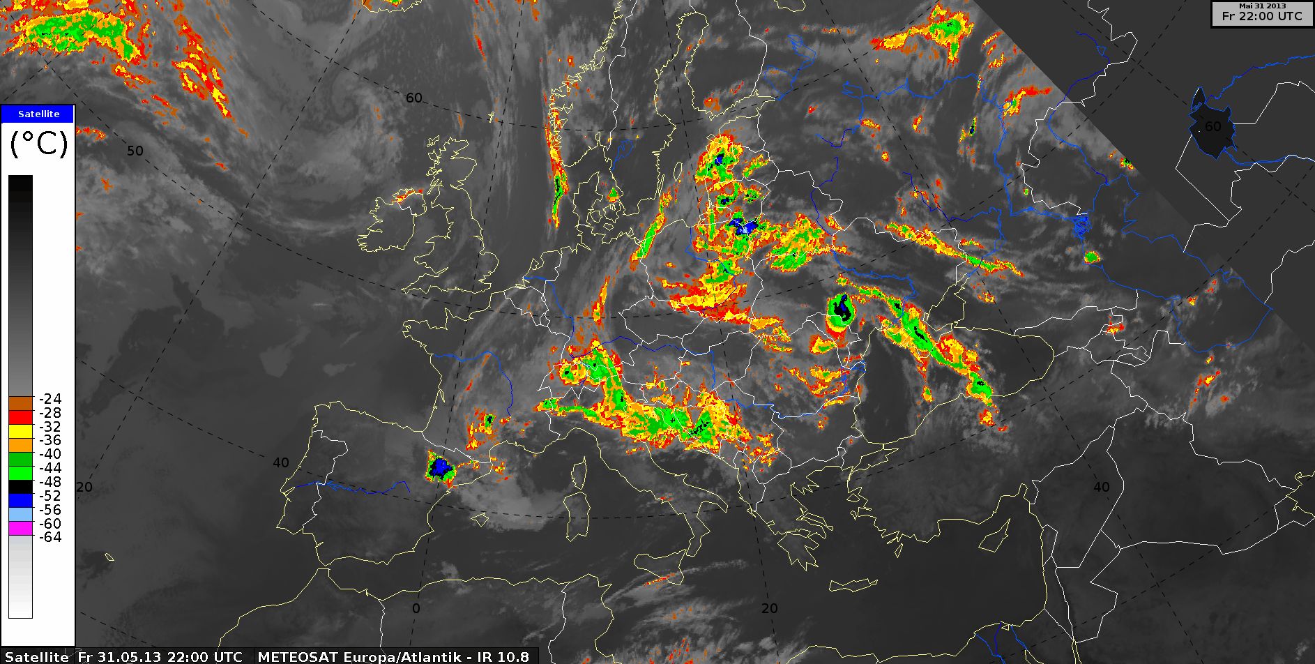
IR10.8 enhanced, 31 May 2013, 00 UTC - 23 UTC (Source: DWD)
Airmass RGB, 31 May 2013, 00 UTC - 23 UTC (Source: DWD)
Dust RGB, 31 May 2013, 00 UTC - 23 UTC (Source: DWD)
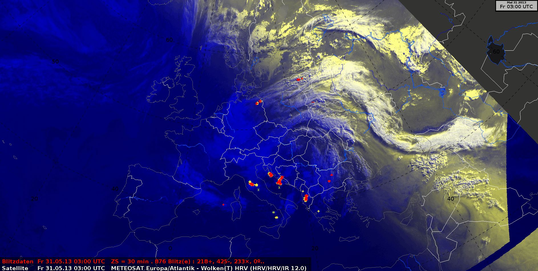
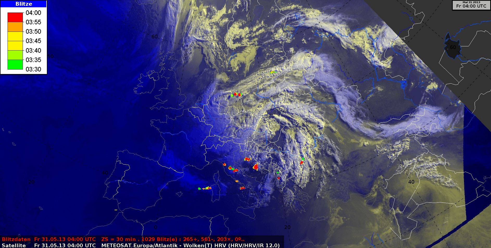
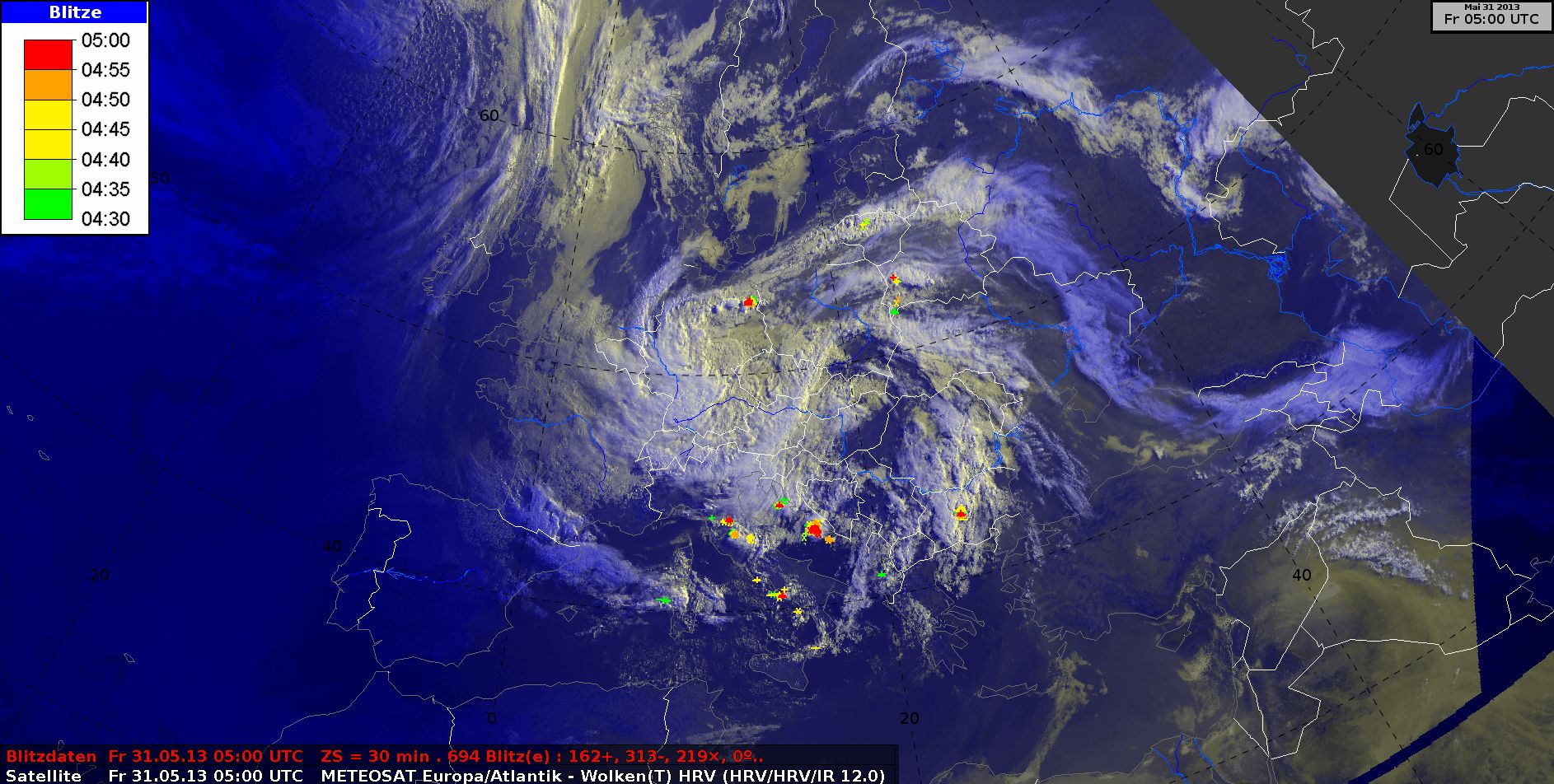
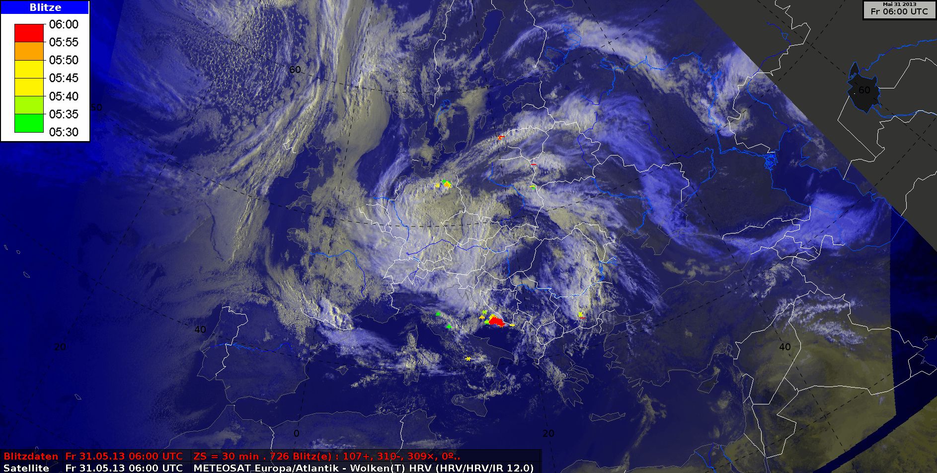
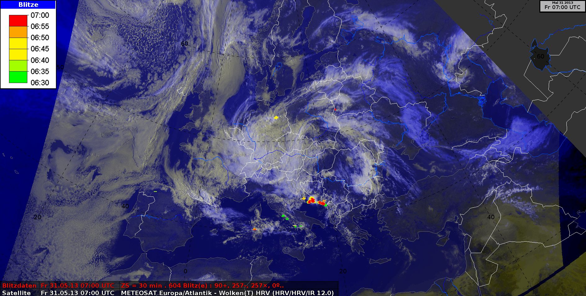
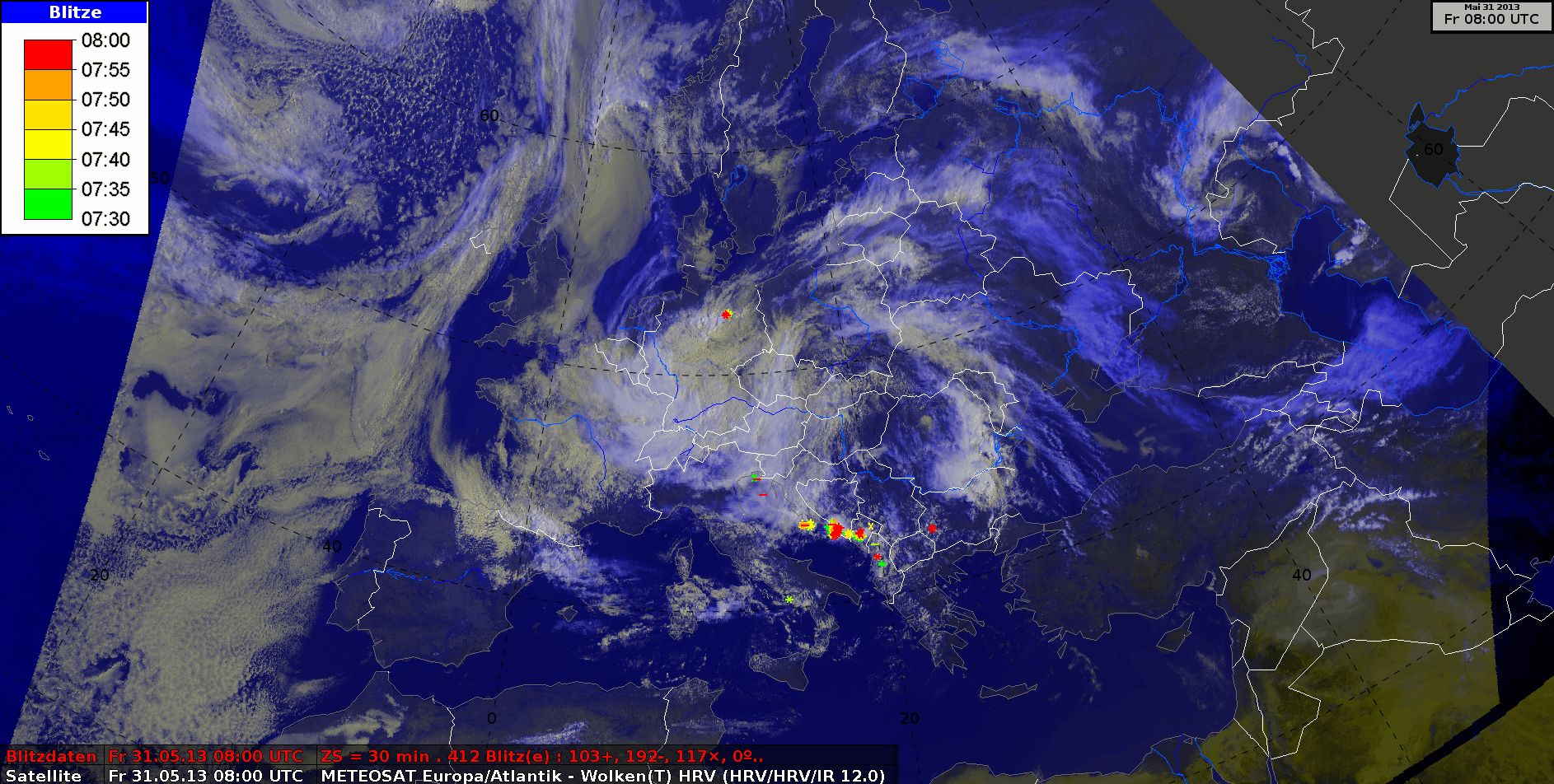
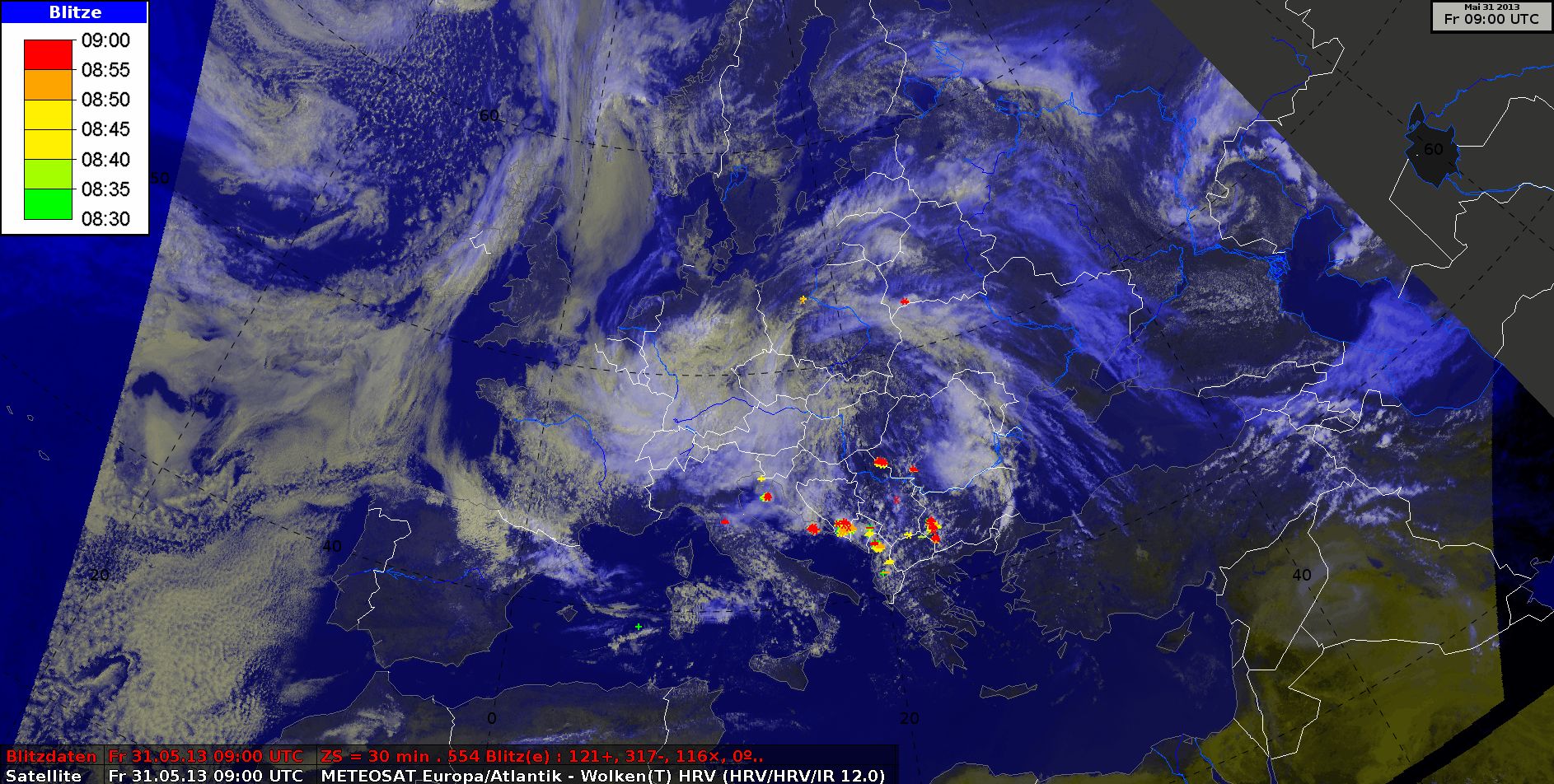
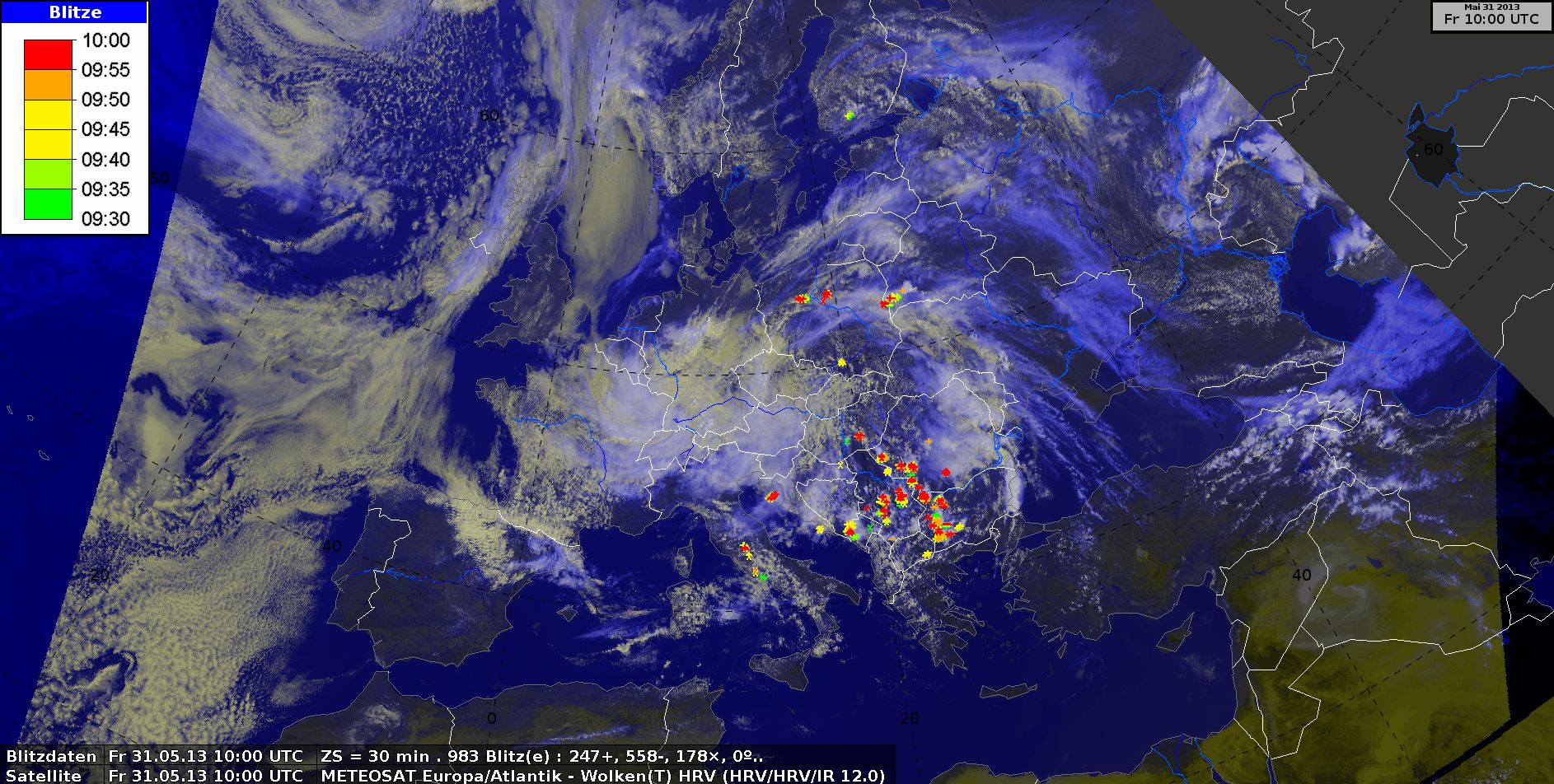
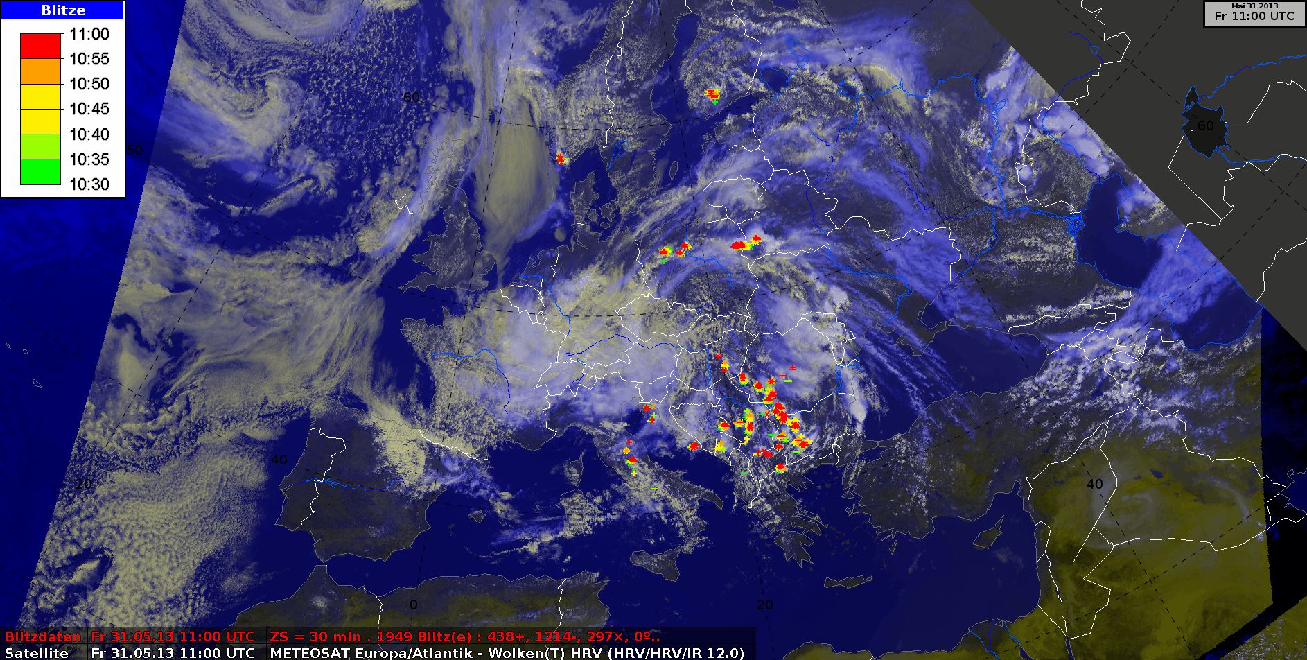
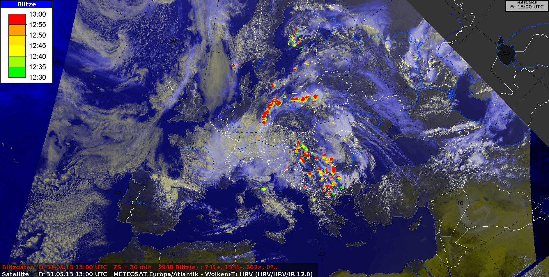
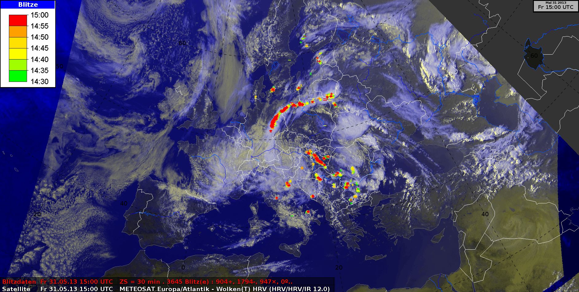
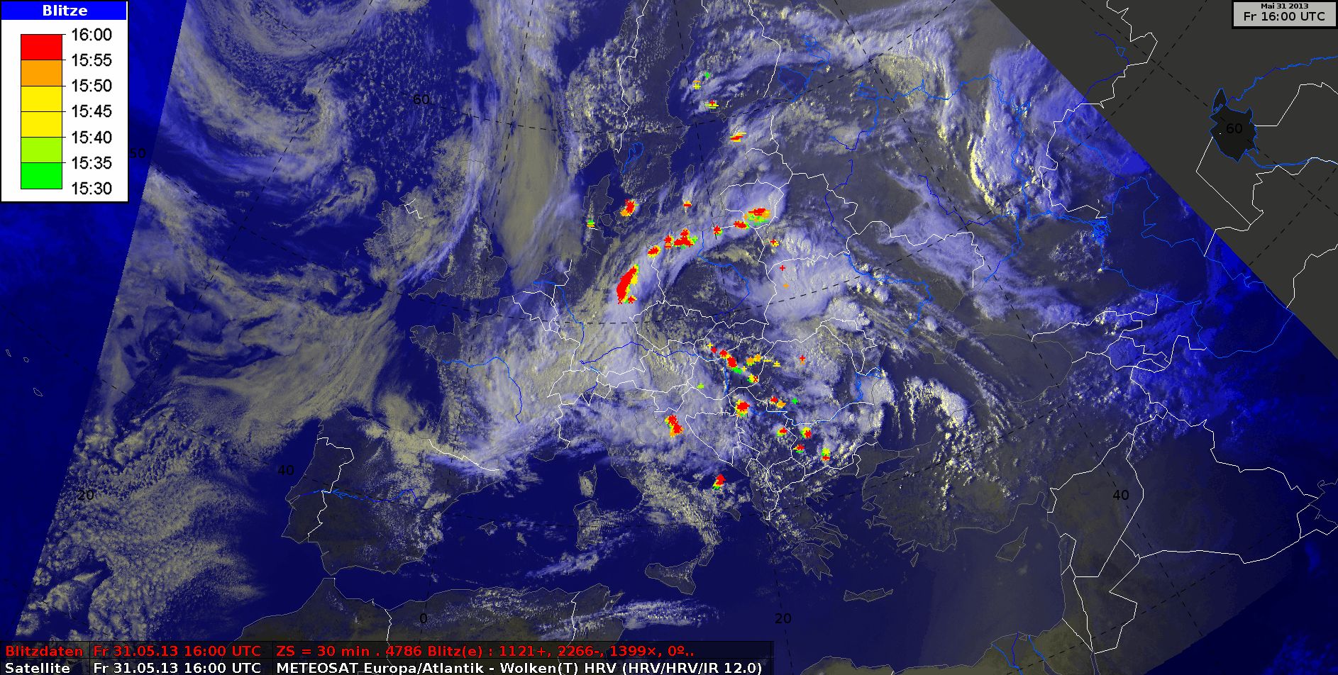
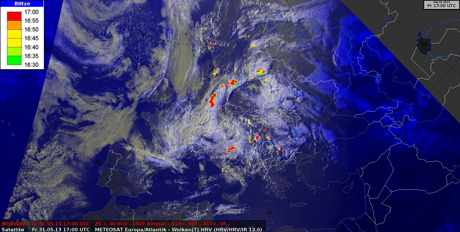
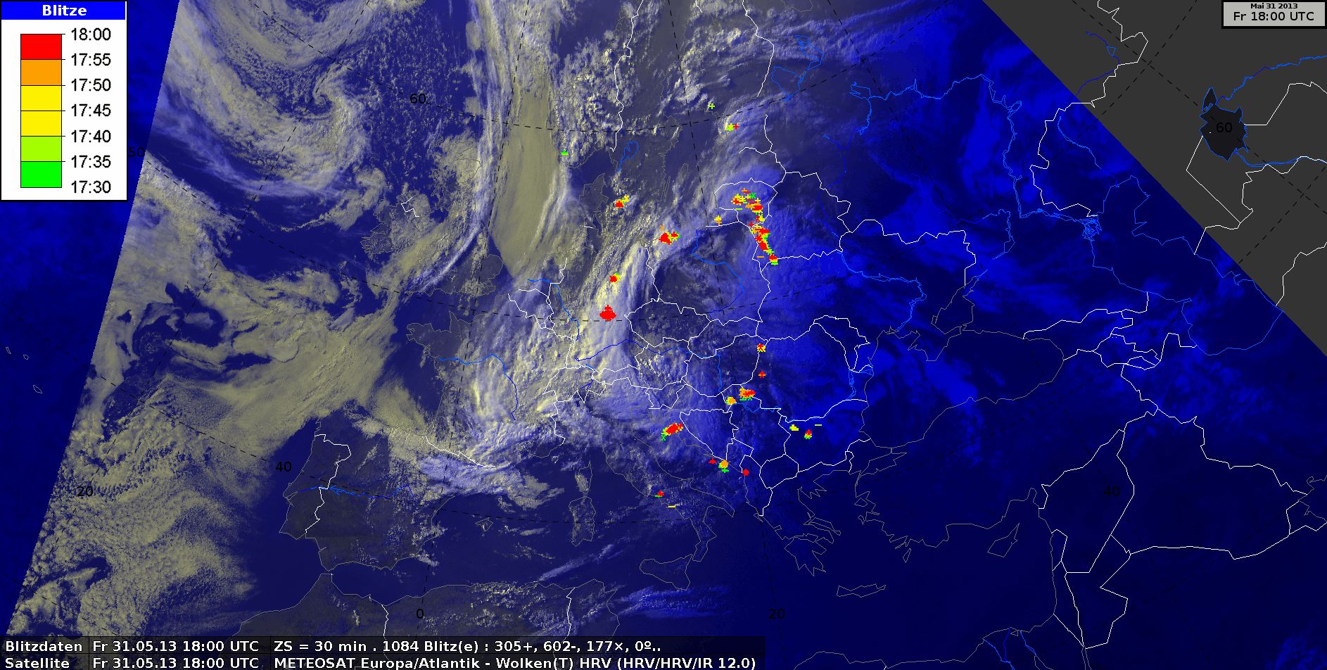
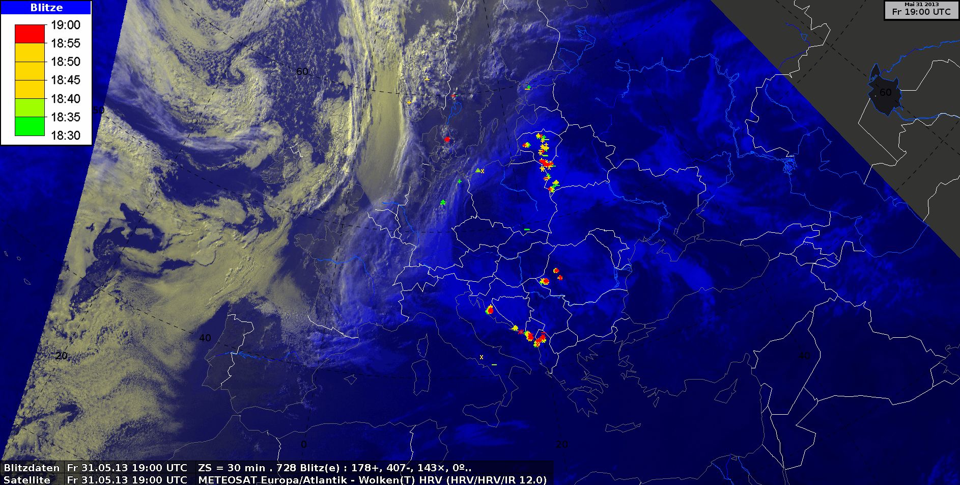
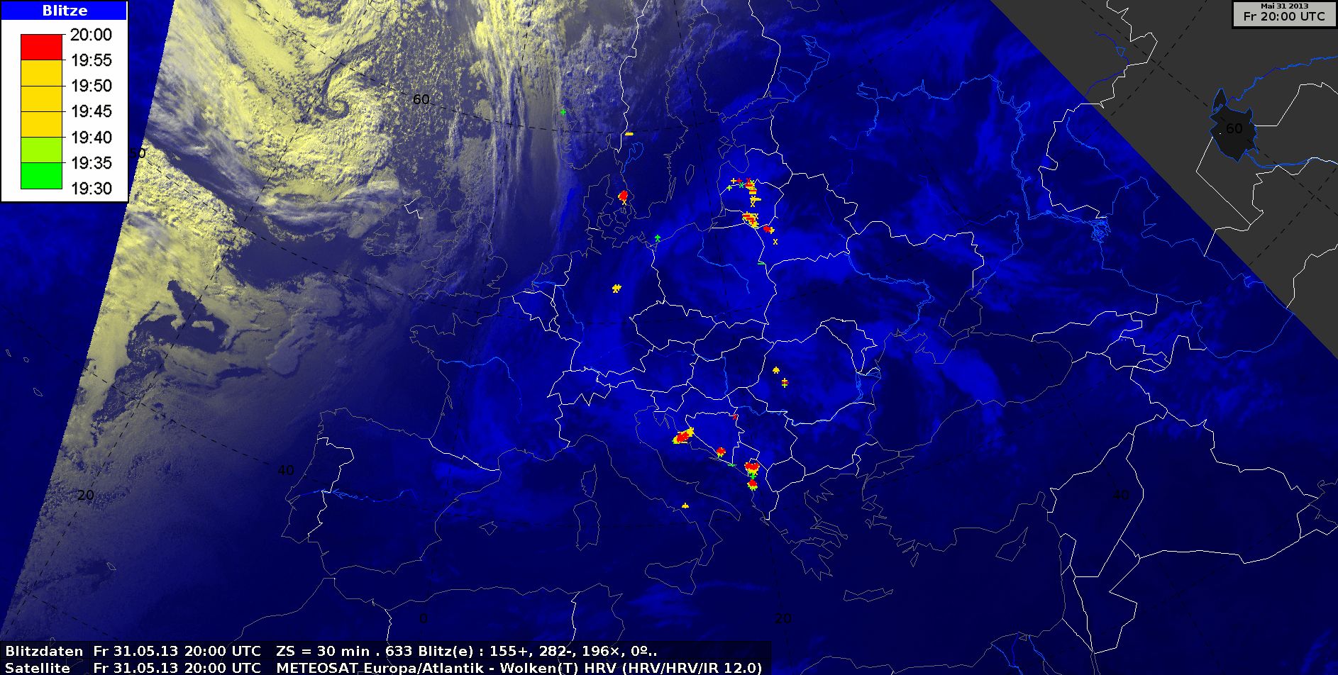
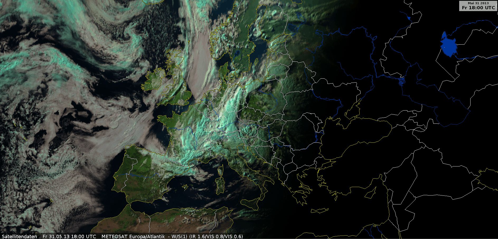
HRV Cloud RGB with Lighting, 31 May 2013, 00 UTC - 23 UTC (Source: DWD)
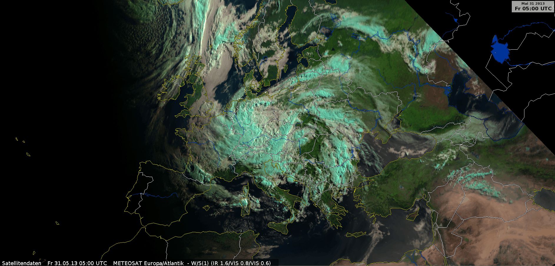
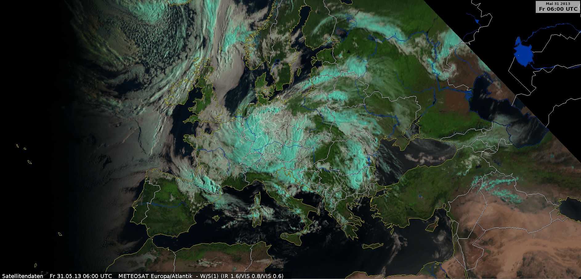
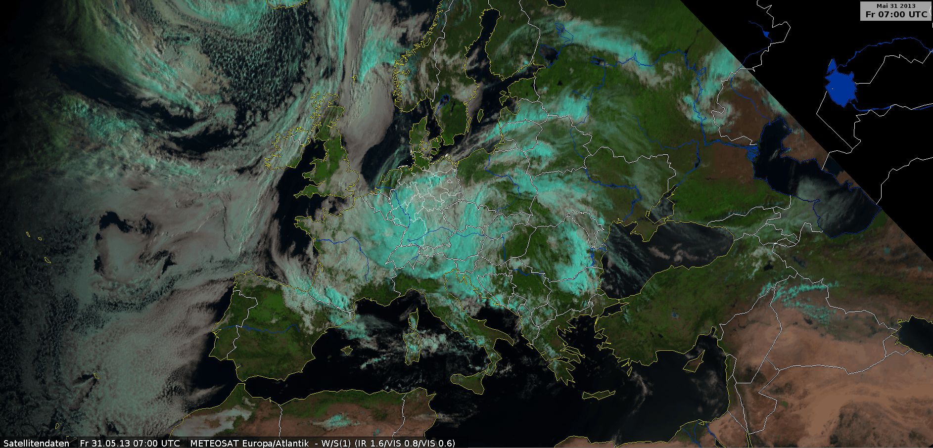
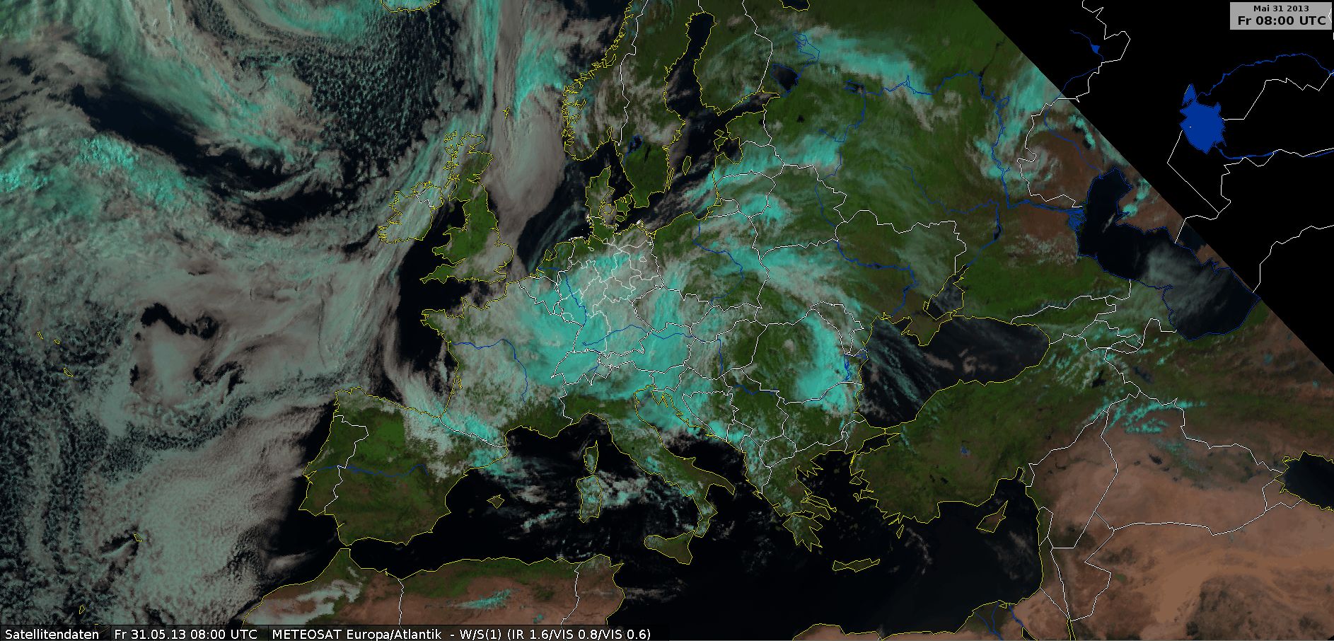
Natural Colour RGB, 31 May 2013, 04 UTC - 18 UTC (Source: DWD)
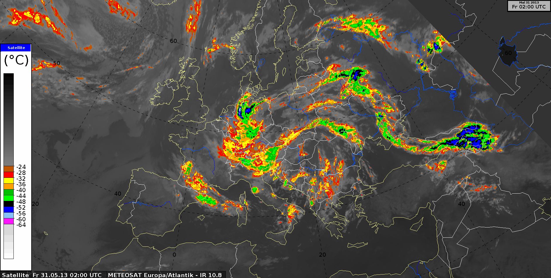
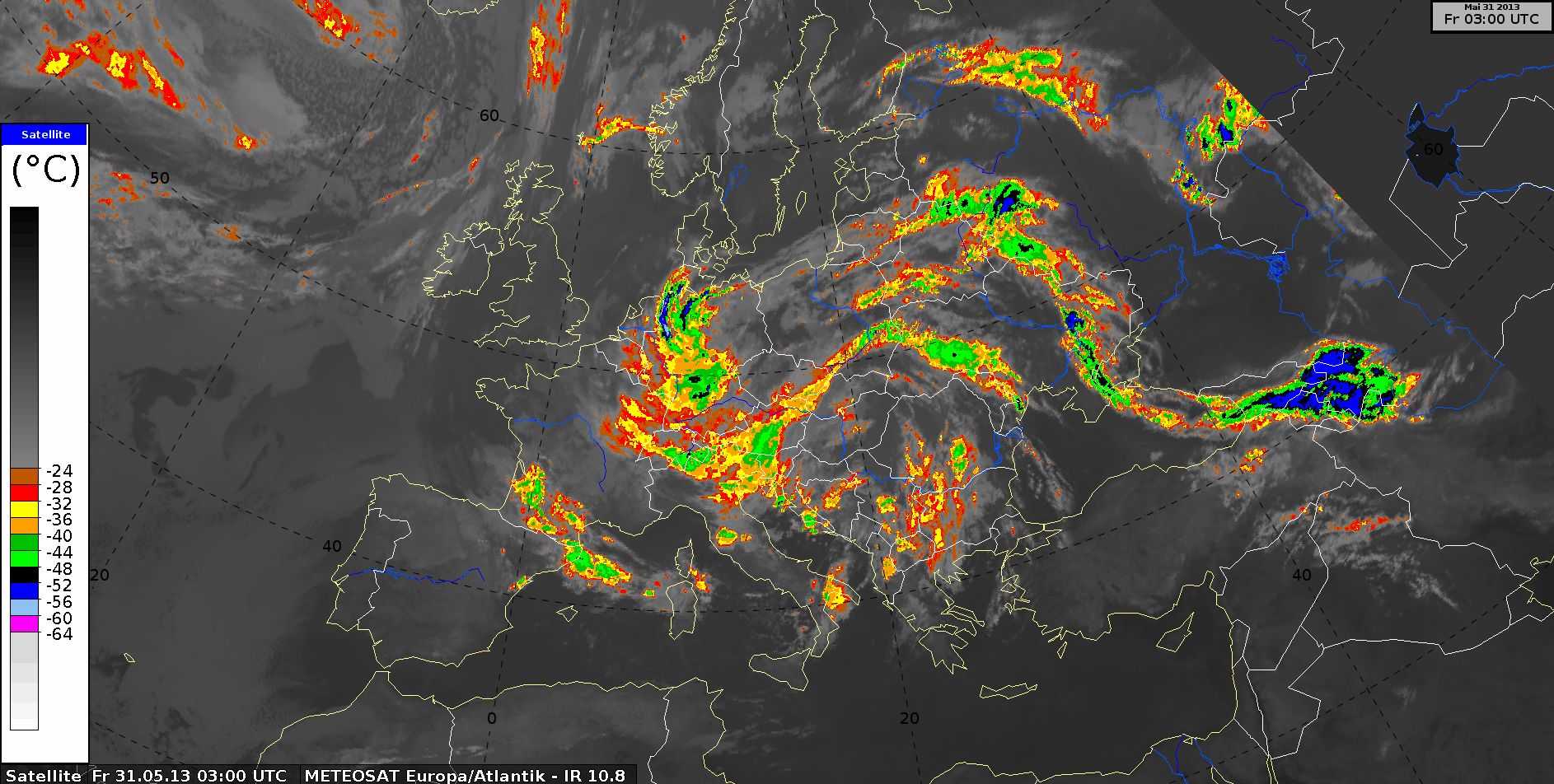
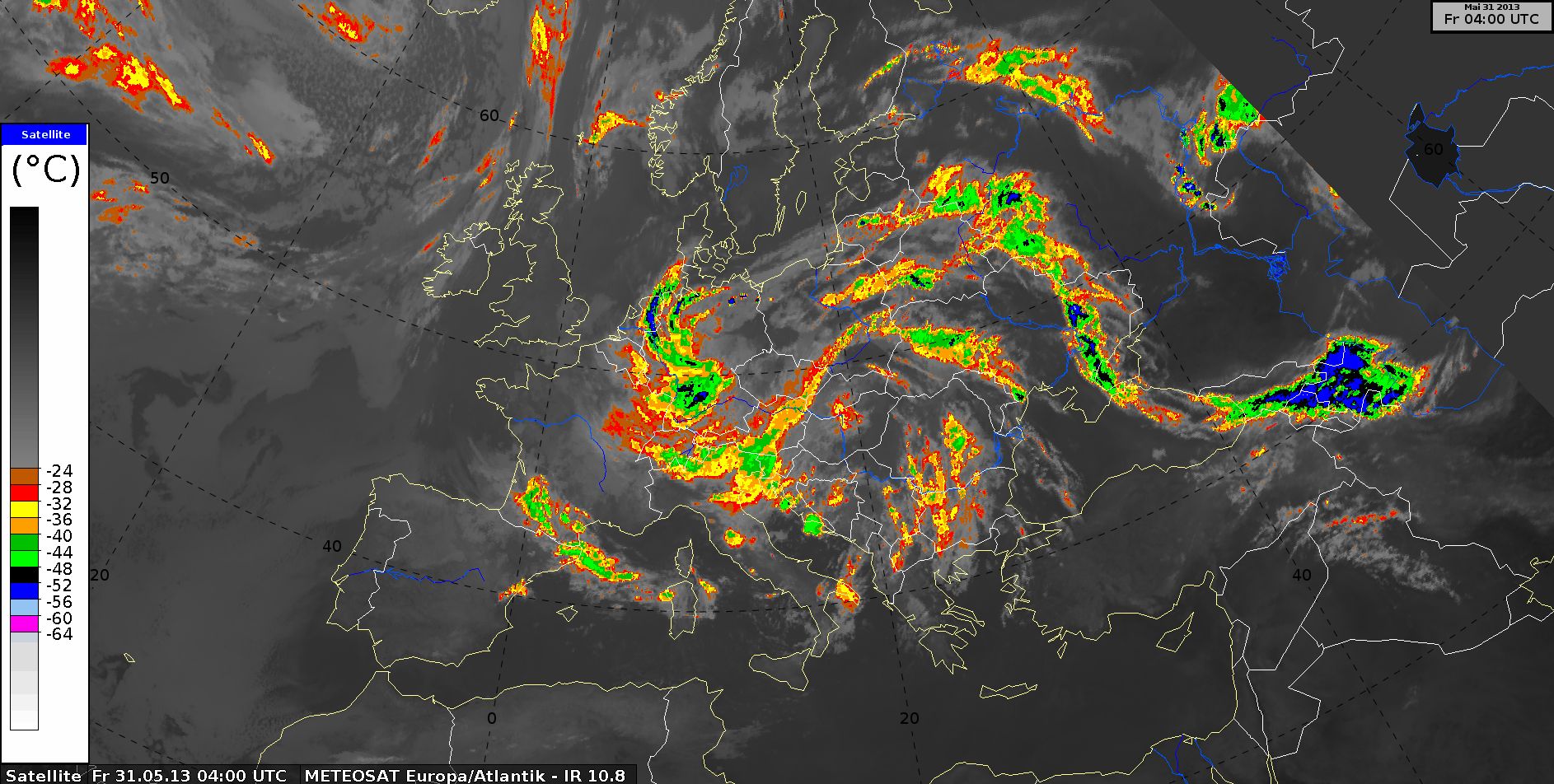
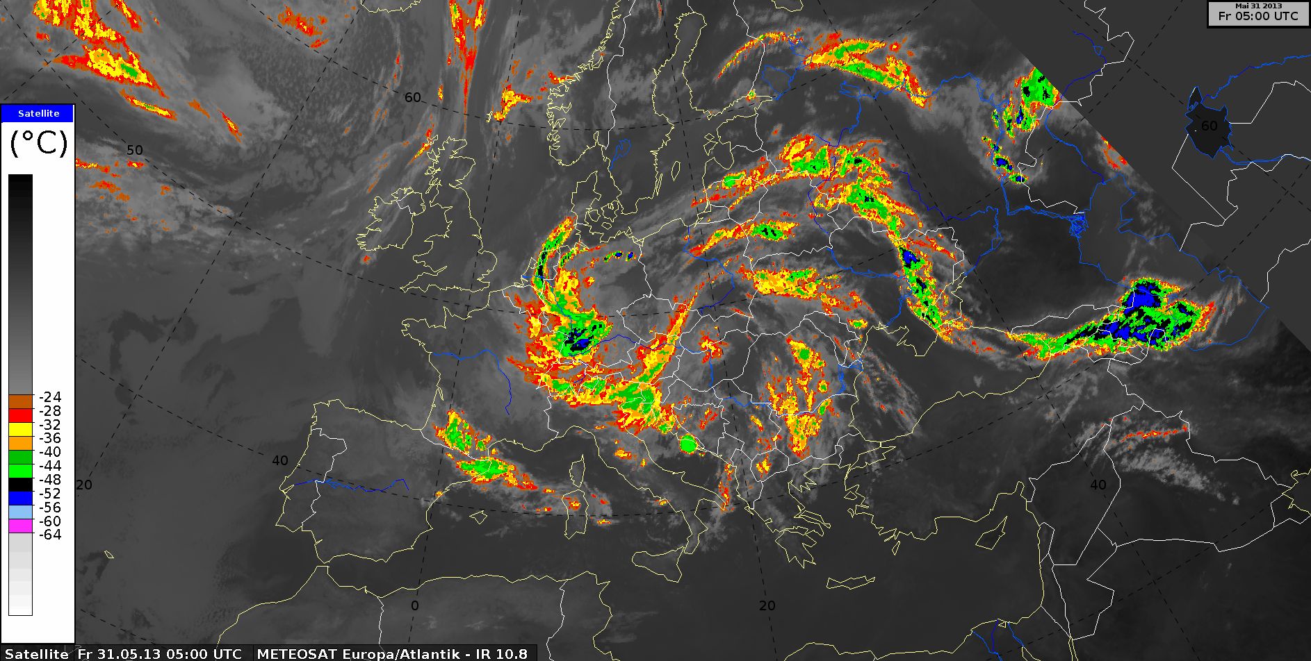
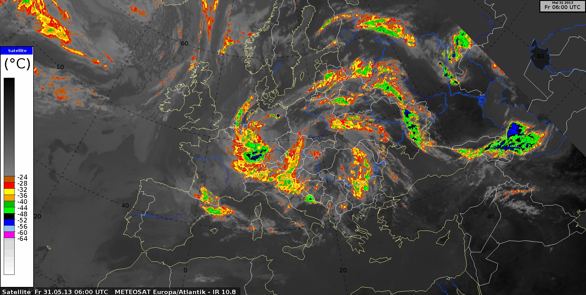
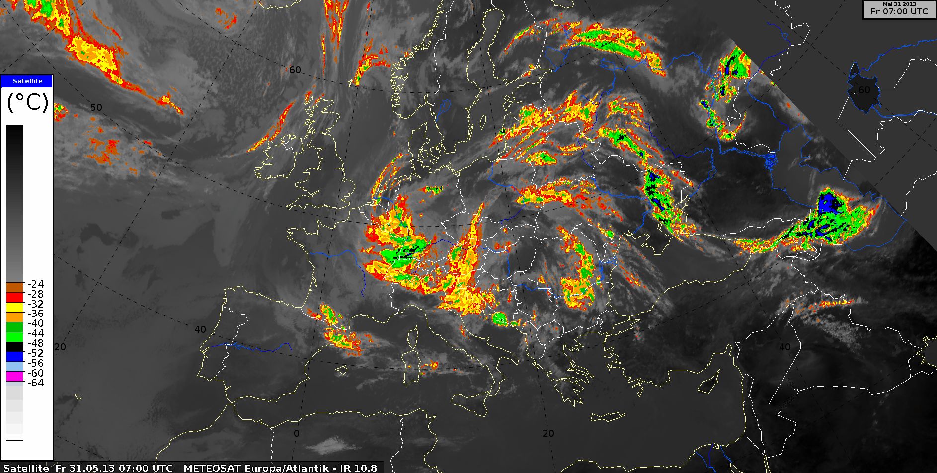
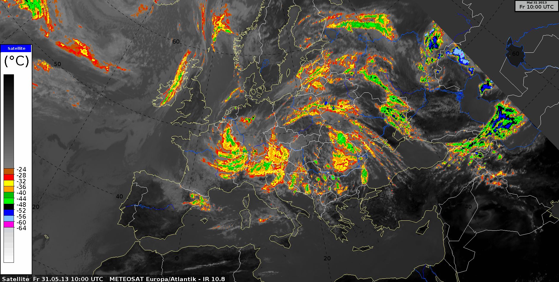
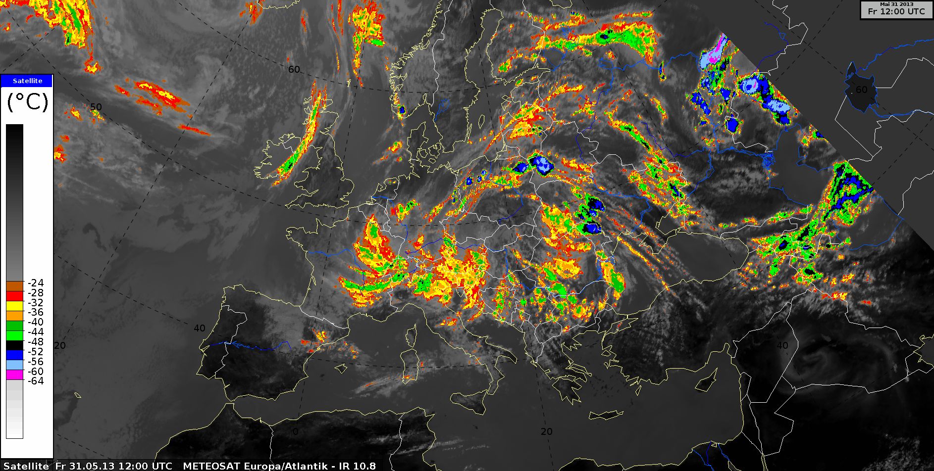
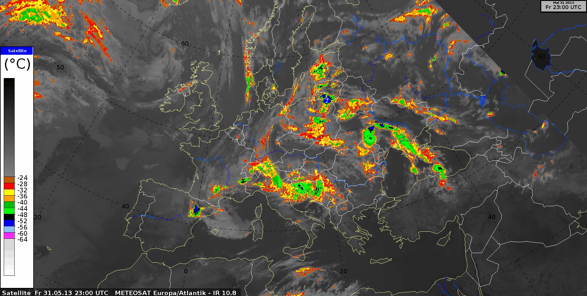
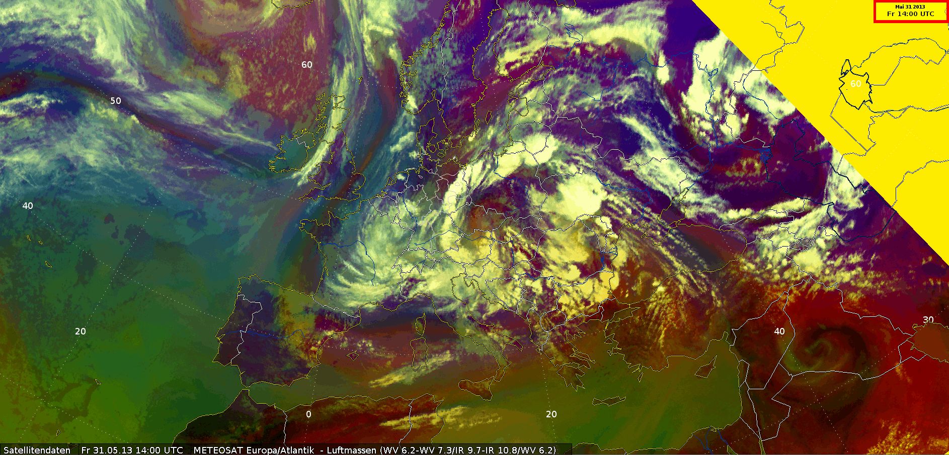
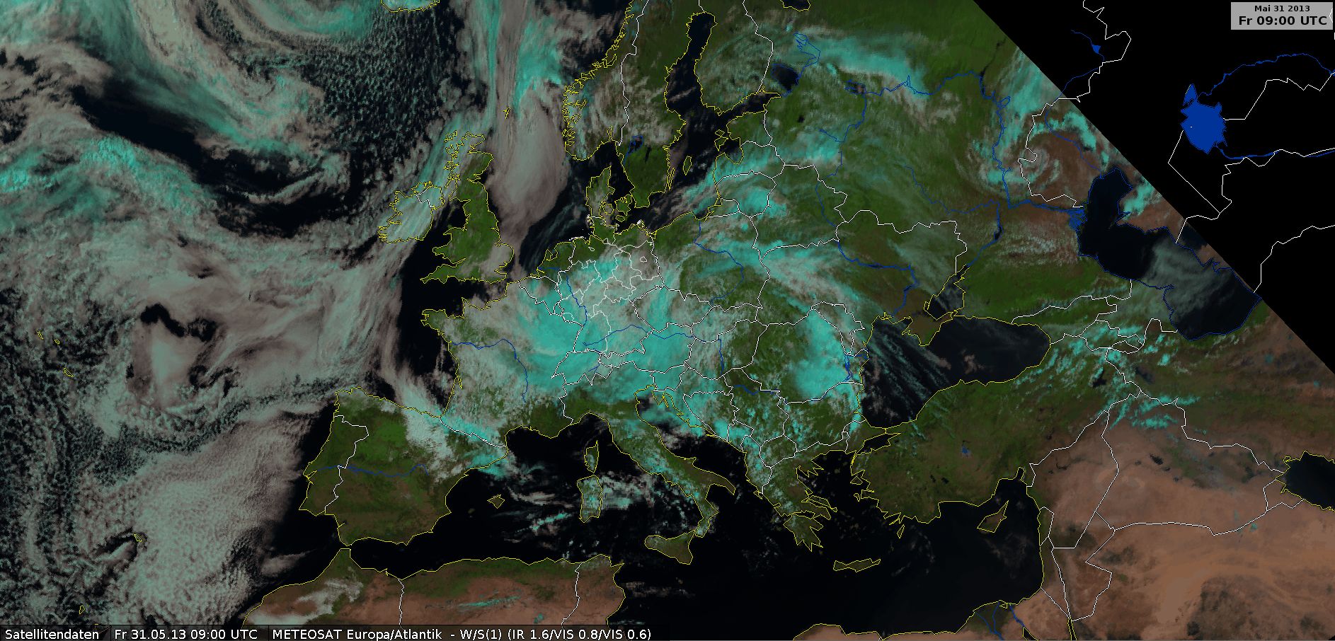
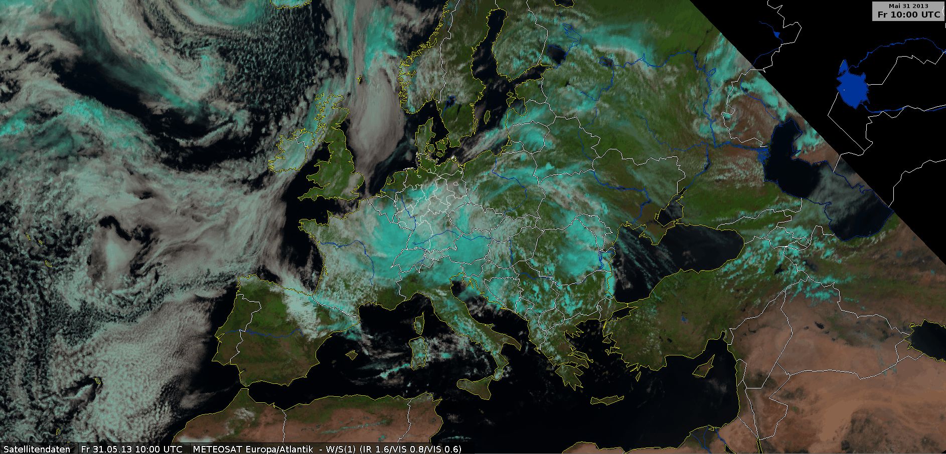
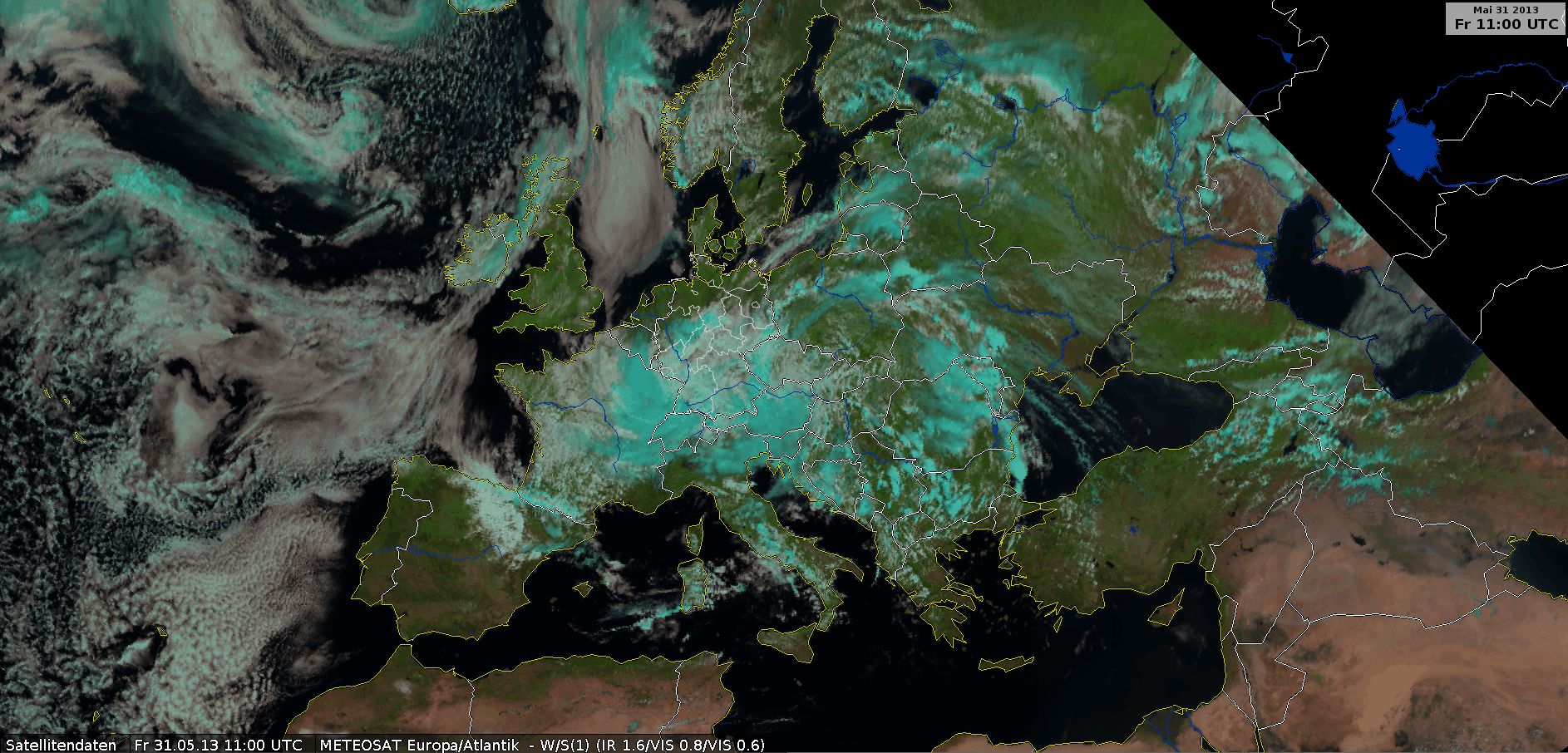
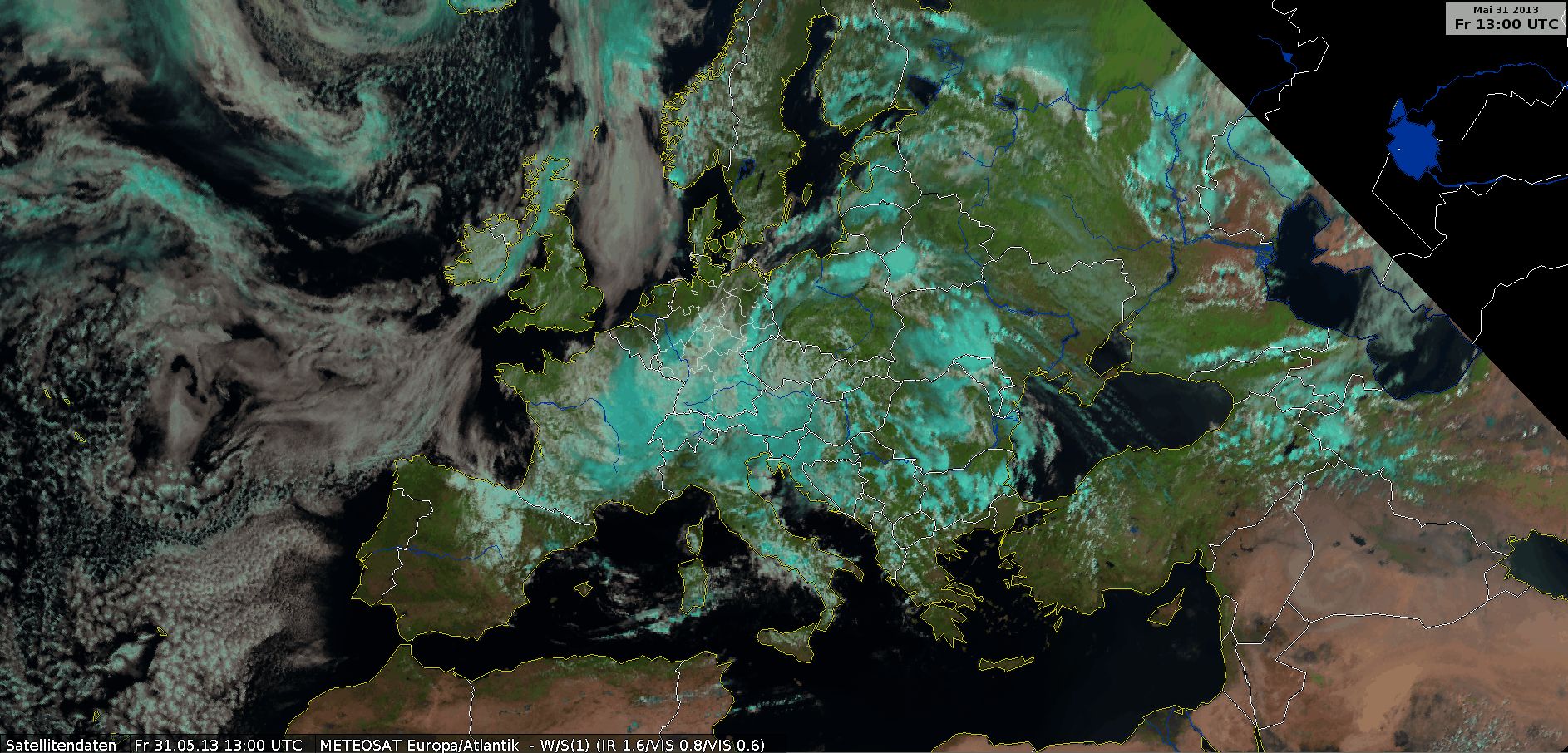
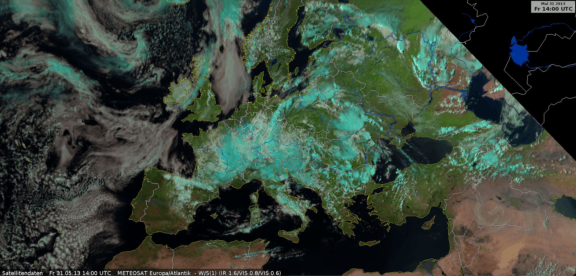
IR10.8 enhanced
IR10.8 enhanced, 31 May 2013, 00 UTC - 23 UTC (Source: DWD)
This image highlights cold cloud tops below -25°C. The development of the thunderstorms is clear along the warm front around 15:00 UTC. The cloud top temperature in east Germany was below -60°C. The colder temperatures also show nighttime convection clearly.
The disadvantage of this image type is that warmer cloud tops are also depicted in shades of grey. The following RGB images are useful for learning more about cloud structure.
The
radio sounding
from Bergen (ca. 100 km south of Hamburg in northern Germany) shows warm air advection between 1 km and 2 km from the ground. The next sounding shows greater instability because of this warm advection, which could be the mechanism behind the thunderstorms that developed in the warm front in the afternoon.
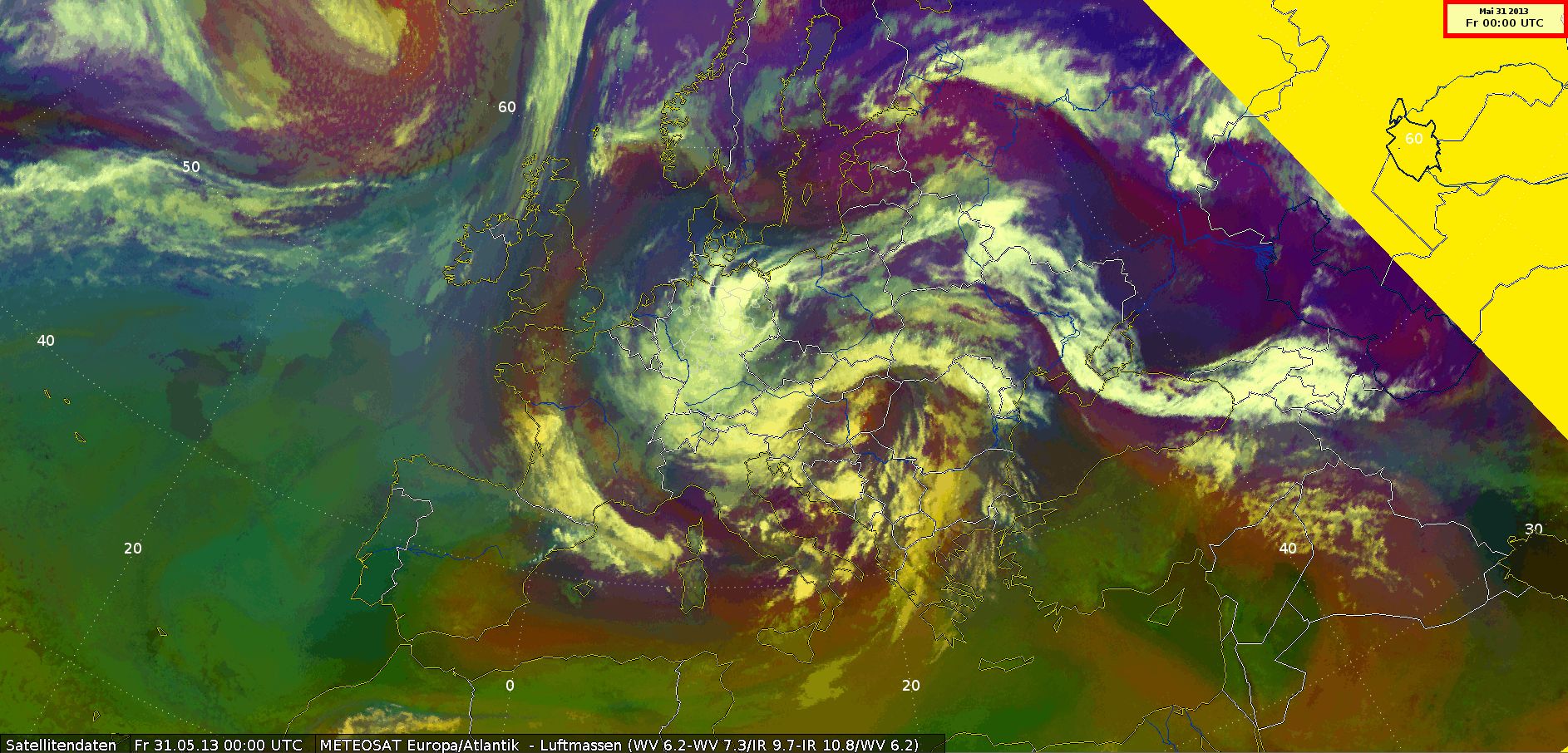
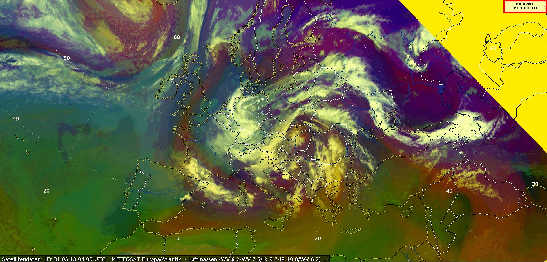
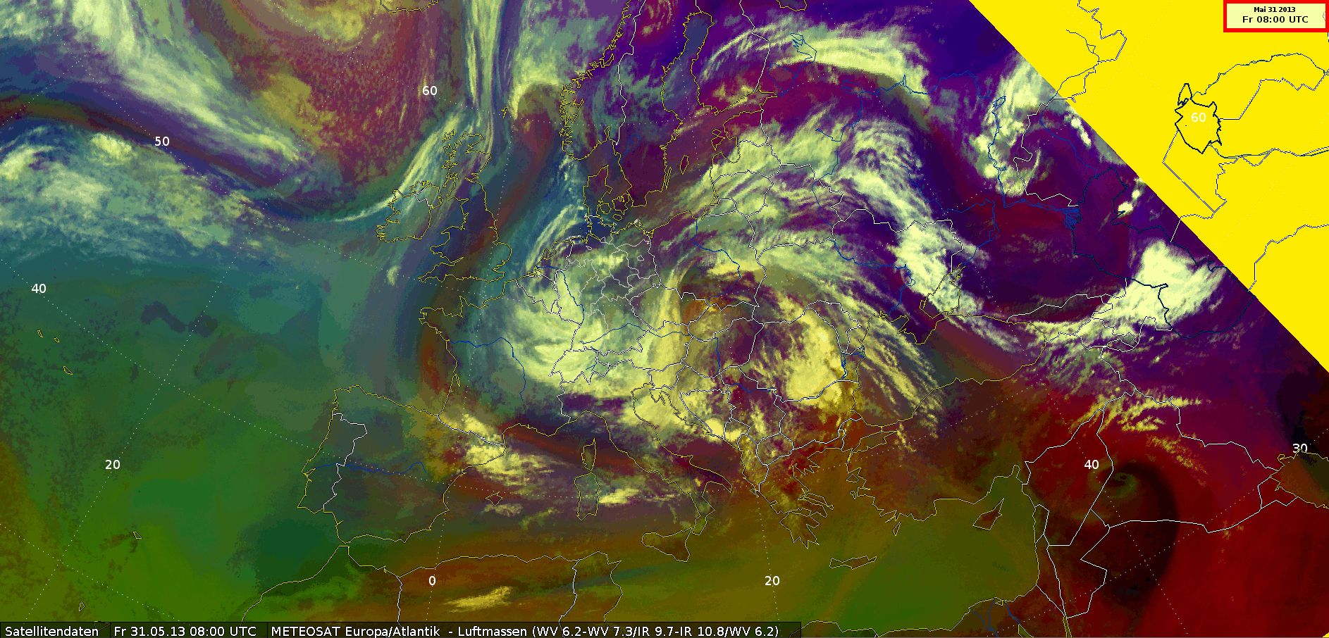
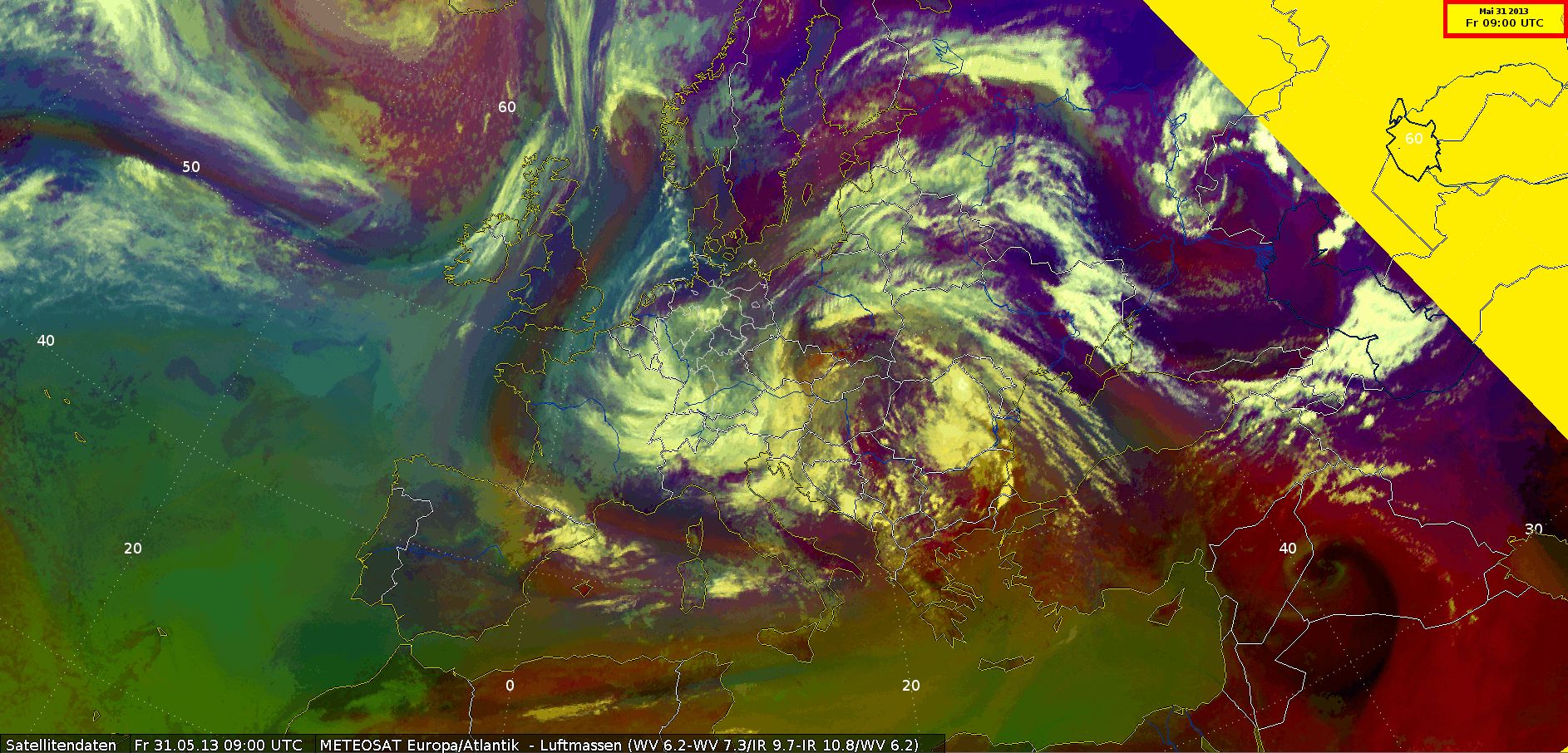
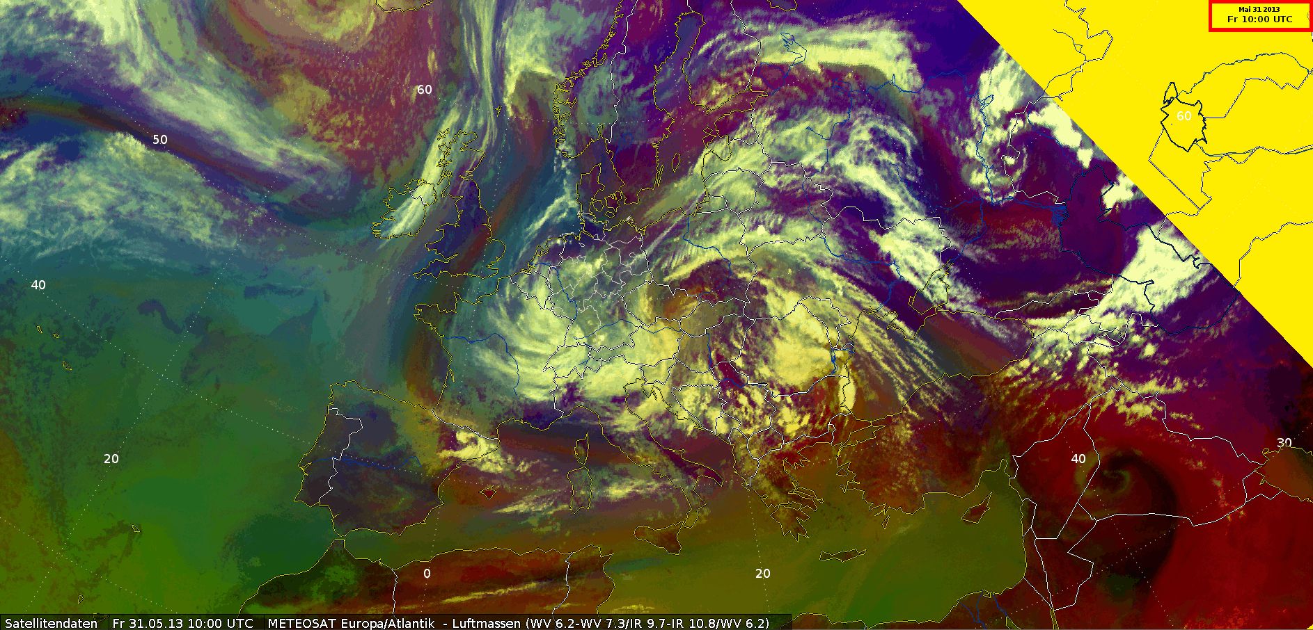
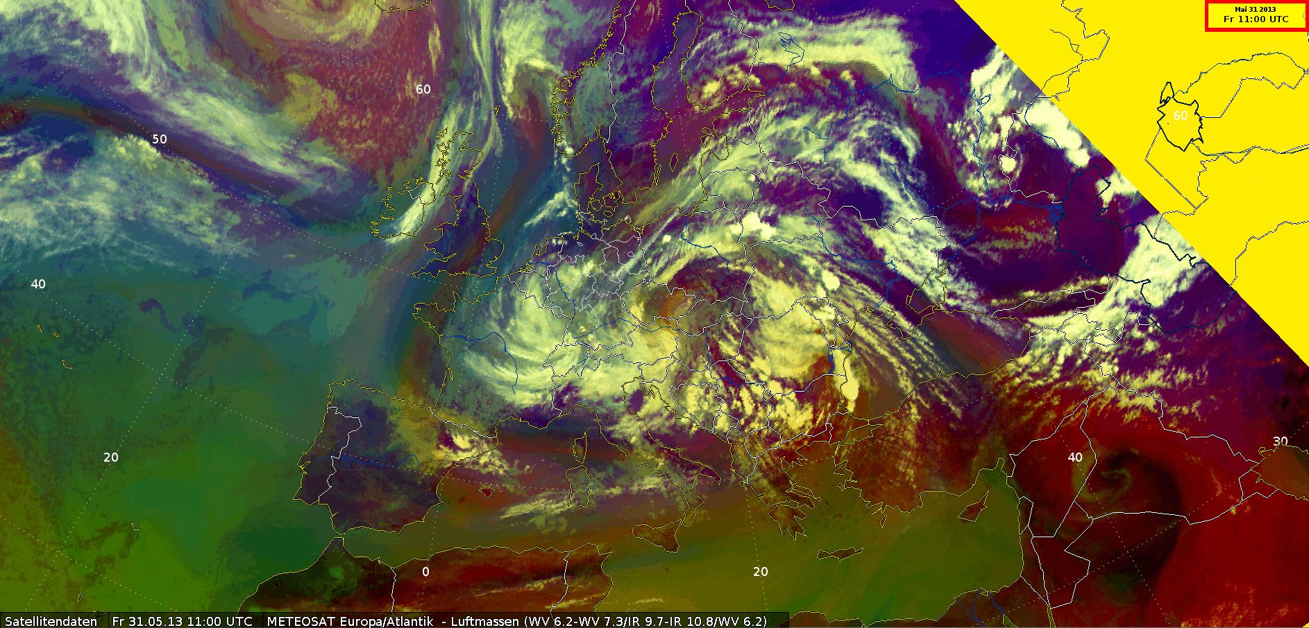
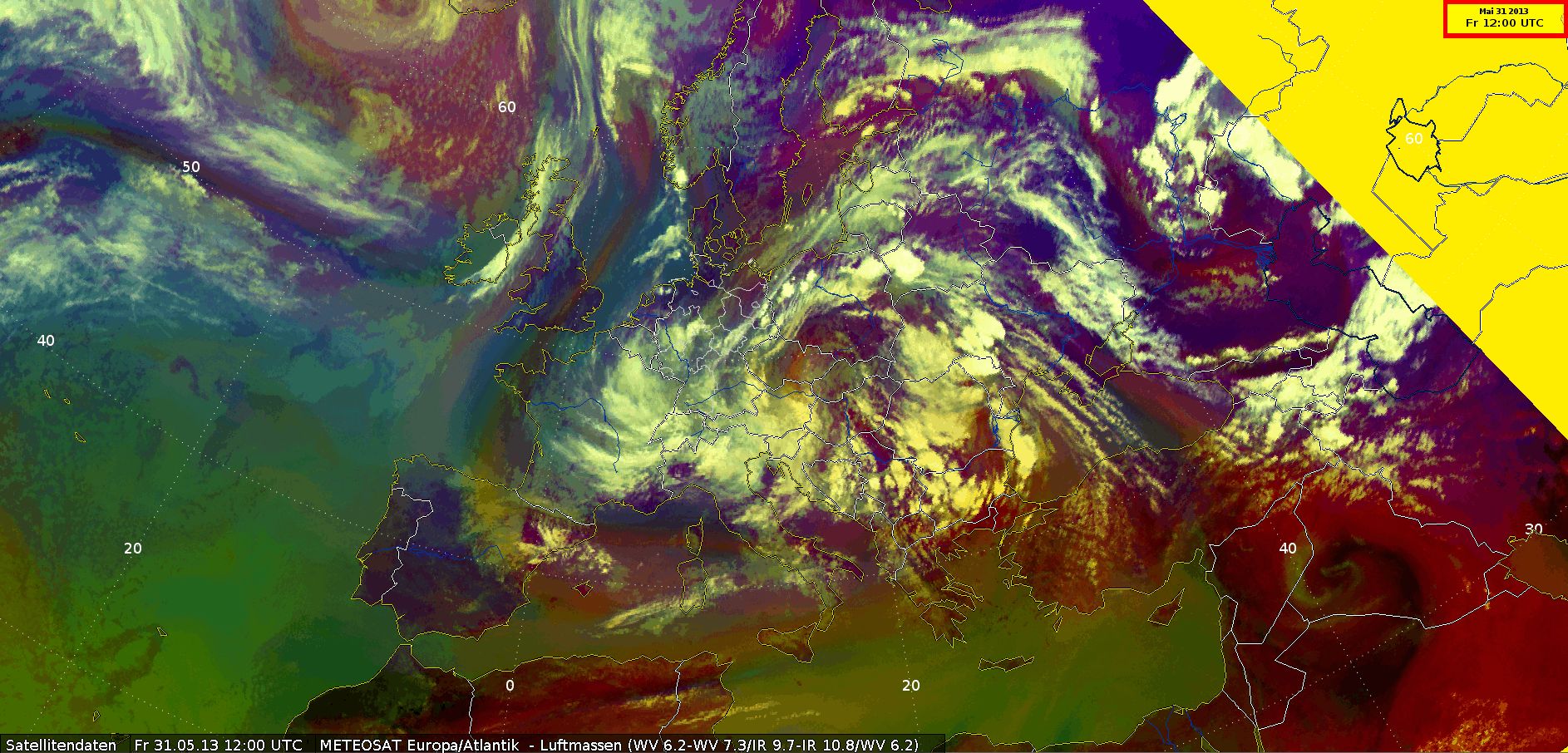
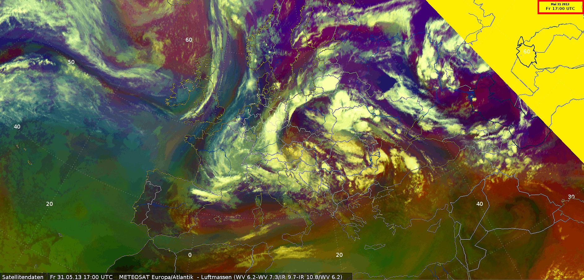
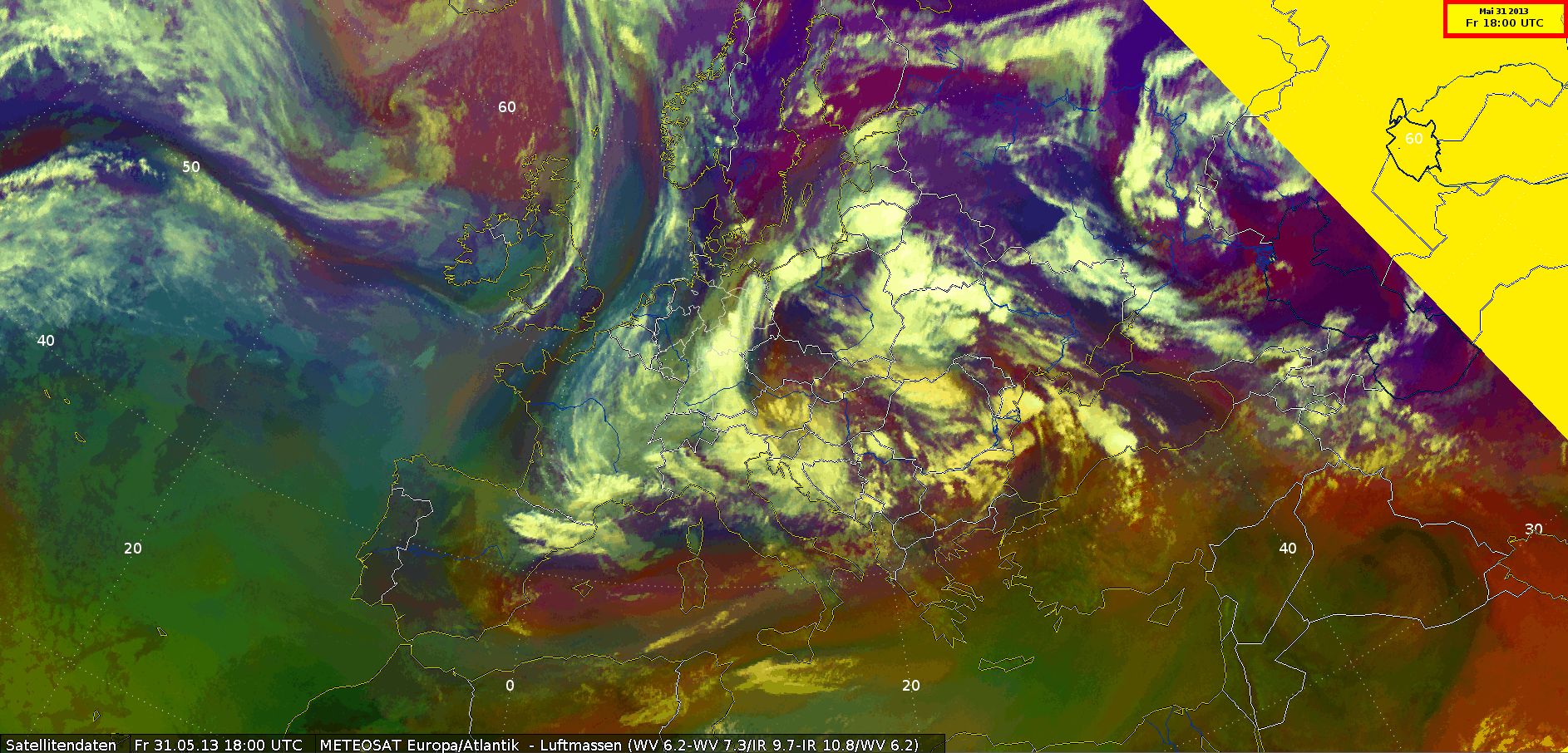
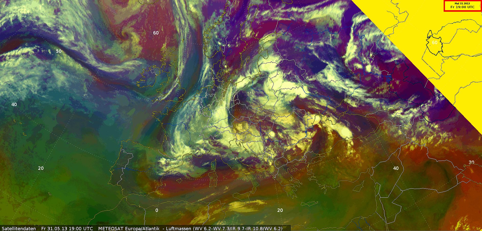
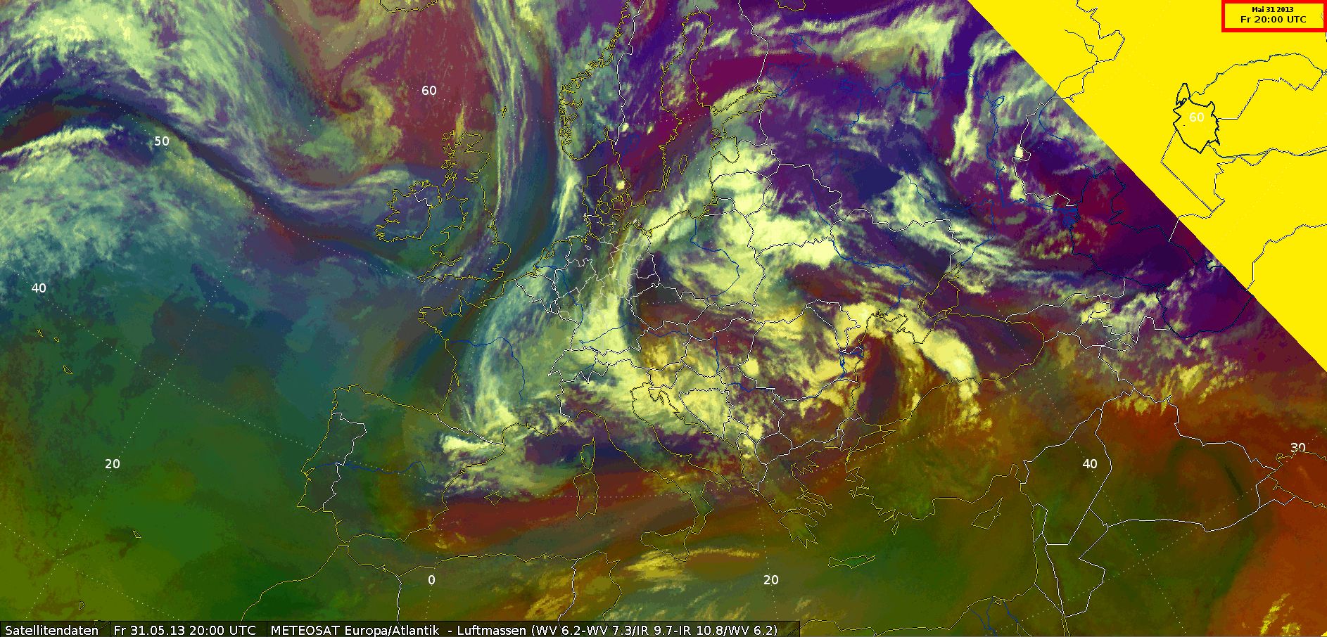
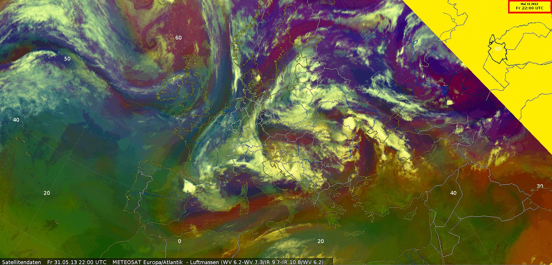
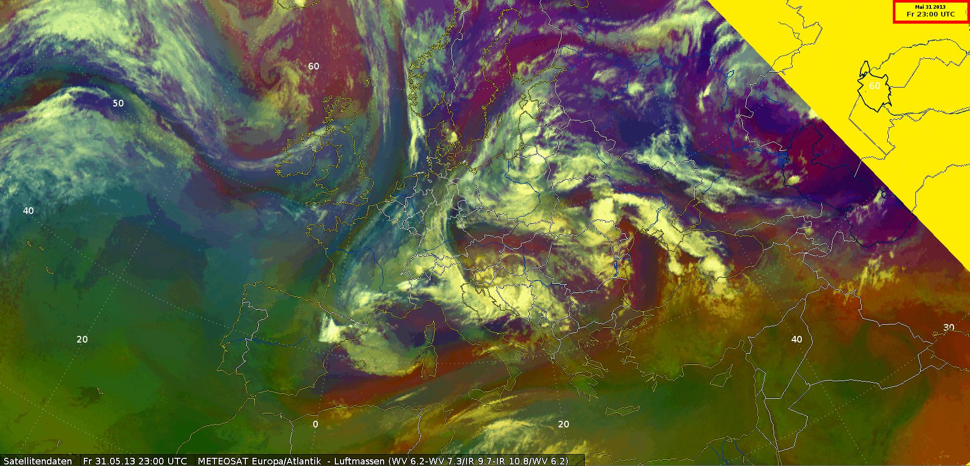
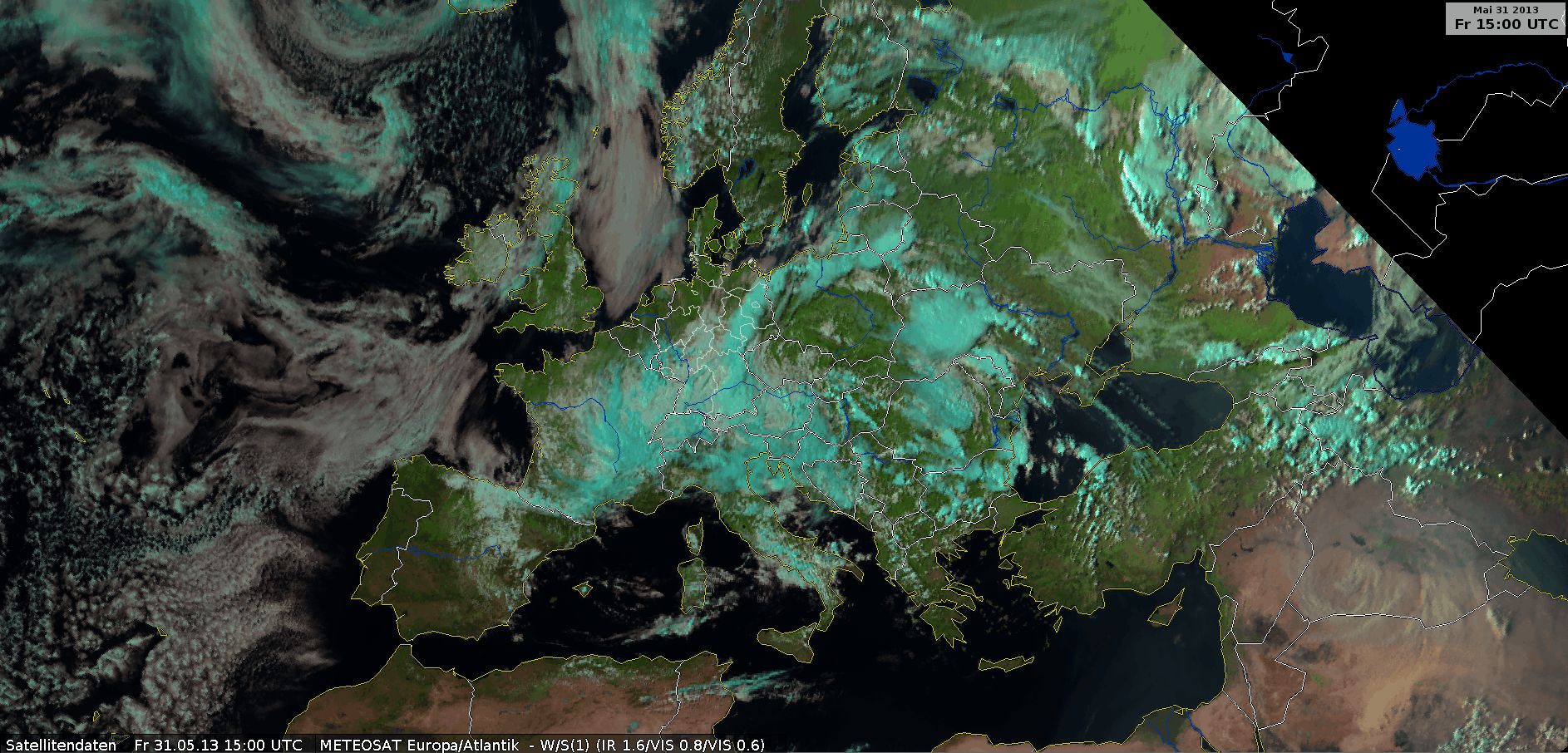
Airmass RGB
Airmass RGB, 31 May 2013, 00 UTC - 23 UTC (Source: DWD)
The difference between the high cumulonimbus clouds in white and the lower clouds is easy to see. We can see the change and swirl of the different air masses. Greenish-red warm air moves north from the Black Sea while cold air moves south over France. There was a small area with dry descending stratospheric air in the center of the low in the afternoon, depicted in a reddish color over the Czech Republic.
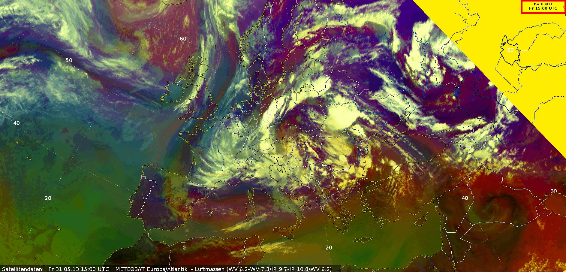
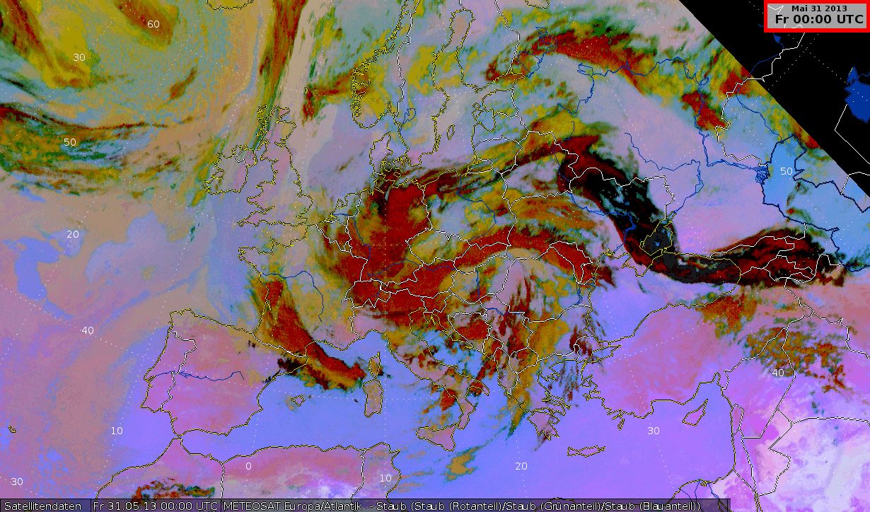
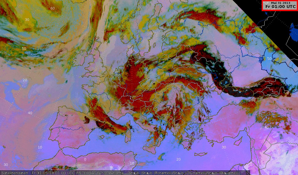
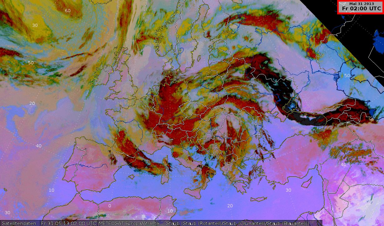
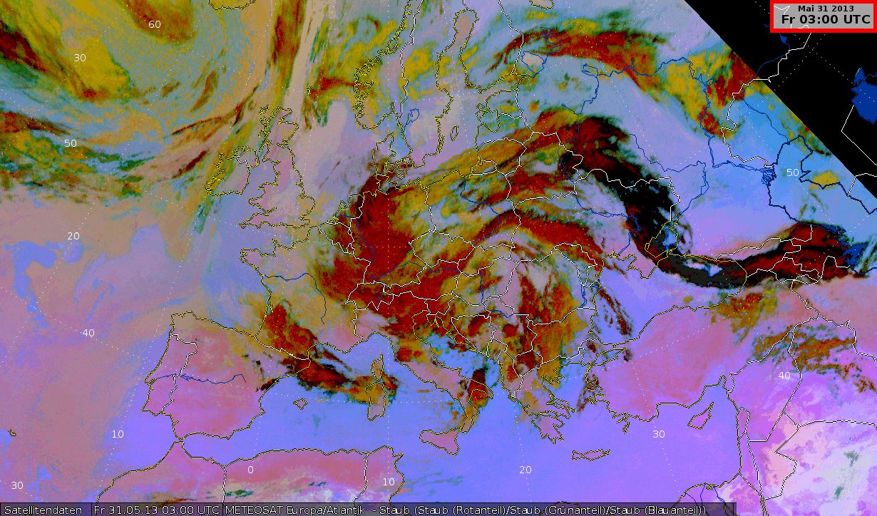
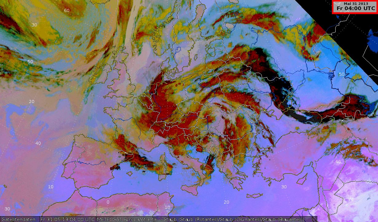
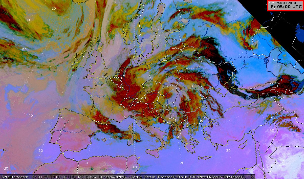
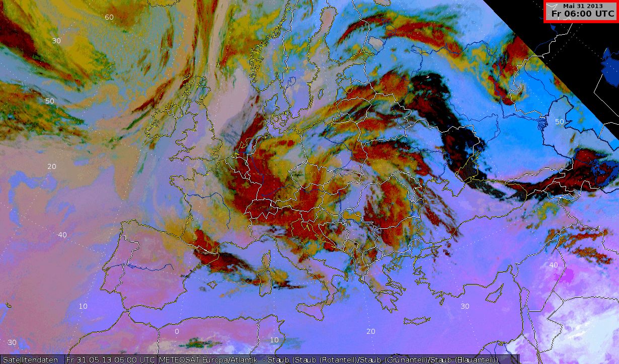
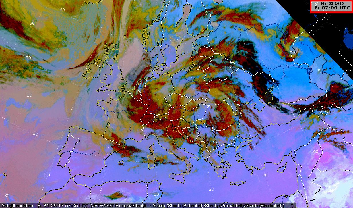
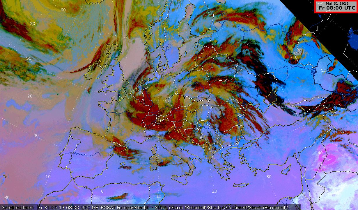
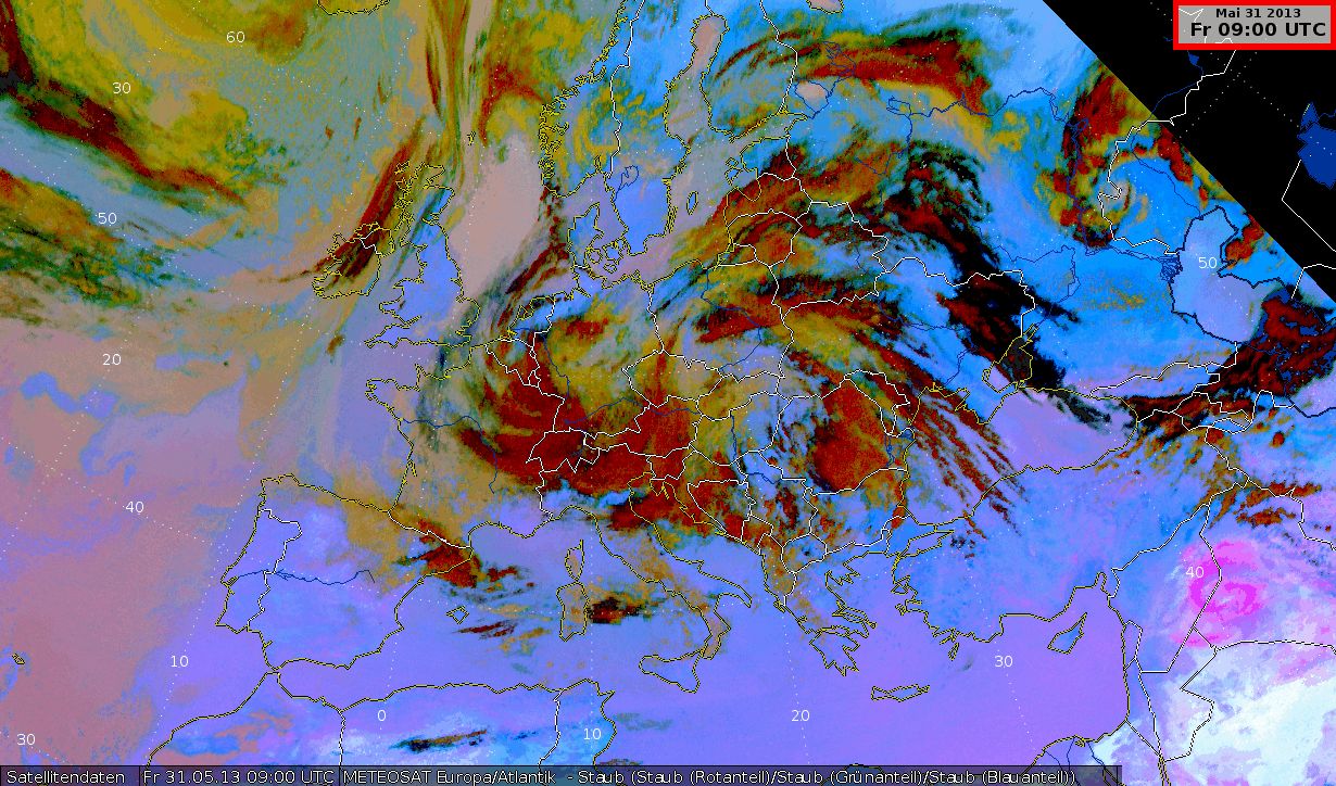
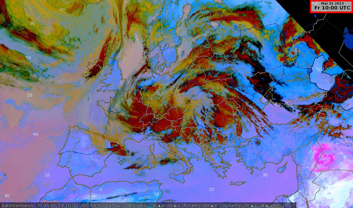
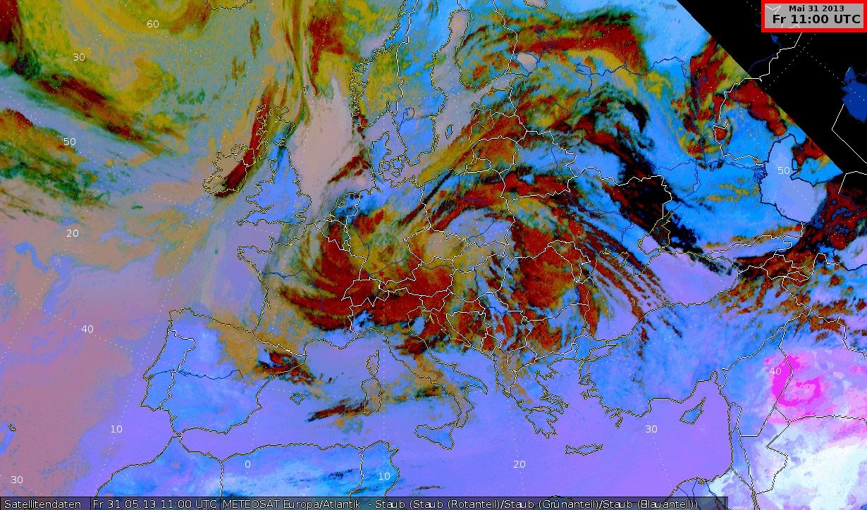
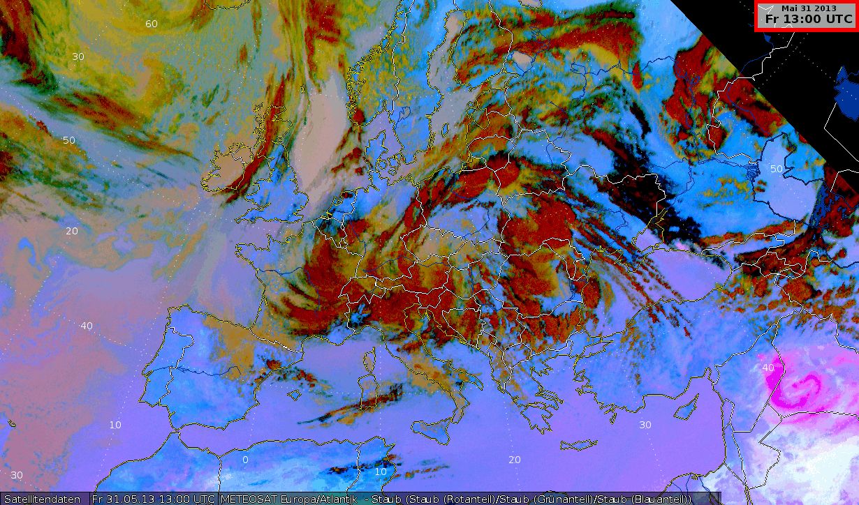
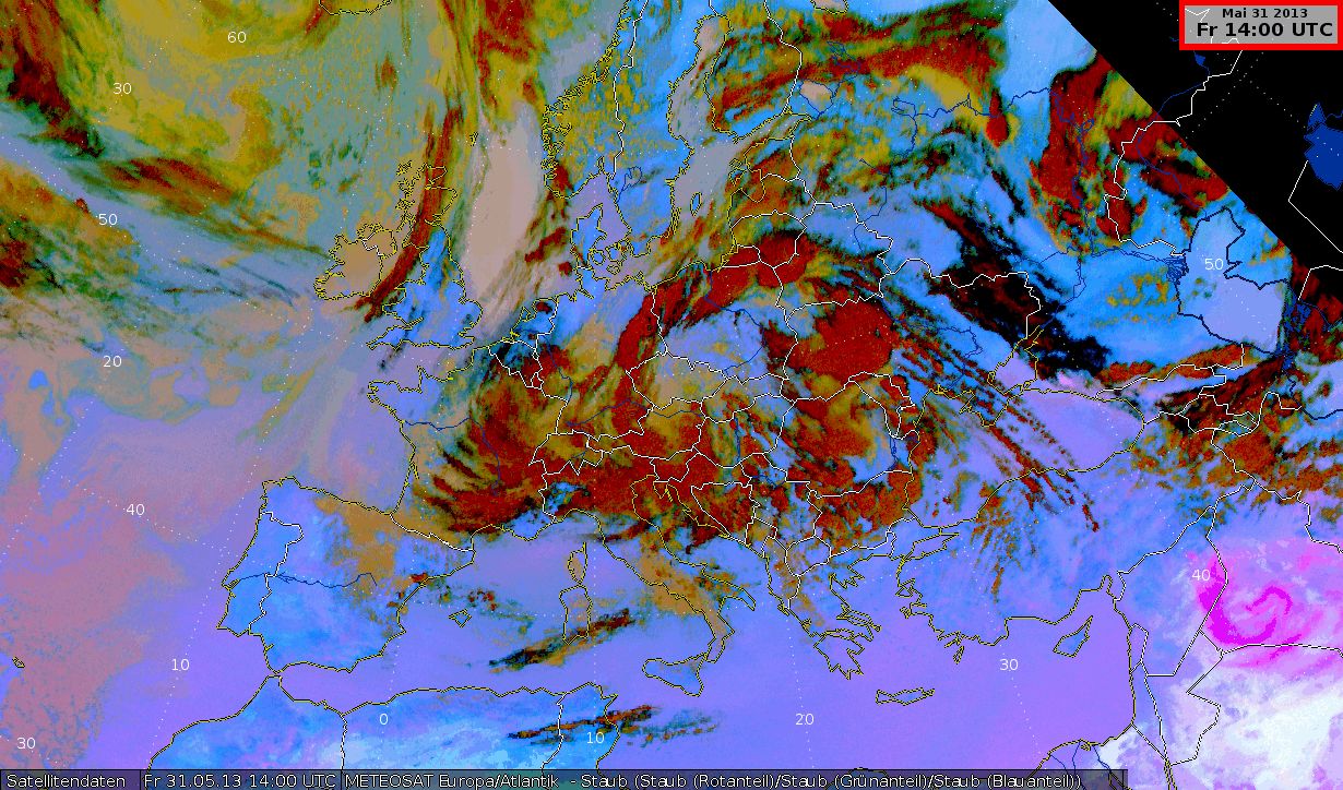
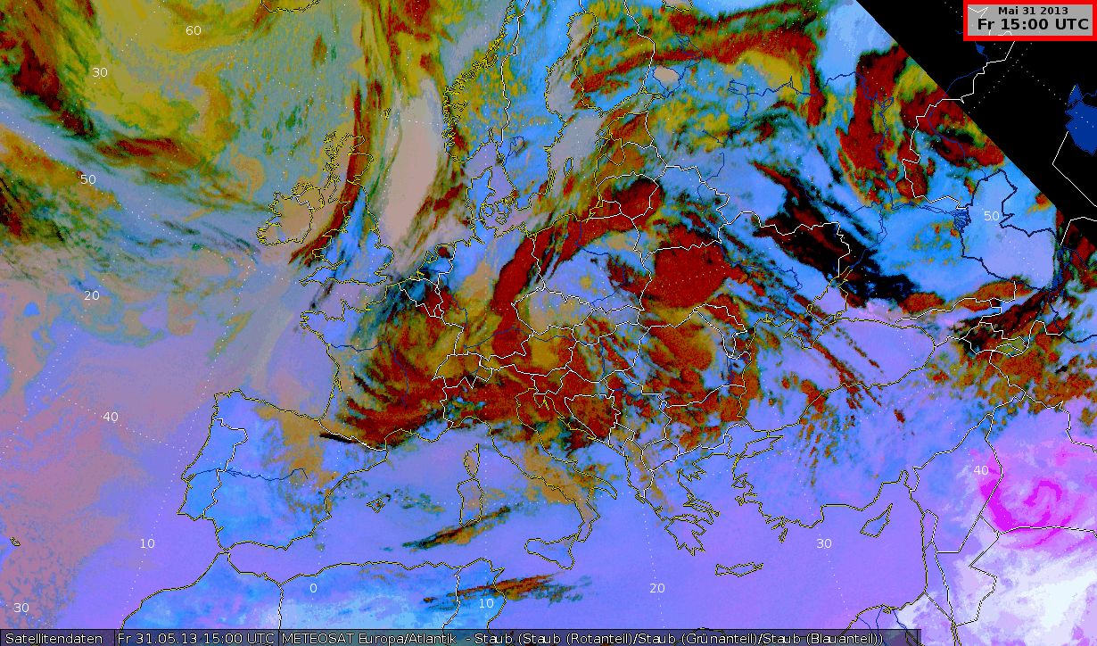
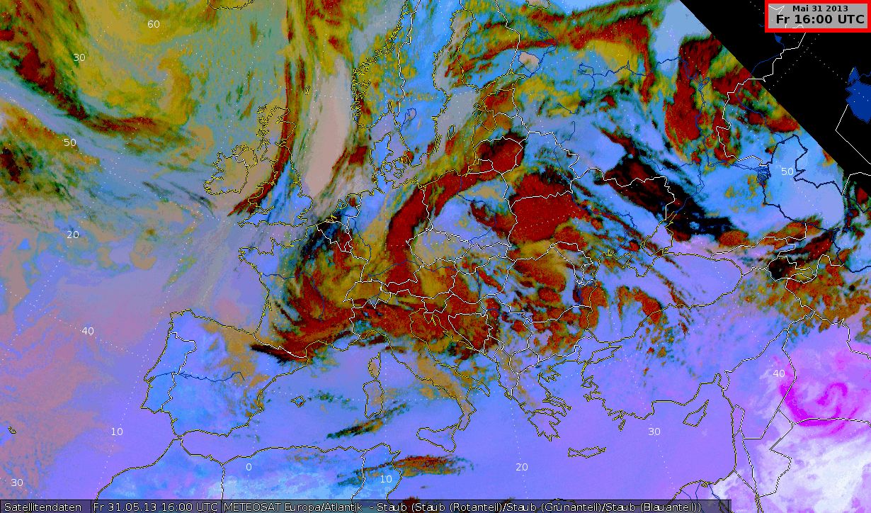
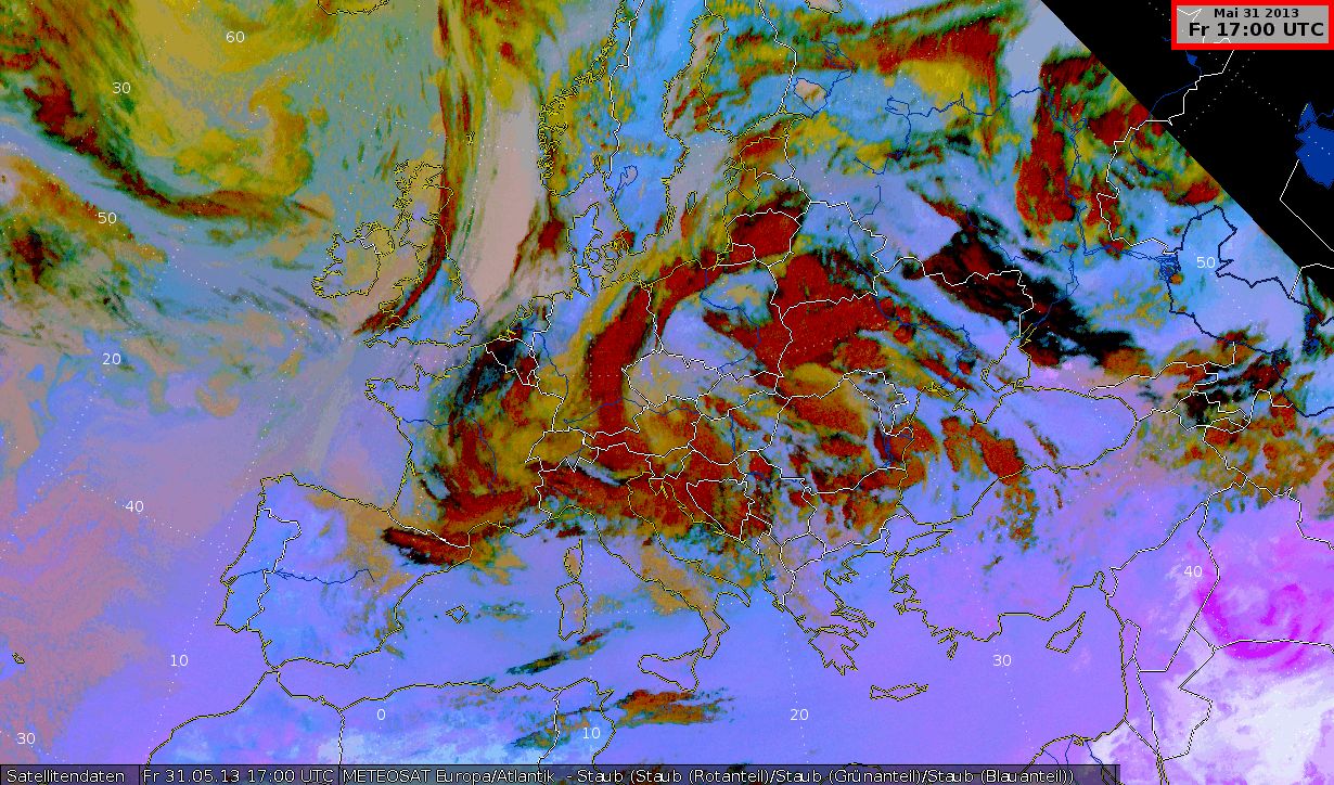
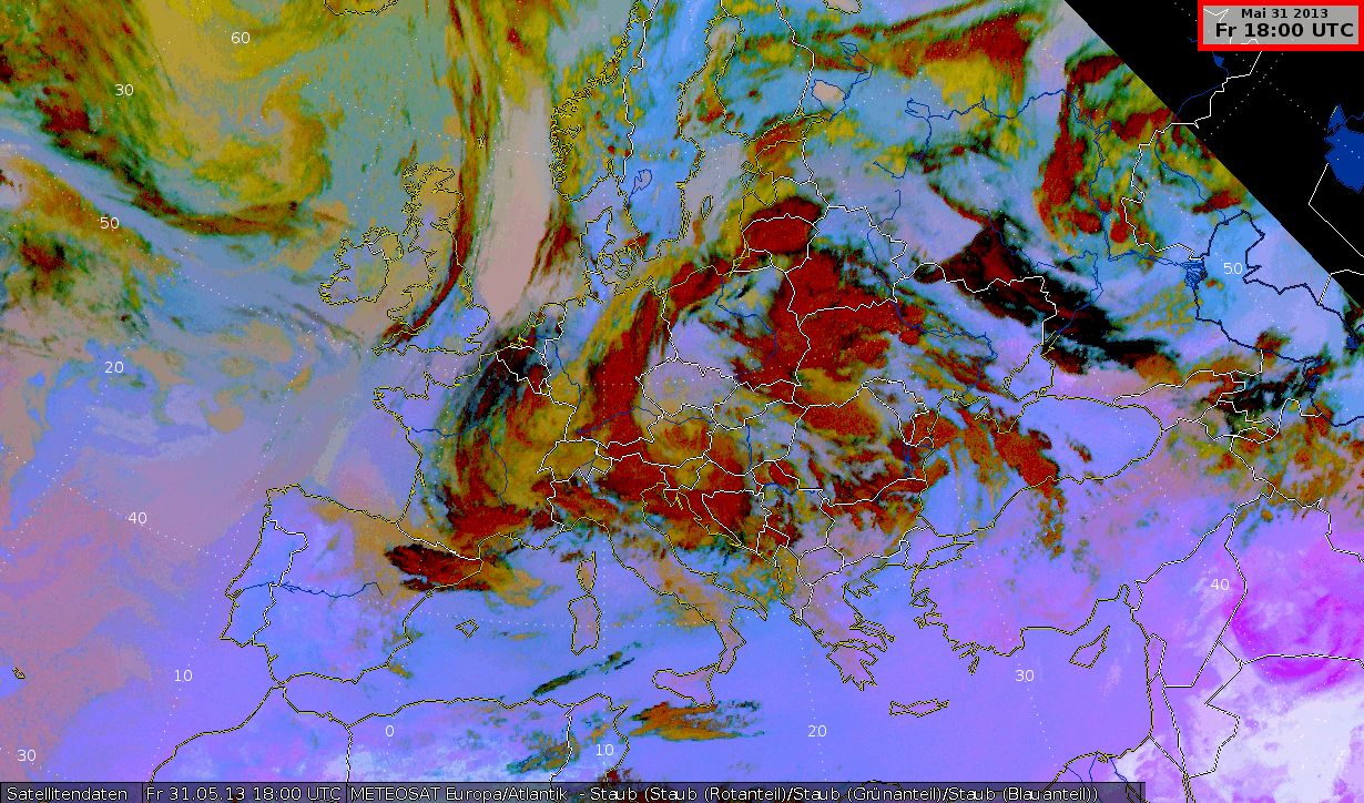
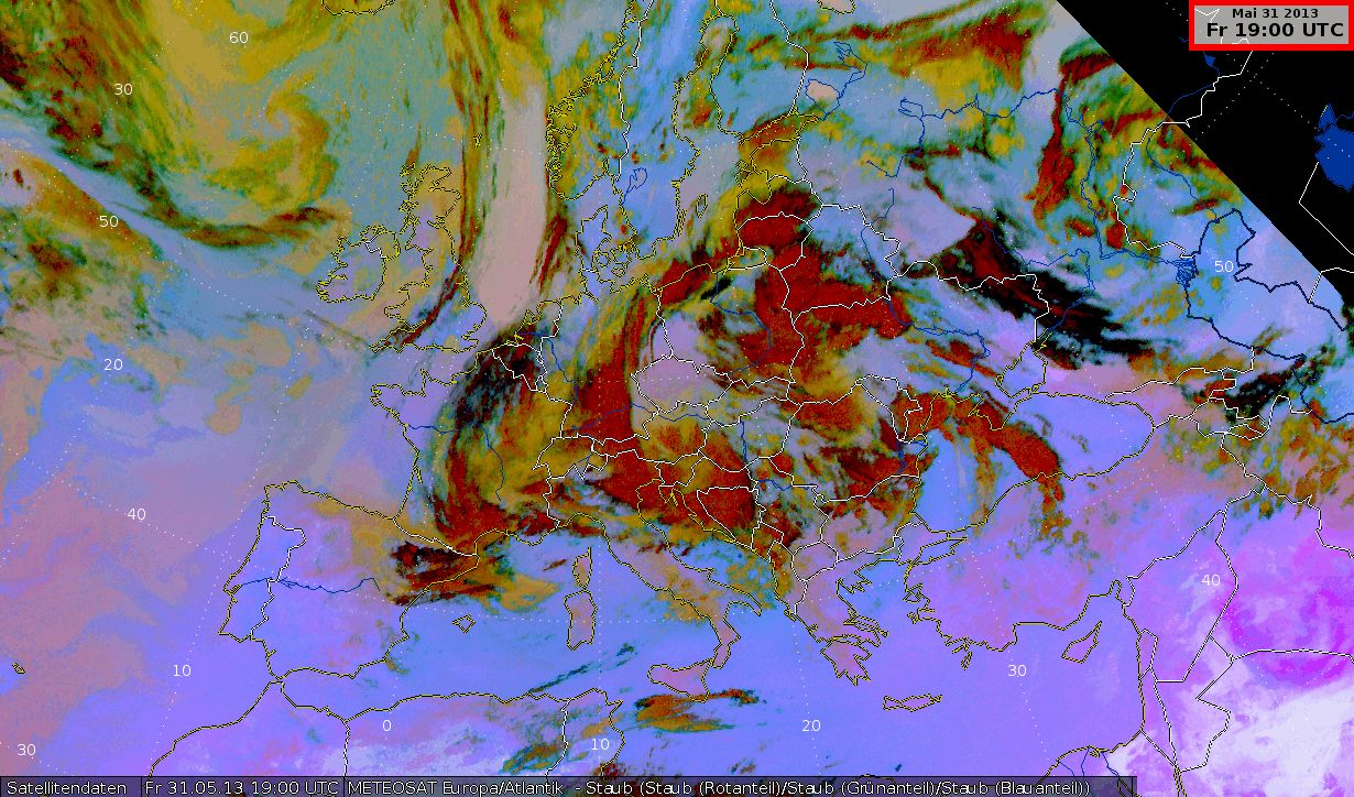
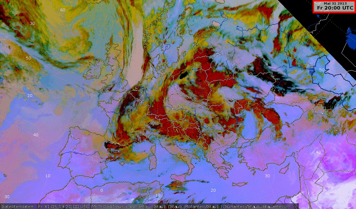
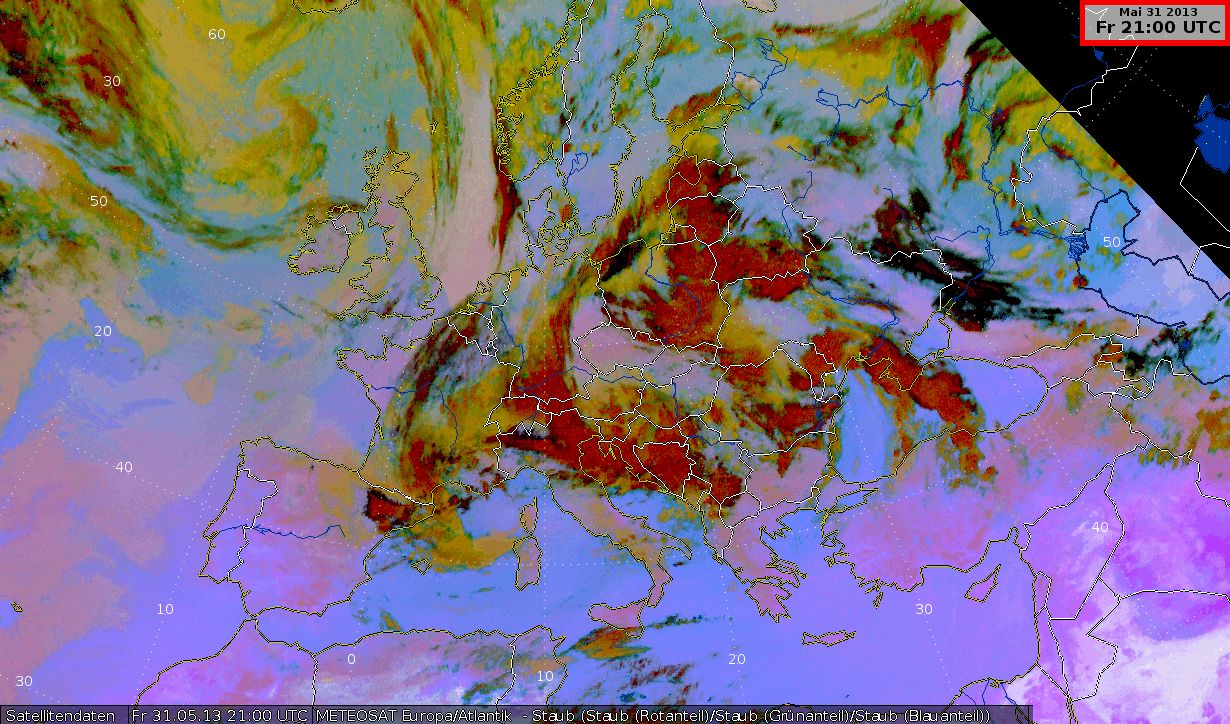
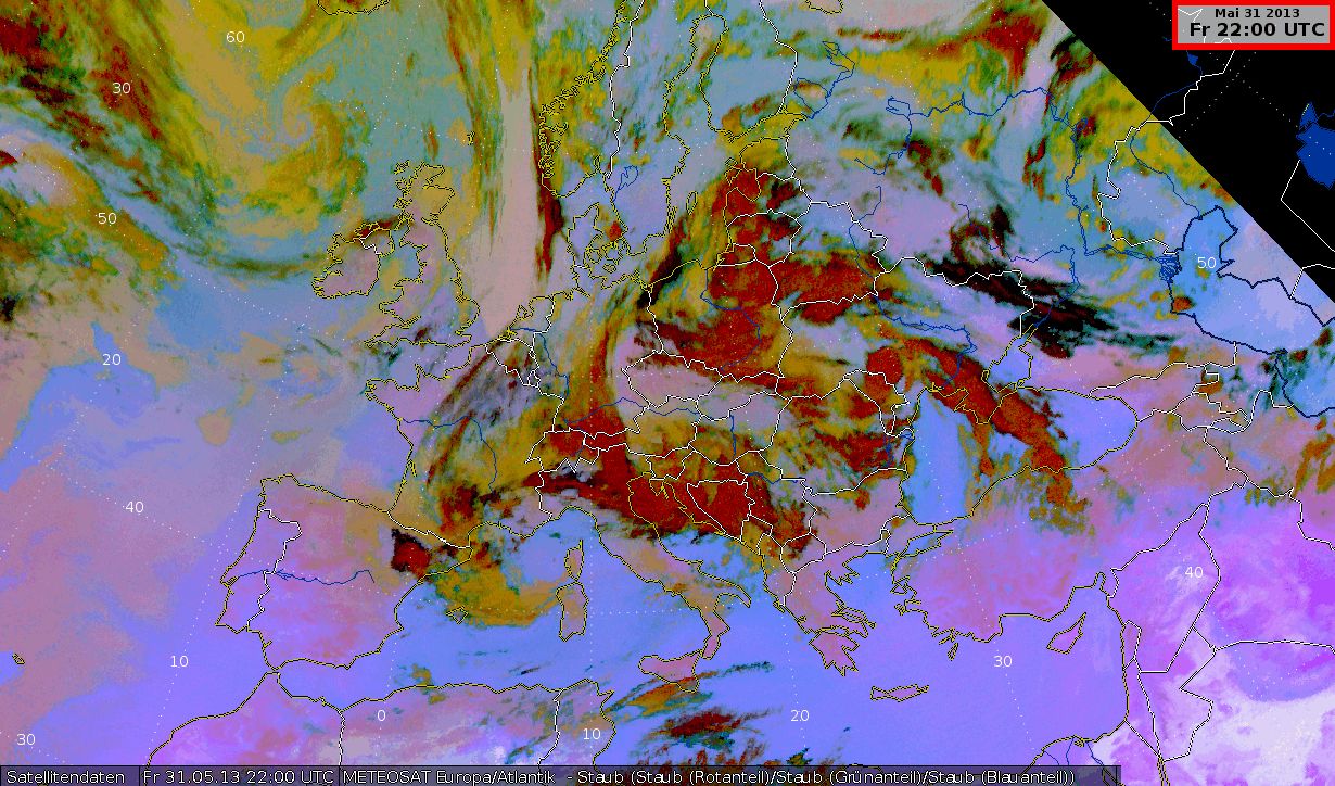
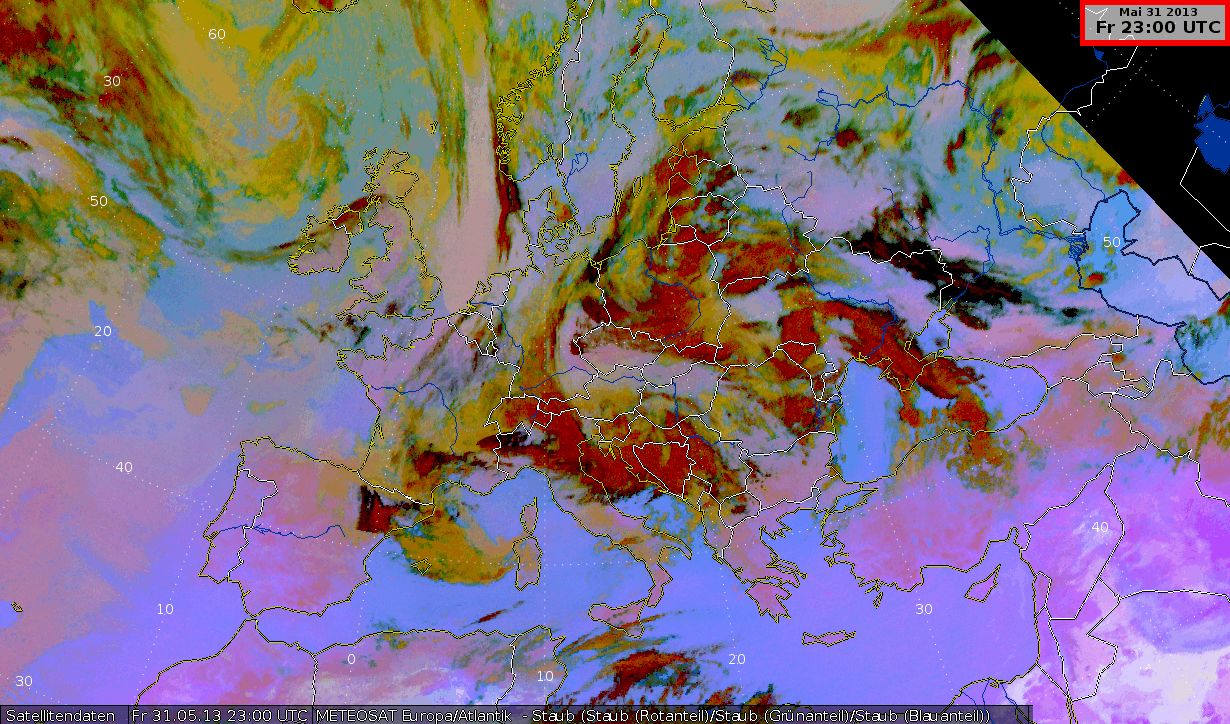
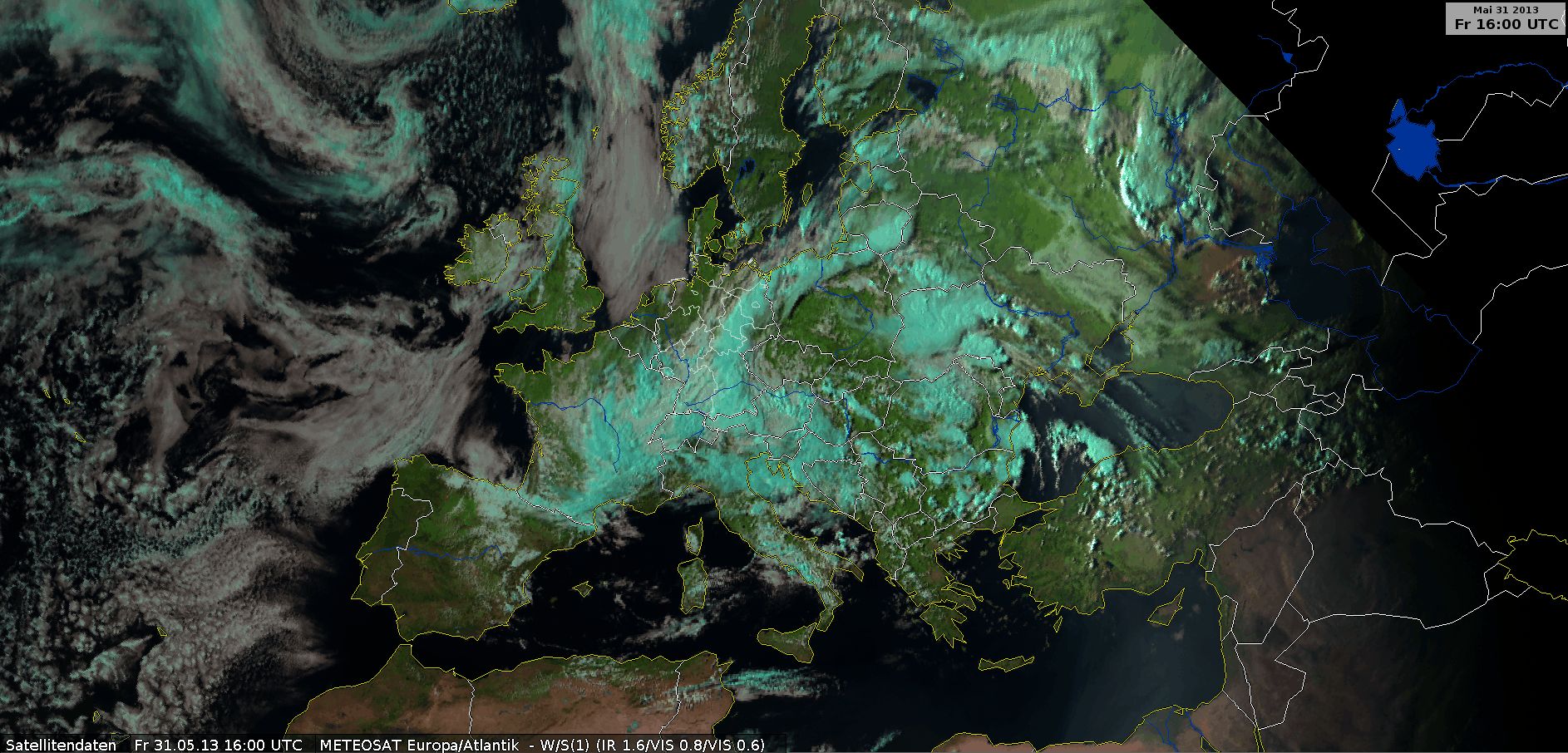
Dust RGB
Dust RGB, 31 May 2013, 00 UTC - 23 UTC (Source: DWD)
The Dust RGB highlights the high clouds in the warm front in a clear red color. At 15:00 UTC the thunderstorms reach a line stretching from Lithuania over northern Poland and the eastern parts of Germany on to eastern Bavaria, Austria and Croatia. There is a clear difference between the thin cirrus clouds in black on the edge of this line and the orange and brownish lower- and mid-tropospheric clouds.
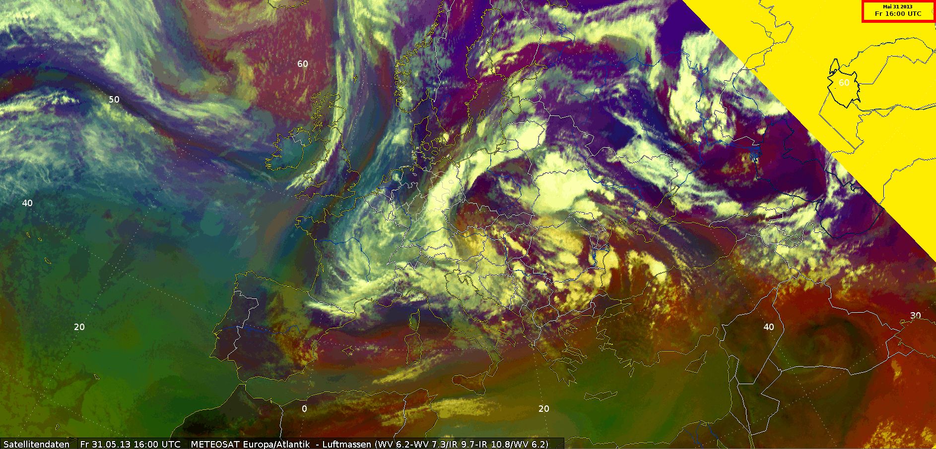
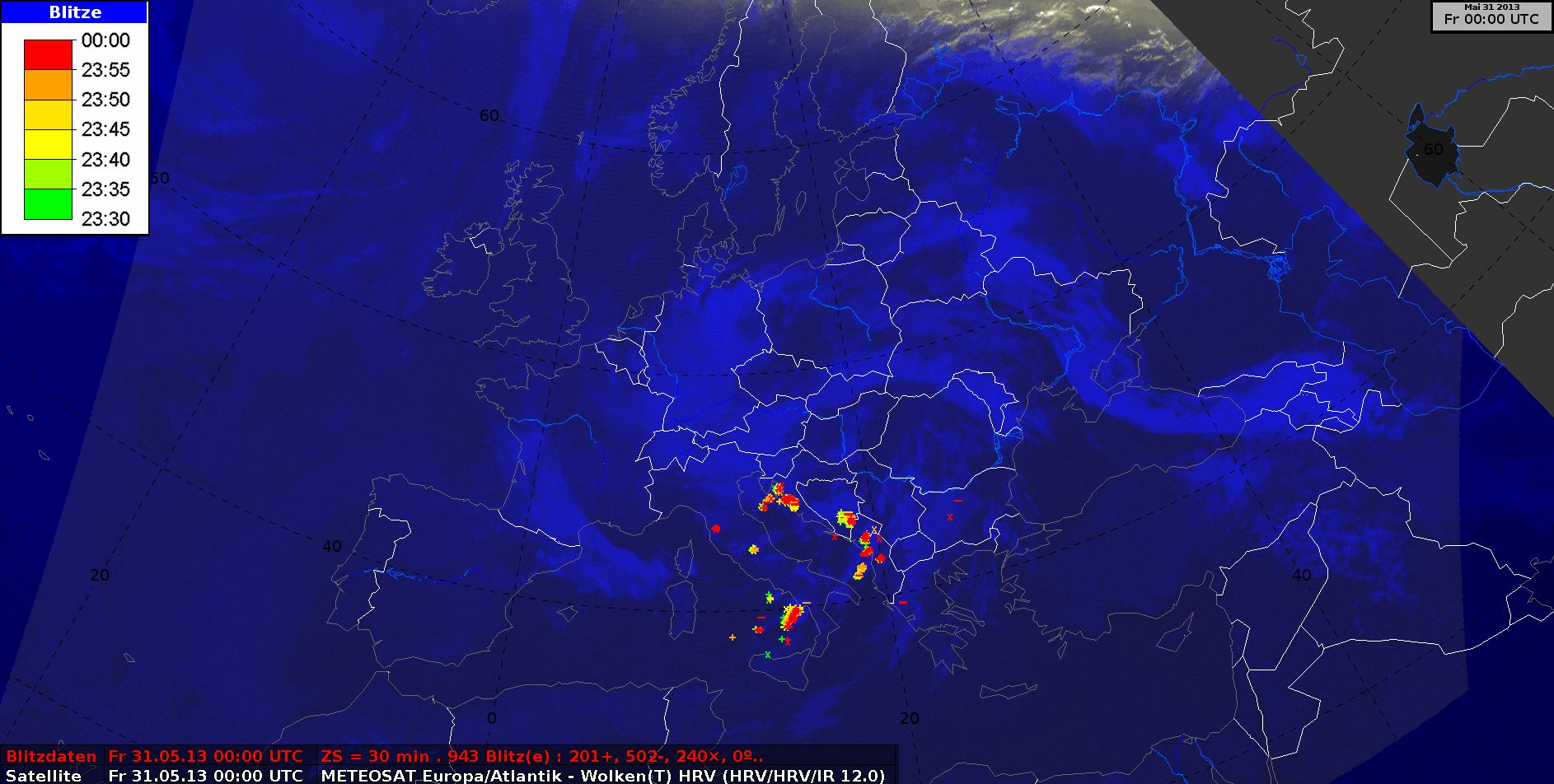
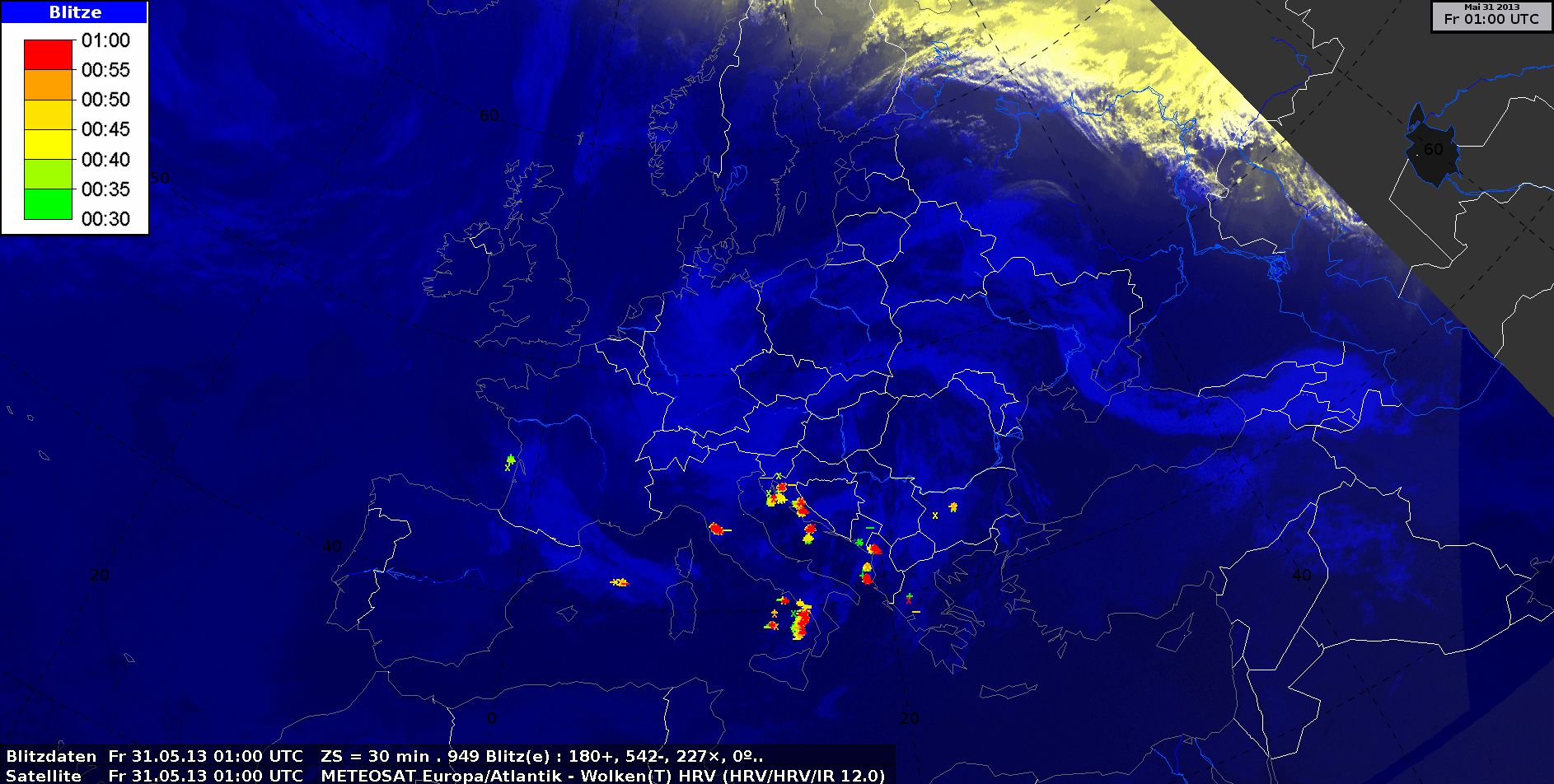
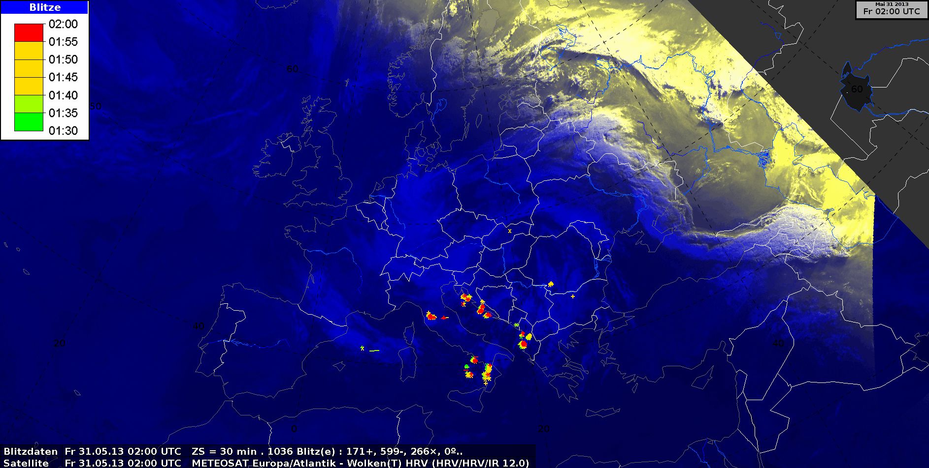
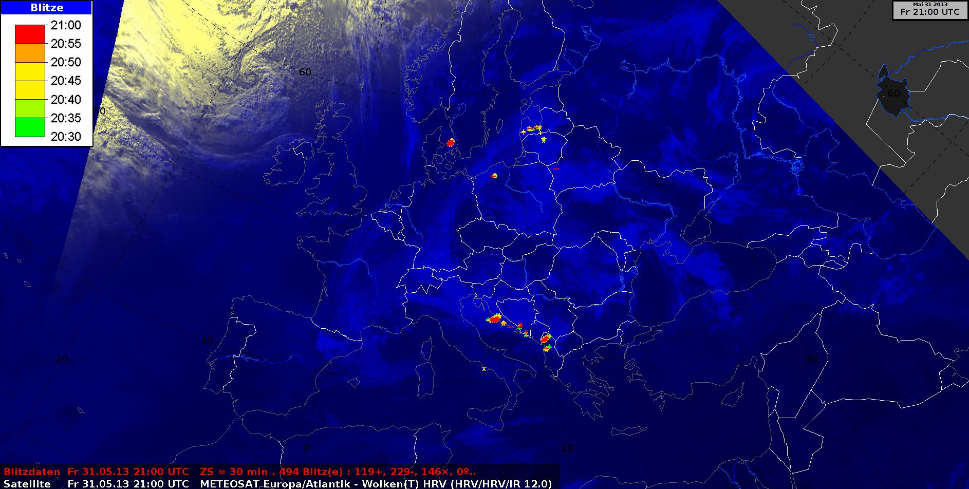
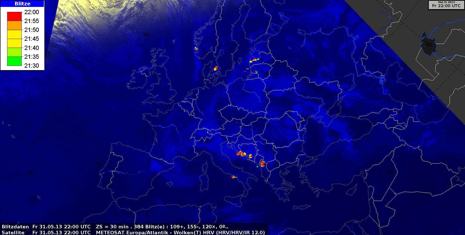
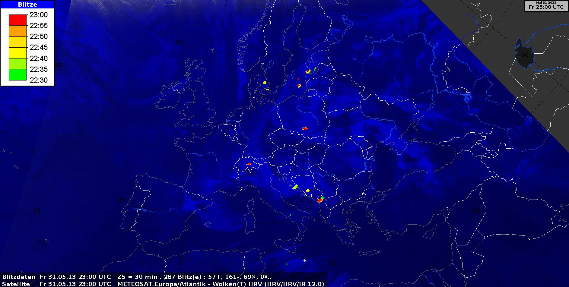
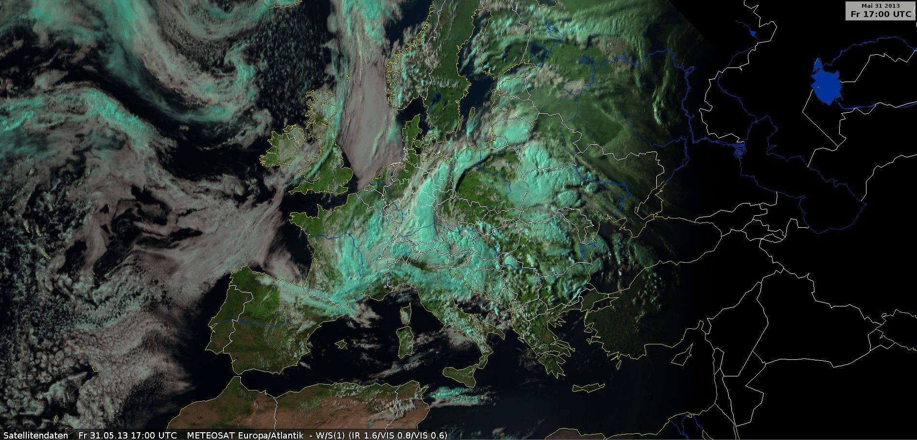
HRV Cloud RGB and Lightning
HRV Cloud RGB with Lighting, 31 May 2013, 00 UTC - 23 UTC (Source: DWD)
There is a visible difference between high clouds, which are shown in white, and medium and low clouds, which are yellow. The active zone of the unstable warm front with thunderstorms is easy to discern in combination with the flashes from strokes of lightning. At 09:00 UTC the first flashes are seen over Poland and they very quickly extend to the eastern parts of Germany.
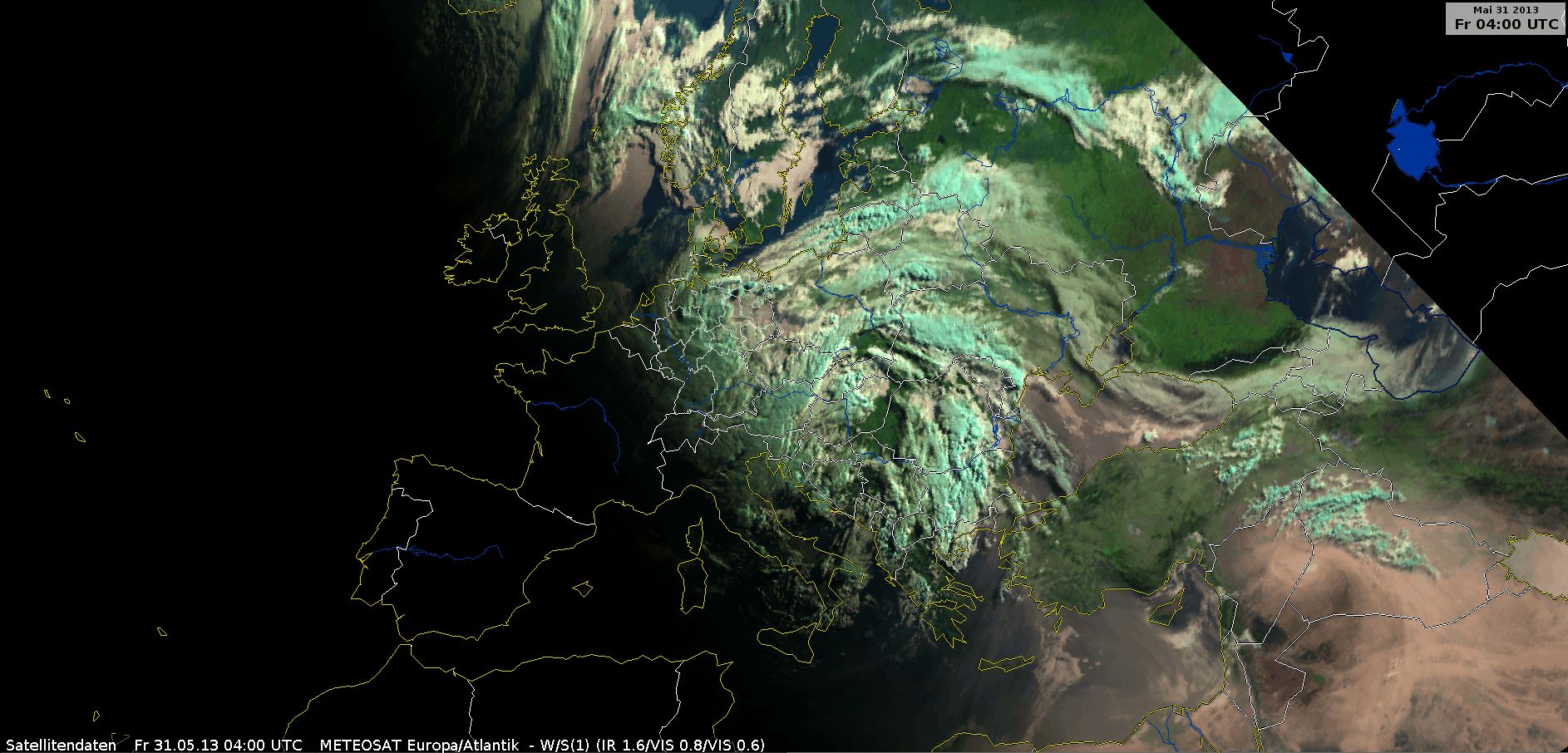
Natural Colour RGB
Natural Colour RGB, 31 May 2013, 04 UTC - 18 UTC (Source: DWD)
A cyan color suggests the presence of ice in cloud tops. This is typical for the development process of rain in cumulonimbus clouds in south and east Europe and nimbostratus clouds with prolonged precipitation in southern Germany. Over Germany and the neighboring states you can see white clouds, which signify water clouds with droplets in this RGB. In these clouds the rain development process consists only of collisions between cloud droplets.
Severe Storm RGB and Day Microphysics RGB
|
|
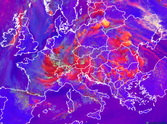
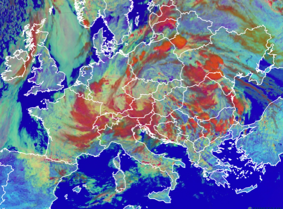
Figure 5.1: Comparison between Severe Storms RGB and Day Microphysics RGB, 31 May at 12 UTC (use the slider).
By comparing the Day Microphysics RGB and the Severe Storm RGB you can see the advantages and disadvantages of both.
The Day Microphysics RGB provides information about the microphysics of many clouds at different levels. At 12:00 UTC the warm front's orange color hints at strong convection, like in the cells over Ukraine and the Balkan states. However, it is difficult to determine differences in intensity.
By changing your view to the Severe Storm RGB, you can see the small yellow dots signifying a strong updraft with small ice particles at the cloud top. The clouds over Poland hint slightly at strong convection while over Belarus the signs are stronger. The reddish color is a sign of big ice particles at the tops.
The Day Microphysics RGB reveals that the other clouds over Germany are mid-level clouds and low level water clouds. A typical low level water cloud in the form of fog or a stratus cloud can be seen over the Northern Sea.
If you want to practice interpreting the colors in these or other RGB image types, consult EUMeTrain's "RGB Colour Interpretation Guide" (www.eumetrain.org).