02 - 03 August 1997 - Key Parameters On Isobaric Surfaces For 03 August 06.00 UTC
|
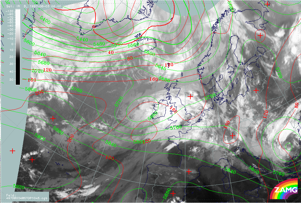
03 August 1997/06.00 UTC - Meteosat IR image; red: height contours 1000 hPa, green: height contours 500 hPa
|
|
|
The site of the Upper Level Low has already been discussed together with the typical cloud features (image above - compare Overview of satellite imagery for 03 August 06.00 UTC).
|
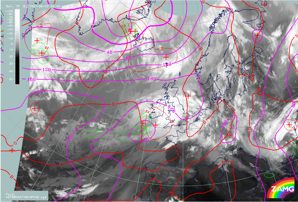
03 August 1997/06.00 UTC - Meteosat IR image; magenta: height contours 1000 hPa, green: positive vorticity advection (PVA) 500 hPa,
red: temparature advection - WA 1000 hPa
|
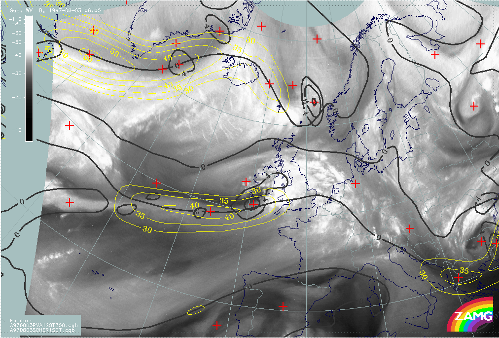
03 August 1997/00.00 UTC - Meteosat WV image; black: positive vorticity advection (PVA) 300 hPa, yellow: isotachs 300 hPa, black: shear
vorticity 300 hPa
|
|
|
The images above present the key parameters for a Rapid Cyclogenesis. Generally speaking all necessary conditions are fulfilled as before, but there are also two new aspects:
- The surface low and the WA maximum are more distinct now;
- All parameters fit better together than before.
So there is a strong indication of Rapid Cyclogenesis developing in the next time period. To check this possibility, the parameters for the next 12 hours, i.e. for the VSRF, are inspected.