19 February 1997 - Use Of Vertical Cross Sections For 06.00 UTC
|
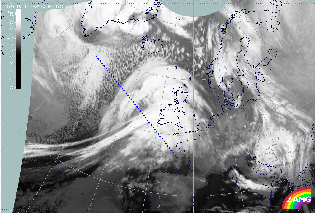
19 February 1997/06.00 UTC - Meteosat IR image; position of vertical cross section indicated
|
|
|
As the systems are really good examples for classical frontal systems another vertical cross section will be investigated for the Cold Front. The vertical cross section line is superimposed on the IR image above; the relevant cross sections can be found in the images below.
|
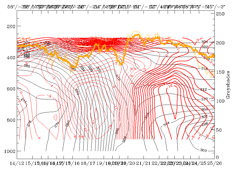
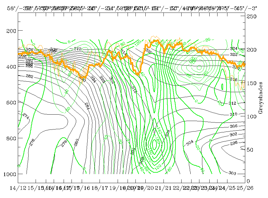
19 February 1997/06.00 UTC - Vertical cross section; black: isentropes (ThetaE), red thin: temperature advection - CA, red thick:
temperature advection - WA, orange thin: IR pixel values, orange thick: WV pixel values
|
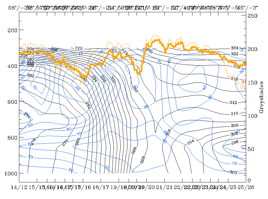
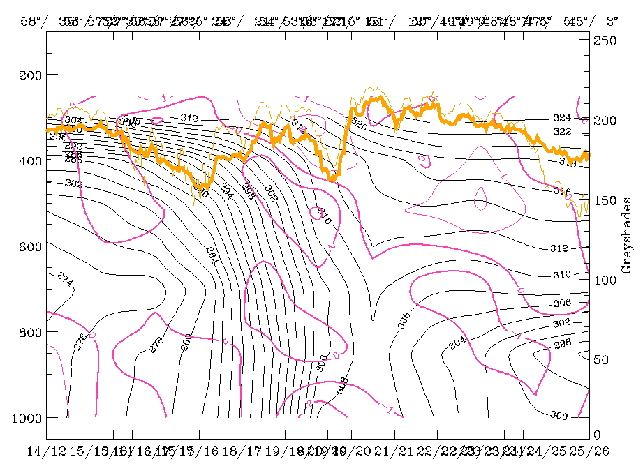
19 February 1997/06.00 UTC - Vertical cross section; black: isentropes (ThetaE), blue: relative humidity, orange thin: IR pixel values,
orange thick: WV pixel values
|
|
|
|
|
|
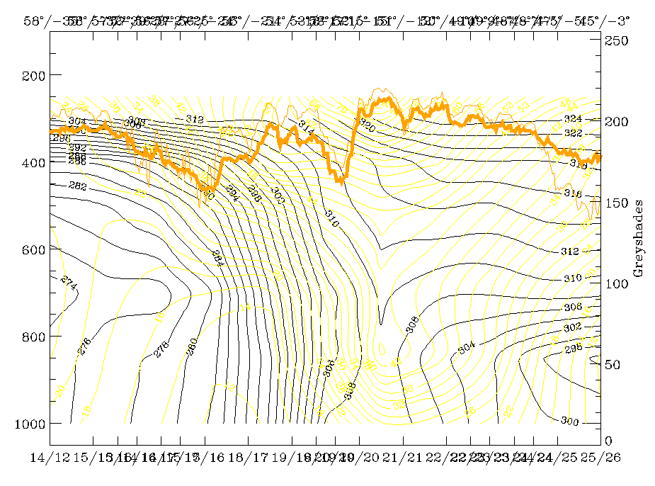
19 February 1997/06.00 UTC - Vertical cross section; black: isentropes (ThetaE), yellow: isotachs, orange thin: IR pixel values, orange
thick: WV pixel values
|
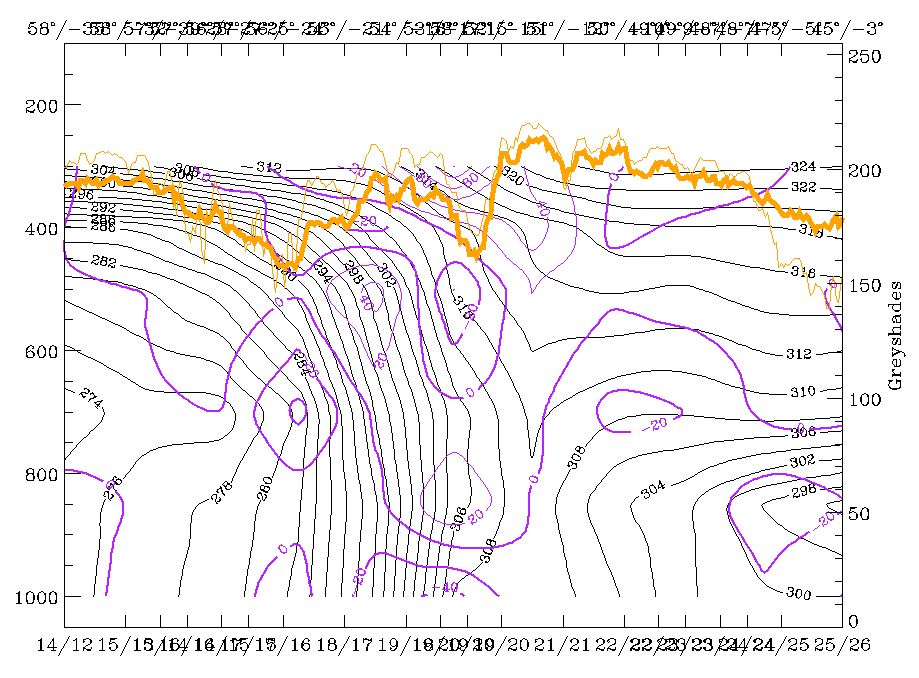
19 February 1997/06.00 UTC - Vertical cross section; black: isentropes (ThetaE), green thick: vorticity advection - PVA, green thin:
vorticity advection - NVA, orange thin: IR pixel values, orange thick: WV pixel values
|
There is still a very steep downward inclined frontal zone in the isentropes with a distinct surface front at 52N/12W which is between the Cold Front band and the cloud head (left and right image top).
The IR signals show two peaks:
- The one within the frontal zone at the rear of the surface front represents the cloud head;
- The other, even higher one in front of the frontal and surface front represents the Cold Front cloudiness.
Consequently in this area of the Cold Front no Ana Front character can be noticed any longer. Temperature advection (left image top) still shows intensive CA already in front of the Cold Front but reveals also the possibility of a secondary upper level Cold Front, a fact which is also supported by the inclination of the isentropes there. This could indicate that the higher cloudiness of the Cold Front is bound to an upper level front while a distinct frontal surface, together with a pronounced surface front, develops with the cloud head to the north.
|
19 February 1997/06.00 UTC - Vertical cross section; black: isentropes (ThetaE), magenta thin: divergence, magenta thick: convergence,
orange thin: IR pixel values, orange thick: WV pixel values
|
19 February 1997/06.00 UTC - Vertical cross section; black: isentropes (ThetaE), lilac: Q-Vector (normal component), orange thin: IR
pixel values, orange thick: WV pixel values
|
|
|
Convergence and frontogenesis shown in images (left and right image) are much weaker now.