19 February 1997 - Very Short Range Forecast For The Frontal System
|
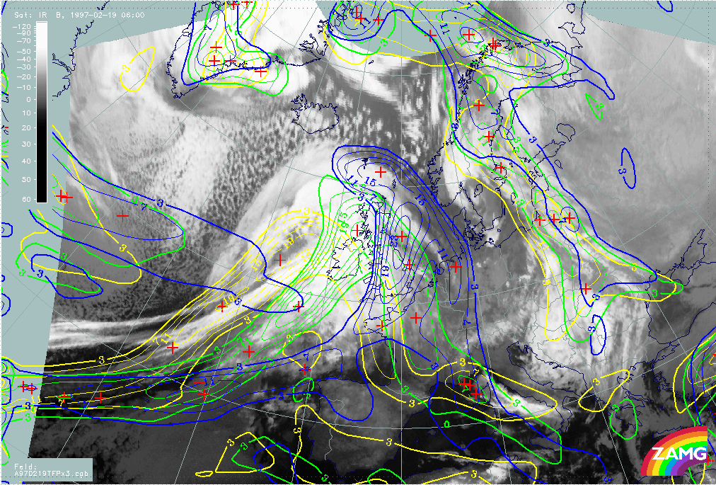
19 February 1997/06.00 UTC - Meteosat IR image; yellow: thermal front parameter (TFP) 500/850 hPa 06.00 UTC, green: thermal front
parameter (TFP) 500/850 hPa 12.00 UTC, blue: thermal front parameter (TFP) 500/850 hPa 18.00 UTC
|
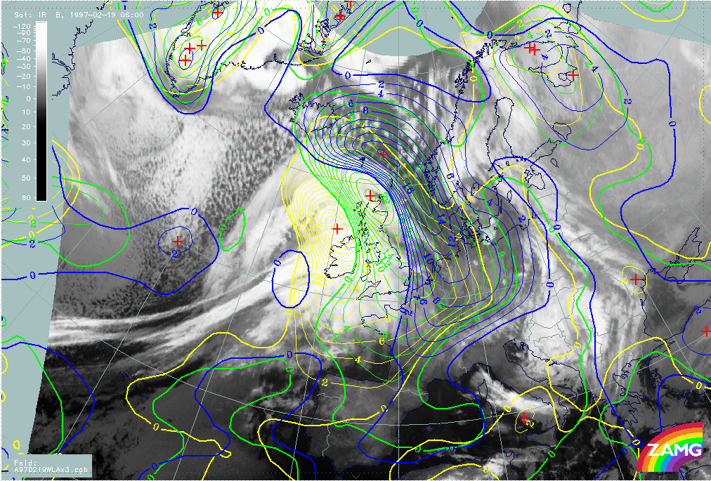
19 February 1997/06.00 UTC - Meteosat IR image; yellow: temperature advection - WA 1000 hPa 06.00 UTC, green: temperature advection -
WA 1000 hPa 12.00 UTC, blue: temperature advection - WA 1000 hPa 18.00 UTC
|
|
|
The images show the path of frontal parameters like TFP (left image) and WA (right image) during the next 12 hours from 06.00 UTC to 18.00 UTC. There is a fast eastward propagation of the TFP across Ireland to England; in the same time interval the warm sector becomes more and more narrow and a spiral structure develops north of Ireland. The WA maximum related to the Warm Front moves in accordance to the TFP and reaches the North Sea and west Europe at 18.00 UTC.