Erdem Erdi discusses the technical aspects of the new MTG data.
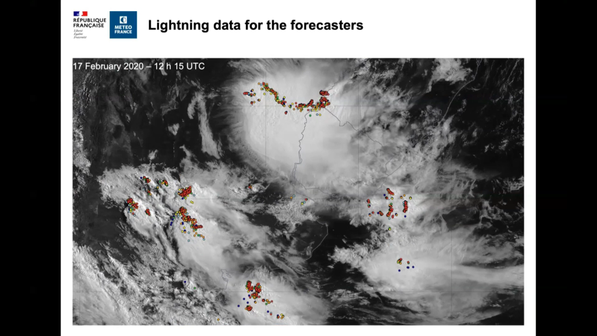
Sylvain Le Moal talks about use of lightning data at Meteo France.
Jos de Laat talks about the way KNMI applies GLM data.
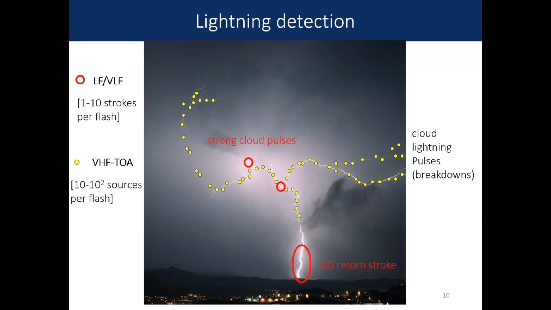
Nicolau Pineda talks about the new LI and comparison between ground based and satellite based lightning measurements.
Bartolomeo Viticchie talks about the new Lightning Imager on the MTG.
Pilar Rípodas talks about the improvements that the MTG will bring in regards to NWC SAF products.
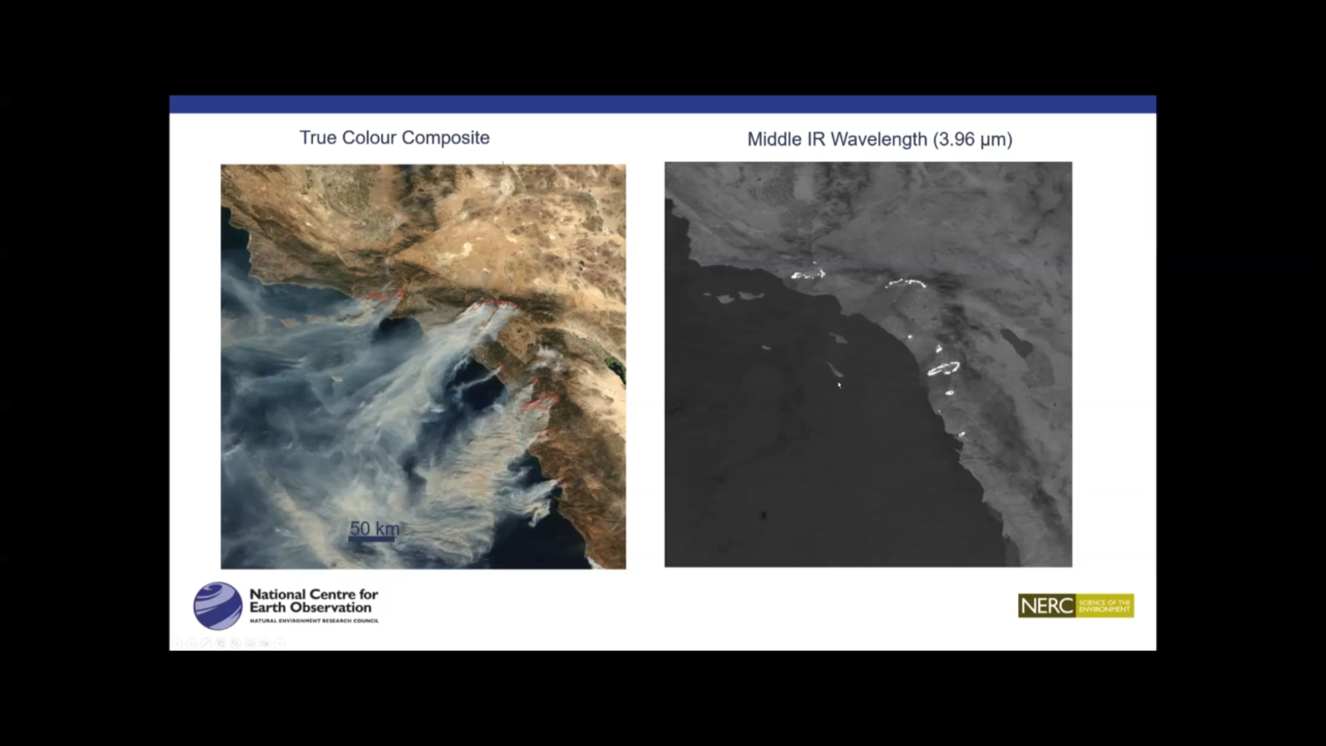
Martin Wooster talks about fire detection and FRP (Fire Radiative Power) product.
Ivan Smiljanic shows how to detect low level moisture with the FCI.