Precipitation forecast
ECMWF and ALADIN model suggest the occurrence of precipitation in the vicinity and over Madeira Island, but clearly underestimate the observed values. In fact, ECMWF forecasts of total precipitation for the Island did not exceed 15 mm in the referred 24 hour period (Figure 3).
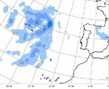
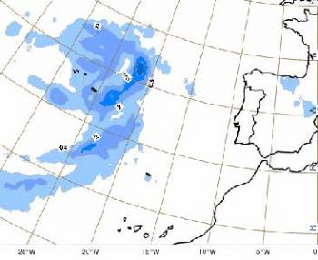

Figure 3: 3 hour precipitation on 01/10/2009 at 18UTC from ECMWF model on 2 consecutive runs: 01/10/2009 at 00 UTC (upper map) and 01/10/2009 at 12 UTC (lower map).
On the other hand, the limited area model ALADIN (recently implemented with a spatial resolution of 9 km at the Portuguese Met. Service, IM) provided higher precipitation amounts than ECMWF model, being closer to the observed precipitation in the mountain station. In the 24 hour period starting at 12UTC on 01/10/2009, ALADIN convective precipitation reached the amount of 31 mm to the south of the Island (Figure 4). In fact, this precipitation amount is about one third of the observed over the mountain. It should be noted that large-scale precipitation was zero at the same grid point and less than 5 mm in neighbor grid-points, namely over the Island. Although both the value and location of the forecast were not fitting the observations, they could be considered a warning to the forecaster that orographic induced (and maybe heavy) precipitation could be likely to occur.
A more comprehensive analysis between the two models still needs to be performed taking into account the separation between large scale and convective precipitation for the same integration periods.
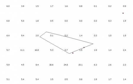
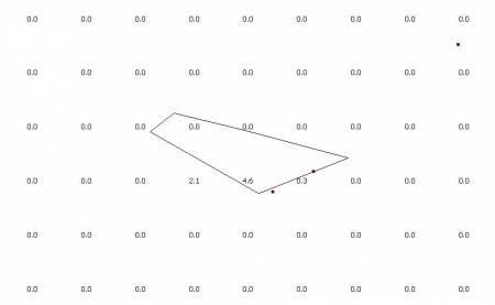
Figure 4: ALADIN 9km model 24 hour convective (top) and large-scale (bottom) precipitation on 02/10/2009 at 12UTC.
In fact, orography in ALADIN (limited area) model is better represented than in the ECMWF model - while the ECMWF model represents Madeira Island with a maximum height of around 850 m, the ALADIN model orography goes up to around 1200 m. Naturally both orographies are less detailed and with lower peaks than the real maximum height of around 1850 m (Figure 5). Nevertheless, mountain phenomena are expected to be better depicted by ALADIN than by ECMWF.
In fact, in the present situation, the precipitation in the other 7 stations of the Island (1 station at 935m and the other 6 stations below 350 m) was pretty insignificant (Figure 6) suggesting an orographic effect on the observed precipitation.
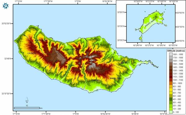
Figure 5: Real Orography of Madeira Island (and of Porto Santo Island in box).
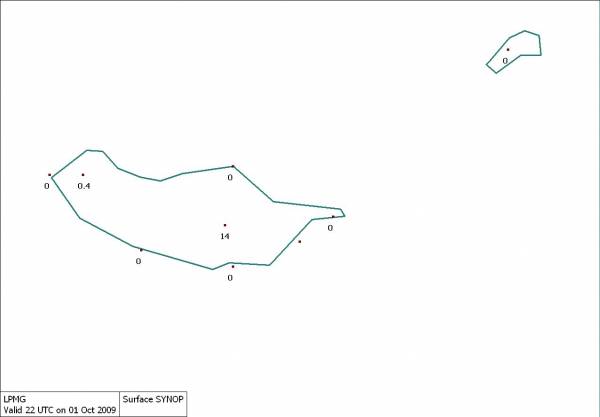
Figure 6: 1 hour precipitation at 22 UTC on 1st October 2009 from Automatic Weather Stations in Madeira and Porto Santo Islands.