Global model (ECMWF)
ECMWF models the fog (low level cloud cover, Figure 4) fairly well overall but doesn't seem to catch the advection of the fog inland from the Gulf of Finland. It rather seems that the fog is moving or spreading towards the coast of Estonia.
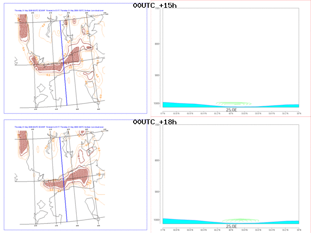
Fig. 4: ECMWF 00UTC +15h and +18h forecasts. Cross section line marked with blue line on the maps.
Animation 1 contains ECMWF forecasts from four different model runs, 00UTC and 12UTC from 20th and 21st of May, presenting timeline from 06UTC 21st to 00UTC 22nd . The different runs agree quite well with each other but the last one, 12UTC 21st, underestimates the fog area on the Gulf until 00UTC 22nd. As already seen in Figure 4 the ECMWF doesn't model the movement of the fog inland until 00UTC 22nd, although there is some low level cloud cover on inland areas at 21UTC 21st also.
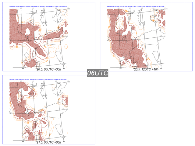
Animation 1: ECMWF forecasts from 20th May 00UTC and 12UTC and from 21st May 00UTC and 12UTC. Timeline from 21st 06UTC to 22nd 00UTC.