Introduction
On 21st May 2009 a dense advection fog coming from the Gulf of Finland caused low visibilities across the region around Helsinki. The fog started to move inland from the Gulf around 1700 UTC and persisted until next morning on land areas while coastal water areas cleared during daytime. Figure 1 illustrates the situation at 1700 UTC with FMI's fog (24h microphysical) product from Meteosat SEVIRI data (*Red: Difference IR12.0 - IR10.8 *Green: Difference IR10.8 - IR8.7 *Blue: Channel IR10.8 ), notice also the fog or low level cloud area in the middle of the eastern Swedish coast.
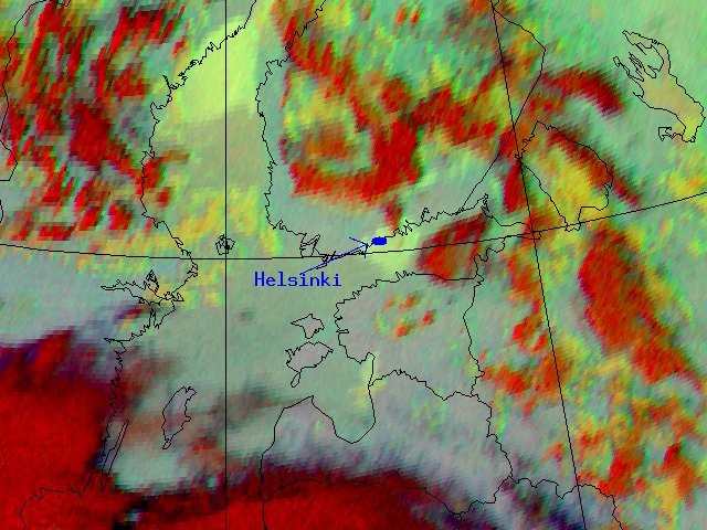
Fig. 1: Fog-product from Meteosat SEVIRI.
These kind of fog situations typically occur in the Southern coast of Finland in April-May when the sea temperature is still cold and warm humid air is advected over the water from Central Europe or the Baltic area (and in the autumn months in reverse fashion as the water is still warm and land cold). This case study is focused on comparing how a global model (ECWMF) and a local model (AROME) performed in forecasting this situation. For basic information about fogs check "Fog and Stratus" from http://www.zamg.ac.at/docu/Manual/SatManu/main.htm under Conceptual models.