18 - 19 February 1996 - Forecast For The Enhanced Cumulus For 18 February 12.00 UTC And 18.00 UTC
|
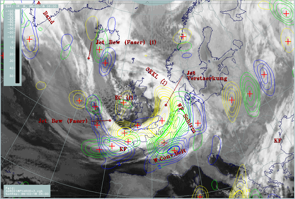
18 February 1996/06.00 UTC - Meteosat IR image; SatRep overlay: names of conceptual models; yellow: positive vorticity advection (PVA)
500 hPa 06.00 UTC, green: positive vorticity advection (PVA) 500 hPa 12.00 UTC, blue: positive vorticity advection (PVA) 500 hPa 18.00
UTC
|
|
|
The discussion here is not a complete forecast procedure for Enhanced Cumuli (ECs); for this compare case study 12 March 1996 (see Case Study: 12 March 1996, Enhanced Cumulus ). Here only the key parameter of PVA 500 hPa is inspected for the 12 hours forecast. The EC over Ireland is accompanied by a distinct PVA maximum at 06.00 UTC (yellow) which cannot be followed further. There is only a very small PVA area nearly at the same place for 12.00 UTC (green), and no distinct centre for 18.00 UTC at all.
Comparing with the images, this is not verified completely because there is an area of enhanced cells which propagates from Ireland at 06.00 UTC to central England at 12.00 and the Netherlands at 18.00 UTC.
|
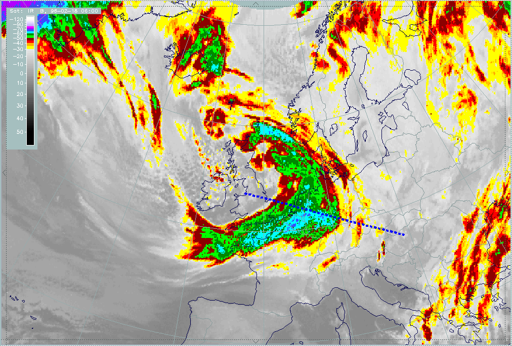
18 February 1996/06.00 UTC - Meteosat IR enhanced image; position of vertical cross section indicated
|
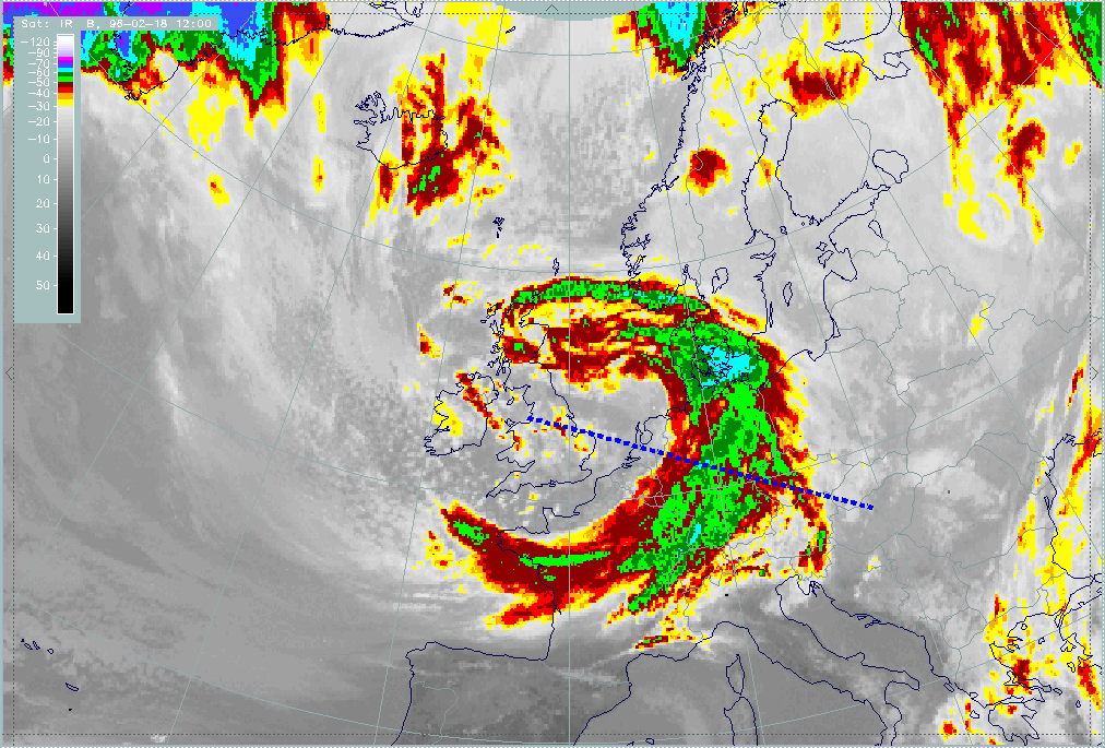
18 February 1996/12.00 UTC - Meteosat IR enhanced image; position of vertical cross section indicated
|
|
|
|
|
|
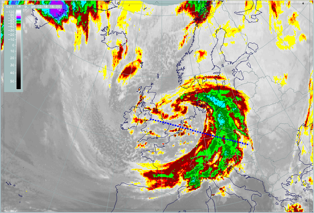
18 February 1996/18.00 UTC - Meteosat IR enhanced image; position of vertical cross section indicated
|