Introduction and short case description
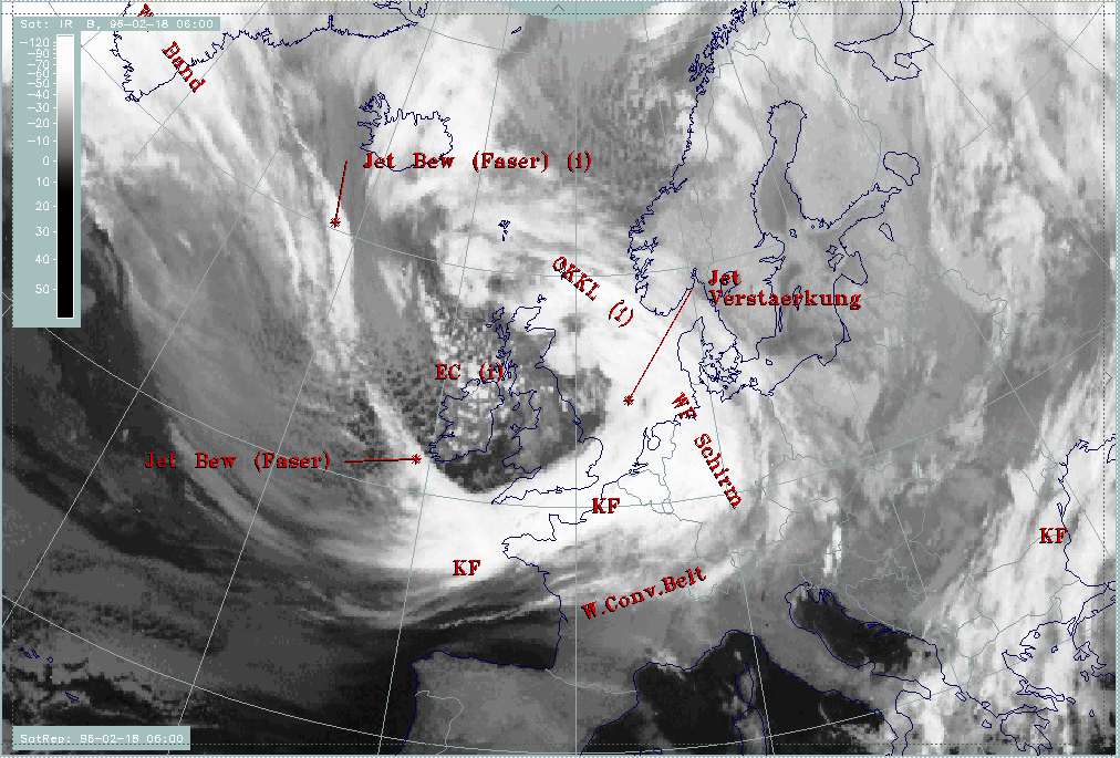
The cloud band of a frontal system stretches from the English Channel and adjacent countries across Belgium, the Netherlands and Germany into the North Sea. The cloudiness is widely accompanied by precipitation in the form of snow in the eastern parts (cyan crosses), in the form of rain west of it (green crosses).
Cloud fibres stretching from Greenland across the Atlantic (approximately 58N/20W) reach the frontal cloud band west of Cornwall (50N/06W). An angle is formed between the frontal cloudiness and the fibres which is typical for the crossing of frontal cloudiness by a jet stream/streak with the fibres indicating the jet axis (compare Cloud fibre at jet axis ).
Cellular cloudiness west of England and over Ireland indicates cold air with an EC or EC-like intensified area embedded (approximately 55N/09W).
The next image shows the names of the conceptual models diagnosed within the SatRep (Satellite Report) and superimposed as a first level of SatRep on the satellite image:
- KF: Cold Front
- WF Schirm: Warm Front Shield
- OKKL: Occlusion
- Jet Verstaerkung: Jet intensification i.e. intensification of frontal cloudiness by jet streak crossing
- Jet Bew (Faser): Jet cloudiness (fibre) i.e. Cloud Fibres related to jet axis
|
18 February 1996/06.00 UTC - Meteosat IR image; SatRep overlay: names of conceptual models
|
|
|
The second and third level of the SatRep show detailed information about the key parameters of the conceptual models as well as about the forecast.