Analysis for 29 January 2004
29 January 2004 00.00 UTC
|
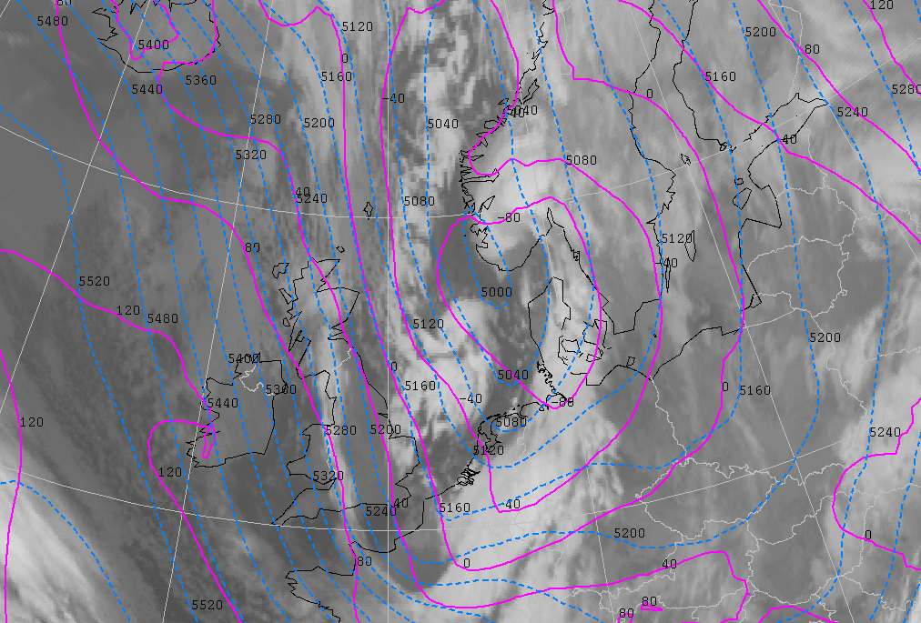
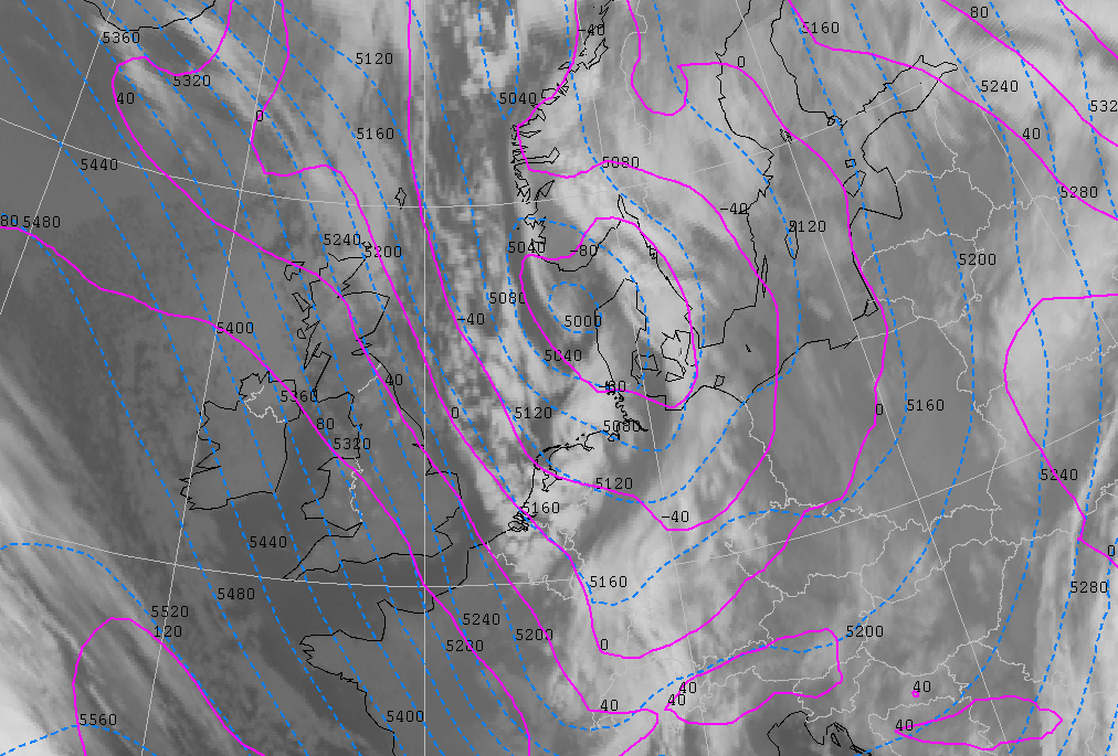
29 January 2004/00.00 UTC - Meteosat IR image; cyan: height contours 500 hPa, magenta: height contours 1000 hPa
|
|
|
According to the model, the centre of the main depression lies in the Skagerak area and the air flow over the North Sea slowly starts to back to a more northwesterly direction. This causes the Polar Low vortex to turn towards the northeastern parts of the German Bight. The vortex still lies ahead of a shallow upper trough and very close to a surface trough in the model fields.
|
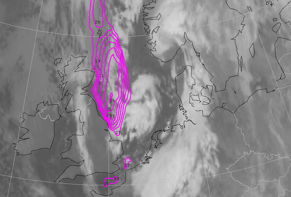
29 January 2004/00.00 UTC - Meteosat IR image; magenta: surface isotachs in knots
|
|
|
Maximum wind speed at this time is 40 knots. This maximum can be found along the west side of the Polar Low, the area where the gradient of isobars is situated. Stations along the east coast of Britain report wind gusts up to 48 knots.
|
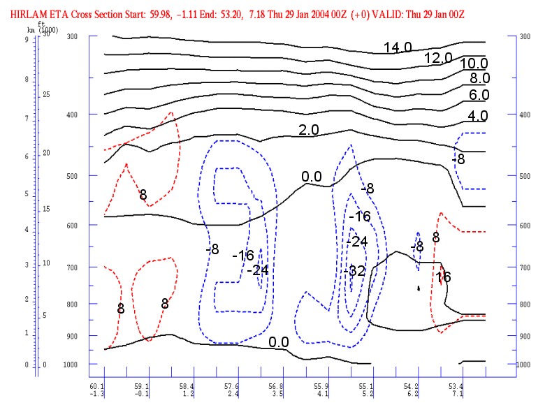
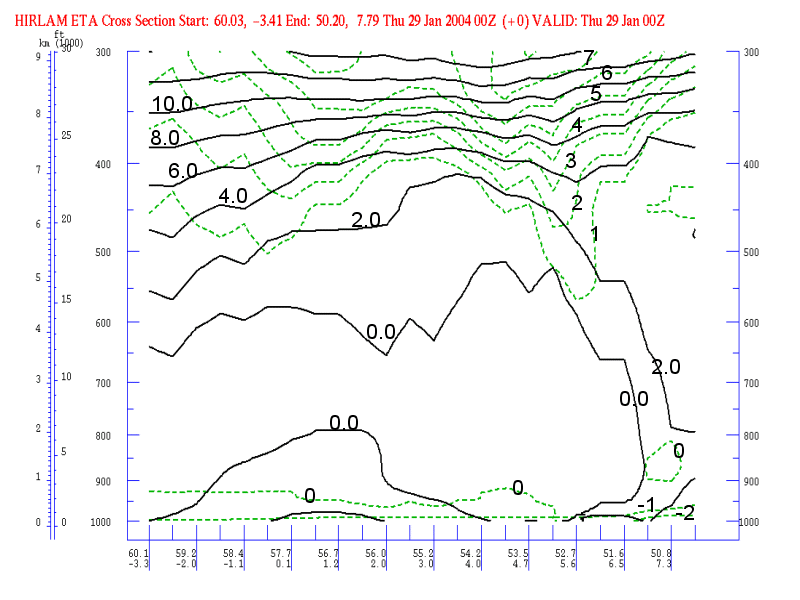
29 January 2004/00.00 UTC - Vertical cross section; black: isentropes (ThetaW), red: vertical motion (omega) - downward motion, blue:
vertical motion (omega) - upward motion, grey: satellite signal
|
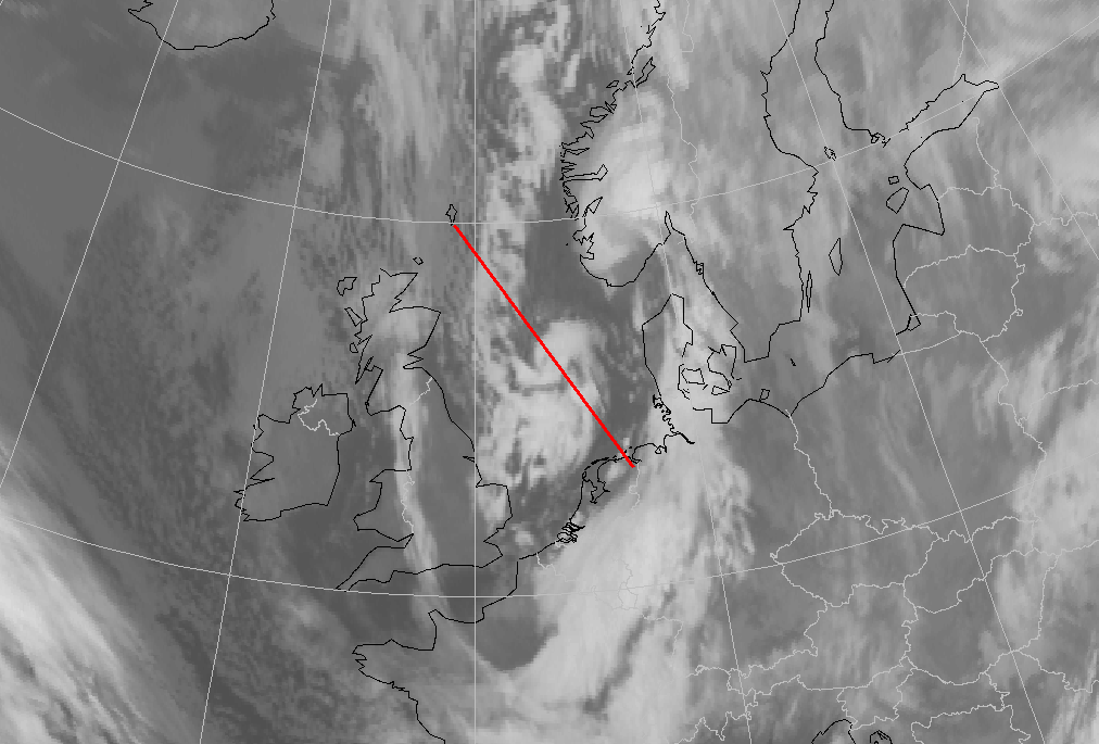
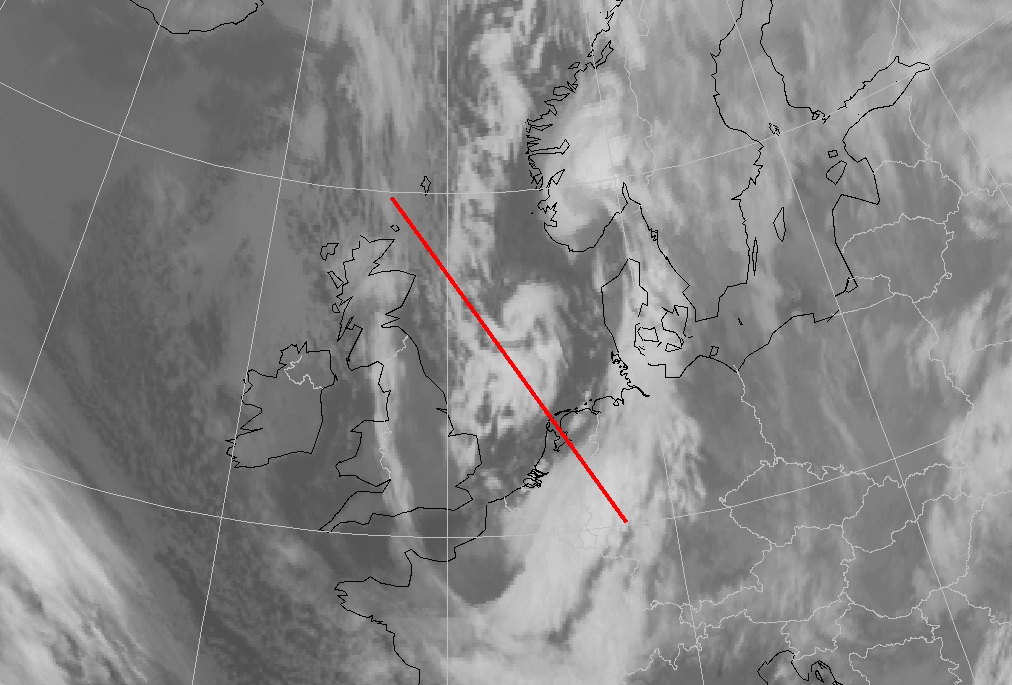
29 January 2004/00.00 UTC - Meteosat IR image; position of vertical cross section indicated
|
|
|
The vertical cross section above shows isolines of ΘW and omega. The vertical cross section has been made in the direction of movement of the Polar Low, and the centre of the vortex lies over the North Sea at approximately 57N/03E. Strong values of negative omega (ascending air) can be found at the centre of the Polar Low. At 700 hPa there is a small area with slightly positive values of omega (not visible in vertical cross section) between the two maxima, that can be explained by the descending air in the centre of a fully grown Polar Low.
|
29 January 2004/00.00 UTC - Vertical cross section;black: isentropes (ThetaW), blue: temperature advection - CA, red: temperature advection - WA, grey: satellite signal
|
29 January 2004/00.00 UTC - Meteosat IR image; position of vertical cross section indicated
|
|
|
This vertical cross section shows the isentropes of ΘW and the potential vorticity. Two anomalies can be found in the potential vorticity. The one to the left side of the cross section is situated to the rear of the Polar Low (position of the centre: 57N/3E) and the one to the right of the cross section is located at the northern side of the Arctic Front.
29 January 2004 06.00 UTC
|
29 January 2004/06.00 UTC - Meteosat IR image; cyan: height contours 500 hPa, magenta: height contours 1000 hPa
|
|
|
The centre of the main depression has reached Denmark. The Polar Low made landfall just before 06.00 UTC and the vortex as such is not visible anymore in the infrared image. The Upper- and surface trough are (compared to the 00.00 UTC analysis) in the same relative position with the Polar Low. Clustered snow showers with strong wind gusts are moving towards the northeast coast of the Netherlands and the northwest coast of Germany. The showers get less intensive as they move over land. The radar pictures (see chapter "description of the synoptic situation") still show the vortex structure of the low. The disappearance of the structure, and the decreasing intensity of the Polar Low starts almost directly after landfall.
|
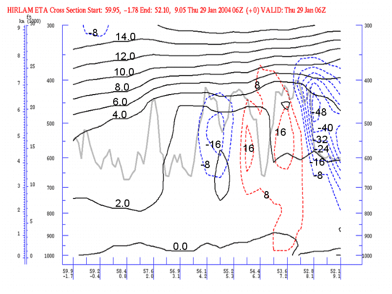
29 January 2004/06.00 UTC - Vertical cross section; black: isentropes (ThetaW), red: vorticity advection - NVA, blue: vorticity advection - PVA, grey: satellite signal
|
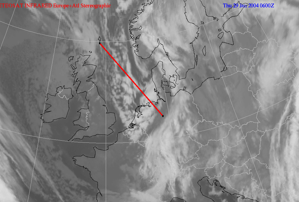
29 January 2004/06.00 UTC - Meteosat IR image; position of vertical cross section indicated
|
|
|
Vertical cross section showing vorticity advection, isentropes and the satellite signal, in the direction of movement of the polar low (54N/07E). A maximum of positive vorticity advection lies at the position of the polar low. This maximum is more pronounced than at 6 and 12 hours earlier.