Analysis for 27 January 2004
27 January 2004 06.00 UTC
|
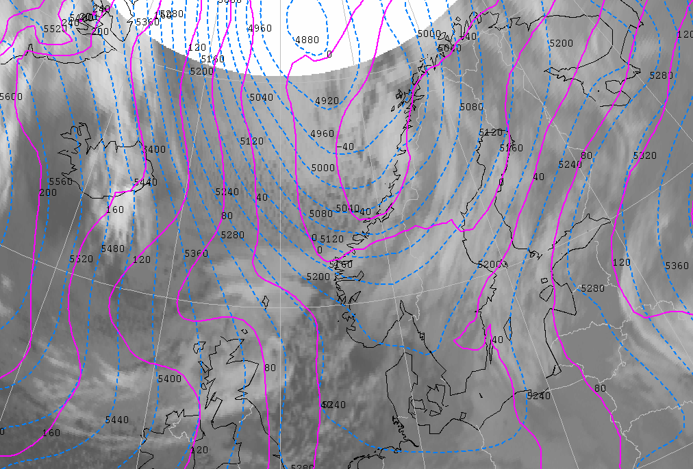
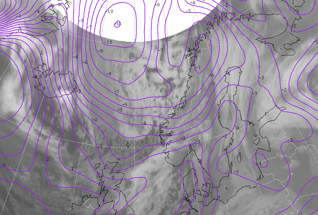
27 January 2004/06.00 UTC - Meteosat IR image; cyan: height contours 500 hPa, magenta: height contours 1000 hPa
|
|
|
The outbreak of arctic air becomes visible between a low-pressure area located to the west of the Norwegian west coast and a high-pressure area west of Iceland.
|
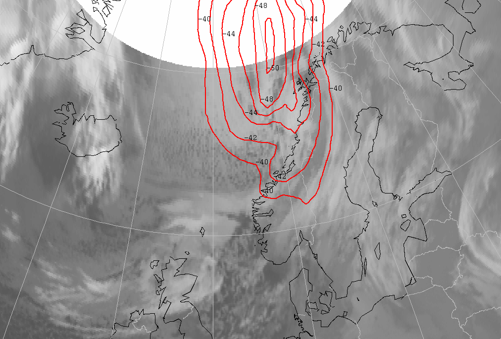
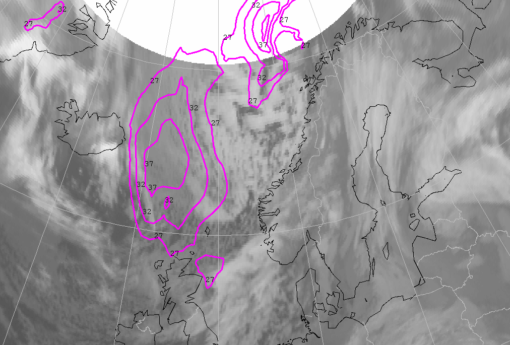
27 January 2004/06.00 UTC - Meteosat IR image; red: temperature 500 hPa
|
|
|
A key parameter for a Polar Low is the temperature at 500 hPa. This temperature has to be -40° Celsius or lower. This condition is fulfilled over a large area in which the lowest temperature is even -50° Celsius.
27 January 2004 18.00 UTC
|
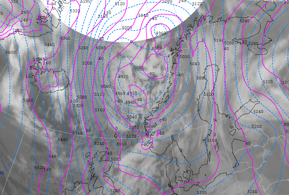
27 January 2004/18.00 UTC - Meteosat IR image; cyan: height contours 500 hPa, magenta: height contours 1000 hPa
|
|
|
At this time, the low-pressure area west of the Norwegian coast has two separate cores with a central pressure around 990 hPa. The most northern low-level trough is situated ahead of a trough at 500 hPa. The first clouds begin to merge at this time and the tops are becoming brighter, which means they are becoming colder. This is all a result of strong upward motion. The first trough is situated from Northern Ireland towards southern Norway; again an upper level trough at 500 hPa follows this low level trough. This upper trough is preceded by thin, high cloudiness.
|
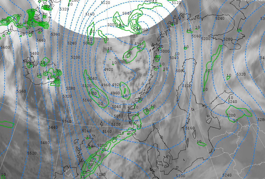
27 January 2004/18.00 UTC - Meteosat IR image; cyan: height contours 500 hPa, green: PVA 500 hPa
|
|
|
There are different areas of significant positive vorticity advection (PVA) above the clustered cloudiness west of the Norwegian coast. An important maximum of PVA is out of the range of the satellite, as it is too far north. An area of PVA coincides with the rear of a patch of cloudiness on the trough at the northern part of the North Sea. This area of PVA precedes an upper level trough at 500 hPa.
|
27 January 2004/18.00 UTC - Meteosat IR image; purple: ThetaW 850 hPa
|
|
|
There is also a baroclinic zone, recognizable through a strong ThetaW gradient from north to south. Polar Lows often develop in a baroclinic zone such as this, and is probably the reason for the development and clustering of heavy showers in this area.
|
27 January 2004/18.00 UTC - Meteosat IR image; magenta: surface isotachs in kts
|
|
|
Another characteristic parameter of Polar Lows is the wind speed. Polar lows are often accompanied by strong winds. At least 27 knots or 14 m/s is the required condition for identifying a Polar Low. The areas east of Iceland and northwest of Norway fulfil this condition. A small vortex will develop later for a short time at the position of the wind maximum east of Scotland. This vortex does not fulfill all the key parameter conditions for Polar Lows, but the wind speed, development in a low level trough followed by an upper level trough, are required conditions. Temperature at 500 hPa is about -35° Celsius and that is too warm for Polar Lows. This vortex does not evolve spectacularly over time.