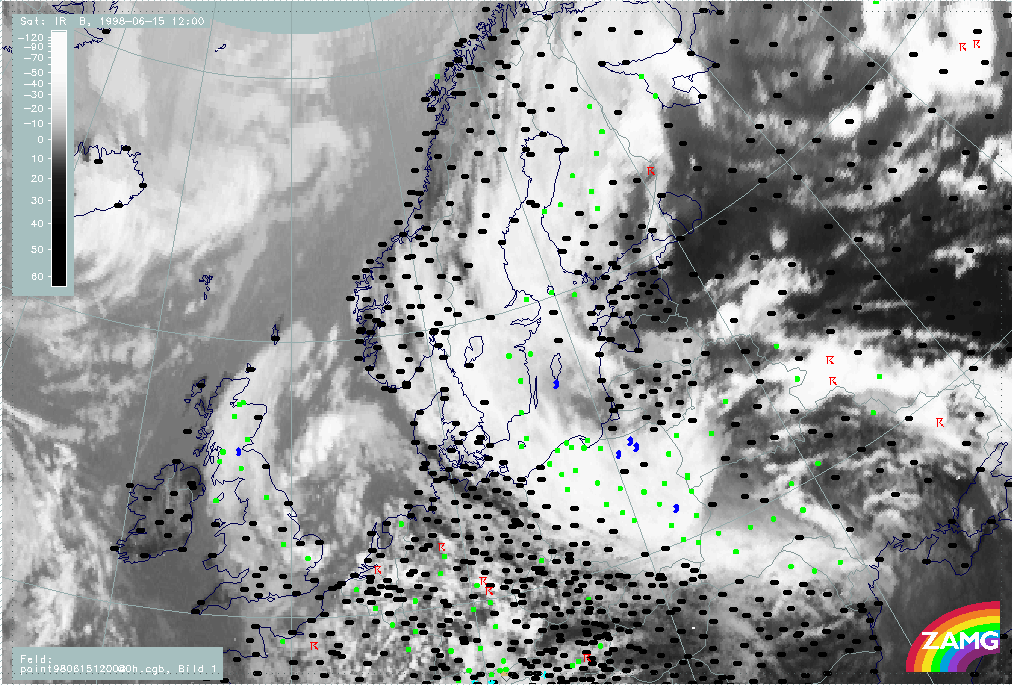
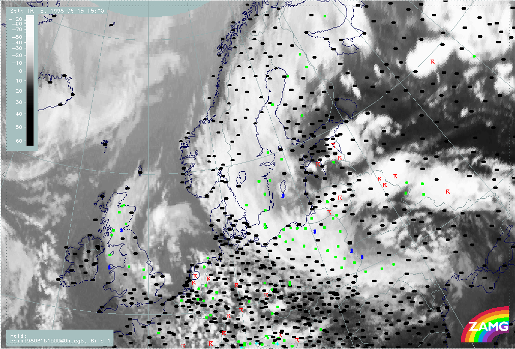
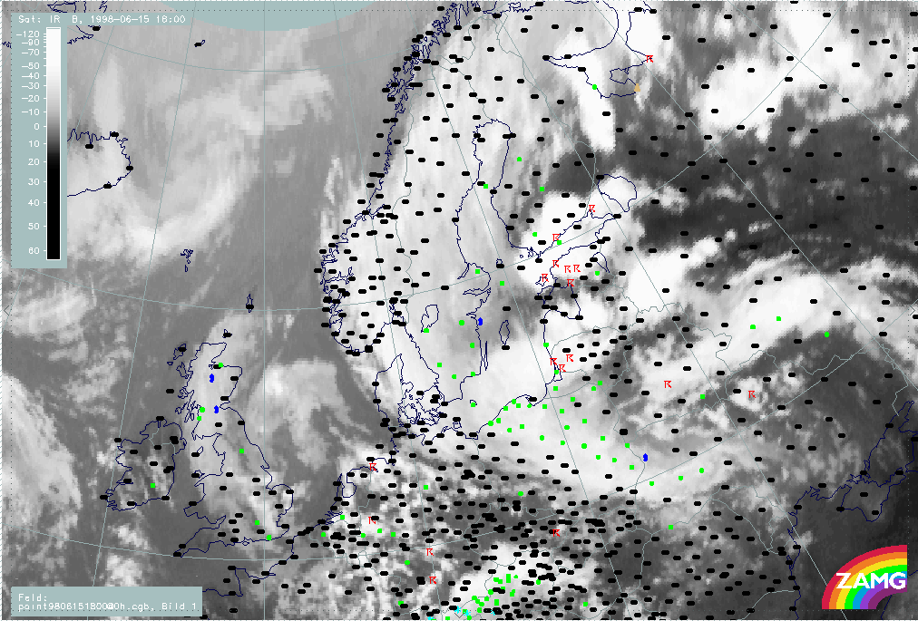
Overview of satellite features at the synoptic scale during the observation period
The following images (Fig. I00a-I00c) show the development of intensive MCS's, initially southeast of the Baltic States (56N/30E - 57N/36E) which, later in the evening, move towards Estonia and further over Finland. The large synoptic-scale frontal systems were located as follows:
- A Warm Front cloud band was located over Finland and Sweden, and it was accompanied by precipitation.
- A Cold Front cloud band was located over White Russia - Ukraine - Russia, and it was accompanied by rain and thunderstorms.
- A CCB Occlusion was located over Romania - Ukraine, and it was accompanied by precipitation.
The development of MCS's within the warm air-mass was rapid resulting in huge multiple MCS in southern Finland, Estonia and White Russia. Many thunderstorms were observed within these MCS's.
|
15 June 1998/12.00 UTC - Meteosat IR image; weather events (green: rain and showers, blue: drizzle, cyan: snow, red: thunderstorm with
precipitation, purple: freezing rain, orange: hail, black: no actual precipitation or thunderstorm with precipitation)
|
15 June 1998/15.00 UTC - Meteosat IR image; weather events (green: rain and showers, blue: drizzle, cyan: snow, red: thunderstorm with
precipitation, purple: freezing rain, orange: hail, black: no actual precipitation or thunderstorm with precipitation)
|
|
|
|
|
|
15 June 1998/18.00 UTC - Meteosat IR image; weather events (green: rain and showers, blue: drizzle, cyan: snow, red: thunderstorm with
precipitation, purple: freezing rain, orange: hail, black: no actual precipitation or thunderstorm with precipitation)
|
|