Metar Observations
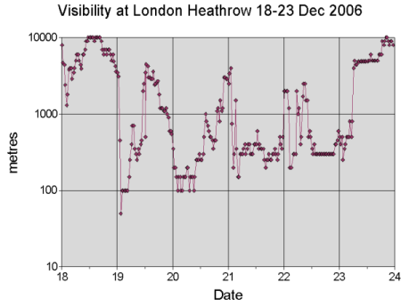
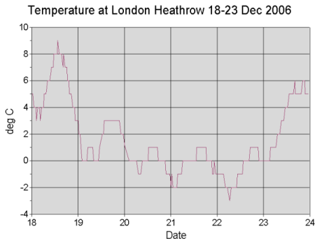
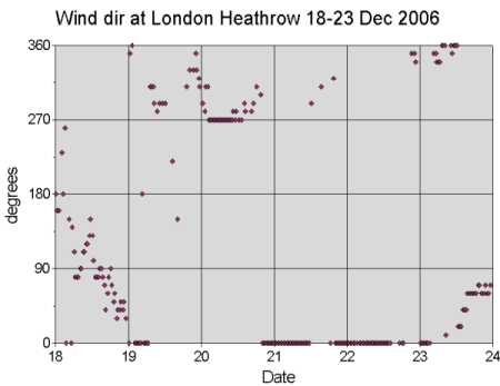
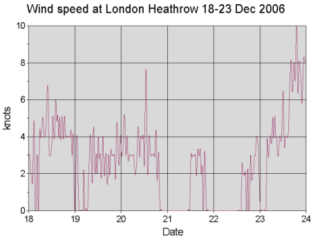
In the graphs below are shown the (horizontal) visibility observations, wind direction and wind speed at London Heathrow 18-23 December (half-hourly METAR Observations). We can identify the following stages:- 19 December: Sudden drop in visibility early in the morning, temperature drop to near zero, winds calming down. Later during the day visibility slightly improving to mist.
- 20 December: Again a quick drop of visibility down to 100 metres, very weak wind (1-2 m/s) and temperature near zero. In the evening slight improvement of aviation conditions.
- 21 December: Once again quick fog formation at night or early morning, slightly freezing conditions at surface (temperature below zero). Calm.
- 22 December: very poor visibility conditions continue throughout the day. Still freezing temperatures and totally calm
- 23 December: Quick improvement of the flight weather: visibility increasing to 5000 metres in just one hour, temperature rising and E-NE wind catching up.
Obviously the conditions have been quite special for aviation forecasting: quick changes in visibility, visibility alternating rapidly from one category to another and the long-lasting nature of the event make the production of TAF (Terminal Aerodrome Forecasts) very challenging.
In the next chapters we do not go into very details of fog forecasting or nowcasting, but rather show a general overview on the case from the synoptic and satellite imagery viewpoint. Also no specific fog models were tested for this case. We use mainly current operational global model analysis and forecast data - even though with reasonably good resolution - for visualising the broad scale features of the fog. The microphysical properties or small-scale features within the fog layer remain beyond the scope of this study.