Authors
Vesa Nietosvaara - Finnish Meteorological InstituteWilfried Jacobs - Deutscher Wetterdienst
Introduction
This case study presents the synoptic analysis of an event that took place from the 18th to 23th December over the UK. During this period dense fog was covering many places in the UK causing extremely bad conditions for aviation. Services at main UK airports, such as Coventry, Gatwick, Manchester, Glasgow, Edinburgh, London City, Norwich, Southampton and Cardiff were badly disrupted. Worst hit was London Heathrow because of its constant traffic. For a busy international airport like Heathrow the cancellation of hundreds of flights just at the peak travel season (a few days before Christmas) meant chaos and significant economic loss. Changes in travel plans affected at least tens of thousands of passengers.Fog itself is a common event at the Bristish Isles at this time of the year. However, the duration of the episode justifies a closer look at the event. In addition, the visibility within the fog was at times very low, and this heavily affected the air-traffic even at airports having the most advanced instrumentation for low-visibility flight operations.
|
|
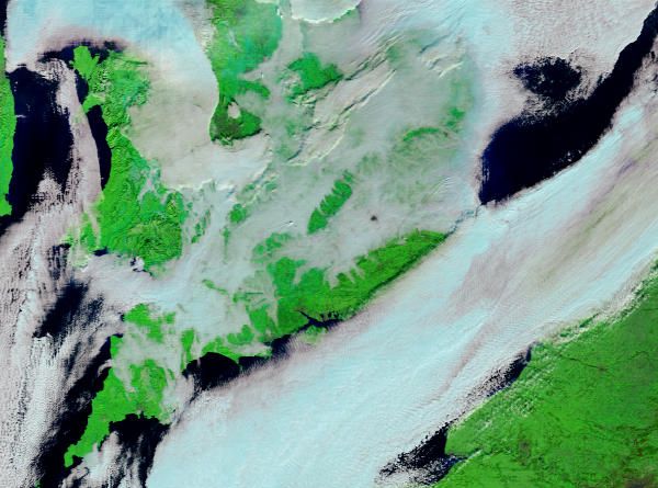
| 21 December 2006/ 1105 UTC - MODIS Terra 7-2-1 (2,13 Ám + 0.9 Ám + 0.65 Ám) RGB combination image.
Patches of low clouds (pinkish colours) can be seen over the English Channel and UK. Cloudless areas can be seen in green. Note the black spot caused by the urban area (London). |
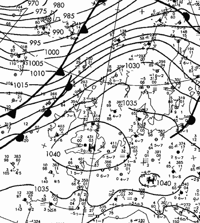
21 December 2006/ 06 UTC- A frontal analysis (DWD). The British Isles and the continental western Europe is under the influence of an anticyclone, and calm conditions prevail. |
This study concentrates only on the area in the southeastern UK, but basically similar synoptic conditions with reduced visibility at times prevailed also on the European continent during this episode. What makes this case study differ from many other case studies is the absence or small influence of atmospheric fronts or dynamic forcing (such as PVA or PV anomalies). During the whole episode winds remained mostly calm, the anticyclonic flow persisted and little change was observed in large-scale dynamics. Thus the focus of the study should and will focus more into the events within the surface and boundary layer.
The whole event took 4-5 days, starting with a sudden drop in visibility on the morning of December 19. During the following three-four days the fog lifted only intermittently. Finally on the morning December 23 the fog dispersed and visibility increased from very poor to moderate (mist).
In the next chapter we show a more detailed overview of the event at London Heathrow , with the help of METAR observations.