Chapter III: Warnings in Slovenia and Croatia
Table of Contents
- Chapter III: Warnings in Slovenia and Croatia
- Warnings in Slovenia and Croatia
Warnings in Slovenia and Croatia
As already pointed out in the Introduction, this event was characterized by early, high-level warnings. The Extreme Forecast Index (EFI) from ECMWF gave a clear signal for extreme amounts of rain as well as other numerical weather models that are used on an everyday basis in forecast offices.
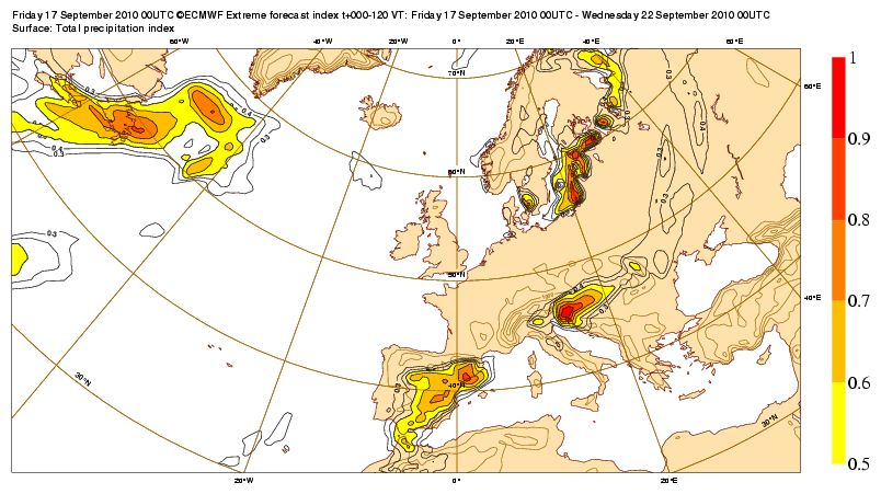
Figure 3.1: Extreme forecast index Friday 17 September 00 UTC t+000-120 VT, Surface total precipitation index
The Croatian Meteorological and Hydrological Institute (DHMZ) issued warnings of this event to the DUZS (National protection and rescue directorate) and to the public and media. DHMZ is a part of EUMETNET and is involved in the EMMA project, so the warnings were also visible on the official DHMZ website (www.meteo.hr) and at https://meteoalarm.org/en/.
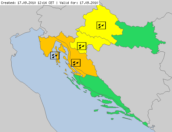
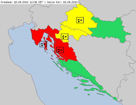
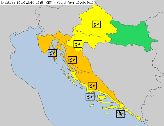
Figure 3.2: Warning issued on the Meteoalarm web page for 17, 18 and 19 September 2010.
The first warning that DHMZ issued to the DUZS on 17 September:
'In the North Adriatic storms can be expected and and stormy gusts of SW wind (30 to 40 knots).
In the night in the North Adriatic and Gorski kotar region extreme rainfall is possible.'
Warning issued on 18 September:
'In the North Adriatic, Western and Northwestern parts of Croatia heavy rainfall is expected, locally more then 50 mm of rain on square meter, and in particular in Istria peninsula, region of town Rijeka and Gorski kotar region 70 to 100 mm of rain.'
Warnings were issued for those locations that were the most critical in the next few days. In the media, and especially on prime time national television broadcasts, the forecasts already mentioned the possibility for strong thundershowers in the North Adriatic and the western parts of Croatia on Wednesday 15 September. On the following days, at the end of official broadcasts the forecaster would indicate the danger areas along with the expected amount ofrainfall.
There was a similar situation in Slovenia. Warnings, including hydrological warnings, were also issued several days ahead. The highest level of warnings were already issued 24 hours before the event (Fig 3.3) and the local authorities, civil services and general public were informed accordingly. The highest level of hydrological warnings were also issued for most of Slovenia during the episode (Fig 3.4). More than 251 million EUR of damage were reported in Slovenia, along with two casualties. A huge part of Slovenian territory was flooded, including more than 8200 buildings.
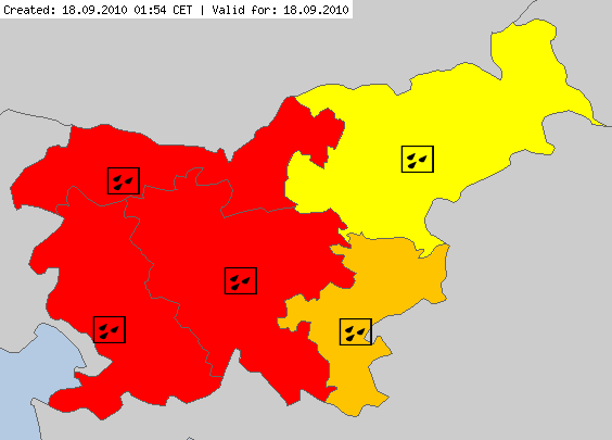
Figure 3.3: Meteoalarm warnings valid for 18 September 2010. Source ARSO.
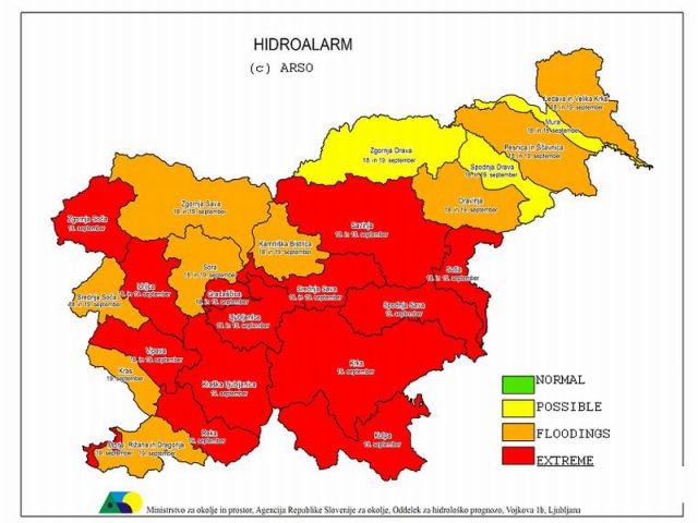
Figure 3.4: Hydrological alarm warnings in Slovenia issued for 18 and 19 Sep 2010.
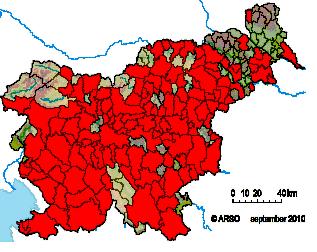
Figure 3.5: Damage reports in Slovenian regions during 17 - 19 Sep 2010. Included are all damage reports due to floods. There is no indication of how severe the damage was in other areas.
From Figure 3.5 it can be seen that the impact of the floods was not limited to one part of Slovenia; the floods resulted in damage reports in almost every part of Slovenia.