Synoptic Analysis
A widespread trough over Western Europe was moving eastwards. In addition to that, a frontal zone influenced western parts of Germany, Denmark and Sweden. Behind this frontal zone, one can see a zone of reddish colours stretching from the English Channel towards the North Sea.
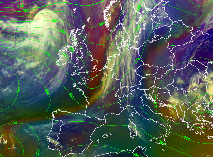
Figure 2.1: Meteosat 9 Airmass RGB and 500 hPa geopotential height - 12 September 2010 12UTC
This indicates an intrusion of dry upper tropospheric or stratospheric air which has higher values of Potential Vorticity (PV). You can also see this perfectly in WV-satellite channels. There, a PV anomaly associated with a vorticity maximum appears as dark and black zones. In front of those areas convective activity is likely to develop.
However, high pressure with few low clouds was decisive for the weather in Austria at that time. Furthermore, an upper level low was situated over Southeast Europe.
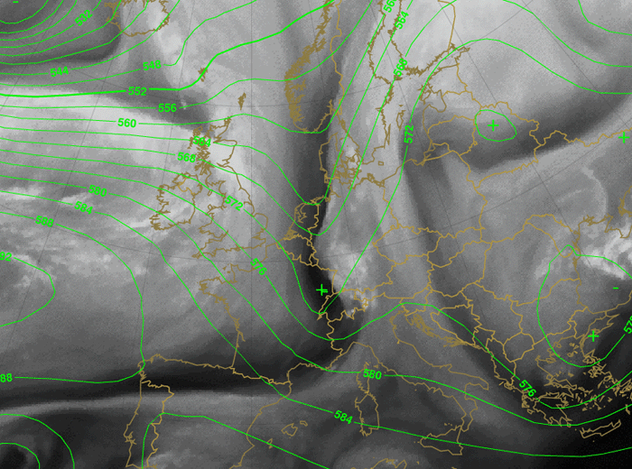
Figure 2.2: Meteosat 9 WV6.2 and 500 hPa geopotential height - 13 September 2010 00UTC
On Monday the 13th at 00 UTC the trough has split in two parts. One sharp trough with a significant dark spot is situated over Switzerland and Northwestern Italy (Fig 2.2). This indicates a strong PV maximum and convection with rain showers and some thunderstorms was initiated in the eastern parts of Switzerland and in Vorarlberg, Austria.
The other spot is weaker and is mainly situated over NW Germany.
During the early morning hours of September 13th, clouds moved eastward very quickly and reached northwestern Austria in the morning.
Watch the dark features (PV maxima) over Switzerland, Northern Italy and Germany. Especially the southern PV maximum was able to trigger convective cells on its front side (white spots over Baden-Württemberg, Bavaria and Tyrol). It is clear that this black feature is rolling up and developing a cut-off low as relative vorticity increases.
Therefore, convective activity was triggered at night without solar insolation.
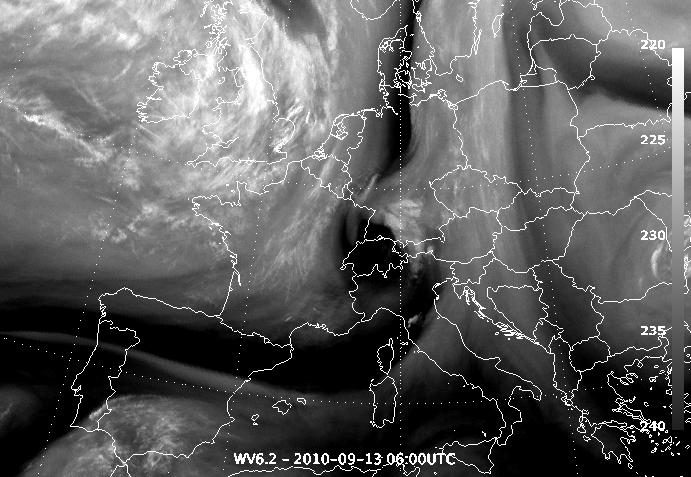
Figure 2.3: Meteosat 9 WV6.2 - 13 September 2010 06UTC
The sounding of Payerne (Fig 2.4) showed very dry air in higher tropospheric layers. In combination with unstable air in lower layers and an advection of colder air in higher altitudes, convection was triggered.
Strong convective cells occurred in Northern Italy due to the development of an upper level low and a most distinctive PV maximum, which can be seen in Fig 2.5. The second PV maximum generated some convective clouds near Berlin due to the passage ofthe northern trough axis.
At 12UTC clouds of a cold front have reached the main parts of Austria. Some weaker convective cells were also detected, and during the day some rain showers were reported.
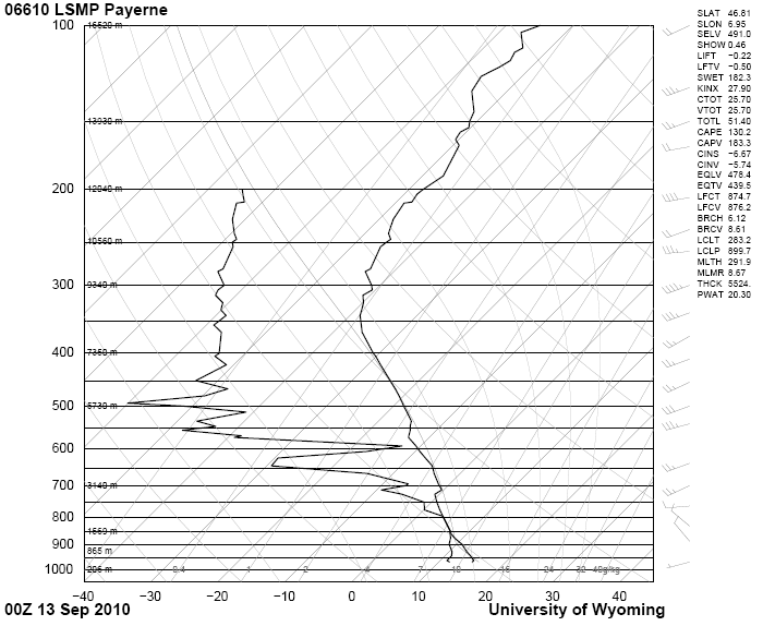
Figure 2.4: Sounding Payerne - 13 September 2010 00UTC
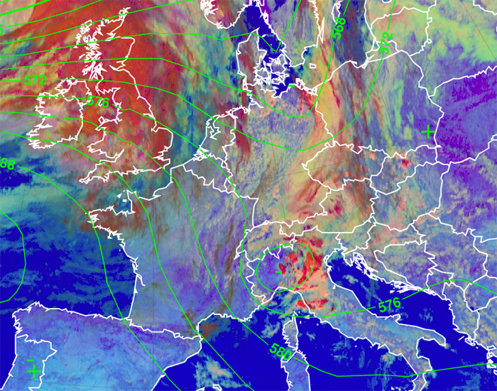
Figure 2.5: Day Microphysics RGB and 500 hPa model field - 13 September 2010 12UTC
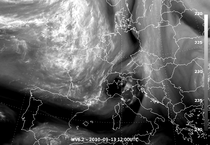
Figure 2.6: Meteosat 9 WV6.2 - 13 September 2010 12UTC