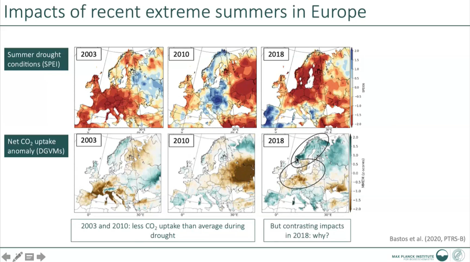
Ana Bastos presents about extreme climate event impact on carbon cycle and vegetation.
Carla Barroso gives insight into EUMETSAT climate data records and services.
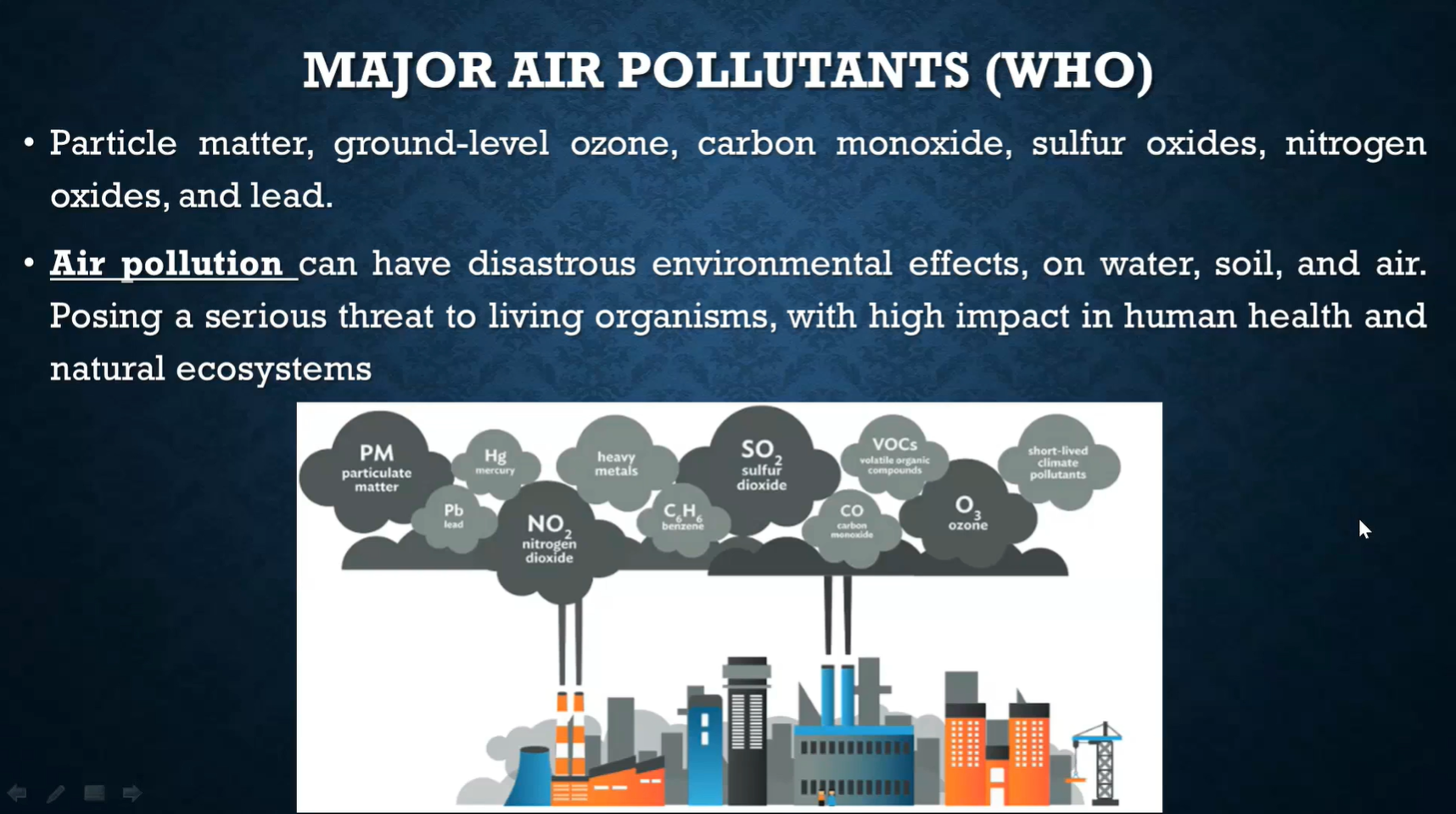
Ana Russo and Rita Durão talk about heatwave impact on air quality, pollutants and evaluation of air quality.
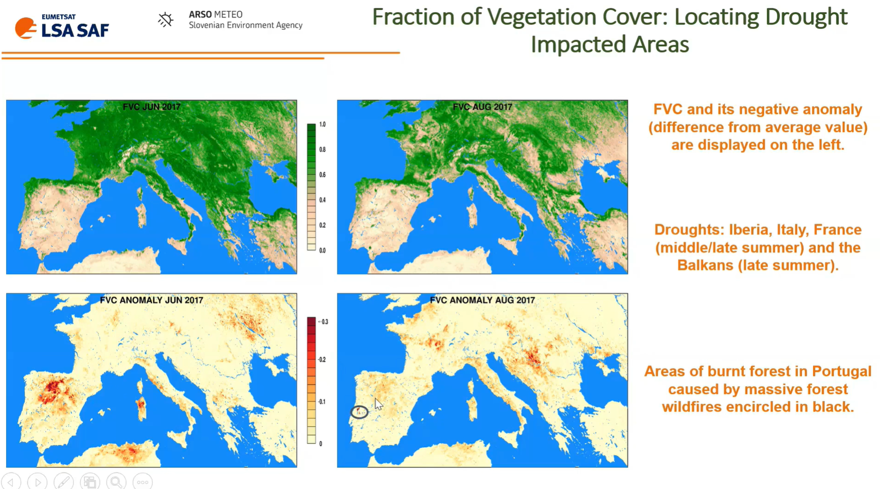
Bostjan Muri talks about using LSA SAF data and vegetation anomalies for drought monitoring.
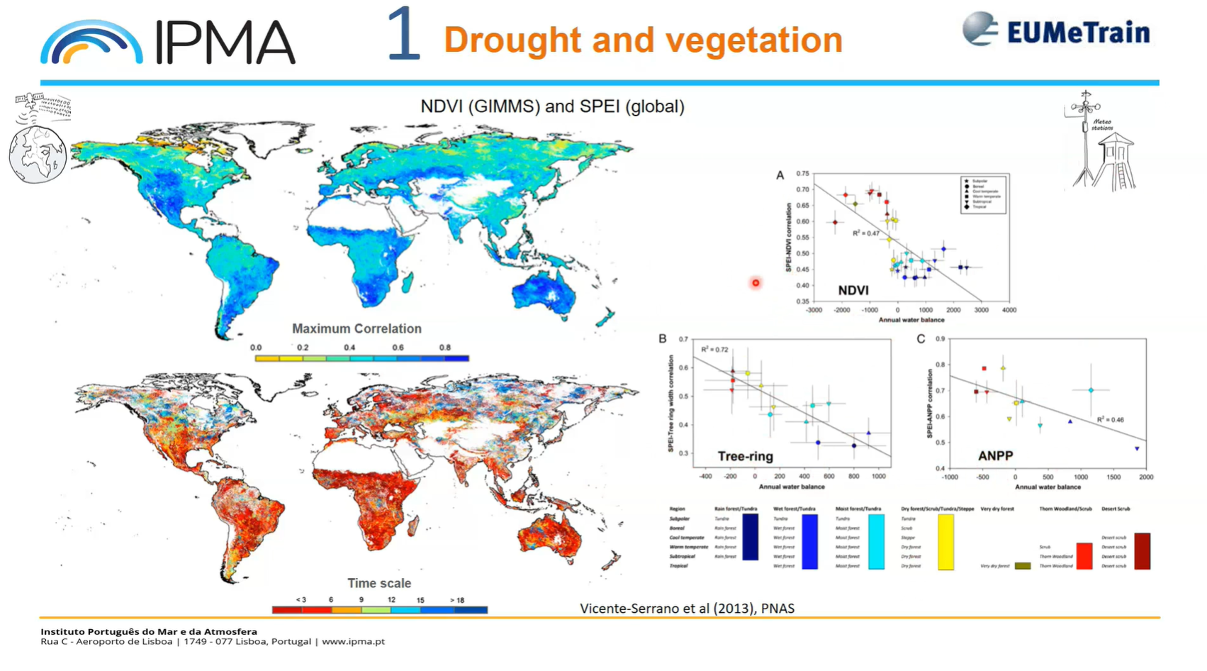
Célia Gouveia presents about heatwave and drought impacts on crops and vegetation.
Beatriz Martinez shows how climate data records analysis can be used to monitor drought affected areas.
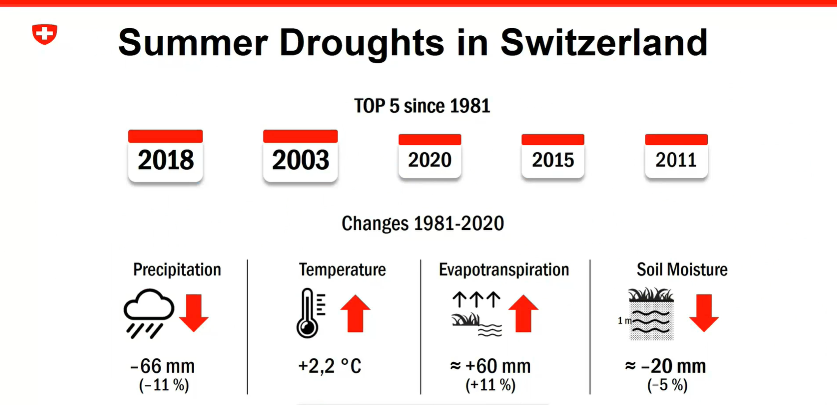
Anke Duguay-Tetzlaff and Vincent Humphrey present about the recent Swiss drought monitoring project and use of EUMETSAT satellite data for drought…
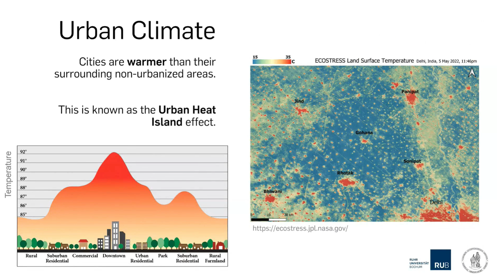
Panagiotis Sismanidis provides insight into urban heat islands including its drivers and impacts.