Severe Storm RGB and Day Microphysics RGB
|
|
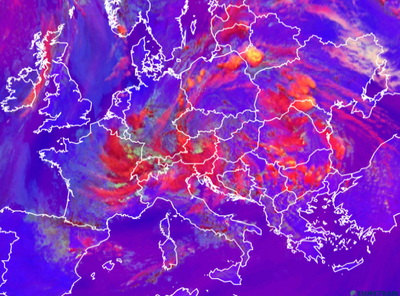
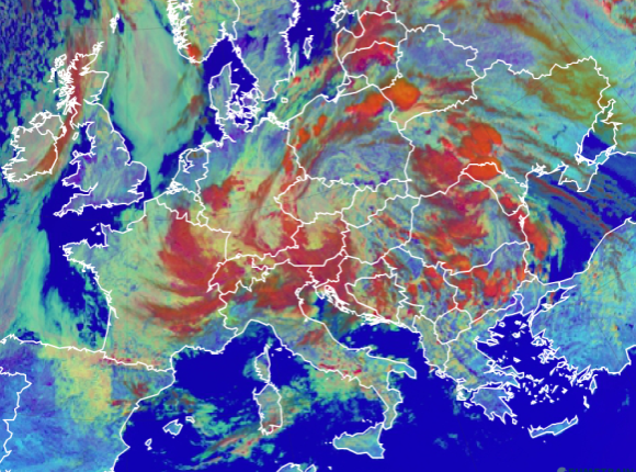
Figure 5.1: Comparison between Severe Storms RGB and Day Microphysics RGB, 31 May at 12 UTC (use the slider).
By comparing the Day Microphysics RGB and the Severe Storm RGB you can see the advantages and disadvantages of both.
The Day Microphysics RGB provides information about the microphysics of many clouds at different levels. At 12:00 UTC the warm front's orange color hints at strong convection, like in the cells over Ukraine and the Balkan states. However, it is difficult to determine differences in intensity.
By changing your view to the Severe Storm RGB, you can see the small yellow dots signifying a strong updraft with small ice particles at the cloud top. The clouds over Poland hint slightly at strong convection while over Belarus the signs are stronger. The reddish color is a sign of big ice particles at the tops.
The Day Microphysics RGB reveals that the other clouds over Germany are mid-level clouds and low level water clouds. A typical low level water cloud in the form of fog or a stratus cloud can be seen over the Northern Sea.
If you want to practice interpreting the colors in these or other RGB image types, consult EUMeTrain's "RGB Colour Interpretation Guide" (www.eumetrain.org).