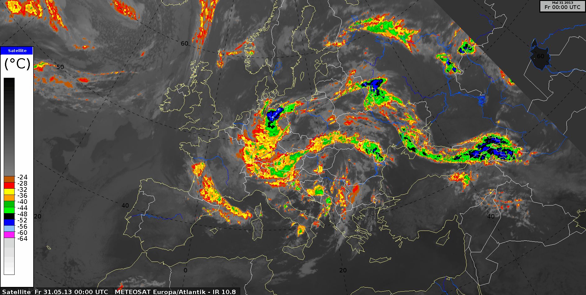
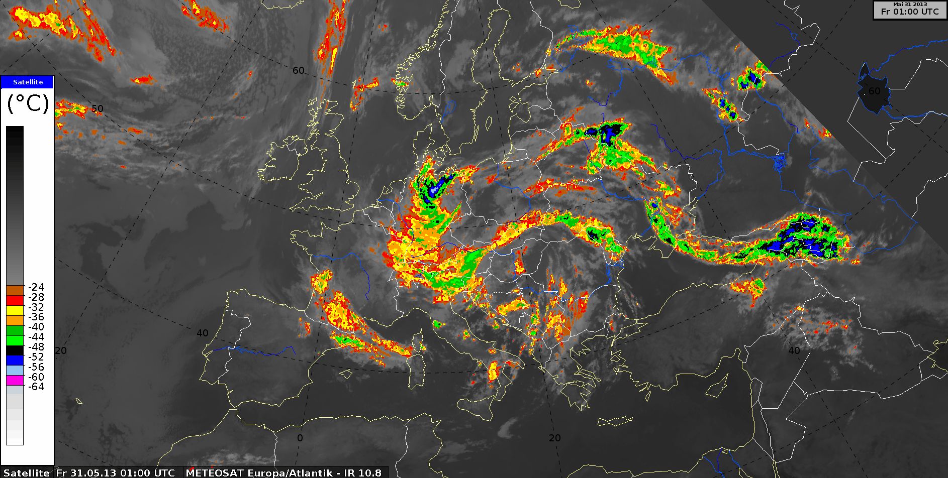
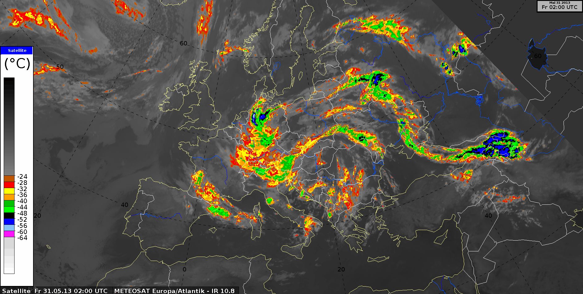
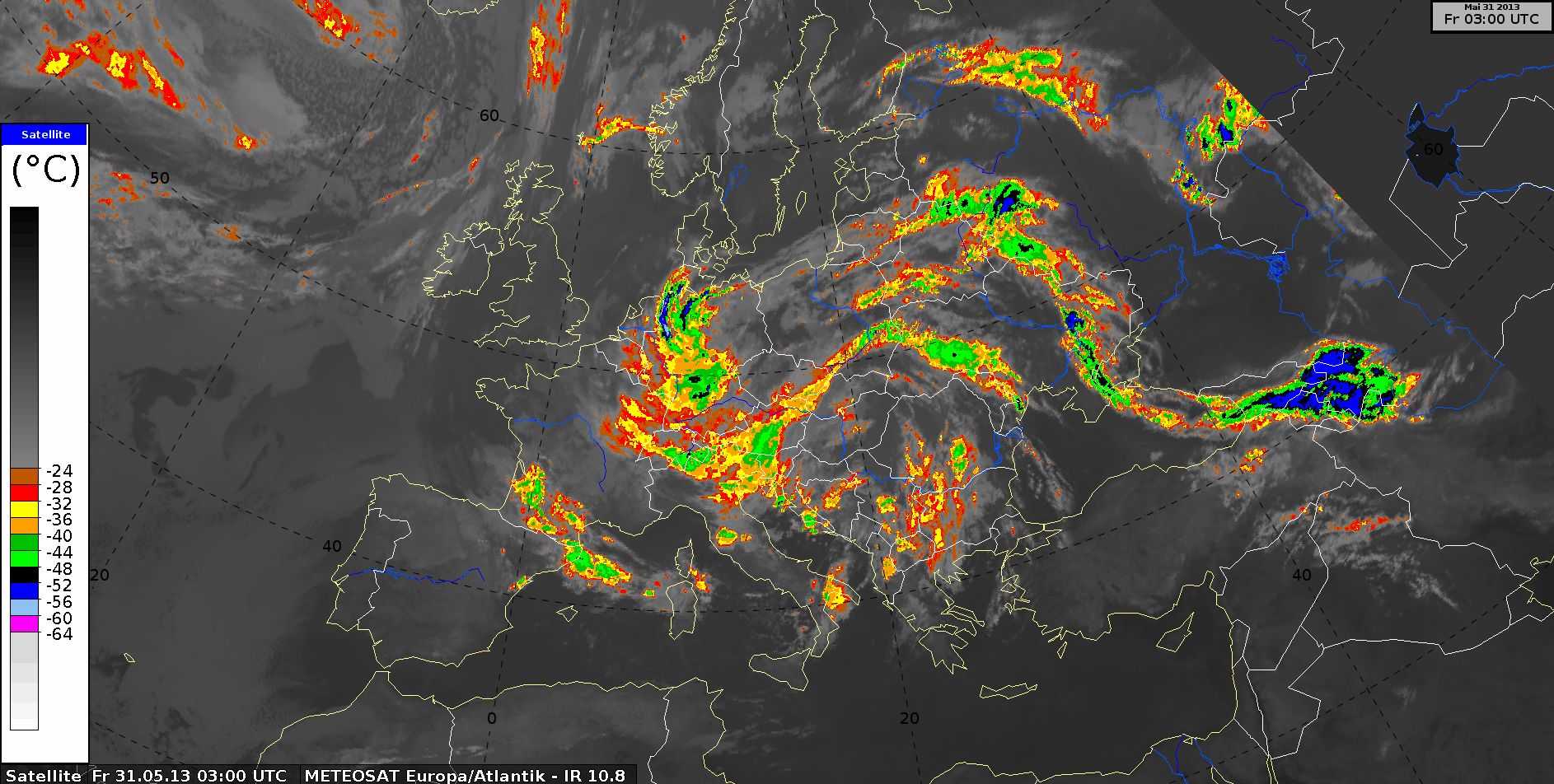
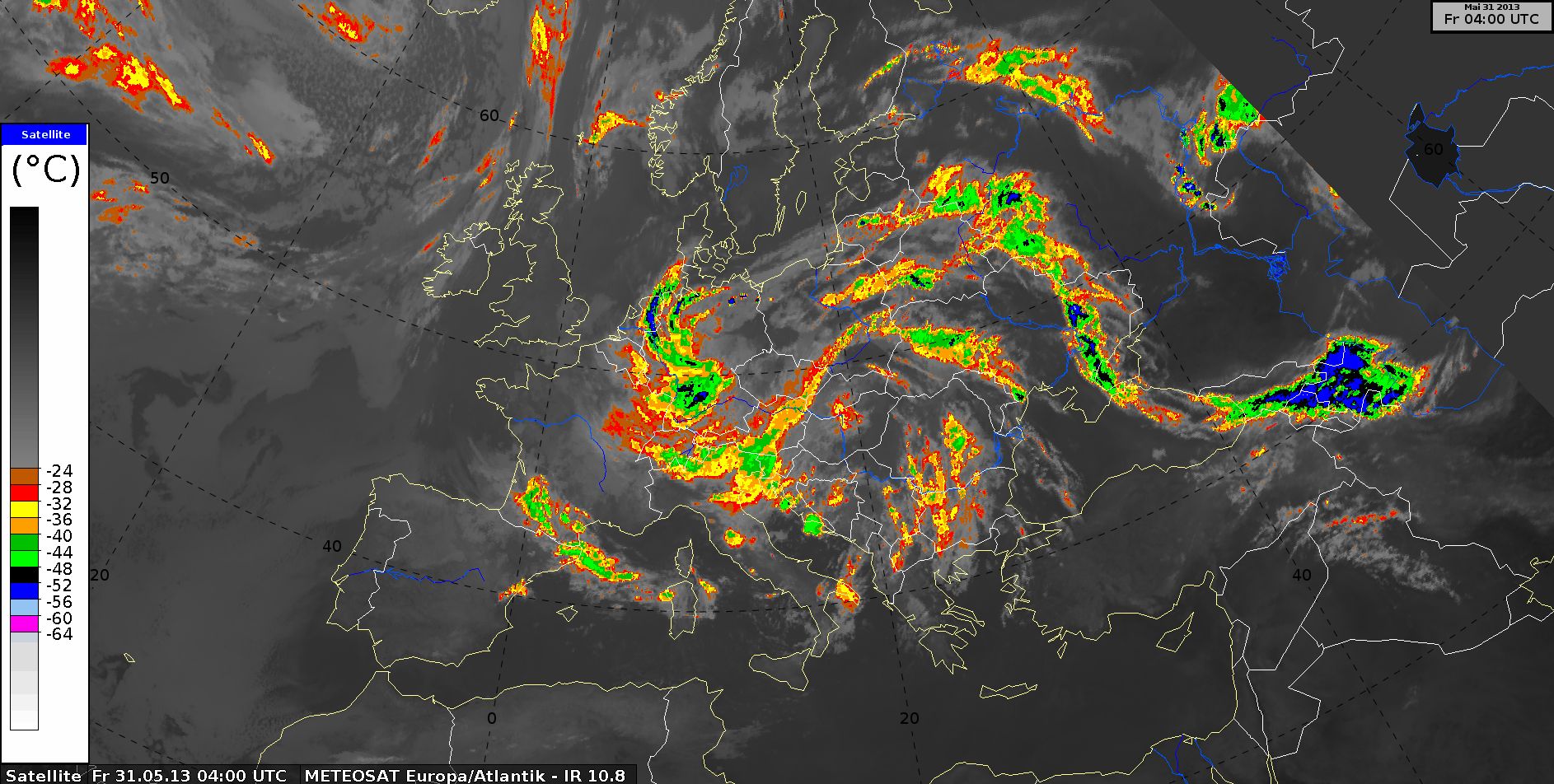
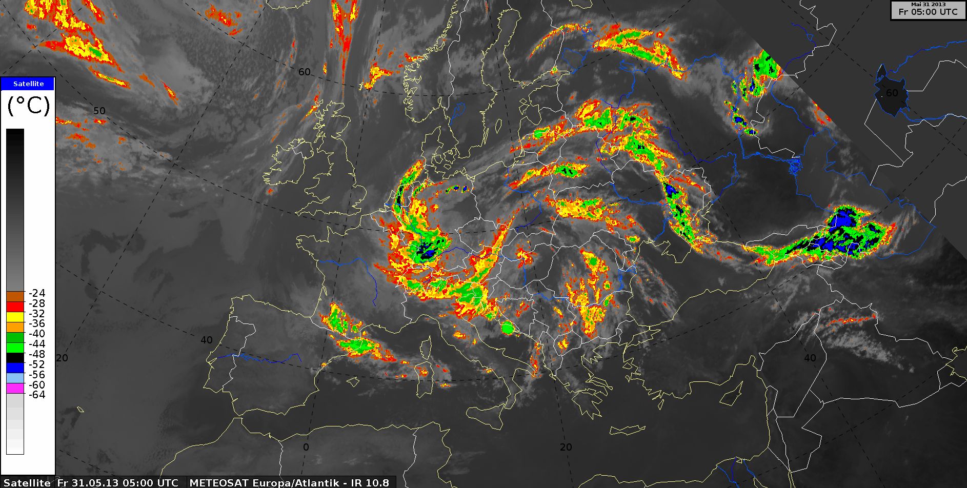
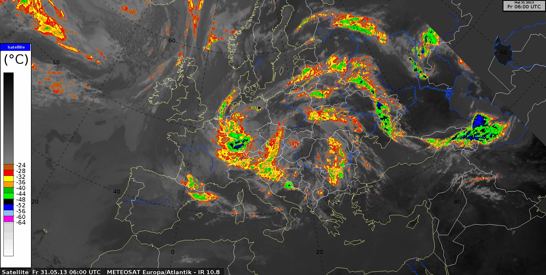
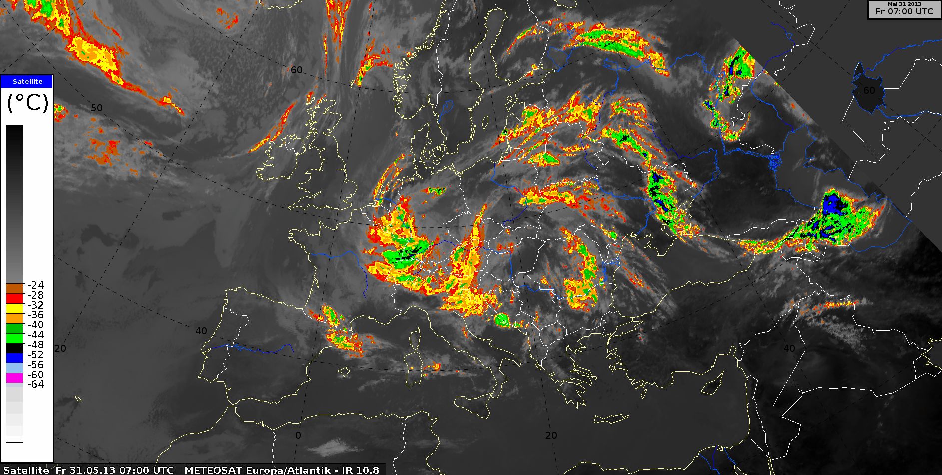
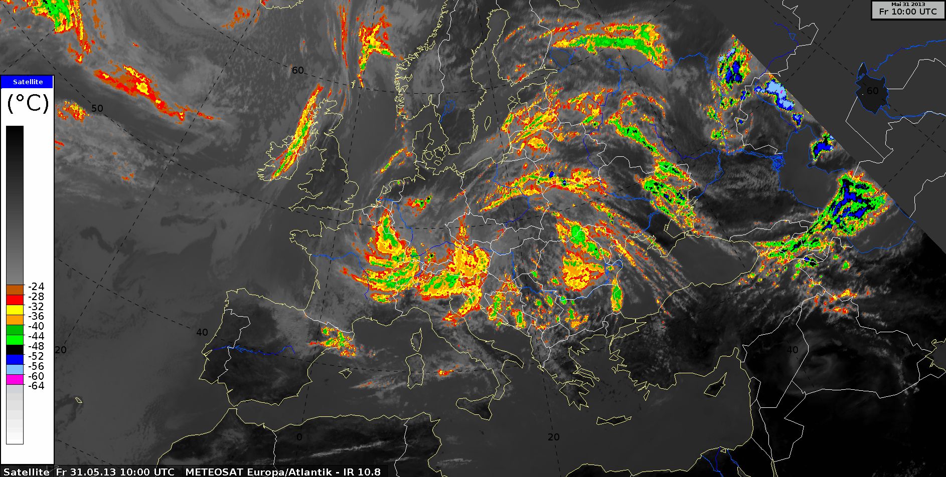
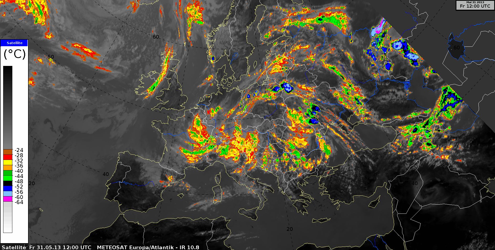
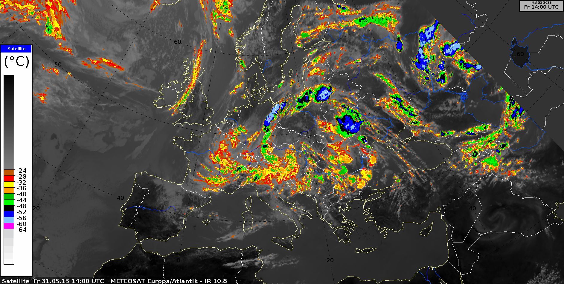
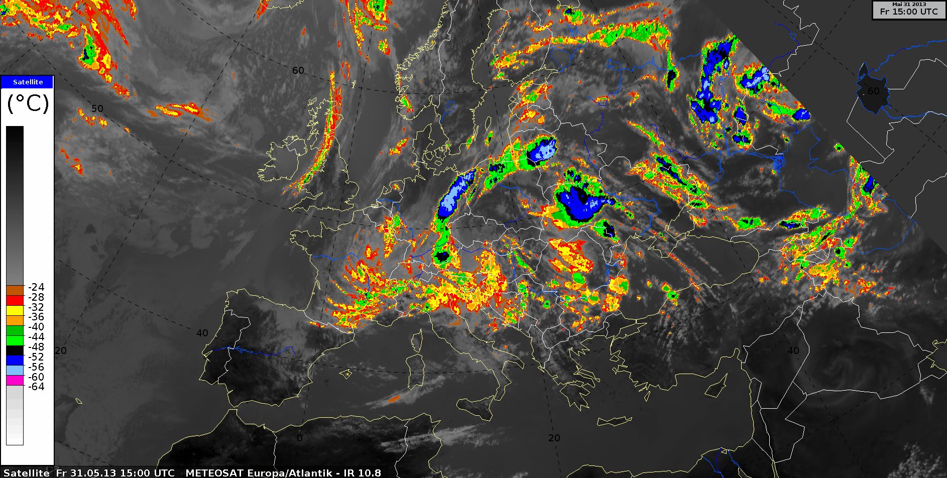
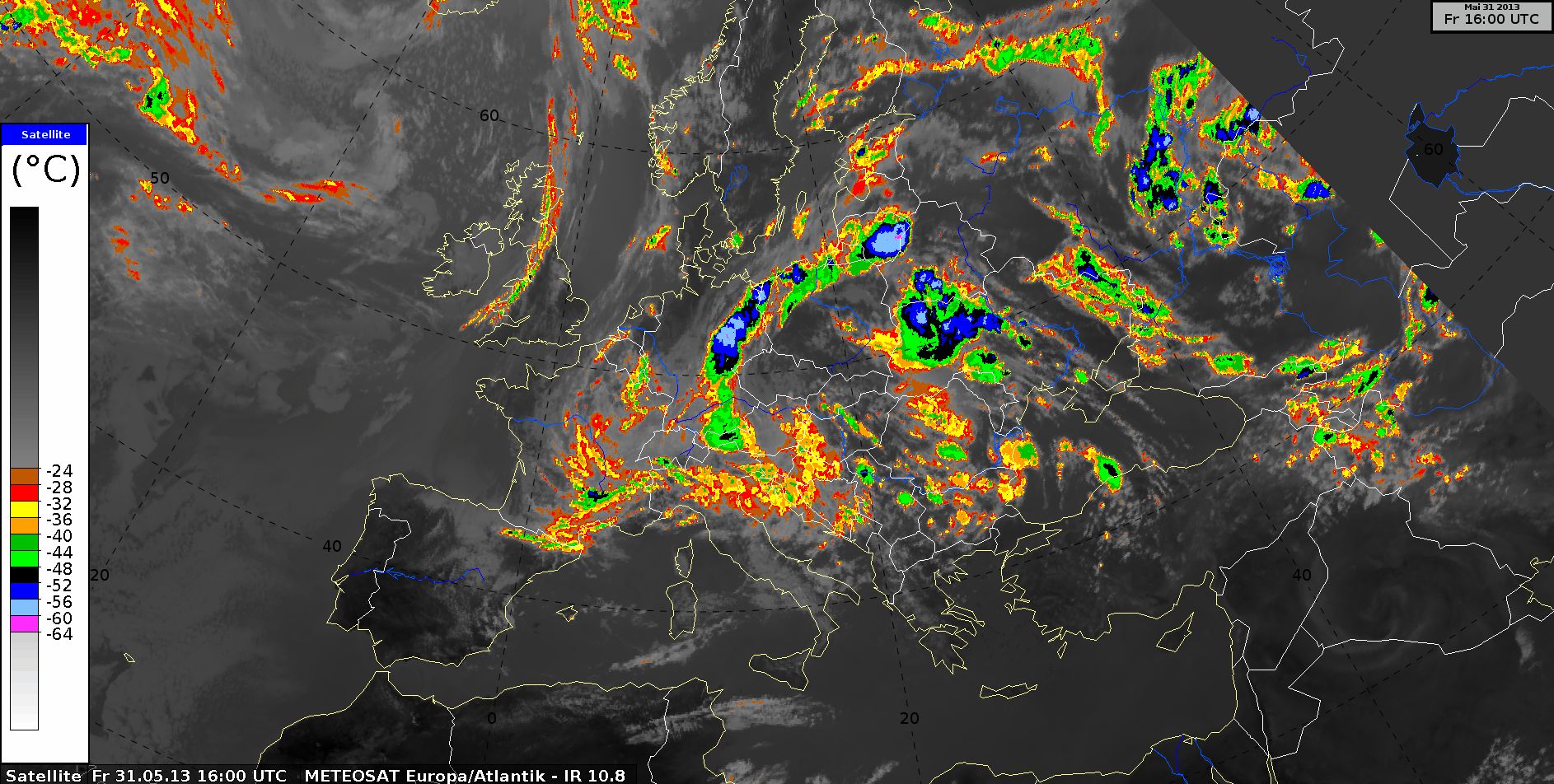
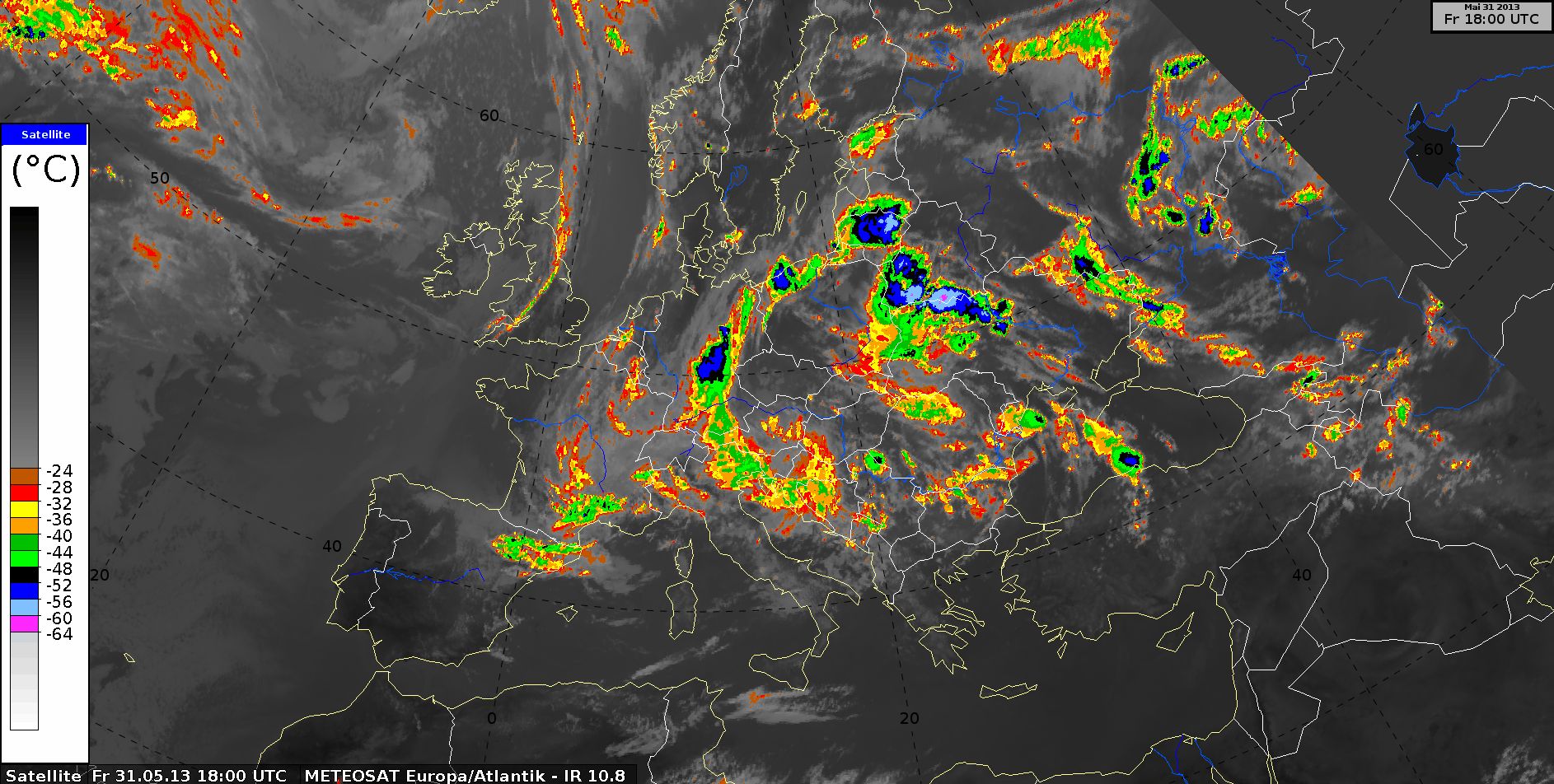
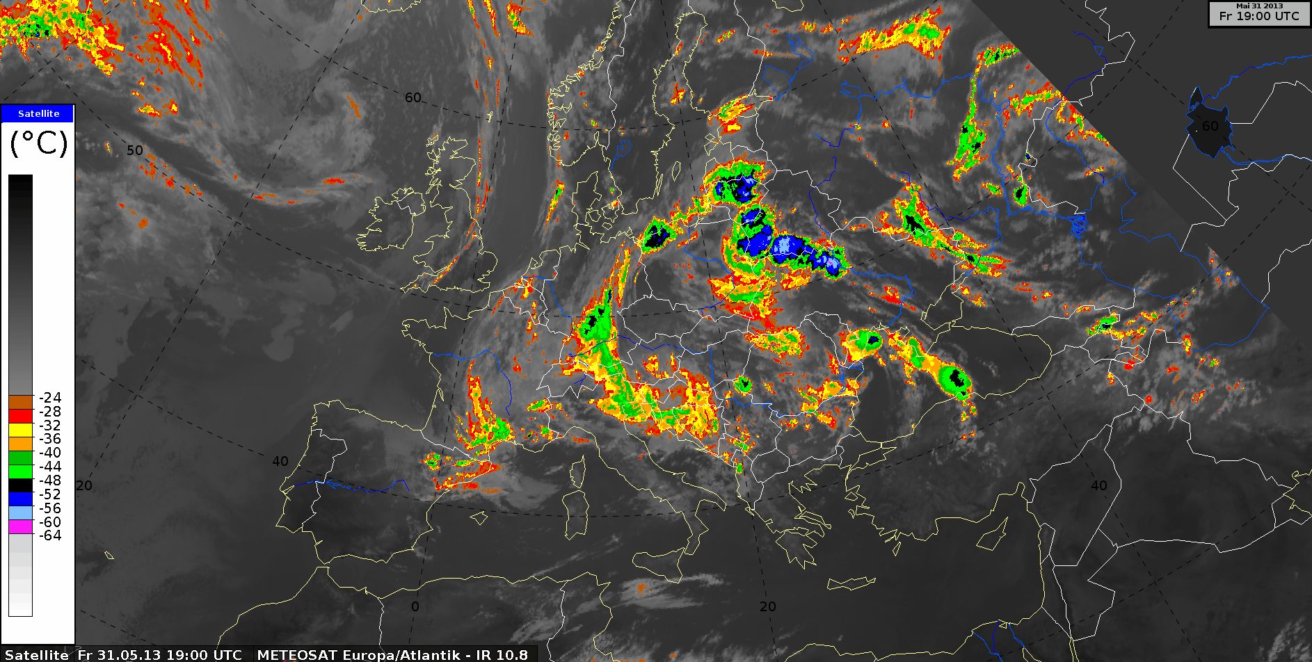
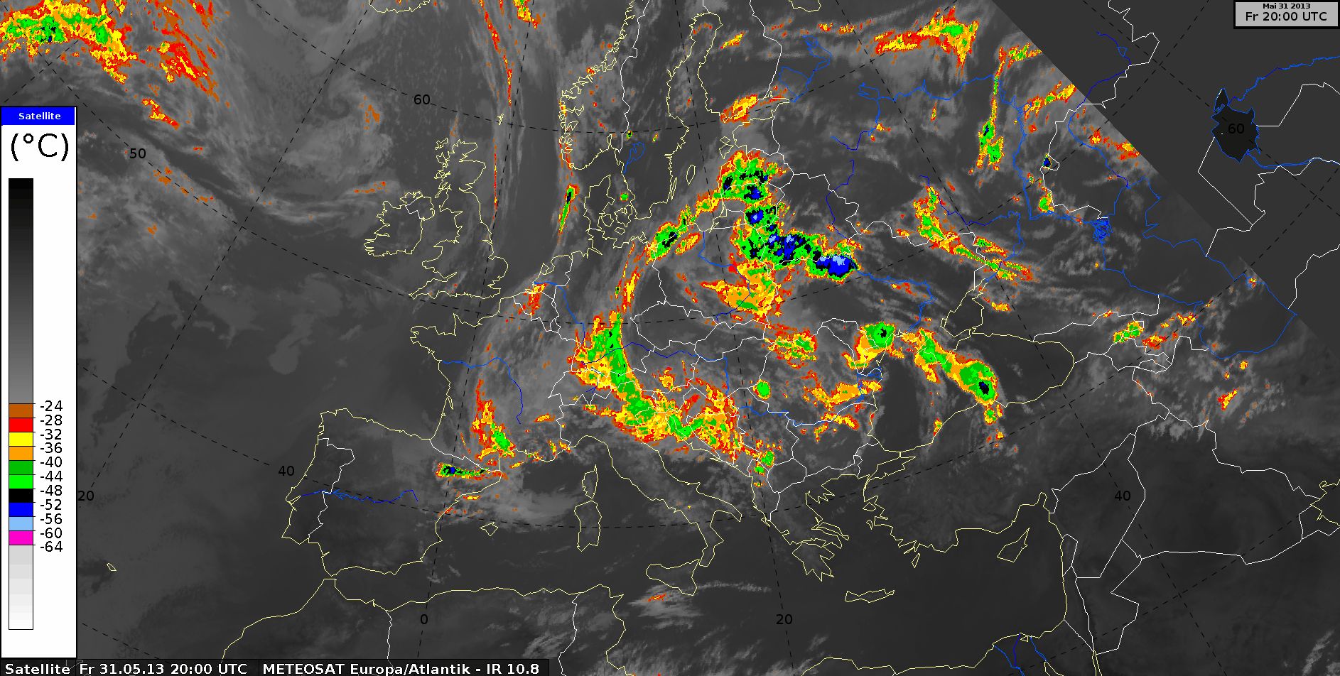
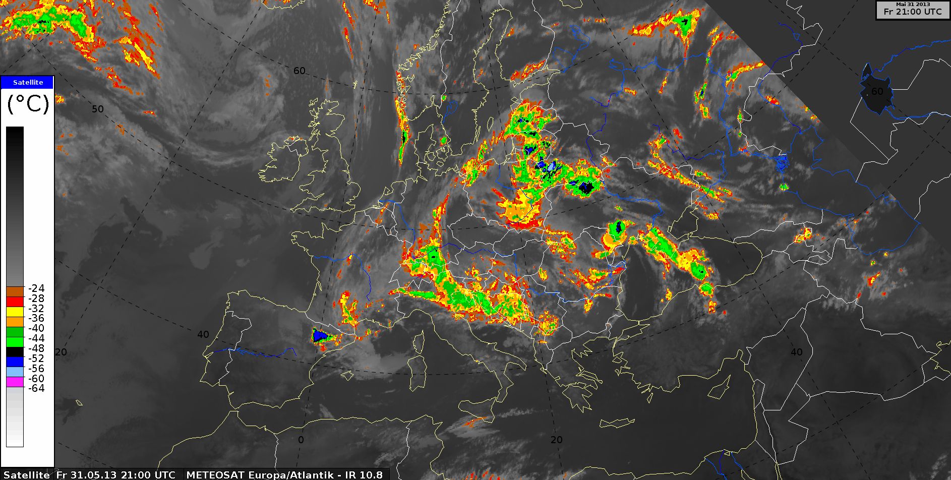
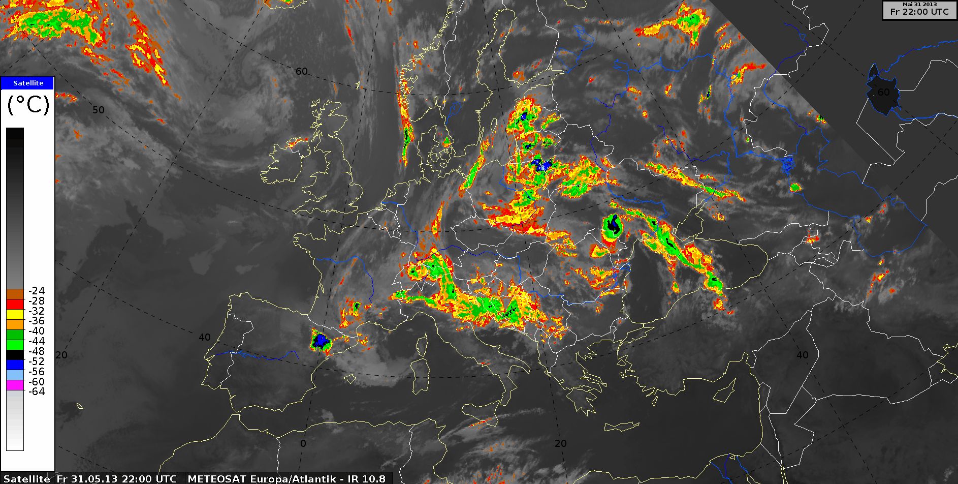
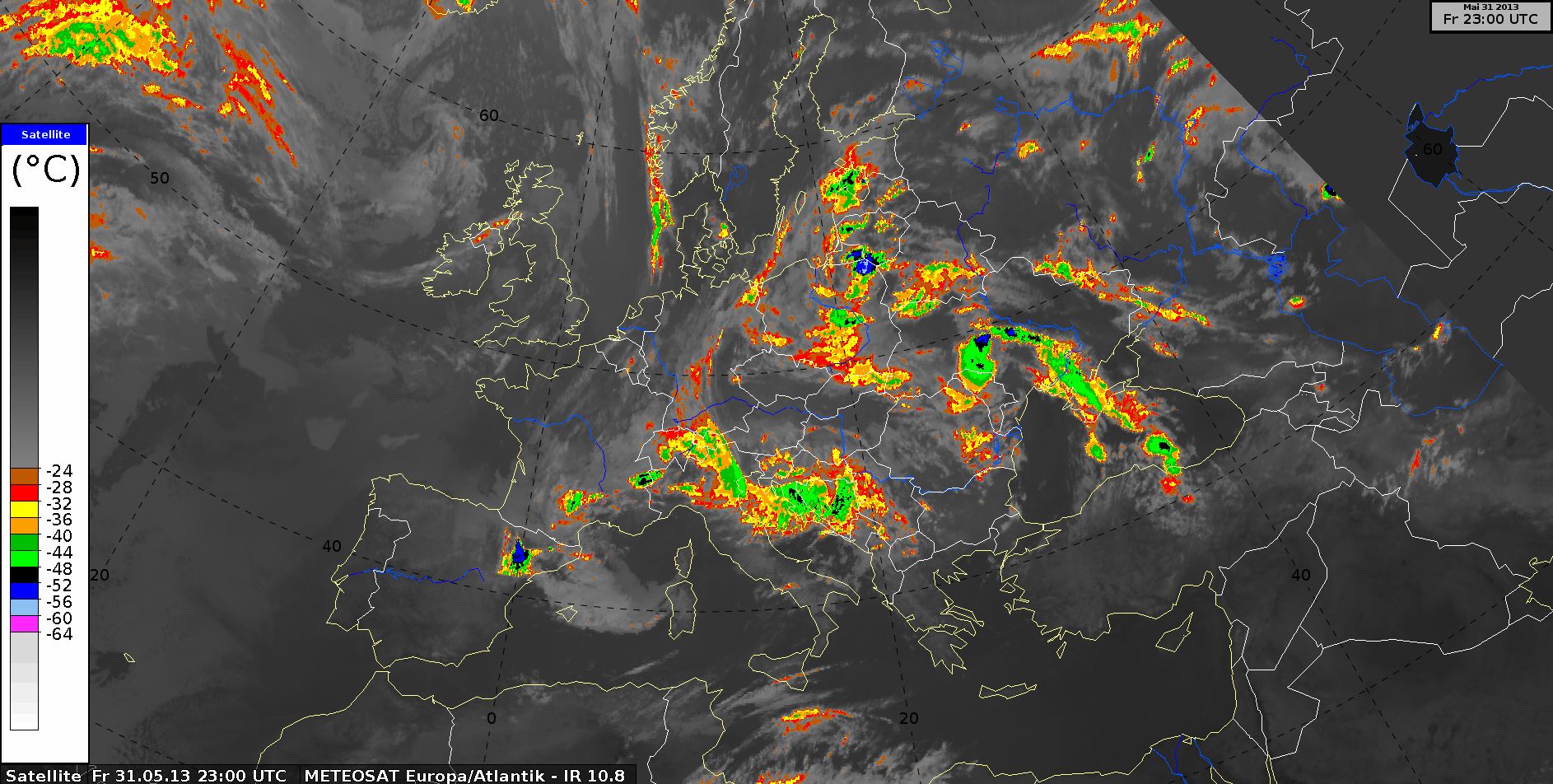
IR10.8 enhanced
IR10.8 enhanced, 31 May 2013, 00 UTC - 23 UTC (Source: DWD)
This image highlights cold cloud tops below -25°C. The development of the thunderstorms is clear along the warm front around 15:00 UTC. The cloud top temperature in east Germany was below -60°C. The colder temperatures also show nighttime convection clearly.
The disadvantage of this image type is that warmer cloud tops are also depicted in shades of grey. The following RGB images are useful for learning more about cloud structure.
The
radio sounding
from Bergen (ca. 100 km south of Hamburg in northern Germany) shows warm air advection between 1 km and 2 km from the ground. The next sounding shows greater instability because of this warm advection, which could be the mechanism behind the thunderstorms that developed in the warm front in the afternoon.