Weather in the days before the flood
A trough began to develop in central Europe on 22 May, seven days before the floods. A polar air mass moved in from the northwest and became a high cold pool, around which intensive surface lows began to circle. Especially in the north and central parts of Germany, the rainfall was transient and regionally very intensive. Starting from 29 May the trough intensified the rainy weather, causing southern and southeastern Germany to experience continuous rain over several days.
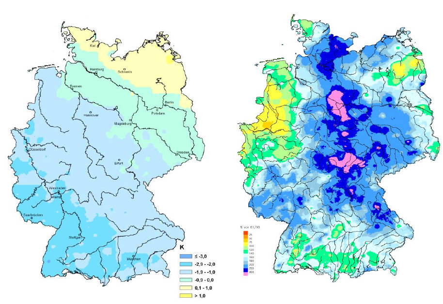
Figure 3.1: Left: Deviation of air temperature in May 2013 from the 1981-2010 average. Right: Precipitation height in May 2013 as a percentage of the 1961-1990 average. Source: (1)
The left chart shows that in May 2013 the southwest was more than 2 K colder. There was a large section of Germany, running from the northwest to the southeast, which was over 1 K below the 1981-2010 average.
The right chart shows precipitation values of double the average (relative to 1961-1990) in May 2013, with some exceptions in the northwest, northeast and some parts of the south. In a wide band from southern Schleswig-Holstein to northern Bavaria the values reached 250% to more than 300% of the monthly average.