Satellite Overview and Synoptic Situation
Cyclonic development followed in this case study was one in a row of cyclones that developed in the Mediterranean from 22 to 29 February. The most interesting feature of this particular cyclogenesis was the beginning phase of the development in the Mediterranean. Cyclogenesis has been triggered on one hand by the influence of an already existing cyclone, coming from the Bay of Biscay across south France and north Spain, as can bee seen in the loop of Meteosat-8 IR images.
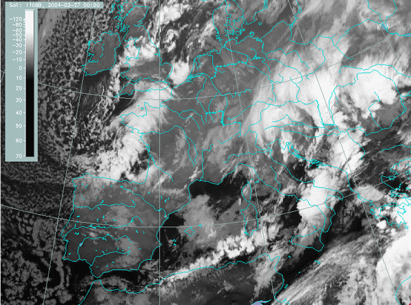
27 February 2004, 00 UTC - Meteosat-8; IR 10.8 micron channel
|
|
The following chapters enable a look at the various stages of the development as seen in satellite images and basic meteorological fields:
Satellite overview
Development of the cyclone is shown and described in the relevant satellite channels in 3 hourly steps:
IR Imagery (Meteosat-8: 10.8 μm channel)
WV Imagery (Meteosat-8: 6.2 μmchannel)
RGB Combination of High Resolution Visible channel on red and green and IR 10.8 μm channel on blue
The last set of images presented are only for daytime because of the High Resolution Visible which is not available during the night.
Some basic facts about RGB combinations of satellite images and their advantages can be found in MSG Interpretation Guide.
Basic synoptic parameters
Cloud configurations in satellite images are combined with the basic field of surface pressure represented by geopotential height at 1000 hPa. The images are shown here in 6-hourly sequence:
IR images and Geopotential height 1000 hPa
Situation in the upper levels is shown by 500 hPa height in 6-hourly sequence.
IR images and Geopotential height 500 hPa
Summary of the investigations in this chapter
In this chapter an overview of the process of cyclogenesis was given through satellite imagery and basic meteorological fields. Satellite images showed that the development in the Mediterranean, started in the evening on 27th February, was closely related to the cyclone coming from the Bay of Biscay. Additionally, the dark stripe in the WV images indicates that the influence of the jet should also be taken into account. Both processes that led to cyclogenesis are analysed in more details in Derived Meteorological Parameters and Physical Background chapters.