Model forecasts
From a forecasting point of view, it is clear that large-scale models are not capable of showing such a development, because it starts as a small-scale feature. However, at the larger scale, the situation indicated by the models was favourable for convective development.
Large scale model forecast (ECMWF)
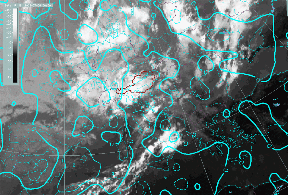
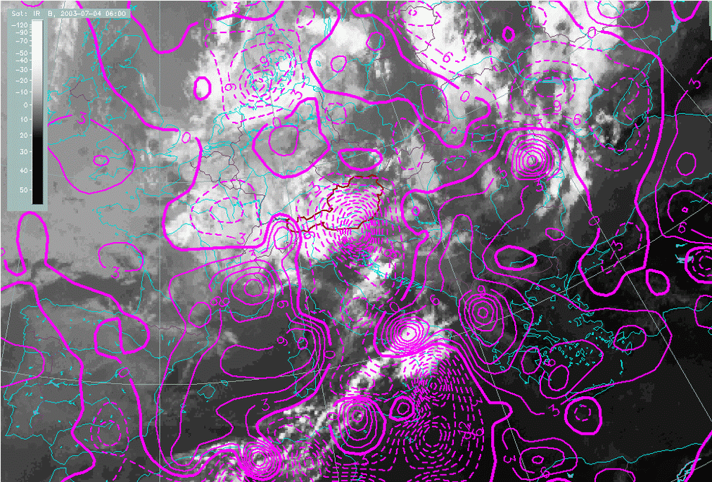
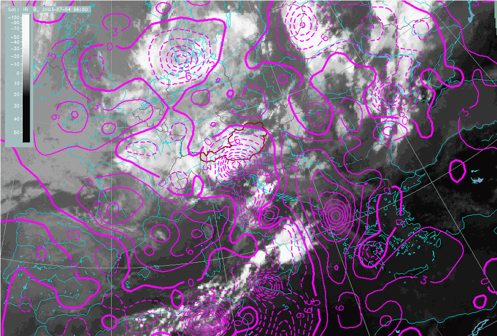
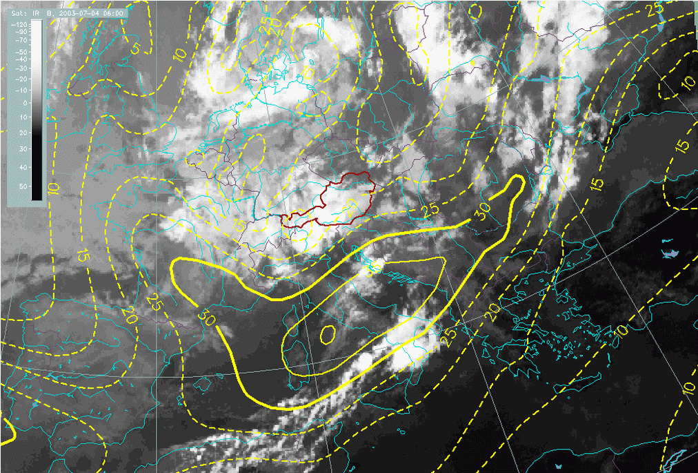
ECMWF forecasts for 06.00 UTC indicated that the region from the North Adriatic, Northern Italy to the Alps was favourable for convective development. There was convergence in the lower layers, and strong upward motion at both 700 and 500 hPa.
|
04 July 2003/06.00 UTC - Meteosat IR image; cyan: divergence 850 hPa
|
04 July 2003/06.00 UTC - Meteosat IR image; magenta: vertical motion (omega) 700 hPa
|
|
|
|
|
|
04 July 2003/06.00 UTC - Meteosat IR image; magenta: vertical motion (omega) 500 hPa
|
|
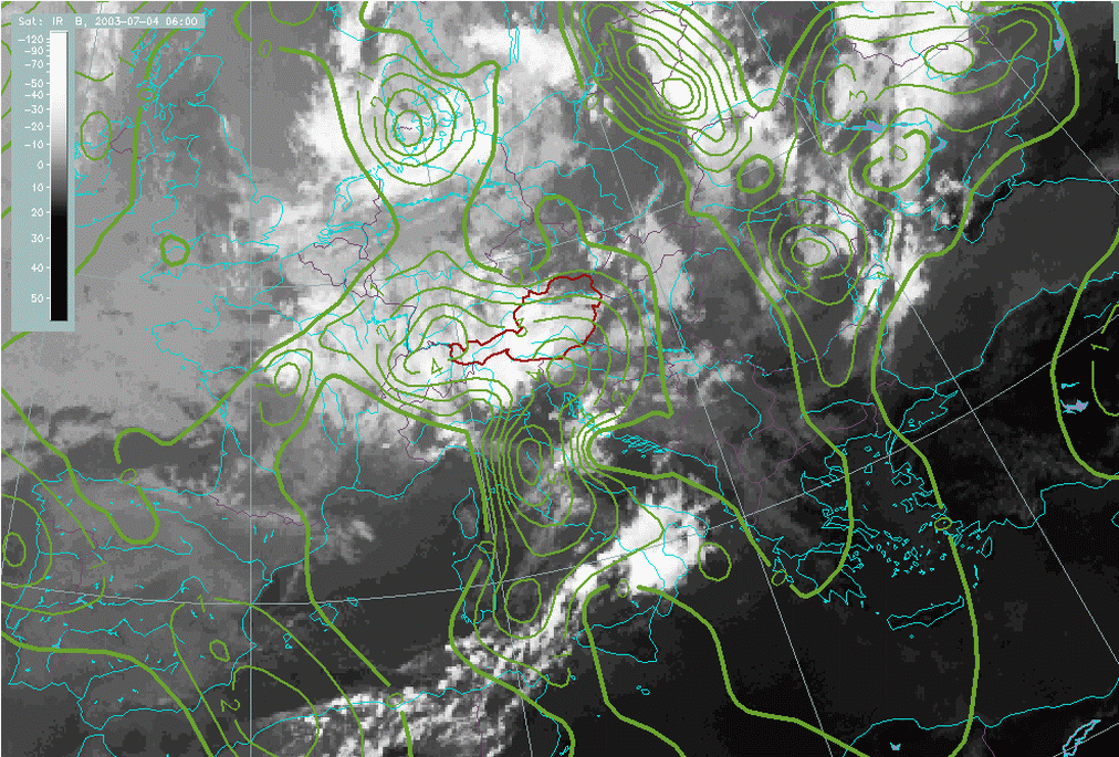
In addition there is strong PVA forecast for the upper layers, associated with the jet and its exit region.
|
04 July 2003/06.00 UTC - Meteosat IR image; green: vorticity advection 300 hPa
|
04 July 2003/06.00 UTC - Meteosat IR image; yellow: isotachs 300 hPa
|
|
|
However, looking more closely at the images, it can be seen that conditions were favourable for convective development but parameters pointed more to the Alpine region then to the mid-Adriatic. Indeed, there was some strong development taking place in the Alpine region, which was caught by the model, whereas the secondary development in the Adriatic was not detected.
Vertical cross sections
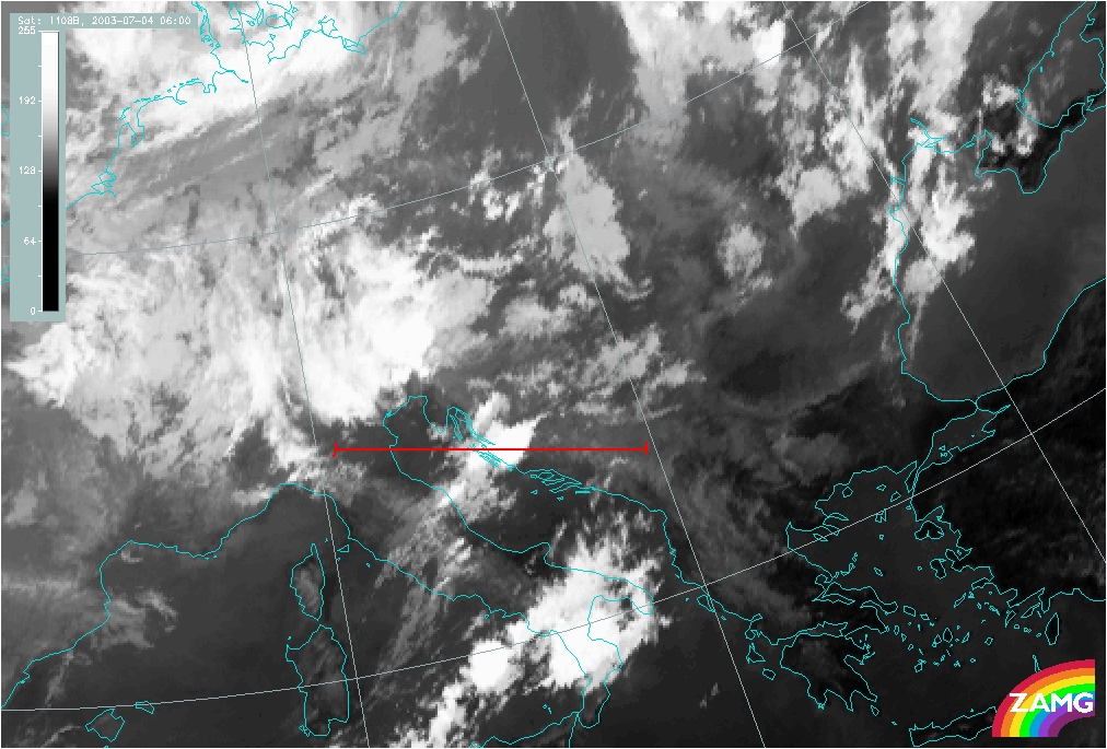
To show the large-scale vertical structure two cross-sections were computed across the region where the strongest convergence in the Adriatic was presumably triggered.
|
04 July 2003/06.00 UTC - Meteosat WV image; position of vertical cross section indicated
|
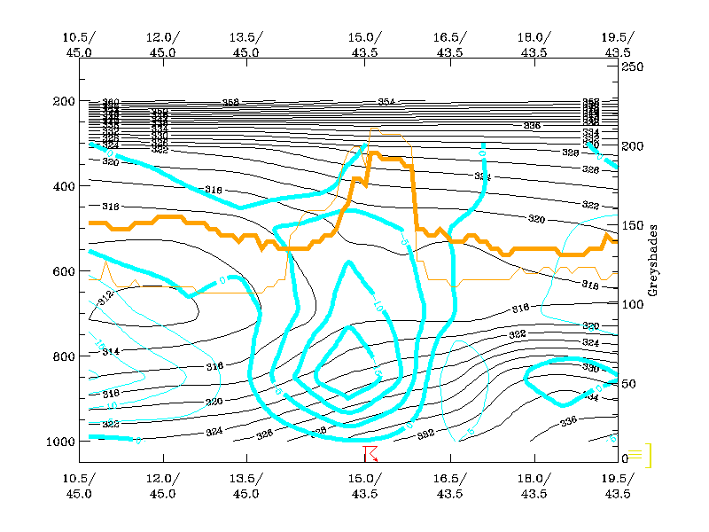
04 July 2003/06.00 UTC - Vertical cross section; black: isentropes (ThetaE), cyan thick: vertical motion (omega) - upward motion, cyan
thin: vertical motion (omega) - downward motion, orange thin: IR pixel values, orange thick: WV pixel values
|
|
|
|
|
|
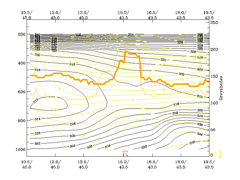
04 July 2003/06.00 UTC - Vertical cross section; black: isentropes (ThetaE), yellow: isotachs, orange thin: IR pixel values, orange
thick: WV pixel values
|
|
Mesoscale convective systems such as this are usually very difficult to forecast because their own internal dynamics evolve on a small scale, and, as a consequence, this isn not well reflected in operational synoptic scale numerical models. Although quasi-geostrophic triggering conditions were present in this case, they are relatively slow in producing precipitation. So in order to produce convection of such intensity there must have been additional mesoscale processes.
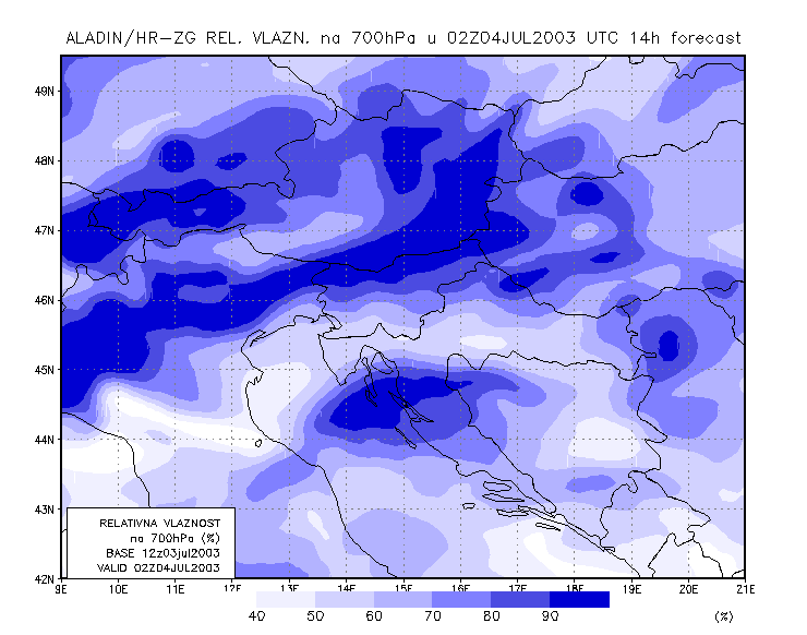
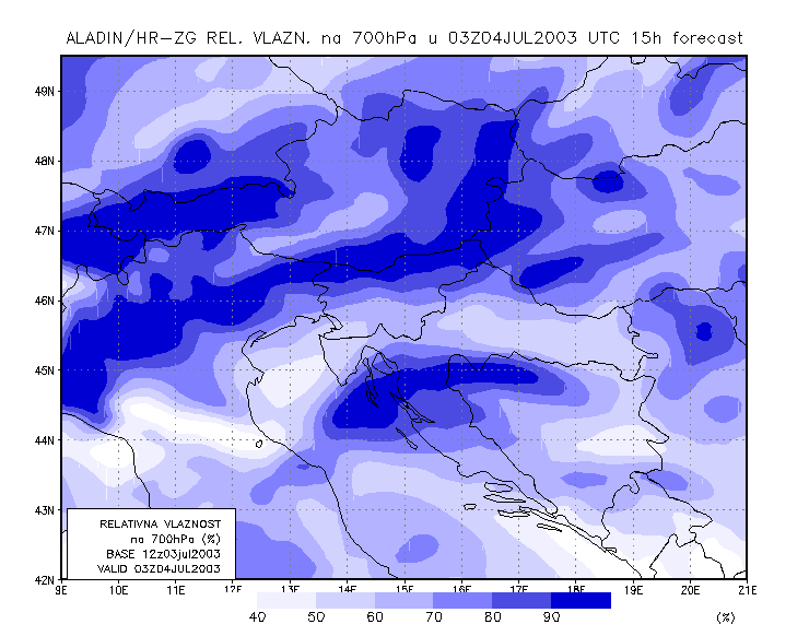
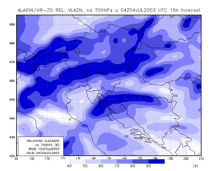
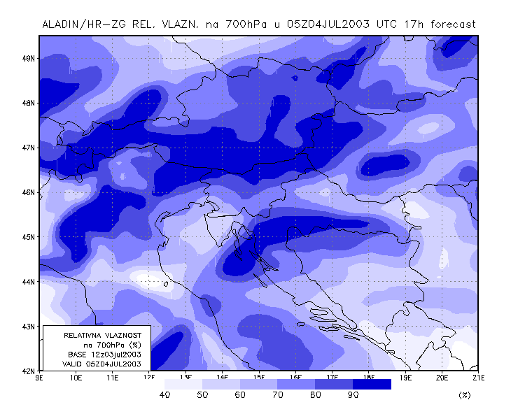
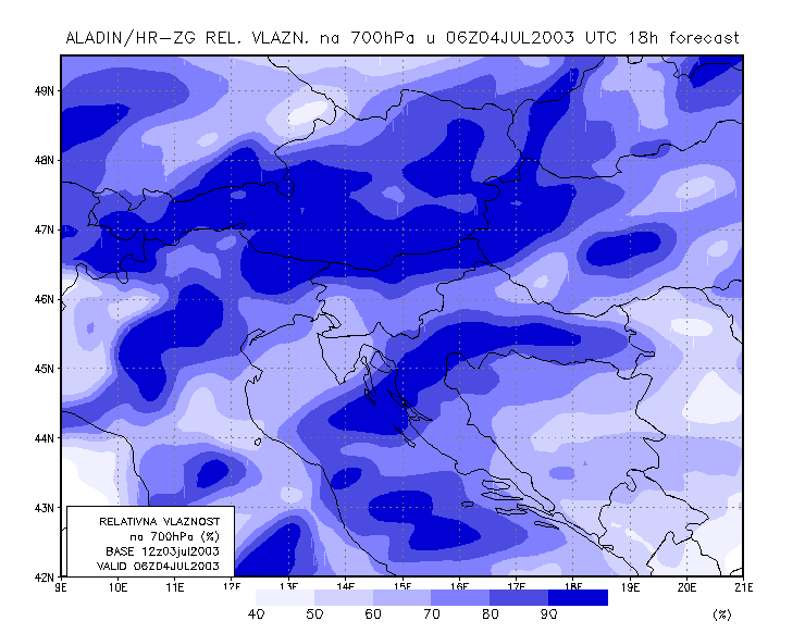
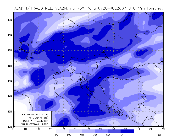
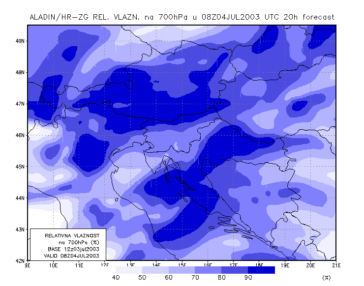
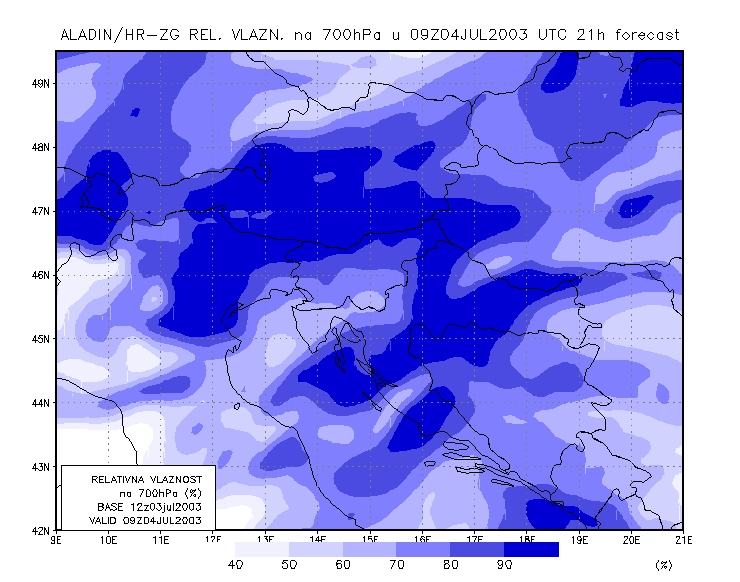
Meso-scale model forecasts (ALADIN)
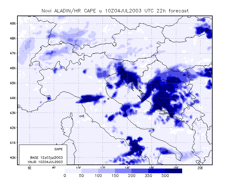
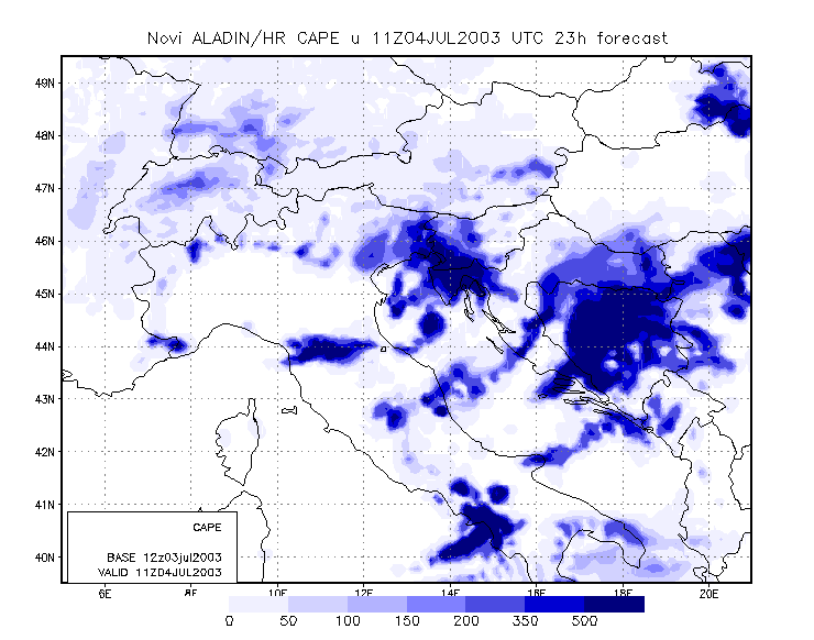
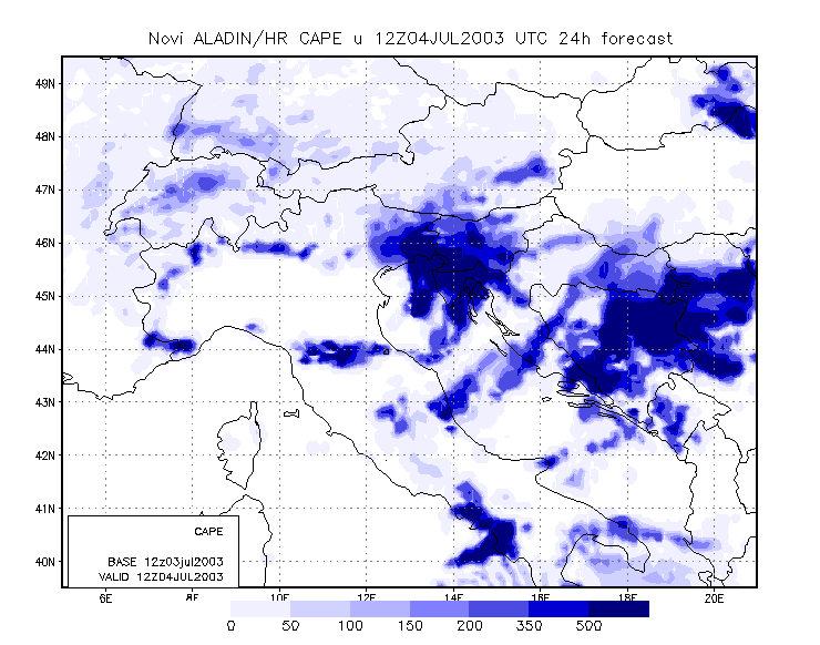
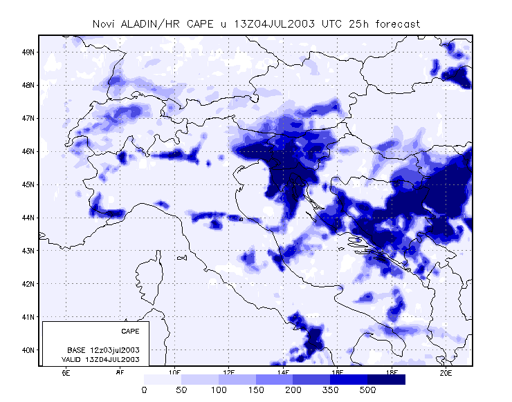
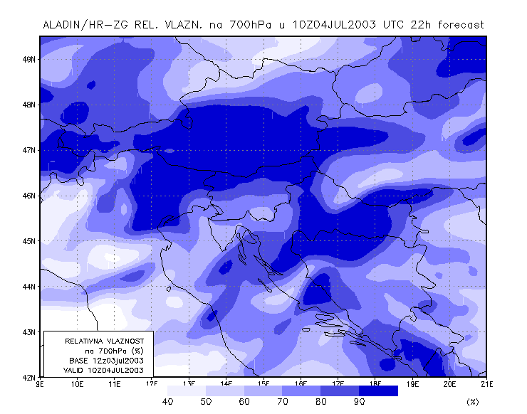
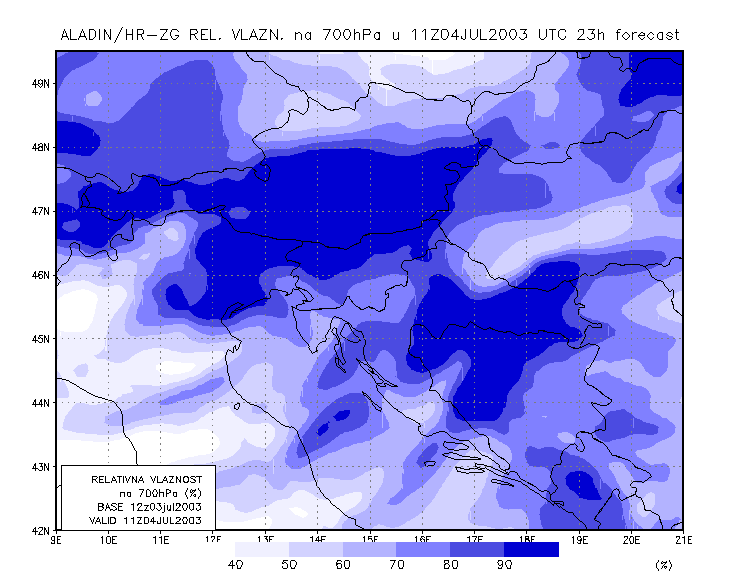
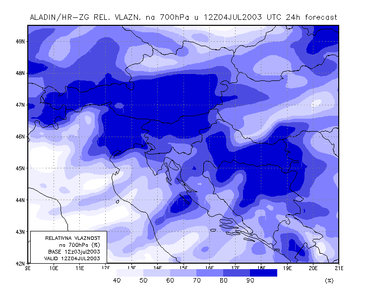
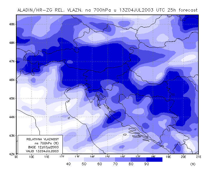
To get closer to the scale of the event, meso-scale model output is studied. The model used is the Aladin model, with 8 km resolution, and which is operationally run at DHMZ.
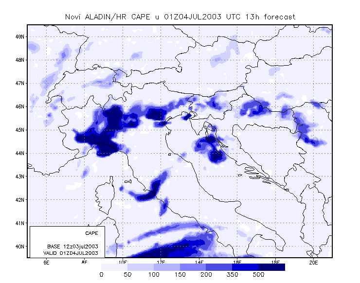
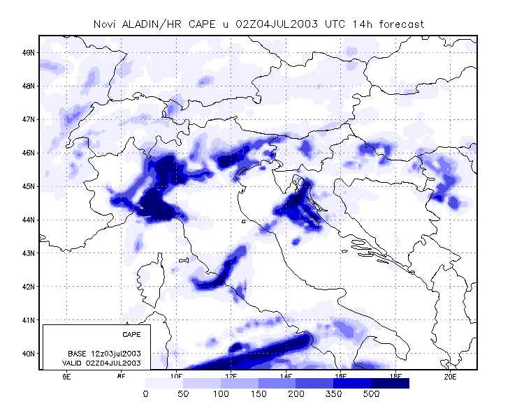
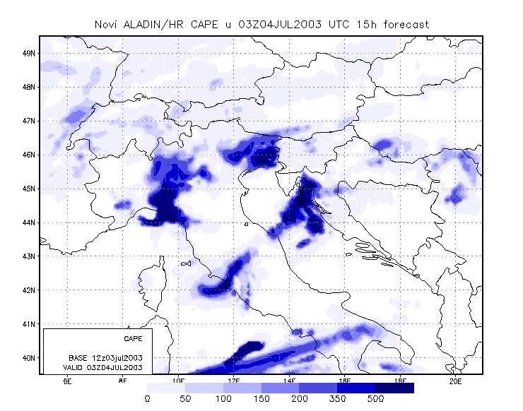
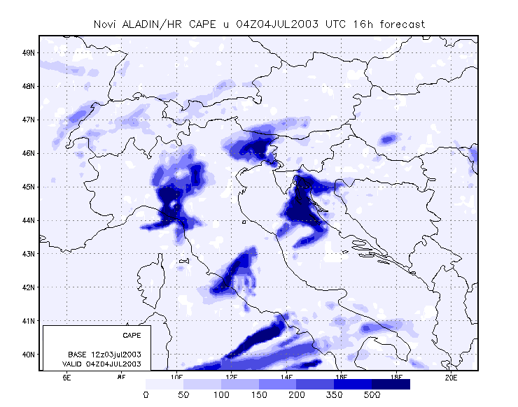
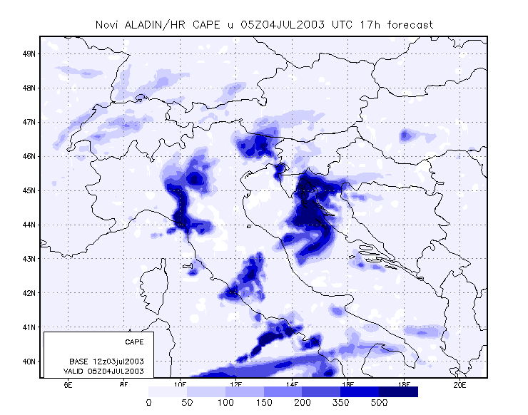
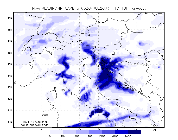
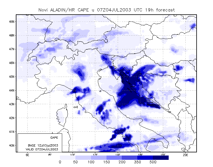
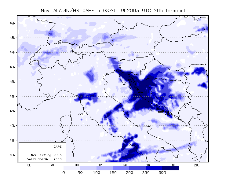
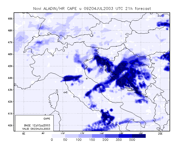
One of the parameters that gave an indication of development at approximately the right time and place was CAPE (Convective Available Potential Energy).
|
04 July 2003/00.00 - ALADIN model forecasts (model run 03 July/12.00 UTC); blue: Convective Available; 00.00 - 13.00 UTC hourly image
loop
|
|
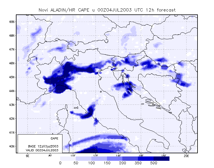
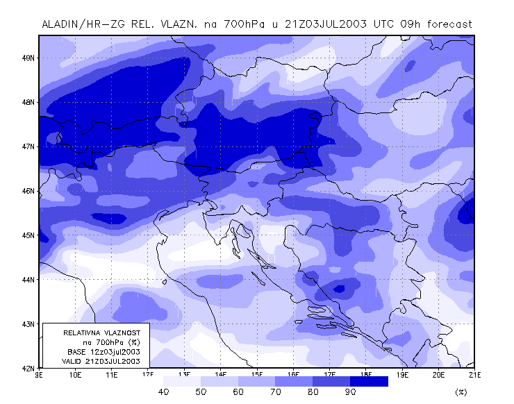
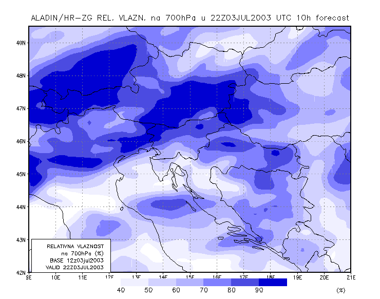
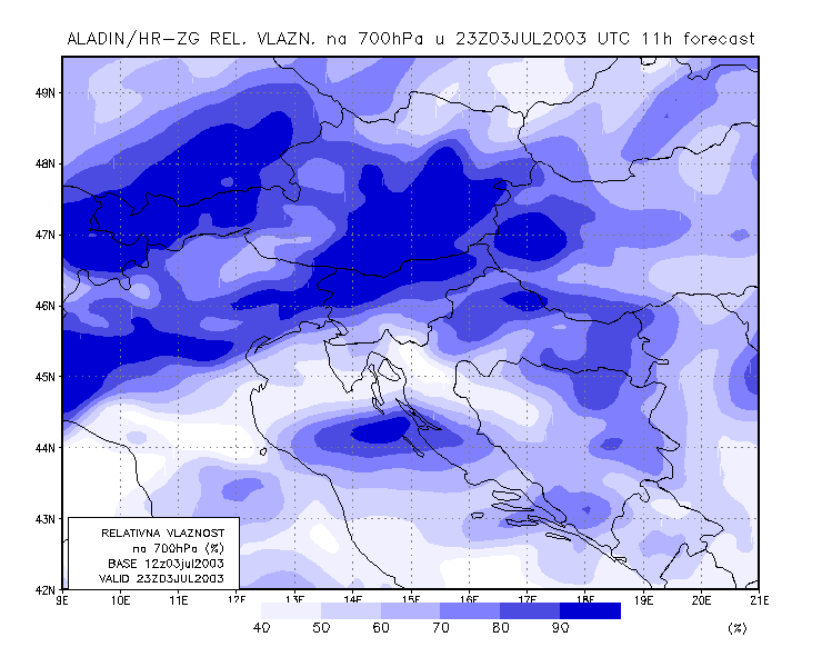
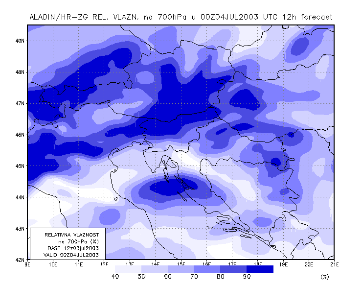
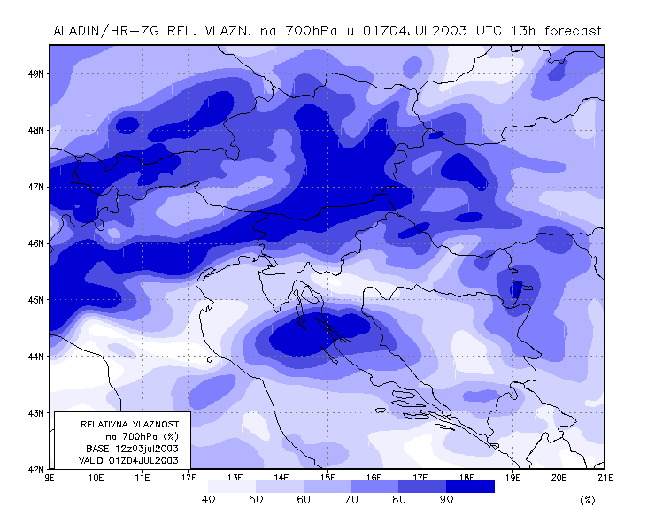
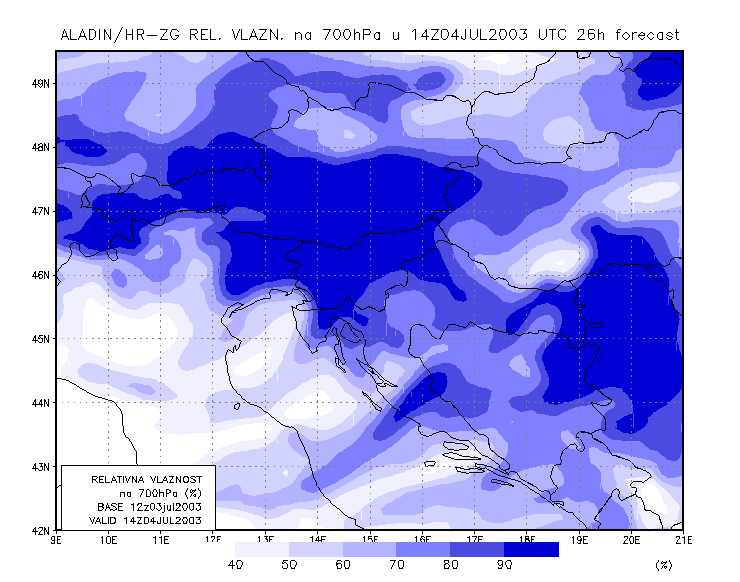
However, looking more closely at the humidity field at 700 hPa, it is clear that the development was ecpexted more to the north and west, and that convection over the southern part was too late, when compared to the actual time of development.
|
03 July 2003/21.00 UTC - ALADIN model forecasts (model run 03 July/12.00 UTC); blue: relative humidity at 700 hPa level (%); 03/21.00 -
04/14.00 UTC hourly image loop
|
|
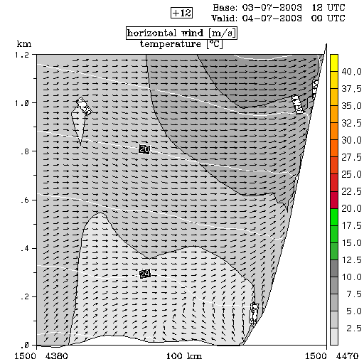
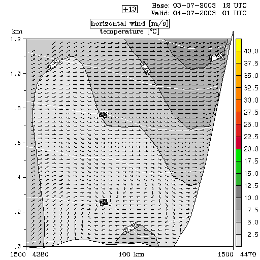
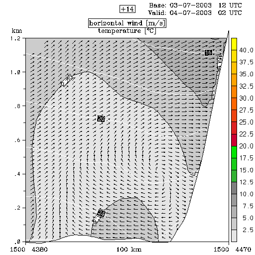
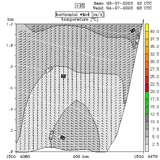
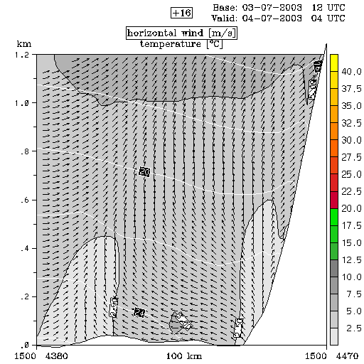
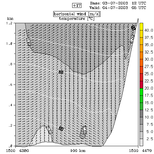
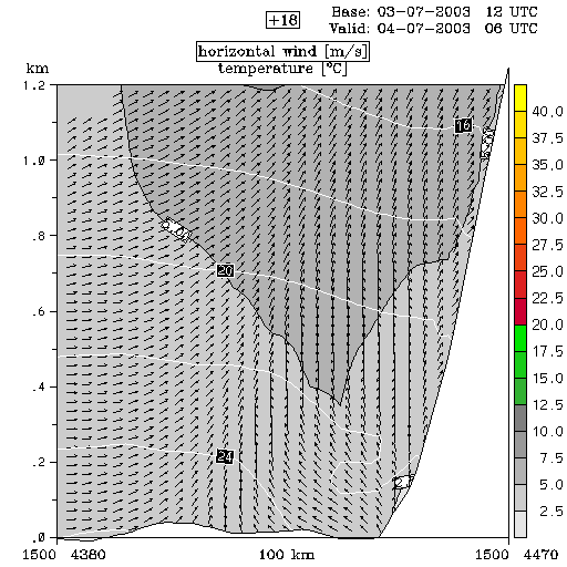
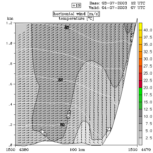
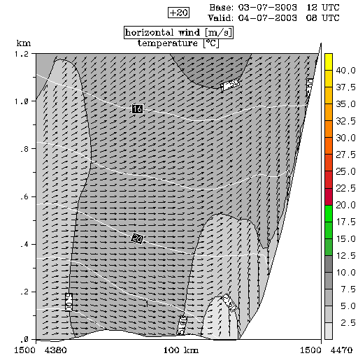
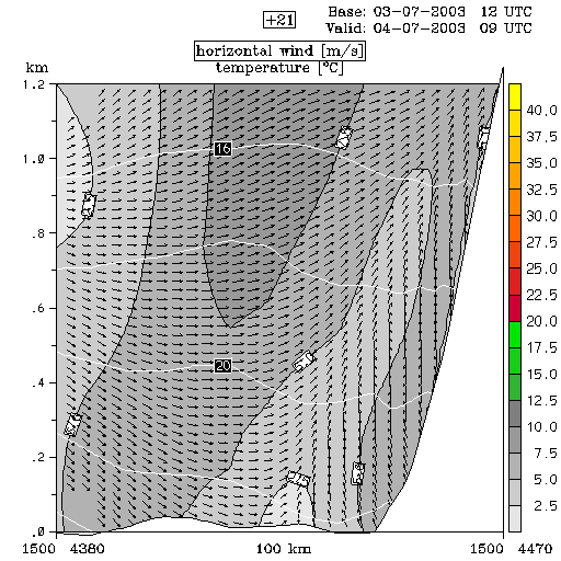
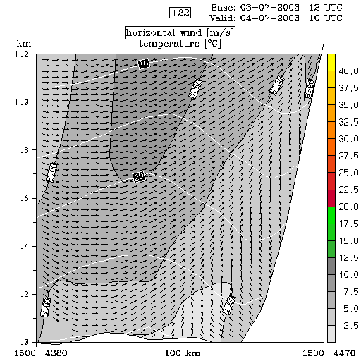
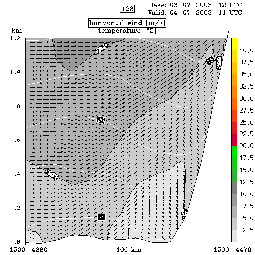
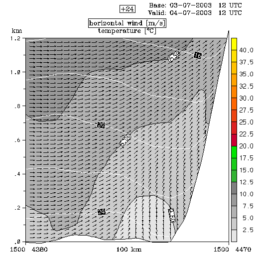
In the vertical cross section (across the island where convection was triggered), what catches the attention is the rather abrupt change of wind direction with height in the vicinity of mainland. This feature is caused by a land-sea circulation being overrun by south-westerly upper level stream.
|
04 July 2003/00.00 UTC - ALADIN model forecasts (model run 03 July/12.00 UTC); white lines: temperature, arrows: horizontal wind, grey
shades: isotachs; 00.00 - 12.00 UTC hourly image loop
|
|
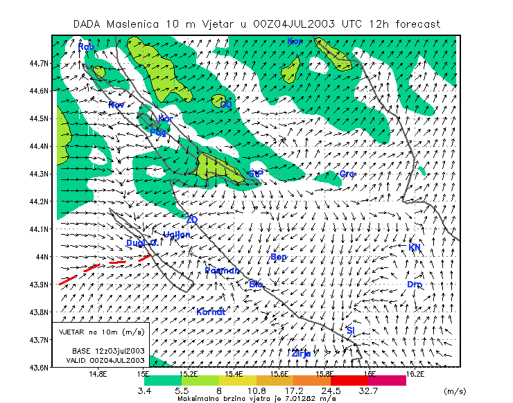
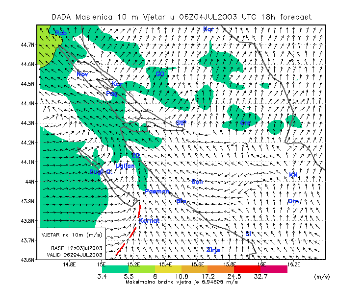
Besides this, the horizontal wind field also shows some interesting features. A dynamical adaptation of ALADIN model, on a 2×2 km grid, for the area of interest is shown. A Convergence Line (marked by red dashed line) can be clearly observed at 00.00 UTC, pointing towards the island where convection was presumably triggered. At 06.00 UTC convergence was again indicated, but a little more to the south.
|
04 July 2003/00.00 UTC - ALADIN model forecasts (model run 03 July/12.00 UTC); arrows: 10 m wind, colour shades: isotachs, red: line of
convergence
|
04 July 2003/00.00 UTC - ALADIN model forecasts (model run 03 July/12.00 UTC); arrows: 10 m wind, colour shades: isotachs, red: line of
convergence
|
|
|
This combination of horizontal wind convergence and strong vertical wind shear probably played an important role in triggering the convection.
Taking into account all analyzed forecast material the following can be concluded:
- Large scale models (in this case ECMWF) are capable of showing overall characteristics of the atmosphere and can give some idea about how favourable the conditions are for convective development. Limits of these models are, on one hand, the resolution which is far too small to precisely catch small-scale development and, on the other hand, the physics of the model which, by making the atmosphere hydrostatic, dont allow the occurence of non-hydrostatic developments. In other words: it is not possible to determine the exact time and place of convective development with the large-scale models.
- Meso-scale models (in this case ALADIN) come closer to the real situation. Some parameters can give a very good indication of what is going on. However, despite their higher resolution, even meso-scale models are not very accurate in predicting the exact time and place of the event.