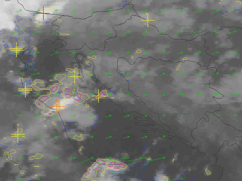
Nowcasting
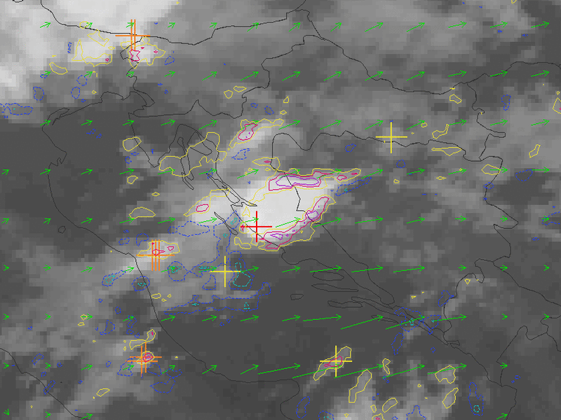
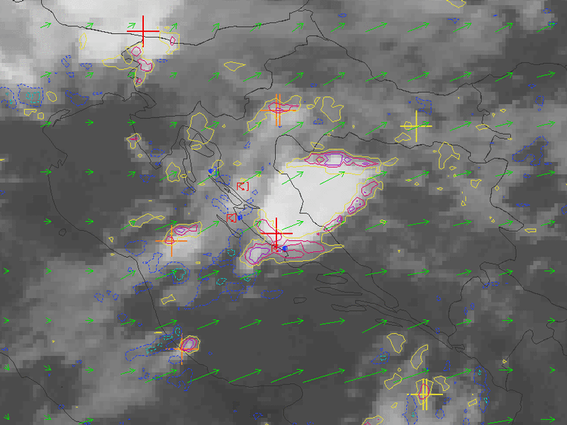
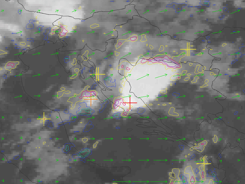
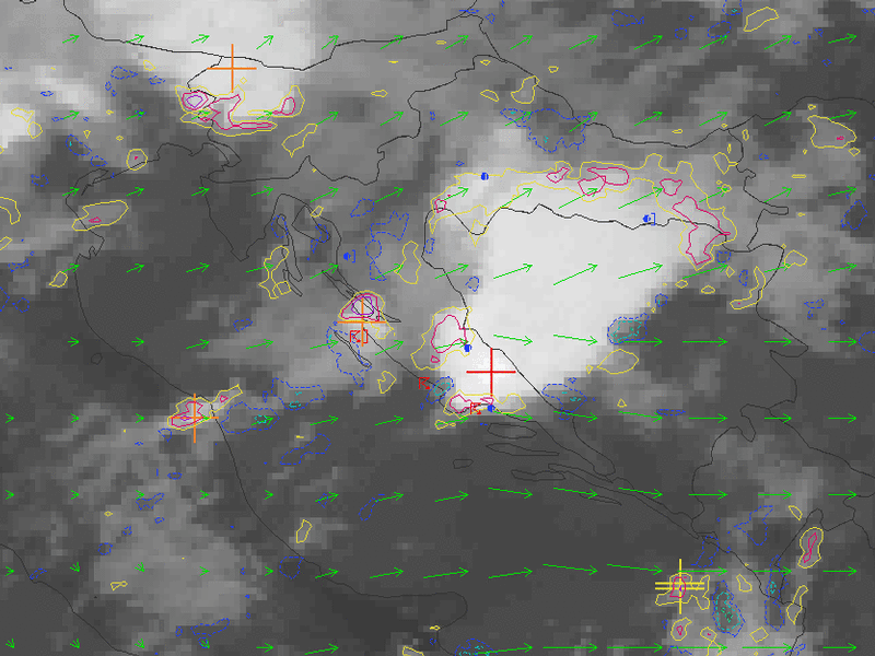
The case of the hailstorm in Dalmatia in July 2003 was a classic case of severe convective development growing out of a rather small scale feature. It was not well detexted by large-scale models and it could only be partly forecast using a meso-scale model. Therefore, nowcasting tools based on satellite imagery were the best to follow the development.
Nowcasting methods used in the following pages were developed within a joint project of five Central European countries. Results are based on
the use of satellite imagery only. For the purpose of following the development, several nowcasting tools are used together:
Atmospheric Motion Vectors - calculated from the displacement of clouds between two consecutive images
Convective Cells - automatically detected, and based upon the radius and brightness temperature of the
features
Development contours - motion corrected change of cloud top temperature between two consecutive images.
|
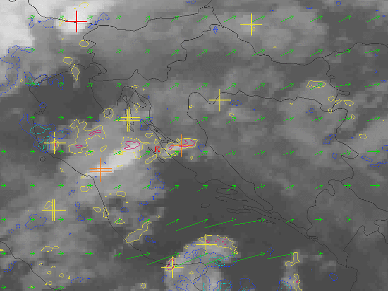
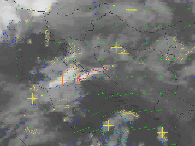
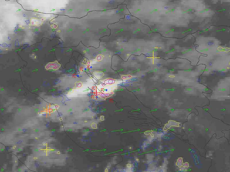
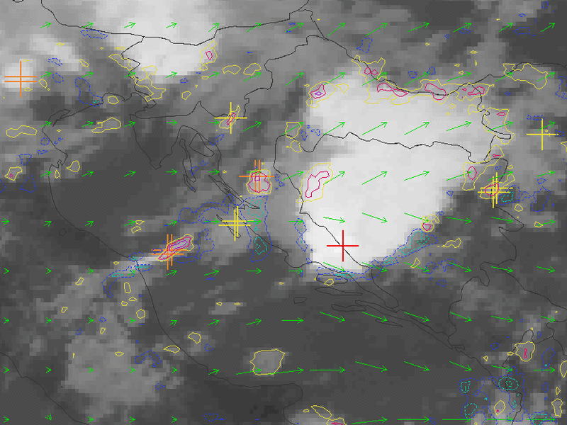
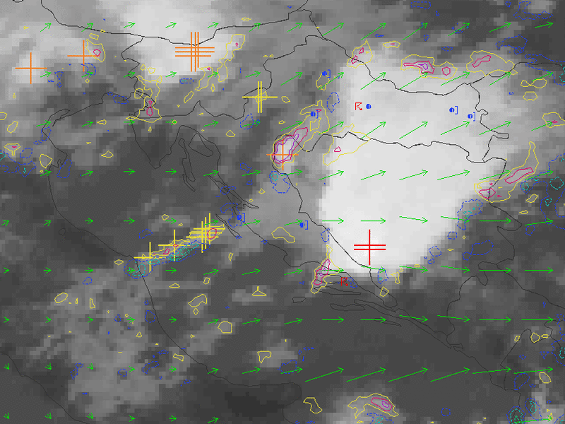
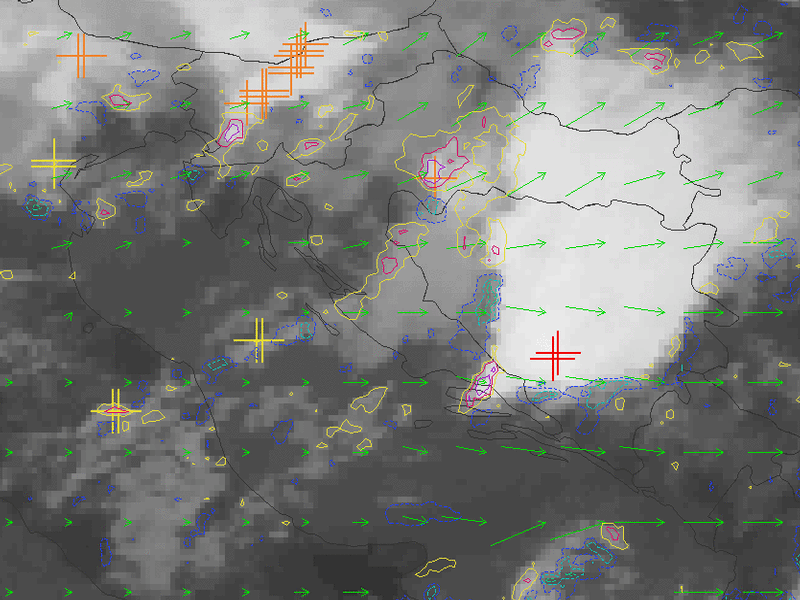
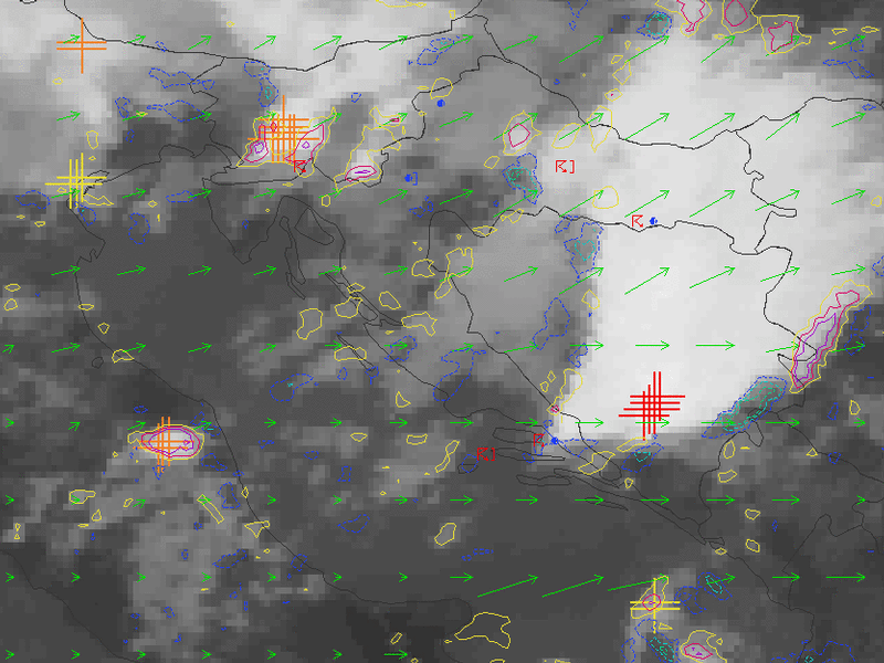
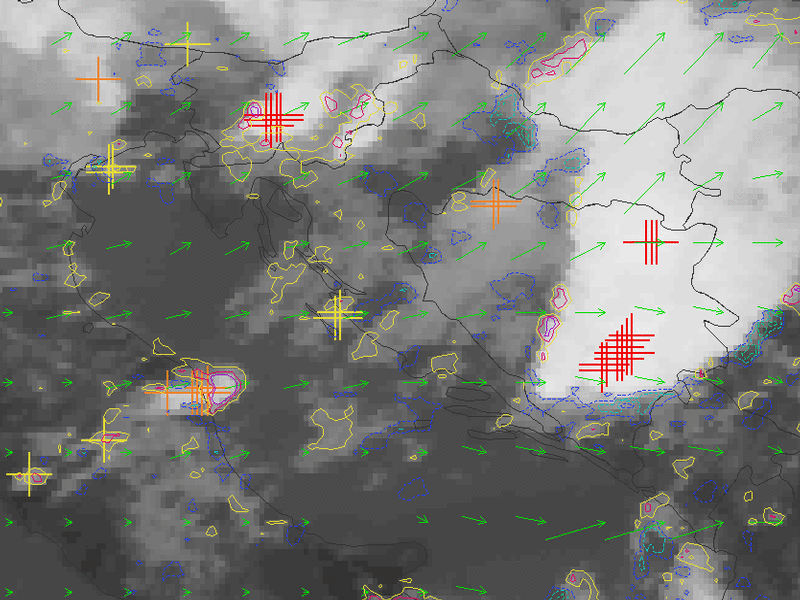
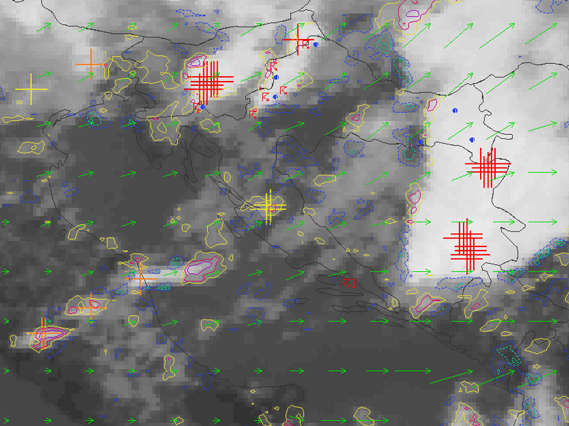
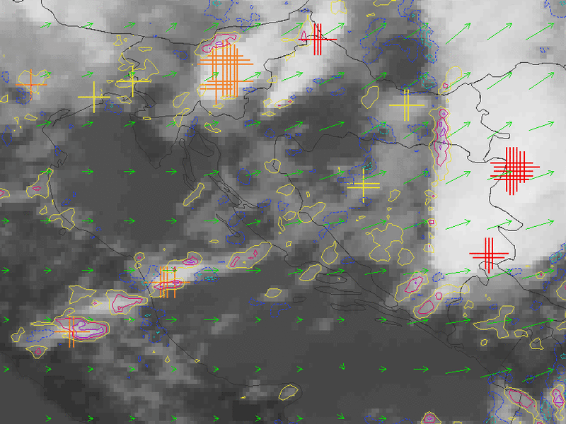
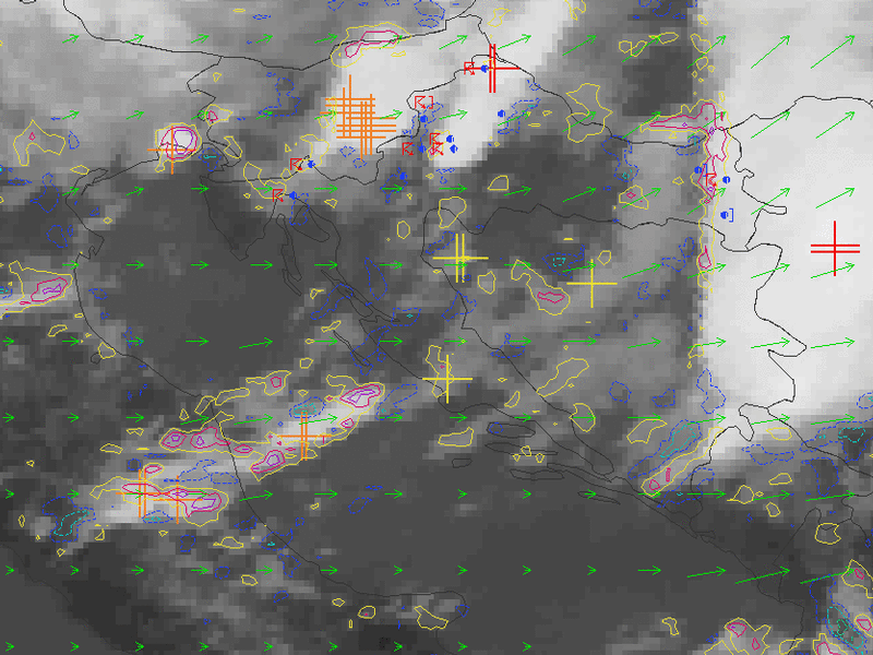
04 July 2003/04.30 - Meteosat IR image; red, orange and yellow crosses: convective cells, yellow, pink and violet lines: development,
light blue and blue: decay, green arrows: atmospheric motion vectors, weather reports; 04.30 - 12.00 UTC half-hourly image loop
|
|
At 04.30 UTC a convective cell was detected and its initial development was seen over the island of Dugi Otok. On the next image it already grows into a deeper cell, then developing further, with first reports of thunderstorms in the region. Half an hour later, again over the same island, there is more development, with the cell now growing rapidly, and with a lot of thunder and some hail reported at 06.00 UTC.