17 April 1996 - Forecast For Cold Front
|
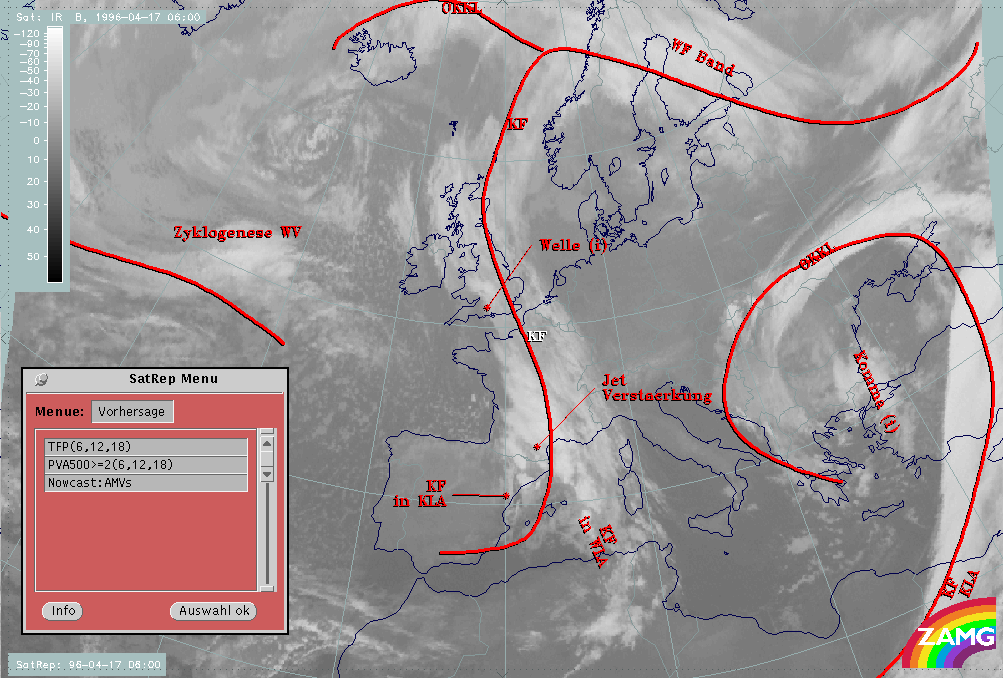
17 April 1996/06.00 UTC - Meteosat IR image; red thick: front indicator, SatRep overlay: names of conceptual models, SatRep menu: key
parameters for Cold Front forecast
|
|
|
Concerning the forecast of the conceptual model "Cold Front", in the SatRep Menu a button "Vorhersage" (= forecast) has to be clicked and the relevant menu appears. As can be seen in the right upper corner, two kinds of forecasts and forecast times are presented:
The very short range forecast VSRF (06.00 - 18.00 UTC, 12 hours)
For the very short range forecasts, six-hourly forecasts from ECMWF are used and those parameters which are key parameters of a conceptual model are prepared as overlays on the satellite image in three different colours, representing the three points of time 06.00, 12.00 and 18.00 UTC:
- yellow: 06.00 UTC
- green: 12.00 UTC
- blue: 18.00 UTC
In the case of the conceptual model "Cold Front" the thermal front parameter (TFP) and maxima of positive vorticity advection (PVA500>=2) are considered.
Nowcasting (0-2 hours)
For this forecast time atmospheric motion vectors (AMVs) are used which extrapolate the cloud systems for the next two hours. These nowcasts are renewed half-hourly or hourly and are not discussed here.
|
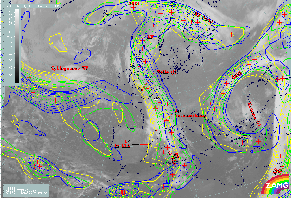
17 April 1996/06.00 UTC - Meteosat IR image; yellow: thermal front parameter (TFP) 500/850 hPa 06.00 UTC, green: thermal front
parameter (TFP) 500/850 hPa 12.00 UTC, blue: thermal front parameter (TFP) 500/850 hPa 18.00 UTC; SatRep overlay: names of conceptual
models
|
|
|
The propagation of the thermal front parameter (TFP) in the part of the Cold Front north of the Pyrenees shows a rather moderate north-eastward movement of about 3 - 4 degrees of latitude. The shape of the TFP stays fairly constant, in particular the Wave - like bulge remains but can be found displaced to the north. Consequently the TFP maximum moves from a location in the middle of the English Channel at 06.00 UTC to the south of the Netherlands at 18.00 UTC, and the Wave bulge from south England at 06.00 UTC to a position east of Scotland at 18.00 UTC.
This rather weak change in the forecast can also be supported by the forecast from the vertical cross section.
|
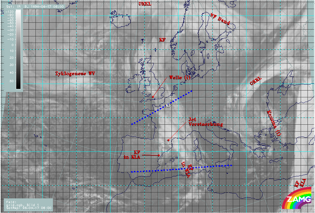
17 April 1996/06.00 UTC - Meteosat IR image; red thick: front indicator, ECMWF grid superimposed; postiion of vertical cross section
indicated, SatRep overlay: names of conceptual models
|
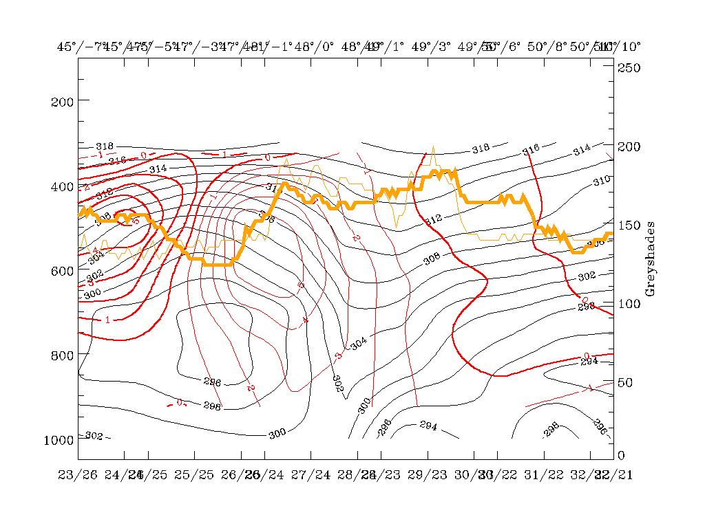
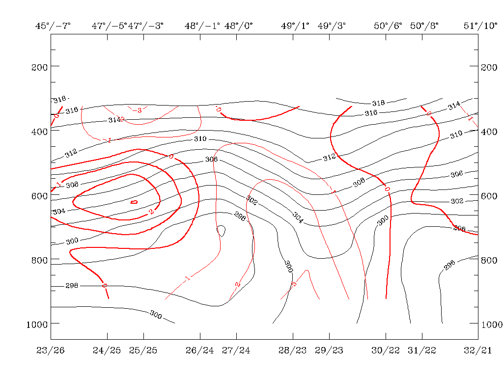
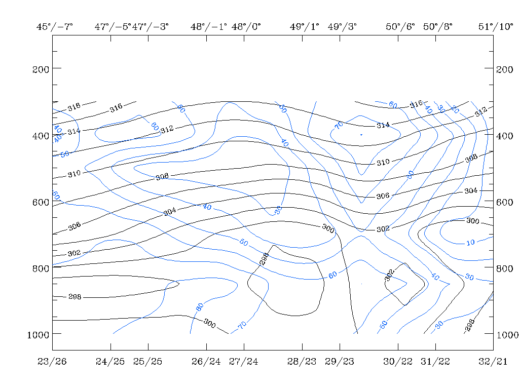
17 April 1996/06.00 UTC - Vertical cross section; black: isentropes (ThetaE), red thin: temperature advection - CA, red thick:
temperature advection - WA, orange thin: IR pixel values, orange thick: WV pixel values
|
|
|
|
|
|
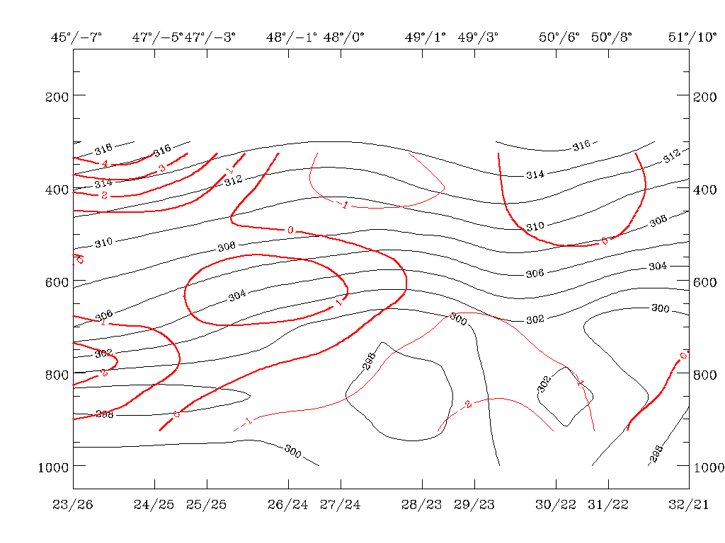
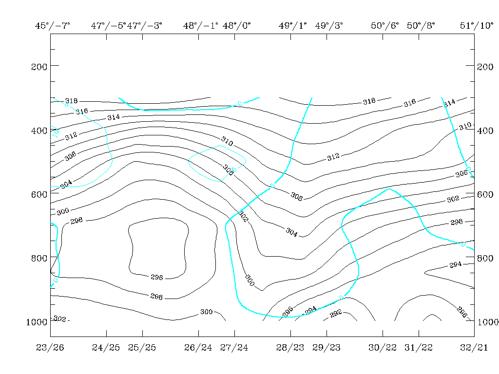
17 April 1996/12.00 UTC - Vertical cross section; black: isentropes (ThetaE), red thin: temperature advection - CA, red thick:
temperature advection - WA, orange thin: IR pixel values, orange thick: WV pixel values
|
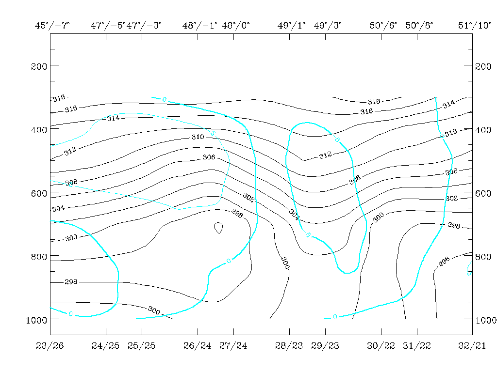
17 April 1996/18.00 UTC - Vertical cross section; black: isentropes (ThetaE), red thin: temperature advection - CA, red thick:
temperature advection - WA, orange thin: IR pixel values, orange thick: WV pixel values
|
The isentropic surfaces characteristic of the front (black lines) shows a continuation of the formation of the trough configuration which in the typical case would be characteristic of an Occlusion band. An eastward movement of the whole configuration as well as an upward shift of the 302K isoline can be observed. The latter fact especially would support the transition of the Cold Front into an Occlusion. However, as with 06.00 UTC (compare Cold Front ) there is CA in the area under discussion; only at 18.00 UTC in high levels does some slight WA approach from the east.
|
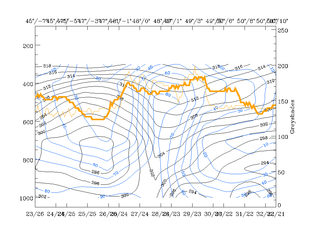
17 April 1996/06.00 UTC - Vertical cross section; black: isentropes (ThetaE), blue: relative humidity, orange thin: IR pixel values,
orange thick: WV pixel values
|
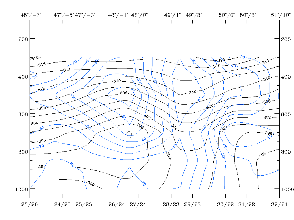
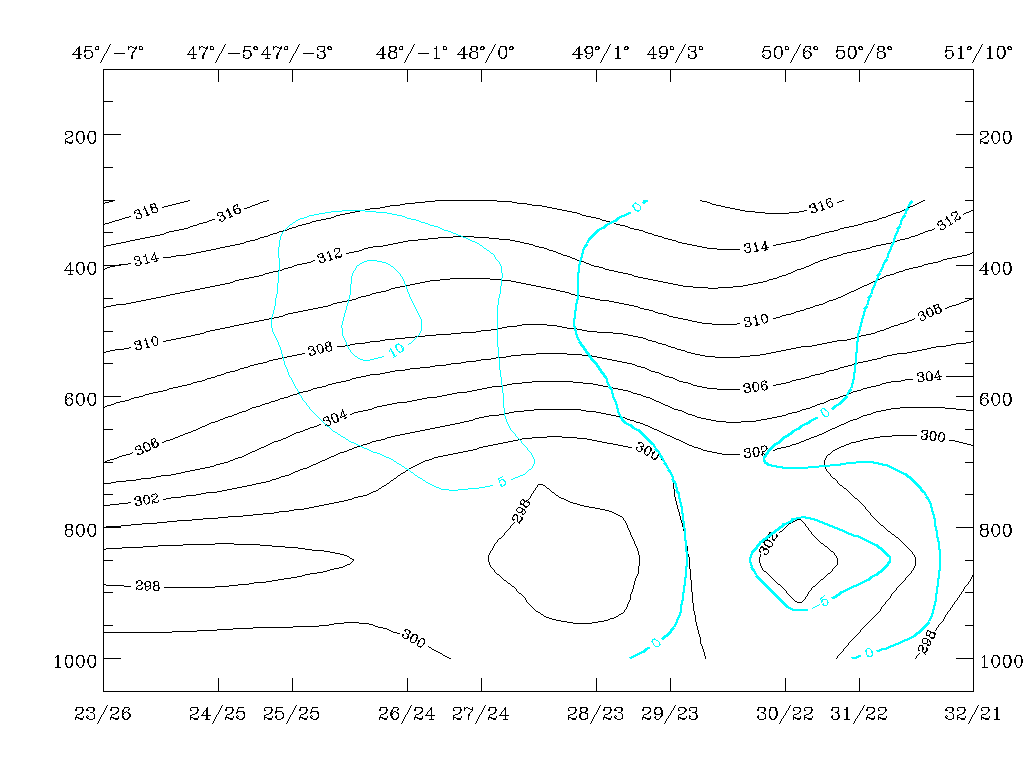
17 April 1996/12.00 UTC - Vertical cross section; black: isentropes (ThetaE), blue: relative humidity, orange thin: IR pixel values,
orange thick: WV pixel values
|
|
|
|
|
|
17 April 1996/18.00 UTC - Vertical cross section; black: isentropes (ThetaE), blue: relative humidity, orange thin: IR pixel values,
orange thick: WV pixel values
|
|
The dry air west of and below the frontal cloud band and the western part of the frontal zone in the vertical cross section sinks, especially between 06.00 and 12.00 UTC; a centre of 20 - 10% can be followed from about 300 hPa at 06.00 UTC down to 500 hPa at 12.00 UTC. For 18.00 UTC no further distinct changes can be noticed.
So from the material shown here no major changes to the Cold Front can be expected, despite a slight eastward movement and a continuation of the physical processes within the frontal cloud band. A rapid decrease in activity cannot be expected because, although decreasing, there is still upward motion between 12.00 and 18.00 UTC, as can be seen from the cross sections below.
|
17 April 1996/06.00 UTC - Vertical cross section; black: isentropes (ThetaE), cyan thick: vertical motion (omega) - upward motion, cyan
thin: vertical motion (omega) - downward motion, orange thin: IR pixel values, orange thick: WV pixel values
|
17 April 1996/12.00 UTC - Vertical cross section; black: isentropes (ThetaE), cyan thick: vertical motion (omega) - upward motion, cyan
thin: vertical motion (omega) - downward motion, orange thin: IR pixel values, orange thick: WV pixel values
|
|
|
|
|
|
17 April 1996/18.00 UTC - Vertical cross section; black: isentropes (ThetaE), cyan thick: vertical motion (omega) - upward motion, cyan
thin: vertical motion (omega) - downward motion, orange thin: IR pixel values, orange thick: WV pixel values
|
|
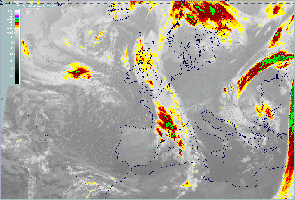
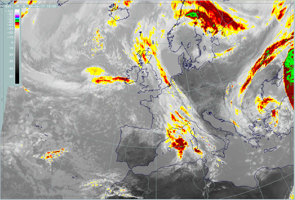
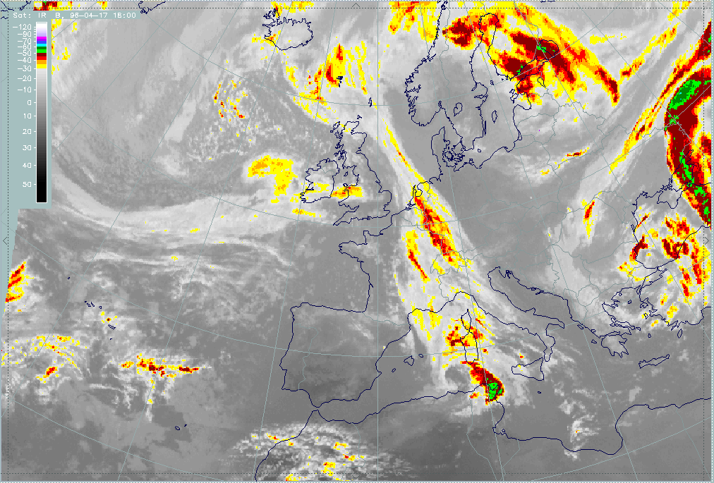
The satellite images for the three points of time confirm these conclusions quite well, but there are two effects which could not have been derived from the forecast material presented here:
- The narrowing of the frontal cloud band over the North Sea which may be a consequence of the continuation of secondary cyclogenesis (this is discussed together with the Wave below);
- The widening of the cloud band over France which may be connected with the processes in the Mediterranean and is discussed under the "special investigation" (compare "Special Investigation": Cyclogenesis in the Western Mediterranean Including Detection of Numerical Model Error).
|
17 April 1996/06.00 UTC - Meteosat IR enhanced image
|
17 April 1996/12.00 UTC - Meteosat IR enhanced image
|
|
|
|
|
|
17 April 1996/18.00 UTC - Meteosat IR enhanced image
|
|