Introduction and short case description
|
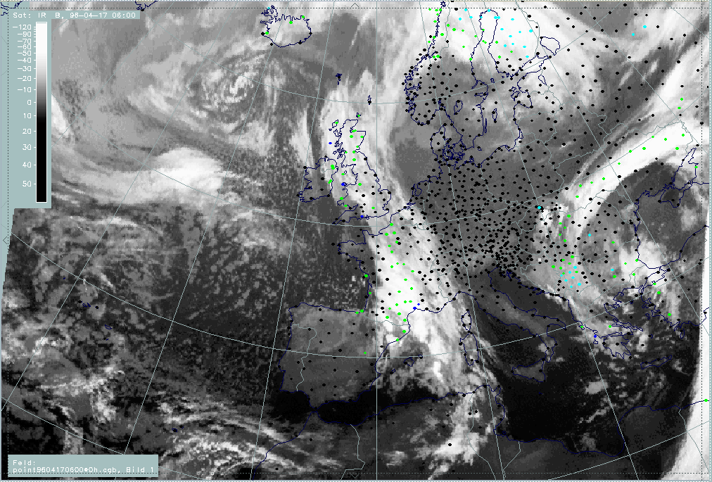
17 April 1996/06.00 UTC - Meteosat IR image; weather events (green: rain and showers, blue: drizzle, cyan: snow, purple: freezing rain,
red: thunderstorm with precipitation, orange: hail, black: no actual precipitation or thunderstorm with precipitation)
|
|
|
There are two main cloud configurations which are analysed in this case study:
- A frontal cloud band extending from Africa and the western Mediterranean Sea northward across France and the British Isles to the
Norwegian coast; this cloud band has lower tops in the leading part and contains two interesting substructures:
- An intensified and broadened cloud area over France which could be indicative of the conceptual model "Wave" (compare Conceptual Models: Wave ) or the conceptual model "Front Intensification by Jet Crossing" (compare Conceptual Models: Front Intensification by Jet Crossing )
- A cloud bulge over the British Isles and Ireland indicative of the conceptual model "Wave" (compare Conceptual Models: Wave ). Cold Front cloud band and Wave are discussed in this chapter; the cloud structures over France and their development can be found as a special investigation (compare "Special Investigation": Cyclogenesis in the Western Mediterranean Including Detection of Numerical Model Error).
- A narrow cloud band over the Atlantic from approximately 47N/30W to 52N/20W; the biggest part consists of low cloud tops except for the easternmost part which shows a cloud configuration very typical of the conceptual model "Rapid Cyclogenesis". This is also discussed as a special investigation (compare "Special Investigation": Rapid Cyclogenesis Including Detection of Numerical Model Error).
Weather reports show that the leading part of the frontal cloud band is free of precipitation, but that there are broad areas of precipitation, especially in the two substructures mentioned above. Weather activity is more severe there. The second cloud system is located over the Atlantic, therefore no weather reports exist.
|
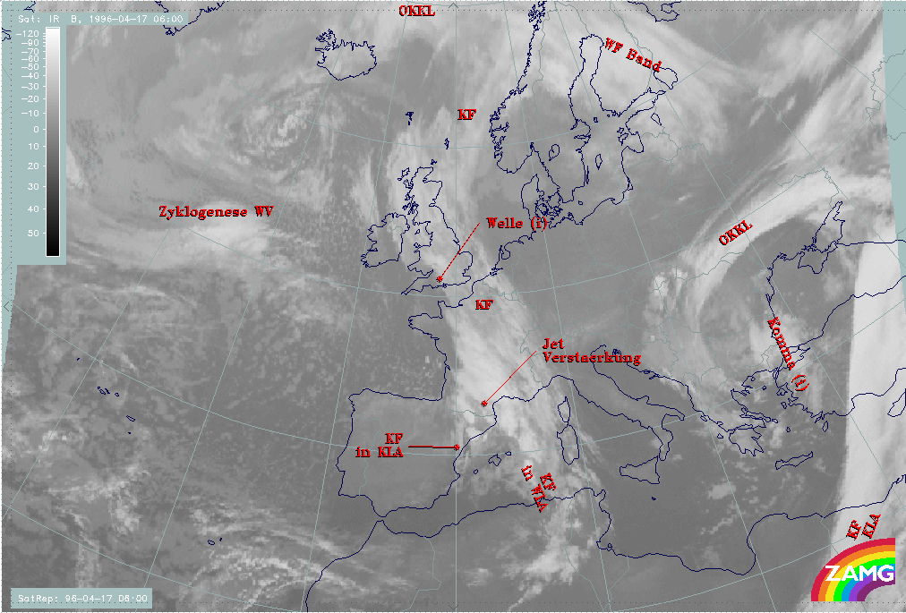
17 April 1996/06.00 UTC - Meteosat IR image; SatRep overlay: names of conceptual models
|
|
|
The SatRep diagnosis of this case identifies the areas already mentioned by "KF" (Cold Front) and "Welle" (Wave), but reveals, especially for the southern part which is discussed under the "special investigation", some more details. These include, for instance, "KF in KLA" which is a Cold Front under the influence of cold advection (CA), and "Jet Verstaerkung" (Jet Intensification).