Synoptic field
From 18th to 20th November 2011, central and eastern parts of Europe, including the Balkan Peninsula, were under the influence of an anticyclone and a weak gradient flow at higher atmospheric levels. This was an ideal synoptic situation for the formation of fog over the Pannonian Basin.
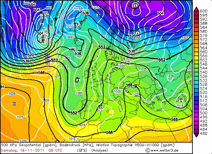
Fig. 2.1. 19th November 2011 06 UTC 500hPa Geopotential (black line), Mean Sea Level Pressure (white line).
Further maintenance of this pressure field and deposition of cold air in the anticyclone caused an increase in the fog thickness and its gradual transition to the stratus cloudiness. This is confirmed by METAR reports showing the visibility observations and current weather at Belgrade Nikola Tesla airport on 18-20 November, 2011:
LYBE 180600Z 19003KT 0100 R12/0125N R30/0100N FZFG VV001 M04/M05 Q1027 NOSIG
LYBE 190600Z 05002KT 0200 R12/0250N R30/0250N FZFG VV001 M02/M04 Q1027 NOSIG
LYBE 200600Z VRB02KT 1800 BR BKN003 M01/M02 Q1028 TEMPO 1000