Select a Chapter:
Chapter I: Von Kármán Vortex Streets over Azores Islands
Table of Contents
Von Kármán Vortex Streets over Azores Islands
On 25th April 2009, a possible but unusual pattern called von Kármán vortex developed to the lee of Pico island (Figures 1 to 4). Very common in Madeira or Canary islands, this feature is not so common in the Azores Islands mainly due to their location in Atlantic Ocean. Note that MSG Infra-red 10.8 and visible 0.6 channels on usual 3km sub-satellite pixel resolution can depict the pattern reasonably well in comparison to NOAA 1km resolution.
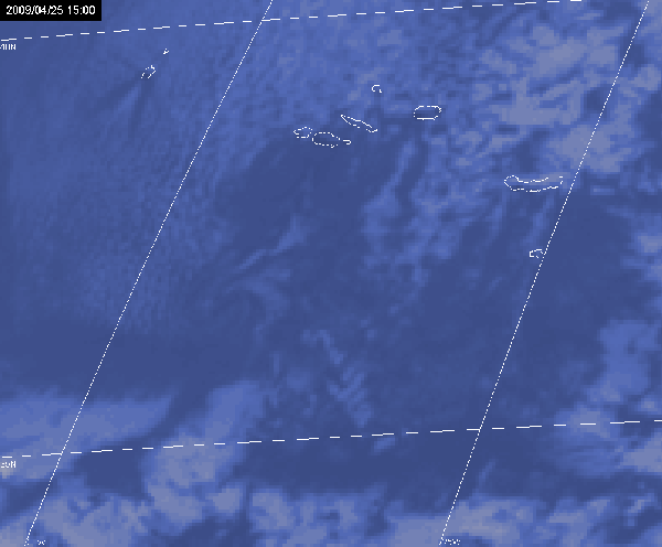
Fig. 1: MSG IR10.8 Image, 25th April 2009 at 15:00 UTC
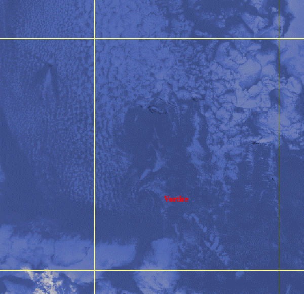
Fig. 2: NOAA Image, channel 4 (IR), 25th April 2009 at 14:59 UTC
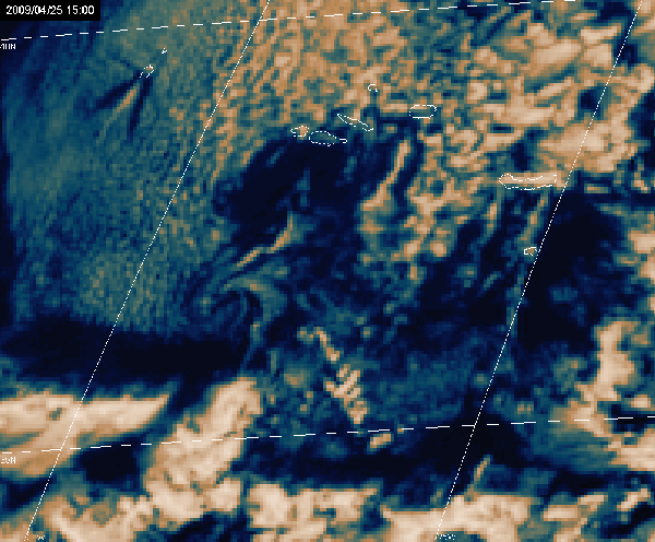
Fig. 3: MSG VIS0.6 Image, 25th April 2009 at 15:00 UTC
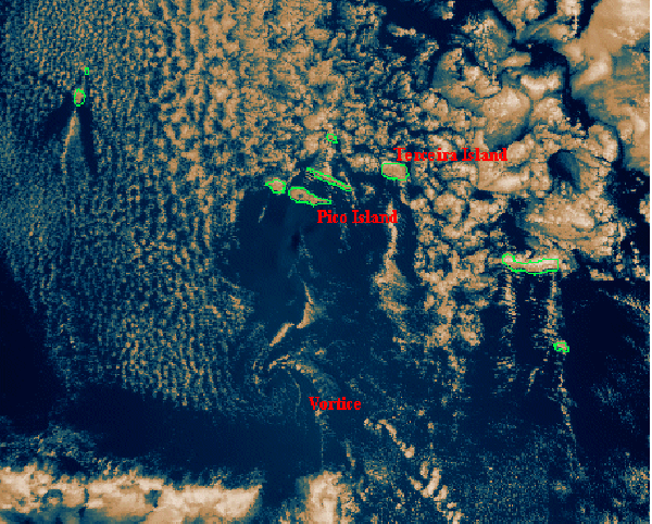
Fig. 4: NOAA Image, channel 1 (VIS), 25th April 2009 at 14:59 UTC
Azores islands were under the influence of an intense sub-tropical high pressure system (Fig. 5) to the northwest of the archipelago and the stratiform clouds that moved over the eastern side made the pattern possible to be seen in satellite imagery. The visualization of atmospheric vortex by satellite is possible by a special combination of geographic and atmospheric conditions (Hubert et al, 1962) which include: (1) an extensive oceanic area covered by stratus or stratocumulus clouds lying beneath a strong inversion; (2) relatively and directionally persistent low-level winds, and (3) mountainous islands that penetrate many hundreds of meters above the inversion. Pico Island is part of the central group of the Azores Islands where a mountain 2351 metres high can be found. On 25th April 2009 an inversion develops around 1300m (12 UTC radiosonde of Lages, Fig.6) with a very stable and deep layer above it; Lages synoptic station (Terceira Island) reported northerly persistent wind between 10 and 15 kt at the surface.
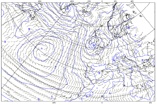
Fig. 5: Mean sea level pressure and 10 m wind, 25th April at 12:00UTC
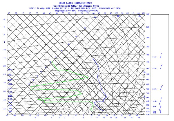
Fig. 6: Tephigram for sounding in Lajes, Azores, 25th April 2009 at 12:00 UTC
Select a Chapter: