Initial Atmospheric Condition
A classic Omega Block situation dominates the weather over Europe (Fig. 2.1). Such an atmospheric constellation is typically for late winter and early spring in the northern hemisphere. The offset between the upper air flow and the temperature wave indicates strong cold air advection backside of the trough over Europe and shows the potential for a southward outbreak. PVA anomalies also announce the intensification of the trough.
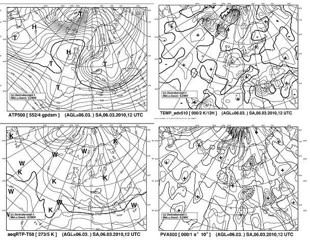
Figure 2.1: ECMWF Analysis 6.3.2010 12UTC - ATP 500, TA, relTop, PVA500
Fig 2.2: The reddish area over France on the Airmass RGB indicates dry descending stratospheric air containing high Potential Vorticity (dark blue isolines). The vertical cross section Fig 2.3 shows high potential Vorticity due to the descending stratospheric air down to the mid troposphere which is a hint for cyclogenesis and supports further development of the system. The Water Vapour Channel (Fig 2.4) shows over France a black area, which supports the theory described above. These facts imply further intensification of the system also because of labilisation of the atmospheric layering due to the cold air advection in the upper troposphere.
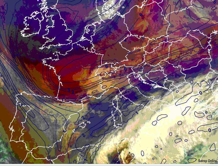
Figure 2.2: 7.3.2010 12 UTC - MSG Airmass RGB; blue lines: Potential Vorticity at 315K isentropic level
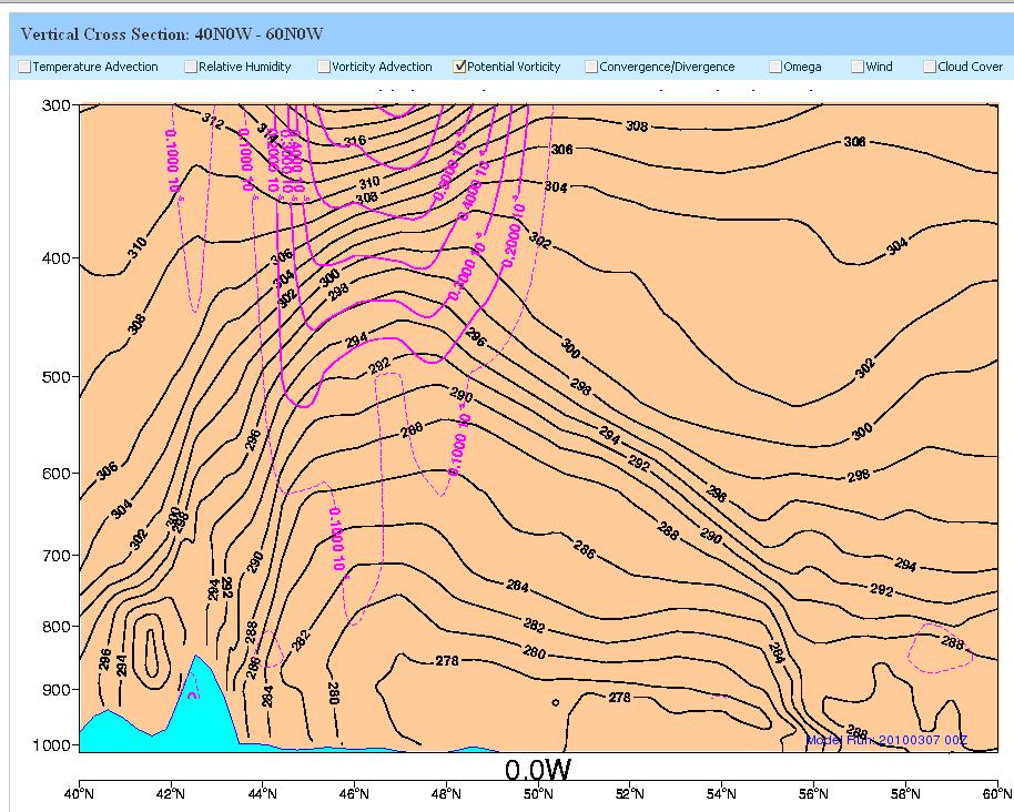
Figure 2.3: 7.3.2010 12 UTC - Vertical Cross Section 40N0W - 60N0W; black lines: ECMWF isentropes; purple lines: ECMWF Potential Vorticity
A dipole in the Temperature Advection over France (Fig 2.4) announces a developing temperature wave which is slightly denoted in the aeqRTP (Fig2.5) and will intensify in the following hours. The still available heavy cold air advection backside of the trough supports a further outbreak of the trough southward.
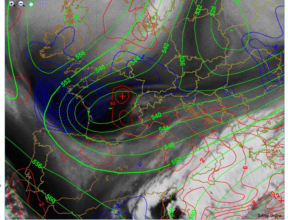
Figure 2.4: 7.3.2010 12 UTC - MSG WV6.2; green lines: ECMWF ATP500; blue lines: ECMWF cold air advection; red lines: ECMWF warm air advection
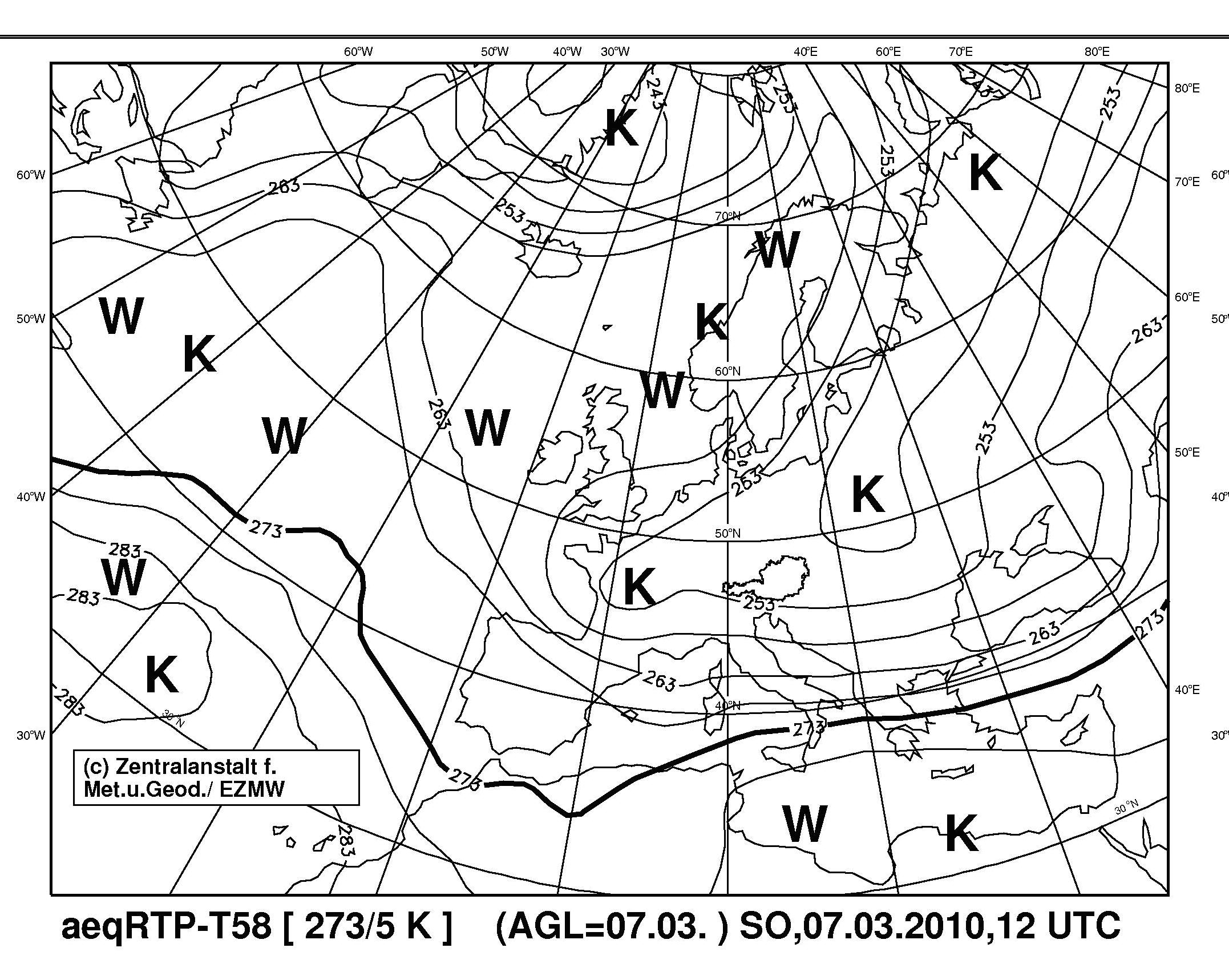
Figure 2.5: ECMWF Analysis 7.3.2010 12UTC - relTop